
LeuCat Adventures
Join us in sharing our adventures as we sail around the world. NEW!!************************************************************************* GET A COPY OF OUR TECHNO-TIPS DOCUMENTS--JUST CLICK ON THEM UNDER THE "FAVORITES" HEADING ON THE RIGHT

24 September 2017
30 August 2017 | San Francisco, CA
07 July 2017
02 July 2017 | Simpson Bay Marina, Cole Bay, Sint Maarten
01 July 2017 | Simpson Bay Marina, Cole Bay, Sint Maarten
30 June 2017 | Simpson Bay Marina, Cole Bay, Sint Maarten
29 June 2017 | Simpson Bay Marina, Cole Bay, Sint Maarten
28 June 2017 | Simpson Bay Marina, Cole Bay, Sint Maarten
27 June 2017 | Simpson Bay Marina, Cole Bay, Sint Maarten
26 June 2017 | Simpson Bay Marina, Cole Bay, Sint Maarten
25 June 2017 | Simpson Bay Marina, Cole Bay, Sint Maarten
24 June 2017
24 June 2017 | Simpson Bay Marina, Cole Bay, Sint Maarten
22 June 2017 | Simpson Bay Marina, Cole Bay, Sint Maarten
21 June 2017 | Simpson Bay Marina, Cole Bay, Sint Maarten
20 June 2017 | Simpson Bay Marina, Cole Bay, Sint Maarten
18 June 2017 | Simpson Bay Marina, Cole Bay, Sint Maarten
17 June 2017 | Simpson Bay Marina, Cole Bay, Sint Maarten
16 June 2017 | Simpson Bay Marina, Cole Bay, Sint Maarten
15 June 2017 | Simpson Bay Marina, Cole Bay, Sint Maarten
Year 10 Day 130 Anxious To Go But…
07 June 2017 | Simpson Bay Marina, Cole Bay, Sint Maarten
Dave/Mostly Sunny
This morning I made my final run over to the Island Water World fuel dock, filling up our jerry jugs with diesel and then mounting them on our deck. Leu Cat is awash with fuel, now carrying about 250 gallons. We are riding a bit lower in the water with all of that weight (about 1700 pounds) on board.
While I was doing that, Mary Margaret fired up the A/C and the oven and made more of her South African seed crackers and babaganoush. I had bought some more eggplant a couple of days ago just for this occasion. They both turned out wonderful!
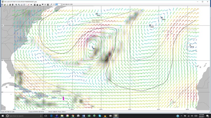
As we grow impatient to start our crossing to the Azores, we still daily check the weather patterns across the North Atlantic. Right now, the second of the three nasty long line of fronts is moving across the route we plan to take. I am glad we have waited while these three fronts move out of our way. Here is the last gale warning for this second front, issued by NOAA: "LOW 46N41W 984 MB MOVING NE 15 KT AND RAPIDLY INTENSIFYING. FRONT EXTENDS FROM 38N50W TO 35N62W. FROM 34N TO 48N BETWEEN 35W AND 50W...AND BETWEEN 31N AND THE FRONT WINDS 25 TO 40 KT. SEAS 8 TO 18 FT." I have bolded the last part, which would have impacted us if we had started our crossing.
The third front is moving off the coast of the Southeastern US but now appears that it will stay north of our route. I was all excited about that development until I noticed that another low, this time coming down from the New York bight, moves into our route and then, in a week, just stalls. In the process of stalling it sucks up another front, this one coming from the southeast, right into it. All of this unstable weather makes our timing to leave this Sunday, dubious. I cannot express how frustrated I am.
I am concerned that my patience will wear thin and I will just say, "screw it, let's go". At that point, I hope Mary Margaret will come and grab my shirt collar, slap me around a bit and knock some sense back into me. Sigh!
To this blog, I am posting a photo of the GIRB file for June 16 that shows the stalled low and the front that came up from the southeast being sucked up into it. The black blobs are the projected areas of storms. They are not as black as they are projected to be on the 15th, so that is encouraging. It appears that the low will be running out of steam by the 17th so maybe we can leave Sint Maarten a few days before since the storm area is about 4 days of sailing to the north of us.
While I was doing that, Mary Margaret fired up the A/C and the oven and made more of her South African seed crackers and babaganoush. I had bought some more eggplant a couple of days ago just for this occasion. They both turned out wonderful!
As we grow impatient to start our crossing to the Azores, we still daily check the weather patterns across the North Atlantic. Right now, the second of the three nasty long line of fronts is moving across the route we plan to take. I am glad we have waited while these three fronts move out of our way. Here is the last gale warning for this second front, issued by NOAA: "LOW 46N41W 984 MB MOVING NE 15 KT AND RAPIDLY INTENSIFYING. FRONT EXTENDS FROM 38N50W TO 35N62W. FROM 34N TO 48N BETWEEN 35W AND 50W...AND BETWEEN 31N AND THE FRONT WINDS 25 TO 40 KT. SEAS 8 TO 18 FT." I have bolded the last part, which would have impacted us if we had started our crossing.
The third front is moving off the coast of the Southeastern US but now appears that it will stay north of our route. I was all excited about that development until I noticed that another low, this time coming down from the New York bight, moves into our route and then, in a week, just stalls. In the process of stalling it sucks up another front, this one coming from the southeast, right into it. All of this unstable weather makes our timing to leave this Sunday, dubious. I cannot express how frustrated I am.
I am concerned that my patience will wear thin and I will just say, "screw it, let's go". At that point, I hope Mary Margaret will come and grab my shirt collar, slap me around a bit and knock some sense back into me. Sigh!
To this blog, I am posting a photo of the GIRB file for June 16 that shows the stalled low and the front that came up from the southeast being sucked up into it. The black blobs are the projected areas of storms. They are not as black as they are projected to be on the 15th, so that is encouraging. It appears that the low will be running out of steam by the 17th so maybe we can leave Sint Maarten a few days before since the storm area is about 4 days of sailing to the north of us.
Comments
| Vessel Name: | Leu Cat |
| Vessel Make/Model: | Lagoon 440 |
| Hailing Port: | Dana Point, CA |
| Crew: | Mary Margaret and Dave Leu |
| About: | Our goals are to spend the next 10 to 15 years cruising around the world and sharing this adventure with family and friends. |
| Extra: | S/V Leu Cat is Lagoon 440 rigged for blue water sailing. It is 44 feet long with a 25 foot beam |
| Social: |
|
Leu Cat's Photos - (Main)
 |
 |
Wedding and Reception photos April 18, 2015, Yosemite, CA
49 Photos
Created 30 April 2015
|
 |
Here are some pics that I took while visiting w/ my parents in the Galapagos Islands
22 Photos
Created 29 March 2010
|
 |
 |
 |
 |
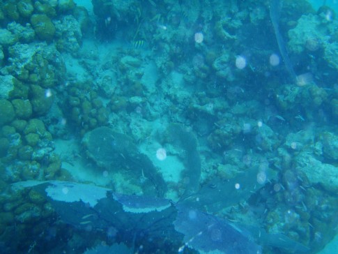 |
Pictures of the sea life in the cut between Little Jost Van Dyke and Green Cay, BVI
30 Photos
Created 17 March 2008
|
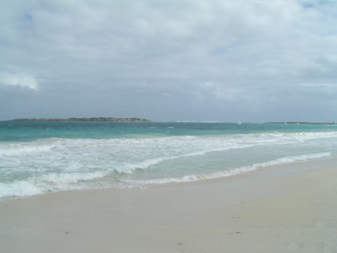 |
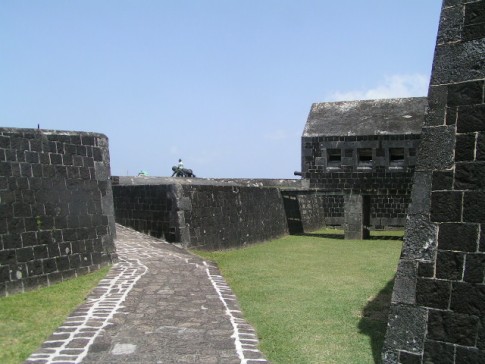
Here are a number of pictures of St. Maarten and the places we visited
36 Photos
Created 21 January 2008
|
 |
Photos of Nanny Cay
6 Photos
Created 11 January 2008
|
 |
Join us as we explore the Spanish, American, and British Virgin Ilsands.
15 Photos
Created 20 October 2007
|
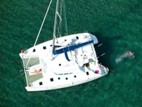 |
To help get you ready to go sailing with us, we wish to introduce you to Leu Cat so you will know what to expect when you get here! Just click on the first photo and then use the "next" button to advance through this slide show.
19 Photos
Created 19 October 2007
|
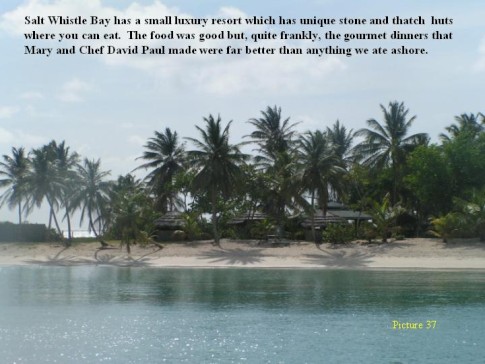 |
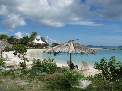
This is a collection of photos documenting our sail through the Windward Islands during May/June 2006 with our son, David Paul.
62 Photos
Created 14 October 2007
|

Who: Mary Margaret and Dave Leu
Port: Dana Point, CA
Gallery


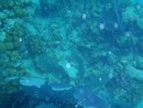
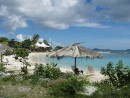

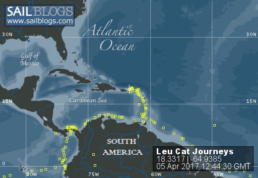
Table of Contents
Favorites
- Get A Copy Of Our Techno Tips Document
- Galley Tips For Cruisers
- Land Travel Tips For Cruisers
- Get A Copy Of Our Yanmar Drive Cone Repair Manual
- Updated Pirate Report
- My Bother Don's and Debbie's Blog
- A Great Sailing Blog
- A remarkable Sail Blog
- Celestial Navigation
- Here is Another Great Sailing Blog
- S/V Totem's Sail Blog
- S/V Infini's Blog Site
SailBlogs Friends


