
The Voyages of s/v Lucky Bird
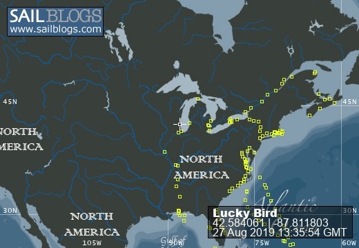
27 August 2019
21 August 2019 | Straits Marina, Mackinaw City
11 August 2019
06 August 2019 | Village of Brockport
30 July 2019
27 July 2019
21 June 2019 | Wickford Cove Marina
09 June 2019
20 May 2019 | Antlantic Yacht Basin
15 May 2019
13 May 2019 | Homer Smith Marina, final Salty Dawg Destination
21 April 2019 | Frenchtown, St. Thomas V.I. Easter Celebration
20 April 2019 | Brewers Bay, St. Thomas VI
11 April 2019 | Nanny Cay Marine, Tortola, BVI
28 March 2019 | Green Cay Marina, St. Croix, US Virgin Islands
25 March 2019
19 March 2019
06 March 2019
24 February 2019 | Jolly Harbor Marina, Antigua
Good Bye Block Island...Another Storm??
08 September 2009 | Cape May New Jersey
Bob/ windy,cloudy, pending Noreaster
I loaded some pictures of Block Island but unfortunately my small digital camera just doesn't have the horsepower to convey the whole story. In one of the shots I tried to capture the dinghy dock crampacked with little gray inflatable dinghys; so tightly packed that boats were three deep from the dock and boaters had to climb from theirs over several others all-the-while trying to maintain a sense of dignity and control. These little boats are not that easy to get in and out and for a people watcher like me it was a hoot observing the various climbing styles. One of the manufacturers might want to use a shot like that as a promotion for these wonderfull little boats. Ours is nine feet with a hard fiberglass bottom. We have a 15 horsepower outboard and man does that little fellow fly. Many cruisers have inflatables with much smaller outboards and they go by putt-putting along and we go by in a flash. Kinda brings out the kid in me, good fun and incredibly useful for exploring or getting back home quickly.
I had checked the GRIB charts and could see another storm brewing in the central US heading for the east coast. It was looking like a classic three day noreaster and the wind charts looked ominous. So here we were once again wanting to do another long passage with the prospects of a significant wind producer waiting for us at the end. It adds stress knowing you need to make the passage and you have to get there before the storm. We did our homework, checking currents, wind direction and made our plans to get up Monday at 05:30 and leave Block Island for a straight shot to Cape May some 205 miles at 240 degrees. The forecast was for NE winds increasing to 15 - 20 with gusts to 25 by Tuesday afternoon or evening and then to 30 overnight. So the window was Monday morning to Tuesday afternoon.
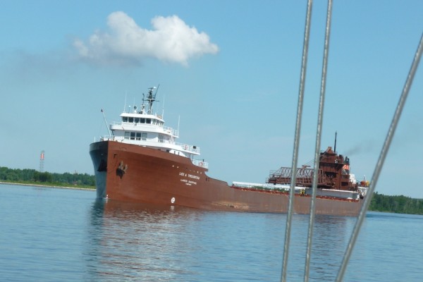
The course of 240 degrees took us across three different traffic lanes for New York. Once again our AIS unit was extremely helpful in a potential crossing situation with a 600 foot freighter. It was late Monday afternoon, I could see the ship on the chartplotter well before I could get a visual. I plotted the ships speed and course with ours and sure enough we would have a situation unless we altered course. Alice was steering and she suggested calling the ship and letting them know our plans. Great, the AIS gave us the ship's name, course and destination. I called, talked with someone on the bridge and let them know what the little sailboat off their starboard bow was about to do. They were surprised by my call and greatful that we were communicating. It worked out perfectly, they passed and we were back on course. Later that evening another crossing, this time all we could see were the oncoming lights, and sailors know that at night it is very difficult to judge distances and ship lights can be confusing. We thought the ship was proceeding on a course to cross our bow, the lights were very confusing and it was closing. I looked at the chartplotter and the AIS icon showed the ship passing behind us and with that knowledge the lights then made sense. No problemo, thank you AIS designers.
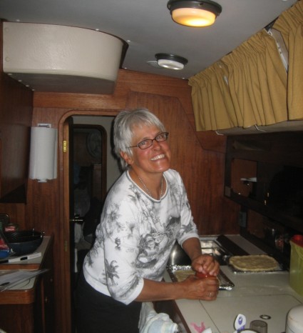
We arrived at the Cape May breakwater at noon Tuesday about three hours ahead of schedule, thank goodness. The wind was up to 15 - 20 and seas were 6 to 9 feet although it's tough to judge sea height from a 42 foot sailboat. They seemed big to me and tossed Lucky Bird around like a toy. I promised Alice a slip rather than anchoring and she is now preparing our first on-board pizza. Pizza ala Lucky Bird, pretty nice, don'tcha know!!
I had checked the GRIB charts and could see another storm brewing in the central US heading for the east coast. It was looking like a classic three day noreaster and the wind charts looked ominous. So here we were once again wanting to do another long passage with the prospects of a significant wind producer waiting for us at the end. It adds stress knowing you need to make the passage and you have to get there before the storm. We did our homework, checking currents, wind direction and made our plans to get up Monday at 05:30 and leave Block Island for a straight shot to Cape May some 205 miles at 240 degrees. The forecast was for NE winds increasing to 15 - 20 with gusts to 25 by Tuesday afternoon or evening and then to 30 overnight. So the window was Monday morning to Tuesday afternoon.
The course of 240 degrees took us across three different traffic lanes for New York. Once again our AIS unit was extremely helpful in a potential crossing situation with a 600 foot freighter. It was late Monday afternoon, I could see the ship on the chartplotter well before I could get a visual. I plotted the ships speed and course with ours and sure enough we would have a situation unless we altered course. Alice was steering and she suggested calling the ship and letting them know our plans. Great, the AIS gave us the ship's name, course and destination. I called, talked with someone on the bridge and let them know what the little sailboat off their starboard bow was about to do. They were surprised by my call and greatful that we were communicating. It worked out perfectly, they passed and we were back on course. Later that evening another crossing, this time all we could see were the oncoming lights, and sailors know that at night it is very difficult to judge distances and ship lights can be confusing. We thought the ship was proceeding on a course to cross our bow, the lights were very confusing and it was closing. I looked at the chartplotter and the AIS icon showed the ship passing behind us and with that knowledge the lights then made sense. No problemo, thank you AIS designers.
We arrived at the Cape May breakwater at noon Tuesday about three hours ahead of schedule, thank goodness. The wind was up to 15 - 20 and seas were 6 to 9 feet although it's tough to judge sea height from a 42 foot sailboat. They seemed big to me and tossed Lucky Bird around like a toy. I promised Alice a slip rather than anchoring and she is now preparing our first on-board pizza. Pizza ala Lucky Bird, pretty nice, don'tcha know!!
Comments
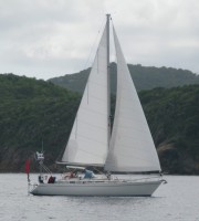
| Vessel Name: | Lucky Bird |
| Vessel Make/Model: | 1990 Moody 425 cc |
| Hailing Port: | Kenosha, WI |
| Crew: | Robert & Alice Smith |
| About: |
Lucky Bird's Photos - Main
 |
This is our second journey south to the Caribbean. This time we've chosen to exit Lake Michigan and proceed south through the in-land waterway system to Mobile. We'll start around Labor Day and take our time exploring the history of middle America.
207 Photos
Created 28 July 2017
|
 |
 |
 |
Bob and Alice return to Lucky Bird after spending the summer in Addison.
31 Photos
Created 4 December 2010
|
 |
Heading into the Windward Islands and further south
108 Photos
Created 22 February 2010
|
 |
The Crew
Who: Robert & Alice Smith
Port: Kenosha, WI
Favorites
SailBlogs Friends
