
The Voyages of s/v Lucky Bird
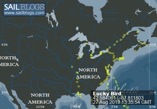
27 August 2019
21 August 2019 | Straits Marina, Mackinaw City
11 August 2019
06 August 2019 | Village of Brockport
30 July 2019
27 July 2019
21 June 2019 | Wickford Cove Marina
09 June 2019
20 May 2019 | Antlantic Yacht Basin
15 May 2019
13 May 2019 | Homer Smith Marina, final Salty Dawg Destination
21 April 2019 | Frenchtown, St. Thomas V.I. Easter Celebration
20 April 2019 | Brewers Bay, St. Thomas VI
11 April 2019 | Nanny Cay Marine, Tortola, BVI
28 March 2019 | Green Cay Marina, St. Croix, US Virgin Islands
25 March 2019
19 March 2019
06 March 2019
24 February 2019 | Jolly Harbor Marina, Antigua
The Loop is Closed
03 August 2012 | St. Ignace, MI

It's hard to believe but our circumnavigation of Lake Superior is now complete. Tonight we sit in St. Ignace, MI having had a wonderful sail down-wind from the anchorage in the St Mary's river, near the Old Fort Joe Point, St. Joseph Island, CA, and right past Mackinac Island. We had to sail an extra distance jybing several times crossing Lake Huron and then back the other way, but the winds were decent and the waves were in the two to four foot range, certainly manageable. But let me back up a bit.
Last night I was sitting in the cockpit near dusk. The full moon rose in the crystal clear eastern sky. Directly beneath the rising moon was anchored the new Coast Guard Cutter Mackinac. A big red ship. I turned to the west and, with the sun having set, the orange and red glow over the sharp black tree-line was majestic. No sounds, just the moon over one shoulder and the trees silhouetted against the glow of the fading day. Our journey around Lake Superior had ended earlier yesterday when we locked down through the Canadian lock at Sault St. Marie.
The previous day was a very long sail. We left the Munising area around 08:00 having spent the night in Murray Bay. Our plan was to sail along the coast line to see the Pictured Rocks and experience the first area designated as a National Shoreline. We figured we would stop at Grand Marias for the night; a short 35 mile sail. The wind was offshore and light but the forecast was for strengthening winds shifting from the SW to the NW.
Along the southern coast of Lake Superior there are very few harbors with fairly long distances between them. A northwest 20 knot wind in my mind meant the potential for really big waves. On Lake Superior even 10 - 15 knot winds builds some nifty waves, so 20 knots with over a 100 mile fetch could mean some very interesting sailing, more than I was looking forward to. So I suggested to Alice we push on for Whitefish Bay and the Harbor Of Refuge around the point.
By now the winds were 15 and building from the SW, offshore, yippiee!!.. Fantastic boat speed and only two to three footers to deal with. But Whitefish was another 45 miles so that meant 80 or so miles for the daylight hours. We pushed on, bypassing Grand Marias. Boat speed 8.5 to 9 and even a 10 once in a while. Good old LB was doing fine. Around 19:30 we approach Whitefish Point, the notorious head of Whitefish Bay, in a thunderstorm. Just like or trip out the St. Lawrence as we approached a new area and were uncertain of the harbor, Mother Nature seems to want to test us. So rather than try an approach in the rain and lightening we decided to stand off. We sailed in circles waiting and waiting. It was starting get dark and we were tired so we headed for the harbor entrance, very very slowly. 20 feet, 18 feet, 12 feet, 8 feet, 6.8 feet, bump. With the wind at our back we were being pushed onto a sand bar in the harbor entrance with breakwaters on both sides. Poor LB was bouncing on the bottom. Full reverse, oh crap the boat is swinging toward the breakwater. Full forward, can I turn the boat before running into the other breakwater? Each incoming wave lifted LB enough to make an ever so incremental turn. Bounce turn, bounce turn and she came around and now each new wave lifted us and we move forward out of the harbor out of danger til we were finally free. No damage other than I was pissed that this was called a Harbor of Refuge and we couldn't get in. Ok, so now what? No harbors within 25 miles and it is now getting pretty dark. Choices right? Push on through the night to get to the lock which opens at 09:00; sail over to Parisienne Island in the middle of Whitefish Bay, or, run down the coast a little further to where there is a spot where the water depth is 16 feet fairly close to shore. We could sit out the wind at anchor and be safe until the morning when the big winds were due. We chose the answer behind door number three. We dropped the hook about ¼ mile offshore in Whitefish Bay, who would have thought? The rolling was tolerable and throughout the night the wind shifted to the west and then northwest, offshore, sweat!!
The NW winds did materialize and we were glad we had gotten off the main lake where I suspect it would have been exciting and challenging. Our trip that day was all downhill. Big winds behind us and then the river current helping us. Whitefish Point to St. Joesph Island in a day. Not bad LB.
Sitting here writing and contemplating what we're going to do with tomorrow's weather my thoughts are of this journey. A small boat and two venturesome people accomplished and experienced at lot. The eastern shore is remote, wild, natural and beautiful. The northern shore with it's bays and islands each unique, each with a history of First Nation people and the miners. So many harbors, similar I suspect to what sailors who cruise the North Channel would say. It all freezes over in the winter enhancing the isolation and through the gails of September, October and November this Lake's reputation is well founded.
We experienced the softer, calmer side of the lake. Many days with no wind; the lake as flat as a glass coffee table; crystal clear water and warm temperatures. We were lucky, our timing was incredible.
So we close this chapter of the adventures of Lucky Bird although we still have some 330 miles to travel down Lake Michigan. Most Mac sailors know the trip home can sometimes be much harder than the race to Mackinac. On our Superior trip the winds were mostly behind us as were traveled countercloclwise around the lake. From here, the wind will most likely be on our nose, so we'll see. Old folks like us don't like having to got to weather in big winds, we prefer Lake Superior style sailing.
Comments
| Vessel Name: | Lucky Bird |
| Vessel Make/Model: | 1990 Moody 425 cc |
| Hailing Port: | Kenosha, WI |
| Crew: | Robert & Alice Smith |
| About: |
Lucky Bird's Photos - Main
 |
This is our second journey south to the Caribbean. This time we've chosen to exit Lake Michigan and proceed south through the in-land waterway system to Mobile. We'll start around Labor Day and take our time exploring the history of middle America.
207 Photos
Created 28 July 2017
|
 |
 |
 |
Bob and Alice return to Lucky Bird after spending the summer in Addison.
31 Photos
Created 4 December 2010
|
 |
Heading into the Windward Islands and further south
108 Photos
Created 22 February 2010
|
 |
The Crew
Who: Robert & Alice Smith
Port: Kenosha, WI
Favorites
SailBlogs Friends
