Cliffs and Petroglyphs
11 August 2022
• (9.78,,139.2w)
by robin
Tonight, we watched the light slowly made its way down the cliff to the west and the clouds up the valley gleaned with the light from the moon still hidden over the cliff to our east. The cliffs that form this bay, Baie Hanaiapa are so close together that we frequently lose the iridium satellite signal. The cliffs tell stories of the island formation and the oceans attempt to level it.
The island formation story appeared over our breakfast of oatmeal with a side of a mango found in the middle of the road. The Marquesas poked their heads out of the sea about 5.5 million years ago. The low morning oatmeal light had illuminated beautiful symmetric triangular shape at the base of the cliff. It looked just like the cinder cones, the result of spluttery volcanic eruptions, that dotted the landscape in the Galapagos. Instead of sitting proudly at the air this cinder cone has been buried by the 600 feet of lava flows. You could see the story in cliff wall. The spluttery cinder cone formed first then lava poured out of the volcano up the valley. At first the lava sloshed up the side of the cinder cone freezing there. Eventually the lava wrapped about the cinder cone stacking flat lava layers over the cinder cone until it formed the 800' cliff we are anchored next to. What an origin story.
The cliff also tells the story of how hard the ocean is working to return the island to the sea. These oceans sit in the middle of our planet's largest oceans with to the persistent trade winds. Since the islands emerged the oceans and the atmosphere have worked to drive the mountains under the water. On the east side of Hiva Oa and on the cliff next to us, there is little rain the ocean processes dominate. The eastern shoreline is mile after mile of vertical cliffs. Along this parched coast, there are no river valleys and no harbors. Every 5 seconds a new swell delivers a punch to the dark rock carving a notch at the base. The ocean waves are chewing away at the rock at sea level. The notch grows until the cliff collapses. In some places the cliffs are a lighter color with rocks only recently exposed. The notch at the base grew so big the cliff collapsed into the sea. Left behind is the new cliff and a flat wave cut terrace that emerges from the sea at low tide. Like three-layer birthday cake where only the first two layers were served, the terraces mark where the ocean has successful sliced and removed the cliffs.
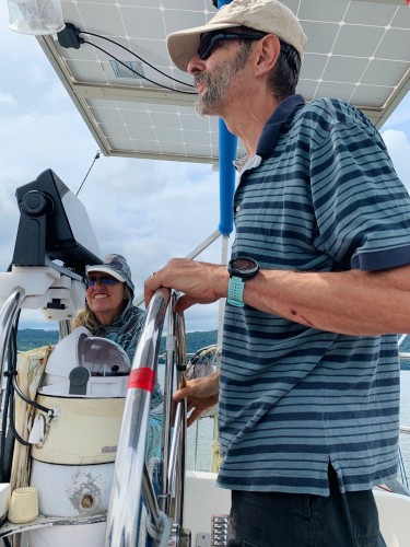
Leaving the boat and the cliffs Karl and I went walking. Karl and I have a long history of looking for rocks. In college we tromped up and down the river valleys in the Green Mountains looking for outcrops with bits of ancient ocean floor for my thesis. Today we went on a petroglyph search. Instead of a geologic map we gathered hints from people along the way. The refrigerator repairman showed us a petroglyph in front of his house and pointed to more at the head of the valley. The farmer leaning against his truck filed with green and red bananas had no opinion. His wife with expressive painted eyebrows was carrying a large yellow box of matches to light fires beneath their trees. She pointed up the road and suggested the water basin for the hydropower was the spot. The several apiaries were buzzy but also offered no directions. We scrambled around the woods discovering large snail shells, a giant turtle shell and one dirty sock I mistook for a petroglyph. Exhausted but delighted with the woods and the birds we declared finding three petroglyphs in one day success. We returned to the town and the boat for dinner under the cliffs.

Comments