
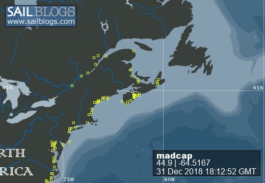
Madcap Sailing

31 December 2018 | Gold River Marina, Nova Scotia, Canada
06 August 2018 | Mahone Bay, Nova Scotia
15 June 2018
26 May 2018 | Gold River Marina, Gold River, NS
18 May 2018 | Gold River Marina, Gold River, NS
24 March 2018 | boat in Gold River, NS and crew in Halifax
22 May 2017 | Whittaker Creek, Oriental, NC
15 May 2017 | Boat in Oriental, crew in New Orleans and Nova Scotia
26 April 2017 | Oriental, NC
26 April 2017 | Oriental, NC
23 April 2017 | Oriental, NC
20 April 2017 | Ocean Isle Marina, Ocean Beach, NC at Mile 335.6
17 April 2017 | Dewees Creek, near Charleston, NC
14 April 2017 | St Simons Island
12 April 2017 | Fernandina Beach, FL
11 April 2017 | St Augustine, FL
07 April 2017 | Vero Beach, Florida
04 April 2017 | Ft Pierce
03 April 2017 | Ft Pierce, FL
30 March 2017 | Ft Pierce, Florida
Navigating New Routes
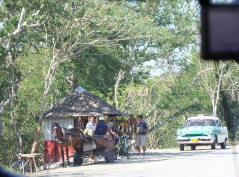
14 March 2015 | Blue Ground Range, Belize
Beth / challenged and satisfied
It has been sheer joy these last couple of days to sail some new routes.
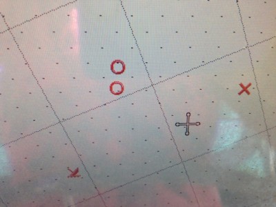
We got out the books and charts and looked for routes that would allow us to sail where we wanted to go. This whole area inside the reef is full of deep water channels mingled with shallow water areas that are passable with care, shoal areas and those heavily studded with coral heads that are best avoided entirely. While we often stick to the larger channels with lots of navigating room, it is fun to challenge ourselves. That first year when we set of to go sailing south, everything was new and there was an excitement to that. This year has been a comfortable one in familiar surroundings, and we were ready to mix it up a little.
Jim entered waypoints on our chartless chart plotter (it still won’t read the map chip), I looked up the areas on my Ipad using the Navionics App, and we set off. The light was good and the sun behind us as we worked our way through relatively shallow waters between South Water Cay and Blueground Range, and it was no trouble to see the brown bars at the entrance. Sometimes the charts will have a suggested bearing instead of a waypoint so we get to practice that too. For example, Freya Rauscher’s excellent book, Cruising Guide to Belize and Mexico’s Caribbean Coast has this to say,
“From the anchorage at South Water Cay, steer a course of 286°T (True) to come into the anchorage between the northern cays in the Blue Ground Range … do not try to round the north end … keep a sharp lookout for several drying patch reefs … entering from the east, you’ll pass about 3/8 mile north of Northeast Cay. Turn to a course of 203°T when Northwest Cay bears 248°T.”
Jim’s binoculars have a built in compass so as he figures out which cay is Northeast Cay, I watch the compass in the chartplotter and make the turns – and we both look for dark or light patches in the water that mean we zigzag a little this way or a little that way.
Sailing from there down to North Long Cocoa the next day was also fun. We started down the Inner Channel, veered off to port to the east side of Pelican Cays and sailed on a course of 170°T down the deep channel past Channel Cay and Tarpum Cay, watching for foul ground and coral patches on both sides until we reached the shallow water area where we could safely cross to North Long Cocoa. No road signs or lines or even navigational aids around here!
When we left North Long Cocoa today, we decided to take the route across the soft coral bar south of Cary Cay. Once again, it was a decision made partly on wind direction, and partly because we had not travelled that route before. This one looked tricky because of the reported 7-foot depth (and we need 6 of those feet) in a very narrow pass over soft coral but it went well. We rechecked the heading according to what we were seeing and once we could see a somewhat lighter bit of water between the really lighter areas we headed across - with me holding the Ipad in one hand and the wheel in the other, and with Rauscher’s waypoints on the chartplotter screen, and Jim with polarized sunglasses on his eyes and binoculars in his hand on bow watch. It was a little disconcerting though, to hear Jim say this time, “OK. I am going up on the bow and I’m just going to shut my eyes and pray!”
I guess he said the right words because it turned out to be no big deal – not as difficult as some other routes we’ve navigated through – and it was a nice end to our latest North Long Cocoa escapade.
Comments
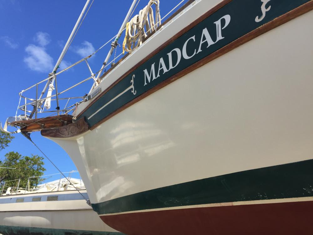
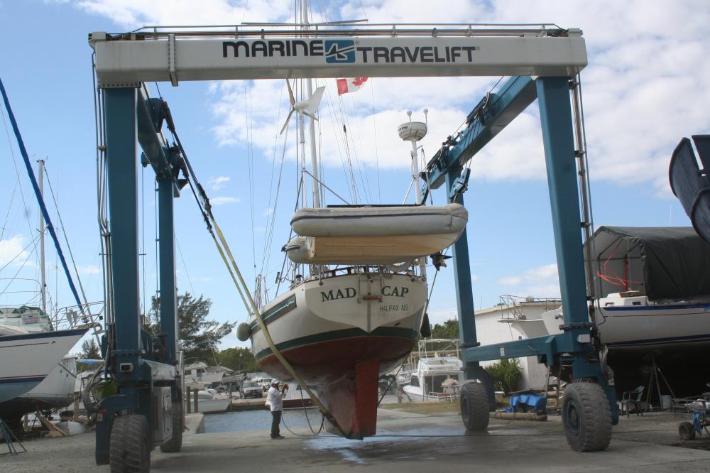
| Vessel Name: | Madcap |
| Vessel Make/Model: | Bayfield 36 |
| Hailing Port: | Halifax, Nova Scotia |
| Crew: | James D Bissell (Jim) and Elizabeth Lusby (Beth) |
| About: | Beth and Jim have spent several winters sailing southern waters on s/v Madcap. They love Halifax in the summer, but loved to spend the winters exploring warmer places - the Bahamas, Cuba, Mexico, Guatemala, Belize, Honduras. |
| Extra: | |
| Social: |
|
Madcap's Photos - Mad Cap Sailing (Main)
 |
 |
 |
 |
 |
 |
 |
 |
 |
 |
 |
 |
 |
 |
 |
 |
 |
 |
 |
 |
 |
Guatemala pics starting Nov 22, 2012
43 Photos
Created 6 December 2012
|
 |
 |
trip to Zion National Park and Bryce Canyon National Park (via Las Vegas)
23 Photos
Created 4 November 2012
|
 |
 |
 |
 |
 |
 |
 |
Madcap
Who: James D Bissell (Jim) and Elizabeth Lusby (Beth)
Port: Halifax, Nova Scotia
SailBlogs Friends


