
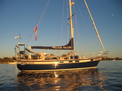
Maltese Falcon
18 April 2016 | Marina Di ragusa
31 January 2014
09 January 2014 | Canada
27 August 2012
04 February 2012 | Marmaris Yacht Marina
18 November 2011 | Marmaris Yacht Marina
30 October 2011 | Marmaris / Rhodes
2016 Preparations Before Leaving
18 April 2016 | Marina Di ragusa
Sunny 25 deg C winds from the south at 20knots
Monday, April 18, 2016
We are in spring here at Marina di Ragusa, a plethora of activity is going on around the marina, some boats already left a week ago people have been flying in from all parts of the world, to get the boat ready for the coming months of cruising.
The boatyard is busy with boat hauling out for a quick clean up or a check and replace of shaft seals, inspecting seacocks, rudder posts and anything else that is usually under water, maybe a new coat of antifouling paint would help too. Other boats are being launched and sent to their slips for final on deck inspection getting stored gear and mounting it where it will be more useful, provisioning before heading away, making sure to stock up on excellent but cheap Sicilian wine.
We are getting close, all repairs are complete, the hardest one was the wind instrument, had to take the trip 4 times up the mast as the cable was getting stuck somewhere then I decided to change the messenger to a lighter nylon line and this worked, did the modification on deck and then up again to help Lillian pull the cable down but again it was getting stuck, we tried soap to no avail, in the meantime sitting all crunched up in a boson’s chair is not a very comfortable situation and I had to be brought down for a rest. Later in the day I was hauled up for the third time, pulled the cable out from the top cleaned of the soap, the seven cable so that one was shorter then the next to have a fine taper, re-taped it very careful not to leave any tape protruding sideways. Asked Lillian to pull from the bottom one more time, she did and the cable came out the bottom as it is supposed to do.
With Lillian’s shoulder not healed yet, I decided to use the windlass to haul me up, so I asked my friend Roy to come and help me and to show Lillian how it is done. After watching Roy doing this Lillian decided that if I need to go up she could do it for me and so she hauled me up three times in one day until the job was complete, I think it was more tiring for me squashed in the boson’s chair. You might say that this is not safe to do. I would agree if using a self-tailing winch because it is harder to release the line from it and also because it is much faster than a windlass, when using a windlass, we also have a separate safety line attached to me, and if by any chance the windlass does not stop for any reason when it is supposed to, all that has to be done is let the tension of the line and the drum just spins without any consequences and since the clutch on the mast is closed the line cannot run free and drop me to the deck.
Fuel filters have been changed, bilges cleaned, a leaking watermaker fitting replaced, mildew from external teak removed, engine room organized, wind, instrument tested and calibrated, genoa raised, new dodger and bimini fitted properly, new instrument cover looks great, all we are waiting for is the new mainsail, I did go to see the work in progress, it looks great and must say that Paolo and his wife Laura are doing a great job at SiSail part of OneSail™, they are true professionals.
Our plans change by the minute, but as of now we are going to spend a few weeks in Malta, then off to Greece, yes Greece for the fourth time but we love it there, then on to Turkey to restart the clock EU clock being a non EU boat. On the way there we plan to visit Crete and on the way back the southern Peloponnese, I will write all about our 2016 anchorages in the fall.
Until then we wish a wonderful summer to everyone and a safe with fair winds to our sailing friends around the world.
Mario & Lillian Borg
Italian Anchorages and Marinas 2013 Part 1
31 January 2014
Mario Borg
Anchoring is our preference when we are cruising, we like the evening breeze, the lack of mosquitoes and the free space around the boat but not all countries offer ideal locations for anchoring like those found in the Eastern Caribbean where the wind blows from the East 95% of the time, so leaving your boat in a busy anchorage is not too stressful.
We started our 2013 summer cruising season in May of 2013 from Cap Monastir Tunisia where the Maltese Falcon had spent the past ten months tied up to the a pontoon. From Cap Monastir we headed to Malta to get all the gear, new upholstery we had in the apartment where we stayed for the past ten months and loaded all back on the boat and we also replaced re all the standing rigging.
Due to the topography of Italy it is very hard to find comfortable anchorages at all the stops so be prepared to have options for your stays at some marinas especially along the west coast of Italy.
Our aim was to head north from Malta and anchor near Marina DI Ragusa, so on July first we left Malta and head north for a 52 nm leg to
Marina the Ragusa, Sicily: N36 46.753 E014 33.018
This is a large bay with sand beaches and sand bottom with excellent holding; we only stayed here for one night as the early morning roll woke us up so from here we headed east towards Sardinia. If you decide to hang around here, the marina to the west is a good option. The town offers a variety of nice restaurants and a few supermarkets, an open market every Tuesday and a couple of well stocked hardware stores. There is a wonderful waterfront along the beach that goes on for miles. It is a very relaxing town mainly comprised of low level multiplexes which are mostly vacant during the winter months.
Licate, Sicily: N 37° 05.774' E 013°55.655'
This is a somewhat protected anchorage west of the main harbour entrance at Licate. The bottom is sand with excellent holding. The town offers a variety of banks, a large supermarket within the marina complex.
Cagliari, Sardinia: N 39 12.075 E 009 07.574
We sailed into St Elmo Marina and took a berth for €50.00 per night. This is a very clean marina with showers and a laundry. Took a taxi for €10.00 to Coast Guard at La Calletta to get our Costituto, afterwards the taxi took us to the very big Mercato Civico di San Benedetto, this is an amazing market with stalls selling bread, fish, meats and vegetables at very good prices, it opens 6 days a week, from there we took another taxi for another €10.00 back to the marina. It is a short walk to the city center where you will find many restaurants and other attractions mainly the old citadel.
Fuel fill is at west break wall far end to the west inside before the boat yard.
Villasimius: N 39 12.075 E 009 29.349
This is very nice to anchor, with a lot of sand for good holding in about 20 to 24ft. At some places close to the new marina the holding is suspect and we had trouble digging in. It has very nice surroundings and many little bays to choose from. Sometimes the swell gets in from offshore but in light air it is a great place to just relax.
Arbatax: N 39 55.272 E 009 42.436
We anchored in the first bay in 32ft over sand with very nice and calm surroundings. Holding is excellent, open to the South and South East, dingy landing is on the beach where allowed. The marina is north of the headland within the main harbour.
Golfo Brandinchi N 40 49.924 E 009 42.249
Anchored in the NW cove in 20 ft. on a sand patch, a lot of weeds and rocks on the way in, almost went over the rocks by mistake as the CM 93 chart is not very good with the location of the rock especially if coming in from the south, you have to make sure you keep the last big rock to your port side, you will go over some depths of 9 feet but that will drop off further north you go.
Isola Tavolara N 40 53.549 E 009 40.893
Just a short ran from Brandinchi to this very nice bay with protection from all sectors. The bottom is mostly sand with dead weeds that wash in during a southerly blow, excellent holding. The view is spectacular with a backdrop of the steep rock to the east of the anchorage. We checked out Capo Coda Cavallo on the way here looks also very nice with very good protection. A bar restaurant ashore. Most of the island is off limits.
Golfo Aranci N 40 59.962 E 009 37.133
We almost sailed to Olbia but by the time we got to the third set of channel markers we had decided we did not like the black colour of the water or the surrounding, mostly cantieri (boat yards and repair facilities)one after the other plus muscle farms everywhere. So we made a U turn and headed out and north to Golfo Aranci, anchored in 30 ft over clear water and sand bottom, the protection is very good except for strong southerly wind which could fetch steep waves by the time they get here. Dingy can be tied up at the Lega Navale pontoon or any of the ladders attached to the nice boardwalk. Most supplies in Town plus a couple of small chandleries and the usual restaurants and bars, pharmacy and even a Guardia Medica Turistica (Tourist medical center) anyone can visit a doctor for a minimal fee of €10.00. To €20.00. Every evening starting at 20:00 hours the main road is closed and a market is set up, this is the time when the restaurants get busy, we found this tradition all over Sardinia. It is very nice to walk around during the evening hours. There is also a fruit and vegie open air market every Tuesday morning, where you can find a lots of local cheeses and local nougat.
Cugnana N 41 01.552 E 009 31.231
We anchored in 9ft over sand, very good protection from most parts but open to the NNE. The holding is suspect in some spots so make sure your anchor is set as some of the sand patches are of a very thin layer of san above a rock base. There is a marina to the north of the anchorage. The anchorage is very peaceful with not much traffic around.
Petra Ruja N 41 03.647 E 009 32.086
We explored this cove and to our surprise it is just fabulous, anchored in 13 ft over sand in water the color of the emerald. There are no bars or restaurants here but it is a very nice place to just do nothing and watch the shoreline with its white sand beaches and the many rocks that jut out of the water in many places. This anchorage is well protected from the Mistral but open to the SE. By 11:00am the place filled up with mostly small power boaters but also included some of the 70ft and 4 other 40ft sailboats which stayed outside farther.
Granu Bay: N 41 08.79 E 009 31.764
On the here we entered Porto Cervo and asked how much for a mooring the answer was not what we expected but here it is for a boat 10-12meters long = €105/night and €400.00 in the marina. So being cheap and on a budget we scooted out of there and went in Cala Granu which to our great surprise is a wonderful anchorage with very good protection from the SW to NW but good all round in settled weather. We anchored in 20 ft over sand in very clear water, there is a small beach at the head of the bay and then the rest is villas. It is only 1 nm so attainable by dingy to Porto Cervo from here so we later. In the evening we got swarms of mosquitos and I had a very sleepless night because of this. No wonder we were alone in this very nice anchorage. We had a bad smell of sewer coming from outside in the early morning hours. We left that day, but still a good spot to anchor if you want to visit the place of the rich and famous.
La Conia, Cannigione: N 41 07.438 E 009 26.553
Anchor just south of the "Island of India Figs" in 13 ft over sand; this is a very good anchorage if the wind is strong from the NW. It is a very good anchorage with good protection even in strong N wind, the island and reef next to the island break down the waves. It is easy access to a very nice supermarket within a 10 min walk. Many restaurants and bars on the main road. This is worth a stay longer than just a day.
Maddalena Archipelago is a group of islands just north of the north coast of Sardinia better known as the Costa Smeralda. This is a protected area where no one is supposed to stay overnight and it is also a -no discharge zone but what we found out is that there is a lot of pressure from the very large Italian and foreign boating community against the rules so that overnight anchoring is allowed, we did not find out for how long but we did stay at a couple of places for more than 3 days. The Park Authorities come around and check to see if you have a permit if not you will have to buy from the Park Authorities and pay more for it than you would if you pay online. We prepaid € 78.00 for a 15 day pass at a tourist office in La Conia. There is a lot of very nice anchorages with crystal clear water and some great snorkeling close to shore around most of the archipelago. A permit can be obtained online from this site below: http://autorizzazioni.lamaddalenapark.it/index.php?ssez=Acquista
Or you can ask around for the tourist office where you can buy from. The following spots are all round the Maddalena Archipelago, this has to be one of the top cruising areas in the world, and it is definitely worth a visit.
Porto Palma, Isola Caprera: N 41 11.296 E 009 27.084
We sailed north from our anchorage at La Conia with just the genoa as the land breeze was still coming from the south so it was a relaxing sail in flat water albeit slow at 3 knots max. We arrived at Porto Palma at Isola Caprera and we were very lucky to find a free mooring, I had to get on the dingy and handle our lines through the stainless eye on the mooring ball as there is no rope attached to the mooring to facilitate the grab, but all worked out well anyway. During the day the bay fills up with local boats and then there are the sailing schools that weave around the anchorage at full tilt, they do now what they are doing so it seemed the danger of them hitting any boat at anchor or moored is minimal. The Park Authorities came by to check our pass. By 8:00pm all the local boat left and we spent a nice evening watching the sunset in perfectly calm water with a southerly land breeze.
Cala Garibaldi: N 41 13.421 E 009 27.407
This is a very nice anchorage with excellent holding and protection from everywhere except N the only problem is that one cannot drop or pick up any one from the concrete dock at the club Med (which is not even open) or at the old unused and broken quay to the NE corner which is a military area. I would not recommend landing on the beach as it is too busy but one can always drop and anchor off the beach to go and visit the Garibaldi Memorial which is worth all the trouble and the long walk up to the fortress where it is located. Not many boats came here during the day and the few that came left within a couple of hours. There are some very nice little beaches that you will see on the way in from the North which are worth a dingy trip to snorkel on.
Cala Portese, Isola Caprera: N 41 11.072 E 009 27.996
This is a very nice bay with sand bottom with excellent holding and protection from S to NW, if the NW is strong a swell will probably find its way here. You can land the dingy on the beach and there are nice walks once you go out of the beach park. There are about 12 laid moorings but by the time we got there they were all taken. The water is crystal clear and it is a pleasure swimming in it at the beach early in the morning.
Cala Corsara, Isola Spargi: N 41 13.762 E 009 20.642
Very nice anchorage with protection from most points, excellent holding over sand bottom and crystal clear water you can almost count the sand granules just amazing... Nice hiking ashore just land the dingy on the beach or swim to shore. Like most places around these parts of Sardinia it gets very busy after 11:00am but clears out by sunset. You can dingy around to other spots to the east shore and do some nice snorkeling in emerald water.
Passo Cecca Di Morto, Isola Budelli: N 41 17.002 E 009 21.562
Moorings are available but one may also anchor, this island has many spots to explore with the dingy, like along the west shores of Isola Santa Maria with very good snorkeling all over the area. There is another mooring field and anchorage to the northeast of Isola Budelli.
Mario Borg
Malta Info
09 January 2014 | Canada
Mario Borg
THE MALTESE ARCHIPELEGO
I am writing this article from the deepest part of my heart as this is my beloved homeland which I love very much but I will try not to be biased with my opinions, as this might misinform my readers. So I will tell you the facts as they are.
This is a land with a long history that dates back to prehistoric times as indicated by the many fossilized remains at Ghar Dalam which dates back to when the archipelago was connected to North Africa and the Europe, the islands have more historical sites per square kilometer than any other place on earth. Its geographical position in the center of the Mediterranean Sea makes it a very convenient and attractive place for many nations that have since invaded or tried to invade it.
The archipelago is comprised of three inhabited islands, Malta the largest; Gozo second largest and Comino the third largest, Filfla is to the south west of Malta but is uninhabited except for the legendary two headed lizard which I have never encountered, anyway this small island the size of two football fields is strictly off limits to visitors.
The native language is derived from the times of the Phoenicians but written in the Latin alphabet and a mixture of European derived words . Most of the population speaks fluent English and a large part also speaks Italian due to the proximity of Italy only 50 miles to the north. The people are very friendly and hospitable and ready to go out of their way to help.
The islands are 8th in the list cars per capita therefore it can be quite hectic driving around the islands at certain times of the day. But don't let that keep you away. During the summer months it becomes a tourist haven with many cruise ships and fly in passengers arriving every day. There is so much to see and do that the cruise ship passengers only get a taste of what is available during the short time they visit, after getting a taste most of them come back for more later.
The main attractions are the Capital City, Valletta, a fortified city overlooking the Grand Harbour to the south and Marsamxett harbour to the north. Within the city, which was built after the Knights of Malta and the Maltese citizens repelled the mighty Ottoman Empire during the Great Siege of 1565 one finds himself surrounded by baroque architecture designed by European architects commissioned by the Knights of Malta. There is also the famous St John's Cathedral with a museum inside where one finds many masterpieces of art namely the beheading of John the Baptist by the infamous Caravaggio, and tapestry brought here from many parts of Europe dating back to the sixteenth century. The History museum, the Art Gallery, the Armoury where one can see authentic suits of armour and other war items dating back the times of The Knights of Malta, they are all a must see attractions. Not to be missed is the spectacular view from Upper Barracca Gardens of the three fortified cities across the Grand Harbour.
Away from the city is plethora of historical sites special mention would be Mdina known locally as the silent city, the Neolithic temples of Hagar Qim, Mnajdra, Tarxien and Ggantia over on Gozo. While visiting the citadel of Mdina you can walk a short distance to the Roman Villa.
Try the Maltese cuisine, most famous of all and also the most affordable are the pastizzi which is a phylio pastry filled with cheese or beans both delicious but not very healthy worth a try and don't worry it will not kill you at least not right away, just enjoy it, Then there is the Maltese ftira a flat type bread similar to the Maltese bread but drawn a little flatter, comes with olive oil tuna salad and tomato paste, just the right thing for a midday break, the rabbit dish this is the Typical Maltese Dish comes either with spaghetti or French fries, served in most Maltese oriented restaurants with a cost average of €14.00 per person worth every cent.
If you visit Malta by boat during the summer months you are treated to a number of very nice and safe anchorages, one can choose to be at the hearth of the night life or secluded in a bay with nothing around except clear waters and beautiful scenery. Most are safe anchorages as the weather during the summer months is stable but one should always keep an eye on the weather forecasts as some NW can be very strong even during the summer months. Check this very informative website for detailed information:
www.maritimedirectory.com.mt/cruising.asp
27 August 2012
SV Maltese Falcon
By Mario & Lillian Borg
Anchorages between Malta and Turkey
A lot has already been written about Greece and Turkey, this is a great cruising area with many open air museums around each corner waiting to be explored, it is fantastic area with many coves and anchorages to choose from most of which are spectacular. We are only writing about our own experience. Our main objective was not to frequent marinas or harbors but at the same time visit as many places of interests as possible given we only had a 90 visa in Greece, instead we prefer to anchor out in the breeze, away from mosquitoes, noise and rats. We found many good anchorages especially going through Greece.
Our main ground tackle consists of a 66 lb Spade anchor set on a bowsprit, with 220 ft of 3/8” HT galvanized chain marked at 1st 6ft (means anchor up just below the surface ready to be cleaned) and every 50 ft and the last 10ft indicating the last part. Therefore we are limited to depths of no more than 44ft with a scope of 5:1 or 31 ft with a scope of 7:1 for storm conditions. All this is controlled with a 1500 watt vertical windlass that includes a capstan and gypsy. We have anchored with a 3:1 scope with no problems as long as we know what the weather is like and how good the holding is or if it’s for a short time.
We planned our destination according to the weather forecast we gathered and made sure we would have a safe anchorage for the length of time we planned to spend on the hook in a particular spot.
We left Malta early May 2011 after waiting for a decent 3 day window to carry as towards mainland Greece a distance of about 350nm. In this first part we cover about the places that we stopped at after leaving Malta up to Piraeus on Mainland Greece; in the 2nd part we will cover from the island of Aegina in the Gulf of Saronica through the Cyclades and the 3rd part will cover from the Cyclades to and including Turkey.
Katakolo, Peloponnesus: 37° 39.1967’ N x 021° 19.657’ E
Our first landfall was Katakolo in the Adriatic Sea; we anchored in 10 ft of water over sand and weed. Just north of the harbor entrance, very good hold. Checking into Greece is a two step job, first you go to immigration where you are issued a cruising log, good for 6 months at a cost of €30.00 passport was looked at but not stamped as we came from another EU country, then you take all the paperwork downstairs to the harbor police and if you are in the marina/harbor you pay, if anchor there is no charge. We checked out the harbor and there was only 4 other boats stern to with their anchors down as there is no laid moorings. The boat yard seems to be functional but we never seen anyone working and the marina office was always closed in the few days we went buy. This is a cruise ship terminal as it is very close to Olympia, one of the most important ancient archeological sites in all of Greece. The town has a small supermarket, many tourist shops, and restaurants on the waterfront. You can visit Olympia buy bus or a short trip on a train that only costs €5.00 per person. To get a Greek SIM card for your phone or modem you will have to go to the next town of Pyrgos, there you will find more shopping and supplies of any kind you need. The ancient city of Olympia is must see site. Word of caution, while we were happily anchored we had some easterly come in, the crews on the boats that were stern to in the harbor could not get off or on to the boat as a swell was making its way into the marina.
Lagana Bay, Zakynthos: 37°41.2781 N x 37°41.2781 N
Lagana Bay is a big bay located on the south of the island most of the bay is a restricted area as it is a loggerhead turtle breading ground and one can only anchor at the SW corner near a small fishing harbor. There is nothing ashore except a few villas but the bay is spectacular and the holding very good in 18 ft over sand. While at anchor we had sustained winds of 20kts and gusts of 30kts. On the way into the bay we encountered two mating turtles; you cannot miss these turtles as they are huge.
Kilini, Peloponnesus: 37°56.0973 N x 021°09.3440 E
We anchored in 12 ft over sand just SE of the harbor, this is a small harbor where you can tie up your boat on the inside of the outer quay. Ferries go in and out and we did not go ashore here as this was an overnight stop. It does have good protection from the Maltemi but is open to the N to East.
Navpaktos, Mainland Greece: 38°23.4892 N x 021°49.7728 E
We motored in very light airs the 45 nm distance to Navpaktos and anchored just south of the harbor entrance in 30 ft over sand. The harbor can only handle about 8 boats stern or bows to, we did not notice laid lines here so you will have to use your anchor. Navpaktos is a medieval harbor built around the 11th century; it is well preserved and is surrounded by cafes and restaurants. The climb up the hill to the old town is easy walk and the view of the Gulf of Patras and Gulf of Korinthos from the top is incredible. The town itself is a good place to provision from; supermarkets are close by on the main road. We did not intend to stay here long as the anchorage is only protected from the north so any westerly’s will roll in this far. We left the next day to our next spot.
Trizonion, island in the Gulf of Korinthos: 38°22.0085 N x 022°04.5184 E
We anchored in 23 ft over tall weeds and mud, the holding is good once you penetrate the weeds. This island offers the best possible anchorage this far. It is protected from all around and you can leave the boat here over winter at the marina. It is a 10 min ride by boat taxi to the mainland. On the island there limited provisioning, a few restaurants which most of them we believe are closed during the winter months. It is a very relaxing place to spend a few days and work on some chores on the boat. There is some short walks around the island.
Galadixi, Mainland Greece: 38°22.9943 N x 022°23.4906 E
We anchored on the north bay in 10 ft over sand and rubble, the holding is good, protection all around you may get a chop from a strong northeasterly. The town is pretty with narrow streets and a few restaurants in the waterfront, bakeries and a few super markets, there is a bus to Itea and from Itea you can take another bus to Ancient Delphi, this is not to be missed. If you go to Delphi make sure that you get back to Itea before the 21:00 hrs bus leaves for Galaxidi, as there is no busses between 13:00 hrs and 21:00 hrs. The better option would be to go and anchor some place close to Itea or go to the Itea harbor where you can tie up along side at certain times of the year. Itea is a big city with all the services although lacking boat chandleries.
Antikiron, Mainland Greece: 38°22.5044 N x 022°37.7342 E
Anchor close to the town wall in about 35 ft over sand, holding is very good, it does look to close to the fishing boats tied to the wall but it is fine, we spent 3 nights here with no problem, very good protection from all around. You can also tie up stern or bows to the harbor which is actually a break-wall but there is no laid lines. Good provisioning in town, many restaurants in the waterfront. There is a military area across the bay; it is restricted to go even close to it.
Alkionides, Mainland Greece: 38°07.0498 N x 022°59.2545 E
We anchored in 15 ft over sand and clear water, well protected from the Maltemi but open to the west, the scenery is spectacular but the ashore we where disappointed with the lack of anything, just a lot of summer houses for the Greeks. No provisioning, but there is a well equipped hardware store.
Gemerno, Mainland Greece: 38°09.2713 N x 023°13.2962 E
We anchored in 15ft over sand with very good holding open only from the west. This is another spectacular anchorage with potentially three areas for anchoring, NE, area near small boat harbor, Middle of the bay in front of the restaurants and SE corner; they are all very nice anchorages with excellent holding. We were the only boat at anchor in the 3rd week of May but the restaurants were open and we also visited the medieval fortress, the entrance is free to this site, you can actually see the fortress from the anchorage. There is a small chapel Byzantine within the castle. In town there is some provisioning and a small hardware store plus a nice bakery. This place is worth a stop.
Loutraki, Mainland Greece: 37°58.4534 N x 022°57.9876 E
Anchored in 42ft over unknown bottom but the anchor grabbed on the first try, there was no noise from the chain dragging on the bottom as we swung back and forth, so I assume it is mud or sand, no weeds showed up on the anchor when we left, it has good protection from mostly everywhere except west... This is a Greek tourist town, the Greeks from Athens drive here to their summer or weekend houses, it looked very busy from the boat as we did not go ashore, this anchorage was for as to be waiting spot to the Korinthos Canal entrance which we went through the next day.
Korinthos Canal: West entrance: 37°57.1929 N x 022°57.4907 E
I am only writing about the Korinthos Canal to be as an update. Call the Korinthos Canal Authority on VHF 11 before leaving your anchorage and they will advise you what to do just follow there instructions and be patient. If you happen to be behind a large ship hang back a little about 150ft so you do not feel the prop wash, it is very narrow in some parts but nothing to be nervous about. Once you reach the east entrance tie up to the dock on the on the south side and go ashore to pay the canal fees. We paid €142.00 for our boat. While there you can top up your fuel, the gentleman in the office will call for you on your behalf. Or if you have your own phone you can call Kapsalakis cell # +6944 3933 01, office # 2741 0240 24, we paid €1.48/Liter. In 2011.
Kanakia, Salamis Island: 37°54.2568 N x 023°24.2458 E
We anchored in 20 ft over sand and weed holding is good, open from the NW to the SW. a couple of restaurants ashore and some summer houses. Very quiet and nice place with a nice little beach.
Piraeus, Mainland Greece: 37°55.9416 N x 37°55.9416 N
This is the only place we decided to go into a marina so we stayed for a couple of days at Zea Marina, for a very reasonable cost of €38.00/day during the last week of May. This is a very convenient place for re-provisioning, purchasing boat parts and of course to visit Athens. To go to Athens you take a 20 min walk over the hill to the main commercial harbor area from there you take the subway or metro to the center of Athens, you can easily spend a day or two in Athens especially if you like walking, for us it was our first time and a great experience. There are other anchorage options to the north east of the entrance into Zea Marina.
After spending 2 wonderful days in Athens, we headed out and south towards Aegina Island. Now that we had entered the Aegean Sea we had to keep a good eye on the weather forecasts, but since it was still late May, the dreaded Maltemi had not started to blow as a matter of fact we hardly did any sailing up to this point. So we decided to head south a little to visit Aegina and Poros, then head up NE to Sounio on the mainland and after that it would be a nice track SE towards Turkey, so even if the Maltemi appeared they would be on our stern quarter, and we would be able to sail with just the genoa.
Up to this point we had very good free wifi with open access while at anchor or we would go to a bar and download any weather to our IPod Touch which gave us a few days of weather forecasts with Windfinder and WindGuru, both worked very well and are very reliable. But keep in mind that the weather in the Med is very difficult to forecast so keep checking and updating the weather as often as possible. While in the Gulf of Saronika the winds were from the NE but very light so we only managed to motor-sail from Piraeus to Aegina to Poros and back to Sounio. This did change later on during our legs through the Cyclades where we had some heavy Maltemi blowing mostly while at anchor.
Aegina: Gulf of Saronika: 37°44.5386 N x 023°25.7315 E
We anchored in 9ft over sand and weed patches south of the marina and main harbor. We had a short dingy ride to the east corner of the marina where you can tie your dingy near the small fishing boats. The anchorage is protected from the Maltemi and we had no problems while there for a few days. There is a bus in town, walk towards the NW till you get to the ferry dock entrance, the bus stop is at the SE corner, from here you can visit the very nice temple of Afea and the amazing church Agios Nektarios. The marina can handle about 100 boats; this is a good marina to leave the boat for a trip back home and even for the winter months. Most of the islands in the Aegean have a daily or weekly ferry service to Piraeus. The town has a lot to offer with many waterfront restaurants, hardware stores, one chandlery, groceries, fish market and even a well stocked supermarket found by turning right from the marina and turn left on the first street, keep walking another 500 m and you will find it on your right.
Poros, Gulf of Saronika: 37°30.0727 N x 023°26.6337 E
We anchored closer to the mainland Peloponnesus at Galates only 300m from the dingy dock. It is well sheltered from all points. The town has very good provision, including a very nice fish market a small supermarket, and chandleries that can have almost anything brought in the next day usually from Athens. The Chora (old town) located above the harbor is very impressive and very nice walking through it. You can also go stern or bows to; the cost for our boat would have been €9.00 not including water and electricity, there is no laid lines so you would have to drop the hook anyways.
Souinio, Mainland Greece: 37°39.2221 N x 024°01.3573 E
We anchored in 30ft over sand and weed patches in the shadow of the Temple of Poseidon. We only planned to stay the one night so we did not go to shore but the view of the temple all lit up at night is something to remember. The holding is vey good and protected from the Maltemi, but I think it will be very gusty as the gust will find their way around the cape into the bay.
Voukarios, Kea Island: 37°40.0663 N x 024°19.5380 E
Anchored in 30 ft over mud and weed, this is a better anchorage than around at Korissia where the ferry comes in. We tried to get a bus to take as to the Chora but they were not running until mid June. It is a nice little town with lots of restaurants and some provisioning, bakeries but no chandleries. The anchorage is well protected from the Maltemi.
Koundouros Bay, Kea Island: 37°34.7394 N x 024°16.7108 E
Be careful anchoring here there is rock areas so look for a sand patch to drop your anchor, once in, it is a lovely anchorage with a couple of restaurants ashore and some nice hoses and windmills. Clear sea but only protection from Maltemi and NE
Kalona Bay, Kynthos Island: 37°24.8775 N x 024°22.5556 E
This is a very nice bay with clear blue water , sand and some weeds patches we anchored in 23 ft. If the wind pipes up from the west you can go around the peninsula and anchor at the east side of the isthmus. You can drag the dingy on the beach on both sides of the isthmus and walk up to the small church on the peninsula there is also a very nice walk in the valley to the NE of the isthmus, well worth it.
Lvadi Bay, Serifos Island: 37°08.5823 N x 024°30.9088 E
We anchored just north of the harbor in 30 ft over mud and weed, the holding is very good, and protection from 360 deg. There is a bus that takes you to the chora on top of the hill, very nice chora with the usual narrow street and old windmills being turned into modern dwellings. There is a great view looking over the bay from near the last church on the very top. You can walk back through marked pathways all the way down to the bay, it is a very nice relaxing walk.
Kamarez, Sifnos Island, 36°59.4708 N x 024°40.4461 E
We anchored in 15 ft over sand, the holding is very good with protection from the Maltemi.
We took a couple buses from here to Apollonia and Kastro which is the chora of Sifnos. It is very nice still using donkeys to transport goods within the very narrow streets of the chora. But checking out the anchorage we found it to be very small maybe one boat and the rest is wide open, a swell was also finding its way to the small one boat anchorage. Therefore do not attempt to go to Kastro to anchor as the bus rides is cheap and very convenient.
Faros, Sifnos Island: 36°56.2833 N x 024°44.8099 E
We anchored close to Nisis Krisoppigi, you cannot miss it as there is a church on the top of the small island, we dropped our anchor in 20 ft over sand, holding is very good but we had a bit of a swell you can also go up the narrow bay but you will have to go stern too shore as this is very narrow, another option is the small bay to the NE of our anchorage, might be better protection from the swell. We only stayed here one night so we did not explore shore.
Ioannis Cove, Paros Island: 37°08.7409 N x 025°13.6809 E
We anchored in 15 ft over clear water with sand bottom, excellent anchorage with all round protection, might get a chop if it turns from the south which is extremely rare during the summer.
When the winds went light we anchored near the harbor of Naousa on the south of the big bay at 37°07.4879 N x 025°14.0896 E in 15 ft over sand and some small rocks. This is a very convenient spot to leave your boat and take a ferry to Santorini and visit the Paroikia. We took a one day trip to Santorini that included a guide and coach, it was worth the money we paid which, €55.00/person. The town of Naousa is worth seeing especially at night.
Naxos, Naxos Island: 37°06.5394 N x 025°22.3279 E
Anchor in 10 to 15 ft over sand close to the beach, if you anchor further out the ferries leave a massive wash and will get uncomfortable. This is an ideal anchorage very well protected. The town offers plenty of provisioning and you can get boat parts shipped in over night through any of the small chandleries in town. There is also a good fish market at the waterfront as you walk along towards the east. There is also bus service to the small villages inland, check with the tourist office for the best places to visit and bus schedules, the tourist office is just in front of the ferry dock. You will need a anchor for the dingy to keep it away from the rough concrete wall just past the beach to the right.
Ormos, Mykanos Island: 37°25.2166 N x 025°19.3628 E
The weather was calm so we decided to head here from Naxos, we anchored in over sand and weed in front of the beach. This is a tourist town with the usual array of restaurants and bars; we walked the 2 miles to the centre Mykanos, very busy place with tourists bumping into each other, but it was worth going to, it is by far the dirtiest place we have been so far.
Elia Beach, Mykanos: 37°25.1348 N x 025°22.9317 E
We anchored in 20ft over sand in clear water, this is just a big bay with several beaches all around good shelter from the Maltemi but nothing also ashore except for a very expensive bar/restaurant.
Kalafatis, Mykanos: 37°26.4434 N x 025°25.4239 E
This is one of the nicest beaches with very good protection from west to NE. We anchored in 20 ft over sand and clear water. There are a couple of hotels ashore so some noise from the ski boats during the day buy very quite at night.
Fournoi Island: 37°34.0710 N x 026°28.5611 E
We passed close to the Island of Ikaria but could not find a suitable anchorage so we kept on going and anchored here in Fournoi. The anchorage is very deep and small so finding a suitable place here was touch and go but we managed to drop the anchor in about 45 ft over sand and weed. Holding is very good; another option is to go alongside the wall in the middle of the bay or stern to the wall on the north side of the bay. On the second day we picked up the one mooring that actually belongs to a local person that owns a large boat but he was away and were told by the locals that we can use it. So we did and boy was I glad as when the Maltemi came here, the gusts were worrisome and the boat would horse around out of control. It is not a very good place to be during the Maltemi. But other than those few hours we had a great time here walking to the main harbor and town for coffee at on of the local cafés up the road from the main harbor.
Pythagorean, Samos Island: 37°41.3255 N x 026°56.7514 E
We anchored in the middle of the bay in 15 ft over sand with very good holding. Some gusts during a spell of Maltemi but not too crazy. This is a very nice anchorage with excellent holding and close to the main harbor of Pythagorean. There is a bus to the capital Samos and also you can stop and provision from the Ldil store close to Samos.
East Bay, Agathonisi Island, 37°27.4247 N x 026°59.0980 E
From here south are the Dodecanese Islands
Anchored in 25ft of water, over sand with very good holding. Very nice anchorage with herds of goats on the hills and along the shore. The water is crystal clear and the holding is excellent in sand. This is the west side of East Bay as there is another bay within to the NE.
Marathos Island: 37°22.0256 N x 026°43.5615 E
We picked one of several mooring here but be careful some of them are to close to each other. After snorkeling over the moorings I found some to be very small whence the reason some of them are so close together because they move during strong winds with boats moored to them. This is a very pleasant area with a few more anchorages around the several islands. Ashore you will find a restaurant and a church on top of the hill with great views.
Leaving Marathos we headed east towards the island of Patmos with its many safe anchorages. The weather was with us but we had to motor sail as the winds were very light from the north east at 8 to 10 knots.
Grikos, Patmos Island: 37°18.1312 N x 026°33.7215 E
On the way here we explored the anchorages near Kampos and the Skala but we found that the new boat harbor in Skala has occupied the anchorage area and we didn’t see any boats at anchor here. The Kampos anchorage is good but all there is, are resort hotels so we carried on south along the coast to Grikos Bay. We anchored and held on the second try as the bottom is very weedy. Once through the weeds the anchor dug in for good. This is a holiday spot with mainly Italian tourists. Some provisions are available but you will have to pay a premium because of the location. We took a bus from the street behind the beach to the Chora of Patmos to visit the Monastery of St John the Theologian, very much worth a visit.
Ormos Lipso, Lipso Island: 37°17.9080 N x 026°45.5223 E
We anchored in 27 ft over sand, east of the little church on the hill and in front of the beach, the holding is very good, very good protection from the Maltemi with no swell during a boisterous night. There are some provisions in the little town and also a few restaurants but not much else. There is a very nice walk up the hill to the east and then down buy just going around to the south and then west.
Pantella Bay, Leros Island: 37°08.9780 N x 026°51.8058 E
This is a very nice anchorage if you manage to find a spot, we spent 5 days here it is just lovely setting with the medieval fortress and the windmills on top of the hill to the SE of the anchorage. We anchored in 20 ft over sand, with very good protection from the Maltemi, if you do not find a spot here there is a lot more room down the coast about ¼ nm. There is also very good anchorages in the main harbor of Lakki which is on the west coast, we went there by bus and saw several boat at anchor close to the marina. From Pantelli beach you can walk up the hill to Agia Marina where you will find provisions including hardware stores, bakeries and a fish market at the waterfront.
Emporio Bay, Kalymnos Island: 37°02.6956 N x 026°55.7010 E
This is a well protected bay with spectacular surroundings, we picked a free mooring for the night close to one of the beach restaurants. There is not much else ashore here but it could be a good place to spend some quite time.
Kamari, Koz Island: 36°44.4512 N x 026°58.3890 E
We anchored in 15ft over white sand with very clean water. This is a huge bay but is well protected from the dreaded Maltemi, there is another anchorage close to the small island of Agia Nikolaous at 36°44.9797 N x 026°59.0827 E in about 12ft over sand. From our anchorage we rented a car for €30/day but not 24 hrs, in other words you pick up the car in the morning and drop it off at 20:00 hrs. It is a good deal because you can do the whole island and stop at the Lidle supermarket that is right on the highway.
Panormitis, Symi Island: 36°33.0058 N x 027°50.7321 E
This is a fantastic anchorage as long as you don’t anchor in front of the opening where you will get hit wit a swell from the west as by this time this area the Maltemi will be coming more from the west. This is a very nice anchorage with the imposing Monastery of Michael the Arc Angle to the east of the bay. You can take a bus from here to the main town Symi to do your checkout from Greece. From here we sailed south and around to the north east of the island and anchored at Pedi Bay: 36°36.8351 N x 027°51.3597 E in 20 ft over a mixture of sand and weeds. Our anchor held us there through a couple of bouts of Maltemi but we did notice that a few boats had trouble dragging. The best spot is as indicated above. You can also tie up for free against the south of the jetty, if you tie up at north of the jetty you may have to move as occasionally the ships tie to that spot for unloading of supplies and water. You can take a bus to the town of Symi cost €1.00 and runs every hour at the ½ hour, and back from town on the hour. To check out of Greece you will need to go first to the port police that are located on the south side of the town of Symi then walk or take a taxi around to the opposite side to clear out with immigration.
Bozburun, Turkey: 36°41.3510 N x 028°02.4103 E
Here we anchored in 40ft over sand, but you can’t see the bottom, very good protection from all sides. You can tie your dingy either at the NW corner of the NE corner of the marina, we prefer the NE corner as it has wood lining the rough concrete. There are quite a few other anchorages around this massive enclosure as it looks more like a lake than the Aegean Sea. In town you will find good provisioning, bakeries, pharmacies and many restaurants serving the charter and gullet clients. There is a bus service to Marmaris at 10 TL per person one way. If you are into carpets you will find the best and nicest pieces at The Magic Carpet Gallery and ask for Sonny, he speaks excellent English. To check in you will have to go to the port police whom you will find at the office which is inline with the east jetty, he will get you an agent (compulsory ) and the agent will get everything for you while you wait in there office. The Cruising log cost was €60:00 and the visa costs depends on the passport you own, plus €35.00 for the agent. There are very nice walks around to the SE.
Datca, Turkey: 36°43.2103 N x 027°41.3388 E
Anchored in 20ft over sand and weeds, south of the harbor the holding is not very good so dive over and make sure your anchor is set. We stayed here for four days and had no problems, except when the wind went too light and the chain would get hang on the tall weeds brings boats very close together. There is also a good anchorage north of the harbor. Datca is a big town with a lot of provisioning options. Don’t miss taking a short bus ride to Old Datca, worth the trip to there. We wanted to go to Knodos but we heard that the anchorage is too small so we opted for a bus from Datca which is actually a very nice drive through some spectacular scenery.
Bodrum, Turkey: 37°01.8713 N x 027°26.1168 E
We anchored in 20ft over black sand but clear water east of the castle, the holding is good but I advise that you dive and check your anchor isn’t caught on some of the debris scattered all over the bottom.
We found this anchorage to be very noisy during the night as the hills surrounding the bay create very good acoustics that amplify all the music generated shore side. The town is very nice but busy with tourists. Provisioning is plenty but do not expect to find many boat supplies in town. The best place for boat supplies is Icmeler a short bus ride towards the south east, anything you need or be done can be found here.
Palmabut Bay, Turkey: 36°40.1873 N x 027°30.3850 E
We anchored in 15ft over sand, with excellent holding. This is a very large bay, not much ashore except a few restaurants. The swell gets in a little bit so keep an eye on the weather if you intend to linger here.
Kuraca, Turkey: 36°45.2354 N x 027°53.7396 E
Anchored in 37ft over sand and weed, the holding is very good and this is a very well protected anchorage from the Maltemi. It is a very nice quite place to hang around. There is a resort ashore behind the palm trees and nothing else.
Orhaniye, Turkey 36°45.2930 N x 028°07.7314 E
Anchored close to the shore where the small restaurants are in 33ft over mud, the holding is excellent and you have protection of 360 degrees. There are a few restaurants ashore, plus a small market called Mama Market, they have wifi and where you can sit down on the patio just to relax. The town of Orhaniye is more like a farming community than a town as it is spread over a valley with few houses and no businesses or provisioning at all but it is a nice 7km walk around. The hills are covered with pine trees so it makes for very nice scenery while having your morning coffee.
Dirsek, Turkey: 36°41.1736 N x 027°59.0268 E
We anchored in 25ft over sand, there is a sand bank that many boats anchor on, it is almost at the entrance and you cannot miss it with good sunlight. The water is clear and the surrounding unspoiled. Well worth a visit here.
From Dirsek we explored Sogut at approx: 36°39.5351 N x 028°04.8770 E but found that a marina has taken over the only area that one could just anchor without going stern to. So then we returned to Bozburun for a few days there.
Ciftlik: 36°42.9243 N x 028°14.4352 E
This is a very pretty anchorage with some restaurants ashore, but during strong Maltemi it can get rolly. We anchored in 21ft over sand and clear water, in front of the Mehmet’ Place restaurant.
Fethiye, Turkey: 36°37.8920 N x 029°06.6854 E
Anchored close to Ece Marina in front of Classic Yacht Hotel/marina in 43ft of water over mud. This is an excellent anchorage to leave the boat and go inland for a few days. You can also anchor across the bay but then you have a longer dingy ride. It is not a clean harbor and I wouldn’t swim in it. Most services are available including topping up your diesel at Ece Marina. The town is very lovely and the Rock tombs are very impressive. There is an amazing open market every Friday. You can walk to the market and the rock tombs from the anchorage.
Turunc, Turkey: 36°46.5181 N x 028°14.9775 E
We picked up one of several mooring available for free. This is a tourist beach with a few hotels and many tour boats coming and going. One night we had swells coming in from the NE but there was no wind and the boat was hitting the mooring bouy which made sleeping impossible as we tried to tame the mooring buoy.
From Turunc we headed the short distance over for our winter spot at Marmaris Yacht Marina. This is an excellent marina with all services available. There is a large boating community organizing tours, walks, billiard, bowling, yoga, etc… Regular scheduled bus services runs every 30 minutes right in front of the main gate and takes you to the city of Marmaris 10 km away.. Bar, restaurant, pool. One can also eat at the fabulous and very clean workers canteen for 7 TL which includes desert. There is also a very nice library with wifi or direct connection internet. Wifi is available throughout the marina complex.
There is a lot more anchorages but impossible to mention all of them. We enjoyed every anchorage we visited and would have loved to anchor in all the places available. Maybe next year we will do that.
Mario & Lillian Borg
Turkish Visa update
04 February 2012 | Marmaris Yacht Marina
Mario Borg
It is now official, everyone requires a new visa after Feb 1st 2012.
Before this new law came into effect one would head over to Rhodes by ferry and return the same day and you will be issued a new 90 day visa and you could do that as many time as you want.
But the new law states that all visitors to Turkey coming by plane or boat or other means will be given a 90 day visa for a period of 180 days. Meaning that you will be given an entry visa valid for 90 days when the 90 days are used you will have to travel out of Turkey and wait another 90 days before you can return to Turkey, at which time you will be given another 90 day visa (90 in 180 days) this is not making the marine industry very happy as they are about to loose a lot of customers. The other option is to apply for a 6month to 5 year resident permit but you will need a contract from the marina you will be staying at or a lease contract if you are renting an apartment for the length of time that you require the visa. This option is not cheap and things get a little complicated on your second year as you will have to fork out about $100/person for state health care insurance. So check this all out before making your plans and get all the quotes required before venturing on.
We have heard from good sources that the marina industry owners are in Ankara lobbing the government for options so it will not be a devastating year next year and beyond.
Having said all that, it is no different than the Schengen Area law. The difference is that not many of the EU countries really enforce it. Turkey is just doing this to come in line with EU Schengen Area law. We are not sure if they will enforce it but I wouldn't take a chance of a heft fine.
We will have to just wait and see.
This new law doesn't effect us, we will be leaving Turkey by mid to end of April of 2012.
Varnishing
18 November 2011 | Marmaris Yacht Marina
Mario
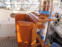
Well since we are so busy here at Marmaris Yacht Marina, with social events, sauna, billiards, dinners etc... etc... during all this relaxation I have decided to tackle touching up on the few pieces of varnished lumber we still have on the exterior of the boat, which of course through the years has been diminished substantially. The only varnished teak left are the cockpit table, the companionway door and framework (the main door to the boat's interior) and the two coaming trims as seen in the background of the picture.
Through the years and with much experience of the degradation of varnish and the resulting upkeep the rest of the exterior teak has been methodically stripped of all varnish. We have some areas of lumber that we just clean with soapy water and seal with a special sealer we found at Budget Marine in St Martin made by SEMCO™, it is very easy to use and apply as is out of the can, after following the instructions labeled on the can, you end up with a matt finish that looks like natural teak that has been sanded and left to slightly bleach in the sun, therefore you can also see the defined grains of the wood, alleluia how much time in maintenance this is saving us which of course leaves a lot more time for social activities and the fun that these activities bring with them. This sealer we do every 6 months without even taping anything as it is very easy to clean (with standard paint thinner) any sealer that eventually gets on to the fiberglass.
The cockpit (the part of the boat where we spend most of the times outdoors) table is a different matter altogether as it is not exposed to the full effects of the environment, it is in the shade of the bimini, (the piece of canvas we have overhead that protects from the sun and other arrogant elements that might be dished down on us) therefore does not deteriorate very often it is more for the nicks and scratches that we maintain it more or less once a year and this happens to be one of those times. We love the look of high gloss varnished teak, looks like there is a glass coating on it especially with many coats added to it 8 to 11 coats at the minimum.
We use Epifanes exterior high gloss, the one that you do not have to sand in-between coats if coated within 36 hours. However I do sand between the last three coats with 380-400 grit sand paper. We start of by scraping down to bare wood any nicks, scratches and other deterioration visible, sand and blend with 180 grit paper, finish sanding these areas with 220 grit paper always with the grain where possible, mix 50-50 varnish and thinner and coat the areas, this already took away a lot of socializing. Wait at least 24hrs in between coats and start building up the next coats with a 75% varnish and 25% thinner solution. When you are happy with the level of coats it is time to wash the whole area with soap and water using a green scotch pad, rinse thoroughly and let dry. Then sand the whole thing with 220 grit paper, remove all dust (no need to tell you how) when you think all of the dust is removed take a tack cloth and wipe down the whole thing making sure you get in tight areas where dust may be hiding. As you can see from this, preparation is 90% of the job, the actual varnishing take little time. Now put as many coats as you want (all depends on how much no socializing you can live with). Sand in between coats with 380-400 grit paper, making sure to remove all the dust before each coat.
Viola' you should end up with a great looking varnish job that even a professional will congratulate on.
| Vessel Name: | Maltese Falcon |
| Vessel Make/Model: | Corbin 39 |
| Hailing Port: | Toronto |
| Crew: | Lillian & Mario Borg |
| About: | |
| Extra: | SSCA Members status Commodores |
Gallery not available
Adventure seekers
Who: Lillian & Mario Borg
Port: Toronto