
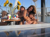
Peter, Heloisa and Auke cruising Westwards around the globe with s/v Mundinho
Our position is updated regularly. Click on Current Position (right side) to find out where we are.
18 December 2012 | Shelter Bay Panama
28 November 2012
19 August 2012 | Panama city BYC
14 August 2012 | 7 34.734'N:78 11.947'W, Bahia Pina, Panama
04 August 2012 | 1 48.992'N:78 43.717'W, Tumaco - Colombia
29 July 2012 | 8 24.0264'N:79 04.9178'W, Isla Pedro Gonzalez - Archipel Las Perlas
23 July 2012 | Panama city
21 July 2012 | Colon, Panama
17 July 2012 | Colon, Panama
10 July 2012 | 9 35.228'N:78 52.950'W, Chichime
29 June 2012 | 9 35.346'N:78 40.542'W, Kalugir Tupu and Banedup
26 June 2012 | 9 35.191'N:78 44.751'W, Miriadiadup
24 June 2012 | 9 35.231'N:78 52.839'W, Uchutupu Pippi
21 June 2012 | 9 32.722'N:78 53.754'W, Cay Limon
15 June 2012 | Colon Panama
13 June 2012 | Shelter BAy, Colon Panama
11 June 2012
08 June 2012
06 June 2012 | Shelter Bay, Colon Panama
04 June 2012 | Shelter Bay, Colon Panama
The end of an upwind battle.
14 August 2012 | 7 34.734'N:78 11.947'W, Bahia Pina, Panama
Peter via Satphone
Our idea had been to sail down South to Salinas in Ecuador. There is a boatyard there reportedly which we wanted to check out and see if it would be good (safe) enough to leave Mundinho for a period of 6 months, while we would have a break from cruising life. The Pacific Cyclone season, present from the begin of November till the end of March forced us to wait somewhere. Originally we had Tahiti in mind to wait. However Tahiti is expensive to wait, and it is still in the cyclone area, and the idea of me doing some freelance work around the world while Heloisa and Auke would stay on board in a cyclone area did not sit good with both of us. Also there are challenges with 6 month stays in French Polynesia for non EU citizen (Heloisa is Brazilian). The Marquises are supposed to be low risk for cyclones, however the BA pilot shows one cyclone reached the Marquises in the last 10 years. You only need one cyclone and a bad positioned bay to end up in troubles so the idea was born to leave the boat in Ecuador. It is late in the year to sail down to Ecuador from Panama. The sailing directions (pilots) are clear about the increased trade winds from the SW for this time of the year and off course you have the always North going Humboldt current (Peru current). After we made port in Tumaco (Colombia) to have a rest of the upwind battle, we tried it two more times. However both times we departed Tumaco heading South we encountered 20 �- 22 knots true winds (which is 24 to 26 apperent wind when close hauled) from the SW once free from the coast, making it a real upwind struggle. Mundinho is doing well upwind and we could do over 5 knots in relative comfort (no slamming) close hauled but naturally on one ear. However the choppy seas caused by the 20 knot winds on top of the ever present large Southern ocean swell and the ever flowing Humboldt Current limit your upwind progress. We would need another 10 days of upwind tacking to reach Salinas in Ec uador into these 20+ knot winds. We decided we were not up for that and turned around, back to Panama, determined to find a place for Mundinho there to leave her for 6 months. The excellent company I have worked for for many years offered a great temporary opportunity which we will take. This will take us all three off Mundinho and have us live in a different country for 6 months while waiting for the Pacific cyclone season to pass, so we are looking for a safe spot to leave the boat. When the Pacific cyclone season is over we come back and continue. While I write this we are underway back to Panama. The only good thing of upwind battles is that once you go downwind you appreciate good sailing conditions so much more. The trip up North from Tumaco back to Panama was a leisurely sailing trip. Last night we sailed into Bahia Pinas (Panama). An open bay that on the charts appeared to provide a good shelter for the night and provide a nice quite night, especially for Auke who was wondering openly when this wobbly mode was going to stop. I had one large scale paper chart of the Panama coast and the C-Map Max electronic small scale chart showing a clear bay with no obstacles, so I figured even easy to enter in the night, even with the never ending nightly rain showers. While lining up with the bay several miles outside in pitch darkness (no moon and heavy overcast) the C-Map electronic chart showed the small scale insert map of the bay incorrectly rotated about 40 degrees with reality (you can verify that by overlaying th e radar picture on the electronic chart), so that was another heads up not to rely on electronic charts for close navigation. If you would have relied on the electronic chart only, it would have placed Mundinho nicely on top (or rather smashed to bits and pieces against it) of a 30 meter high black rock, Morro de Pinas, which is guarding the West side of the entrance of the bay. The only lighthouse (Punta Pina) displayed on the chart marking the West side of the bay was extinguished, however the entry on radar was elative easy to do into this bay. It gave however a kind of erie feeling to pass half a mile of a large rock, clearly visible on the radar but only when it is really abeam you visually see a faint outline against the horizon of the rock and then only you see it because you know where to look due to the radar. That is always the case when you have no moon and heavy overcast in remote areas, where there is no articfical lights from citys etc. Pitch black darknes s rules then. It is easy to understand that the "prudent mariner" would stand at sea till daylight before entering in the days when radar was not avaialble. As the BA pilot described the coast as being with cliffs and steep rocky green hills I knew they would be provide good returns on the radar, different then with reefs for example which are always very tricky to find on radar. Last night at 23:00 we anchored deep inside the bay in pitch darkness in 12 meters of water. Only the radar (and our floodlight) showing some other (fishing) boats anchored in front of us. This morning we were welcomed by a most beautiful sight of a perfect bay. Green and lush steep hills surround us. This is a perfect movie quality type bay! We will have breakfast (Heloisa is making pancakes as I type this) and raise anchor to sail to Balboa (Panama city), another 120 nm to the NE.
All well with boat and crew.
All well with boat and crew.
Comments
| Vessel Name: | Mundinho |
| Vessel Make/Model: | Koopmans 42 - Ketch - Alu Centerboard |
| Hailing Port: | Harlingen - Holland |
| Crew: | Peter, Heloisa and Auke |
| About: | We are a family of three, a rather international get together with myself being Dutch, my lovely wife being Brazilian and our 7 year old son who carries a Dutch and Brazilian citizenship |
| Extra: | You can follow us here during our two year sailing trip that will take us together via the Caribbean and the Islands in the Pacific to New Zealand. Beyond that I will take Mundinho to Europe solo. |
| Home Page: | www.sv-mundinho.com |
Gallery not available
Family of three travelling West Bound (slowly)
Who: Peter, Heloisa and Auke
Port: Harlingen - Holland
All Blogs posted
Peter and Heloisa and their 7 year old son Auke are traveling with their sailing vessel a Koopmans 42. On this blog you can find updates regularly posted of their preparation and trip itself. Feel free to leave a message or raise a question if you have any for Peter and Heloisa.