Movin’ along
04 February 2020
• Myrtle Beach SC
by Michael and Barbara Turney • Sunny
Tuesday 4 February 2020
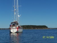
This morning we were 390 miles from Norfolk. I did a reverse timing recce and came up with the following: without endangering ourselves or Nelleke Moorehead City is 4-5 days from Norfolk and we are 5 days from Moorehead City and that includes stops to wait for tides to get by the skinny bits. Best case we should get to Deltaville by the 15th or 16th, but that timing will allow us to stay at a dock for an extra if there is bad weather as is forecast for this coming Thursday. It looks like that will be somewhere in the vicinity of Wrightsville Beach. Either that or Southport. Both in NC. We are underway at 7:20 in the morning. I am looking forward to today's trip because, as I said before, to me this is the prettiest part of the ICW. The day promises to be clear and while not hot at least not freezing cold. We started the days in our parkas but I expect it by lunchtime will be down to polo shirts. Shortly after beginning our trip a fellow in a speed boat ran up to us and asked us to please be careful ahead as he had a shed drift net in the water across the river. I've never seen such a thing but he was very nice and polite and when we altered course and went around it he was also grateful. Just one more adventure in the cruising lifestyle. on this part of the ICW as I mentioned mature trees grow along the edge of the river but in the background you can see flat open field that used to be rice patties. This part of the country was famous for raising rice. Of course the field hands at the original time we're all slaves but from what we've been able to gather the owners and the slaves around here seem to get along. Indeed, when they passed away they were buried in the same cemetery, which to my way of thinking would indicate a certain common acceptance.
We spent most of the morning pushing an adverse title current which slowed our speed down to a little over five nights or 6 miles an hour. I didn't mind this so much because as I said this is a very pretty stretch of the ICW. We also found out by judicious use of the binoculars by Barbara and consultation of the Internet why this is so. This part of the ICW is a wildlife preserve stretching for some considerable distance on both sides of the waterway. This has virtually eliminated the development of homes and condos which would otherwise probably proliferate along here being as we are this close to Myrtle Beach. It remains to be seen with the current administration in Washington whether or not this particular wildlife preserve can be maintained considering how gutted the EPA has become.
This stretch of the ICW is essentially the Waccamaw river. I wondered where the name came from, and one naughty thought came to my mind which was That it was the local first Nations dialect for the slap yo mama but Barbara did the research and found out that it was actually the name of the native tribe that lived here before the Europeans came.
Coming down the ICW, once again we are struck by the number of political flags fluttering from hoists along the waterway. I think it speaks to the people that put them up that they don't understand basic flag etiquette, namely that a national flag should be the only flag on a hoist. You don't Put the national flag and right underneath it hang a political flag. It's simply bad flag manners.
At any rate, shortly before noon we caught the ebb current and were, for us rocketing along at over seven knots.
We arrived at the Lightkeeper's Marina at two in the afternoon. A trip of 47 miles today and we are at mile 346, just at the border between North and South Carolina. Tomorrow we will have a shorter day either to Southport or to the Carolina State Park on the other side of Cape Fear River. It all depends if we can get into the state park marina at anything but high tide.


Comments