In NC. Hurray.
05 February 2020
• Carolina State Park Marina
by Michael and Barbara Turney • Cloudy but warm

Wednesday 5 February 2020
Thank you Mimi. I don’t want to be wishing my life away, do I? It took me until I started writing today’s post to figure out what you meant by your comment but eventually the penny dropped.
I feel my cold is almost gone but still it has the ability to combine with a twelve hour day, nine of which is out in the fresh air, to knock the stuffing out of me. I am quite used to cruisers midnight being at around nine o’clock but not six thirty which is what it has been for me lately. Then, of course, you wake up earlier than you wish to. We do want to be underway at first light but we would rather not be sitting about waiting for it.
We began today at mile 346. There was a boat at the marina right across from us owned by a fellow who had multiple jobs ranging from charter captain to coast guard inspector to several others. He has more than one boat so I guess he needs the jobs to pay for his maritime habit. At any rate he gave us loads of advice for today. Our objective for this afternoon will be the Carolina State Park Marina at about mile marker 296 which will mean a 50 mile day. We will hole up there for two nights as it promises to have thunderstorms and 40-50mm of rain on Thursday and I am unhappy enough with cold but to be wet and cold all day..... Friday the plan will be to make for Mile Hammock Bay to anchor in the middle of the Marine Base Camp Lejune and then Saturday head for Moorehead City which will be mile marker 200 on the ICW. My dream from there, will be to go as far as Dowery Creek Marina at the south end of Pungo River Alligator Creek Canal on Sunday. That might be too far as it’s a 75 mile trip but there are a number of fallback anchorages before we get there. When we do anchor I will be bringing out the generator to run while we are stopped both to keep the batteries charged and to allow us to run an electric heater.
As it is by 10:30 we came through the one supposed major skinny bit for today, Lockwood Folly. There was a dredge operating there and we never saw anything less than a foot and a half under the keel at dead low Tide. I will however complain on this blog at the fact that we have yet to get a response when we try to hail any of the dredge operations we’ve come across on this trip. They are supposed to be monitoring channel 16 as well as channel 13 and they have an answered to neither. Perhaps they are frustrated at having to answer questions from private boaters like us but it does make you feel like complaining to the Coast Guard.
There are two things that I find interesting about our cruising on this trip. First the coldest part of our return north was actually in Florida. It’s been warmer in South Carolina and now that we are in North Carolina here as well. Even Georgia was warmer than Florida! Second, it is obvious that we are moving in non-boating season. We are the only boat that we have come across that he’s heading north, and even the boats that are heading south are fewer number and I making tracks as fast as they can. The other thing that’s significantly different is there is a lot less yap on the VHF. In Florida of course there are more boaters on the water but up here the only radio traffic I’ve heard were people hailing bridges for openings and occasionally, very, very occasionally, one boat or hailing their buddy boat and then they switch to a working channel.
As for navigation on this trip there are two things that I simply can’t say enough good things about. First TowBoatUS. Anyone boating in the United States that does not have that is not only missing out on a good thing but they are out of their minds. Second, AquaMaps with the US Corps of Engineer survey charts overlaid. These have been a mercy for us navigating the very shallow parts of the ICW. We have not found them to be mistaken at any time. Famous last words, but hopefully not.
I also discovered why the digital depth sounder at the helm station wasn’t working. We also have a fishfinder at the steering station in the cabin which I had been running at the same time. The other day I forgot to turn it on and magically the digital depth sounder at the top side steering station began to work perfectly. I had been warned that sometimes one depth sounder will confuse another, and I guess that was the case here. it just took an accident for me to find that out.
We got to Carolina Beach State Park Marina at two o’clock and squeezed in at two hours after low tide with a five and a half foot draft. This took a bit of force as we touched bottom on the way in. We wouldn’t if we had come in an hour later. This is a really nice place. $33/ night regardless of length which includes power! Well worth planning to get in here and leave at the top half cycle of the tide. It is a State Park with walking trails and a visitors centre as well. Also, I was not aware that the Venus flytrap was indigenous only to this area.
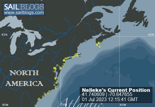
Today we steamed for seven and a quarter hours and travelled 58.9 miles and are now at mile marker 297.1. We are approximately 320 miles to go! I am beginning to think we will meet our schedule.


Comments