Voyages North
23 July 2023
21 August 2021
11 July 2021 | Posted in Seattle
16 May 2021
07 January 2021
10 April 2020 | Posted in Seattle
31 August 2019 | Posted at Port McNeill
31 August 2019
30 August 2019
30 August 2019 | Posted at Port MCNeill
13 August 2019 | Posted at Prince Rupert
13 August 2019 | Posted at Prince Rupert
03 August 2019 | Posted at Ketchikan
02 August 2019 | Posted at Metlakatla
02 August 2019 | posted in Metlakatla AK
22 July 2019 | Posted at Klawock/Craig
22 July 2019 | Posted at Klawock/Craig
09 July 2019 | Posted at Juneau
09 July 2019 | Posted at Juneau
27 June 2019
Gardner Canal 53 34’N 128 49’W. July 28-August 4, 2012
12 August 2012 | posted at Ocean Falls
Elsie Hulsizer

Photo: motoring north in Gardner Canal.
Steve looked at Osprey's log and announced, "We've gone 1,000 nautical miles since leaving Seattle. He punched a few buttons on the chart plotter and said, "But we're only 432 miles from Seattle!"
An hour later we passed Staniforth Point. Almost immediately, the water turned turquoise (from glacial silt), the hillsides became steeper and higher and the trees changed from scrubby cedars to stately hemlock ands spruce. We had entered Gardner Canal, one of coastal B.C.'s most beautiful -- and least visited--bodies of water. Winding southeast into mountainous terrain for almost 48 miles, Gardner Canal is not strictly a canal but a fjord. And like most fjords it is deep, as much as 200 fathoms (1200 feet or approximately 600 m), and created by glaciers.
We have met only a few other boaters who have been here. Those who have been rave about it. We were curious to find out why it rated so many raves and also, why so few boaters go there.
We spent a week exploring Gardner Canal. The farther in we ventured, the more spectacular the scenery -- and the colder the water and air. Out came the fleece and away went short-sleeved T-shirts and shorts. I felt as if we were in Alaska. In fact, not only did the air feel like Alaska, but the scenery could have been in Alaska. If you prefer your glaciers at a distance and your waters iceberg-free, Gardner Canal is like a mini-SE Alaska. If Alaskans want to know what Tracy Arm, Endicott Arm and even parts of Glacier Bay will look like as the glaciers melt away, this is a good place to come.
We stayed overnight at four different anchorages and stopped at two others. Here's what we found.
Europa (aka Shearwater) Hot Springs 53 26.95'N 128 33.50'W July 29-31, 2012.

Photo: Europa (aka Shearwater) Hot Springs
Above the canal, steep hills rose to rounded domes and in the middle of the little bay a stream poured in past a marshy flat. Two vacant parks buoys were in the bay.
"I vote we stay here two nights," said Steve. Since leaving Laredo Channel two long days before, we'd been motoring almost full time in calms. We were tired of listening to the engine drone.
We spent the night and next day at anchor off the stream, went ashore and lolled in the hot springs and just generally relaxed. A raised shelter with a picnic table and benches covered the hot springs which were surrounded by ferns, like a grotto. Europa Springs are definitely one of B.C.'s best hotsprings.
We had the place to ourselves. We thought we were in a most beautiful setting, but we didn't realize how much more beautiful the scenery could get.
Owyacumish Bay. 31 July, 2012 and 2 August, 2012

Photo: Brim River in Owyacumish Bay.
Mists swirled around mountain tops and waterfalls spurted from promontories as we motored farther into the canal, leaving Europa Hot Springs behind. Then we entered Europa Reach where bare walls of gray stone gouged by glaciers confronted us. Every corner we turned showed something more amazing. A short distance later we came to Owyacumish Bay. I couldn't remember seeing a more beautiful little spot. The Owyacumish Creek tumbled into the bay as a waterfall on the west side and the Brim River flowed across a marsh into the head of the bay. Beyond the Brim River rose two gray stone domes.
We didn't stay that day but vowed to return. Two days later we did. The sun was out and everything glowed. I paddled my kayak up the Brim River followed by a curious seal.
The only drawback was anchoring. Much of the bay was too deep except for the parts that were too shallow. No matter where we anchored, Steve was afraid we'd be on the flats at low tide. We stayed for a couple of hours and then went on, back to Europa Hot Springs.
Kemano Beach. July 31, 2012.

Photo: Kemano Beach marina.
We passed Entrance Pt with its lone totem pole and motored into a small marina with small-boat slips. As we passed the log breakwater a 12 knot wind came up, making maneuvering in the tight space difficult. Osprey just barely fit on an outside dock.
"Kemano Yacht Club" read the sign on a small metal building. It sounded promising until we walked around to the other side and discovered the sign on that side read "Fire Suppressant Equipment." The building was locked. Only two boats occupied the small marina, a red steel sailboat and an aluminum workboat. Ashore, a second larger building marked "warehouse," a fuel tank and a dumpster were the only facilities. A cold wind blew across the empty land. Two foot ferries occupied a larger dock next to the marina. "Authorized Personnel Only" read the sign on that dock. The smaller ferry was getting ready to leave and two crewmen waved to us. We put our trash in the dumpster and left. No sooner did we leave the marina than the 12 knot wind died to nothing.
Kemano Beach served as the staging area for the construction of Kitimat's power plant, a cold war project famous for being hidden inside a mountain. Today, Kemano serves only as access to that power plant. I couldn't help but think how nice it would be if the little marina were developed, with water and power, larger slips, picnic tables ashore. Maybe then more boats would come to this beautiful fjord.
Chief Matthews Bay. 53 22.51'N 128 03.51'W. July 31-Aug 1, 2012.

Photo: waterfall in Chief Matthews Bay. For scale, note the fishing boat at its base on the right side.
We motored southeast down Whidbey Reach, oohing and aahing at the numerous waterfalls that tumbled down the faces of steep four to six thousand ft mountains. We anchored in the southeast corner of the bay, just off a huge grassy delta, in 22m of water. Just a few feet ahead of us was a drying tide flat and just a few feet behind us was deep water. Three and a half miles of open water stretched north to the mouth of the bay and across the Canal. Three quarters of a mile of open water stretched to the west side of the bay. This is a huge bay. One other boat was in the bay when we anchored but it left before nightfall.

Photo: Osprey anchored in Chief Matthews Bay.
That night the wind blew out the bay, holding us offshore. I was glad it didn't blow in the opposite direction because three and a half miles of open water would build up substantial waves. In the morning we got up to see the drying tide flat just a few feet away and to smell the tang of low tide. Mists swirled over the flats and through the trees on the steep hillside above us.
We waited for the tide to rise, then put the outboard on the dingy and motored across the bay to the entrance to Kowesas River. We stopped at the Kowesas Lodge, a cabin built in partnership with the Na Na Kila Institute in Kitimaat Village and Ecotrust Canada. No one was around. Swallow droppings coated much of the porch floor but inside were varnished floors, tables and chairs, and a full set of kitchen appliances, along with a full pantry.
We motored the dinghy upriver through swirling currents, past huge beached trees and along banks bordered with flowers and bushes. "I wouldn't want to be caught out here," said Steve as we turned to go. "It might be a week before somebody came by." And that's in the summer!

Photo Kowesas River
Kitlope Anchorage. August 1-2, 2012.

Photo: Tide flat in Kitlope Anchorage at low tide.
We left Chief Matthews Bay and motored deeper into Gardner Canal, towards Kitlope Anchorage at the very end of the Canal. More steep mountains with waterfalls lined both sides of the canal. At Price Cove we looked up a valley to see a glacier high up the mountain.
As we approached the anchorage at the mouth of the Kitlope River we could see two powerboats anchored off of it (we later learned they were both from nearby Kitimat). I kept looking at the chart plotter, then at the boats, then at the paper chart, trying to make sense of where they were. It looked as if they were anchored in very deep water. But as we passed the first one, the bottom came up. We finally anchored in 16 m of water, in what the chart said should be about 50m. Substantial silting had obviously occurred. Just ahead of us I could see currents swirling from a stream coming into the bay.
In the morning, at low tide, a torrent roared off our stern. If we had been just a few feet to port, we would have been in a raging river. We waited for the tide to come in and left, humbled by the challenge of anchoring in this beautiful spot.
As we left Gardner Canal we reflected that in our week there we had seen only less than half a dozen other boats and most of them from nearby Kitimat. Boaters are missing out on a place of rare beauty. We're trying to figure out how to get more anchor line on Osprey so that next time we come we can anchor in deeper water.
Photo: looking up a glacial valley. Glacier can be seen at the top left.

Steve looked at Osprey's log and announced, "We've gone 1,000 nautical miles since leaving Seattle. He punched a few buttons on the chart plotter and said, "But we're only 432 miles from Seattle!"
An hour later we passed Staniforth Point. Almost immediately, the water turned turquoise (from glacial silt), the hillsides became steeper and higher and the trees changed from scrubby cedars to stately hemlock ands spruce. We had entered Gardner Canal, one of coastal B.C.'s most beautiful -- and least visited--bodies of water. Winding southeast into mountainous terrain for almost 48 miles, Gardner Canal is not strictly a canal but a fjord. And like most fjords it is deep, as much as 200 fathoms (1200 feet or approximately 600 m), and created by glaciers.
We have met only a few other boaters who have been here. Those who have been rave about it. We were curious to find out why it rated so many raves and also, why so few boaters go there.
We spent a week exploring Gardner Canal. The farther in we ventured, the more spectacular the scenery -- and the colder the water and air. Out came the fleece and away went short-sleeved T-shirts and shorts. I felt as if we were in Alaska. In fact, not only did the air feel like Alaska, but the scenery could have been in Alaska. If you prefer your glaciers at a distance and your waters iceberg-free, Gardner Canal is like a mini-SE Alaska. If Alaskans want to know what Tracy Arm, Endicott Arm and even parts of Glacier Bay will look like as the glaciers melt away, this is a good place to come.
We stayed overnight at four different anchorages and stopped at two others. Here's what we found.
Europa (aka Shearwater) Hot Springs 53 26.95'N 128 33.50'W July 29-31, 2012.
Photo: Europa (aka Shearwater) Hot Springs
Above the canal, steep hills rose to rounded domes and in the middle of the little bay a stream poured in past a marshy flat. Two vacant parks buoys were in the bay.
"I vote we stay here two nights," said Steve. Since leaving Laredo Channel two long days before, we'd been motoring almost full time in calms. We were tired of listening to the engine drone.
We spent the night and next day at anchor off the stream, went ashore and lolled in the hot springs and just generally relaxed. A raised shelter with a picnic table and benches covered the hot springs which were surrounded by ferns, like a grotto. Europa Springs are definitely one of B.C.'s best hotsprings.
We had the place to ourselves. We thought we were in a most beautiful setting, but we didn't realize how much more beautiful the scenery could get.
Owyacumish Bay. 31 July, 2012 and 2 August, 2012
Photo: Brim River in Owyacumish Bay.
Mists swirled around mountain tops and waterfalls spurted from promontories as we motored farther into the canal, leaving Europa Hot Springs behind. Then we entered Europa Reach where bare walls of gray stone gouged by glaciers confronted us. Every corner we turned showed something more amazing. A short distance later we came to Owyacumish Bay. I couldn't remember seeing a more beautiful little spot. The Owyacumish Creek tumbled into the bay as a waterfall on the west side and the Brim River flowed across a marsh into the head of the bay. Beyond the Brim River rose two gray stone domes.
We didn't stay that day but vowed to return. Two days later we did. The sun was out and everything glowed. I paddled my kayak up the Brim River followed by a curious seal.
The only drawback was anchoring. Much of the bay was too deep except for the parts that were too shallow. No matter where we anchored, Steve was afraid we'd be on the flats at low tide. We stayed for a couple of hours and then went on, back to Europa Hot Springs.
Kemano Beach. July 31, 2012.
Photo: Kemano Beach marina.
We passed Entrance Pt with its lone totem pole and motored into a small marina with small-boat slips. As we passed the log breakwater a 12 knot wind came up, making maneuvering in the tight space difficult. Osprey just barely fit on an outside dock.
"Kemano Yacht Club" read the sign on a small metal building. It sounded promising until we walked around to the other side and discovered the sign on that side read "Fire Suppressant Equipment." The building was locked. Only two boats occupied the small marina, a red steel sailboat and an aluminum workboat. Ashore, a second larger building marked "warehouse," a fuel tank and a dumpster were the only facilities. A cold wind blew across the empty land. Two foot ferries occupied a larger dock next to the marina. "Authorized Personnel Only" read the sign on that dock. The smaller ferry was getting ready to leave and two crewmen waved to us. We put our trash in the dumpster and left. No sooner did we leave the marina than the 12 knot wind died to nothing.
Kemano Beach served as the staging area for the construction of Kitimat's power plant, a cold war project famous for being hidden inside a mountain. Today, Kemano serves only as access to that power plant. I couldn't help but think how nice it would be if the little marina were developed, with water and power, larger slips, picnic tables ashore. Maybe then more boats would come to this beautiful fjord.
Chief Matthews Bay. 53 22.51'N 128 03.51'W. July 31-Aug 1, 2012.
Photo: waterfall in Chief Matthews Bay. For scale, note the fishing boat at its base on the right side.
We motored southeast down Whidbey Reach, oohing and aahing at the numerous waterfalls that tumbled down the faces of steep four to six thousand ft mountains. We anchored in the southeast corner of the bay, just off a huge grassy delta, in 22m of water. Just a few feet ahead of us was a drying tide flat and just a few feet behind us was deep water. Three and a half miles of open water stretched north to the mouth of the bay and across the Canal. Three quarters of a mile of open water stretched to the west side of the bay. This is a huge bay. One other boat was in the bay when we anchored but it left before nightfall.
Photo: Osprey anchored in Chief Matthews Bay.
That night the wind blew out the bay, holding us offshore. I was glad it didn't blow in the opposite direction because three and a half miles of open water would build up substantial waves. In the morning we got up to see the drying tide flat just a few feet away and to smell the tang of low tide. Mists swirled over the flats and through the trees on the steep hillside above us.
We waited for the tide to rise, then put the outboard on the dingy and motored across the bay to the entrance to Kowesas River. We stopped at the Kowesas Lodge, a cabin built in partnership with the Na Na Kila Institute in Kitimaat Village and Ecotrust Canada. No one was around. Swallow droppings coated much of the porch floor but inside were varnished floors, tables and chairs, and a full set of kitchen appliances, along with a full pantry.
We motored the dinghy upriver through swirling currents, past huge beached trees and along banks bordered with flowers and bushes. "I wouldn't want to be caught out here," said Steve as we turned to go. "It might be a week before somebody came by." And that's in the summer!
Photo Kowesas River
Kitlope Anchorage. August 1-2, 2012.
Photo: Tide flat in Kitlope Anchorage at low tide.
We left Chief Matthews Bay and motored deeper into Gardner Canal, towards Kitlope Anchorage at the very end of the Canal. More steep mountains with waterfalls lined both sides of the canal. At Price Cove we looked up a valley to see a glacier high up the mountain.
As we approached the anchorage at the mouth of the Kitlope River we could see two powerboats anchored off of it (we later learned they were both from nearby Kitimat). I kept looking at the chart plotter, then at the boats, then at the paper chart, trying to make sense of where they were. It looked as if they were anchored in very deep water. But as we passed the first one, the bottom came up. We finally anchored in 16 m of water, in what the chart said should be about 50m. Substantial silting had obviously occurred. Just ahead of us I could see currents swirling from a stream coming into the bay.
In the morning, at low tide, a torrent roared off our stern. If we had been just a few feet to port, we would have been in a raging river. We waited for the tide to come in and left, humbled by the challenge of anchoring in this beautiful spot.
As we left Gardner Canal we reflected that in our week there we had seen only less than half a dozen other boats and most of them from nearby Kitimat. Boaters are missing out on a place of rare beauty. We're trying to figure out how to get more anchor line on Osprey so that next time we come we can anchor in deeper water.
Photo: looking up a glacial valley. Glacier can be seen at the top left.
Comments
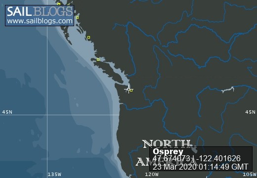
| Vessel Name: | Osprey |
| Vessel Make/Model: | Annapolis 44 sloop |
| Hailing Port: | Seattle |
| Crew: | Steve and Elsie Hulsizer (author of Glaciers, Bears and Totems and Voyages to Windward) |
| About: | |
| Extra: |
Osprey's Photos - Main
No items in this gallery.
Voyages North on SV Osprey
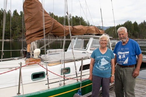
Who: Steve and Elsie Hulsizer (author of Glaciers, Bears and Totems and Voyages to Windward)
Port: Seattle
SailBlogs Friends

