Voyages North
23 July 2023
21 August 2021
11 July 2021 | Posted in Seattle
16 May 2021
07 January 2021
10 April 2020 | Posted in Seattle
31 August 2019 | Posted at Port McNeill
31 August 2019
30 August 2019
30 August 2019 | Posted at Port MCNeill
13 August 2019 | Posted at Prince Rupert
13 August 2019 | Posted at Prince Rupert
03 August 2019 | Posted at Ketchikan
02 August 2019 | Posted at Metlakatla
02 August 2019 | posted in Metlakatla AK
22 July 2019 | Posted at Klawock/Craig
22 July 2019 | Posted at Klawock/Craig
09 July 2019 | Posted at Juneau
09 July 2019 | Posted at Juneau
27 June 2019
Alison Sound - worth the rapids July 24, 2014
02 August 2014

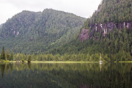
Photo: Alison Sound anchorage
Photo: Anchorage at the head of Alison Sound in Belize Inlet.
A broad river delta stretched ahead of us and steep promontories towered above us. This anchorage was so different from little Village Cove where we had anchored the night before that it was hard to believe we'd come only 30 miles to get here.
We'd passed through dramatic scenery on the way. The long east-west arm of Belize Inlet with peaks on either side rising taller the farther from the ocean we traveled gave the sense of motoring into the mountains -- except of course we had been at sea level all the way. Just before we turned into Alison Sound, the sight of a half dome towering over the inlet had astonished us. Closer to the water, cliffs of bare black rock lined the shore.

Photo: Half dome in Belize Inlet, with waterfall.
Just the trip up Belize Inlet to Alison Sound had made braving the rapids worth it, I thought. And then we saw the pictograph.
Our guidebooks had described it but all we knew of its location was it was west of Summers Bay. As we approached the bay we scanned the shore, looking for a cliff with light colored rock, the rock of choice for pictograph artists. There was only one cliff in the area, it had to be it. We motored over.
"I think I see it," said Steve, pointing to a spot about 20 ft up. "Just above that small tree."
It took me a few seconds to find it, but when I did I had a start of amazement. A simple drawing in red ochre of 6 small canoes facing one large one -- all clear and bright as if they'd been painted yesterday. No one knows who painted it other than it was probably a member of the Nakwaktok First Nations and could have been done more than 100 years ago. Archaeologists believe that this pictograph, and one other in Belize Inlet, depicts an attack by Nakwaktoks on a trading ship and subsequent reprisals in 1862.

Photo: Pictograph in Alison Sound
Later that afternoon, we took the dinghy up Waump Creek. As we approached the delta, I looked down through the water, expecting to see seaweed or swirls of mixing saltwater as at other deltas. But all I saw was bare sand and clear water. The tide was falling and water logged stumps crowned with flowers stuck out above the water like little islands, their limbs free of mussels and barnacles With the only source of salt water the narrow Nakwakto Rapids and with an additional barrier in the form of narrows in Allison Sound, little salt water gets up here. It was like cruising in a lake except with tides.

Photo: the mouth of Waump Creek
Photo: Anchorage at the head of Alison Sound in Belize Inlet.
A broad river delta stretched ahead of us and steep promontories towered above us. This anchorage was so different from little Village Cove where we had anchored the night before that it was hard to believe we'd come only 30 miles to get here.
We'd passed through dramatic scenery on the way. The long east-west arm of Belize Inlet with peaks on either side rising taller the farther from the ocean we traveled gave the sense of motoring into the mountains -- except of course we had been at sea level all the way. Just before we turned into Alison Sound, the sight of a half dome towering over the inlet had astonished us. Closer to the water, cliffs of bare black rock lined the shore.

Photo: Half dome in Belize Inlet, with waterfall.
Just the trip up Belize Inlet to Alison Sound had made braving the rapids worth it, I thought. And then we saw the pictograph.
Our guidebooks had described it but all we knew of its location was it was west of Summers Bay. As we approached the bay we scanned the shore, looking for a cliff with light colored rock, the rock of choice for pictograph artists. There was only one cliff in the area, it had to be it. We motored over.
"I think I see it," said Steve, pointing to a spot about 20 ft up. "Just above that small tree."
It took me a few seconds to find it, but when I did I had a start of amazement. A simple drawing in red ochre of 6 small canoes facing one large one -- all clear and bright as if they'd been painted yesterday. No one knows who painted it other than it was probably a member of the Nakwaktok First Nations and could have been done more than 100 years ago. Archaeologists believe that this pictograph, and one other in Belize Inlet, depicts an attack by Nakwaktoks on a trading ship and subsequent reprisals in 1862.

Photo: Pictograph in Alison Sound
Later that afternoon, we took the dinghy up Waump Creek. As we approached the delta, I looked down through the water, expecting to see seaweed or swirls of mixing saltwater as at other deltas. But all I saw was bare sand and clear water. The tide was falling and water logged stumps crowned with flowers stuck out above the water like little islands, their limbs free of mussels and barnacles With the only source of salt water the narrow Nakwakto Rapids and with an additional barrier in the form of narrows in Allison Sound, little salt water gets up here. It was like cruising in a lake except with tides.

Photo: the mouth of Waump Creek
Comments
| Vessel Name: | Osprey |
| Vessel Make/Model: | Annapolis 44 sloop |
| Hailing Port: | Seattle |
| Crew: | Steve and Elsie Hulsizer (author of Glaciers, Bears and Totems and Voyages to Windward) |
| About: | |
| Extra: |
Osprey's Photos - Main
No items in this gallery.
Voyages North on SV Osprey

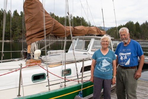
Who: Steve and Elsie Hulsizer (author of Glaciers, Bears and Totems and Voyages to Windward)
Port: Seattle


