Voyages North
23 July 2023
21 August 2021
11 July 2021 | Posted in Seattle
16 May 2021
07 January 2021
10 April 2020 | Posted in Seattle
31 August 2019 | Posted at Port McNeill
31 August 2019
30 August 2019
30 August 2019 | Posted at Port MCNeill
13 August 2019 | Posted at Prince Rupert
13 August 2019 | Posted at Prince Rupert
03 August 2019 | Posted at Ketchikan
02 August 2019 | Posted at Metlakatla
02 August 2019 | posted in Metlakatla AK
22 July 2019 | Posted at Klawock/Craig
22 July 2019 | Posted at Klawock/Craig
09 July 2019 | Posted at Juneau
09 July 2019 | Posted at Juneau
27 June 2019
Port Neville (Johnstone Strait) to Cordero Islands. August 18, 2016
29 August 2016
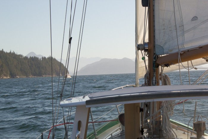
Photo: Sailing in Sunderland Channel
We exited Port Neville with our mainsail rattling in the stiff breeze. It was going to be a fast ride south down Johnstone Strait to our planned turn at Sunderland Channel, four miles away.
The Inside Passage in this area between Vancouver Island and the mainland is a maze of channels, offering a number of alternate routes south. Johnstone Strait, the most direct, is also the windiest and roughest. It's the route we usually take because it's the fastest and we're more apt to be able to sail. But today, we were planning to turn off at Sunderland Channel and take an alternate route to look for pictographs (see post on Roscoe Inlet for more about pictographs).
Once out of Port Neville, we let out the main, rolled out the jib and headed down Johnstone Strait, Osprey seemingly flying through the water.
"We'll never be able to get close enough to shore in this wind to find those pictographs," said Steve. "Let's just keep going in Johnstone.
But then we noticed our speed over ground was only five knots when we should have been at least seven. We hadn't checked the current in Johnstone Strait because we planned to be in it for only a few miles. A quick look at the current tables showed we had three more hours of ebb. We needed the flood. Wind against the tide would not only slow us down, it would make for an uncomfortable wet ride. Already, Osprey was bucking in the steep waves as we got farther out in the Strait. Steve, at the wheel, had to struggle to keep us on course.
"The side channels like Sunderland are supposed to be quieter," said Steve. "Let's try it."
Forty-five minutes later we entered Sunderland Channel. The seas quieted and the wind slackened. We skimmed along the shore on a broad reach. We could looking for pictographs after all, but we would have to look fast.
Shaw Point came into view, the site of the first pictograph on our list for the day. Steve had the binoculars. "I see it! You'll have about one minute to photograph it before we'll be past it. Can you do it?"
I had seen it too, even without the binoculars. As Steve steered the boat towards it I could see it was a copper clearly outlined in red. I quickly shot a distant image to put the pictograph in perspective, changed lenses to the telephoto, took two more shots, then a shot of our chart plotter to get the location. A quick glance of the camera screen showed I'd gotten good images.
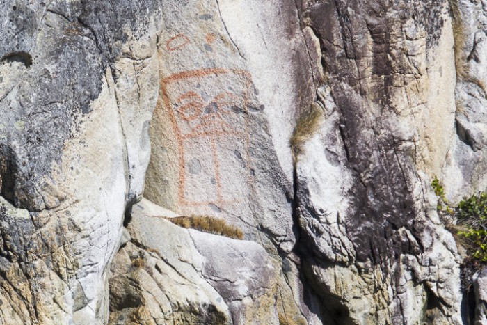
Photo: A pictograph of a copper on Shaw Point, Sunderland Channel.
I was just putting my camera down when Steve asked, "What's that in the water? Is that an animal?"
I looked ahead and saw a dark shape approaching the beach. Two round ears stuck above the water. A bear! Would it get out of the water soon enough for me to photograph it? It seemed to be taking forever to swim just a short distance. "Come on, bear," said Steve. "Swim!" Just as we were about to pass it, the bear hoisted itself out of the water, shook itself off and climbed up the beach. I had just enough time to get a series of photos.
The bear had obviously been swimming across the channel from Hardwick Island, a distance of almost exactly a mile. We had heard of bears crossing channels like this, now we had seen it in real life.
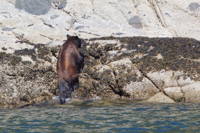
Photo: Black bear climbing up the beach.
A beautiful pictograph and a bear, both in just a few minutes. I was glad we'd chosen the slower route.
We continued sailing up Sunderland Channel, motored through Whirlpool Rapids in Wellbore Channel with the flood, sailed again in Chancellor Channel, then finally, motoring through Greene Pt Rapids, ended our day at anchor in the Cordero Islands.
We had one of the best sailing days of the whole trip in channels we would normally expect to be calm.
We exited Port Neville with our mainsail rattling in the stiff breeze. It was going to be a fast ride south down Johnstone Strait to our planned turn at Sunderland Channel, four miles away.
The Inside Passage in this area between Vancouver Island and the mainland is a maze of channels, offering a number of alternate routes south. Johnstone Strait, the most direct, is also the windiest and roughest. It's the route we usually take because it's the fastest and we're more apt to be able to sail. But today, we were planning to turn off at Sunderland Channel and take an alternate route to look for pictographs (see post on Roscoe Inlet for more about pictographs).
Once out of Port Neville, we let out the main, rolled out the jib and headed down Johnstone Strait, Osprey seemingly flying through the water.
"We'll never be able to get close enough to shore in this wind to find those pictographs," said Steve. "Let's just keep going in Johnstone.
But then we noticed our speed over ground was only five knots when we should have been at least seven. We hadn't checked the current in Johnstone Strait because we planned to be in it for only a few miles. A quick look at the current tables showed we had three more hours of ebb. We needed the flood. Wind against the tide would not only slow us down, it would make for an uncomfortable wet ride. Already, Osprey was bucking in the steep waves as we got farther out in the Strait. Steve, at the wheel, had to struggle to keep us on course.
"The side channels like Sunderland are supposed to be quieter," said Steve. "Let's try it."
Forty-five minutes later we entered Sunderland Channel. The seas quieted and the wind slackened. We skimmed along the shore on a broad reach. We could looking for pictographs after all, but we would have to look fast.
Shaw Point came into view, the site of the first pictograph on our list for the day. Steve had the binoculars. "I see it! You'll have about one minute to photograph it before we'll be past it. Can you do it?"
I had seen it too, even without the binoculars. As Steve steered the boat towards it I could see it was a copper clearly outlined in red. I quickly shot a distant image to put the pictograph in perspective, changed lenses to the telephoto, took two more shots, then a shot of our chart plotter to get the location. A quick glance of the camera screen showed I'd gotten good images.

Photo: A pictograph of a copper on Shaw Point, Sunderland Channel.
I was just putting my camera down when Steve asked, "What's that in the water? Is that an animal?"
I looked ahead and saw a dark shape approaching the beach. Two round ears stuck above the water. A bear! Would it get out of the water soon enough for me to photograph it? It seemed to be taking forever to swim just a short distance. "Come on, bear," said Steve. "Swim!" Just as we were about to pass it, the bear hoisted itself out of the water, shook itself off and climbed up the beach. I had just enough time to get a series of photos.
The bear had obviously been swimming across the channel from Hardwick Island, a distance of almost exactly a mile. We had heard of bears crossing channels like this, now we had seen it in real life.

Photo: Black bear climbing up the beach.
A beautiful pictograph and a bear, both in just a few minutes. I was glad we'd chosen the slower route.
We continued sailing up Sunderland Channel, motored through Whirlpool Rapids in Wellbore Channel with the flood, sailed again in Chancellor Channel, then finally, motoring through Greene Pt Rapids, ended our day at anchor in the Cordero Islands.
We had one of the best sailing days of the whole trip in channels we would normally expect to be calm.
Comments
| Vessel Name: | Osprey |
| Vessel Make/Model: | Annapolis 44 sloop |
| Hailing Port: | Seattle |
| Crew: | Steve and Elsie Hulsizer (author of Glaciers, Bears and Totems and Voyages to Windward) |
| About: | |
| Extra: |
Osprey's Photos - Main
No items in this gallery.
Voyages North on SV Osprey
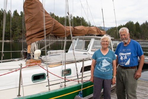
Who: Steve and Elsie Hulsizer (author of Glaciers, Bears and Totems and Voyages to Windward)
Port: Seattle
