Voyages North
23 July 2023
21 August 2021
11 July 2021 | Posted in Seattle
16 May 2021
07 January 2021
10 April 2020 | Posted in Seattle
31 August 2019 | Posted at Port McNeill
31 August 2019
30 August 2019
30 August 2019 | Posted at Port MCNeill
13 August 2019 | Posted at Prince Rupert
13 August 2019 | Posted at Prince Rupert
03 August 2019 | Posted at Ketchikan
02 August 2019 | Posted at Metlakatla
02 August 2019 | posted in Metlakatla AK
22 July 2019 | Posted at Klawock/Craig
22 July 2019 | Posted at Klawock/Craig
09 July 2019 | Posted at Juneau
09 July 2019 | Posted at Juneau
27 June 2019
Storm on the Way
13 September 2008 | Bacchante Bay, Clayoquot Sound
Elsie Hulsizer
Hot Springs Cove to Bacchante Bay (49 26.6N, 126 02.7W), Clayoquot Sound. August 26, Tuesday.
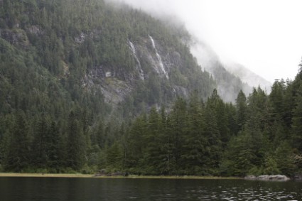
Photo: Bacchante Bay
Another storm is on its way and we make sure we leave Hot Springs Cove by noon to avoid it. The wind is just coming up when we motor out the cove and turn the corner into Sydney Inlet. We raise sail and have a boisterous ride downwind for about 15 minutes. Then we sail out of the wind. We look back to see it behind us, slowly catching up. We drift, then sail, then drift again. This pattern continues all the way into Shelter Inlet where it also starts pouring rain. We finally give up and motor the rest of the way up Shelter Inlet to Bacchante Bay where we anchor in the rain.
It pours all afternoon and into the evening. Before it gets dark I open the hatch and look up at the hillsides above us. We've anchored here many times before but this is the first time we've seen waterfalls. From our anchorage we can see at least three that we never knew were here.
We stay two nights in Bacchante Bay while it rains continuously. Not the soft drizzle that's so common here but real rain that we could hear drumming on the roof.
Bacchante Bay to Ahousat, Clayoquot Sound (49 16.9N, 126 04.2W) August 28
When it finally stops raining long enough to see where we're going, we motor out Bacchante Bay into Shelter Inlet where we stop to fish for rockfish. But we only catch two small ones. Jigger is more excited than we are. We motor through the rocks of Sulfur Passage into Millar Channel where the rain returns and the visibility drops. We motor under radar into Matilda Inlet and tie up at the Ahousat General Store dock. We have lunch at the caf� and find they have a new cook, a young woman from the Ahousat band who has just completed chef's school in Nanaimo. But Patti is still there supervising and the fish and chips, with Patti's Battle Axe batter, are still delicious.
On the dock we find a boat with a homeport of Colorado that has just sailed in from Hawaii after cruising the South Pacific. They hadn't planned on stopping here and are now trying to cruise the West Coast of Vancouver Island with no paper charts: only computer charts. It's not working too well and they're keeping to all the easy anchorages which means they're missing some of the best. We spend some time giving them some pointers, then, although it's still pouring rain, leave for Quait Bay.
Comments
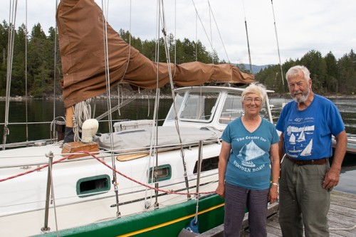
| Vessel Name: | Osprey |
| Vessel Make/Model: | Annapolis 44 sloop |
| Hailing Port: | Seattle |
| Crew: | Steve and Elsie Hulsizer (author of Glaciers, Bears and Totems and Voyages to Windward) |
| About: | |
| Extra: |
Osprey's Photos - Main
No items in this gallery.
Voyages North on SV Osprey
Who: Steve and Elsie Hulsizer (author of Glaciers, Bears and Totems and Voyages to Windward)
Port: Seattle
SailBlogs Friends

