Pathfinder to the Sea
... Go east older couple!
29 May 2023 | Champlain canal and Lake
24 May 2023 | Hudson River
23 May 2023 | New York City
21 May 2023 | Jersey coast
19 May 2023
17 May 2023 | Chesapeake Bay
15 May 2023
14 May 2023
13 May 2023
30 April 2023 | Charleston, SC
23 April 2023 | Beaufort, SC
14 April 2023 | Cumberland and Jekyll Islands
08 April 2023 | Florida
06 April 2023 | Gulf Stream
05 April 2023 | Powell Cay
02 April 2023 | Manjack Cay
01 April 2023 | Green Turtle Cay
29 March 2023 | Marsh Harbor
26 March 2023
26 March 2023 | Hopetown
Coastal Jump #4 – Beaufort, NC to Charleston, SC (around Cape Fear)
20 November 2022 | Mt Pleasant, SC
Roger Wallace
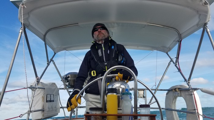
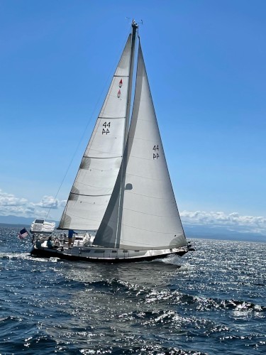
The crew for this leg is once again the three musketeers- Peter, Fritz and myself. The pre-departure routing showed a planned for 222nm from Beaufort, NC to Charleston, SC. Cape Fear was the only obstacle we had to get around and it would push us out to ~22nm offshore. If all went well, we'd be done in just under 48 hours.
This jump was down right placid compared to the last one and will be remembered less for the sailing and more for some other pleasures of sailing long distances in the ocean.
Modern navigation electronics are a little scary in how precise they are for both the planning phase (route) and the execution phase (track). Our recorded track shows that we very closely followed our planned route until 15-20nm after Cape Fear (Frying Pan Shoals) which we rounded during the night. The winds started to back off the following day and our track began to wander as we tried to keep Pathfinder moving in the lighter breeze. Although Pathfinder is a heavy boat, she sails amazingly well in light air and we kept her moving at above 4 knots for a long time. How long the light air would last was an open question and we intentionally sailed closer to shore in the hopes of getting a cell signal which would allow us to get an updated weather forecast. No luck.
Now there are advantages of sailing slow such as being overtaken by a large pod of dolphins. The dolphins were well spread out as they came by and we could see them to both sides of Pathfinder. Many of the dolphins changed course to check us out which allowed us to check them out too. Some came in from port, most came in from starboard. Some swam under the boat and some briefly stayed on our bow. We could see many of the dolphins just under the surface staying on the front side of the waves- underwater surfing. That was a treat.
We were still too far off the coast to get cell service, even though we were close to Myrtle Beach and its taller buildings. Without an updated forecast and the sun setting on our second day (~31 hours into the trip), what was a sailboat crew to do. Motoring was clearly in our future, but I was in no rush to start the engine. So, I called for furling the sails and we just drifted in the ocean while we watched the sunset. The crew approved of this short intermission. A nice, peaceful sunset was the second, non-sailing, treat of this leg.
After the sun set, we motored for several hours towards a navigation aid offshore of Cape Roman at which point the wind began to fill in and we started sailing again. We were into our second night; the moon was near new (in other words- it was dark); and we were at the peak of the Leonid meteor showers. Many amazing meteors were the third treat for this leg. We saw fireballs; we saw meteors that left glowing dust trails in their wake; and there was one meteor that lit up our sails and the entire ocean around us, albiet very briefly.
The wind filled in more as the night progressed and Pathfinder was once again moving fast. We rounded the last navigational aid of the night and headed towards the Charleston shipping channel. The wind was on our nose as we turned to go up the shipping channel so it was time to furl the sails and start the engine again.
One thing that has surprised me this trip is how shallow the east coast of the United State is. We have frequently been sailing out of sight of land and the water is only 30' deep. It doesn't feel right. One consequence of this shallow coast is that shipping channels into various harbors are loooong. We picked up the Charleston ship channel 5-6nm off the coast. The jettys for the ship channel extend 3nm offshore. It's a long way in. That said- we entered Charleston Harbor at sunrise- as planned.
Charleston is home to Fort Sumter and I wasn't going to pass up an opportunity to see it on our way by, especially in a beautiful morning light. I had charted our route to divert across the ship channel and past Fort Sumter even before starting this leg. We had some amazing views and I think all three of us got some good pictures.
Our cruise past Fort Sumter had another benefit. We were well outside of the ship channel and it offered me time to call several marinas in the hope of finding a slip for a couple of nights. I wanted a slip for two reasons. First- Peter, Fritz and I had completed two major coastal jumps in a short time and a shore based celebration was in order. Second- a crew change. Fritz needed to head home for Thanksgiving and Susan was coming down for Thanksgiving and the last long coastal jump on our journey south. Fritz's pending departure was another reason for us to enjoy an evening out.
I wasn't having much luck finding a marina with an empty slip as we had caught up to the major southbound fleet of boats going through the intercoastal waterway (ICW) and slips were in high demand. Rather than motor towards this marina or that marina in the hopes of something working out, especially against an out going current, I decided we should just drop anchor in the outer harbor until I could figure something out. There were no other boats anchored there, but it seamed both logical and doable. So, that's what we did. We cooked breakfast once the anchor was set and the engine off.
Anchoring in the outer harbor had its advantages in regards to boat/ship watching. All three of us were like kids in a candy shop as this type of vessel or that type of vessel went by. However, I think Peter and Fritz would agree that I won the nerdy kid award when the research vessel Atlantis went past. 30+ years ago, I had a job offer as a research engineer to work on the support ship for the research submarine Alvin. Atlantis is that ship now. It was an offer I turned down because I had applied when I was moving to Boston to live with Susan. Susan didn't see the logic of me moving to Boston only to go work at sea. Anyways, it was cool to see the ship.
A marina to the northeast of Charleston (Mt. Pleasant) called while we were on anchor- they had a slip for us. It wasn't in Charleston proper, but it was in the shadow of the USS Yorktown aircraft carrier. So, at the proper time in the tide cycle, we weighed anchor and headed for the Yorktown.
Jump #4 done!
Comments
| Vessel Name: | Pathfinder |
| Vessel Make/Model: | Bristol 38.8 |
| Hailing Port: | Kingsland Bay, VT, USA |
| Crew: | Roger & Susan |
| About: | |
| Extra: |
Pathfinder's Photos - Main
 |
|
|
|
|
|
|
|
These are photos taken on our walk out to the preserve (2 miles from the harbor) and as we explored the preserve. It is part of the Bahamanian National Trust holdings that opened 10 years ago. The paths are beautiful and it was wonderful to get into the local forest and understand a bit about the various plants that have been important in the culture and landscape here.
16 Photos
Created 18 March 2023
|
|
This is a beautiful national park, uninhabited and so beautiful! Pictures of the beaches, ruins and sky views.
17 Photos
Created 12 March 2023
|
|
Photos of our time in Georgetown. Hike to the monument on Stocking Iland, exploring an old Canal, ruins and a defunct resort on Crab Island and race awards.
22 Photos
Created 12 March 2023
|
|
Pictures from Bill Bagg's and environs
2 Photos
Created 12 January 2023
|
Profile Block Title
Who: Roger & Susan
Port: Kingsland Bay, VT, USA