Pathfinder to the Sea
... Go east older couple!
29 May 2023 | Champlain canal and Lake
24 May 2023 | Hudson River
23 May 2023 | New York City
21 May 2023 | Jersey coast
19 May 2023
17 May 2023 | Chesapeake Bay
15 May 2023
14 May 2023
13 May 2023
30 April 2023 | Charleston, SC
23 April 2023 | Beaufort, SC
14 April 2023 | Cumberland and Jekyll Islands
08 April 2023 | Florida
06 April 2023 | Gulf Stream
05 April 2023 | Powell Cay
02 April 2023 | Manjack Cay
01 April 2023 | Green Turtle Cay
29 March 2023 | Marsh Harbor
26 March 2023
26 March 2023 | Hopetown
Coastal Jump #5 – Charleston, SC to St. Marys, GA
23 November 2022 | St Marys, GA
Roger Wallace
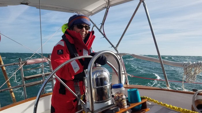
Imagine this- Pathfinder broad reaching with just our genoa in a long channel entrance from the ocean with 10-12 foot waves coming in from our starboard aft quarter; and those same waves breaking on a jetty a short distance down wind of us. Oh, and Susan- calm, cool and collected helming us in! I described the conditions as "knarly." The two other sailboats to enter the channel that day described it as terrifying. That is how our last big coastal jump for this trip south ended. All that was left was a stately entrance into St. Marys, GA which is several miles back from the inlet. That entrance the definite high point for this 168nm leg.
We departed Charleston, SC near sunrise on November 21st to catch the outgoing tide. There is a lot of water inland of many of the long ocean channels we have used and the currents are very fast. We actually exited the channel relatively quickly through a charted and bouyed break in the south jetty. There were other boats going the same way. However, for the second time in our trip the charts were wrong and the depth much shallower. I was not happy. There was one narrow slot of deeper water that I was trying to keep us in and tensions rose on the boat as a result. We got through the area without incident and I trust time and other shared experiences will heal any left over feelings- like they typically do.
We had another avian passenger during the first day- a seagull (exact species ??) that first landed forward of our dodger. The gull moved around several times and flew off several times more, only to come back. During it's last flight back to the boat, it soared just over the cockpit between the dodger and bimini for an extended period and I waved it off several times before it finally landed- on Peter's head!
The remainder of our first day passed without incident except that Susan was feeling seasick due to the seastate which was bigger than average. We would be passing by Savannah, GA near sunset. However, we could see a cluster of AIS targets offshore of Savannah from a long way away. I installed AIS on Pathfinder during my time alone on the Hudson. I see AIS, which uses the VHF antenna as a vital, modern day, navigation tool for the ocean and was very careful about the install- especially the antenna and antenna cable. Being meticuluous paid big dividends. I received AIS targets 38nm's away when I first turned the system on. Most installers are happy with 20nm reception. This also meant Pathfinder's VHF signal would have an extended range. So, there were lots of AIS targets further ahead than we could see and my first guess was that they were fishing boats clustered around a fishing ground. A check of AIS data proved otherwise. There were 30 large ships (many 1,200ft long) at anchor 15nm offshore of Savannah. They must be waiting for dock space to unload. They were almost in our way.
Our planned route had us passing the cluster of ships just inshore and then we would gybe out and pass downwind of them. I had hoped that their size and number may create a quasi artificial island and give us smoother seas for awhile downwind. That didn't happen.
The seas stayed above average and it got dark. With heavy seas and no visual reference- Susan finally succumbed to seasickness. She went down hard and spend the night mostly curled up in the cockpit- sometimes sleeping sometimes not. I was sad that Susan's first night at sea on Pathfinder was not good. I was also thankful to still have Peter crewing. He committed to making this trip south and honored that commitment. I gave Peter a "best case, but not realisitic" scenerio that had us arriving in St Johns, GA on November 15th. We were seven days behind that scenerio. That isn't too bad given that I was determined to move on good weather windows and not a schedule. I am still glad Peter stayed for the extra seven days.
We had one encounter with a ship during the night that made me nervous. We sailed just on the edge of a pilot transfer zone at the end of some TSS zones (think traffic lanes for ships). There was an inbound ship that was repeatably tried to hail the harbor pilot in broken english. That same shipped turned towards us several times and kept getting closer (never closer than several miles). My best guess is that they captain mistook Pathfinder for a pilot boat. The transfer zone was relatively big, but we finally cleared it and the ship stopped steering towards us.
Susan started feeling better after sunrise on the 22nd. We were a few hours behind schedule, but doing OK. Now, how to redeem this trip for Susuan. I know- give her the helm going into St. Marys inlet. Steering through the inlet wasn't difficult, but we couldn't give up any seaway given jetty and breaking waves downwind of us. Susan said she was blissfully ignorant of the situation. Similar to Fritz and Peter saying they were glad they couldn't see the size of the waves coming at us our first night out of the Chesapeake.
The inlet had a "sedement trap" outside of the jettys. It must have been an underwater structure because there was nothing to see except that the water clearly had sand suspended in it which made me reluctanct to start the engine. We were a couple of hours late reaching the inlet relative to tidal currents and were sailing fast against a fast current. The knot meter showed us doing seven knots- the GPS showed us doing two knots as we were passing between Cumberland Island, GA and Amelia Island, FL. We started the engine and begin motor sailing once past Fort Clinch at the top of Amelia Island.
We motor-sailed to the first hard bend in the St Marys river at which point we put away the genoa. We motored another hour against the current and set anchor among the other boats that had come to St Marys for their Thanksgiving feast for boaters.
Thus ends the big coastal jumps for this southbound trip. I will continue to move Pathfinder by myself slowly south via the ICW (which will have it's own challenges and rewards). Susan will rejoin me before Christmas somewhere near Titusville or slightly south of there.
Comments
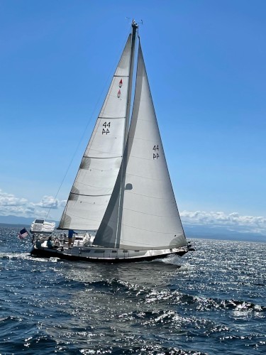
| Vessel Name: | Pathfinder |
| Vessel Make/Model: | Bristol 38.8 |
| Hailing Port: | Kingsland Bay, VT, USA |
| Crew: | Roger & Susan |
| About: | |
| Extra: |
Pathfinder's Photos - Main
 |
|
|
|
|
|
|
|
These are photos taken on our walk out to the preserve (2 miles from the harbor) and as we explored the preserve. It is part of the Bahamanian National Trust holdings that opened 10 years ago. The paths are beautiful and it was wonderful to get into the local forest and understand a bit about the various plants that have been important in the culture and landscape here.
16 Photos
Created 18 March 2023
|
|
This is a beautiful national park, uninhabited and so beautiful! Pictures of the beaches, ruins and sky views.
17 Photos
Created 12 March 2023
|
|
Photos of our time in Georgetown. Hike to the monument on Stocking Iland, exploring an old Canal, ruins and a defunct resort on Crab Island and race awards.
22 Photos
Created 12 March 2023
|
|
Pictures from Bill Bagg's and environs
2 Photos
Created 12 January 2023
|
Profile Block Title
Who: Roger & Susan
Port: Kingsland Bay, VT, USA