
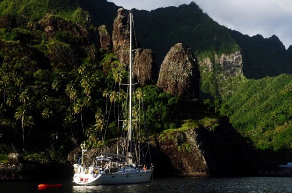
S.V Red Sky
"Red Sky at Night Sailors delight. Red Sky in the Morn Sailors be warned !"

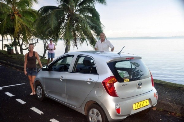
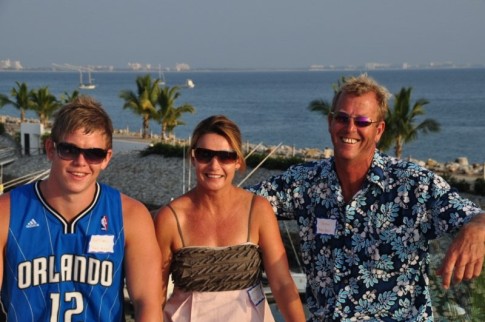
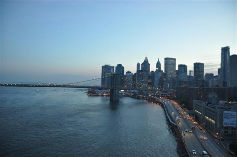
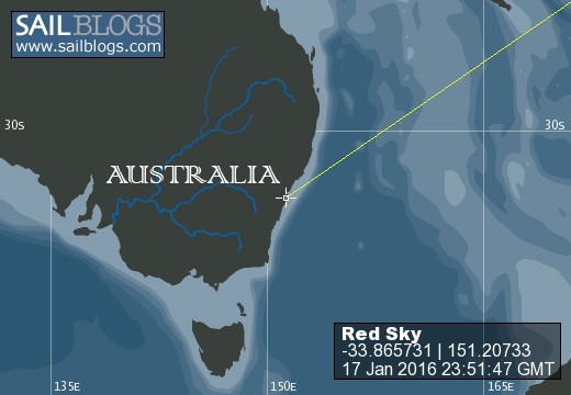
17 January 2016 | Manly Sydney Australia
27 October 2012 | Vuda Point Marina
23 October 2012 | Vuda Point Marina
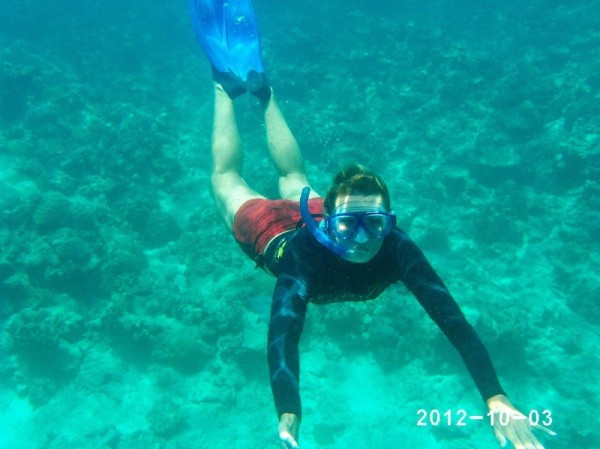
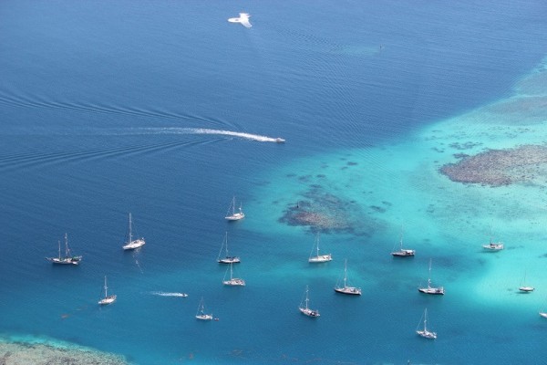
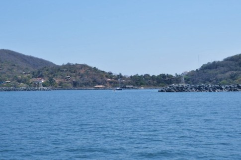
03 October 2012 | Fiji Western Division
29 September 2012 | Fiji Western Division
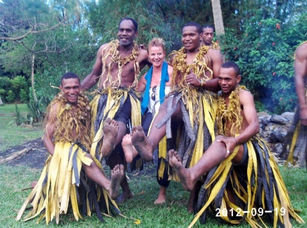
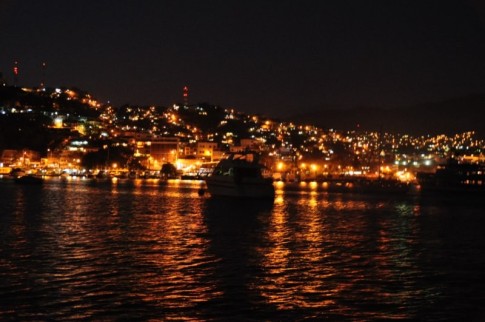
23 September 2012 | Port Denarau Marina
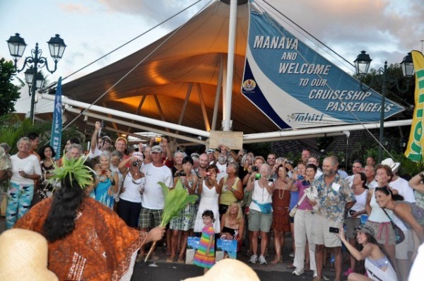
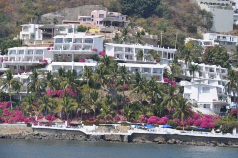
11 September 2012 | 18 7.42'S:178 25.32'E, Suva
10 September 2012 | 19 13.78'S:179 14.37'W, Enroute Day 2 - Destination Suva
09 September 2012 | 19 5.48'S:176 40.52'W, Enroute Day 1
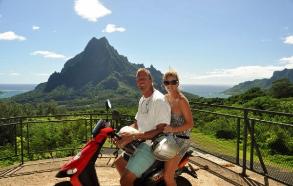
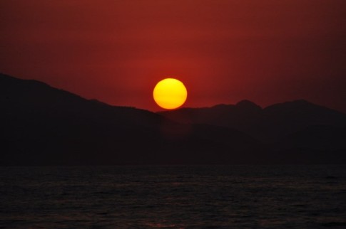
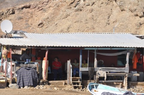
06 September 2012 | Neiafu Harbour - Vava`u Tonga
21 August 2012 | Anchorages
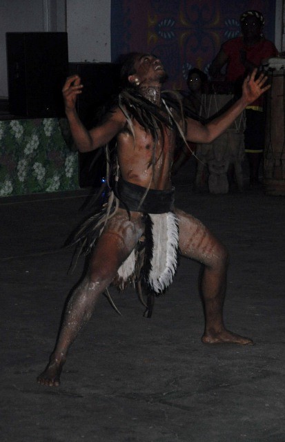
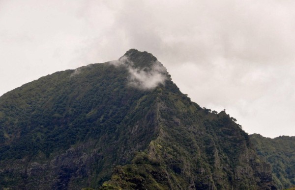
20 August 2012 | Islands
07 August 2012 | 18 39.11'S:173 59.18'W, Vavau
06 August 2012 | 18 48.55'S:172 0.54'W, Capricorn Sea Mount
05 August 2012
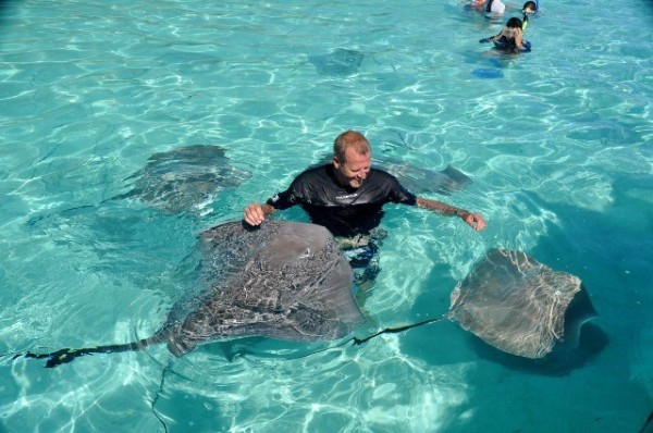
05 August 2012 | Niue - Cook Islands
03 August 2012 | 19 3.21'S:169 55.45'W, Nuie
02 August 2012 | 19 17.19'S:167 54.09'W, Palmerston - Vavau Tonga - Day 3
01 August 2012 | 18 30.32'S:165 33.68'W, Palmerston - Vavau Tonga - Day 2
31 July 2012 | 18 8.10'S:163 51.78'W, Palmerston - Vavau Tonga - Day 1
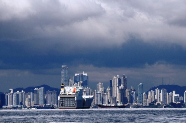
Panama Canal Cruise
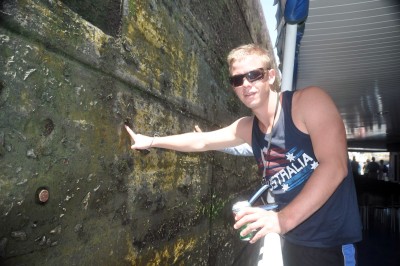
12 February 2012 | Panama
John
Hi all ,
Matt arrived safe and sound on Thursday and having caught up on his sleep he went out on the town last night with a couple of guys that were doing a yacht delivery. Seemed like a good idea at the time but when I woke him this morning at 8.00 to go on our cruise up the Panama Canal I think he wished he had got home earlier than 3.00am and that he didn`t drink as much as he did !
Anyway we headed off to transit the Canal -- 2 of the 3 locks -- on a tour boat .
I was a great trip , one I have wanted to do for a very long time and the experience was all that I hoped it would be . There is a new album in the Gallery with lots of pictures and for those of you who are interested below are some facts about the Canal;
The Panama Canal is a waterway that cuts across Panama to link the Atlantic and Pacific Oceans.
It is one of the greatest engineering achievements in the world.
On its completion, the canal shortened a ships voyage dramatically, by avoiding ships making this trip travelling around South America, a distance of more than 20,900 kilometres.
People of many lands dreamed of building a canal across Central America for hundreds of years.
Vasco Nunez de Balboa, the first European to reach the Pacific, saw the possibility of a canal connecting the Atlantic and Pacific oceans in the early 16th Century.
Throughout the 19th Century the U.S. and Great Britain considered a canal across Nicaragua, the two nations almost went to war because of disputes over which one would control the proposed canal.
In 1846 Colombia signed a treaty with the U. S. to guard all trade routes across Panama and to preserve Panama's neutrality.
In 1850, in the Clayton-Bulwer treaty, the U.S. and Great Britain agreed to protect the neutrality of a canal to be built somewhere across the Central American isthmus.
During the California gold rush in the mid 1800s many prospectors sailed from Atlantic Coast ports to Panama, crossed the isthmus by boat, on mules, and on foot, and then took another ship for California.
In 1850, Colombia let a U.S. company to build a railway across Panama, and it was completed in 1855 linking Colon on the Atlantic side and Panama City on the Pacific side.
In 1878, Colombia granted a French adventurer named Lucien Napoleon Bonaparte Wyse the right to build a canal across Panama.
He sold the right to a French company headed by Ferdinand Marie de Lesseps, who had directed the construction of the Suez Canal.
The French also bought control of the Panama Railroad.
The digging began in 1882, they planned a canal that would run at sea level, without locks.
In 1886, the French to decided to build the canal similar to the present one.
De Lesseps and his assistants planned most of the project carefully, and efficiently, but they wasted great quantities of material and effort.
A group of dishonest politicians who supported De Lesseps stole large amounts of money from the company.
They also lacked the proper tools to complete such a huge digging job and fight the epidemics of tropical diseases that hit the workers.
De Lesseps' company went bankrupt in 1889.
A second French firm, the New Panama Canal Company, took over the property and franchise in 1894, waiting until a buyer could be found for the franchise.
An U S. company started work on a canal across Nicaragua in 1889.
But their money ran out of soon after beginning the project.
Both the American and French groups tried to get the U.S. Government interested to buy their rights and property.
The Panama Railway Company's American owners opposed any Central American canal construction because it would be competing with their interest.
During the Spanish-American War, in the late 1890's the U.S. Government and Congress realised the benefits and the necessity of a canal for national defence.
Some Panamanians fearing that Panama would lose the commercial benefits of a canal and the French company worrying about losing the sale of its property to the U.S.
The Panamanians, with the help of the French and some encouragement from the U.S., revolted against Colombia, and declared Panama independent.
The U.S. sent ships to Panama to protect the Panama Railroad and preventing the Colombian troops from reaching Panama City, the centre of the revolution.
The French company managed to convince the U.S. that their offer of Panama rights and property and the Panama Railroad, would be safer, though more difficult terrain than Nicaragua, because of volcanic instability.
In the Hay-Bunau-Varilla treaty of 1903, Theodore Roosevelt gained for the USA the concession from Panama for a 16-km (10-mile) wide Canal Zone under perpetual control of the US government.
The United States gave Panama an initial payment of 10 million U.S. dollars and guaranteed Panama's independence and a regular, yearly rental.
The U.S. Congress decided to build a canal with locks, rather than the sea-level canal that the French had originally planned.
U.S. Engineers believed that a canal with locks would be cheaper and faster to build and would control the floodwaters of the Chagres River better than a sea-level canal would.
The canal was built in about 10 years at a cost of about 400 million U.S. dollars.
Thousands of workers using steam shovels and dredges to cut through jungles, hills, and swamps, and fighting tropical diseases like malaria and yellow fever.
After World War II and years of negotiations, President, Jimmy Carter succeeded in 1977 obtaining congressional approval of the Panama Canal treaties which provide for relinquishing total control of the Panama Canal and the Canal Zone to Panama by 2000, while assuring the Canal's perpetual neutrality.
International law requires that the U.S. allow commercial and military vessels of all nations to pass through the canal in peacetime.
A treaty signed by the U.S. and Panama in 1977 guarantees that the canal will remain open to all nations even in time of war.
The agreement gives the U.S. the right to use military force if necessary to protect the canal's neutrality.
The Canal is nearly 82 kilometres long from Limon Bay on the Atlantic Ocean in a northwest to southeast direction to the Bay of Panama on the Pacific Ocean.
The canal has three sets of locks, (waterfilled chambers) which raise and lower ships from one level to another.
The locks were built in pairs to allow ships to pass through in both directions at the same time.
Each lock has a usable length of 300 metres, a width of 34 metres, and a depth of about 20 metres.
The dimensions of the locks limit the size of ships that can use the canal, supertankers and large Aircraftcarriers cannot pass through it.
A ship sailing from the Atlantic Ocean enters the canal by way of Limon Bay, near the city of Colon.
A canal pilot comes on board from a small boat.
The pilot has complete charge of the ship during its trip through the canal.
The Gatun Locks are like giant steps.
Three pairs of concrete chambers that lift ship about 26 metres from sea level to Gatun Lake.
Small electric locomotives called mules run on rails along both sides of the locks.
They help to position, stabilise, pull and guide the ship in the locks.
Canal workers fasten the ends of the locomotives' towing cables to the vessel.
The locomotives then help to pull the ship, into the first chamber.
Huge steel gates close behind the vessel.
Valves open to allow water from Gatun Lake to flow into the lock.
In the next 8 to 15 minutes, the rising water slowly raises the ship.
When the water level is the same in both chambers, the gates in front of the ship swing outward and the locomotives help to pull the vessel into the second chamber.
This process is repeated until the third chamber raises the ship to the level of Gatun Lake.
Once in the lake the cables get released and the ship sails on under its own power.
On the south side of Gatun Lake, is the huge Gatun Dam, this 18-million-cubic-metre earth dam is only second to the Hoover Dam.
Gatun Dam created the 422 square kilometre Gatun Lake from the waters of the Chagres River.
As ships reach the south-eastern end of Gatun Lake they enter the 13 kilometres long and 150 metres wide Gaillard Cut, with a minimum depth of 13 metres.
It is an engineering term for an artificially created passageway or channel and runs between Gold Hill on the east and Contractor's Hill on the west.
In 1913, it was named in honour of David DuBose Gaillard, the engineer in charge of digging between the hills.
Dredgers work constantly to keep the channel clear of earth-slides.
The Gaillard Cut is only wide enough for one-way traffic, but work began to widen it to accommodate two-way traffic.
After the Gaillard Cut, electric locomotives help to pull, the ships into the Pedro Miguel Locks, which lower the vessels 9 metres in one step to the Miraflores Lake.
Than the ships sails about two and half kilometres to the Miraflores Locks, where two chambers lower them to the level of the Pacific Ocean.
The distances these chambers must lower the ship depend on the height of the tide in the Pacific, which about 4 metres a day.
Tides on the Atlantic side change only about 60 centimetres daily.
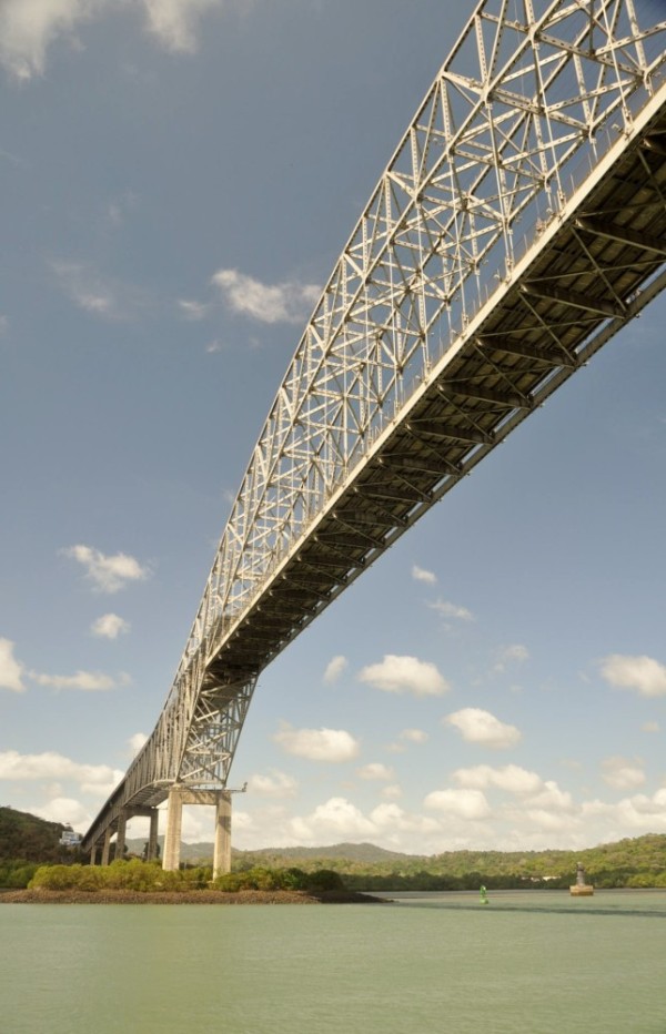
After the locks, the ships head down a 13 kilometres long channel, passing the towns of Balboa, and La Boca and the Thatcher Ferry Bridge, an important link in the Pan American Highway.
In the Bay of Panama the pilot leaves, the vessels as they head toward the open sea.
The ships have travelled about 80 kilometres from the Atlantic to the Pacific in about eight hours.
More 12,000 ocean-going vessels travel through it yearly, an average of about 34 per day.
Matt arrived safe and sound on Thursday and having caught up on his sleep he went out on the town last night with a couple of guys that were doing a yacht delivery. Seemed like a good idea at the time but when I woke him this morning at 8.00 to go on our cruise up the Panama Canal I think he wished he had got home earlier than 3.00am and that he didn`t drink as much as he did !
Anyway we headed off to transit the Canal -- 2 of the 3 locks -- on a tour boat .
I was a great trip , one I have wanted to do for a very long time and the experience was all that I hoped it would be . There is a new album in the Gallery with lots of pictures and for those of you who are interested below are some facts about the Canal;
The Panama Canal is a waterway that cuts across Panama to link the Atlantic and Pacific Oceans.
It is one of the greatest engineering achievements in the world.
On its completion, the canal shortened a ships voyage dramatically, by avoiding ships making this trip travelling around South America, a distance of more than 20,900 kilometres.
People of many lands dreamed of building a canal across Central America for hundreds of years.
Vasco Nunez de Balboa, the first European to reach the Pacific, saw the possibility of a canal connecting the Atlantic and Pacific oceans in the early 16th Century.
Throughout the 19th Century the U.S. and Great Britain considered a canal across Nicaragua, the two nations almost went to war because of disputes over which one would control the proposed canal.
In 1846 Colombia signed a treaty with the U. S. to guard all trade routes across Panama and to preserve Panama's neutrality.
In 1850, in the Clayton-Bulwer treaty, the U.S. and Great Britain agreed to protect the neutrality of a canal to be built somewhere across the Central American isthmus.
During the California gold rush in the mid 1800s many prospectors sailed from Atlantic Coast ports to Panama, crossed the isthmus by boat, on mules, and on foot, and then took another ship for California.
In 1850, Colombia let a U.S. company to build a railway across Panama, and it was completed in 1855 linking Colon on the Atlantic side and Panama City on the Pacific side.
In 1878, Colombia granted a French adventurer named Lucien Napoleon Bonaparte Wyse the right to build a canal across Panama.
He sold the right to a French company headed by Ferdinand Marie de Lesseps, who had directed the construction of the Suez Canal.
The French also bought control of the Panama Railroad.
The digging began in 1882, they planned a canal that would run at sea level, without locks.
In 1886, the French to decided to build the canal similar to the present one.
De Lesseps and his assistants planned most of the project carefully, and efficiently, but they wasted great quantities of material and effort.
A group of dishonest politicians who supported De Lesseps stole large amounts of money from the company.
They also lacked the proper tools to complete such a huge digging job and fight the epidemics of tropical diseases that hit the workers.
De Lesseps' company went bankrupt in 1889.
A second French firm, the New Panama Canal Company, took over the property and franchise in 1894, waiting until a buyer could be found for the franchise.
An U S. company started work on a canal across Nicaragua in 1889.
But their money ran out of soon after beginning the project.
Both the American and French groups tried to get the U.S. Government interested to buy their rights and property.
The Panama Railway Company's American owners opposed any Central American canal construction because it would be competing with their interest.
During the Spanish-American War, in the late 1890's the U.S. Government and Congress realised the benefits and the necessity of a canal for national defence.
Some Panamanians fearing that Panama would lose the commercial benefits of a canal and the French company worrying about losing the sale of its property to the U.S.
The Panamanians, with the help of the French and some encouragement from the U.S., revolted against Colombia, and declared Panama independent.
The U.S. sent ships to Panama to protect the Panama Railroad and preventing the Colombian troops from reaching Panama City, the centre of the revolution.
The French company managed to convince the U.S. that their offer of Panama rights and property and the Panama Railroad, would be safer, though more difficult terrain than Nicaragua, because of volcanic instability.
In the Hay-Bunau-Varilla treaty of 1903, Theodore Roosevelt gained for the USA the concession from Panama for a 16-km (10-mile) wide Canal Zone under perpetual control of the US government.
The United States gave Panama an initial payment of 10 million U.S. dollars and guaranteed Panama's independence and a regular, yearly rental.
The U.S. Congress decided to build a canal with locks, rather than the sea-level canal that the French had originally planned.
U.S. Engineers believed that a canal with locks would be cheaper and faster to build and would control the floodwaters of the Chagres River better than a sea-level canal would.
The canal was built in about 10 years at a cost of about 400 million U.S. dollars.
Thousands of workers using steam shovels and dredges to cut through jungles, hills, and swamps, and fighting tropical diseases like malaria and yellow fever.
After World War II and years of negotiations, President, Jimmy Carter succeeded in 1977 obtaining congressional approval of the Panama Canal treaties which provide for relinquishing total control of the Panama Canal and the Canal Zone to Panama by 2000, while assuring the Canal's perpetual neutrality.
International law requires that the U.S. allow commercial and military vessels of all nations to pass through the canal in peacetime.
A treaty signed by the U.S. and Panama in 1977 guarantees that the canal will remain open to all nations even in time of war.
The agreement gives the U.S. the right to use military force if necessary to protect the canal's neutrality.
The Canal is nearly 82 kilometres long from Limon Bay on the Atlantic Ocean in a northwest to southeast direction to the Bay of Panama on the Pacific Ocean.
The canal has three sets of locks, (waterfilled chambers) which raise and lower ships from one level to another.
The locks were built in pairs to allow ships to pass through in both directions at the same time.
Each lock has a usable length of 300 metres, a width of 34 metres, and a depth of about 20 metres.
The dimensions of the locks limit the size of ships that can use the canal, supertankers and large Aircraftcarriers cannot pass through it.
A ship sailing from the Atlantic Ocean enters the canal by way of Limon Bay, near the city of Colon.
A canal pilot comes on board from a small boat.
The pilot has complete charge of the ship during its trip through the canal.
The Gatun Locks are like giant steps.
Three pairs of concrete chambers that lift ship about 26 metres from sea level to Gatun Lake.
Small electric locomotives called mules run on rails along both sides of the locks.
They help to position, stabilise, pull and guide the ship in the locks.
Canal workers fasten the ends of the locomotives' towing cables to the vessel.
The locomotives then help to pull the ship, into the first chamber.
Huge steel gates close behind the vessel.
Valves open to allow water from Gatun Lake to flow into the lock.
In the next 8 to 15 minutes, the rising water slowly raises the ship.
When the water level is the same in both chambers, the gates in front of the ship swing outward and the locomotives help to pull the vessel into the second chamber.
This process is repeated until the third chamber raises the ship to the level of Gatun Lake.
Once in the lake the cables get released and the ship sails on under its own power.
On the south side of Gatun Lake, is the huge Gatun Dam, this 18-million-cubic-metre earth dam is only second to the Hoover Dam.
Gatun Dam created the 422 square kilometre Gatun Lake from the waters of the Chagres River.
As ships reach the south-eastern end of Gatun Lake they enter the 13 kilometres long and 150 metres wide Gaillard Cut, with a minimum depth of 13 metres.
It is an engineering term for an artificially created passageway or channel and runs between Gold Hill on the east and Contractor's Hill on the west.
In 1913, it was named in honour of David DuBose Gaillard, the engineer in charge of digging between the hills.
Dredgers work constantly to keep the channel clear of earth-slides.
The Gaillard Cut is only wide enough for one-way traffic, but work began to widen it to accommodate two-way traffic.
After the Gaillard Cut, electric locomotives help to pull, the ships into the Pedro Miguel Locks, which lower the vessels 9 metres in one step to the Miraflores Lake.
Than the ships sails about two and half kilometres to the Miraflores Locks, where two chambers lower them to the level of the Pacific Ocean.
The distances these chambers must lower the ship depend on the height of the tide in the Pacific, which about 4 metres a day.
Tides on the Atlantic side change only about 60 centimetres daily.
After the locks, the ships head down a 13 kilometres long channel, passing the towns of Balboa, and La Boca and the Thatcher Ferry Bridge, an important link in the Pan American Highway.
In the Bay of Panama the pilot leaves, the vessels as they head toward the open sea.
The ships have travelled about 80 kilometres from the Atlantic to the Pacific in about eight hours.
More 12,000 ocean-going vessels travel through it yearly, an average of about 34 per day.
Comments
| Vessel Name: | Red Sky |
| Vessel Make/Model: | Moody 54 |
| Hailing Port: | Brisbane Australia |
| Crew: | John & Leanne Hembrow |
| Extra: | We are "Living the Dash" What is the dash? It`s the bit between when you are born and when you die ; e.g. Here lies Fred 1950-2010. When it is all said and done that dash represents your life. LIVE THE DASH ! |
| Home Page: | http://www.sailblogs.com/member/redsky/ |
| Social: |
|
Red Sky's Photos - Main
 |
 |
 |
 |
 |
38 Photos
Created 5 August 2012
|
 |
 |
 |
 |
 |
 |
 |
 |
 |
 |
 |
Last Port for the Marquesas
16 Photos
Created 13 May 2012
|
 |
Islands ; 1. Tahuata ; 2. Fatu Hiva ; 3. Ua Poa. plus some fishing catches.
37 Photos
Created 8 May 2012
|
 |
 |
 |
There are 3 separate albums , one for each of the 3 islands we visited -- click on this album to see them !
1 Photo | 3 Sub-Albums
Created 12 March 2012
|
 |
 |
 |
 |
Fun in the Sun - Picnic Island to Isla Contador
19 Photos
Created 4 January 2012
|
 |
 |
Maestro , Perfect Wave & Us
Isla Contradora Los Perlas Islands
Panama
20 Photos
Created 25 December 2011
|
 |
 |
 |
 |
El Salvador to Golfito continued
53 Photos
Created 4 December 2011
|
 |
Pics of our Journey from El Salvador to Golfito
27 Photos
Created 4 December 2011
|
 |
 |
Playa Los Flores & Punta Mango Surfari
121 Photos
Created 28 April 2011
|
 |
 |
 |
 |
 |
 |
 |
 |
 |
 |
 |
 |
 |
 |
 |
 |
 |
 |
 |
 |
 |
 |
 |
 |
 |
 |
 |
Leg 3 Bahia Santa Maria - Cabo San Lucas
11 Photos
Created 7 November 2010
|
 |
Leg 2 Turtle Bay to Bahia Santa Maria
43 Photos | 1 Sub-Album
Created 7 November 2010
|
 |
 |
Huntington beach , Newport Harbour , Dana Point , San Diego Harbour.
28 Photos
Created 15 October 2010
|
 |
 |
 |
 |
 |
8 Day Whirlwind tour including Day at Disneyland
98 Photos | 2 Sub-Albums
Created 19 May 2010
|
 |
S.V Red Sky
Who: John & Leanne Hembrow
Port: Brisbane Australia
Gallery


Below are shortcuts to some of our earlier blog entries
Websites relevant to our blog Click on any of the links below
- Aquatic Optics Quality Polarized Sunglasses With or without Bi-Focal Reading Lenses Starting @ $60.0
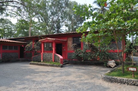
- Villa Del Olas - Holiday home in El Salvador
- El-Salvador Info
- Island Cruising Association-New Zealand
- Baja Ha Ha Rally
- Latitude 38 Magazine
- Ocens Weather and email services
- Southbound Group
- Tourin El-Salvador
SailBlogs Friends


