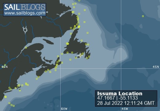
Issuma

28 July 2022
28 July 2022
08 May 2022
18 April 2022
07 April 2022
04 March 2022
17 February 2022 | Little Bay, Marystown, Newfoundland, Canada
16 February 2022
09 February 2022
06 February 2022 | Little Bay, Marystown, Newfoundland, Canada
05 February 2022 | Little Bay, Marystown, Newfoundland, Canada
01 February 2022 | Little Bay, Marystown, Newfoundland, Canada
30 January 2022 | Little Bay, Marystown, Newfoundland, Canada
25 January 2022 | Little Bay, Marystown, Newfoundland, Canada
24 January 2022 | Duricle Cove
17 January 2022
11 September 2021 | Little Bay, Marystown, Newfoundland, Canada
27 August 2021 | Grey River
26 August 2021 | Grand Bruit
26 July 2021 | Isle Valen
Navigation Area
18 April 2022
Richard Hudson
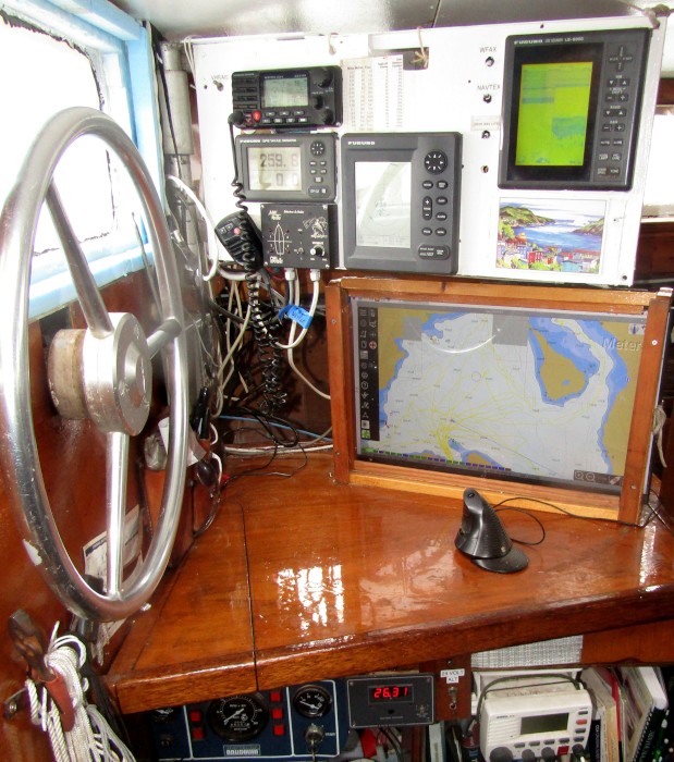
Just inside the entry to the pilothouse is the navigation table. Originally a chart table, now that I mostly navigate with the chart plotter, paper chart navigation is either done here, or on the main table, depending on the size of the chart.
The instrument panel is on a hinge, and swings so it is visible from outside. Little ropes go to little cleats to adjust the position of the panel. The instruments are inside the boat to keep them out of the weather--though most are water-resistant, I'd hate to test exactly how resistant they are with a big wave.
On the left, at the top is the VHF radio/AIS receiver, under that is the GPS, under that is the Radar Detector.
In the center at the bottom is the Radar. Above the Radar are some printed tables, one shows decimals of nautical miles to metres and feet (this is because the anchor alarm on the GPS uses decimal miles, so you need to know how large a swing radius in decimal miles is [ie 0.03 miles is 56m]).
Beside that table is a table showing how much extra distance is traveled by being off course. This is used to figure out, if we change course by X degrees to get more speed (better wind angle), is the greater speed more than the greater distance that needs to be sailed by being off course.
On the right is the Depth Sounder / Fish Finder, with art underneath. Below the panel is the chartplotter. The (paper) logbook normally sits on the table in front of the chartplotter, but isn't in the photo.
Below the table are the engine controls, a voltmeter (showing 26.31 volts), spare radio and navigation-related books.
Comments
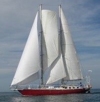
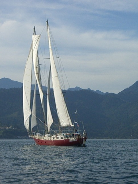
| Vessel Name: | Issuma |
| Vessel Make/Model: | Damien II, 15m/50' steel staysail schooner with lifting keel |
| Extra: | Designed for Antarctica. Built in France by META in 1981. Draft 1.3m/4.5' with keel up, 3.2m/10.5' with keel down. More details at http://www.issuma.com/rhudson/issumaboat/IssumaDetails.htm |
| Home Page: | http://www.issuma.com/rhudson/ |
| Social: |
|
Issuma's Photos - Main
 |