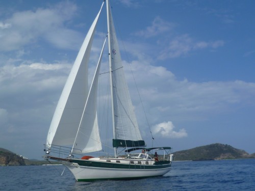
SV Riparian - Sailing out of Colorado
After years of preparing our boat and ourselves, we are starting out on a three month cruise of the Caribbean.
| Vessel Name: | Riparian |
| Vessel Make/Model: | Gozzard 36 |
| Hailing Port: | Littleton, Colorado USA |
| Crew: | Lynn and JoAnn Adams |
| About: | We have spent the past 5 winters learning how to sail, operate and repair our boat in the US and British Virgin Islands. |
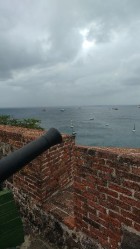
18 April 2017 | 17 555'N:62 522'W, Gallows Baai, Oranjestad, St. Eustatius
Fort Oranje and First Salute to America
In 1776, Statia was a Dutch freeport that was a huge sea port. Hundreds of ships came here to trade. Much of the gunpowder, weapons and supplies for the American Revolution came through Statia. In 1776, a United States ship, the Andrew Doria, entered the harbor and fired a salute, the salute was [...]

18 April 2017 | 17 555'N:62 522'W, Gallows Baai, Oranjestad, St. Eustatius
The Qwill
Easter Monday is a holiday on Statia and most businesses are closed, a good day to take a walk up the Quill. The Quill is the larger volcano on Statia. It is dormant, with its last eruption around 400 AD. It gets its name from English misspelling of the Dutch "Kwil" which means pit which is a great [...]
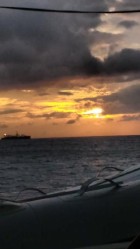
16 April 2017 | 17 555'N:62 522'W, Gallows Baai, Oranjestad, St. Eustatius
Arrival at St. Eustatius
After a beautiful sail from St. Barts we arrived in St. Eustatius about 4 PM. As it is Easter, the harbormaster and customs folks have the day off, so we raised the "Q" flag and will spend the night on the boat to check in tomorrow. The guide book said there were several public mooring available, [...]
The Qwill

On the way back to the boat, we arranged for an island tour for the next day to see more of Statia.