Alaska to Oregon A Summer Adventure
| Vessel Name: | JAVA |
| Vessel Make/Model: | Cascade 36' |
| Hailing Port: | St Helens, Oregon |
| Crew: | Roger & Sandra Campbell |
| About: | Roger & I have been living aboard Java for 7 years now. We sailed to Alaska in 2004. We liked it so well we decided to stay for awhile. We cruised all over Southeast Alaska. Now it's time to head back to Oregon. |
| Extra: | Java is a homebuilt Cascade 36'. Her hull was laid up in 1977 and she was launched in 1982. She is strong and fast and a real classic. |
24 August 2008 | St Helens Oregon
Campbell River Southbound
Good morning everyone. I can't believe it has been 4 weeks since my last update! As of my last blog we were in Campbell River B.C. We spent several days enjoying Campbell River. ( lots of things to see and do in Campbell River) We left Campbell River on the 25th of July and headed for Gorge Harbour in Desolation Sound. We really enjoyed our stay in Gorge Harbour. Late in the afternoon boats started showing up to anchor, this is always my favorite time of day in a busy anchorage. It is a lot of fun to watch how each boat picks a spot and trys to anchor. Some get it on the first try, some try half a dozen times before they are happy, some anchor right on top of you and then ask if they are too close???? We had light showers during the night and cooler morning temps. We decided to head south to Sturt Bay on Texada Island. It seems that once you are south of Campbell River the amount of boat traffic increases like crazy!!! Its been years since we have seen this many boats in a single day. Nasty weather kept us in Sturt Bay for a few days and the docks were filled with mostly sailboats wanting to go south like we were. After 3 days in Sturt Bay we all headed south down Texada Island. We were going to try a new anchorage in Bull Passage, between Texada and Lasqueti Islands but as we neared the south end of Texada Island the weather radio announced that area Whisky Gulf ( area Whisky Gulf is a military training area north of Nanimo that we need to cross) Was open for transit but it would be closed the next day so we decided to go ahead and cross over to Nanoose on Vancouver Island. On July 31st we went from Nanoose down through Dodd Narrows into the Gulf Islands of B.C. Northern B.C. is so different from Southern B.C. I think my personal favorite area is from the north end of Vancouver Island To Prince Rupert. The lower parts of B.C. and Washington are so full of boats its like being on a freeway made of water. It seems that everyone is in a big hurry and they don't care who they run over to get there!!! We spent several days exploring Ganges on Saltsprings Island. Its a really fun place to just hang out. They have a large outdoor market every Saturday with live music and lots of food. You can anchor just about anywhere in the harbour it is so shallow only 20'-30' deep. It was like anchoring in a giant parking lot with boats everywhere. From Ganges we sailed down to Port Browning on North Pender Island. Port Browning is very laid back with lots of room for anchoring. At least it is starting to warm up a little bit the farther south we get. After a couple of days in Port Browning we decided it was time to clear customs and head for home. We sailed into Roche Harbor to clear customs. Everything went very smothly at the customs office and we were on our way in less than 20 min. We were going to fill up with fuel but the place was like a zoo so we headed out to anchor. We couldn't wait to get out of there. There were boats of every size and shape going in every direction. And some driven by some very young kids. The next morning 8/6 we headed south down Haro Strait and then southwest across the Strait of Juan de Fuca. After leaving Race Rocks behind on the Canadian side we headed for the Pillar Point side of the Strait. It was starting to get a little snotty out there and we had read and people have told us that you can anchor behind Pillar Point. Don't believe it!! We motered around behind Pillar Point and finally dropped anchor in 19' of water 500 yards from shore. This did not provide very much shelter, but at least it was beter than being out on the strait. The boat rocked and rooled all night long. When we got up at first light we were sitting in 10' of water. I can't believe anyone in their right mind would say that you can anchor here! We pulled anchor and headed for Neah Bay. After filling up with fuel we motered over to the marina and tied up for a couple of days waiting for our weather window to run down the "outside". We would like to run all the way from Neah Bay to the Columbia River. It is 146 miles and should take about 24 hours. Up early Sat. 8/9 morning weather doesn't sound too bad so we left Neah Bay at 0800. No fog, light wind and low swell. ( so far so good) After rounding Tatoosh Island seas became unsettled and the wind was up to 15 kts over the bow. After passing Umatilla Reef wind increased to 25 kts and swells were up to 5' at about 3 sec. apart. Now we were starting to take a beating, and after hitting the rock back in June we weren't sure how much of a beating we wanted to put Java and ourselves through. By now its really starting to get ugly, so I called the CG and asked for a bar report for La Push. We were only about an hour away. The CG at LaPush said the bar was open no restrictions to come on in, so we did. We stayed in La Push for 2 days. They have really been fixing up the place, it looks a lot better than it did the last time we were there. On Mon. 8/11 we left La Push at 0730 on mostly calm seas and no wind. Todays ride was a lot better. The swells were 4'-5' and 8-10 sec. apart. It took us 11 1/2 hours to travel 69 miles. During our passage today we saw a couple of whales spout and Roger thought he saw an Orca. If it was an Orca it is the only one we saw on the entire trip! We tied up to the docks in Westport. Boy what a difference. Westport looks like it is closing up while La Push looks like it is booming. Now for our last leg down the outside. It is Wed.8/13 and we will have to leave Westport by 0500 to be able to make high slack on the Columbia River Bar at 1300. At 0500 it is dark and misty fog. We are ready to go except when I turn our nav. lights on the only ones that come on are oursteaming light and our stern light.( crappppppppp!!!!!!!!) If we are going to make it to the Columbia River in time we have to go now, so we did. We used our GPS and Radar to get us out of Westport and the only other boat we encountered was,yes you guessed it , The Coast Guard. We were sure they were going to stop us because of no lights but they came within 50' of us and then just kept going. After about an hour the sun came up and the fog started to burn off a little. We had 2-3 miles of visibility and stayed about 3 miles offshore. It was a fairly easy run today. Crossing the Columbia River Bar Was a workout but no problems. Lots of small fishing boats all over the bar. We continued up river past Astoria to Tongue Point where we dropped anchor. When we left Westport this morning it was cold and foggy, we havn't had temps over 72 all summer. By the time we were anchored it was 100!!!!!! Welcome to summer all at once. The next day we ran 40 miles up river to Walker Island where we dropped anchor and tried to find some shade. It was 100 again today. Roger said it was all my fault for complaining about being cold. Now we are back in St Helens trying to get back into the marina life. Thank you for sailing along with us. It has been a good trip. Take care everyone Sandra
22 July 2008 | Sointula, Malcom Island
A day in the sun
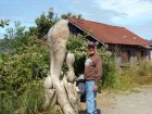
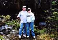
Roger enjoying some sunshine in Sointula. Its a fun place to walk around. You never know what you might see.
21 July 2008 | Campbell River, Vancouver Island B.C.
Bella Bella to Campbell River
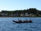
Good morning everyone. We are in Campbell River B.C. We have been back on the water for 3 weeks now. Boy does it feel good!!!! During our stay in Shearwater the native band from Bella Bella was preparing their canoe for a trip south. They are going to paddle down to Cowichan Bay for a First Nations gathering. We left Bella Bella the same day they did. After leaving Bella Bella we made several short runs before making our crossing of Queen Charlotte Strait. After crossing the strait we arrived in Port Hardy on the north end of Vancouver Island late in the afternoon. We decided to spend a couple of nights at anchor before moving on. During our second day in Port Hardy I was standing on deck when I saw the canor from Bella Bella paddling our way!!! The canoe from Port Hardy had gone out to meet them and escort them in. As the canoes passed by Java I yelled out " HURRAY FOR BELLA BELLA" and they all raised their paddles in salute. Wow that was soooooo cool!!!! After leaving Port Hardy we sailed south to Sointula on Malcom Island. Malcom Island was settled by a group of imagrants from Finnland as a Utopia. They wanted a place where everyone was equal. No one owned anything, everything was shared and everyone worked as a group. Many of the homes and buildings Date back to the early 1900's, and everything is very well kept. They even have a working blacksmith's shop from 1909 where you can try your hand at being a blacksmith. After leaving Sointula we worked our way down Johnstone Strait. The wind blew over 30 knots and the seas were up 4-5' and very close together. This was not a fun day. Boy were we glad to drop anchor in Port Harvey!!! The next morning was a lot better so we continued down Johnstone Strait. Midway down the strait we caught up with the canoe from Bella Bella. They have been adding more canoes from villages as they pass. At this point they are up to 12 canoes. We are a couple of days ahead of them so we will watch for them to pass Campbell River. It will be fun to see where we run into them next. Take care everyone, Sandra
03 July 2008 | Fraser Reach, B.C.
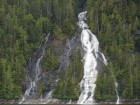
Waterfalls
With so much snow still remaining there are waterfalls everywhere.
03 July 2008 | Fraser Reach, B.C.
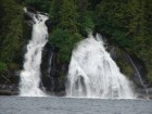
Waterfalls
We have been seeing some of the most beautiful waterfalls along the way
Dinner time
