
Voyages of Sarah Jean II
16 October 2011
03 October 2011
30 September 2011
29 September 2011
28 September 2011
19 September 2011
14 September 2011 | Vava'u Tonga
12 September 2011
04 September 2011
06 August 2011 | Mopelia - West of the Societies
05 August 2011 | Niue Island
23 July 2011 | Mopelia
15 July 2011 | Mopelia
02 July 2011
28 June 2011
28 June 2011
18 June 2011 | Moorea
10 June 2011 | Kauehi Atoll - Tuomotus
10 June 2011
03 June 2011
Sitka to Prince Rupert - August 4 to 18, 2017
22 August 2017
Beth
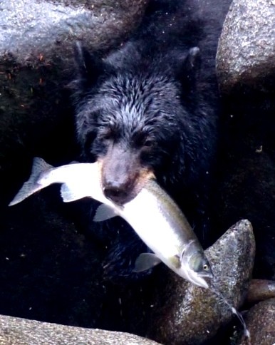
Photo above is a black bear fishing in Anan Creek.
One route we considered on this leg was to sail south on the outside west coast of Baranof Island. We had however previously decided that one of the things we really wanted to see in SEAK was bears fishing for salmon in the rivers. One of the best places to view this is at Anan Wildlife Observatory just south of Wrangell. The anchorage at Anan is reportedly not that great so we booked a tour with Alaska Charters and Adventures out of Wrangell for Aug. 11. The fastest route to Wrangell was through Peril Strait. We also really wanted to visit Red Bluff Bay and Baranof Warm Springs. So we left Sitka on Aug. 4 and headed west through Peril Strait.
Baranof Warm Springs - Baranof Island, east side
We really enjoyed this delightful little community on the east side of Baranof Island. The dock was full with fishing boats but we found a spot to anchor in the corner of the bay south of the waterfall. We hiked up to the natural hot springs by the raging river where the water was very hot and the fishermen were enjoying a soak. The public baths are on the boardwalk by the anchorage with private rooms and a big tub full of hot water. You can sit in the private tub and enjoy the view out the window of your boat in the anchorage. Gorgeous! Ironically we were here on one of the hottest days of the summer but the bath still felt good!
Red Bluff Bay - Baranof Island, east side
This is a spectacular anchorage with towering granite cliffs, waterfalls, snow capped mountains and red rock bluffs. We viewed 6 bears in the river delta at this anchorage!
Rocky Pass - Between Kupreanof and Kuiu Islands
We decided to transit Rocky Pass on our way to Wrangell. It is advisable to navigate only at high water slack as the channel is narrow and shallow. We didn't encounter any water less than 18' at high slack. We anchored at the "Summit" overnight and waited for slack high tide the next day to exit Rocky Pass. It wasn't a problem and enjoyed some kayaking while we waited.
Point Baker - Prince of Wales Island, north end
This is a small but interesting little community of 25 people with a fishing lodge, store, fuel and a dock. The harbour is well protected. We watched fishermen haul in some huge halibut caught in Sumner Strait. We caught some halibut ourselves the next day in Buster Bay, Sumner Strait.
Anan Wildlife Observatory, tour from Wrangell
We moored at Reliance Harbour this time at Wrangell after checking the tides to ensure we had enough water. Fuel dock is in Reliance Harbour. We enjoyed dinner out at the Stikine Hotel and then met our small tour group (4 total including us!) the next morning.
Our trip to the Anan Wildlife Observatory was one of the highlights of our trip to SEAK. We were able to observe bears from the viewing platform, sometimes only a few feet away. There is also a blind where you can watch bears catch salmon from the river right in front of your eyes! Amazing! We saw at least 10 bears and 2-3 with cubs. We really enjoyed the experience and highly recommend it. There were 2 boats anchored at Anan but the wind comes up in the afternoon on a lee shore that is steep to so it's not the best anchorage but boats anchor there.
Thorne Bay, Prince of Wales Island
Enroute to Thorne Bay we spent a night in Santa Anna Bay which is a good protected anchorage. We had planned to head to Coffman Cove but strong SE winds in Clarence Strait changed our minds so we chose Thorne Bay instead, a former logging community. It has some amenities, a well stocked store, a good marina and friendly people. We discovered that most of the communities on Prince of Wales Island are connected by paved roads, built by the logging industry. It would have been interesting to rent a car and explore these communities by car.
Kasaan, Prince of Wales Island
The Haida migrated to this community (originally to Old Kasaan across the harbour) from Haida Gwaii, BC in the 1800's. A lovely walk through the forest, past a few homes, leads to a "Great House" built in the 1880's but has been restored. There are also several totems, the "Totem Trail Cafe" and a carving house. There is a good (and free) government dock. It's worth a visit to Kasaan.
We stopped at Ketchikan for fuel, and anchored in Pond Bay, Duke Island and Foggy Bay en route to Prince Rupert.
Juneau & Sitka - July 13 to August 4, 2017
22 August 2017
Beth
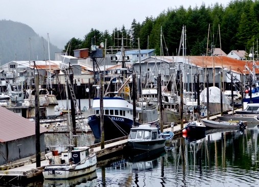
Photo above is the fishing village of Pelican
We left Juneau on July 13 to head west to Sitka. We saw humpback whales again near Retreat Point in Lynn Canal and also saw some bubble net feeding near Funter Bay in Icy Strait at the north end of Chatham Strait. This humpback whale feeding ritual apparently only occurs in Alaska and is amazing to witness.
Tenakee Springs
We sailed south down Chatham Strait so we could visit this funky little community. There is a small marina and an assortment of lovely little homes and gardens along the waterfront. A walking path runs alongside these homes. The locals are a colourful bunch and use bicycles and ATV's on the path. There is a store, ferry service, a bakery and a bath house. Tenakee is known for its hot springs and locals and visitors bathe (naked) in the public bath house. Don't worry, there are separate scheduled times for women and men. Tenakee is definitely worth the stop. We stopped enroute at Pavlov Bay. There is a waterfall here where bears can be viewed fishing for salmon in August.
Pelican
We sailed west out Icy Stait to take the route via Lisianski Strait to Sitka. We especially wanted to visit the village of Pelican. It is a small fishing community with a good marina that used to have a more active fish processing plant but now sports fishing has become more popular here. Guests fly in by float plane and stay in the fishing lodges. They were catching a lot of fish! There is a boardwalk and a cafe but the store and bar have both closed down. Fuel is available by jerry cans. We enjoyed this location off the beaten path. We had attempted to dock at Elfin Cove but the dock was full and there wasn't a suitable place to anchor. It also sounds like an interesting little community with a boardwalk.
Enroute to Sitka
We sailed down the west coast of Chichagof Island to Sitka and found many suitable anchorages - Porcupine Bay, Portlock Harbor, Kimshan (where we waited out a gale) and Double Cove. We did some salmon fishing along the way on the outside, and enjoyed some kayaking.
Sitka
This town on the west side of Baranoff Island is very picturesque with snow capped mountains, Mt. Edgecumbe; an inactive volcano, and many beautiful islands near the harbour. We stayed in Eliason Harbor, the new transient marina at the north end of town. From here it was a short 15 min walk into town. There are fewer cruise ships in Sitka so the town is not as touristy. There are many good shops and cafes. "Ludwig's Bistro" has amazing food! The sports fishing is great is Sitka. I flew home to see my Mom from Sitka and my friend Janie from Toronto flew in here to sail with us. We visited Goddard Hot Springs to the south and St. Lazaria Island where we saw puffins and sea otters. We also caught a king salmon in Sitka Bay.
Juneau & Glacier Bay - June 2 to July 13, 2017
22 August 2017
Beth
Photo above is Sarah Jean II in Glacier Bay
Ford's Terror
We met up with our friends Cinda and Fred on SV Songline, local Alaskans, in Taku Harbor on June 2. We celebrated Norm's birthday on June 3 together, Songline and Sarah Jean II rafted together. It was wonderful to see them again. We cruised together for a week. First stop - Ford's Terror. The description of how to enter this remote anchorage up Endicott Arm invoked terror "Tidal currents rush through the narrowest part of the inlet with great velocity" Douglass book. But we had our local guides with us so we were game to give it a try.
We anchored in Tracy Arm Cove the night before and determined the time for slack current. Ford's Terror is 30 minutes past the closest tide station. We waited at the entrance with great anticipation and then it was time! We glided easily through the small opening and were greeted by towering granite cliffs, magnificent waterfalls and a beautiful basin for our anchorage. We were fortunate to see 2 bears here. One of our favourite anchorages in SEAK!
Dawes Glacier
After exiting Ford's Terror we motored up Endicott Arm to view Dawes Glacier. We were able to get quite close to the glacier (within a mile), after navigating large icebergs and bergy bits. The face was an amazing wall of blue ice and when we turned our engine off and floated we could hear the ice crack and chunks the size of a bus fall off. The National Geographic expedition boat "Sea Lion" was also there taking people in zodiacs up closer to the glacier.
Tracy Arm - North and South Sawyer Glaciers
We took our son Brian and his girlfriend, Nicole up Tracy Arm when they flew in to Juneau to sail with us. Tracy Arm is close to Juneau and is a great place to see glaciers without needing a permit. We waited out a rainy day in Tracy Arm Cove and the next day was brilliant sunshine. It was a beautiful day for viewing glaciers. We were able to get up close to North Sawyer, within ¼ mile. We anchored in a bite by the last point before South Sawyer Glacier and took turns taking the dinghy up closer to the glacier. It was an exciting day, dodging bergy bits and viewing these amazing glaciers. On this day Endicott Arm was choked with ice that had fallen off the glacier but Tracy Arm was clear of ice until we were close to the glaciers.
Admiralty Cove - Admiralty Island
This anchorage was reportedly a good place to view bears. Norm and I were apprehensive about walking on shore where we were likely to run into bears but Cinda and Fred were bringing their guns! As is the case for most Alaskans they have guns for bear encounters. Norm and I had our bear spray but we felt safer with our gun toting friends! Sure enough we saw a Mama Bear (sow) and 2 cubs! No need to use the guns. They scurried off into the woods when they saw us. We caught some nice Dungeness crabs in this anchorage as well.
Auke Bay - Juneau
We chose Auke Bay Harbor (Statter Bay Marina) on the west side of Juneau for our stay in Juneau. It's close to the airport (10 min) as we had to pick up friends who were flying in to sail with us. The marinas in downtown Juneau require sailing under the bridge to Douglas Island and our mast is too tall. Douglas Marina was another option (before the bridge) but we would need to go up Gastineau Channel. This location would add extra miles onto our route to Glacier Bay, our next stop. Auke Bay had many amenities; a Laundromat within walking distance, a cafe with wifi, a little store, and a pub. We rented a car from the airport for provisioning and touring Juneau.
Juneau
There are lots of fun things to do in Juneau. We hiked the Perseverance Trail, biked out to Herbert Glacier, hiked the Eagle River and the short walk out to Nugget Falls at Mendenall Glacier. There are so many great hikes in Juneau. We took the tram up Douglas Mountain, visited the Fish Hatchery, Alaskan Brewing Company and the Amalga Gin Distillery. When the cruise ships are in town, often 4 per day, downtown Juneau can get busy. The Red Dog Saloon is worth a visit and "The Rookery" and "Salt" are great restaurants as well as the "Douglas Island Pub". We did our provisioning at Costco, Fred Meyer and Safeway.
Glacier Bay
We booked our permit for Glacier Bay 60 days ahead online. We planned to take our friends Randy & Julie to Glacier Bay and we knew the date they were flying to Juneau so we were able to book our time slot more easily than some cruisers. Glacier Bay only allows 25 boats in the park per day. Half of these permits can be obtained last minute so this is another way to obtain a permit.
It takes about 3 days to sail to Glacier Bay. On the way we stopped at Swanson Bay where there is a free government dock (quite common in AK). We also stayed at the marina at Hoonah. This is a native village with amenities such as fuel, showers, restaurants, Icy Point Strait Brewery and a good grocery store. Cruise ships also stop here since Icy Point was developed for the cruise ship industry complete with a zipline! We passed Point Adolphus where we saw sea otters and humpback whales. We anchored in Mud Bay after some successful halibut fishing in this bay.
You are required to check in with Glacier Bay Park on your way in by VHF radio. A compulsory orientation is given at Park Headquarters at Bartlett Cove. Some of the inlets in the park are closed to motorized vessels. Fuel is available in Bartlett Cove. There are only 2 cruise ships allowed in Glacier Bay per day so the park did not seem crowded.
We anchored in Blue Mouse Cove, Reid Inlet, South Sandy Cove and Bartlett Cove. Exploring Reid Glacier, John Hopkins Inlet, Lamplugh Glacier, Marjerie Glacier and Grand Pacific Glacier can all be done from the anchorage in Reid Inlet. We saw brown bears in Reid Inlet, many humpback whales, sea otters, puffins and sea lions at South Marble Island, and a porcupine on the trail at Bartlett Cove. We saw Orca whales in Icy Strait. We were lucky with the weather as well, 5 out of 7 days were sunny. We felt Glacier Bay is well worth the visit! The scenery is magnificent with snow capped mountains as far as the eye can see.
Ketchikan to Juneau: May 23 - May 31, 2017
12 June 2017
Beth
Ketchikan, Revillagigedo Island
55' 21.0" N, 131' 41.1" W
We arrived at the dock in Ketchikan at 11:00 am from Foggy Bay and the sun came out! The way the marinas work in Alaska is you call the harbour master as you are nearing the town either by phone or on VHF Channel 73. After giving them your overall length and draft they will assign you a berth. The marinas in Alaska all seem to operate this way. It works well. We were assigned to a slip in Bar Harbour Marina which is at the north end of town. It was a 30 minute walk into town which we didn't mind as we needed the exercise. Bar Harbour is also close to Safeway which is good for provisioning and to the laundromat. Thomas Basin is the marina in the city center. It's closer to all the action, shops, restaurants, museums and the cruise ship terminal! So it depends on your preference and what's important to you, easy provisioning and walking or being close to downtown.
Clearing in to Alaska was a breeze. We simply called US Customs after docking. A friendly customs officer came down to our boat at the dock, asked us a few questions and completed his paperwork. NO questions about food or alcohol. So don't worry about the produce or meat you are bringing into Alaska.
Ketchikan has lots to offer due to the cruise ship traffic. They often have 4-8 cruise ships per day, 4 in the morning and 4 in the afternoon. We weren't as bothered as we thought we might be by the cruise ship patrons. We enjoyed talking to the locals who owned shops in Ketchikan, the bookstore, the quilt and yarn store, and the gift shops. Creek St. is a photographer's delight with its wooden boardwalk and colourful buildings. The "Discovery Centre" is a must see with excellent displays of Alaskan life, fishing, mining, logging, tourism and native history. Overall we really liked Ketchikan, our first Alaska town. We stayed 2 nights.
Meyer's Chuck, Cleveland Peninsula
55' 44.3" N, 132' 15.5" W
The narrow channel in Ketchikan was busy as we left with float planes taking off, cruise ships arriving, humpback whales "bubble feeding", numerous other boats leaving and a current! So keep a watchful eye. We had fueled up south of town when we arrived so we were good to go. The weather is still cool in May and we continued to wear our toques and gloves. The snow capped mountains of Prince of Wales Island to the west were beautiful as we sailed up Clarence Strait. The Alaskan ferry passed us going south.
We wanted to go to Meyer's Chuck on a recommendation from a friend and really enjoyed its quaint feel. We decided to anchor as there was a good NW wind blowing in the anchorage and we didn't want to get pinned on the dock. Shortly after anchoring a 112' MV "Shadowfax" steamed into the bay and used its many thrusters to parallel park at the dock taking up all the available space! A small Canadian Nordic Tug "Sandpiper II" that came in before "Shadowfax" was left to anchor out like us. Then a local man and woman pulled up to our boat in their skiff to inform us that we had anchored on the "runway"! Apparently a float plane was scheduled to arrive at Meyer's Chuck in 10 min and he needed the whole length of the bay to land. So we quickly pulled up the anchor and sure enough the float plane arrived. He aborted the first attempt to land and circled around and was successful the second time. After he left we reanchored back in our original spot. There weren't a lot of other choices in the bay. We took a walk ashore but didn't meet any locals. It seemed as though most of the buildings were summer homes. There used to be a school here and the government built the beautiful new dock for the school kids. Now it's just used by the cruisers! We became aware of the size of the tides when we were in Meyer's Chuck. It was a 24' tide that day and the bay looked totally different at low tide!
Wrangell, Wrangell Island
56' 27.4" N, 132' 23.0" W
There was a strong NW wind blowing so we decided to take the more inland route through Zimovia Strait to Wrangell. The route up Clarence Strait would have given us NW winds on the nose. We did enjoy a short sail across Ernest Sound and spotted several whale spouts silhouetted in the sun on this bluebird day. We were assigned to the Heritage Marina in Wrangell by the harbour master. It is a nice new marina (2007) with enough depth for us. The downtown marina is closer to town but not good for boats with draft. "S/V Vagabon" was beside us at the dock, Dave & Liska from Seattle whom we had met in Port McNeil. We discussed strategies for transiting the Wrangell Narrows the next day and then we all walked the 30 min into town. There was 1 cruise ship in dock. Wrangell has a western feel to it and is smaller than Ketchikan, only 3,000 people. They have a number of tours available for visiting the nearby Le Conte Glacier or the Anan Wildlife Conservatory where you can observe bears feasting on salmon in the river in July & Aug.
Petersburg, Mitkof Island and the Wrangell Narrows
56' 48.6" N, 132' 57.9" W
Norm figured out the timing for the famous Wrangell Narrows. From all reports it sounded very intimidating...be at the start of the Narrows at Port Alexander 3 hours prior to high slack at the Summit. The Summit is 2/3 of the way through the Narrows. We would ride the flood to the summit and then ride the ebb out to Petersburg. The whole transit turned out to be quite easy. For anyone who has ever dealt with Yuculta or Dent Rapids in BC this was a piece of cake. The current was never greater than 2-3 knots. It was a lovely ride through beautiful countryside with cottages and people fishing. As we turned the corner at the end of the Narrows the most magnificent snow capped mountains appeared as a back drop to Petersburg. There was a 2 kt current running in that channel but we managed to tie up at the fuel dock and then found our berth assigned by the harbour master.
Petersburg is a commercial fishing town. I've never seen so many large fishing boats in my life! Fishing season hasn't kicked into gear yet but when it does I'm sure the town is bustling. We enjoyed a walk ashore seeing some of the Norwegian heritage sites of this town and found a take-out pizza for out dinner.
Snug Cove, Gambier Bay, Admiralty Island
57' 25.3" N, 133' 58.0" W
We decided to leave Petersburg early the next morning at 7 am as we had a 57 nm day ahead. We were whisked out the channel with a 6 kt ebb current! SOG was 12.5! WOW what a ride! We enjoyed a peaceful early morning motor up Frederick Sound keeping our eyes peeled for whales that were supposed to enjoy the cool waters of this area. The humpback whales come to Alaska to feed during the summer months and then return to Hawaii during the summer to give birth. We didn't see any whales until we turned north up Stephen's Passage and then we saw several. AND we saw our first iceberg! We were so excited. We changed course slightly so we could take a good look at it up close and take photos of course! And we picked up some glacier ice for our gin & tonics later that evening.
As we entered Snug Cove we spotted 2 brown bears on the beach and motored over slowly for a closer look and photos. Then a humpback whale was close enough that we heard him exhale! Snug Cove was just as it sounds, snug and safe and sound. Apparently Admiralty Island is known to have the highest population of brown bears in Alaska so it was a good stop for wildlife viewing too.
Tracy Arm Cove, Holkam Bay
57' 48.7" N, 133' 37.8" W
From our weather reports we knew that Tuesday was going to be the last sunny day for a while. We wanted to see the famous Tracy Arm in the sunshine so on Monday we enjoyed a nice sail over to Tracy Arm. This is where everyone anchors to make the day trip up Tracy Arm and back. There aren't any anchorages at the head of the bay so cruisers usually return to Tracy Arm Cove. The trip is 45 nm so it's a full day. We were astounded at the number of icebergs near the entrance to the anchorage. "Do we need to anchor with the icebergs" I asked? We found a spot away from the icebergs and as it turns out most do not enter the bay due to the shallow water at the entrance. The anchorage is lovely with views of snow capped mountains and surf scoters and eagles calling the bay home. We launched the dinghy and explored the bay. We weren't brave enough to go ashore however even though we had our newly purchased bear spray (in Ketchikan).
Tracy Arm
The day began with grey skies and even a sprinkle of rain and I was beginning to think the forecasters had it all wrong. But then the sun broke through the clouds and it turned out to be a magnificent day. The water was emerald green and the sheer granite cliffs were stunning, carved by ancient glaciers. There were cascading waterfalls everywhere and beautiful snow capped mountains served as a back drop against a blue blue sky. We loved it. The surprise was that we had to dodge icebergs all the way up the inlet. At the turn to North Sawyer Glacier we thought we couldn't go any further due to the amount of pack ice but then a tour boat zoomed past near the shore so we followed his path which was much less constricted with ice. We were able to make it to the last turn to South Sawyer Glacier. The glacier looked like a dam or a rock face. You could see the blue ice and the enormous size of it. We decided not to go further for risk of damaging our boat from the icebergs. With our fin keel and spade rudder Sarah Jean is vulnerable. So we dropped a lunch hook at the waterfall and sat in the hot sun in the cockpit. When we were pulling up anchor a black bear came out of the woods. He looked like he was hoping to find salmon in the stream. It's too soon buddy. Come back in July! On the return trip we saw quite a few more seal pups and their moms on ice flows and I spotted 2 mountain goats up high on the mountain. What a spectacular day!
Taku Harbour, just S of Juneau
58' 04.1" N, 134' 00.8" W
Well after 8 days of sun we finally had rain today. But we are nicely tucked in at Taku Harbour, 20 miles south from Juneau. We're tucked in at the dock here and our friends Fred & Cinda from Juneau arrive on their sailboat "Songline" tomorrow. Can't wait to see them. It's been 4 long years since we've seen them. We both sailed home from the South Pacific and spent some time in Hawaii together on the sail home. They are anxious to share with us this amazing cruising ground they call home, SE Alaska. Stay tuned for some adventures with some "Real Alaskans"!
Central Coast: May 16-22, 2017
12 June 2017
Beth
Route
We chose the popular route north through the Central Coast that the ferries and cruise ships take. We had heard it was very pretty and we plan on taking the outside route south, hopefully with NW winds. We also wanted the fastest route as we were trying to make tracks north to meet our friends who live in Juneau, Fred & Cinda on "s/v Songline". We cruised with them in the South Pacific. They had vacation booked June 1 so our goal was to arrive in Juneau by that time so we could cruise together again with them in their native Alaska!
Shearwater, Kliktsoatli Harbour
52' 08.82" N, 128' 05.29" W
We headed up Fitz Hugh Sound after leaving Pruth Bay via Haikai Pass. We motored as we had no wind. We chose Lama Passage to Shearwater. Shearwater Marina is a good stop on the Central Coast. It has a good dock and had lots of space in May but they said they get very busy in the summer. Good store, fuel dock, laundry, showers and a pub with reasonable wifi. Good cell reception from Bella Bella. Even a haul out facility if you need that. We spent a night at the dock.
Khutze Inlet - Princess Royal Channel
53' 05.2" N, 128' 25.09" W
On the way to this anchorage we transited Seaforth Channel we were visited by Pacific White Sided Dolphins. We then took Finlayson Channel, Tolmie Channel followed by Princess Royal Channel. We loved PRC. It's beautiful with its snow capped mountains, waterfall and granite cliffs. We also loved Khutze Bay as we saw 3 grizzly bears, or brown bears as they call them in Alaska! We were so excited to see these bears! The head of the bay has a grassy area where bears feed in the evening. MV "Honu" was using a drone to capture the bear action! Anchoring here is tricky as it shoals up quickly near the mouth of the river and then drops off quickly. Choose a spot closer to the waterfall.
Nettle Basin - Grenville Channel
53' 32.6" N, 129' 35.6" W
We stopped at Hartley Bay for fuel. We were able to sail up Grenville Channel with a SE wind! We decided to anchor at the popular Nettle Basin but it was too popular! Eight boats were in there. Anchoring is difficult in Nettle as the bay is shallow near the mouth of the river (beautiful waterfall) and then becomes quite deep (like Khutze). There wasn't any room for us that we were comfortable with so we headed back out to the entrance to Nettle where there was a small sand spit. The bottom was rocky but we held. There are lots of logs to avoid in Grenville Channel and tugs. No cruise ships? Maybe they took the outside route with the SE winds.
Hunt Inlet, Porcher Is, near Prince Rupert
54' 03.8" N, 130' 26.3" W
We decided not to stop at Prince Rupert as we're making tracks north and we didn't want to pick up a lot of fresh food that might be taken away from us by US Customs when we entered Alaska. We planned to re-provision in Ketchikan. We enjoyed Prince Rupert in 2009 (Cow Bay) when we sailed to Haida Gwaii and we'll definitely stop here on the way south. We sailed all the way up Grenville Channel in SE winds. There was a SE gale blowing on the outside on this day but was supposed to subside by the next day when we hoped to cross Dixon Entrance. We actually had gusts up to 39 kt as we approached Dixon Entrance. We chose Hunt Inlet for an anchorage as it lies on the edge to Dixon Entrance to we could make a quick getaway in the morning. It offered good protection from SE winds.
Foggy Bay, Alaska and Dixon Entrance Crossing
54' 57.0" N, 130' 56.4" W
Foggy Bay lived up to its name. It was very foggy, rainy and generally yucky when we anchored here. Most boats anchor here for the night en route to Ketchikan as it's too far to sail in one day (90 nm). We phoned US Customs before we left the Prince Rupert area to let them know we'd be anchoring in Foggy Bay for the night. We were able to sail across Dixon Entrance in 20 kt SE and then motorsail as the winds subsided. I was glad for the fleece lined rubber gloves Norm purchased for us in Port McNeil as it rained most of the day and we were very wet when we arrived. We were able to anchor in the inner harbour even though Navionics said it was only 10' in the channel. It was actually 16' at a zero tide. There were 8 boats in the anchorage that night. We were all huddled down below with our heaters on trying to warm up and dry out. I kept busy cooking up all our raw meat and making apple crisp with our apples so all this food wouldn't be taken away from us by US Customs. Well I need not have bothered as we discovered the next day. US Customs in Ketchikan wasn't concerned at all about food or booze. The nice Customs officer just wanted to know if we had pets on board and get his paperwork completed. Oh well, I had a lot of precooked meals that would keep us going for a while!
Alaska here we come!
Port McNeil to Pruth Bay
19 May 2017 | Vancouver
Norm
Port McNeil - North Island Marina 50' 35.51" N, 127' 05.43" W
Port Mcneil was a convenient and practical place to stop. The Port Hardy airport is only about 1/2 hour away and made it easy for Beth to fly home to visit her mom. While this harbour not particular cute, in the Ganges sort of way, Port McNeil has fuel, laundry, groceries, marine shops, several banks and a good coffee shop all within a few minutes walk from the marina. Steve and Jessica, the young owner/operators of North Island Marina are super friendly and helpful, even letting us borrow their van to run some errands.
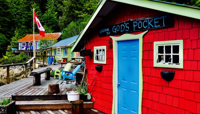
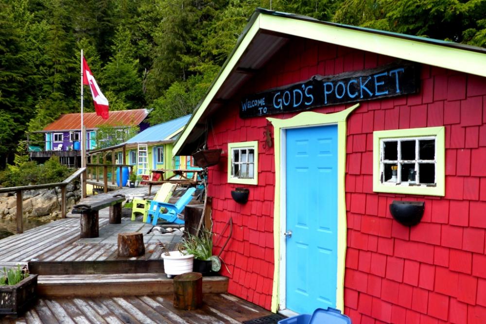
God's Pocket Dive Resort on Hurst Island 50' 50.41" N, 127' 35.59" W
We left Port McNeil in wet and blustery conditions with 15-20 knots SE blowing us up Queen Charlotte Strait. With only the genoa for power we still made quick progress up the Strait. Just short of our destination the wind changed from SE to NW over the course of about 30 seconds! Oh well - time to put away the sail anyway, we're almost there! We dropped the hook just in front of the resort in about 50 feet of water in calm conditions. We found the bay pretty tight and were concerned about staying there overnight with only 3:1 scope.
God's Pocket is a little indent on the north side of Hurst Island. It was named by fisherman at the turn of the century who used it for refuge when storms churned up the seas out in the Strait. It then became a steamship stop and then a fishing resort. The present owners, Annie and Bill, bought the place about 20 years ago and changed it into an eco oriented dive and kayaking resort. They greeted us upon arrival and we quickly learned that we both had family on Mayne Island. Small world!
There were no guests when we visited. Annie and Bill were having a short break before the summer season started. They invited us to wander around. We loved the funky character and brilliant colours of the various cottages and out buildings. We are tropical water divers, but for those with dry suits and other cold water gear, this looked like a fabulous place to hang out for a while. The diving is reported to be some of the best on the BC coast.
See photo gallery.
Harlequin Bay - Seeking Refuge 50" 50.43" N, 127' 33.90 W
With a frontal system forecast to produce NW winds of 25 knots around midnight we both agreed that God's Pocket was too sketchy for an overnight anchorage. We liked the look of Harlequin Bay on the SE side of Hurst Island so pulled up the anchor and motored around the island to check it out. Weaving through a minefield of rocks we found a nice spot in the lee of the island where we could lay out lots of scope. We saw no harlequin ducks but did spot some furry sea otters! The forecast was accurate - it started howling at about midnight. While the anchorage provided good wind protection, swell from Queen Charlotte Strait wrapped around the headlands making for a lumpy night and not much sleep.
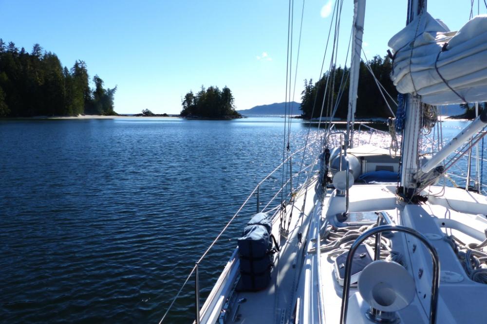
Passage Across Queen Charlotte Sound to Fury Cove 51' 29.67" N, 127' 45.58" W
Once of the challenging legs of this trip is getting across the open ocean area of Queen Charlotte Sound, located between the northern tip of Vancouver Island and Calvert Island where protection can be found again. The prevailing winds are NW so we decided to work our way up Goletas Channel and then exit into the open salt chuck through Shadwell Passage. This would give us the best wind angle across the Sound to Fury Cove and it turned out to be a good strategy.
The morning of departure was clear and crisp with a fresh NW breeze of about 25 knots kicking up galloping horses in Queen Charlotte Strait. So we motored our way up the more protected Goletas Channel in lighetr 15 knot winds and flat seas, waiting for the wind to settle down as forecast. Once through Shadwell Passage and out into open ocean the wind backed to a moderate westerly, setting us up for an amazing close reach all the way across the Sound. The sky stayed crystal clear all day giving us great views of the endless chain of snow capped peaks along the coast. But all good things must come to an end. After an epic sail the wind died just before landfall. We motored into the well protected inner lagoon at Fury Cover and anchored in about 40 ft. Once again, we had the anchorage to ourselves!
With a small sandy beach and many tree covered islets we found it a beautiful and restful spot after a long day of sailing. The warmth of the sun gave an encouraging hint of the summer weather to come. Happy hour was on the foredeck, followed by dinner in the cockpit! Great to finally be outdoors in the evening!
See photo gallery.
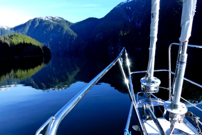
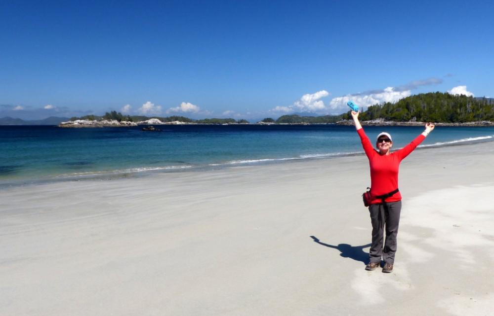
Pruth Bay and West & North Beaches 51' 39.28" N, 128' 07.44" W
Pruth Bay is located on Calvert Island about 20 miles NW of Fury Cove. This makes for an easy morning trip passage, leaving the afternoon to explore the fabulous west coast beaches. We were lucky to have the rare combination of SE wind and sunshine, making for a great downwind sail up Fitz Hugh Sound. When we rounded Wedgborough Point into Kwakshua Channel the wind died and temperature went up. Enjoying the sunny and calm conditions Norm untied the dinghy on the foredeck to get ready for going ashore. That was a mistake! As we approached the end of the channel strong wind gusts off the ocean nearly blew the dinghy off the deck! He won't do that again. We anchored in about 50 feet just east of the substantial dock of the Hakai Marine Institute.
A few years ago this bay was the site of a private fishing lodge. But it is now a privately funded marine research and teaching centre. The good news is they do not mind cruisers walking through the grounds to the beaches on the west side of the island, and even have a designated dinghy dock for visitors!
A well marked trail took us to a massive white sand beach. Dotted with tiny islands, crystal clear water, surf rolling in, West Beach was an idyllic west coast paradise. And it was all ours! We strolled north along the beach and found the trail to the North Beach. This 15 minute hike was a little more gnarly with muddy sections and a few climbs, but there were boardwalks and stairs here and there. The trail opened onto a huge, calm crescent shaped beach. It was well protected from the SE wind making it hot and sunny! Time for T-shirts and a few yoga stretches on the beach!
See photo gallery.
Port Mcneil was a convenient and practical place to stop. The Port Hardy airport is only about 1/2 hour away and made it easy for Beth to fly home to visit her mom. While this harbour not particular cute, in the Ganges sort of way, Port McNeil has fuel, laundry, groceries, marine shops, several banks and a good coffee shop all within a few minutes walk from the marina. Steve and Jessica, the young owner/operators of North Island Marina are super friendly and helpful, even letting us borrow their van to run some errands.
God's Pocket Dive Resort on Hurst Island 50' 50.41" N, 127' 35.59" W
We left Port McNeil in wet and blustery conditions with 15-20 knots SE blowing us up Queen Charlotte Strait. With only the genoa for power we still made quick progress up the Strait. Just short of our destination the wind changed from SE to NW over the course of about 30 seconds! Oh well - time to put away the sail anyway, we're almost there! We dropped the hook just in front of the resort in about 50 feet of water in calm conditions. We found the bay pretty tight and were concerned about staying there overnight with only 3:1 scope.
God's Pocket is a little indent on the north side of Hurst Island. It was named by fisherman at the turn of the century who used it for refuge when storms churned up the seas out in the Strait. It then became a steamship stop and then a fishing resort. The present owners, Annie and Bill, bought the place about 20 years ago and changed it into an eco oriented dive and kayaking resort. They greeted us upon arrival and we quickly learned that we both had family on Mayne Island. Small world!
There were no guests when we visited. Annie and Bill were having a short break before the summer season started. They invited us to wander around. We loved the funky character and brilliant colours of the various cottages and out buildings. We are tropical water divers, but for those with dry suits and other cold water gear, this looked like a fabulous place to hang out for a while. The diving is reported to be some of the best on the BC coast.
See photo gallery.
Harlequin Bay - Seeking Refuge 50" 50.43" N, 127' 33.90 W
With a frontal system forecast to produce NW winds of 25 knots around midnight we both agreed that God's Pocket was too sketchy for an overnight anchorage. We liked the look of Harlequin Bay on the SE side of Hurst Island so pulled up the anchor and motored around the island to check it out. Weaving through a minefield of rocks we found a nice spot in the lee of the island where we could lay out lots of scope. We saw no harlequin ducks but did spot some furry sea otters! The forecast was accurate - it started howling at about midnight. While the anchorage provided good wind protection, swell from Queen Charlotte Strait wrapped around the headlands making for a lumpy night and not much sleep.
Passage Across Queen Charlotte Sound to Fury Cove 51' 29.67" N, 127' 45.58" W
Once of the challenging legs of this trip is getting across the open ocean area of Queen Charlotte Sound, located between the northern tip of Vancouver Island and Calvert Island where protection can be found again. The prevailing winds are NW so we decided to work our way up Goletas Channel and then exit into the open salt chuck through Shadwell Passage. This would give us the best wind angle across the Sound to Fury Cove and it turned out to be a good strategy.
The morning of departure was clear and crisp with a fresh NW breeze of about 25 knots kicking up galloping horses in Queen Charlotte Strait. So we motored our way up the more protected Goletas Channel in lighetr 15 knot winds and flat seas, waiting for the wind to settle down as forecast. Once through Shadwell Passage and out into open ocean the wind backed to a moderate westerly, setting us up for an amazing close reach all the way across the Sound. The sky stayed crystal clear all day giving us great views of the endless chain of snow capped peaks along the coast. But all good things must come to an end. After an epic sail the wind died just before landfall. We motored into the well protected inner lagoon at Fury Cover and anchored in about 40 ft. Once again, we had the anchorage to ourselves!
With a small sandy beach and many tree covered islets we found it a beautiful and restful spot after a long day of sailing. The warmth of the sun gave an encouraging hint of the summer weather to come. Happy hour was on the foredeck, followed by dinner in the cockpit! Great to finally be outdoors in the evening!
See photo gallery.
Pruth Bay and West & North Beaches 51' 39.28" N, 128' 07.44" W
Pruth Bay is located on Calvert Island about 20 miles NW of Fury Cove. This makes for an easy morning trip passage, leaving the afternoon to explore the fabulous west coast beaches. We were lucky to have the rare combination of SE wind and sunshine, making for a great downwind sail up Fitz Hugh Sound. When we rounded Wedgborough Point into Kwakshua Channel the wind died and temperature went up. Enjoying the sunny and calm conditions Norm untied the dinghy on the foredeck to get ready for going ashore. That was a mistake! As we approached the end of the channel strong wind gusts off the ocean nearly blew the dinghy off the deck! He won't do that again. We anchored in about 50 feet just east of the substantial dock of the Hakai Marine Institute.
A few years ago this bay was the site of a private fishing lodge. But it is now a privately funded marine research and teaching centre. The good news is they do not mind cruisers walking through the grounds to the beaches on the west side of the island, and even have a designated dinghy dock for visitors!
A well marked trail took us to a massive white sand beach. Dotted with tiny islands, crystal clear water, surf rolling in, West Beach was an idyllic west coast paradise. And it was all ours! We strolled north along the beach and found the trail to the North Beach. This 15 minute hike was a little more gnarly with muddy sections and a few climbs, but there were boardwalks and stairs here and there. The trail opened onto a huge, calm crescent shaped beach. It was well protected from the SE wind making it hot and sunny! Time for T-shirts and a few yoga stretches on the beach!
See photo gallery.
| Vessel Name: | Sarah Jean II |
| Vessel Make/Model: | Saga 43 |
| Hailing Port: | Vancouver, BC |
| Crew: | Norm and Beth Cooper |
| About: | Our home is in White Rock BC. We set sail Sept. 8, 2010 for San Francisco, Mexico, the South Pacific and New Zealand. In April 2013 we will begin our voyage home through Hawaii, completing a 3 year Pacific circumnavigation. |
| Extra: | We'd love to hear from you - send us an email at bethandnorm@gmail.com |
Sarah Jean II's Photos - Main
.JPG) |
.JPG) |
.JPG) |
 |
Pruth Bay, located on Calvert Island, is an essential stop along the way. The harbour on the east side is well protected and provides access to west coast beaches by a short trail. The former fishing lodge is now a marine research centre. Visiting boaters are welcome to use their dinghy dock.
6 Photos
Created 18 May 2017
|
 |
We enjoyed a great close reach across Queen Charlotte Sound under sunny skies. At the end of the day we anchored in Fury Cove, beautiful and secure with room for lots of boats . . . but we were alone!
3 Photos
Created 18 May 2017
|
 |
This funky eco resort is located on the north side of Hurst Island. The area has some of the best diving on the BC coast.
7 Photos
Created 18 May 2017
|
 |
Sointula is a remote but charming community located on Malcolm Island directly east of Port McNeil. It was established in 1901 by a group of Finnish settlers who wanted to create a utopian socialist society.
19 Photos
Created 12 May 2017
|
 |
We spent a couple of days exploring this historic First Nations community located on Cormorant Island near Port McNeil.
11 Photos
Created 12 May 2017
|
 |
Working our way north through Seymour Narrows and up Johnstone Strait.
11 Photos
Created 12 May 2017
|
 |
A few photos as we head up the Strait of Georgia, kicking off our 5 month trip to Alaska.
4 Photos
Created 12 May 2017
|
 |
We stopped in Hawaii for a rest and provisions but spent most of our time in the boat yard doing repairs. The photos are of a of a few days exploring wild and wacky Waikiki!
37 Photos
Created 8 July 2013
|
 |
This was a vigorous upwind sail of 2,300 miles across the equator and the ITCZ.
22 Photos
Created 8 July 2013
|
 |
We spent our time in the tiny village of Te Tetua. Wonderful, hospitable people. An island paradise! Penrhyn is famous for the fine weaving of hats and fans that the women do, and for the golden colored pipi pearls that are found only on this atoll.
49 Photos
Created 8 July 2013
|
 |
We spent a couple of weeks here exploring by foot, scooter and snorkel.
20 Photos
Created 8 July 2013
|
 |
On this passage we were joined by David as guest crew. We also ran into some heavy weather - the BIG LOW!
13 Photos
Created 8 July 2013
|
 |
The Hauraki Gulf is the vast playground to the east of Auckland where there are many islands and anchorages to explore.
25 Photos
Created 17 March 2013
|
 |
Located about 100 miles offshore northeast of Auckland, Great Barrier is wild and remote. Breathtaking beaches, abundant wildlife and excellent hiking. We spent a couple of weeks on The Barrier.
30 Photos
Created 17 March 2013
|
 |
Kawau Island is just north of Auckland. We went to visit our friends Daniel and Michelle on s/v Evangeline. They introduced us to the famous offshore sailors Lin and Larry Pardey who live on Kawau.
21 Photos
Created 17 March 2013
|
 |
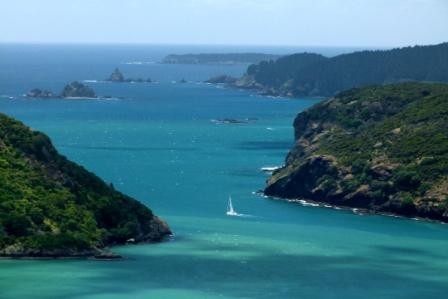
A place with a funny name but it has a beautiful sandy beach and stunning grassy headlands for walking. A super anchorage in south or southeast winds.
11 Photos
Created 17 March 2013
|
 |
This very protected bay just south of Cape Brett is the home of an old whaling station. It provides access to the Cape Brett trail where we tramped about one day.
4 Photos
Created 17 March 2013
|
 |
Beutiful oddshore islands just south of Whangaroa Harbour. Clear water and good kayaking. Home of the wreck of the Rainbow Warrier.
9 Photos
Created 17 March 2013
|
 |
An amazingly protected harbour north of the Bay of Islands. Great hikes with spectacular views.
10 Photos
Created 17 March 2013
|
 |
A few shots around the lovely town and marina at Opua, our home away from home
19 Photos
Created 23 December 2012
|
 |
We stayed here a few days en route to New Zealand from Noumea. It is a beautiful tropical setting at the very south end of New Caledonia.
26 Photos
Created 23 December 2012
|
 |
Photos of our arrival into New Caledonia and the very modern City of Noumea, a startling contrast to Vanuatu.
47 Photos
Created 23 December 2012
|
 |
This is a great anchorage. We stopped here when winds were in our face as we attempted to go south. Very pretty onshore!
10 Photos
Created 23 December 2012
|
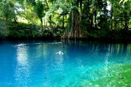 |
A few shots of the Blue Hole, a spectacular freshwater spring near the town of Luganville.
8 Photos
Created 23 December 2012
|
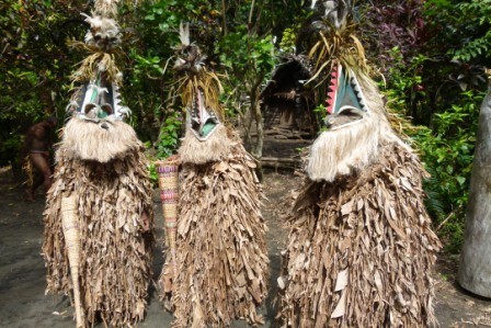 |
Land of black volcanic beaches, black magic, wood carving and colorful kastom mask dancing!
50 Photos
Created 22 December 2012
|
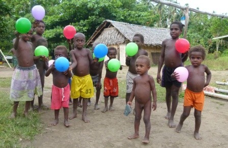 |
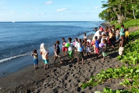
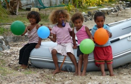
A wonderful anchorage providing access to several villages. We saw the most amazing kastom dancing - performed by both men AND women! Balloons were a big hit with the kids!
27 Photos
Created 22 December 2012
|
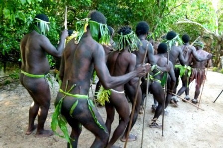 |
Wearing only bits of grass and penis sheathes, thrusting spears into the air, they emerged out of the jungle stomping and chanting . . .
12 Photos
Created 22 December 2012
|
 |
This where we helped bring a giant marlin to the villagers and where we saw some amazing traditional dancing. The next album is dedicated just to the dancing.
40 Photos
Created 22 December 2012
|
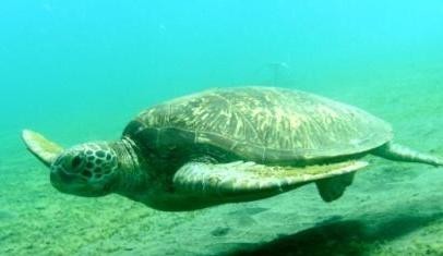 |
Home of dugongs and lots of sea turtles, this is an awesome anchorage!
12 Photos
Created 22 December 2012
|
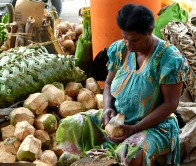 |
The biggest city in Vanuatu where we stopped to stock up on food at the great public market.
12 Photos
Created 5 October 2012
|
 |
This is the seldom visited anchorage where we stopped with friends to deliver much needed school supplies.
40 Photos
Created 5 October 2012
|
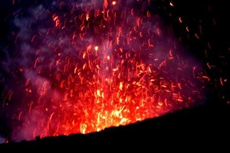 |
Views of the Port Resolution area including a visit to the fiery volcano!
45 Photos
Created 5 October 2012
|
 |
This is the most southerly island in Vanuatu and our point of arrival. Beautiful gardens, dugout canoes and the spectacular Mystery island are shown in this album.
36 Photos
Created 5 October 2012
|
 |
This is the great little island where we spent about a week in September, including our 29th anniversary.
30 Photos
Created 15 September 2012
|
 |
Our son, Brian, and his girlfriend, Lindsay, visited us for a couple of weeks. We cruised the Yasawa Island Group and had an excellent time - village visits, hikes, diving, good music & great company!
87 Photos
Created 25 August 2012
|
 |
This small island was simply stunning. A beautiful village, white sandy beaches, great hiking trails and crystal clear water. This island is not to be missed!
27 Photos
Created 4 August 2012
|
 |
Ono Island is located in SW Fiji at the north end of Kadavu Island. It is surrounded by the Great Astrolabe Reef. The area has some great diving!
46 Photos
Created 4 August 2012
|
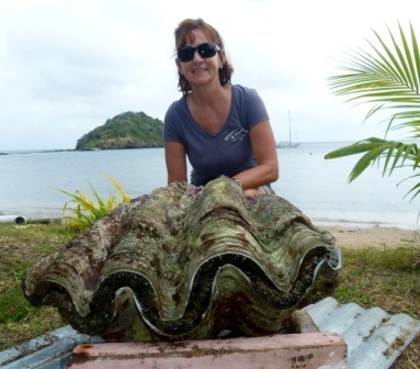 |
This series of photos guides you through the step by step process of spawning giant clams. We watched this in Makogai.
18 Photos
Created 4 August 2012
|
 |
A fascinating place with sea turtles, giant clam breeding and the ruins of a huge leper colony.
33 Photos
Created 4 August 2012
|
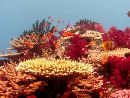 |
Viani Bay is thye anchorage near to Rainbow Reef, one of Fiji's top dive spots. We did 4 dives here with Jack Fischer and got a few good photos.
13 Photos
Created 4 August 2012
|
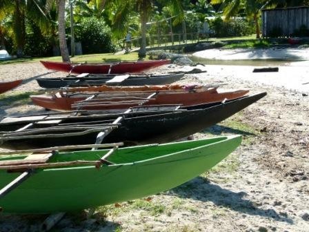 |
This village was one of our favorites. The friendly people are originally from Tuvalu and have brought much of their culture with them - including dugout canoes and great weaving skills.
20 Photos
Created 4 August 2012
|
 |
This unique island is NE of Taveuni. We visited Albert Cove and Katherine Bay.
34 Photos
Created 4 August 2012
|
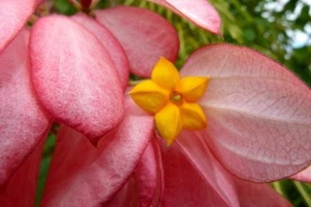 |
A day spent with Suzy from s/v Sidewinder climbing up to the Tavoro Waterfalls and then hiking the Lavena Coastal Trail.
29 Photos
Created 13 July 2012
|
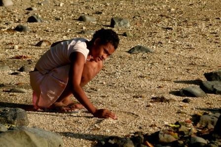 |
We really enjoyed Qamea Island. We anchored in Namata Bay and got to know the wonderful MItchell family. Meet some some of them in this album!
19 Photos
Created 13 July 2012
|
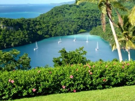 |
A few shots from our excursion to the north side including a high mountain plantation and very cool cathedral cave.
11 Photos
Created 13 July 2012
|
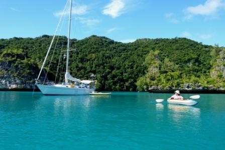 |
We anchored here for a few days and enjoyed exploring the many islands and hidden caves by kayak.
16 Photos
Created 13 July 2012
|
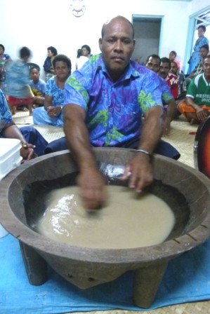 |
Our visit to the charming village of Daliconi near the Bay of Islands in the Northern Lau Group
16 Photos
Created 17 June 2012
|
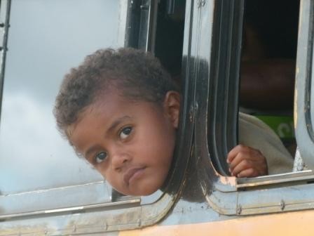 |
One day we took the bus from Savusavu to Labasa on the opposite side of he island. It is a big town with a large Indo Fijiin population. The market is great and the bus ride is an adventure!
23 Photos
Created 12 June 2012
|
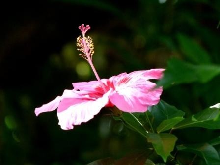 |
This album shows our arrival port of Savusavu and an excursions to the Cousteau Dive Resort.
37 Photos
Created 12 June 2012
|
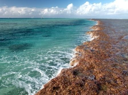 |
Our excellent passage from New Zealand to Fiji including a stop at Minerva Reef - a circular atoll in the middle of the ocean!
31 Photos
Created 11 June 2012
|
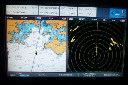 |
A few shots of our excellent passage from Tonga to NZ with Kyle Russell aboard as crew.
29 Photos
Created 31 October 2011
|
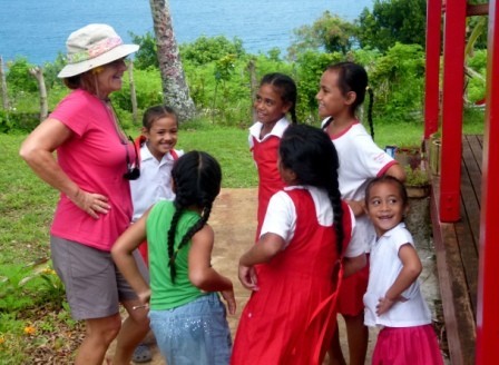 |
We visited the villages of Matamaka and Nuapapu where we went to church, had lunch with the locals and then the next day visited a school. Lots of fun and some great images!
38 Photos
Created 29 September 2011
|
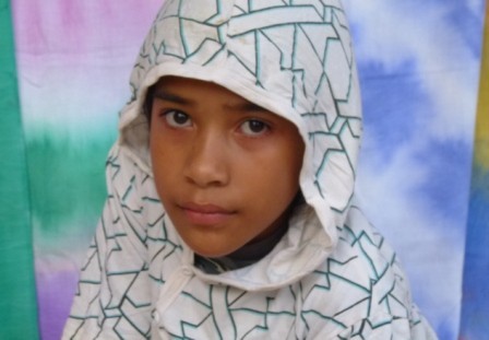 |
Even more shots of this great cruising area!
26 Photos
Created 29 September 2011
|
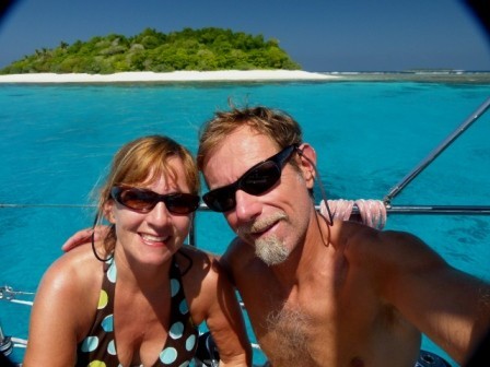 |
More of the same great sights and experiences!
36 Photos
Created 28 September 2011
|
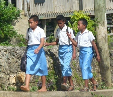 |
We have so many great photos of Vava'u they are divided into a few albums. This is the first. People, boats, spectacular anchorages and unexpected sights - such as grave quilts!
36 Photos
Created 28 September 2011
|
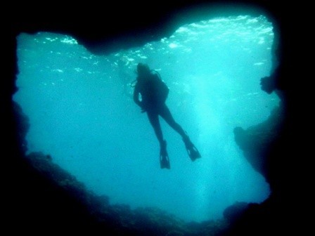 |
Photos of the awesome underwater world of Vava'u including caves, coral, fish and some other creatures.
20 Photos
Created 28 September 2011
|
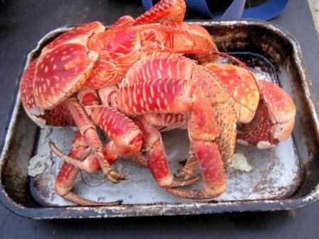 |
A beutiful atoll with a population of only 3 permanent residents awaits those who brave the narrow pass into the lagoon.
25 Photos
Created 5 August 2011
|
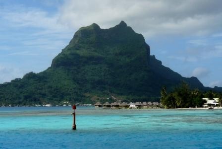 |
Bora Bora has lived up to its mythical reputation - a towering green volcanic peak surounded by motu islands and a beautiful blue lagoon!
21 Photos
Created 28 June 2011
|
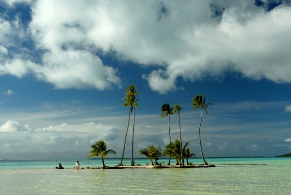 |
We had a short visit to these islans but it was long enough to enjoy a visit to the luxurious Le Tahaa Resort. Wow!
24 Photos
Created 28 June 2011
|
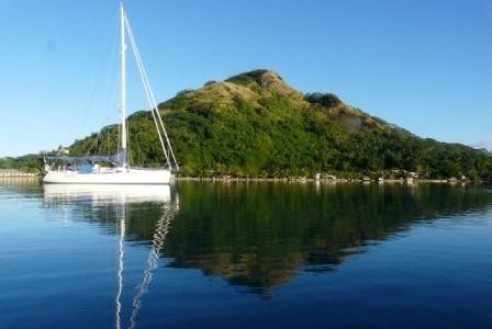 |
We came to this small gem after an overnight passage from Moorea. Baie D'Avea was one our favorite anchorages so far, made better by very calm conditions!
43 Photos
Created 28 June 2011
|
 |
This is where freinds Bob & janey joined us. Spectacular bays with towering volcanic spires were the highlight of this paradise.
39 Photos
Created 28 June 2011
|
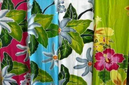 |
The exotic island of Tahiti where we celebrated Norm's birthday. Pics include the Papeete market, super yachts and sunsets over Moorea!
27 Photos
Created 28 June 2011
|
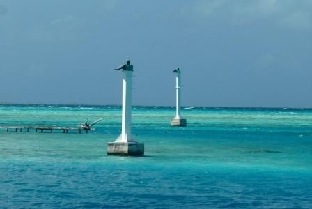 |
This tiny anchorage is located on the outside of the atoll so there is no need to deal with passes or current predictions.
9 Photos
Created 28 June 2011
|
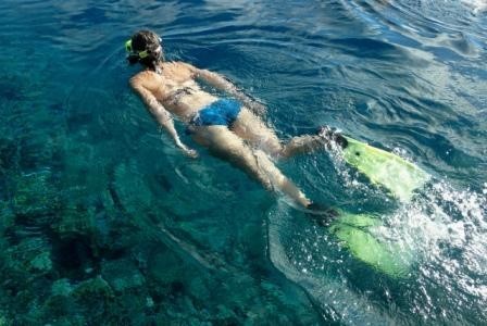 |
Crystal clear water, sharks around our boat, spectacular lagoons and a funky bar overlooking the pass made this one of our favorite stops!
30 Photos
Created 25 June 2011
|
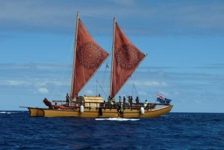 |
This album includes shots of the main village, scuba diving, arrival of the traditional Vaka boats and, of course, our daughter, Amanda, who joined us for some fun times!
29 Photos
Created 25 June 2011
|
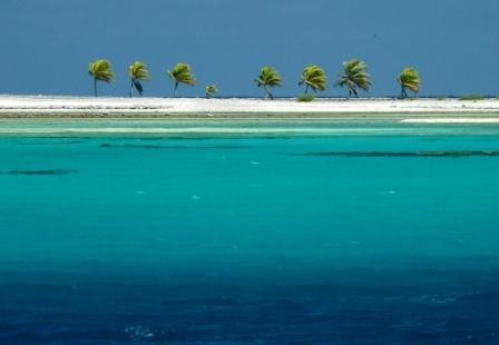 |
This was our first atoll in the Tuomotus Group. Crystal clear water, beautiful motus and quiet isolation made this stop very special.
35 Photos
Created 10 June 2011
|
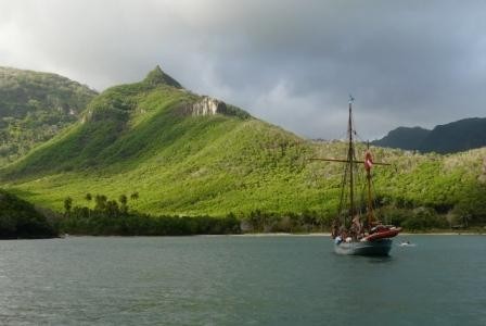 |
Towering cliffs, a rugged hike, huge wterfall and the site of a Survivor TV series - Daniel's Bay has lots to see and experience!
29 Photos
Created 3 June 2011
|
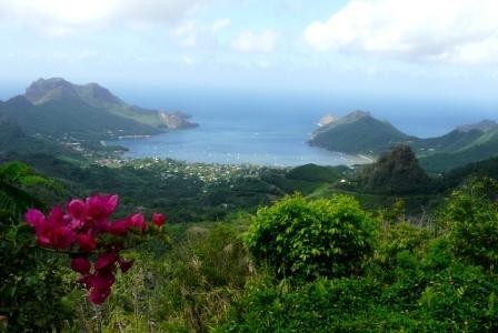 |
Wow - what a great island! Excellent harbour, waterfalls, pine forests and high ranch country. Come inside the album and see!
33 Photos
Created 3 June 2011
|
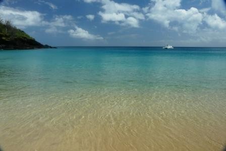 |
We visited Hapatoni Bay, famous for artisans, especially carvers. We also visited Hana Moe Noa Bay and Ivaiva Bay where the beaches were white sand and the water crystal clear!
24 Photos
Created 27 April 2011
|
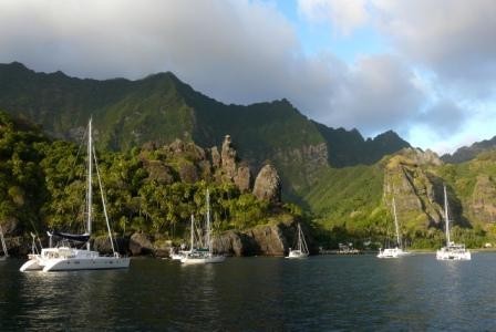 |
Fatu Hiva is probably the most spectacular island in the Marquesas Group. Photos include the Bay of Virgins, mountain hikes and a traditional pig roast dinner.
61 Photos | 1 Sub-Album
Created 27 April 2011
|
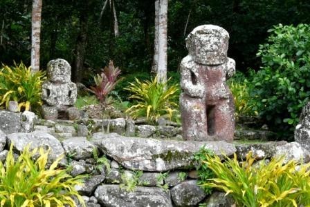 |
This was our first landfall in the Marquesas. Photos include the anchorage at Taahuku Bay and village of Atuona, along with an inland road trip across island to Puamau Bay.
84 Photos
Created 27 April 2011
|
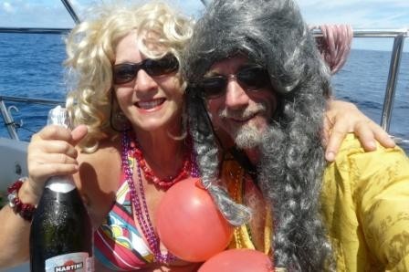 |
We had a wonderful 19 day passage from La Cruz, Mexico to Hiva Oa in the Marquesas Group of French Polynesia. Photos include everything from laundry day to our equator crossing.
64 Photos
Created 27 April 2011
|
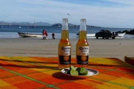 |
We spent a couple of weeks in February exploring the Gold Coast from Puerto Vallarta south to Manzanillo.
47 Photos
Created 16 February 2011
|
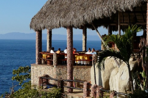 |
A few shots of the great marina at La Cruz and our explorations around the Puerto Vallarta area.
17 Photos
Created 16 February 2011
|
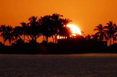 |
We took a panga trip up the Rio Tovara near San Blas. This is a mangrove jungle area with many birds, iguanas, turtles and even crocodiles.
18 Photos
Created 22 January 2011
|
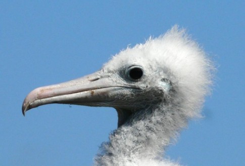 |
This magic island is a breeding area for many species of birds including frigates and blue footed boobies. The birds have no fear of people - allowing very close encounters and amazing photos!
38 Photos
Created 22 January 2011
|
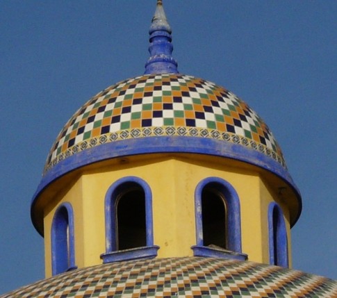 |
A collection of random photos taken at Marina El Cid and Old Mazatlan. We enjoyed the city, especially the many art studios and galleries.
38 Photos
Created 12 January 2011
|
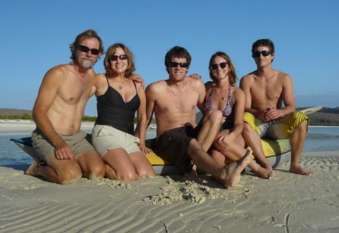 |
A great family Christmas together sailing in the Sea of Cortez from Puerto Escondito to La Paz. Hikes, snorkeling, sea lions, wake boarding, beach cattle and more . . .
112 Photos
Created 2 January 2011
|
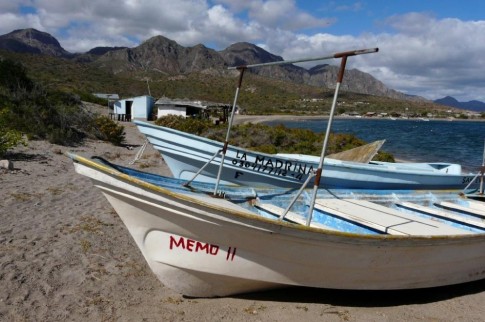 |
This is the bay and fishing village where we holed up during a big norther.
18 Photos
Created 9 December 2010
|
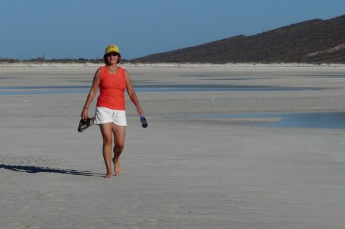 |
This wonderful cruising area is located just north of La Paz. Red cliffs, crystal clear water and white sandy beaches abound!
34 Photos
Created 9 December 2010
|
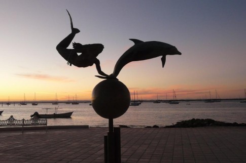 |
We spent about a week in this wonderful Mexican city. It is laid back with no visile tourist industry except for the yachties like us. We liked this place!
16 Photos
Created 9 December 2010
|
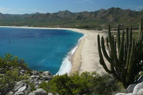 |
This is a wonderful anchorage on the Baja Cape between Cabo and La Paz. We spent a couple of days here snorkeling, hiking and enjoying the beach.
12 Photos | 1 Sub-Album
Created 15 November 2010
|
 |
A visit to the town of Two Harbors, including a great hike, followed by a visit to the bigger town of Avalon.
24 Photos
Created 14 November 2010
|
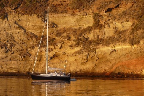 |
We anchored in Pelican Bay and did a great hike along the bluffs to Prisoners Bay. Vistas and some wildlife incliding an island fox!
31 Photos
Created 13 October 2010
|
 |
Beautiful beaches, elephant seals, sand dunes and great hiking - San Miguel has it all!
29 Photos | 1 Sub-Album
Created 13 October 2010
|
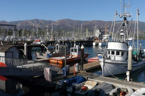 |
A few shots around the marina while we were waiting out a big blow.
9 Photos
Created 13 October 2010
|
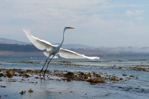 |
A few photos a day at anchor in San Simeon including kayaking in the bay and views of the Hearst Castle verlooking the ocean.
12 Photos
Created 1 October 2010
|
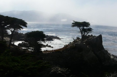 |
Shots of Monterey, the famous aquairium and a bike ride along the 17 Mile Drive to Carmel.
46 Photos
Created 28 September 2010
|
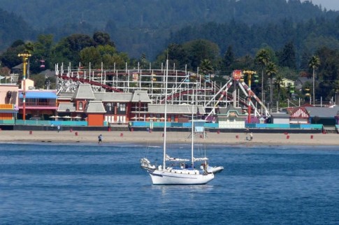 |
Photos of Santa Cruz Marina and a bike ride to the boardwalk, pier and surfer museum. We then road to the cute village of Capitola a few miles south of Santa Cruz.
17 Photos
Created 28 September 2010
|
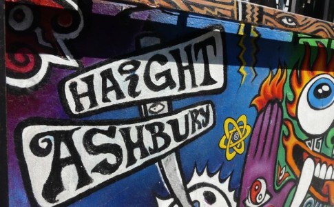 |
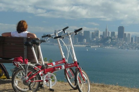 |
Angel Island is located in the middle of San Francisco Bay. We spent the day exploring it on our folding bikes. Awesome views in all directions!
16 Photos
Created 19 September 2010
|
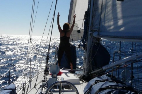 |
Passage from Cictora to San Francisco. Departure on Sept 6. Arrival on Sept 11. Crew were Kris & Ryan. Great first passage for Sarah Jean II.
43 Photos
Created 15 September 2010
|
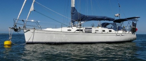 |
About Us
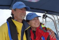
Who: Norm and Beth Cooper
Port: Vancouver, BC
Gallery


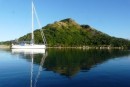
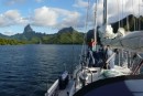
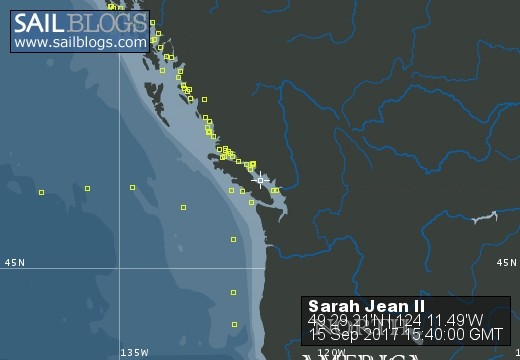
SailBlogs Friends


