
SVs Saraoni and Sundari
09 April 2024 | The Broadwater, Gold Coast, Australia
03 March 2024 | Hope Harbour marina, Gold Coast, Australia
03 January 2024 | Karragarra Channel, South Moreton Bay Islands, Queensland
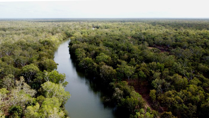
15 December 2023 | Riverheads, Mary River, Great Sandy Strait, Queensland
23 October 2023 | Great Keppel Island
07 August 2023 | Trinity Inlet, Cairns, North Queensland
23 July 2023 | Trinity Inlet, Cairns, Far North Queensland.
07 July 2023 | Cairns
19 May 2023 | North West island, Capricornia Cays, Queensland
15 May 2023 | Burnett River, Bundaberg, Queensland.
29 April 2023 | Manly marina, Moreton Bay, Queensland, Australia
04 March 2023 | South Auckland, New Zealand
18 January 2023 | Gold Coast Broadwater, Queensland
17 November 2022 | Collie, Southern WA, Australia
29 October 2022 | Albany, SW Australia
14 October 2022 | Augusta, WA, Australia
15 August 2022 | Karragarra Passage, Southern Moreton Bay, Queensland, Australia
14 July 2022 | Raby Bay, off Moreton Bay, Queensland
13 June 2022 | Camooweal, Far West Queensland
20 May 2022 | Alice Springs, Northern Territory, Australia
Tunasafiri Kwa Africa!*
09 April 2024 | The Broadwater, Gold Coast, Australia
Alison and Geoff Williams | Warm and sunny

Photo shows a lone male elephant on a road in Kruger National Park we encountered in October 2012. We weren't sure at the time what the intentions of the elephant were!
It seems hard to register that we have now been in Australia for nearly six whole years, with only 2 relatively short side trips to New Zealand, just across the turbulent ditch. This long period has of course been partly extended by Covid rules and maybe the very size of Australia has meant that we have been kept busy exploring new places whenever we could.
Now we are flying away, with Sundari safely tucked away in Hope Harbour, while we pass through Perth en route to Cape Town. We are hiring a car to drive east along the Garden Route and the Wild Coast as far as KwaZulu Natal, then north past Eswatini / Swaziland and into Kruger and then off to Johannesburg.
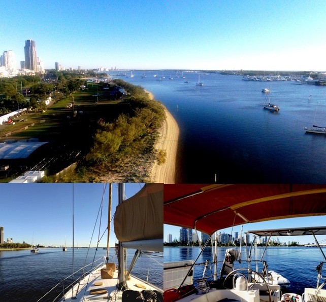
Anchored in the Broadwater for the next few days before flying off to Africa!
From there we will fly up to Entebbe in Uganda on the north coast of Lake Victoria, and visit the area south west of Uganda's capital, Kampala to look for chimps in their last remaining forest habitats amongst other Ugandan wildlife refuges. Finally, our African odyssey will take us to the city of Arusha near Mount Kilimanjaro and we will hire a 4 x 4 to take us to Tarangire national park, Ngorongoro Crater and the Serengeti. We should be back in Brisbane ready to sail north in mid June after a short stopover in Kuala Lumpur.
It's not the first time we have been in Africa, of course. We were last in South Africa in 2012 when we spent five weeks in the eastern half of Africa's most developed country. We sailed up through the Red Sea in 2010, visiting Eritrea, Sudan and Egypt, while in 2013, we spent time in Morocco and Cape Verde, off the West African coast. And on our long trip from New Zealand to Britain in 1979 we spent several weeks in Kenya, hitch hiking around the country and dropping into Mombasa on the coast where my (Geoff's) Dad was working.
Years before that, I lived in East Africa for five years with my family. My time there as a developing teenager, living in two equally developing young African nations, only just emerging from the shadow of colonial rule, was probably the most influential of my life.
It was where my life-long hatred of racism originated and an awareness of glaring socio-economic inequities. It was also where I discovered just how amazing the world of nature was, with the rich experiences of bountiful birdlife, amazing underwater coral ecosystems and mammalian megafauna.
It was where my mother died and was buried in a now overgrown cemetery on the outskirts of burgeoning and bustling Kampala. It was also where I learned to drive, and where I had my first taste of a job, albeit a volunteer one, on the border with the Congo in Queen Elizabeth National Park, working with and amongst that magic park's elephants, hippos, buffalo, lions and hyenas.
We don't expect to see an Africa unchanged. Nowhere else in the world has stayed the same. Africa generally remains near the bottom of the global statistical heap in terms of life expectancy, access to clean water, adequate housing and food supply. The continent is huge, of course, and diverse, and we will have too little time to make any meaningful analysis of what lies ahead for Africa's human population as well as what remains of African nature.
Climate change is just as important a challenge for Africa as it is here so far away in Australia. Only in the last few weeks, detailed aerial and underwater observations have revealed yet another depressing coral bleaching event, this time stretching well into the southern reefs. If wealthy Australia can't do enough to look after its natural marvels, and do its share in reducing emissions, who can blame poverty stricken African governments for not doing enough?
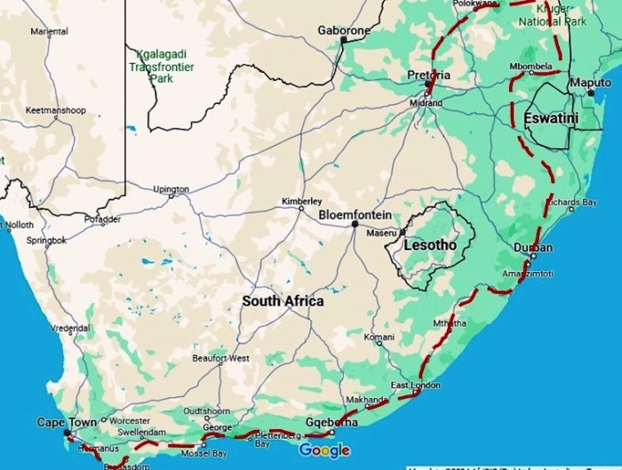
Route in South Africa from Cape Town to Johannesburg
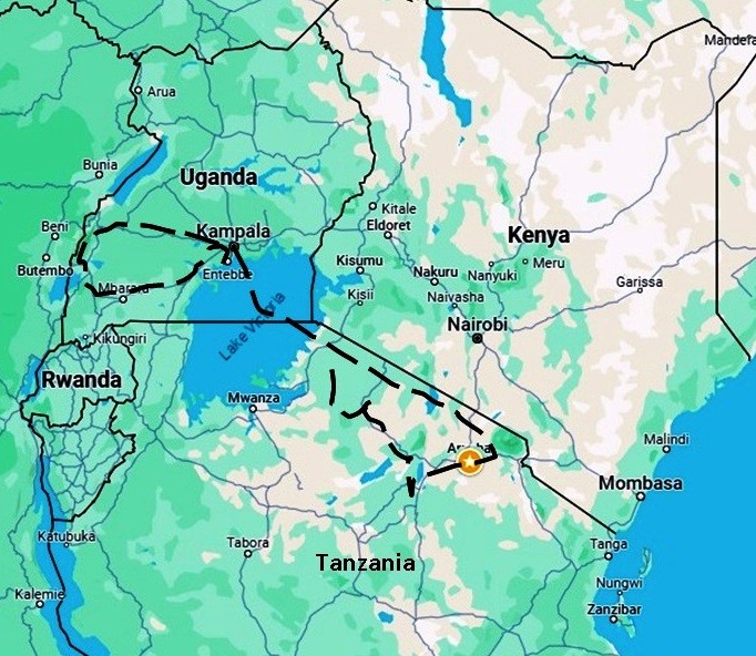
Route in East Africa from Entebbe in Uganda to Arusha in Tanzania
* "Tunasafiri Kwa Africa" - Kiswahili for "We are off to Africa". Kiswahili is a lingua franca language across East Africa, especially Tanzania, where it is the national language, and Kenya. It is actually the native language of the Waswahili, the people of the east coast opposite Unguja / Zanzibar. Kiswahili is not so common in Uganda and not spoken in South Africa where Afrikaans, English, Xhosa, Zulu and other African languages are the official languages.
It seems hard to register that we have now been in Australia for nearly six whole years, with only 2 relatively short side trips to New Zealand, just across the turbulent ditch. This long period has of course been partly extended by Covid rules and maybe the very size of Australia has meant that we have been kept busy exploring new places whenever we could.
Now we are flying away, with Sundari safely tucked away in Hope Harbour, while we pass through Perth en route to Cape Town. We are hiring a car to drive east along the Garden Route and the Wild Coast as far as KwaZulu Natal, then north past Eswatini / Swaziland and into Kruger and then off to Johannesburg.
Anchored in the Broadwater for the next few days before flying off to Africa!
From there we will fly up to Entebbe in Uganda on the north coast of Lake Victoria, and visit the area south west of Uganda's capital, Kampala to look for chimps in their last remaining forest habitats amongst other Ugandan wildlife refuges. Finally, our African odyssey will take us to the city of Arusha near Mount Kilimanjaro and we will hire a 4 x 4 to take us to Tarangire national park, Ngorongoro Crater and the Serengeti. We should be back in Brisbane ready to sail north in mid June after a short stopover in Kuala Lumpur.
It's not the first time we have been in Africa, of course. We were last in South Africa in 2012 when we spent five weeks in the eastern half of Africa's most developed country. We sailed up through the Red Sea in 2010, visiting Eritrea, Sudan and Egypt, while in 2013, we spent time in Morocco and Cape Verde, off the West African coast. And on our long trip from New Zealand to Britain in 1979 we spent several weeks in Kenya, hitch hiking around the country and dropping into Mombasa on the coast where my (Geoff's) Dad was working.
Years before that, I lived in East Africa for five years with my family. My time there as a developing teenager, living in two equally developing young African nations, only just emerging from the shadow of colonial rule, was probably the most influential of my life.
It was where my life-long hatred of racism originated and an awareness of glaring socio-economic inequities. It was also where I discovered just how amazing the world of nature was, with the rich experiences of bountiful birdlife, amazing underwater coral ecosystems and mammalian megafauna.
It was where my mother died and was buried in a now overgrown cemetery on the outskirts of burgeoning and bustling Kampala. It was also where I learned to drive, and where I had my first taste of a job, albeit a volunteer one, on the border with the Congo in Queen Elizabeth National Park, working with and amongst that magic park's elephants, hippos, buffalo, lions and hyenas.
We don't expect to see an Africa unchanged. Nowhere else in the world has stayed the same. Africa generally remains near the bottom of the global statistical heap in terms of life expectancy, access to clean water, adequate housing and food supply. The continent is huge, of course, and diverse, and we will have too little time to make any meaningful analysis of what lies ahead for Africa's human population as well as what remains of African nature.
Climate change is just as important a challenge for Africa as it is here so far away in Australia. Only in the last few weeks, detailed aerial and underwater observations have revealed yet another depressing coral bleaching event, this time stretching well into the southern reefs. If wealthy Australia can't do enough to look after its natural marvels, and do its share in reducing emissions, who can blame poverty stricken African governments for not doing enough?
Route in South Africa from Cape Town to Johannesburg
Route in East Africa from Entebbe in Uganda to Arusha in Tanzania
* "Tunasafiri Kwa Africa" - Kiswahili for "We are off to Africa". Kiswahili is a lingua franca language across East Africa, especially Tanzania, where it is the national language, and Kenya. It is actually the native language of the Waswahili, the people of the east coast opposite Unguja / Zanzibar. Kiswahili is not so common in Uganda and not spoken in South Africa where Afrikaans, English, Xhosa, Zulu and other African languages are the official languages.
East Coast Pottering
03 March 2024 | Hope Harbour marina, Gold Coast, Australia
Alison and Geoff Williams | Hot and humid, drizzly.
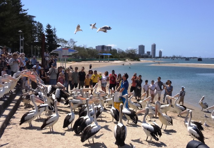
Photo shows the daily fish feeding frenzy outside a fish and chip restaurant on the Broadwater. Pelicans and silver gulls are there for easy pickings and tourists come to goggle at them.
We are back on the boat in Hope Harbour marina on the Gold Coast after a few weeks pottering around up and down the east coast of New South Wales and Queensland. Our trip south towards Sydney was cut short when it became obvious that we had lost a good weather window and would be locked into the barred Clarence River for rather too long if we had left the Gold Coast when we could.
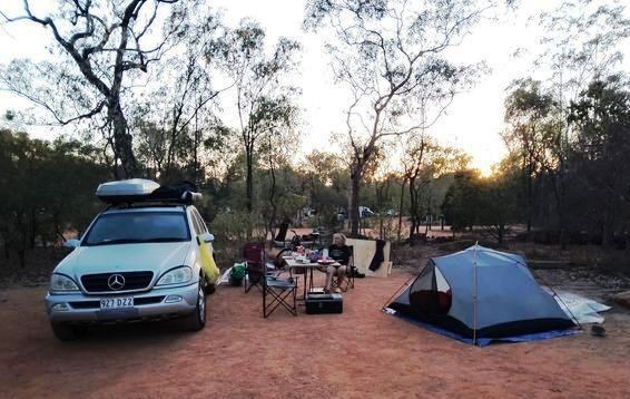
Not shy of opting for Plan B, we tied Sundari up in Hope Harbour and set off in Matilda, loaded up with kayaks, bikes, camping and hiking gear.
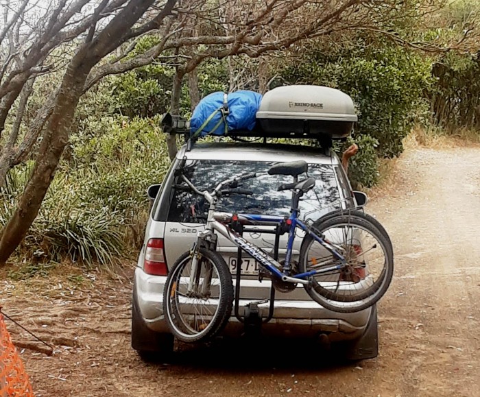
The Merc. loaded up with kayaks, bikes and camping stuff
We have passed through New South Wales plenty of times, but hardly ever explored what it has to offer naturally.
The NSW coastline is beautiful, but an awkward place for cruising, mainly because potential anchorages are mostly on offer only after navigating a river bar. In summer, the often constant easterly ocean swell can make many of these river entrances treacherous. When the swell is down, a few rivers are navigable to a deep drafted yacht like Sundari, but the entrance has to be precisely timed for a safe entrance. Once in, the rivers provide good anchorage, but you are then locked in until the bar opens again!
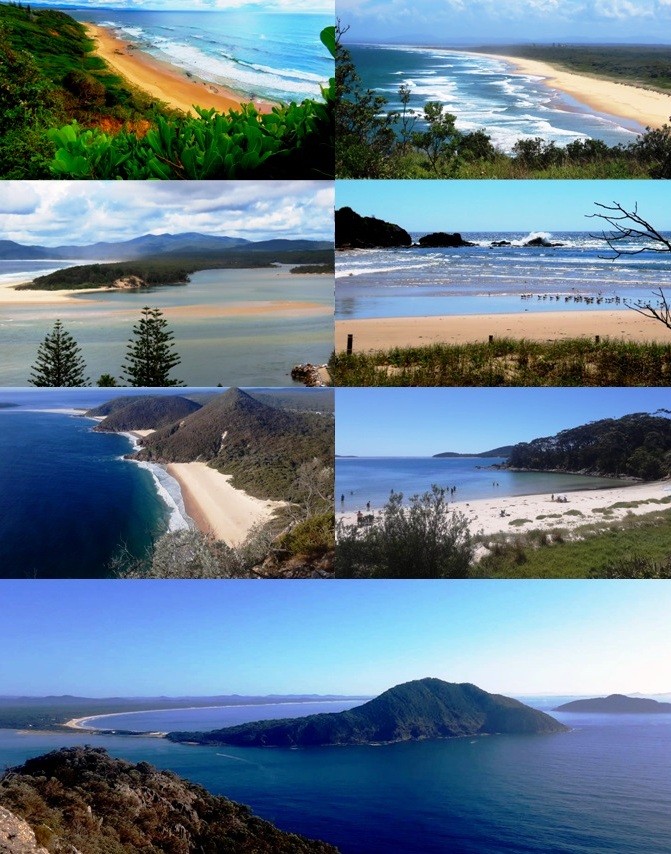
A few of many beautiful beaches and coastal scenes on the NSW coast
We are not new to bar crossings. We have crossed the often dangerous Wide Bay bar at the southern end of K'Gari many times, and have crossed into the Richmond and Clarence rivers in Saraoni. The most dangerous bar we tried to cross was the Vailala on the Papuan coast. We attempted this bar in Corsair with no beacons or navigational guidance back in 1989 and nearly drowned. The unsuccessful attempt meant we had to beat back against the trade wind for 150 nm to Port Moresby where we left the boat on a mooring and flew to the little jungle school of Ihu. The headmaster had been led to believe that we had disappeared and our boat sunk after we had been sighted trying to cross the bar by local fishermen!
Our wanderings took us on to the New England tableland, past gorges and escarpments down to the coast near Sydney. From Lake Macquarie, we explored each inlet in turn, travelling northwards past the Hunter, Port Stephens and the Myall Lakes, Forster/Tuncurry, the Manning River, Camden Haven, Port Macquarie, the Macleay, Nambucca Heads, Coffs Harbour, Sandon, the Clarence and Richmond Rivers.
Lovely, long stretches of sandy beaches between bush covered headlands and calm inlets punctuate the coast north of Sydney, but civilization in the form of condos, beach mansions and associated urban development is taking over in many places where the river mouths meet the sea. Weekends and public or school holidays close to any large city are times to avoid!
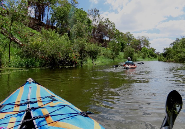
The weather was really too hot to enjoy too much strenuous outdoor activity but we walked where we could and kayaked in some lovely inlets. To beat the heat, we have just spent time up in the Border Ranges on the Queensland side, the Sunshine Coast hinterland and the upper reaches of the Mary River.
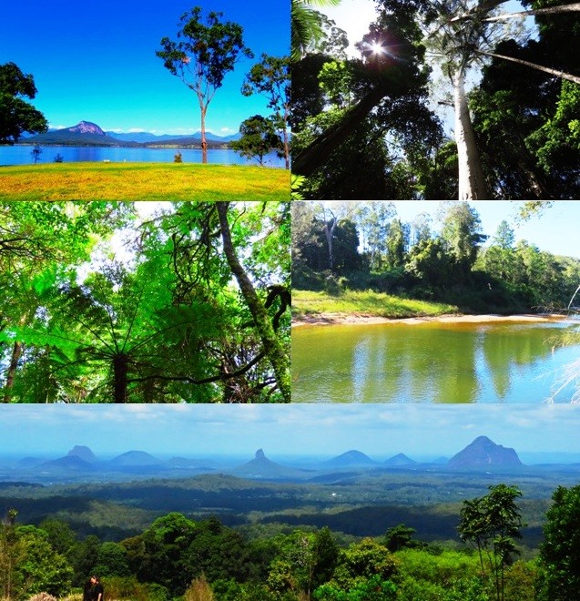
The hinterland of both the Gold Coast and the Sunshine Coast still have pockets of sub tropical rainforest and quite a few reservoirs turned into recreation resources.
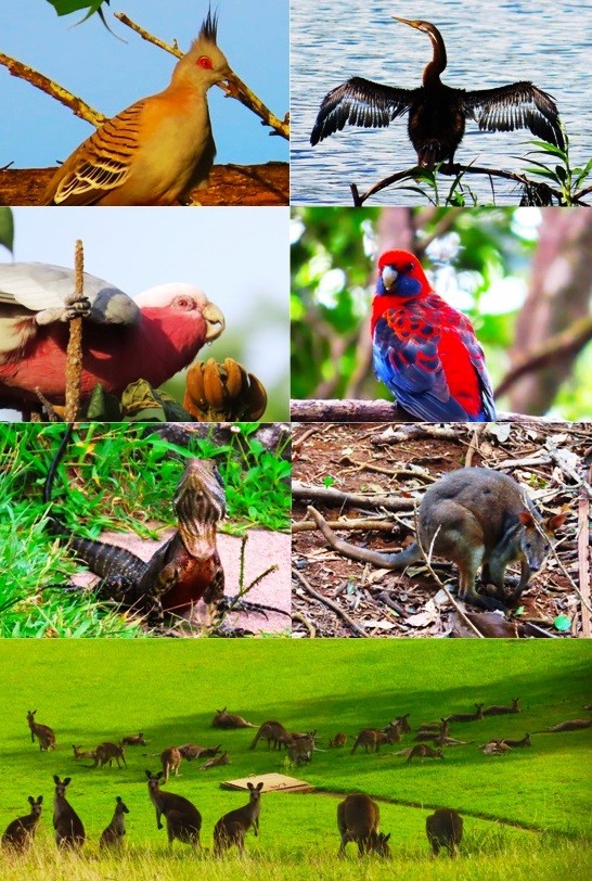
As usual, we are always on the lookout for amazing wildlife opportunities.
If it hadn't been for a lengthy wait for our Australian citizenship applications to be approved, we would have made plans to leave Sundari on the east coast and make a trip to Europe (last time we were there was 2013!) and Africa (not sure whether that was going to be Entebbe in Uganda or Cape Town). Plans are somewhat hazy as the applications have only just been approved, but we don't actually become citizens until we attend a citizenship ceremony, the date of which is unknown!
It is now the first days of Autumn here and we have to make a choice whether to stay put, sail south, or sail north and leave the boat in Bundaberg or Gladstone when we can fly off for the two months away from Australia.
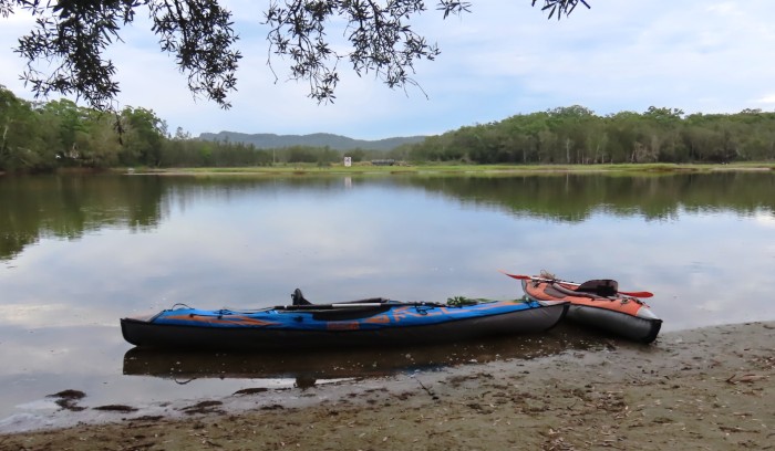
Finding places to kayak while we limbo dance!
We are back on the boat in Hope Harbour marina on the Gold Coast after a few weeks pottering around up and down the east coast of New South Wales and Queensland. Our trip south towards Sydney was cut short when it became obvious that we had lost a good weather window and would be locked into the barred Clarence River for rather too long if we had left the Gold Coast when we could.
Not shy of opting for Plan B, we tied Sundari up in Hope Harbour and set off in Matilda, loaded up with kayaks, bikes, camping and hiking gear.
The Merc. loaded up with kayaks, bikes and camping stuff
We have passed through New South Wales plenty of times, but hardly ever explored what it has to offer naturally.
The NSW coastline is beautiful, but an awkward place for cruising, mainly because potential anchorages are mostly on offer only after navigating a river bar. In summer, the often constant easterly ocean swell can make many of these river entrances treacherous. When the swell is down, a few rivers are navigable to a deep drafted yacht like Sundari, but the entrance has to be precisely timed for a safe entrance. Once in, the rivers provide good anchorage, but you are then locked in until the bar opens again!
A few of many beautiful beaches and coastal scenes on the NSW coast
We are not new to bar crossings. We have crossed the often dangerous Wide Bay bar at the southern end of K'Gari many times, and have crossed into the Richmond and Clarence rivers in Saraoni. The most dangerous bar we tried to cross was the Vailala on the Papuan coast. We attempted this bar in Corsair with no beacons or navigational guidance back in 1989 and nearly drowned. The unsuccessful attempt meant we had to beat back against the trade wind for 150 nm to Port Moresby where we left the boat on a mooring and flew to the little jungle school of Ihu. The headmaster had been led to believe that we had disappeared and our boat sunk after we had been sighted trying to cross the bar by local fishermen!
Our wanderings took us on to the New England tableland, past gorges and escarpments down to the coast near Sydney. From Lake Macquarie, we explored each inlet in turn, travelling northwards past the Hunter, Port Stephens and the Myall Lakes, Forster/Tuncurry, the Manning River, Camden Haven, Port Macquarie, the Macleay, Nambucca Heads, Coffs Harbour, Sandon, the Clarence and Richmond Rivers.
Lovely, long stretches of sandy beaches between bush covered headlands and calm inlets punctuate the coast north of Sydney, but civilization in the form of condos, beach mansions and associated urban development is taking over in many places where the river mouths meet the sea. Weekends and public or school holidays close to any large city are times to avoid!
The weather was really too hot to enjoy too much strenuous outdoor activity but we walked where we could and kayaked in some lovely inlets. To beat the heat, we have just spent time up in the Border Ranges on the Queensland side, the Sunshine Coast hinterland and the upper reaches of the Mary River.
The hinterland of both the Gold Coast and the Sunshine Coast still have pockets of sub tropical rainforest and quite a few reservoirs turned into recreation resources.
As usual, we are always on the lookout for amazing wildlife opportunities.
If it hadn't been for a lengthy wait for our Australian citizenship applications to be approved, we would have made plans to leave Sundari on the east coast and make a trip to Europe (last time we were there was 2013!) and Africa (not sure whether that was going to be Entebbe in Uganda or Cape Town). Plans are somewhat hazy as the applications have only just been approved, but we don't actually become citizens until we attend a citizenship ceremony, the date of which is unknown!
It is now the first days of Autumn here and we have to make a choice whether to stay put, sail south, or sail north and leave the boat in Bundaberg or Gladstone when we can fly off for the two months away from Australia.
Finding places to kayak while we limbo dance!
Quandamooka Stopover
03 January 2024 | Karragarra Channel, South Moreton Bay Islands, Queensland
Alison and Geoff Williams | Varying from hot and steamy to wet and stormy
Photo shows Sundari on its mooring between Karragarra and Lamb islands in the Karragarra Channel. Karragarra Island is in the background. This is Quandamooka Country - the Aboriginal name for Moreton Bay.
We seem to have been having a longer than usual stopover in the Karragarra Channel. We should have been sailing south along the New South Wales coast right now with a possible deviation to Lord Howe Island, but horrendous weather in South East Queensland (and North eastern NSW) has postponed movement away from the security of our mooring!
We're not sure what has happened to El Nino. Very severe thunderstorms and heavy rain for days at a time, with days in between baking in the upper thirties, have not quite fitted the usual El Nino pattern - more like a repeat of the last three years of La Nina. Climate scientists seem to be as flummoxed as us and are blaming 'unusually' (!) warm ocean water surrounding Australia on the amount of moisture in the air descending upon us.
Around a dozen people have died in one weather related accident or another since just before Christmas, three who fell overboard off a launch in 70 knots of wind a few miles north of us in Moreton Bay.
Heigh Ho, we have been dealing with a few maintenance issues on the boat, done the usual shuffling of stuff to and from the 'Boat Shed', swam off the back of the boat, or the beach at Karragarra or Lamb when it's been too hot, watching the daily sparring match between the local sea eagles and their tiny avian tormentors and sorting out documentation now needed for our Oz citizenship applications.
We still haven't recovered Matilda, patiently hanging around back up in Bundaberg, but will be going up to collect it next week, depositing it by the Boat Shed and departing southwards to resume our southern quest via the Gold Coast.
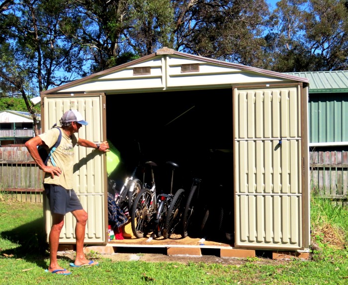
We now have 8 bikes in the shed and 1 more in the car up in Bundy. We need a new shed or need to get rid of some of this junk or all of the above!
In between the wet and stormy weather, it's been baking, so we have been in the sea as much as we can. The little beaches scattered around these populated islands have BBQ facilities, public loos and freshwater showers, which are actually more refreshing than the sea. This pic shows Karragarra in the foreground and Lamb to the North, with North Stradbroke (Minjerribah) in the far distance.
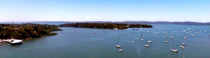
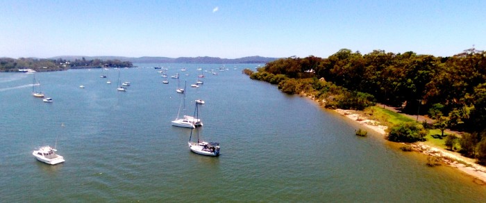
The scattering of moored boats in the Karragarra Channel. Macleay Island is the nearest island seen at the back left. Lamb is further to the right, separated from Macleay by the Lucas Passage. In the hazier distance is the long hummocky island of North Stradbroke, most of which is Naree Budjong Djara National Park. Most of North Stradbroke and Moreton Islands have been handed back to the remaining Quandamooka people. The Karragarra Channel is a well trafficked marine thouroughfare that is used by boats transiting between Moreton Bay to the north and the Gold Coast's Broadwater 25 miles away to the South.
This drone photo shows Russell Island, the fourth of this tightly knit quartet of inhabited SMB islands, in the distance, with the Krummel Passage separating it from Karragarra in the foreground. While Karragarra is the smallest island in area and population, Russell is the largest of the four islands with the most residents and land area.
This photo shows the mainland in the far distance, with a number of low lying mangrove islands scattered between the Redland Bay coast and Karragarra in the foreground.
Note the rather ungainly structure in the photo on Karragarra. Each of the four South Moreton Bay islands now sports a new ferry terminal for the frequent fast ferries which skim across the water between Redland Bay and the islands. The council has also built new dinghy docks and pontoons for larger boats at each island,which has made it a lot easier to get ashore and safely leave your dinghy as well as take Sundari alongside and fill up with water!
We seem to have been having a longer than usual stopover in the Karragarra Channel. We should have been sailing south along the New South Wales coast right now with a possible deviation to Lord Howe Island, but horrendous weather in South East Queensland (and North eastern NSW) has postponed movement away from the security of our mooring!
We're not sure what has happened to El Nino. Very severe thunderstorms and heavy rain for days at a time, with days in between baking in the upper thirties, have not quite fitted the usual El Nino pattern - more like a repeat of the last three years of La Nina. Climate scientists seem to be as flummoxed as us and are blaming 'unusually' (!) warm ocean water surrounding Australia on the amount of moisture in the air descending upon us.
Around a dozen people have died in one weather related accident or another since just before Christmas, three who fell overboard off a launch in 70 knots of wind a few miles north of us in Moreton Bay.
Heigh Ho, we have been dealing with a few maintenance issues on the boat, done the usual shuffling of stuff to and from the 'Boat Shed', swam off the back of the boat, or the beach at Karragarra or Lamb when it's been too hot, watching the daily sparring match between the local sea eagles and their tiny avian tormentors and sorting out documentation now needed for our Oz citizenship applications.
We still haven't recovered Matilda, patiently hanging around back up in Bundaberg, but will be going up to collect it next week, depositing it by the Boat Shed and departing southwards to resume our southern quest via the Gold Coast.
We now have 8 bikes in the shed and 1 more in the car up in Bundy. We need a new shed or need to get rid of some of this junk or all of the above!
In between the wet and stormy weather, it's been baking, so we have been in the sea as much as we can. The little beaches scattered around these populated islands have BBQ facilities, public loos and freshwater showers, which are actually more refreshing than the sea. This pic shows Karragarra in the foreground and Lamb to the North, with North Stradbroke (Minjerribah) in the far distance.
The scattering of moored boats in the Karragarra Channel. Macleay Island is the nearest island seen at the back left. Lamb is further to the right, separated from Macleay by the Lucas Passage. In the hazier distance is the long hummocky island of North Stradbroke, most of which is Naree Budjong Djara National Park. Most of North Stradbroke and Moreton Islands have been handed back to the remaining Quandamooka people. The Karragarra Channel is a well trafficked marine thouroughfare that is used by boats transiting between Moreton Bay to the north and the Gold Coast's Broadwater 25 miles away to the South.
This drone photo shows Russell Island, the fourth of this tightly knit quartet of inhabited SMB islands, in the distance, with the Krummel Passage separating it from Karragarra in the foreground. While Karragarra is the smallest island in area and population, Russell is the largest of the four islands with the most residents and land area.
This photo shows the mainland in the far distance, with a number of low lying mangrove islands scattered between the Redland Bay coast and Karragarra in the foreground.
Note the rather ungainly structure in the photo on Karragarra. Each of the four South Moreton Bay islands now sports a new ferry terminal for the frequent fast ferries which skim across the water between Redland Bay and the islands. The council has also built new dinghy docks and pontoons for larger boats at each island,which has made it a lot easier to get ashore and safely leave your dinghy as well as take Sundari alongside and fill up with water!
Southward Bound in Another Stormy Southern Summer
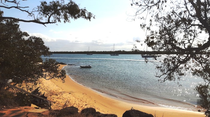
15 December 2023 | Riverheads, Mary River, Great Sandy Strait, Queensland
Alison and Geoff Williams | 15 to 20 knot northerlies and hot!
Photo shows Sundari anchored off the River Heads boat ramp at the mouth of the Mary.
We are anchored at the mouth of the Mary River, half way down the Great Sandy Strait, after a long 60nm sail down from Bundaberg's Burnett River. It was probably the best sail we have had this year, with consistent 10 to 20 knot north easterlies.
We have been in the Burnett for most of the time since our arrival from Mackay at least a month ago. Time has drifted by in the Burnett, as we have been hoping for a side trip up to Lady Musgrave lagoon. Sadly, this wasn't to be and we had Sundari hauled out for a bottom antifoul instead while we made inland trips to the Bunya Mountains and the Cooloola Coast.
Sundari anchored in its favourite calm spot in the lower reaches of the Burnett River.
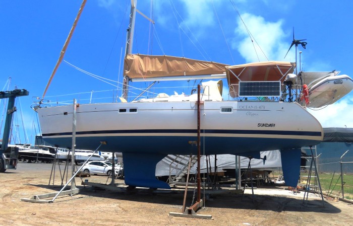
Sundari getting its hull scrubbed and painted with new antifouling paint.
While we were perched up on Bundy Port marina's hard stand, a low developed for the third time this year in the Solomons. Unlike Cyclones Lola and Mal, which both tracked south and then south east, the new system moved into the Coral Sea and long range forecasts predicted a possible path right across Bundaberg and K'Gari. The new cyclone, named Jasper, was the first December cyclone to develop in the Coral Sea in an El Nino year since records began - how often have we have been hearing these records being broken lately?
After a rather agonising long 10 day wait, especially for Far North Queensland boaties and land based residents, the cyclone eventually crossed the coast just north of Cape Tribulation nearly a week ago as a category 2 system. While the wind and wave damage wasn't too bad (apart from to coral reef and seagrass beds), torrential rain falling from the stalled system led to the worst flooding to hit the area since (guess what) records began. Jasper crossed the coast at the Aboriginal community of Wujal Wujal, all 300 inhabitants being eventually evacuated to Cooktown, mainly because of floods inundating their homes.
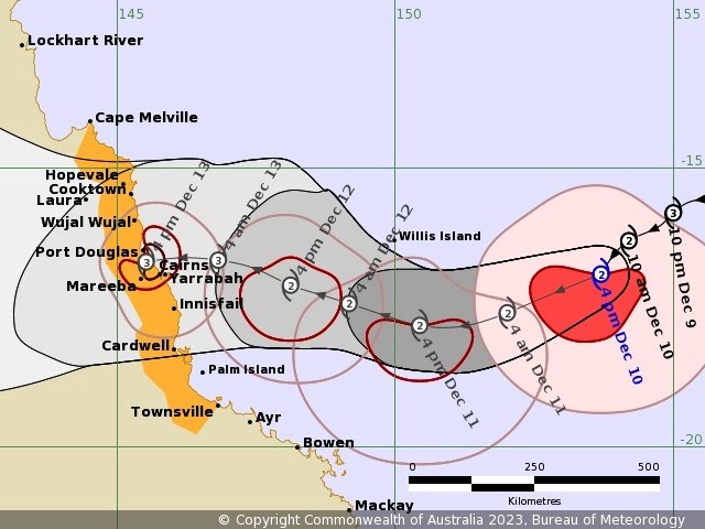
The tracking map published by the BOM showing Jasper's track across the Coral Sea.
At this time of the year, inland troughs tend to create northerlies ahead of them and late afternoon or evening thunderstorms on the coast. These can be very strong - a storm in the outskirts of Brisbane yesterday reached 80 knots! We are keeping a close eye on the radar when the northerlies are blowing as when the storm comes through it typically reverses the wind direction 180 degrees making sheltered anchorages a lee shore!
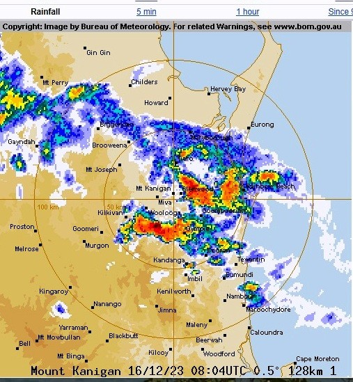
A line of thunderstorms shown on the BOM radar approaching the Sandy Strait and K'Gari this afternoon as this blog was written.
These same northerlies that brought us down to the Sandy Strait ease on Sunday, so we should be able to cross the shallows at Sheridan Flats and the Wide Bay Bar on Monday or Tuesday, in transit to Moreton Bay and our mooring off Lamb Island.
We still have to retrieve Matilda, left in Bundaberg, and help our Bundy friends with fitting a new anchor winch on their yacht "Kindred Spirit" but we are unlikely to stay in Moreton Bay for too long - it's just too hot here in summer! We will sail as far south as we can get to, weather permitting, while we are still waiting for our Oz citizenship applications to be completed. Hopefully, it won't be much longer, so we will be then planning on doing something more energetic and away from Australia next year.
It seems to have been a long year and probably, for many people in currently war torn parts of the planet, far too long. In many cases there seems to be no prospect of much improvement any time soon. Israel/Gaza, Ukraine, Sudan, Myanmar and Ethiopia/Tigre are all sad places at the end of 2023. Simmering violence persists in Haiti, the Maghreb (West Africa), the drug wars of Mexico and too many other places to mention. Climate change is not yet being addressed sufficiently by the world's governments and the rise of the far right and right adjacent makes for a gloomy vision for 2024. This is possibly the first time for many years that wishing everyone a Happy Christmas and New Year without any evidence that it will be so for many seems a trifle banal. Wishing family and friends both, of course, is another matter!
We have bought ourselves a joint Christmas present - a larger version of one of our 2 kayaks. The U.S. designed and manufactured Advanced Elements single kayak that we bought in 2019 with the French Itiwit is a bit rough around the edges but is still usable. The new kayak is the one up from the Advanced Elements kayak that we already have - it was sold second hand but in very good condition. It's capable of carrying more than the single kayak, so we will hopefully be using it for some multi day kayak adventures next year. We will also be planning at least one long hiking trip and one long bike trip - preferably not in Australia!
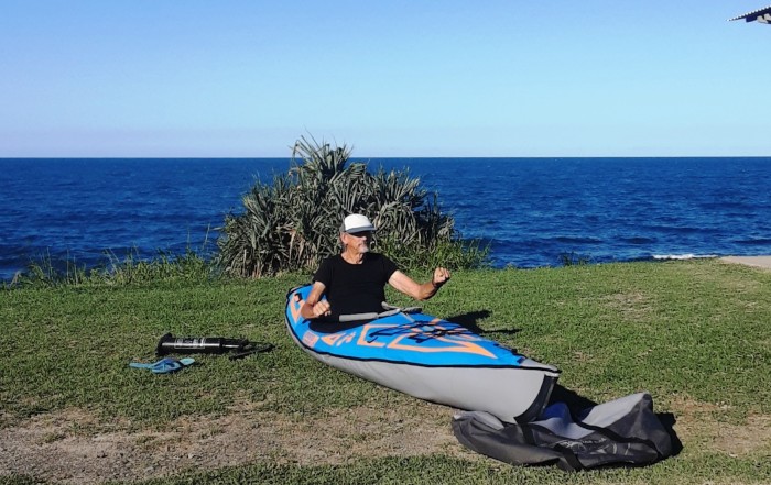
Geoff unpacks the new kayak and tries it out for size on the Burnett Heads foreshore.
Trial run in the new kayak up the Kolan River near the Bucca Crossing.
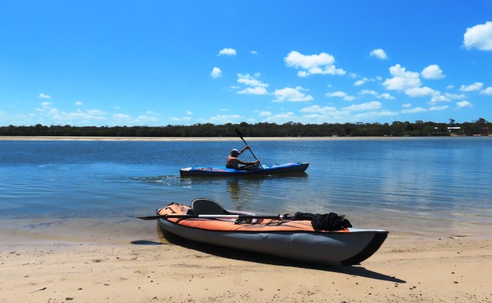
The 2 kayaks together on a sand bank in the Elliott River.
Update: We are now anchored off Tangalooma, Moreton Island, after another fantastic 90 nm sail down from the Wide Bay Bar. Very calm and sunny here with dolphins and turtles in attendance and a large number of 4WDs on the sandy beach.
We are anchored at the mouth of the Mary River, half way down the Great Sandy Strait, after a long 60nm sail down from Bundaberg's Burnett River. It was probably the best sail we have had this year, with consistent 10 to 20 knot north easterlies.
We have been in the Burnett for most of the time since our arrival from Mackay at least a month ago. Time has drifted by in the Burnett, as we have been hoping for a side trip up to Lady Musgrave lagoon. Sadly, this wasn't to be and we had Sundari hauled out for a bottom antifoul instead while we made inland trips to the Bunya Mountains and the Cooloola Coast.
Sundari anchored in its favourite calm spot in the lower reaches of the Burnett River.
Sundari getting its hull scrubbed and painted with new antifouling paint.
While we were perched up on Bundy Port marina's hard stand, a low developed for the third time this year in the Solomons. Unlike Cyclones Lola and Mal, which both tracked south and then south east, the new system moved into the Coral Sea and long range forecasts predicted a possible path right across Bundaberg and K'Gari. The new cyclone, named Jasper, was the first December cyclone to develop in the Coral Sea in an El Nino year since records began - how often have we have been hearing these records being broken lately?
After a rather agonising long 10 day wait, especially for Far North Queensland boaties and land based residents, the cyclone eventually crossed the coast just north of Cape Tribulation nearly a week ago as a category 2 system. While the wind and wave damage wasn't too bad (apart from to coral reef and seagrass beds), torrential rain falling from the stalled system led to the worst flooding to hit the area since (guess what) records began. Jasper crossed the coast at the Aboriginal community of Wujal Wujal, all 300 inhabitants being eventually evacuated to Cooktown, mainly because of floods inundating their homes.
The tracking map published by the BOM showing Jasper's track across the Coral Sea.
At this time of the year, inland troughs tend to create northerlies ahead of them and late afternoon or evening thunderstorms on the coast. These can be very strong - a storm in the outskirts of Brisbane yesterday reached 80 knots! We are keeping a close eye on the radar when the northerlies are blowing as when the storm comes through it typically reverses the wind direction 180 degrees making sheltered anchorages a lee shore!
A line of thunderstorms shown on the BOM radar approaching the Sandy Strait and K'Gari this afternoon as this blog was written.
These same northerlies that brought us down to the Sandy Strait ease on Sunday, so we should be able to cross the shallows at Sheridan Flats and the Wide Bay Bar on Monday or Tuesday, in transit to Moreton Bay and our mooring off Lamb Island.
We still have to retrieve Matilda, left in Bundaberg, and help our Bundy friends with fitting a new anchor winch on their yacht "Kindred Spirit" but we are unlikely to stay in Moreton Bay for too long - it's just too hot here in summer! We will sail as far south as we can get to, weather permitting, while we are still waiting for our Oz citizenship applications to be completed. Hopefully, it won't be much longer, so we will be then planning on doing something more energetic and away from Australia next year.
It seems to have been a long year and probably, for many people in currently war torn parts of the planet, far too long. In many cases there seems to be no prospect of much improvement any time soon. Israel/Gaza, Ukraine, Sudan, Myanmar and Ethiopia/Tigre are all sad places at the end of 2023. Simmering violence persists in Haiti, the Maghreb (West Africa), the drug wars of Mexico and too many other places to mention. Climate change is not yet being addressed sufficiently by the world's governments and the rise of the far right and right adjacent makes for a gloomy vision for 2024. This is possibly the first time for many years that wishing everyone a Happy Christmas and New Year without any evidence that it will be so for many seems a trifle banal. Wishing family and friends both, of course, is another matter!
We have bought ourselves a joint Christmas present - a larger version of one of our 2 kayaks. The U.S. designed and manufactured Advanced Elements single kayak that we bought in 2019 with the French Itiwit is a bit rough around the edges but is still usable. The new kayak is the one up from the Advanced Elements kayak that we already have - it was sold second hand but in very good condition. It's capable of carrying more than the single kayak, so we will hopefully be using it for some multi day kayak adventures next year. We will also be planning at least one long hiking trip and one long bike trip - preferably not in Australia!
Geoff unpacks the new kayak and tries it out for size on the Burnett Heads foreshore.
Trial run in the new kayak up the Kolan River near the Bucca Crossing.
The 2 kayaks together on a sand bank in the Elliott River.
Update: We are now anchored off Tangalooma, Moreton Island, after another fantastic 90 nm sail down from the Wide Bay Bar. Very calm and sunny here with dolphins and turtles in attendance and a large number of 4WDs on the sandy beach.
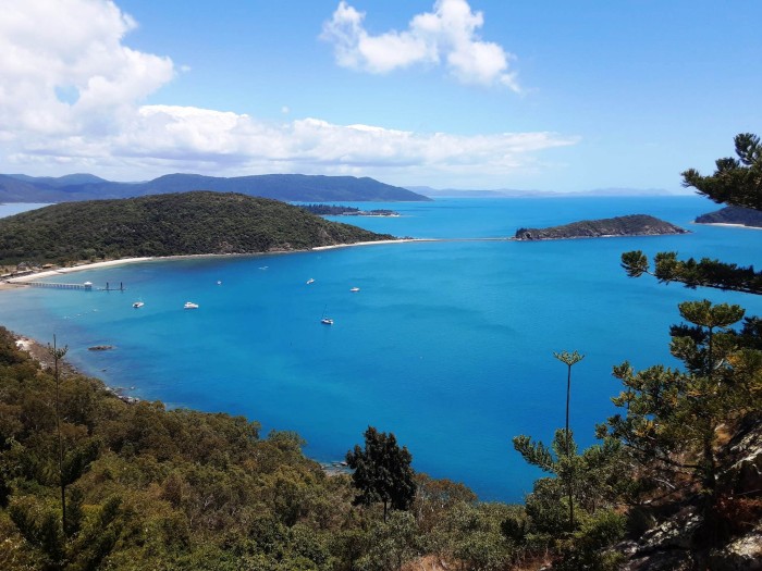
Waltzing Matilda With Sister Sue
23 October 2023 | Great Keppel Island
Alison and Geoff Williams | Hot and sunny, light to moderate north east winds
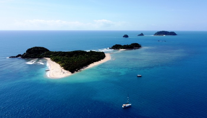
Photo shows a drone view of Port Newry, near Mackay, just one of 15 lovely island anchorages we stopped at on the way from Cairns to Mackay. Sundari is in the near foreground.
We have arrived back on the shores of Great Keppel Island, 5 months and many hundreds of sea miles since we were here last on the trip north. A decision to sail overnight from Mackay, our last stopping off point, was soon curtailed after passing a southbound whale, one of the very last of this year's stragglers. We passed another two this morning, a mum and a calf, the latter probably a late birther. The wind has been from the north to north east, but the only decent sailing day was today, close to the coast south of Port Clinton.
Had a lovely sail today (for a change!) from Port Clinton into the Keppel Group, with its fantastic beaches and harsh, dry hills.
Geoff's sister, Sue, accompanied us for nearly two months, as we sailed south in three steps from Cairns through to Mackay, a total distance logged of around 550 nautical miles. Sue's now back in France, plotting her next adventures.
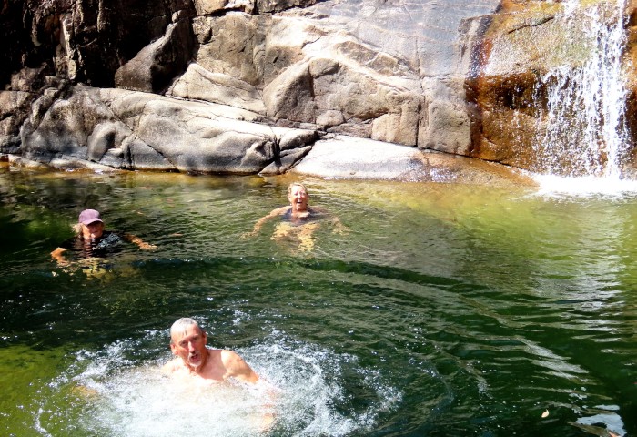
The three of us splashing around in a pool at the 'Rock Slides', in the Paluma Range, near Townsville.
We last met up with Sue in Panama when we crossed over from the Caribbean to the Pacific through the Panama Canal. Sue's work, Covid and distance have been a deterrent to meeting up in the last 8 years. Sue has recently retired from a busy life in charge of a Sheffield not for profit company, and is making the transition to life without having to worry about her job.
Having both Matilda, the Merc. to waltz around in and the boat available proved to be a good combination as it meant that Sue got to see quite a lot of Australia in the time she was here, especially as it was the first time she had been to the country before.
We stayed based in Cairns for the first three weeks, mainly because the trades were still strong and would have made south bound sailing too tough. We still got around the hinterland, revisiting the Daintree rainforest, Atherton Tableland, Cassowary Coast and inland on the Savannah Way as far as the Undara lava tubes and Georgetown, in addition to a four day sprint out to the outer barrier reef.
Sundari perched just off the reef at Sudbury Cay on the outer barrier.
Underwater/Overwater at Sudbury Cay
Campsite at Undara lava tubes. Sue slept in the car and we opted for the tent.
The trip south, once the wind eased, was first down to Townsville, stopping at Fitzroy Island, the Franklands, Mourilyan Harbour, Orpheus in the Palms and Magnetic Island. The second leg took us past Cape Bowling Green, Cape Upstart, Gloucester Island to the Whitsundays, while the last leg to Mackay took us to Shaw Island, Thomas, the Newrys and St Bees and Keswick Islands.
Sundari at Normanby Island in the Frankland Group.
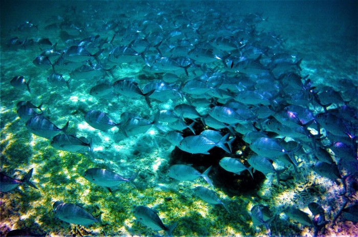
Shoal of friendly trevally at Normanby island.
Sundari at Saddleback Island,with Gloucester Island in the background.
Bauer Bay at South Molle in the Whitsundays.
Sue was able to spot some of Oz's iconic wildlife, including wallabies (on the first day out!), kangaroos, koalas (on Magnetic Island), crocodiles, goannas, turtles and 2 rather distant humpback whales. She unexpectedly eyeballed a cassowary in the Daintree and an emu in the outback. She saw more species of birds and fish than she will ever remember, plenty of both botanical and geological interest, swam, kayaked, snorkelled, beachcombed, walked and climbed, hopefully a holiday to remember!
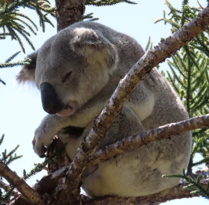
Sleepy koala in a pine tree near the Forts, Magnetic Island.
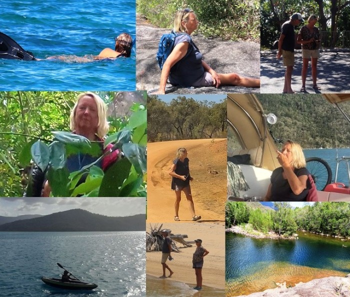
Sue enjoying her time in Oz
We haven't made plans for the next few months yet and will take each week as it comes. We still have the Bunker Group's cays and reefs at the southern end of the Barrier Reef to get to in what is now warmer weather than when we sailed north, so hopefully we can now do some diving!
The cyclone season seems to have started unusually early with the formation of Cyclone Lola in the southern Solomons a couple of days ago. Like all cyclones, it's hard to know where they will wander. Lola is now rated at category 5, the strongest level, and is expected to move across Vanuatu towards New Caledonia before fizzling out. It's not going to affect us in any way, except remind us that it's not the time of year to hang around for too long in the tropics!
We have arrived back on the shores of Great Keppel Island, 5 months and many hundreds of sea miles since we were here last on the trip north. A decision to sail overnight from Mackay, our last stopping off point, was soon curtailed after passing a southbound whale, one of the very last of this year's stragglers. We passed another two this morning, a mum and a calf, the latter probably a late birther. The wind has been from the north to north east, but the only decent sailing day was today, close to the coast south of Port Clinton.
Had a lovely sail today (for a change!) from Port Clinton into the Keppel Group, with its fantastic beaches and harsh, dry hills.
Geoff's sister, Sue, accompanied us for nearly two months, as we sailed south in three steps from Cairns through to Mackay, a total distance logged of around 550 nautical miles. Sue's now back in France, plotting her next adventures.
The three of us splashing around in a pool at the 'Rock Slides', in the Paluma Range, near Townsville.
We last met up with Sue in Panama when we crossed over from the Caribbean to the Pacific through the Panama Canal. Sue's work, Covid and distance have been a deterrent to meeting up in the last 8 years. Sue has recently retired from a busy life in charge of a Sheffield not for profit company, and is making the transition to life without having to worry about her job.
Having both Matilda, the Merc. to waltz around in and the boat available proved to be a good combination as it meant that Sue got to see quite a lot of Australia in the time she was here, especially as it was the first time she had been to the country before.
We stayed based in Cairns for the first three weeks, mainly because the trades were still strong and would have made south bound sailing too tough. We still got around the hinterland, revisiting the Daintree rainforest, Atherton Tableland, Cassowary Coast and inland on the Savannah Way as far as the Undara lava tubes and Georgetown, in addition to a four day sprint out to the outer barrier reef.
Sundari perched just off the reef at Sudbury Cay on the outer barrier.
Underwater/Overwater at Sudbury Cay
Campsite at Undara lava tubes. Sue slept in the car and we opted for the tent.
The trip south, once the wind eased, was first down to Townsville, stopping at Fitzroy Island, the Franklands, Mourilyan Harbour, Orpheus in the Palms and Magnetic Island. The second leg took us past Cape Bowling Green, Cape Upstart, Gloucester Island to the Whitsundays, while the last leg to Mackay took us to Shaw Island, Thomas, the Newrys and St Bees and Keswick Islands.
Sundari at Normanby Island in the Frankland Group.
Shoal of friendly trevally at Normanby island.
Sundari at Saddleback Island,with Gloucester Island in the background.
Bauer Bay at South Molle in the Whitsundays.
Sue was able to spot some of Oz's iconic wildlife, including wallabies (on the first day out!), kangaroos, koalas (on Magnetic Island), crocodiles, goannas, turtles and 2 rather distant humpback whales. She unexpectedly eyeballed a cassowary in the Daintree and an emu in the outback. She saw more species of birds and fish than she will ever remember, plenty of both botanical and geological interest, swam, kayaked, snorkelled, beachcombed, walked and climbed, hopefully a holiday to remember!
Sleepy koala in a pine tree near the Forts, Magnetic Island.
Sue enjoying her time in Oz
We haven't made plans for the next few months yet and will take each week as it comes. We still have the Bunker Group's cays and reefs at the southern end of the Barrier Reef to get to in what is now warmer weather than when we sailed north, so hopefully we can now do some diving!
The cyclone season seems to have started unusually early with the formation of Cyclone Lola in the southern Solomons a couple of days ago. Like all cyclones, it's hard to know where they will wander. Lola is now rated at category 5, the strongest level, and is expected to move across Vanuatu towards New Caledonia before fizzling out. It's not going to affect us in any way, except remind us that it's not the time of year to hang around for too long in the tropics!
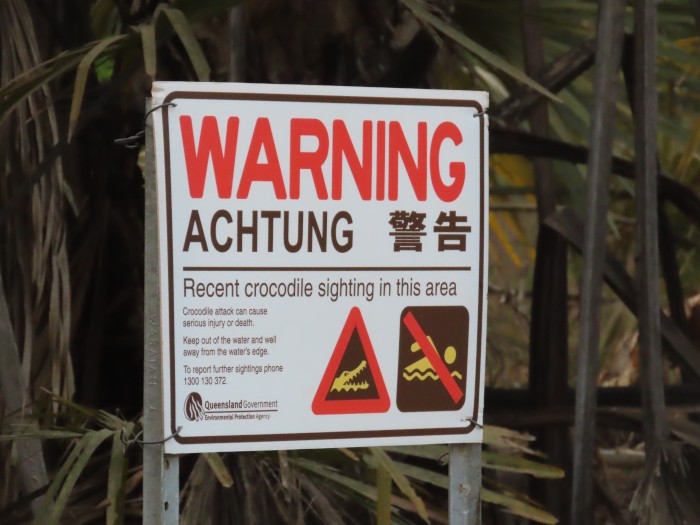
Achtung!
07 August 2023 | Trinity Inlet, Cairns, North Queensland
Alison and Geoff Williams | Windy and wet!
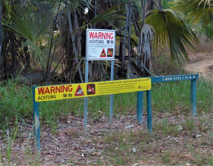
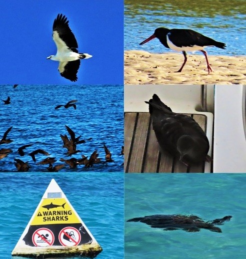
Photo shows one of the typical crocodile warning signs now seen everywhere near large estuaries and the coast in Northern Australia. This one was located by a lovely section of the North Kennedy River in Rinyirru (Lakefield) National Park.
From Gladstone on Queensland's Central coast right round northern Australia to Broome in Western Australia there are warning signs in English, German and Chinese about the potential danger of saltwater crocodiles. The crocodile recovery story has paralleled that of the baleen whales. Once almost hunted to extinction, strict bans on hunting in the 1970s of both the smaller freshwater crocs and their larger more dangerous saltwater relatives has led to a remarkable resurgence in numbers. There is the occasional injury or death from crocs in the three northern states, but generally crocs keep to their preferred habitat and the incidents usually happen when locals or tourists get careless.
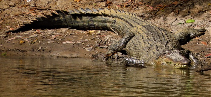
Large saltwater crocodile sunning itself on the banks of the North Kennedy River in Rinyirru National Park.
We got used to crocs when we were teaching in the Northern Territory in the late 1990s and 2000s, especially so because we were living amongst them on Saraoni and using a dinghy to get to and from the shore! In Darwin, each creek had a large baited (with chickens) metal cage to trap the crocs which would venture from time to time into the harbour from elsewhere. The trapped crocs would then be transported to a crocodile farm. The thousands of crocs living elsewhere were left to live a normal life. It did put a damper on swimming from a mainland beach (potentially suicidal), and this has now become the norm in most of northern Queensland, although crocs rarely bother to visit the offshore islands. Freshwater crocs live in many of the inland rivers, but aren't really a danger unless they are cornered.
We have just returned from a trip up into the Cape York Peninsula, which has large areas still in wilderness. Much of the peninsula is hard to access without a 4 wheel drive vehicle or light plane, so we contented ourselves with exploring the southern half of the huge Lakefield National Park, now renamed Rinyirru, the Aboriginal name, about 350 km north of Cairns and lying in a sunnier, drier area, in the rain shadow of the coastal mountains. Rinyirru is criss-crossed by several large river systems and their associated overflow billabongs and wetlands. Of course, there are plenty of crocs here, but they are not always easy to see unless they have hauled out on to the banks to get warm in the sun. Termite mounds, agile wallabies and birds in large numbers were everywhere, very typical of a Northern Australian savannah woodland environment. We did venture down several narrow, bumpy, sandy 4 wheel drive tracks to camp by water lily covered lagoons, but really need a more suitable vehicle if we want to do any more of this sort of exploration.
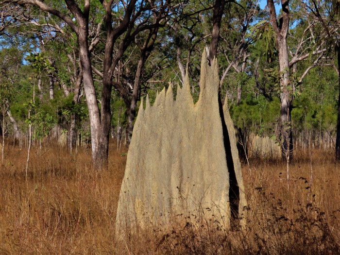
Magnetic termite mound in Rinyirru National Park. Termites are the main herbivores in Northern Australia and their biomass far exceeds wallabies or other grazers.
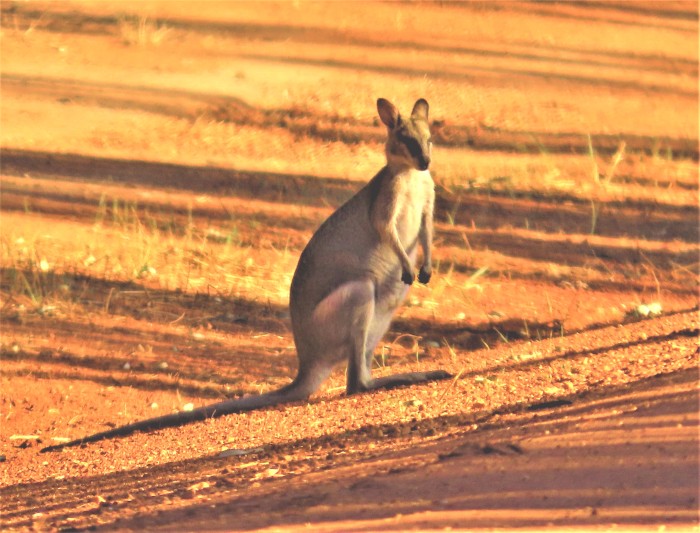
Agile wallabies replace kangaroos as the main grazing mammals in Northern Australia. Unfortunately, too many get killed on the roads when they are attracted to green, nutritious grass growing on the verges.
One of Rinyirru's many rivers snaking across the flat lowlands of this national park. This drone photo was taken at Catfish lagoon near where we saw several large crocs. They didn't seem to be bothered by the drone hovering near them, but took off when they heard a 4 wheel drive vehicle turn up!
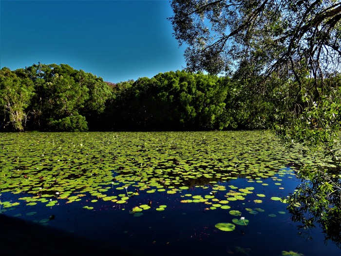
A water lily covered billabong (Keatings Lagoon) near Cooktown.
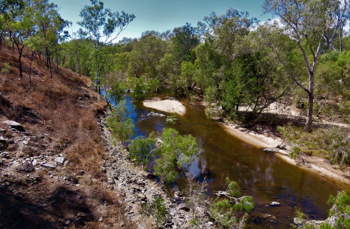
Despite August being in the middle of the dry season, many of Cape York's rivers are still flowing after 3 wet La Niña years. This is the lovely Palmer River on the way up to Laura on the Peninsula Development Road.
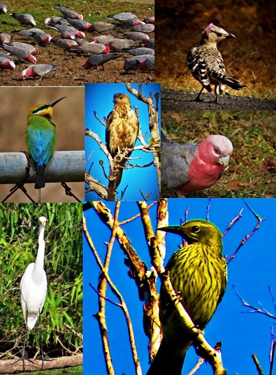
Birds of many species on the Cape York Peninsula trip.
From top left: galahs at Laura, Great Bower bird
rainbow bee-eater, whistling kite, galah
Intermediate egret, oriole.
The constant strong winds and rain in Cairns are about to subside in the next few days, which will be a blessing as we can then get out to the reefs again. Not sure how long the calmer weather will last, although normally September is the start of better (for sailing) weather here. The Australian Bureau of Meteorology (BOM) has yet to declare an El Niño in the Pacific, despite the U.N. having declared one having begun. This is apparently because the BOM says that the trade winds are still too strong - in a normal El Niño, the skies are clearer and the trades are reduced or reversed, something which would suit us down to the ground! In any case, even climate scientists don't really know any more what is normal and what has been modified by climate change. The oceans are definitely warmer than ever and this may have influenced the amount of (supposedly) dry season rain we have had the last few weeks.
From Gladstone on Queensland's Central coast right round northern Australia to Broome in Western Australia there are warning signs in English, German and Chinese about the potential danger of saltwater crocodiles. The crocodile recovery story has paralleled that of the baleen whales. Once almost hunted to extinction, strict bans on hunting in the 1970s of both the smaller freshwater crocs and their larger more dangerous saltwater relatives has led to a remarkable resurgence in numbers. There is the occasional injury or death from crocs in the three northern states, but generally crocs keep to their preferred habitat and the incidents usually happen when locals or tourists get careless.
Large saltwater crocodile sunning itself on the banks of the North Kennedy River in Rinyirru National Park.
We got used to crocs when we were teaching in the Northern Territory in the late 1990s and 2000s, especially so because we were living amongst them on Saraoni and using a dinghy to get to and from the shore! In Darwin, each creek had a large baited (with chickens) metal cage to trap the crocs which would venture from time to time into the harbour from elsewhere. The trapped crocs would then be transported to a crocodile farm. The thousands of crocs living elsewhere were left to live a normal life. It did put a damper on swimming from a mainland beach (potentially suicidal), and this has now become the norm in most of northern Queensland, although crocs rarely bother to visit the offshore islands. Freshwater crocs live in many of the inland rivers, but aren't really a danger unless they are cornered.
We have just returned from a trip up into the Cape York Peninsula, which has large areas still in wilderness. Much of the peninsula is hard to access without a 4 wheel drive vehicle or light plane, so we contented ourselves with exploring the southern half of the huge Lakefield National Park, now renamed Rinyirru, the Aboriginal name, about 350 km north of Cairns and lying in a sunnier, drier area, in the rain shadow of the coastal mountains. Rinyirru is criss-crossed by several large river systems and their associated overflow billabongs and wetlands. Of course, there are plenty of crocs here, but they are not always easy to see unless they have hauled out on to the banks to get warm in the sun. Termite mounds, agile wallabies and birds in large numbers were everywhere, very typical of a Northern Australian savannah woodland environment. We did venture down several narrow, bumpy, sandy 4 wheel drive tracks to camp by water lily covered lagoons, but really need a more suitable vehicle if we want to do any more of this sort of exploration.
Magnetic termite mound in Rinyirru National Park. Termites are the main herbivores in Northern Australia and their biomass far exceeds wallabies or other grazers.
Agile wallabies replace kangaroos as the main grazing mammals in Northern Australia. Unfortunately, too many get killed on the roads when they are attracted to green, nutritious grass growing on the verges.
One of Rinyirru's many rivers snaking across the flat lowlands of this national park. This drone photo was taken at Catfish lagoon near where we saw several large crocs. They didn't seem to be bothered by the drone hovering near them, but took off when they heard a 4 wheel drive vehicle turn up!
A water lily covered billabong (Keatings Lagoon) near Cooktown.
Despite August being in the middle of the dry season, many of Cape York's rivers are still flowing after 3 wet La Niña years. This is the lovely Palmer River on the way up to Laura on the Peninsula Development Road.
Birds of many species on the Cape York Peninsula trip.
From top left: galahs at Laura, Great Bower bird
rainbow bee-eater, whistling kite, galah
Intermediate egret, oriole.
The constant strong winds and rain in Cairns are about to subside in the next few days, which will be a blessing as we can then get out to the reefs again. Not sure how long the calmer weather will last, although normally September is the start of better (for sailing) weather here. The Australian Bureau of Meteorology (BOM) has yet to declare an El Niño in the Pacific, despite the U.N. having declared one having begun. This is apparently because the BOM says that the trade winds are still too strong - in a normal El Niño, the skies are clearer and the trades are reduced or reversed, something which would suit us down to the ground! In any case, even climate scientists don't really know any more what is normal and what has been modified by climate change. The oceans are definitely warmer than ever and this may have influenced the amount of (supposedly) dry season rain we have had the last few weeks.
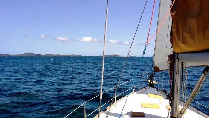
Whale Season - Where the Rainforest (Almost) Meets the Reef
23 July 2023 | Trinity Inlet, Cairns, Far North Queensland.
Alison and Geoff Williams | Calm and hot today, return to strong SE trade winds tomorrow!
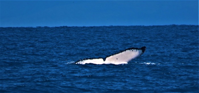
Photo above shows the tail of a humpback whale that surfaced just behind Sundari this morning. We are in the middle of the Great Barrier Reef's whale season.
"Where the rainforest meets the reef" is one of those rather corny phrases used by the North Queensland tourist industry to promote their 'products'. It is almost correct, though, as there are pockets of coastal rainforest left standing between the Bloomfield River and Cardwell, although most of the rainforest that survived the settlers' axes are up on the higher or steeper parts of the Great Divide.
Where the rainforest is still in existence on the coast - around Mission Beach and the Daintree, it meets the Great Barrier Reef lagoon, not the reef, which is further offshore. Admittedly, the outer barrier reef is closer in the Cairns region than further south. To the North of Cairns, the barrier closes in an almost unbroken line (the Ribbon reefs) and there are hundreds of patch reefs to navigate between in the lagoon, as we know from traversing the area several times.
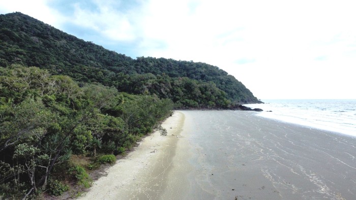
The rainforest, pictured here on the Daintree coast, meets the Great Barrier Reef lagoon north of Port Douglas.
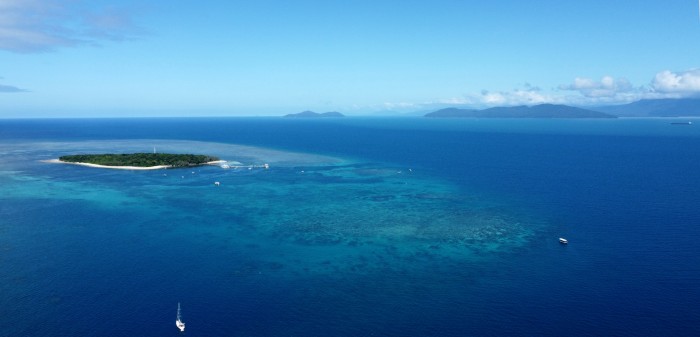
The reef - here pictured by our drone at Green Island, is only 12 miles out from Cairns. That's Sundari, by the way, anchored all on its own right down there!
The whales, humpbacks anyway, have certainly reached this part of the lagoon on their winter vacation from Antarctica. We have seen quite a few on our latest trip out to the reef. One even surfaced just behind Sundari while getting ready to up anchor off Michaelmas Cay this morning!
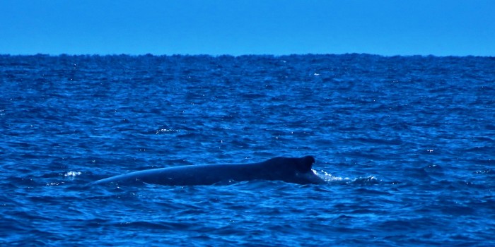
Typical view of a humpback whale's humped back and small dorsal fin when it surfaces. This whale was seen near Oyster Reef yesterday
Since we arrived in Cairns, now just over three weeks ago, the trades have been blowing almost continuously at around 20 to 25 knots, typical of July and August, the mid-winter months. There have been only two gaps in the strong winds calm enough for us to visit the nearby cays and reefs and do some snorkelling and prepare ourselves for some diving. It's not much fun behind just a reef for protection, but when it does calm down, which it did do over the last three days, it can be quite magical.
Relatively close to Cairns are the reefs of Green Island, Arlington, Upolu, Oyster, Vlassof and Michaelmas. Green Island is the only vegetated cay anywhere near Cairns and is delightful, despite the hordes of day trippers that are ferried to the island every day. Upolu's cay disappeared courtesy of Cyclone Yasi in 2011, but Vlassof still has a scrap of sand remaining. Michaelmas has a larger sand cay which is a roosting site for thousands of sea birds, mainly brown boobies, terns and noddies. The cay is an amazing site in the day time and the birds don't seem to go to sleep very easily at night, either!
The coral we've seen was in much better shape than elsewhere close to the mainland coast, where bleaching, siltation and cyclone damage have taken a toll. In fact, the underwater scenery and diversity of marine life we saw this morning were the best since the atolls of French Polynesia!
Ready for an underwater excursion in the shallows near Michaelmas Cay!
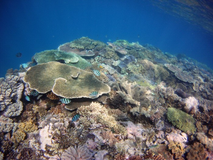
Coral cover on one of Michaelmas Cay's large bommies.
Green Island is the only vegetated (with rainforest) coral cay near Cairns.
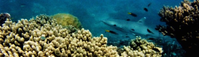
This white tipped reef shark appeared at a bommie near Green Island.
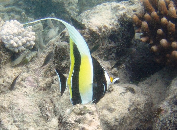
Moorish idol in one of Michaelmas Cay's coral gardens.
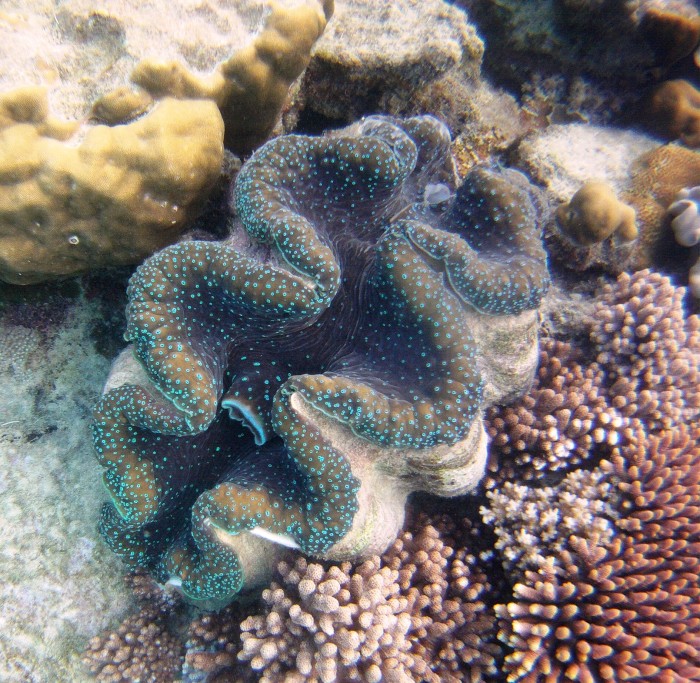
One of several giant clams in the shallow coral gardens at Michaelmas Cay.
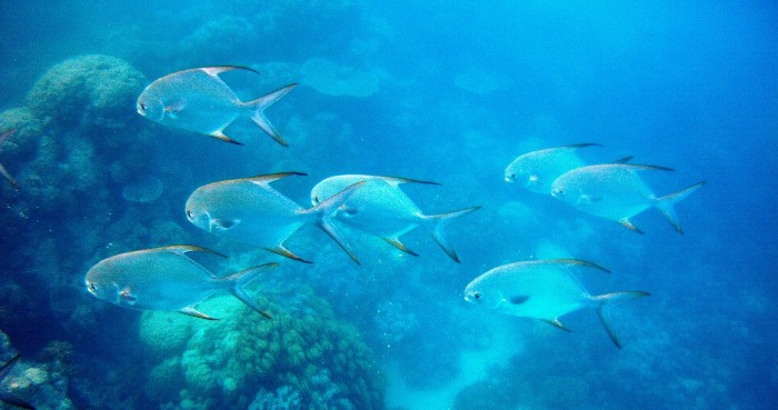
Large shoals of friendly jacks near one of the bommies.
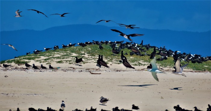
At times, it seemed that every stretch of sand on Michaelmas Cay was covered by noisy seabirds.
While the wind has been up, we have taken time to go exploring the hinterland. Although we've driven through the Atherton Tableland before and up as far as the Daintree ferry, this time we've had time to explore further. The Daintree national park is quite unique. There are many plants and animals that are found there and nowhere else, like Bennett's tree kangaroos. Like around Mission Bay and the coast just south of Innisfail, the Daintree is one of the only places on the east coast where cassowaries are still hanging on. Like the Daintree, the Tableland is like nowhere else in Oz, in many places more like New Zealand, with dairy farms, forest pockets everywhere and tree ferns. We've been to many of the little volcanic crater lakes and searched (in vain!) for Lumholtz tree kangaroos.
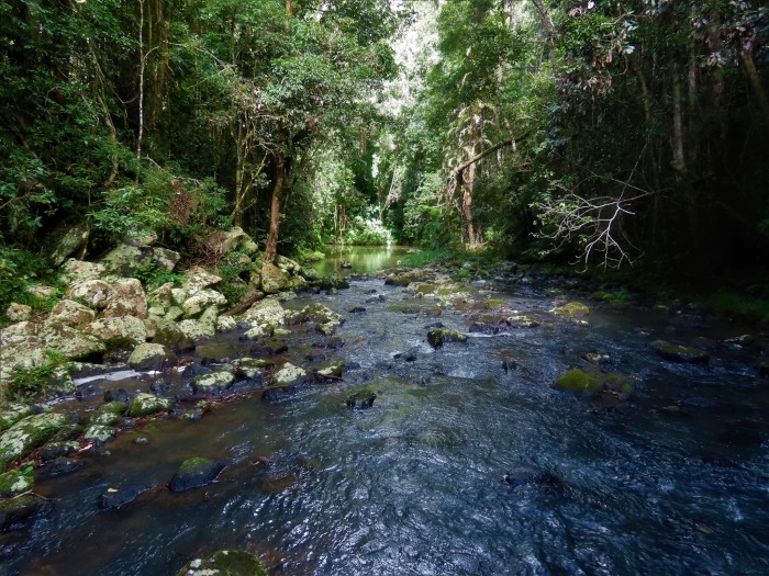
Creek running through thick coastal rainforest north of Cairns.
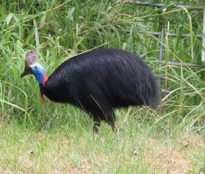
Female cassowary seen by the roadside near Etty Bay, just south of Innisfail.
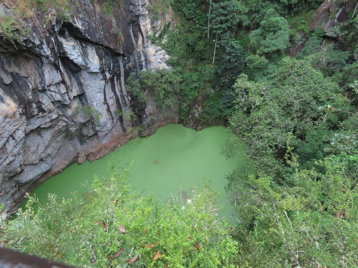
Mount Hypipamee crater on the Atherton Tableland.
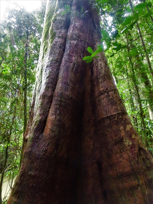
Many of the rainforest trees, like this one in the Daintree, have buttress roots.
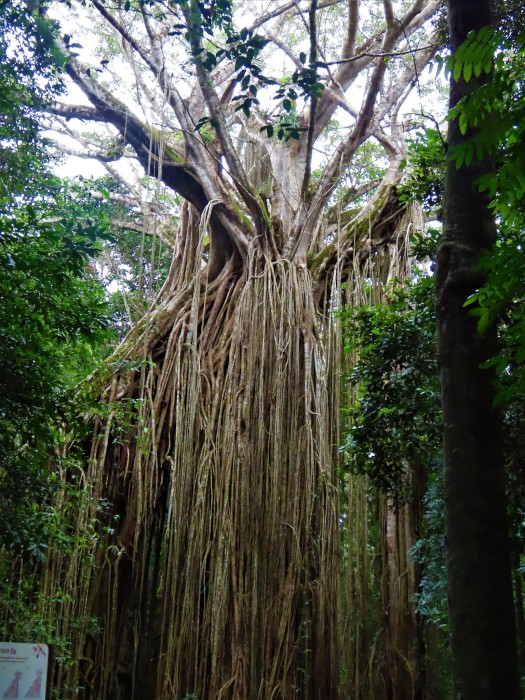
A strangler fig near Yungaburra on the Atherton Tableland.
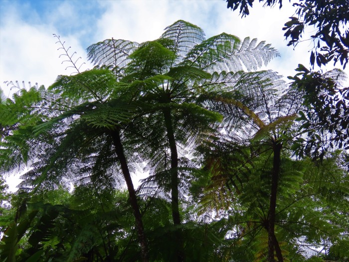
Tree ferns, like these on the Atherton Tableland, always seem to prefer cooler climates. They look like their Gondwanan counterparts in NZ.
We've also caught up with our 90 year old friend Hazel Menehira and her partner, Hank West. It was Hazel's 90th birthday and a surprise party was organized by her son who lives in the Gold Coast. Relatives flew over from New Zealand and a Zoom session saw Hazel struck silent as her scattered whanau all over the world beamed in with smiles, waves and greetings.
We also met up with another old friend, Tim Montcrief from Tasmania, an ex Sail Indonesia rally participant, off with his partner, Dawn, on the long trip to Cape York at the tip of Australia.
We will set off for the outback while the wind continues to whistle and wait for it to abate before heading out to the reefs again! Sister Sue arrives at the end of August, so we will be in this area until then.
"Where the rainforest meets the reef" is one of those rather corny phrases used by the North Queensland tourist industry to promote their 'products'. It is almost correct, though, as there are pockets of coastal rainforest left standing between the Bloomfield River and Cardwell, although most of the rainforest that survived the settlers' axes are up on the higher or steeper parts of the Great Divide.
Where the rainforest is still in existence on the coast - around Mission Beach and the Daintree, it meets the Great Barrier Reef lagoon, not the reef, which is further offshore. Admittedly, the outer barrier reef is closer in the Cairns region than further south. To the North of Cairns, the barrier closes in an almost unbroken line (the Ribbon reefs) and there are hundreds of patch reefs to navigate between in the lagoon, as we know from traversing the area several times.
The rainforest, pictured here on the Daintree coast, meets the Great Barrier Reef lagoon north of Port Douglas.
The reef - here pictured by our drone at Green Island, is only 12 miles out from Cairns. That's Sundari, by the way, anchored all on its own right down there!
The whales, humpbacks anyway, have certainly reached this part of the lagoon on their winter vacation from Antarctica. We have seen quite a few on our latest trip out to the reef. One even surfaced just behind Sundari while getting ready to up anchor off Michaelmas Cay this morning!
Typical view of a humpback whale's humped back and small dorsal fin when it surfaces. This whale was seen near Oyster Reef yesterday
Since we arrived in Cairns, now just over three weeks ago, the trades have been blowing almost continuously at around 20 to 25 knots, typical of July and August, the mid-winter months. There have been only two gaps in the strong winds calm enough for us to visit the nearby cays and reefs and do some snorkelling and prepare ourselves for some diving. It's not much fun behind just a reef for protection, but when it does calm down, which it did do over the last three days, it can be quite magical.
Relatively close to Cairns are the reefs of Green Island, Arlington, Upolu, Oyster, Vlassof and Michaelmas. Green Island is the only vegetated cay anywhere near Cairns and is delightful, despite the hordes of day trippers that are ferried to the island every day. Upolu's cay disappeared courtesy of Cyclone Yasi in 2011, but Vlassof still has a scrap of sand remaining. Michaelmas has a larger sand cay which is a roosting site for thousands of sea birds, mainly brown boobies, terns and noddies. The cay is an amazing site in the day time and the birds don't seem to go to sleep very easily at night, either!
The coral we've seen was in much better shape than elsewhere close to the mainland coast, where bleaching, siltation and cyclone damage have taken a toll. In fact, the underwater scenery and diversity of marine life we saw this morning were the best since the atolls of French Polynesia!
Ready for an underwater excursion in the shallows near Michaelmas Cay!
Coral cover on one of Michaelmas Cay's large bommies.
Green Island is the only vegetated (with rainforest) coral cay near Cairns.
This white tipped reef shark appeared at a bommie near Green Island.
Moorish idol in one of Michaelmas Cay's coral gardens.
One of several giant clams in the shallow coral gardens at Michaelmas Cay.
Large shoals of friendly jacks near one of the bommies.
At times, it seemed that every stretch of sand on Michaelmas Cay was covered by noisy seabirds.
While the wind has been up, we have taken time to go exploring the hinterland. Although we've driven through the Atherton Tableland before and up as far as the Daintree ferry, this time we've had time to explore further. The Daintree national park is quite unique. There are many plants and animals that are found there and nowhere else, like Bennett's tree kangaroos. Like around Mission Bay and the coast just south of Innisfail, the Daintree is one of the only places on the east coast where cassowaries are still hanging on. Like the Daintree, the Tableland is like nowhere else in Oz, in many places more like New Zealand, with dairy farms, forest pockets everywhere and tree ferns. We've been to many of the little volcanic crater lakes and searched (in vain!) for Lumholtz tree kangaroos.
Creek running through thick coastal rainforest north of Cairns.
Female cassowary seen by the roadside near Etty Bay, just south of Innisfail.
Mount Hypipamee crater on the Atherton Tableland.
Many of the rainforest trees, like this one in the Daintree, have buttress roots.
A strangler fig near Yungaburra on the Atherton Tableland.
Tree ferns, like these on the Atherton Tableland, always seem to prefer cooler climates. They look like their Gondwanan counterparts in NZ.
We've also caught up with our 90 year old friend Hazel Menehira and her partner, Hank West. It was Hazel's 90th birthday and a surprise party was organized by her son who lives in the Gold Coast. Relatives flew over from New Zealand and a Zoom session saw Hazel struck silent as her scattered whanau all over the world beamed in with smiles, waves and greetings.
We also met up with another old friend, Tim Montcrief from Tasmania, an ex Sail Indonesia rally participant, off with his partner, Dawn, on the long trip to Cape York at the tip of Australia.
We will set off for the outback while the wind continues to whistle and wait for it to abate before heading out to the reefs again! Sister Sue arrives at the end of August, so we will be in this area until then.
Destination Cairns
07 July 2023 | Cairns
Alison and Geoff Williams | Windy south easterlies
Photo shows Sundari anchored at Goold Island, just north of the Hinchinbrook Channel.
We are on a Ports North pile mooring in Cairns' Trinity Inlet, opposite the substantial navy base. We are now about 800nm (1500km) north of Moreton Bay and Brisbane and just under 2 months from when we sailed out from that bay on May 3rd.
Cairns has obviously recovered from its Covid 19 severe headache when almost no-one was able to or wanted to visit one of Oz's premier tourism hot spots. We hired a car last week and struck traffic congestion like we haven't seen or wanted to see for a long while, the streets thronged with crowds, many of whom had signed up for one of the 'Great Barrier Reef' tour packages.
We've been here before by boat, the first time in 1988, on Corsair and twice on Saraoni, in 2001 and 2008. When we were working in Papua New Guinea between 1988 and 1997, Cairns was our much visited 'home away from home', more so than either Britain or New Zealand.
Cairns is still best visited by boat, with the grand vista of the mountainous hinterland all around the harbour.
To get here, we sailed the well trodden path up from the Keppels, through the island studded, but stressful, part of Queensland's remote central coast to the Whitsundays, then hop scotched it to Magnetic Island and Townsville. From Townsville, we sailed to the Palm Group, and using light winds, entered Zoe Bay on the eastern side of Hinchinbrook Island, usually verboten to yachts, as it is exposed to the trades. Once past Hinchinbrook, the wet tropics dominate, with a succession of rain-forested islands before Fitzroy Island and finally the corner at Cape Grafton before Cairns.
We sampled one of the outer reefs that had supposedly not been too badly damaged by the trifecta of cyclones, coral bleaching and silt run off. Beaver reef and its tiny sand cay were only 20 nautical miles east of Dunk Island and its lovely anchorage, so an easy target. We have downloaded the Eye on the Reef app that the Great Barrier Reef Marine Authority urges transient visitors to the reef use. So we will add our comments and reports over the next few months as we sample some of the reefs that are accessible.
Scenes along the route to Cairns from the left, row by row:
Great Keppel's Middle Island, Curlew Island, Florence Bay, Magnetic Island
Cape Upstart
Horseshoe Bay, Orpheus Island
Hinchinbrook's Zoe Bay, Zoe creek waterfall
Characteristic wildlife en route to Cairns:
Rainbow bee-eater, kookaburra on Great Keppel;
Sleepy koala at the Forts, allied rock wallaby at Nelly Bay, Magnetic Island;
Giant clam and plate coral at Orpheus Island in the Palm Group.
Since we've been in Cairns, we have hired a car and visited the Daintree River and the Daintree National Park. We have been up to the Daintree once before by car and have sailed past the Cape Tribulation area twice before (going north and south), but this time used the Daintree ferry and explored the coastal Daintree rainforest. This, and our exploration of nearby reefs, will be the subject of the next blog!
Doing O-Cay in the Southern Great Barrier Reef
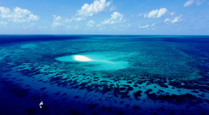
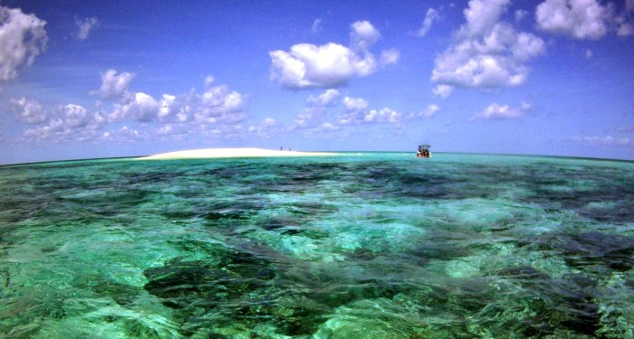
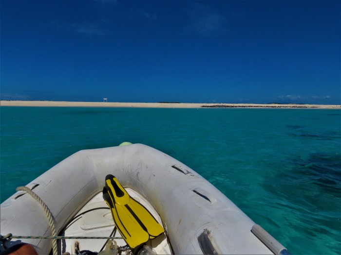
19 May 2023 | North West island, Capricornia Cays, Queensland
Alison and Geoff Williams | Calm and sunny p.m., windy southerlies overnight
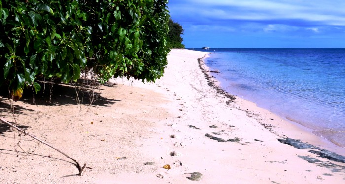
Photo shows Sundari anchored in the lee of North West Island, a coral cay.
We are anchored off the northernmost of the Capricornia Cays in the southern section of the Great Barrier Reef, North West Island. The island, the second largest coral cay on the Barrier Reef is about 40nm from the mainland, north of Gladstone.
Approaching North West Island, the beach surrounding the cay and the Pisonia forest.
The Great Barrier Reef, despite the name, is not a uniform linear barrier like the one in New Caledonia or Papua New Guinea. It is comprised of a large number of disconnected reefs and islands. Most of the islands are continental in character, i.e. bits of the mainland that were surrounded by sea after the last sea level rise. Despite their origin, most have surrounding fringing coral reefs.
The Capricornia Cays are somewhat different as they are made up of sand that has accumulated on a series of reef patches growing on a large offshore bank. Most of the cays (there are around 7 of them) have a special type of Pisonia forest on them. Further north, there are some similar cays near Cairns, while many of the cays even further north towards the Torres Strait, have mangroves growing on them rather than Pisonia.
We have had mostly lovely weather, a bit windy and cool in the morning, but in the afternoons, calm and sunny. The cay, like most of its type, is surrounded by a coral platform, the reef flat, which is exposed at low tide and hard to access from the sea.
At high tide, we could spot sharks, rays and turtles in the shallows patrolling the shallow top of the reef. Black noddy terns nest here in their tens of thousands as do wedge tailed shearwaters (muttonbirds).
The noddies nest in the Pisonia branches, while the shearwaters burrow into the soft, sandy soil. Neither are nesting at the moment - it's a summer thing - but there are still plenty of noddies, who fly away from their treetop roosts at dawn and return just before dark. Few shearwaters are still here, as most migrate to other parts of the pacific in winter, but one disoriented shearwater flew into our cockpit after dark and stayed there all night!
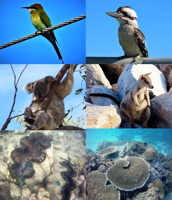
Wildlife in and around NW Island:
white bellied sea eagle, oystercatcher
black noddy terns, wedgetailed shearwater
watch out for sharks, turtle in the shallows
We are off to the Keppel Islands tomorrow and heading north towards the Whitsundays after the next bout of strong winds, expected to last from Monday to Wednesday next week.
We are anchored off the northernmost of the Capricornia Cays in the southern section of the Great Barrier Reef, North West Island. The island, the second largest coral cay on the Barrier Reef is about 40nm from the mainland, north of Gladstone.
Approaching North West Island, the beach surrounding the cay and the Pisonia forest.
The Great Barrier Reef, despite the name, is not a uniform linear barrier like the one in New Caledonia or Papua New Guinea. It is comprised of a large number of disconnected reefs and islands. Most of the islands are continental in character, i.e. bits of the mainland that were surrounded by sea after the last sea level rise. Despite their origin, most have surrounding fringing coral reefs.
The Capricornia Cays are somewhat different as they are made up of sand that has accumulated on a series of reef patches growing on a large offshore bank. Most of the cays (there are around 7 of them) have a special type of Pisonia forest on them. Further north, there are some similar cays near Cairns, while many of the cays even further north towards the Torres Strait, have mangroves growing on them rather than Pisonia.
We have had mostly lovely weather, a bit windy and cool in the morning, but in the afternoons, calm and sunny. The cay, like most of its type, is surrounded by a coral platform, the reef flat, which is exposed at low tide and hard to access from the sea.
At high tide, we could spot sharks, rays and turtles in the shallows patrolling the shallow top of the reef. Black noddy terns nest here in their tens of thousands as do wedge tailed shearwaters (muttonbirds).
The noddies nest in the Pisonia branches, while the shearwaters burrow into the soft, sandy soil. Neither are nesting at the moment - it's a summer thing - but there are still plenty of noddies, who fly away from their treetop roosts at dawn and return just before dark. Few shearwaters are still here, as most migrate to other parts of the pacific in winter, but one disoriented shearwater flew into our cockpit after dark and stayed there all night!
Wildlife in and around NW Island:
white bellied sea eagle, oystercatcher
black noddy terns, wedgetailed shearwater
watch out for sharks, turtle in the shallows
We are off to the Keppel Islands tomorrow and heading north towards the Whitsundays after the next bout of strong winds, expected to last from Monday to Wednesday next week.
Battle of the Models
15 May 2023 | Burnett River, Bundaberg, Queensland.
Alison and Geoff Williams | East north easterlies, drizzle
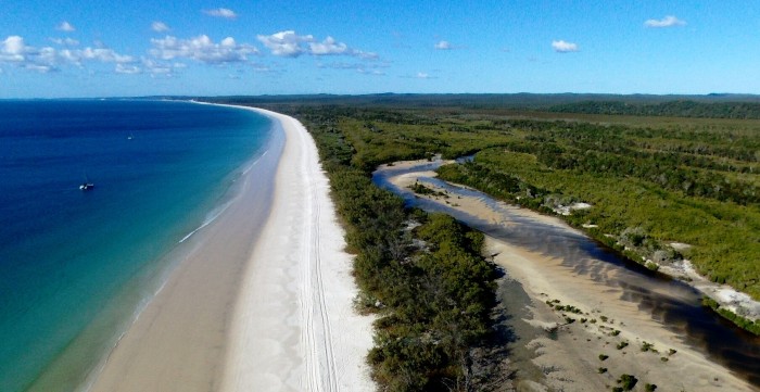
Drone photo shows the lovely anchorage along the 60 km long Platypus Bay along the northern coast of K'Gari.
We are anchored in our old haunts in the lower reaches of the Burnett River waiting for a clear weather window to sail north along the Queensland coast and out to the southernmost of the Great Barrier reefs, the 50 nautical mile stretch of the Capricornia / Bunker Group of reefs and associated coral cays.
We left Moreton Bay a couple of weeks ago, the arrival of Alison's old school friend, Clodagh, from Albany in WA, fortuitously coinciding with very favourable conditions for the passage north across the sometimes impassable Wide Bay Bar and the tricky onwards sail through the Great Sandy Strait inside K'Gari (Fraser island).
The main objective this tropical sailing season is to explore the outer reefs along the Great Barrier Reef, but this depends of course on calm enough weather to find safe and comfortable places to anchor.
When we first started sailing back in the late 1980s, we had little access to weather forecasting beyond a rather uncertain 3 day coastal forecast. We remember leaving the lovely anchorage behind Urupukapuka Island in the Bay of Islands in New Zealand in July 1987 for a trans Tasman ocean crossing with a favourable forecast, only to turn back a day later as a storm was forecast. A few hours later we had 2 anchors down with 60 knots of wind bearing down on us.
Of course, the forecasting of weather has improved immensely since then, but one wonders whether it really is so much better. Weather forecasts are made by supercomputers that crunch the data they obtain from thousands of weather stations around the world, satellite data and other information. There are several computer models available to the ordinary sailor, and conventional wisdom is that when the models align, i.e. say the same thing, the forecast is likely to be accurate.
The problem at the moment is that the models are not showing the same thing at all. There is a trough developing off the east coast of Australia and the possibility of a low pressure system. These conditions are common at this time of the year in the subtropics as the water remains warm after the summer. One model shows northerlies; another, westerlies, one more southerlies and a fourth south easterlies! If this was a forecast for a week or more away, then the discrepancies might be understandable, but they are not. They are for tomorrow! With such a battle of the models, we will just elect to stay at anchor here in the safety of the Burnett and wait for more certainty.
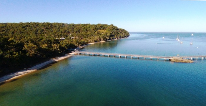
The anchorage off Kingfisher Resort on the west side of K'Gari in ideal conditions on the way north a week ago.
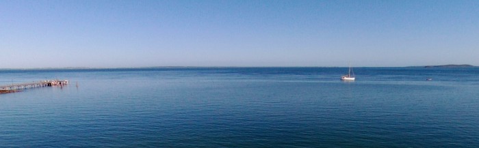
Sundari, anchored off Kingfisher Resort, K'Gari.
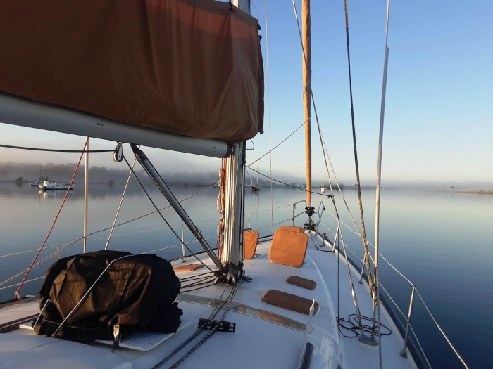
Lovely misty morning in the Burnett River after the forecast low clears off to seaward faster than predicted...shallow sub-tropical lows and troughs are notoriously hard to forecast. Note the covered dive compressor on top of the deck in the foreground - still unused!
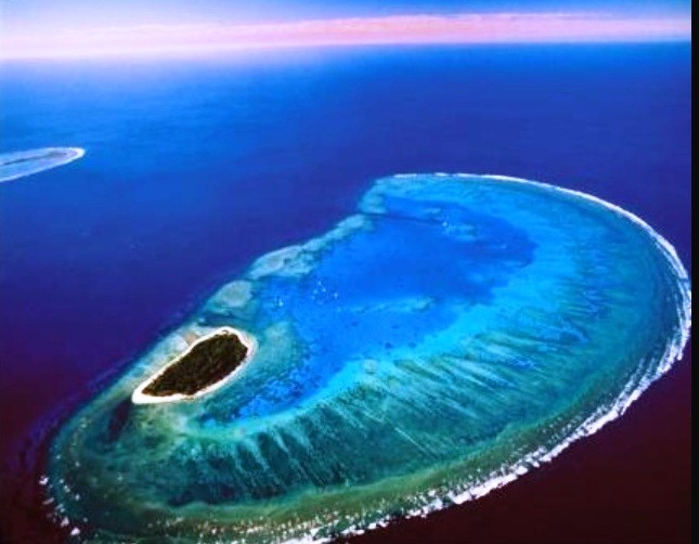
One of the Capricornia Cays to the north of Bundaberg - the southernmost of the Great Barrier Reefs - not our photo though!
We are anchored in our old haunts in the lower reaches of the Burnett River waiting for a clear weather window to sail north along the Queensland coast and out to the southernmost of the Great Barrier reefs, the 50 nautical mile stretch of the Capricornia / Bunker Group of reefs and associated coral cays.
We left Moreton Bay a couple of weeks ago, the arrival of Alison's old school friend, Clodagh, from Albany in WA, fortuitously coinciding with very favourable conditions for the passage north across the sometimes impassable Wide Bay Bar and the tricky onwards sail through the Great Sandy Strait inside K'Gari (Fraser island).
The main objective this tropical sailing season is to explore the outer reefs along the Great Barrier Reef, but this depends of course on calm enough weather to find safe and comfortable places to anchor.
When we first started sailing back in the late 1980s, we had little access to weather forecasting beyond a rather uncertain 3 day coastal forecast. We remember leaving the lovely anchorage behind Urupukapuka Island in the Bay of Islands in New Zealand in July 1987 for a trans Tasman ocean crossing with a favourable forecast, only to turn back a day later as a storm was forecast. A few hours later we had 2 anchors down with 60 knots of wind bearing down on us.
Of course, the forecasting of weather has improved immensely since then, but one wonders whether it really is so much better. Weather forecasts are made by supercomputers that crunch the data they obtain from thousands of weather stations around the world, satellite data and other information. There are several computer models available to the ordinary sailor, and conventional wisdom is that when the models align, i.e. say the same thing, the forecast is likely to be accurate.
The problem at the moment is that the models are not showing the same thing at all. There is a trough developing off the east coast of Australia and the possibility of a low pressure system. These conditions are common at this time of the year in the subtropics as the water remains warm after the summer. One model shows northerlies; another, westerlies, one more southerlies and a fourth south easterlies! If this was a forecast for a week or more away, then the discrepancies might be understandable, but they are not. They are for tomorrow! With such a battle of the models, we will just elect to stay at anchor here in the safety of the Burnett and wait for more certainty.
The anchorage off Kingfisher Resort on the west side of K'Gari in ideal conditions on the way north a week ago.
Sundari, anchored off Kingfisher Resort, K'Gari.
Lovely misty morning in the Burnett River after the forecast low clears off to seaward faster than predicted...shallow sub-tropical lows and troughs are notoriously hard to forecast. Note the covered dive compressor on top of the deck in the foreground - still unused!
One of the Capricornia Cays to the north of Bundaberg - the southernmost of the Great Barrier Reefs - not our photo though!
Remembering Papua New Guinea With Corsair
29 April 2023 | Manly marina, Moreton Bay, Queensland, Australia
Alison and Geoff Williams | Warm with little wind
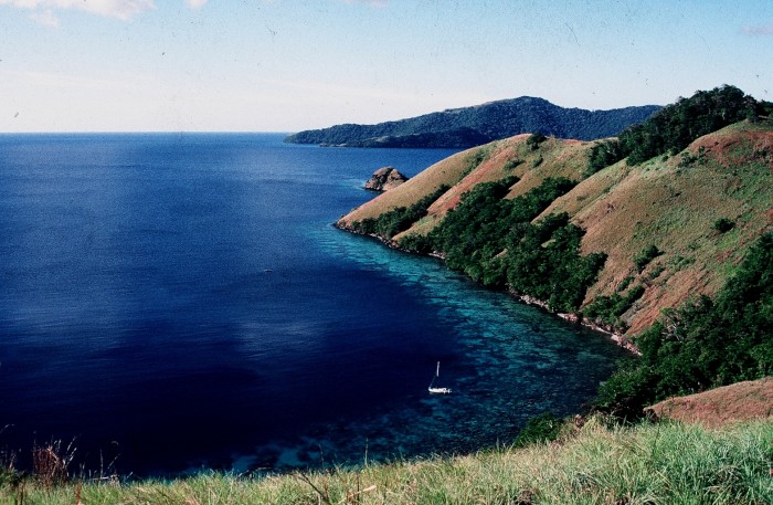
Photo shows Corsair perched on the edge of the fringing coral reef inside the lee of Kwatoto Island in PNG's D'Entrecasteaux Group.
We are in Manly Boat Harbour on the west side of Moreton Bay with Sundari, making last minute preparations to head north along the Queensland coast. Alison's old school chum, Clodagh, will be sailing with us for the first part of our trip, flying into Brisbane from WA's Albany, while sister Sue from Sheffield and the French Charentes, will join us later this year.
We were here 35 years ago in our first yacht, the 1933 kauri sloop, "Corsair", also preparing to head north towards the Torres Strait after a visit from Alison's sister and brother in law, Susan and Nick.
Little did we know at the time that we would end up teaching and living in Papua New Guinea for nearly ten years, an experience like nothing else we have ever had, before or after. At the time we sort of blundered into life in PNG, having little cruising money to sail on to Asia and the Red Sea as we had originally planned.
In the end, we taught in three PNG government high schools, mostly in rural areas, and with mostly PNG citizens as teachers and colleagues. The last year we were in PNG we had a cooperative agreement with the nascent tourist bureau in Milne Bay Province to approach the island province's villagers to see whether eco tourism development would be acceptable to them.
From a sailing point of view, it was the most challenging, dangerous, exhilarating and rewarding of times, often sailing in waters that had never been charted sufficiently, or at all, more often than not without a working auxiliary engine, relying on sailing skills that we had to develop fast to avoid a multiude of potential calamities.
Our status as teachers in PNG's own education system gave us a window onto a world that few have ever had the privilege to experience. PNG was certainly at the time we were there somewhere between the stone-age and the space age, having to cope with the pressures of both.
The photos in this blog give a small indication of our time out of school and on the water while we were in PNG. Will we return? We would love to, but in some ways, Corsair was probably an ideal vessel to explore the more remote and interesting parts of this fascinating country, of a size and construction that ordinary villagers could cope with and adapt to. Despite the fact that Saraoni, our second yacht we owned for over 22 years, was named after one of our favourite PNG anchorages, we feel that fancy yachts sailing into PNG waters may be just a bit too much for ordinary villagers to be comfortable with, who for the most part showed us the most amazing generosity and hospitality while we were sailing amongst their astonishingly beautiful island homes.
Early Days with Corsair
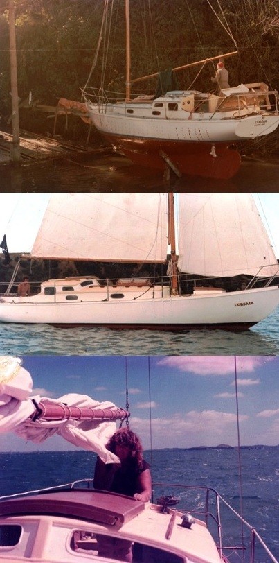
Corsair, a 1933 kauri racing sloop, was bought by us in Auckland in 1986, and brought up to some sort of ocean readiness in a Panmure boat yard (first photo) over a 6 month time period. The second photo shows Corsair on its first sea outing at Izzie Bay on Rangitoto island in the Hauraki Gulf, and the third photo shows Alison skippering Corsair back into Auckland Harbour. We were to cross the turbulent Tasman only a few months later, after little prior experience, an ocean adventure that took us 17 sometimes tortuous days.
The Papuan Gulf - 1988-1989
After sailing from NZ's Bay of Islands in July 1987 (mid winter!), first to New Caledonia, then along the Queensland coast, we arrived in Port Moresby, PNG's capital, expecting to sail back to Cairns to earn some more money before continuing westwards into Asia. Instead, more by accident than intention, we ended up at Ihu High Scool in PNG's Gulf Province, surrounded by jungle, teaching for a year and a half. We tried to get Corsair into Ihu's swift flowing Vailala river, but with no charting ever having been done, this was quite a perilous adventure and we ended up nearly sunk on the bar and forced to beat south against the trade winds for 120 miles back to Port Moresby, returning to Ihu more sensibly by small plane instead.
Ihu was in fact only accessible by occasional small plane landings or unnanounced arrivals of the freight ship. Many of the school kids who weren't from the local area had to walk to school and back at the start and end of each term for up to a week at a time through the bush. There was no phone contact with the outside world, but Alison built and ran the school's trade store, which became a popular place for school kids, staff, government workers and villagers near and far.
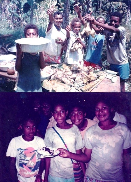
Photo shows an exuberant end of year 'class party' for Alison's class group. They saved up all year to have a feast at the end of the school year!
The Torres Strait and Daru - 1989 to 1993
Our second school posting was at Daru High School, situated on the island of Daru at the northern end of the Torres Strait. Daru was a dysfunctional and chaotic town but also the 'capital' of PNG's resource rich Western province. We stayed there for four years, anchored in the lee of the island in what euphemistically could be called a 'harbour'. We made two trips down to Australia's Thursday Island during that time, mostly under sail, as our engine soon went kaput, a perilous 100 nm trip through swift currents and jagged reefs.
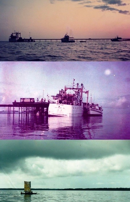
Daru's wharf and most frequent cargo ship are shown in the top two photos, counterposed with the commonly seen local sailing canoes, with their sails stitched together out of rice bags.
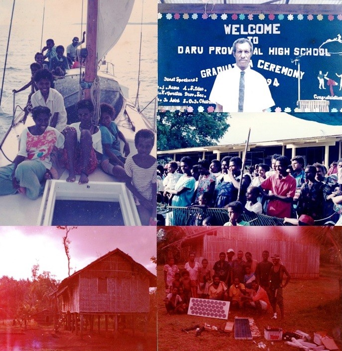
Daru was located between impoverished PNG and affluent Australia. Many Daru residents had relatives on both sides of the porous border. The Torres Strait is a fascinating place with a troubled history. Daru families had high hopes for their kids' achievements in school and our time at the school was often hard work. Apart from the odd foreign volunteer, all the teachers were PNG trained citizens, teaching a high school curriculum all in English! Successful high school students went on to senior secondary school elsewhere in PNG and the highest achievers were given scholarships to continue secondary school in Australia.
Photos show a PNG colleague's extended family on Corsair on a holiday trip back to his mainland home, a science teacher at an end of year graduation with the adoring family audience at the ceremony (top right and centre right photos). The bottom two photos were taken in a remote inland village where Geoff helped a student set up a solar electrification project - all funded through his own fundraising efforts!
Alotau and Milne Bay - 1995 to 1998
Photo shows Corsair anchored off the picturesque East Cape of Milne Bay in late 1997. There are far too many photos of this part of our sailing lives, and so have posted them in the gallery HERE.
Just click on the link, then each photo opens up when you select it in the gallery. Switch from one photo to another by pressing 'Next' in the menu bar.
Our third and final school posting was to Alotau's Cameron Secondary School in PNG's eastern Milne Bay Province. This was a pretty and geographically varied island archipelago region. We spent the first two years teaching, both as heads of department in the newly created senior school. Our students for the most part went on to college, university or tech college if successful in their exams. Those who didn't do so well went back to their respective villages. We were given a newly built house courtesy of EU funding, but like elsewhere in our PNG school postings we slept on Corsair, using the house as a convenient place to leave our surplus boat stuff and freshen up for school time. Our school house was in fact used as a favourite lodging spot for visitors and inspectors who turned up at the school from time to time!
Our last year in Milne Bay was spent cruising around most of the province, charting anchorages and taking notes of facilities and hazards, talking to villagers and generally enjoying ourselves. Many Milne Bay people have a good command of English as well as Tok Pisin, Motu and their own and possibly other local languages and dialects so it was easy to learn a lot about their way of life, hopes and dreams.
Whatever we learned we passed on to Jennifer Varsilli, the enthusiastic Milne Bay tourism department head, who wanted to know whether small scale village based eco tourism was feasible in selected parts of the province, as direct flights into Alotau from Cairns had just started.
We were lucky as many of the villagers recognised us as teachers from the same school that their kids were at, or had gone to. This made quite a difference when travelling around the beautiful coastline of Milne Bay's islands and mainland bays. Incidentally, we still have hundreds of detailed drawings and notes of the anchorages we went to and explored, mostly being the only yacht to have ventured there. It was only in the Louisiades did we ever really encounter any other cruising yachts. At Bagaman in the Calvados Chain we met up with Heather and John from Bundaberg in Queensland on their 32 foot yacht "Kindred Spirit", who we have kept in contact with ever since.
Photo shows Corsair on show and on sale in Port Moresby marina early 1998.
We finally left PNG in February 1998 after trying to sell Corsair in Port Moresby. We left the boat eventually with an Australian couple who managed moorings south of the city and flew to Cairns and bought Saraoni, our second yacht. Saraoni was named after the island that protected our favourite anchorage at the mouth of Milne Bay while teaching in Alotau. Corsair was finally sold after 8 months while we were engaged in teaching at schools in Darwin in the Northern Territory.
We are in Manly Boat Harbour on the west side of Moreton Bay with Sundari, making last minute preparations to head north along the Queensland coast. Alison's old school chum, Clodagh, will be sailing with us for the first part of our trip, flying into Brisbane from WA's Albany, while sister Sue from Sheffield and the French Charentes, will join us later this year.
We were here 35 years ago in our first yacht, the 1933 kauri sloop, "Corsair", also preparing to head north towards the Torres Strait after a visit from Alison's sister and brother in law, Susan and Nick.
Little did we know at the time that we would end up teaching and living in Papua New Guinea for nearly ten years, an experience like nothing else we have ever had, before or after. At the time we sort of blundered into life in PNG, having little cruising money to sail on to Asia and the Red Sea as we had originally planned.
In the end, we taught in three PNG government high schools, mostly in rural areas, and with mostly PNG citizens as teachers and colleagues. The last year we were in PNG we had a cooperative agreement with the nascent tourist bureau in Milne Bay Province to approach the island province's villagers to see whether eco tourism development would be acceptable to them.
From a sailing point of view, it was the most challenging, dangerous, exhilarating and rewarding of times, often sailing in waters that had never been charted sufficiently, or at all, more often than not without a working auxiliary engine, relying on sailing skills that we had to develop fast to avoid a multiude of potential calamities.
Our status as teachers in PNG's own education system gave us a window onto a world that few have ever had the privilege to experience. PNG was certainly at the time we were there somewhere between the stone-age and the space age, having to cope with the pressures of both.
The photos in this blog give a small indication of our time out of school and on the water while we were in PNG. Will we return? We would love to, but in some ways, Corsair was probably an ideal vessel to explore the more remote and interesting parts of this fascinating country, of a size and construction that ordinary villagers could cope with and adapt to. Despite the fact that Saraoni, our second yacht we owned for over 22 years, was named after one of our favourite PNG anchorages, we feel that fancy yachts sailing into PNG waters may be just a bit too much for ordinary villagers to be comfortable with, who for the most part showed us the most amazing generosity and hospitality while we were sailing amongst their astonishingly beautiful island homes.
Early Days with Corsair
Corsair, a 1933 kauri racing sloop, was bought by us in Auckland in 1986, and brought up to some sort of ocean readiness in a Panmure boat yard (first photo) over a 6 month time period. The second photo shows Corsair on its first sea outing at Izzie Bay on Rangitoto island in the Hauraki Gulf, and the third photo shows Alison skippering Corsair back into Auckland Harbour. We were to cross the turbulent Tasman only a few months later, after little prior experience, an ocean adventure that took us 17 sometimes tortuous days.
The Papuan Gulf - 1988-1989
After sailing from NZ's Bay of Islands in July 1987 (mid winter!), first to New Caledonia, then along the Queensland coast, we arrived in Port Moresby, PNG's capital, expecting to sail back to Cairns to earn some more money before continuing westwards into Asia. Instead, more by accident than intention, we ended up at Ihu High Scool in PNG's Gulf Province, surrounded by jungle, teaching for a year and a half. We tried to get Corsair into Ihu's swift flowing Vailala river, but with no charting ever having been done, this was quite a perilous adventure and we ended up nearly sunk on the bar and forced to beat south against the trade winds for 120 miles back to Port Moresby, returning to Ihu more sensibly by small plane instead.
Ihu was in fact only accessible by occasional small plane landings or unnanounced arrivals of the freight ship. Many of the school kids who weren't from the local area had to walk to school and back at the start and end of each term for up to a week at a time through the bush. There was no phone contact with the outside world, but Alison built and ran the school's trade store, which became a popular place for school kids, staff, government workers and villagers near and far.
Photo shows an exuberant end of year 'class party' for Alison's class group. They saved up all year to have a feast at the end of the school year!
The Torres Strait and Daru - 1989 to 1993
Our second school posting was at Daru High School, situated on the island of Daru at the northern end of the Torres Strait. Daru was a dysfunctional and chaotic town but also the 'capital' of PNG's resource rich Western province. We stayed there for four years, anchored in the lee of the island in what euphemistically could be called a 'harbour'. We made two trips down to Australia's Thursday Island during that time, mostly under sail, as our engine soon went kaput, a perilous 100 nm trip through swift currents and jagged reefs.
Daru's wharf and most frequent cargo ship are shown in the top two photos, counterposed with the commonly seen local sailing canoes, with their sails stitched together out of rice bags.
Daru was located between impoverished PNG and affluent Australia. Many Daru residents had relatives on both sides of the porous border. The Torres Strait is a fascinating place with a troubled history. Daru families had high hopes for their kids' achievements in school and our time at the school was often hard work. Apart from the odd foreign volunteer, all the teachers were PNG trained citizens, teaching a high school curriculum all in English! Successful high school students went on to senior secondary school elsewhere in PNG and the highest achievers were given scholarships to continue secondary school in Australia.
Photos show a PNG colleague's extended family on Corsair on a holiday trip back to his mainland home, a science teacher at an end of year graduation with the adoring family audience at the ceremony (top right and centre right photos). The bottom two photos were taken in a remote inland village where Geoff helped a student set up a solar electrification project - all funded through his own fundraising efforts!
Alotau and Milne Bay - 1995 to 1998
Photo shows Corsair anchored off the picturesque East Cape of Milne Bay in late 1997. There are far too many photos of this part of our sailing lives, and so have posted them in the gallery HERE.
Just click on the link, then each photo opens up when you select it in the gallery. Switch from one photo to another by pressing 'Next' in the menu bar.
Our third and final school posting was to Alotau's Cameron Secondary School in PNG's eastern Milne Bay Province. This was a pretty and geographically varied island archipelago region. We spent the first two years teaching, both as heads of department in the newly created senior school. Our students for the most part went on to college, university or tech college if successful in their exams. Those who didn't do so well went back to their respective villages. We were given a newly built house courtesy of EU funding, but like elsewhere in our PNG school postings we slept on Corsair, using the house as a convenient place to leave our surplus boat stuff and freshen up for school time. Our school house was in fact used as a favourite lodging spot for visitors and inspectors who turned up at the school from time to time!
Our last year in Milne Bay was spent cruising around most of the province, charting anchorages and taking notes of facilities and hazards, talking to villagers and generally enjoying ourselves. Many Milne Bay people have a good command of English as well as Tok Pisin, Motu and their own and possibly other local languages and dialects so it was easy to learn a lot about their way of life, hopes and dreams.
Whatever we learned we passed on to Jennifer Varsilli, the enthusiastic Milne Bay tourism department head, who wanted to know whether small scale village based eco tourism was feasible in selected parts of the province, as direct flights into Alotau from Cairns had just started.
We were lucky as many of the villagers recognised us as teachers from the same school that their kids were at, or had gone to. This made quite a difference when travelling around the beautiful coastline of Milne Bay's islands and mainland bays. Incidentally, we still have hundreds of detailed drawings and notes of the anchorages we went to and explored, mostly being the only yacht to have ventured there. It was only in the Louisiades did we ever really encounter any other cruising yachts. At Bagaman in the Calvados Chain we met up with Heather and John from Bundaberg in Queensland on their 32 foot yacht "Kindred Spirit", who we have kept in contact with ever since.
Photo shows Corsair on show and on sale in Port Moresby marina early 1998.
We finally left PNG in February 1998 after trying to sell Corsair in Port Moresby. We left the boat eventually with an Australian couple who managed moorings south of the city and flew to Cairns and bought Saraoni, our second yacht. Saraoni was named after the island that protected our favourite anchorage at the mouth of Milne Bay while teaching in Alotau. Corsair was finally sold after 8 months while we were engaged in teaching at schools in Darwin in the Northern Territory.
Scooby Doo in Te Tai Tokerau
04 March 2023 | South Auckland, New Zealand
Alison and Geoff Williams | Warm and sunny, light winds
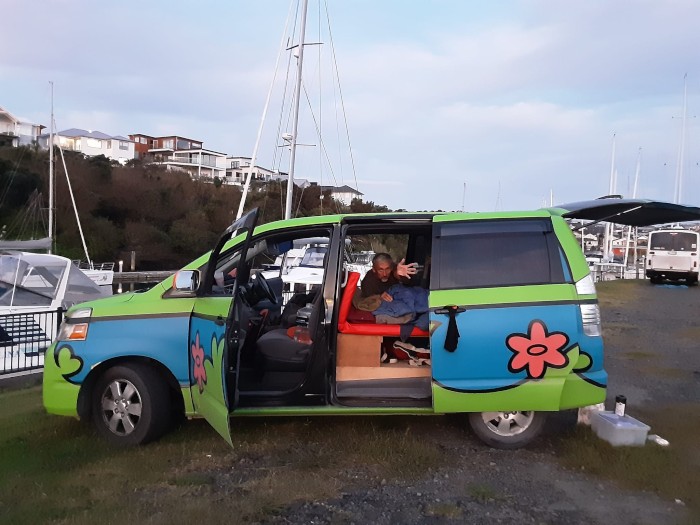
Photo shows the Wicked camper van we hired for our two weeks or so in New Zealand. We had no idea of the meaning of the slogan on the side (Mystery machine) until people (mainly kids) told us it was the van that the four young detectives and their dog (Scooby Doo) used in a popular TV programme. It got a lot of thumbs up and grins from the kids we passed!
We are in an AirBnB in Papatoetoe, South Auckland, ready for the plane flight back to the Gold Coast and Sundari. We arrived a week after a disastrous cyclone (Gabrielle) and heavy flooding in Northland, Auckland and the Coromandel. Roads were still cut when we arrived and many houses red stickered awaiting investigation after slips and mud engulfed whole communities. As usual in these climate change enhanced times, the floods were 'unprecedented'. Luckily for us, we have had warm to hot, sunny, summery weather every day we have been travelling around the North.
The old sailing dinghy we had left behind on a dinghy rack at Tutukaka was still there, so we hastily rigged it for a photo ad!
Our main objective on this visit was to dispose of the daunting quantity of stuff we had left behind in a Bay of Islands storage locker, the two dinghies left behind in Tutukaka and catch up with old friends. Rather to our surprise, everything went very smoothly, although we had to make detours in places because of closed roads in Northland (Te Tai Tokerau). By yesterday, after 10 days of selling stuff we didn't want to bring back to Australia, we had sold 2 outboards, the sailing dinghy, a VHF radio, a pile of nylon, plaited mooring ropes, a ream of NZ east coast paper charts, a bilge pump, lifebuoy light, bosun's chair, two sets of paddles, a bicycle, a bicycle basket, a bicycle carrier and a tent and sleeping mat! There was also a hell of a lot of stuff to dump in the waste tip and charity shops. We still seem to be bringing back on the plane rather a lot of stuff we haven't used, or had even seen for 6 years, including Alison's bike and a heap of memorabilia.

The Sail Indo rally gathering at Bryce and Martha's kiwifruit orchard west of Whangarei - some circumnavigators were here, too
As far as old friends were concerned, we stayed with family friends, Alan and Janice, twice (arriving and leaving), in their new, comfortable home in Snells Beach, overlooking Kawau Bay. They have both got quite absorbed in the local community since retirement, Alan enthusiastically trying to help restore native bird populations, including kiwi, and Jan active in nearby Warkworth's museum.
The Sail Indonesia gathering at Bryce and Martha's kiwifruit orchard west of Whangarei brought 30 odd sailors, (now mostly ex sailors!) some of whom we had sailed many sea miles with and shared memorable experiences. We also caught up with more sailors, Megan and Andy (Wairua) and Glynis (Sea Hawk) in Kerikeri, Ron (Pilgrim) on the Russel Road, and, by phone, Craig and Lynne (Solan) in Waihi and David (Sahula) on Kawau Island.
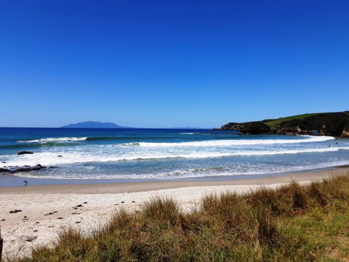
Tawharanui Reserve and its lovely beach and view towards Little and Great Barrier Islands is located on a peninsula near where Alan and Jan live in Snells Beach.
Megan, Andy and young son now live in Kerikeri. They crossed the Pacific in the smallest of sloops the same year we did. Andy is about to fly to Suva in Fiji to bring back an equally small catamaran.
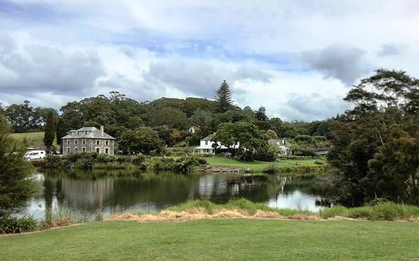
Kerikeri Basin and the Stone Store, where we were moored for a few months immediately before we crossed the Tasman on our 1933 kauri sloop, "Corsair".
We should be back on Sundari by this time tomorrow and have a few days in the marina before getting ready for this year's sailing adventure.
We did have time to snatch a few hours visiting old, familiar places in Te Tai Tokerau, but walks were out because of cyclone damage, thankfully not so severe as on the east coast and in poor Vanuatu, currently recovering after two cyclones passed through.

Maninangina kauri hugger, Puketi Forest, west of Kerikeri.
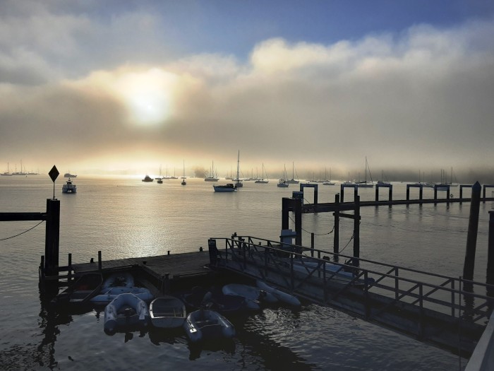
Opua moorings on a misty morning, near where we left a heap of junk in a storage locker.
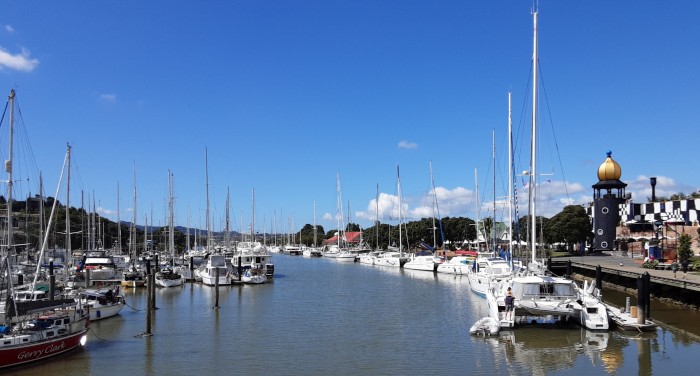
Whangarei Town Basin, with many new overseas yachts in attendance this summer after the pandemic closures.
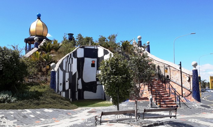
The weird looking, new Hundertwasser Art Gallery and roof garden at the Whangarei Town Basin.
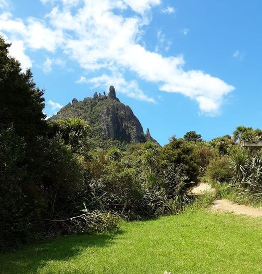
Mount Manaia, a craggy, volcanic landmark near Whangarei Heads was out of bounds because of cyclone damage, but we did hear several kiwi calling at night.
We are in an AirBnB in Papatoetoe, South Auckland, ready for the plane flight back to the Gold Coast and Sundari. We arrived a week after a disastrous cyclone (Gabrielle) and heavy flooding in Northland, Auckland and the Coromandel. Roads were still cut when we arrived and many houses red stickered awaiting investigation after slips and mud engulfed whole communities. As usual in these climate change enhanced times, the floods were 'unprecedented'. Luckily for us, we have had warm to hot, sunny, summery weather every day we have been travelling around the North.
The old sailing dinghy we had left behind on a dinghy rack at Tutukaka was still there, so we hastily rigged it for a photo ad!
Our main objective on this visit was to dispose of the daunting quantity of stuff we had left behind in a Bay of Islands storage locker, the two dinghies left behind in Tutukaka and catch up with old friends. Rather to our surprise, everything went very smoothly, although we had to make detours in places because of closed roads in Northland (Te Tai Tokerau). By yesterday, after 10 days of selling stuff we didn't want to bring back to Australia, we had sold 2 outboards, the sailing dinghy, a VHF radio, a pile of nylon, plaited mooring ropes, a ream of NZ east coast paper charts, a bilge pump, lifebuoy light, bosun's chair, two sets of paddles, a bicycle, a bicycle basket, a bicycle carrier and a tent and sleeping mat! There was also a hell of a lot of stuff to dump in the waste tip and charity shops. We still seem to be bringing back on the plane rather a lot of stuff we haven't used, or had even seen for 6 years, including Alison's bike and a heap of memorabilia.
The Sail Indo rally gathering at Bryce and Martha's kiwifruit orchard west of Whangarei - some circumnavigators were here, too
As far as old friends were concerned, we stayed with family friends, Alan and Janice, twice (arriving and leaving), in their new, comfortable home in Snells Beach, overlooking Kawau Bay. They have both got quite absorbed in the local community since retirement, Alan enthusiastically trying to help restore native bird populations, including kiwi, and Jan active in nearby Warkworth's museum.
The Sail Indonesia gathering at Bryce and Martha's kiwifruit orchard west of Whangarei brought 30 odd sailors, (now mostly ex sailors!) some of whom we had sailed many sea miles with and shared memorable experiences. We also caught up with more sailors, Megan and Andy (Wairua) and Glynis (Sea Hawk) in Kerikeri, Ron (Pilgrim) on the Russel Road, and, by phone, Craig and Lynne (Solan) in Waihi and David (Sahula) on Kawau Island.
Tawharanui Reserve and its lovely beach and view towards Little and Great Barrier Islands is located on a peninsula near where Alan and Jan live in Snells Beach.
Megan, Andy and young son now live in Kerikeri. They crossed the Pacific in the smallest of sloops the same year we did. Andy is about to fly to Suva in Fiji to bring back an equally small catamaran.
Kerikeri Basin and the Stone Store, where we were moored for a few months immediately before we crossed the Tasman on our 1933 kauri sloop, "Corsair".
We should be back on Sundari by this time tomorrow and have a few days in the marina before getting ready for this year's sailing adventure.
We did have time to snatch a few hours visiting old, familiar places in Te Tai Tokerau, but walks were out because of cyclone damage, thankfully not so severe as on the east coast and in poor Vanuatu, currently recovering after two cyclones passed through.
Maninangina kauri hugger, Puketi Forest, west of Kerikeri.
Opua moorings on a misty morning, near where we left a heap of junk in a storage locker.
Whangarei Town Basin, with many new overseas yachts in attendance this summer after the pandemic closures.
The weird looking, new Hundertwasser Art Gallery and roof garden at the Whangarei Town Basin.
Mount Manaia, a craggy, volcanic landmark near Whangarei Heads was out of bounds because of cyclone damage, but we did hear several kiwi calling at night.
Gold Coast Interlude
18 January 2023 | Gold Coast Broadwater, Queensland
Alison and Geoff Williams | Warm and sunny, east to south east trade winds.
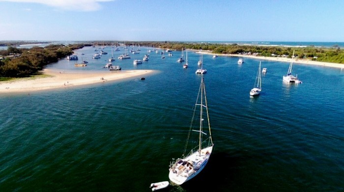
Photo taken using the drone last year showing Sundari in the Gold Coast Broadwater near Sea World. We are in the exact same spot again!
It's been a while since we posted a blog, so here goes. We are back on Sundari, anchored just off the beach near Sea World in the Gold Coast, not far from where the tragic helicopter accident involving the 2 colliding Sea World helicopters occurred. This anchorage is almost unbearable over busy weekend and holiday periods, but we have persevered as it is sheltered and safe and it's easy to get ashore and do the stuff that us boaties have to do.
This mainly means repairing things on the boat that have broken down and improving parts of the boat that make it more comfortable or efficient. The current jobs have included repairing the freezer and one of our 3 outboards, installing new galley equipment and solar panels and spending money on a new, small inflatable dinghy for use where the tidal ranges make using our large RIB difficult. All a bit boring compared to tripping around, but we are getting ready for our next adventures.
We sail up to Moreton Bay in a day or two to check out our mooring and piece of land on Lamb Island, then head off to nearby Stradbroke Island for some diving, swimming, kayaking, cycling and maybe even some croc spotting! Later next month we have to fly over to NZ to dispose of all the stuff in our storage shed in the Bay of Islands that has been languishing there since we sailed from Opua in June 2017. We also have a yachties get together near Whangarei involving survivors of some of the Sail Indo rallies, one of which (2008) we participated in.
This year we have dedicated to trying out our almost unused dive equipment up the Barrier Reef and possibly in PNG if we make it that far. Sister Sue is flying out for a few weeks on the boat so have that to look forward to as well. Covid and distance have made contact with family reduced mostly to emails, Facebook and phone calls. The Queensland sailing season more or less ends by November, so this year we may keep sailing south to New South Wales, Tasmania and Victoria for the summer. We are also making plans to revisit SE Asia for wildlife and a trip either to East Africa (Tanzania, Uganda?) or western South Africa, Namibia and Botswana.
The last of La Nina is playing itself out in North Queensland and NZ's North Island. The forecast is for a complete switch to a moderate to strong El Nino. Not good news for farmers, and it will probably increase the bushfire risk on land, but it will be a relief for us yachties as it means dry conditions and weaker trade winds, so hopefully pleasanter on the water.
Westward Ho! Tripping North to the Coral Coast
17 November 2022 | Collie, Southern WA, Australia
Alison and Geoff Williams | Cool and wet

Photo shows a green turtle at Osprey Bay on the Ningaloo coast, near Exmouth.
We are in the small coal mining town of Collie in another 'shoebox' room, primarily designed for mine workers, but open for travellers like us. Collie is south east of Perth amongst low hills. Both the Munda Biddi (cycling) and the Bibbulmun (hiking) trails pass through here on their way south, although this time we are doing neither and are on our slow way back towards the east coast of Australia after a side trip up to Exmouth and the Coral Coast.
Western Australia is a huge state. It stretches from the cool, temperate south coast right up to the Kimberley in the deep tropics. Having retrieved Matilda, the Merc., we headed north along the coast from Perth by passing kilometre after kilometre of white sand beaches, sand dunes and small coastal towns after eventually freeing ourselves from the remorselessly spreading northern suburbs of Perth.
In succession, we sampled the national parks of Nambung, Lesueur, Kalbarri and Francois Peron, each of which progressively got dryer and dryer. The eucalypt forests of the south became mulga, Banksia and Grevillea scrub and then low heathland. Each national park was uniquely different, Nambung with its limestone pinnacles, Lesueur with its swathes of wildflowers, Kalbarri , its Murchison River gorge and Francois Peron, perched between the tentacles of Shark Bay.
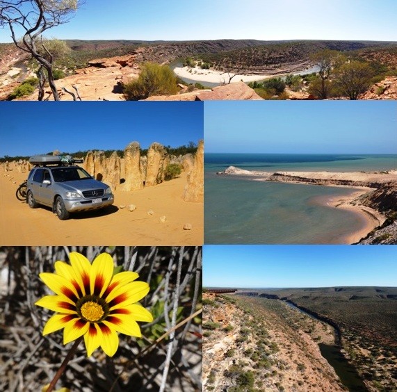
Photos taken between Perth and Shark Bay: from top row to bottom right:
Kalbarri NP: The Murchison River gorge
Kambung NP: the pinnacles, Francois Peron NP: Shark Bay
Wildflower in Lesueur NP, Murchison River in Kalbarri NP.
Ningaloo Reef is about 1,200 km north of Perth and just west of the little town of Exmouth which lies near the top of the Exmouth Gulf. Ningaloo is an unusual feature, being a fringing coral reef, unusual because it is on the western side of a major continental landmass and because nowhere else in Australia is there a coral reef attached to the mainland shoreline. The Great Barrier reefs on Queensland's coast lie at a distance from the mainland and although there are fringing reefs there, they are all attached to the sides of offshore islands.
Ningaloo is managed by WA's Parks and Wildlife department who have done a good job protecting the 250 km long reef from development and deterioration from visitor pressure. We were wondering how the coral communities here had fared compared to the coral reefs in Queensland, so we were glad to note that there was very little damage, although both the amount of coral and the diversity of marine life wasn't as great as many other reefs we have been to. Ningaloo is lucky in that it is not exposed to sediment from rivers, is located in a low rainfall area and there is no farming nearby, all of which mean the main danger is from offshore gas exploitation and climate change. The latter is a very real threat. Depending on how humanity faces up to its collective challenge at stabilising temperatures, Ningaloo is on track to irreversible damage because of bleaching episodes, expected to have reached a frequency that will not allow recovery by 2045. That goes for all other world reefs as well, of course.
Ningaloo is also known for its whale sharks, the world's largest, who like the humpback whales, come up this far north in the winter months. By August they have gone south again, so we didn't see either large whales or their fishy cousins. What we did see was a remarkable green turtle nesting occasion. We had seen turtles while snorkelling and many more looking into the lagoon while on the Ningaloo beaches, but one night, with clear skies and a full moon we ventured out from our campsite to search for turtles coming ashore to lay eggs. They prefer high tides and dark skies, so we started looking at about 9 pm just as the moon was rising. First we saw a turtle arrive on the shoreline, then as we walked slowly along the beach, nesting turtle after turtle became visible in our red torch lights. Most of them had already got to the egg laying stage, by which time they are oblivious to disturbance, but others were digging their nests and others still, laboriously making their way up the beach past the high tide mark.
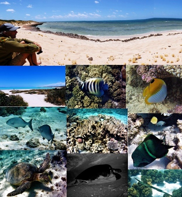
Photos taken at Ningaloo Marine Park near Exmouth:
Geoff at Turquoise Bay
Lovely Ningaloo beach, amgel fish, butterfly fish
Trevally, lagoon coral bommie, bumphead parrot fish
Green turtle, Nesting turtle climbing the beach at night, flutemouth.
We are watching the unfolding flooding events in the eastern states, which have had a disproportionate effect on northern and eastern Victoria and outback NSW. We will be making our way back soon but will probably stick to a coastal route to avoid flooded highways and towns. The three climatic events that exacerbate flooding - La Niña, the negative phase of the Indian Dipole and the positive phase of the Southern Annular Modulation are all predicted to ease in the next few months, hopefully allowing the east to dry out and create a more normal pattern of weather next year.
We are in the small coal mining town of Collie in another 'shoebox' room, primarily designed for mine workers, but open for travellers like us. Collie is south east of Perth amongst low hills. Both the Munda Biddi (cycling) and the Bibbulmun (hiking) trails pass through here on their way south, although this time we are doing neither and are on our slow way back towards the east coast of Australia after a side trip up to Exmouth and the Coral Coast.
Western Australia is a huge state. It stretches from the cool, temperate south coast right up to the Kimberley in the deep tropics. Having retrieved Matilda, the Merc., we headed north along the coast from Perth by passing kilometre after kilometre of white sand beaches, sand dunes and small coastal towns after eventually freeing ourselves from the remorselessly spreading northern suburbs of Perth.
In succession, we sampled the national parks of Nambung, Lesueur, Kalbarri and Francois Peron, each of which progressively got dryer and dryer. The eucalypt forests of the south became mulga, Banksia and Grevillea scrub and then low heathland. Each national park was uniquely different, Nambung with its limestone pinnacles, Lesueur with its swathes of wildflowers, Kalbarri , its Murchison River gorge and Francois Peron, perched between the tentacles of Shark Bay.
Photos taken between Perth and Shark Bay: from top row to bottom right:
Kalbarri NP: The Murchison River gorge
Kambung NP: the pinnacles, Francois Peron NP: Shark Bay
Wildflower in Lesueur NP, Murchison River in Kalbarri NP.
Ningaloo Reef is about 1,200 km north of Perth and just west of the little town of Exmouth which lies near the top of the Exmouth Gulf. Ningaloo is an unusual feature, being a fringing coral reef, unusual because it is on the western side of a major continental landmass and because nowhere else in Australia is there a coral reef attached to the mainland shoreline. The Great Barrier reefs on Queensland's coast lie at a distance from the mainland and although there are fringing reefs there, they are all attached to the sides of offshore islands.
Ningaloo is managed by WA's Parks and Wildlife department who have done a good job protecting the 250 km long reef from development and deterioration from visitor pressure. We were wondering how the coral communities here had fared compared to the coral reefs in Queensland, so we were glad to note that there was very little damage, although both the amount of coral and the diversity of marine life wasn't as great as many other reefs we have been to. Ningaloo is lucky in that it is not exposed to sediment from rivers, is located in a low rainfall area and there is no farming nearby, all of which mean the main danger is from offshore gas exploitation and climate change. The latter is a very real threat. Depending on how humanity faces up to its collective challenge at stabilising temperatures, Ningaloo is on track to irreversible damage because of bleaching episodes, expected to have reached a frequency that will not allow recovery by 2045. That goes for all other world reefs as well, of course.
Ningaloo is also known for its whale sharks, the world's largest, who like the humpback whales, come up this far north in the winter months. By August they have gone south again, so we didn't see either large whales or their fishy cousins. What we did see was a remarkable green turtle nesting occasion. We had seen turtles while snorkelling and many more looking into the lagoon while on the Ningaloo beaches, but one night, with clear skies and a full moon we ventured out from our campsite to search for turtles coming ashore to lay eggs. They prefer high tides and dark skies, so we started looking at about 9 pm just as the moon was rising. First we saw a turtle arrive on the shoreline, then as we walked slowly along the beach, nesting turtle after turtle became visible in our red torch lights. Most of them had already got to the egg laying stage, by which time they are oblivious to disturbance, but others were digging their nests and others still, laboriously making their way up the beach past the high tide mark.
Photos taken at Ningaloo Marine Park near Exmouth:
Geoff at Turquoise Bay
Lovely Ningaloo beach, amgel fish, butterfly fish
Trevally, lagoon coral bommie, bumphead parrot fish
Green turtle, Nesting turtle climbing the beach at night, flutemouth.
We are watching the unfolding flooding events in the eastern states, which have had a disproportionate effect on northern and eastern Victoria and outback NSW. We will be making our way back soon but will probably stick to a coastal route to avoid flooded highways and towns. The three climatic events that exacerbate flooding - La Niña, the negative phase of the Indian Dipole and the positive phase of the Southern Annular Modulation are all predicted to ease in the next few months, hopefully allowing the east to dry out and create a more normal pattern of weather next year.
Westward Ho! The Bike Trip Perth to Albany
29 October 2022 | Albany, SW Australia
Alison and Geoff Williams | Cold, grey and wet
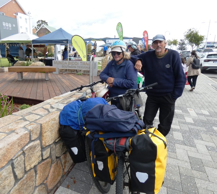
Photo shows us at the southern terminus of the Munda Biddi cycle trail near the Visitor's Centre on the main street in the Albany CBD. The northern terminus is near the village of Mundaring, nearly 1,000 km away in the Perth Hills.
We are in the city of Albany, snug and warm in what the hotel calls a "shoebox room". We have completed the cycle trip from Perth, about 620 km in total and will soon bus it back to retrieve Matilda, the Merc. and then drive northwards to see old Darwin friends, Judy and Miles in Geraldton, and as far north as the Coral Coast at Ningaloo before retracing our steps back to the Gold Coast.
Our bike trip wasn't one of the longest we have ever done, but nonetheless satisfying and interesting. We rode straight out of Baldivis and headed to the coast south of Perth. By using the map and keeping an eye out we were able to keep to cycle paths and quiet roads for the most part as we headed down through busy Mandurah, then Bunbury, Busselton, Dunsborough, Margaret River and Augusta. The coastal ride was at first quite flat and wild flowers were everywhere, multicoloured daisies and orchids most conspicuous amongst hundreds of species we couldn't recognise.
The coast to the west of the small touristy town of Margaret River is the location for the 6 day Cape to Cape hike. We didn't have time for this as well as the Perth to Albany ride, but we did get to see both capes, poking out as they do, west and south towards the Southern Ocean. The sea was curiously calm and we were able to spot 5 humpback whales passing Cape Naturaliste as they made their way south towards Antarctica.
From Augusta, we headed east to the little town of Pemberton, surrounded by tall karri forest, unique to South West Australia, and followed the Munda Biddi cycle trail, or close to it, all the way to Albany on the south coast through a lot of forest, a lot of hills and the small villages of Northcliff, Walpole and Denmark.
Albany is West Australia's oldest town and the site of the first colonial capital in the west, but soon lost out to Fremantle and nearby Perth on the Swan River. It has a magnificent harbour in Princess Royal and the scenery to the west and east is spectacular, but we found the spring climate down here wet and cold and it wasn't often we saw sight of the sun. Alison caught up with her old Tavistock school chum here, Clodagh, who we last saw in Sydney in 1979(!). Clodagh was born in Australia, but her parents moved to Devon when she was young. She moved back to Oz when she could leave school and has brought up 5 kids, ran a professional photographic business and skippered her own racing yacht in the wild seas off the SW coast.
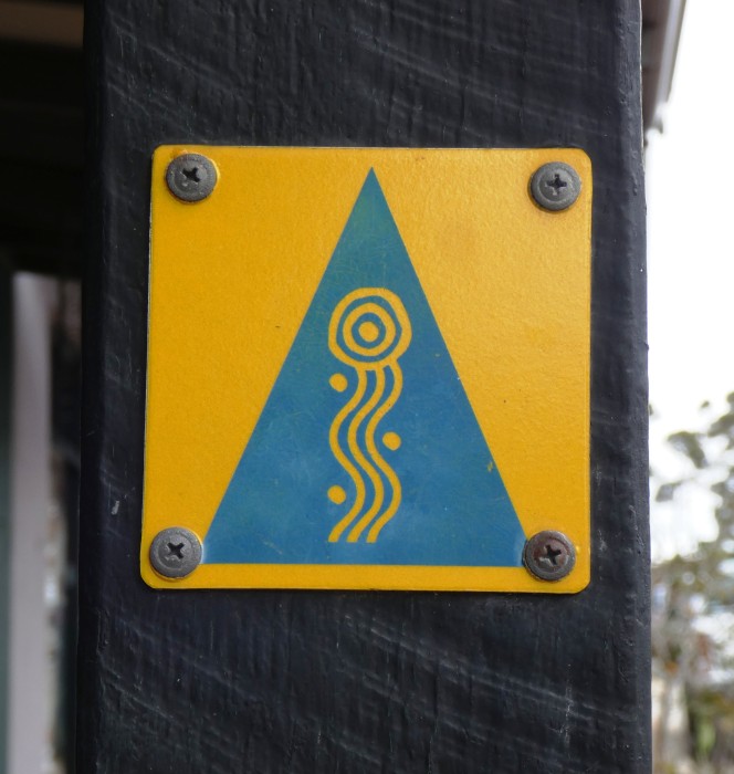
Munda Biddi trail marker
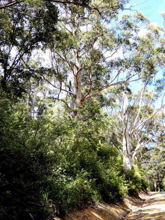
Through the karri forest
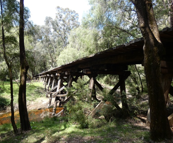
River Road bridge
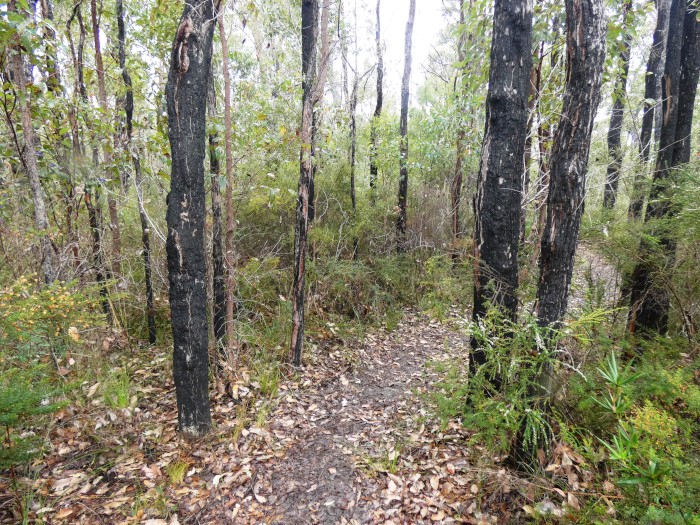
The Munda Biddi trail snaking through the forest
Karri forest between Pemberton and Northcliff
Munda Biddi trail sign
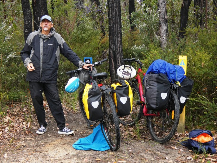
Sheltering from the rain
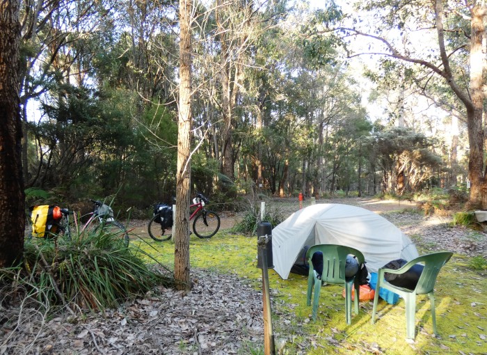
Northcliff campsite
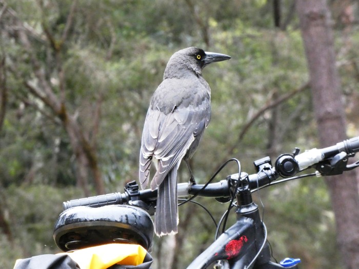
Cheeky grey currawong
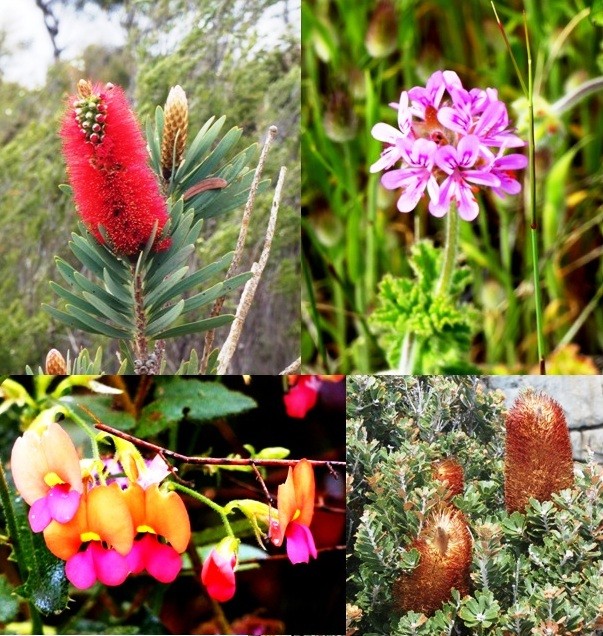
Wildflowers along the trail
Trail junction
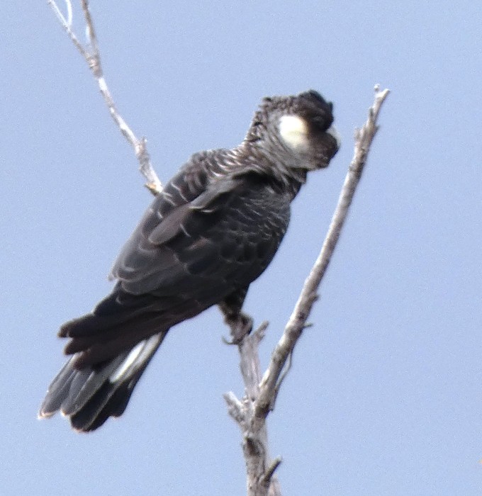
Carnaby’s black cockatoo
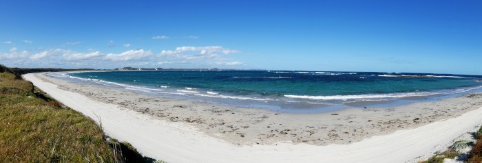
Peaceful Bay
Leafy sea dragon silo art on the Albany foreshore
We are in the city of Albany, snug and warm in what the hotel calls a "shoebox room". We have completed the cycle trip from Perth, about 620 km in total and will soon bus it back to retrieve Matilda, the Merc. and then drive northwards to see old Darwin friends, Judy and Miles in Geraldton, and as far north as the Coral Coast at Ningaloo before retracing our steps back to the Gold Coast.
Our bike trip wasn't one of the longest we have ever done, but nonetheless satisfying and interesting. We rode straight out of Baldivis and headed to the coast south of Perth. By using the map and keeping an eye out we were able to keep to cycle paths and quiet roads for the most part as we headed down through busy Mandurah, then Bunbury, Busselton, Dunsborough, Margaret River and Augusta. The coastal ride was at first quite flat and wild flowers were everywhere, multicoloured daisies and orchids most conspicuous amongst hundreds of species we couldn't recognise.
The coast to the west of the small touristy town of Margaret River is the location for the 6 day Cape to Cape hike. We didn't have time for this as well as the Perth to Albany ride, but we did get to see both capes, poking out as they do, west and south towards the Southern Ocean. The sea was curiously calm and we were able to spot 5 humpback whales passing Cape Naturaliste as they made their way south towards Antarctica.
From Augusta, we headed east to the little town of Pemberton, surrounded by tall karri forest, unique to South West Australia, and followed the Munda Biddi cycle trail, or close to it, all the way to Albany on the south coast through a lot of forest, a lot of hills and the small villages of Northcliff, Walpole and Denmark.
Albany is West Australia's oldest town and the site of the first colonial capital in the west, but soon lost out to Fremantle and nearby Perth on the Swan River. It has a magnificent harbour in Princess Royal and the scenery to the west and east is spectacular, but we found the spring climate down here wet and cold and it wasn't often we saw sight of the sun. Alison caught up with her old Tavistock school chum here, Clodagh, who we last saw in Sydney in 1979(!). Clodagh was born in Australia, but her parents moved to Devon when she was young. She moved back to Oz when she could leave school and has brought up 5 kids, ran a professional photographic business and skippered her own racing yacht in the wild seas off the SW coast.
Munda Biddi trail marker
Through the karri forest
River Road bridge
The Munda Biddi trail snaking through the forest
Karri forest between Pemberton and Northcliff
Munda Biddi trail sign
Sheltering from the rain
Northcliff campsite
Cheeky grey currawong
Wildflowers along the trail
Trail junction
Carnaby’s black cockatoo
Peaceful Bay
Leafy sea dragon silo art on the Albany foreshore
Westward Ho! The Long Haul to W.A.
14 October 2022 | Augusta, WA, Australia
Alison and Geoff Williams | Cold, damp and grey!
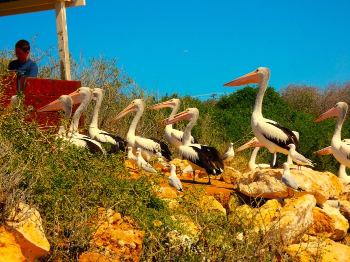
Photo above shows pelicans lining up for a free feed from returning fishermen at the Elliston, SA, boat ramp.
We are as far south west as you can go in this huge continent before an ocean swim to South Africa or the Antarctic. We are camped in the small village of Augusta, near Cape Leeuwin, one of the two big capes (the other is Cape Naturaliste) that a boat must pass if it is to proceed from the west coast of Australia to the South coast or vice versa. We are not in Sundari, of course, but on bikes as part of our cycle trip from Perth to Albany via the south west coast and the Munda Biddi bike trail, which we start in Pemberton 110 km east of here. It is about 400 km along the trail between Pemberton and Albany, about 10 days cycling for us as long as nothing gets broken!
According to Google Maps we are 4,500 km from Brisbane and it certainly seems a long way. Taking advantage of a slight drop in the price of petrol we took off about 5 weeks ago, driving through southern Queensland, across NSW and SA, then across the vast treelessness of the Nullarbor Plain and finally into WA's wheat and gold mining belt between Kalgoorlie and the Perth Hills. Neither of us has visited WA since Geoff's 1975 (!) hitchhiking trip from Sydney to Perth on route from NZ to England.
Wherever we go it seems that there is always an ex yachtie that we know from years ago. Jen and Nick, ex Devon Gypsy, have lived near Rockingham, just south of Perth for many years. We met them on the 2008 Sail Indonesia Rally and subsequently in Rebak Marina, Malaysia. They have run their sprawling mansion as a B and B for the last few years, but with Jen's Mum now needing care, the B and B side of things has been put on hold. We stayed with them for a few days while planning our cycling trip, and also saw Jean and Alan, ex Tuatara, who dropped in after their shorter section of the Munda Biddi Trail.
Jean and Alan's home is in Hamilton, NZ, and this was their first overseas adventure since the start of the pandemic.
After completing the Albany section of the trail, we will rejoin Matilda, left at Jen and Nick's and drive up north first to Geraldton, where old friends Judy and Miles are still living on a yacht in the harbour, then possibly (dependent on how the fuel price creeps up) as far as Ningaloo Reef near Exmouth.
We have our kayaks with us (on Matilda) and hope to do some kayaking before making the long trek back to the Gold Coast where Sundari is berthed.
The weather down here has been cold and damp, more like an early spring in New Zealand. Hopefully, as the days go by it should warm up, although the forecast doesn't show much improvement for the next week. The arrival of La Nina number three back in the eastern states has been catastrophic, with Victoria, Tasmania and NSW being hardest hit by flooding, so we are probably better off on this side of the continent!
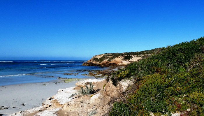
Sheringa Beach, SA
Silo art, SA
Southern right whale statue, small SA town. Southern rights migrate to the head of the Bight each winter to mate and give birth. We passed the Bight towards the end of the whale season and didn't see any, but did spot 5 returning humpbacks passing Cape Naturaliste in WA just a couple of days ago.
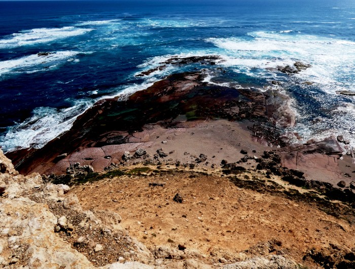
Point Labatt sea lion colony, SA. It's the largest breeding colony of sea lions on the Australian mainland.
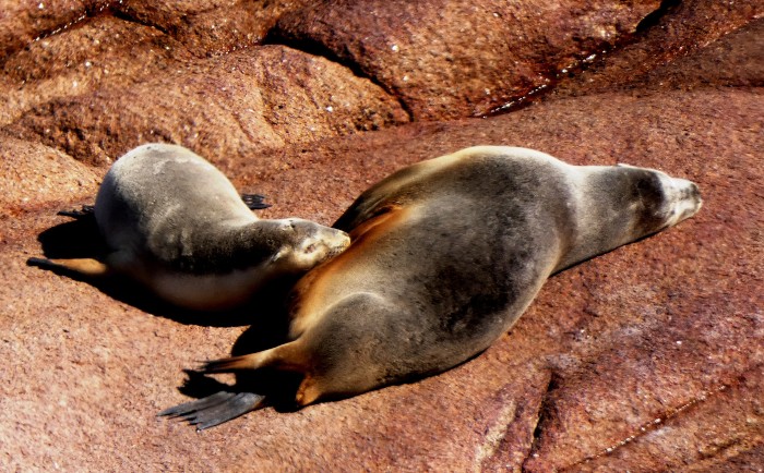
Australian sea lions, Point Labatt breeding colony, SA.
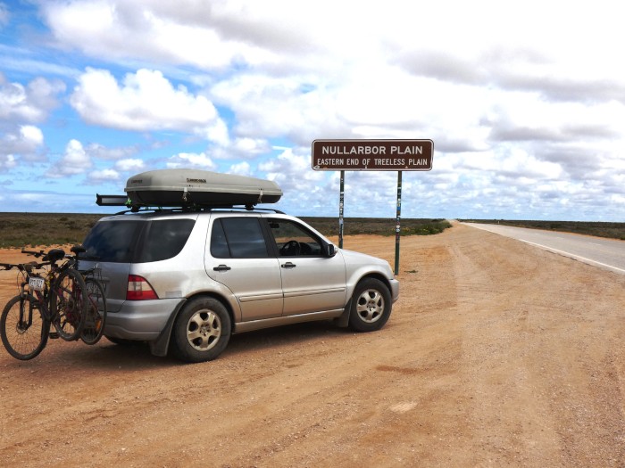
Approaching the Nullarbor from the SA side.
Nullarbor shed
Warning sign - camels, roos, wombats. We didn't see any mammals at all across the Nullarbor.
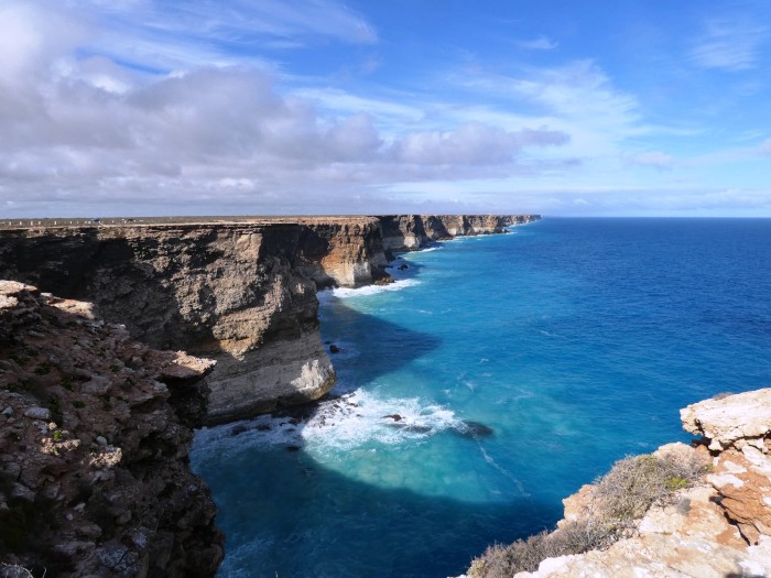
Great Australian Bight cliffs, Nullarbor coast
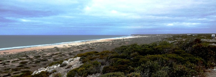
Nullarbor coast looking west
Kalgoorlie gold mine
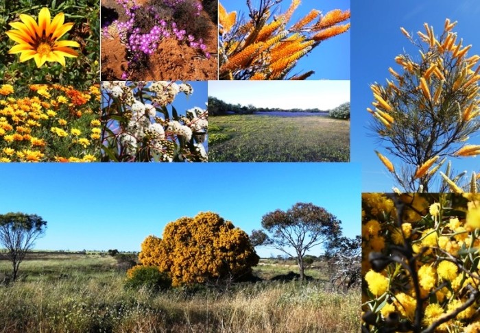
Small selection of spring wildflowers in SA and WA. The wildflowers were at their best when we arrived. Dazzling daisies, orchids as well as flowering shrubs and trees, especially Grevilleas, Banksias, gums, paperbarks and wattles.
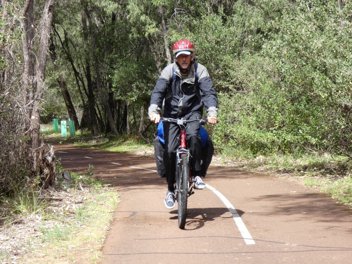
Off on the bike trip!
We are as far south west as you can go in this huge continent before an ocean swim to South Africa or the Antarctic. We are camped in the small village of Augusta, near Cape Leeuwin, one of the two big capes (the other is Cape Naturaliste) that a boat must pass if it is to proceed from the west coast of Australia to the South coast or vice versa. We are not in Sundari, of course, but on bikes as part of our cycle trip from Perth to Albany via the south west coast and the Munda Biddi bike trail, which we start in Pemberton 110 km east of here. It is about 400 km along the trail between Pemberton and Albany, about 10 days cycling for us as long as nothing gets broken!
According to Google Maps we are 4,500 km from Brisbane and it certainly seems a long way. Taking advantage of a slight drop in the price of petrol we took off about 5 weeks ago, driving through southern Queensland, across NSW and SA, then across the vast treelessness of the Nullarbor Plain and finally into WA's wheat and gold mining belt between Kalgoorlie and the Perth Hills. Neither of us has visited WA since Geoff's 1975 (!) hitchhiking trip from Sydney to Perth on route from NZ to England.
Wherever we go it seems that there is always an ex yachtie that we know from years ago. Jen and Nick, ex Devon Gypsy, have lived near Rockingham, just south of Perth for many years. We met them on the 2008 Sail Indonesia Rally and subsequently in Rebak Marina, Malaysia. They have run their sprawling mansion as a B and B for the last few years, but with Jen's Mum now needing care, the B and B side of things has been put on hold. We stayed with them for a few days while planning our cycling trip, and also saw Jean and Alan, ex Tuatara, who dropped in after their shorter section of the Munda Biddi Trail.
Jean and Alan's home is in Hamilton, NZ, and this was their first overseas adventure since the start of the pandemic.
After completing the Albany section of the trail, we will rejoin Matilda, left at Jen and Nick's and drive up north first to Geraldton, where old friends Judy and Miles are still living on a yacht in the harbour, then possibly (dependent on how the fuel price creeps up) as far as Ningaloo Reef near Exmouth.
We have our kayaks with us (on Matilda) and hope to do some kayaking before making the long trek back to the Gold Coast where Sundari is berthed.
The weather down here has been cold and damp, more like an early spring in New Zealand. Hopefully, as the days go by it should warm up, although the forecast doesn't show much improvement for the next week. The arrival of La Nina number three back in the eastern states has been catastrophic, with Victoria, Tasmania and NSW being hardest hit by flooding, so we are probably better off on this side of the continent!
Sheringa Beach, SA
Silo art, SA
Southern right whale statue, small SA town. Southern rights migrate to the head of the Bight each winter to mate and give birth. We passed the Bight towards the end of the whale season and didn't see any, but did spot 5 returning humpbacks passing Cape Naturaliste in WA just a couple of days ago.
Point Labatt sea lion colony, SA. It's the largest breeding colony of sea lions on the Australian mainland.
Australian sea lions, Point Labatt breeding colony, SA.
Approaching the Nullarbor from the SA side.
Nullarbor shed
Warning sign - camels, roos, wombats. We didn't see any mammals at all across the Nullarbor.
Great Australian Bight cliffs, Nullarbor coast
Nullarbor coast looking west
Kalgoorlie gold mine
Small selection of spring wildflowers in SA and WA. The wildflowers were at their best when we arrived. Dazzling daisies, orchids as well as flowering shrubs and trees, especially Grevilleas, Banksias, gums, paperbarks and wattles.
Off on the bike trip!
On the Wild Side…… in the South Moreton Bay Islands
15 August 2022 | Karragarra Passage, Southern Moreton Bay, Queensland, Australia
Alison and Geoff Williams | Cool nights, sunny days
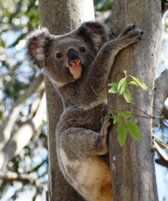
Photo above shows a young male koala at Coombabah on the Gold Coast near Helensvale, one of five healthy koalas we came across on a recent visit to this remnant, protected patch of bush.
We are on our mooring in the Karragarra passage in the SMBI (South Moreton Bay Islands), nearer Karragarra Island on our South side than to Lamb Island to the North, where we have our slice of land. We have been hanging around while planning our next long trip to Western Australia next month.
The mooring location is quite comfortable as it is not exposed to the open sea and the longest fetch is less than a mile to the direct east or west. We have had a few nasty days, when the wind has piped up or it has drizzled, but mostly the days have been pleasant with warm, sunny days after cool nights and mornings.
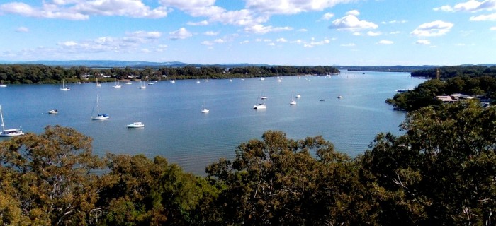
The Karragarra Passage looking westwards from above Rosie and Mike's place on Lamb Island. Karragarra island is across the passage. Tambourine Mountain, in the Gold Coast hinterland, is in the distance at the far left.
Because we are physically closer to Karragarra, the smallest of the SMBI islands, we awake to the discordant morning symphony of thousands of island birds, with kookaburras normally the first to wake us up. When the nights are still, we can hear the weird wail of the bush curlews and the call of the boobook (NZ: morepork) owl, coming from the western end of the island.
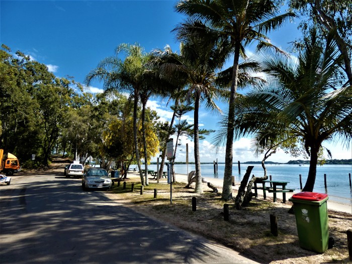
Karragarra's beach near the BBQs and ferry landing.
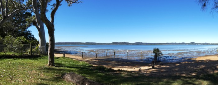
Lamb's only beach has a picnic spot and a view across the sand banks to Minjerribah/ North Stradbroke.
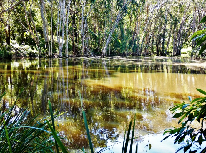
The old dam on Lamb Island, close to where our shed is located, is overflowing after two seasons of more than average rain. It has attracted a breeding colony of sacred ibises, several maned ducks, shags and an egret or two.
Karragarra is probably the nicest of the four closely knit SMBI islands as it has a public reserve along the entire northern coast, closest to us, as well as fewer inhabitants and car traffic on its few roads.
Karragarra and Macleay Islands both have user friendly beaches, but Lamb and Russell's beaches are more mangrovy and muddy. Lamb Island is also home to many birds and we have a butcher bird and a family of bush curlews who have taken up residence on our plot. The most common birds here are noisy friar birds, corellas, sulphur crested cockatoos, galahs, rainbow lorikeets, butcher birds, magpies, magpie larks, brown and blue faced honey eaters, drongos, kookaburras, sacred ibises, lapwing plovers, egrets and herons, ducks, whistling and Brahminy kites, and white breasted sea eagles.
Swallows are everywhere swooping around and trying unsuccessfuly to make a nest in Sundari's boom bag. Pelicans, shags and terns fly in to the passage when the tinnies are out catching prawns at either end of the passage. The occasional pod of dolphins, a dugong or turtle, pass by Sundari, but normally avoid this passage because of the ferry traffic.
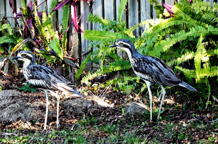
Two bush stone curlews who have taken to hang around our plot on Lamb Island.
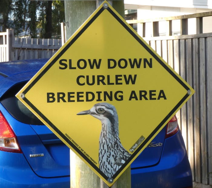
Signs try and slow down the islands' motorists as the mostly nocturnal bush curlews are sleepy in the day time.
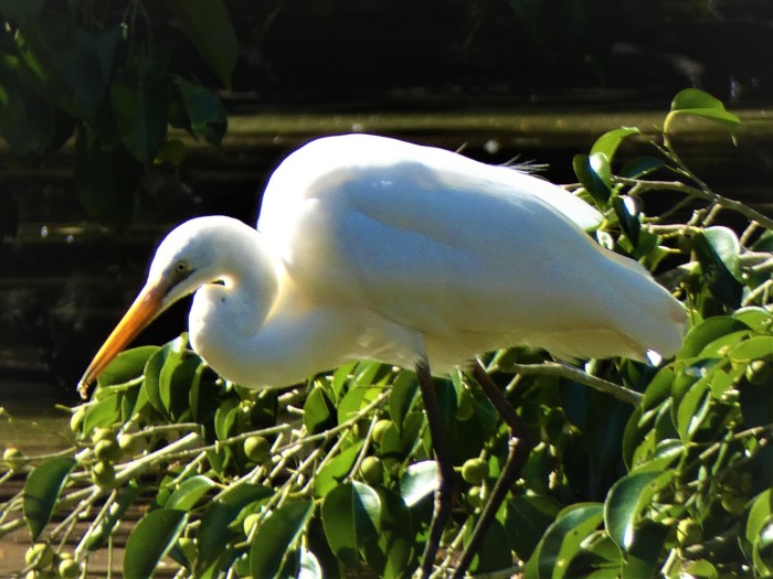
An intermediate egret at Lamb Island's dam. This species seems to be the most common of SMBI's herons.
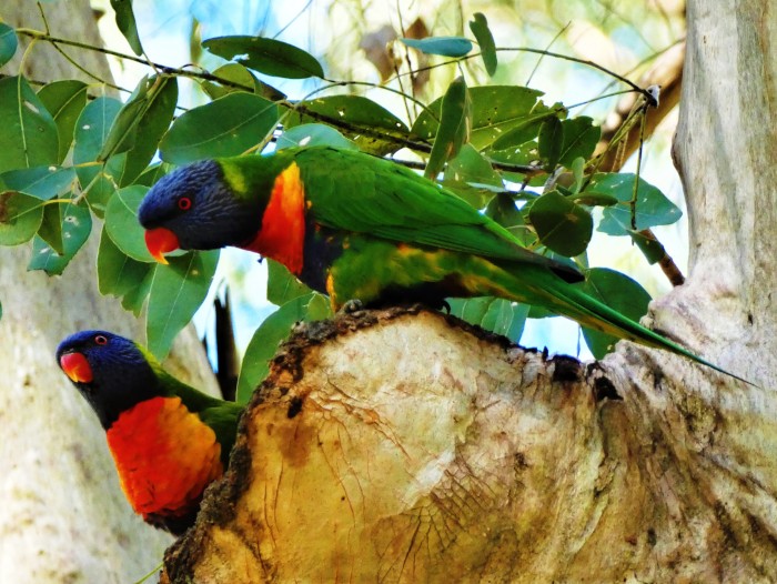
A pair of rainbow lorikeets setting up their nest in a hole in a paperbark tree on Lamb Island.
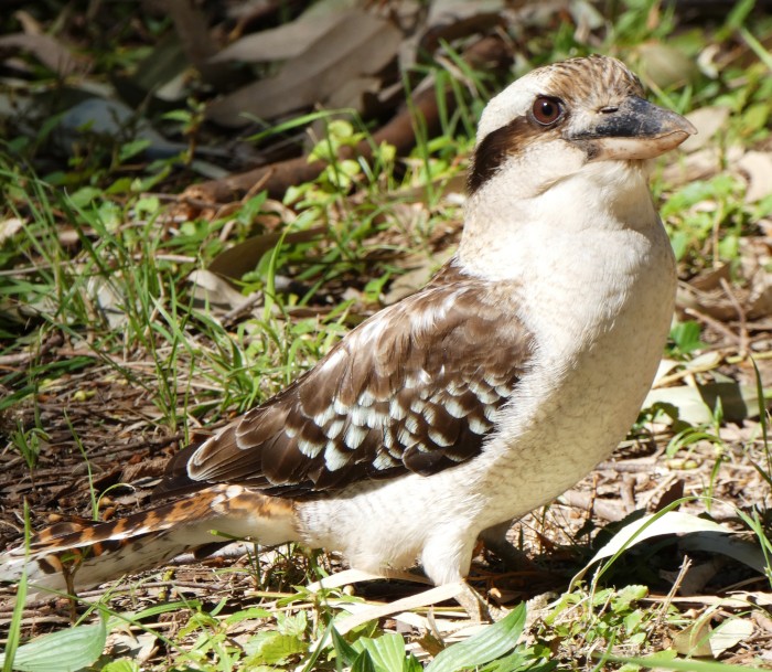
As regular as clockwork, kookaburras, like this one on Karragarra, wake us up in the early morning.
Since we have been back on our mooring we have been to and fro from the "Boat Shed" carrying stuff and erecting a water catching system comprised of a gutter and water tank. This is so we don't have to rely on mains water, which we can't get until we submit house building plans. We also have a flourishing compost bin going to help nourish the fruit trees we will plant when we get back from our adventures in WA.
Redlands is koala territory, or perhaps more correctly, was koala territory. It had the right mix of favourite gum trees that koalas like and even just twenty years ago was probably home to tens of thousands of wild koalas.
Koalas are now listed as endangered in both Queensland and NSW for different reasons. In NSW, the bushfires and land clearance (aka deforestation) has killed many thousands of koalas and destroyed significant amounts of habitat. In Queensland, it is the scale of urban development, especially around greater Brisbane, that has decimated koala numbers. Many fragments of suitable habitat remain protected, but young koalas by necessity must move out of the place they were born in because of territorial prerogatives.
The bush fragments are crisscrossed by major roads with increasing levels of traffic. All the koala signs in the world cannot protect wandering young koalas from being killed as they cross these rivers of death. We have explored many of Redlands' bush fragments in vain, but at last struck the jackpot when we returned to the Coombabah wetlands in the Gold Coast not far from Helensvale. We came across five koalas in quick succession on a lovely, sunny, but cool late winter weekend. They all seemed healthy and responsive and it was nice to see the pleasure that the weekend walkers had when seeing them, for some the first time.
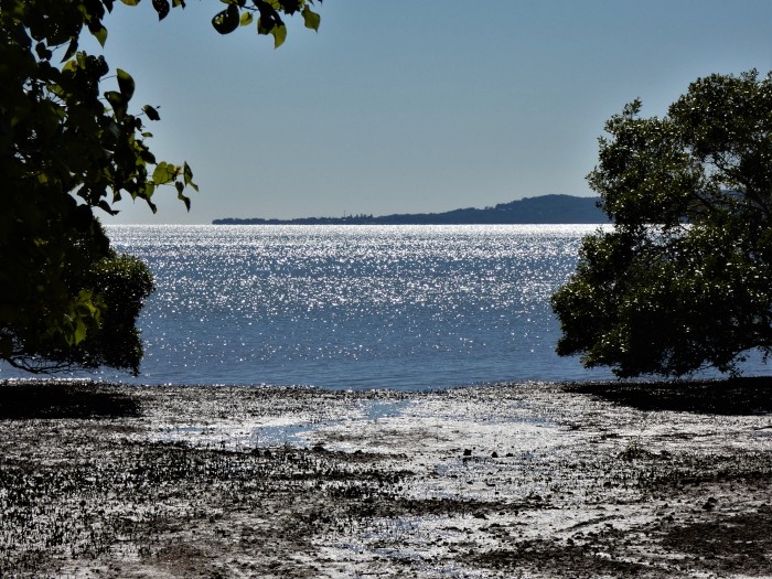
The little village of Dunwich on Minjerribah, here seen from Lamb Island's northern shore. North Stradbroke / Minjerribah has a thriving koala population, distinct from the Redlands mainland. No-one seems to be sure how they got on to this huge sand island, but they may represent a significantly important refuge as the mainland koala population dwindles.
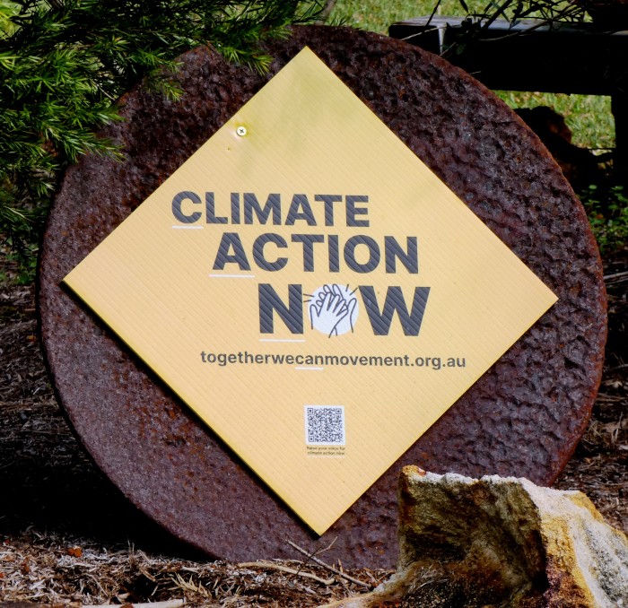
These calls to action on climate change have popped up on the SMBI islands recently. It's not exactly a very progressive population here, but the fact that the signs haven't been vandalised or torn down suggests a new era. Climate change has certainly not just affceted many of Australia's unique creatures but increasing numbers of its citizens, too.
We are on our mooring in the Karragarra passage in the SMBI (South Moreton Bay Islands), nearer Karragarra Island on our South side than to Lamb Island to the North, where we have our slice of land. We have been hanging around while planning our next long trip to Western Australia next month.
The mooring location is quite comfortable as it is not exposed to the open sea and the longest fetch is less than a mile to the direct east or west. We have had a few nasty days, when the wind has piped up or it has drizzled, but mostly the days have been pleasant with warm, sunny days after cool nights and mornings.
The Karragarra Passage looking westwards from above Rosie and Mike's place on Lamb Island. Karragarra island is across the passage. Tambourine Mountain, in the Gold Coast hinterland, is in the distance at the far left.
Because we are physically closer to Karragarra, the smallest of the SMBI islands, we awake to the discordant morning symphony of thousands of island birds, with kookaburras normally the first to wake us up. When the nights are still, we can hear the weird wail of the bush curlews and the call of the boobook (NZ: morepork) owl, coming from the western end of the island.
Karragarra's beach near the BBQs and ferry landing.
Lamb's only beach has a picnic spot and a view across the sand banks to Minjerribah/ North Stradbroke.
The old dam on Lamb Island, close to where our shed is located, is overflowing after two seasons of more than average rain. It has attracted a breeding colony of sacred ibises, several maned ducks, shags and an egret or two.
Karragarra is probably the nicest of the four closely knit SMBI islands as it has a public reserve along the entire northern coast, closest to us, as well as fewer inhabitants and car traffic on its few roads.
Karragarra and Macleay Islands both have user friendly beaches, but Lamb and Russell's beaches are more mangrovy and muddy. Lamb Island is also home to many birds and we have a butcher bird and a family of bush curlews who have taken up residence on our plot. The most common birds here are noisy friar birds, corellas, sulphur crested cockatoos, galahs, rainbow lorikeets, butcher birds, magpies, magpie larks, brown and blue faced honey eaters, drongos, kookaburras, sacred ibises, lapwing plovers, egrets and herons, ducks, whistling and Brahminy kites, and white breasted sea eagles.
Swallows are everywhere swooping around and trying unsuccessfuly to make a nest in Sundari's boom bag. Pelicans, shags and terns fly in to the passage when the tinnies are out catching prawns at either end of the passage. The occasional pod of dolphins, a dugong or turtle, pass by Sundari, but normally avoid this passage because of the ferry traffic.
Two bush stone curlews who have taken to hang around our plot on Lamb Island.
Signs try and slow down the islands' motorists as the mostly nocturnal bush curlews are sleepy in the day time.
An intermediate egret at Lamb Island's dam. This species seems to be the most common of SMBI's herons.
A pair of rainbow lorikeets setting up their nest in a hole in a paperbark tree on Lamb Island.
As regular as clockwork, kookaburras, like this one on Karragarra, wake us up in the early morning.
Since we have been back on our mooring we have been to and fro from the "Boat Shed" carrying stuff and erecting a water catching system comprised of a gutter and water tank. This is so we don't have to rely on mains water, which we can't get until we submit house building plans. We also have a flourishing compost bin going to help nourish the fruit trees we will plant when we get back from our adventures in WA.
Redlands is koala territory, or perhaps more correctly, was koala territory. It had the right mix of favourite gum trees that koalas like and even just twenty years ago was probably home to tens of thousands of wild koalas.
Koalas are now listed as endangered in both Queensland and NSW for different reasons. In NSW, the bushfires and land clearance (aka deforestation) has killed many thousands of koalas and destroyed significant amounts of habitat. In Queensland, it is the scale of urban development, especially around greater Brisbane, that has decimated koala numbers. Many fragments of suitable habitat remain protected, but young koalas by necessity must move out of the place they were born in because of territorial prerogatives.
The bush fragments are crisscrossed by major roads with increasing levels of traffic. All the koala signs in the world cannot protect wandering young koalas from being killed as they cross these rivers of death. We have explored many of Redlands' bush fragments in vain, but at last struck the jackpot when we returned to the Coombabah wetlands in the Gold Coast not far from Helensvale. We came across five koalas in quick succession on a lovely, sunny, but cool late winter weekend. They all seemed healthy and responsive and it was nice to see the pleasure that the weekend walkers had when seeing them, for some the first time.
The little village of Dunwich on Minjerribah, here seen from Lamb Island's northern shore. North Stradbroke / Minjerribah has a thriving koala population, distinct from the Redlands mainland. No-one seems to be sure how they got on to this huge sand island, but they may represent a significantly important refuge as the mainland koala population dwindles.
These calls to action on climate change have popped up on the SMBI islands recently. It's not exactly a very progressive population here, but the fact that the signs haven't been vandalised or torn down suggests a new era. Climate change has certainly not just affceted many of Australia's unique creatures but increasing numbers of its citizens, too.
The Mysterious Case of the Waltzing Matilda
14 July 2022 | Raby Bay, off Moreton Bay, Queensland
Alison and Geoff Williams | Cold south westerlies with clear skies
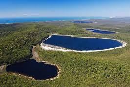
Photo shows an aerial view of Lakes Jennings through to Boomanjin in the central southern part of Fraser Island / K'gari. (not our photo!)
We are back on Sundari and preparing to leave Raby Bay, probably initially at least to swing on our own mooring while we plan our next adventure. We have returned from a whistlestop trip to Bundy to get our rusting anchor galvanised and spend 6 days walking around the Southern Lakes of K'gari / Fraser Island. More about this hike a little later, but we will now address the title of this blog: the mysterious disappearance and reappearance of our gas guzzling camper car, the venerable "Matilda".
We had left Matilda parked just up from the Fraser barge ramp, assuming that was a safe place to leave it. Or not! On our return 6 days later, we were flummoxed to find that Matilda had vanished! Bummer! Had Matilda waltzed away all on its own, or was it due to foul play? Fortunately, especially because Riverheads, the suburb at the mouth of the Mary River where the ferry to Fraser is located, has no public transport link to anywhere else, we have friends in the form of Brian and Jill, ex SV Destiny and SV Maxed Out, who have swallowed the anchor(s) and are residents of the nearby sprawling suburban metropolis of Hervey Bay. Brian picked us up and we were told to stay in their town house as long as we needed to sort ourselves out. Matilda not only was our home away from home in the form of a comfortable bed, and all basic camping stuff, but our computers and a newly galvanised anchor, too, meaning we were facing a substantial loss in uninsured assets.
A trip to the local plods to make a stolen car report was followed by a post on the local community Facebook site. Courtesy of other yachties stranded up in Cairns we had use of their little car, nicknamed "Button". Within a half an hour, a guy called Tony messaged us to say that he had spotted Matilda lounging around near his home. Yay! Things got a little weird when we met up with Tony in an affluent part of Hervey Bay. Matilda had been stripped of just about everything inside, but Tony said he had met up with a woman who had claimed to have bought the car for $800. When she was told that the car was stolen property, she had promptly disappeared. The cops turned up and for once seemed quite human. The car was even subject to fingerprint and DNA forensic analysis. We at least had our wheels back - running around Australia is unfortunately pretty difficult without a car.
Thanks to Brian and Jill for all their help as well as the very sympathetic community on the Facebook site who deluged the thread with helpful comments and support.
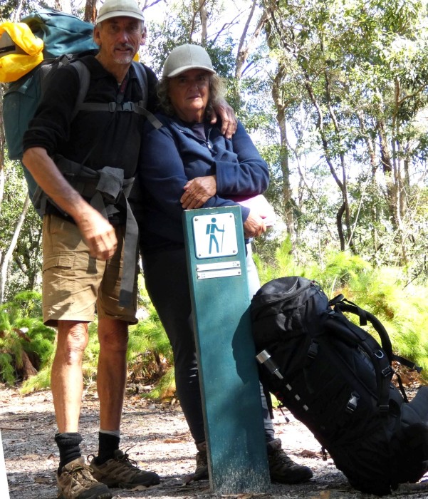
Backpacks on again for our 60 km version of the Fraser Island Great Walk
Now for the hike around the Southern dune lakes of K'gari. This is a walk which is hard to do from the boat as leaving it anchored in the Sandy Strait is always a worrying prospect. We have hiked it up to Lake McKenzie a couple of times before, but have always returned the same day.
K'gari has around 40 of these unique perched lakes, isolated freshwater lakes formed by depressions in the sandy floor of the island which have filled up with rainwater. They are all quite stunning, with shallow, clear water surrounded by blindingly white silica sand beaches. The walking tracks link up the lakes and the forest on K'gari, which alternates from wallum heath to Eucalyptus woodland and pockets of rainforest, all rather amazing considering that all this growth takes place on the sandy soil built up by sediment driven north in ocean currents from New South Wales.
We walked to and around 6 of these 40 lakes - Boorangoora (McKenzie), Basin, Jennings, Birrabeen, Benaroon and Boomanjin. Boomanjin was the largest of Fraser's lakes and the largest perched dune lake in the world, while Basin Lake was the smallest we visited.
We did the walk after 3 days of rain and the nights were long and cold in the tent, but the days warm with lovely clear blue skies. We still haven't had the time to see Fraser's wild east coast and the Valley of the Giants - where some of the huge forest giants missed by the early loggers still stand. Maybe another year!
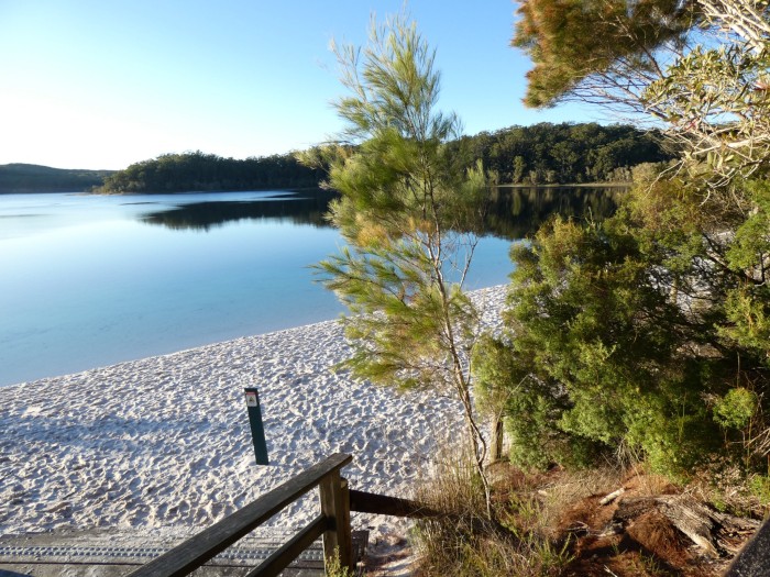
Lake McKenzie - the most commonly visited of the 40 dune lakes on Fraser/K'gari.
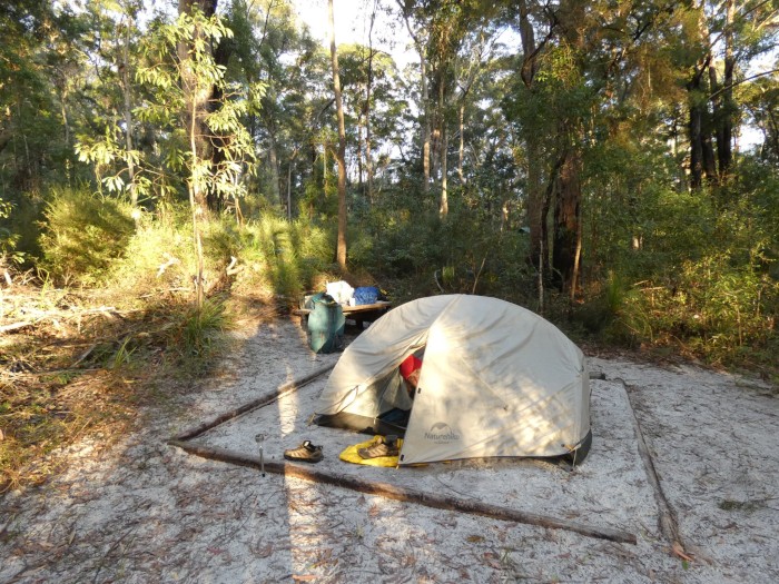
Campsite at Lake Benaroon
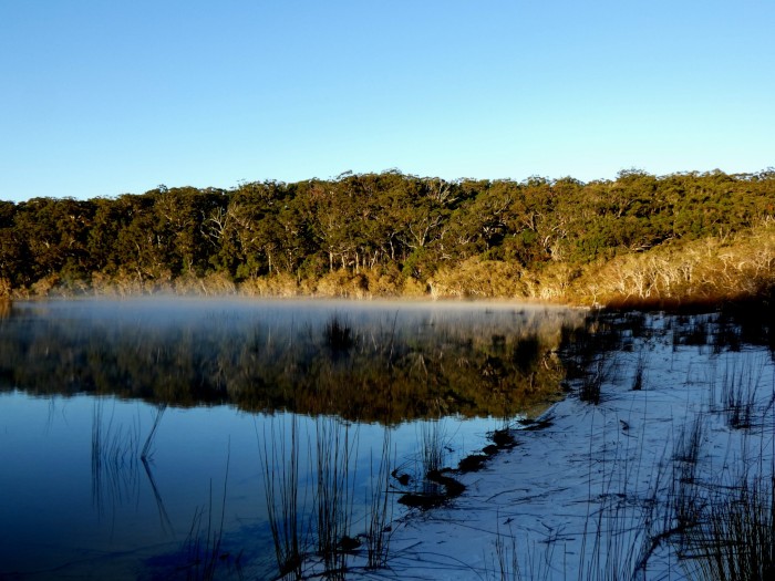
Misty morning at Lake Benaroon
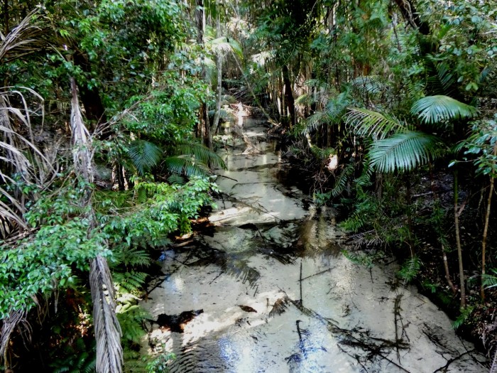
Wanggoolba Creek crossing at Central Station. The white colour is the sand beneath the crystal clear, but shallow creek
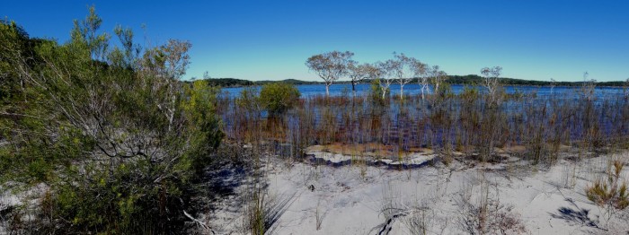
Lake Boomanjin - the world's largest perched dune lake.
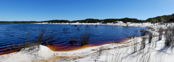
Lake Boomanjin again - note the white silica beaches.
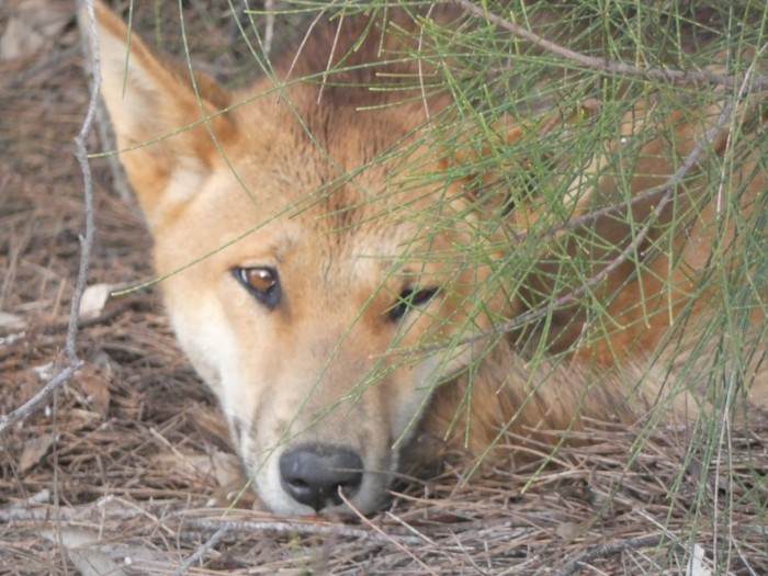
Sleepy dingo at the Wanggoolba ferry terminal.
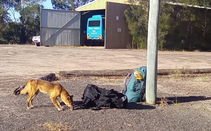
The same dingo decided to inspect our packs while waiting for the ferry.
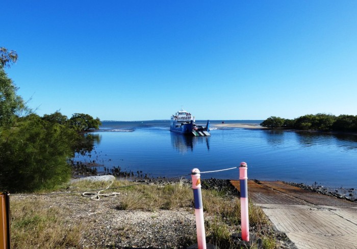
The ferry arriving at Wanggoolba Creek before the discovery of the missing Matilda.
With much of the Southern hemisphere in winter, the nasty virus has managed to cling on, mutate and make a come back, leaving health officals and politicians scratching their heads as to what to do. We are avoiding crowded places, wear masks when we can't and have had our second booster, but many of our friends or friends or relatives of friends have already had Covid. As some health experts have been saying, ignoring the disease doesn't actually make it go away, but we wish it would!
We are back on Sundari and preparing to leave Raby Bay, probably initially at least to swing on our own mooring while we plan our next adventure. We have returned from a whistlestop trip to Bundy to get our rusting anchor galvanised and spend 6 days walking around the Southern Lakes of K'gari / Fraser Island. More about this hike a little later, but we will now address the title of this blog: the mysterious disappearance and reappearance of our gas guzzling camper car, the venerable "Matilda".
We had left Matilda parked just up from the Fraser barge ramp, assuming that was a safe place to leave it. Or not! On our return 6 days later, we were flummoxed to find that Matilda had vanished! Bummer! Had Matilda waltzed away all on its own, or was it due to foul play? Fortunately, especially because Riverheads, the suburb at the mouth of the Mary River where the ferry to Fraser is located, has no public transport link to anywhere else, we have friends in the form of Brian and Jill, ex SV Destiny and SV Maxed Out, who have swallowed the anchor(s) and are residents of the nearby sprawling suburban metropolis of Hervey Bay. Brian picked us up and we were told to stay in their town house as long as we needed to sort ourselves out. Matilda not only was our home away from home in the form of a comfortable bed, and all basic camping stuff, but our computers and a newly galvanised anchor, too, meaning we were facing a substantial loss in uninsured assets.
A trip to the local plods to make a stolen car report was followed by a post on the local community Facebook site. Courtesy of other yachties stranded up in Cairns we had use of their little car, nicknamed "Button". Within a half an hour, a guy called Tony messaged us to say that he had spotted Matilda lounging around near his home. Yay! Things got a little weird when we met up with Tony in an affluent part of Hervey Bay. Matilda had been stripped of just about everything inside, but Tony said he had met up with a woman who had claimed to have bought the car for $800. When she was told that the car was stolen property, she had promptly disappeared. The cops turned up and for once seemed quite human. The car was even subject to fingerprint and DNA forensic analysis. We at least had our wheels back - running around Australia is unfortunately pretty difficult without a car.
Thanks to Brian and Jill for all their help as well as the very sympathetic community on the Facebook site who deluged the thread with helpful comments and support.
Backpacks on again for our 60 km version of the Fraser Island Great Walk
Now for the hike around the Southern dune lakes of K'gari. This is a walk which is hard to do from the boat as leaving it anchored in the Sandy Strait is always a worrying prospect. We have hiked it up to Lake McKenzie a couple of times before, but have always returned the same day.
K'gari has around 40 of these unique perched lakes, isolated freshwater lakes formed by depressions in the sandy floor of the island which have filled up with rainwater. They are all quite stunning, with shallow, clear water surrounded by blindingly white silica sand beaches. The walking tracks link up the lakes and the forest on K'gari, which alternates from wallum heath to Eucalyptus woodland and pockets of rainforest, all rather amazing considering that all this growth takes place on the sandy soil built up by sediment driven north in ocean currents from New South Wales.
We walked to and around 6 of these 40 lakes - Boorangoora (McKenzie), Basin, Jennings, Birrabeen, Benaroon and Boomanjin. Boomanjin was the largest of Fraser's lakes and the largest perched dune lake in the world, while Basin Lake was the smallest we visited.
We did the walk after 3 days of rain and the nights were long and cold in the tent, but the days warm with lovely clear blue skies. We still haven't had the time to see Fraser's wild east coast and the Valley of the Giants - where some of the huge forest giants missed by the early loggers still stand. Maybe another year!
Lake McKenzie - the most commonly visited of the 40 dune lakes on Fraser/K'gari.
Campsite at Lake Benaroon
Misty morning at Lake Benaroon
Wanggoolba Creek crossing at Central Station. The white colour is the sand beneath the crystal clear, but shallow creek
Lake Boomanjin - the world's largest perched dune lake.
Lake Boomanjin again - note the white silica beaches.
Sleepy dingo at the Wanggoolba ferry terminal.
The same dingo decided to inspect our packs while waiting for the ferry.
The ferry arriving at Wanggoolba Creek before the discovery of the missing Matilda.
With much of the Southern hemisphere in winter, the nasty virus has managed to cling on, mutate and make a come back, leaving health officals and politicians scratching their heads as to what to do. We are avoiding crowded places, wear masks when we can't and have had our second booster, but many of our friends or friends or relatives of friends have already had Covid. As some health experts have been saying, ignoring the disease doesn't actually make it go away, but we wish it would!
From Rock Country to Croc Country
13 June 2022 | Camooweal, Far West Queensland
Alison and Geoff Williams | Cool mornings, sunny days
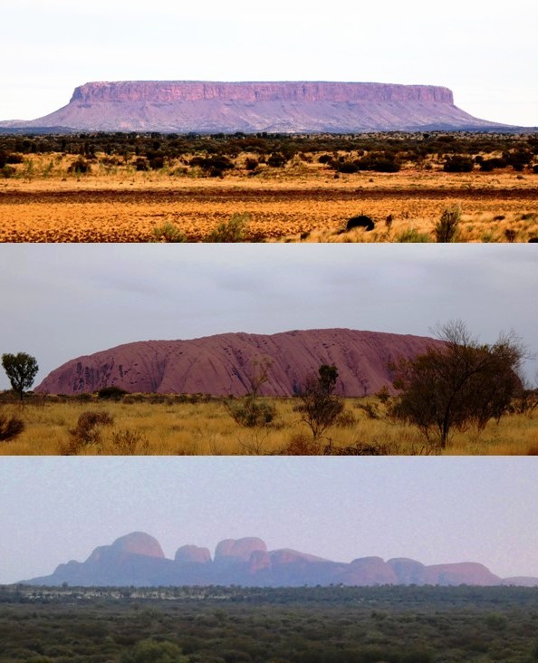
Rock country (photo above): Mount Conner on the way to Uluru (Ayer's Rock) and the Olgas (Kata Tjuta). Uluru and the Olgas are huge monoliths (rocks) but not the largest in Australia, which is Mount Augustus in WA. Still impressive.
We're back in Western Queensland on the way back to the boat after traversing the full length of the Northern Territory from Uluru / Kata Tjuta in the South to Darwin in the Top End. We squeezed in the long side trip to Uluru /Kata Tjuta after coming off the Larapinta Trail, then drove 1,000 km north to the thermal pools at Mataranka and into Nitmiluk / Katherine Gorge.
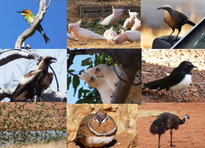
Birds seen between Alice and Katherine: by row, left to right:
Bee-eater, pink cockatoos, babbler,
Wedge-tailed eagle, corellas, willy wagtail,
Budgies, spinifex pigeon, emu.
The temperatures for the 6 day Jatbula Trail hike were decidedly unpromising, with maxima in the Gorge and nearby Katherine township forecast to be 36 to 37oC. No doubt it would have been a few more degrees higher on the exposed tableland where the first few days of the trail crosses, but we shouldered our backpacks once again, crossed the Gorge on the ferry and headed off for Edith Falls/ Leliyn where the trail ends and there is road access.
The trail was, like the Larapinta, unformed, and often only navigable because of the blue triangular trail markers, but it was not as strenuous as the Larapinta Trail in the West MacDonnells. The major challenge was the heat. By 10 a.m. it was already too hot to keep walking with a full backpack, but the trail was often so slow going that we didn't reach each day's campsite until after noon. Fortunately, every campsite was located close to delightful creeks, waterfalls, pools and cascades, so we spent the rest of the afternoon escaping the heat and the flies by swimming and sitting in the water! The last 2 days took us along the Edith River after descending from the Arnhem Land tableland - plenty of wildlife and..mosquitos, but there were lovely waterholes to cool off in all along the river, with some of the best left to the last just short of Leliyn.
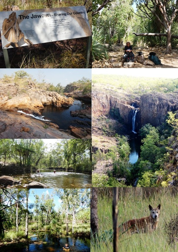
Jatbula Trail, pics from left to right by row:
Jawoyn Country, Alison at Sandy Camp,
Crystal Creek, 17 Mile waterfall,
Both of us cooling off in the first waterhole on the Edith River,
Alison in the Edith river downstream, dingo, one of a pack of 8 near Sweetwater Pool.
Back off the trail at Leliyn we drove the 300 km up to Darwin where we had spent nearly 3 years teaching back in the late 90s. Darwin has of course grown considerably, even since 2008 when we were last in the city on Saraoni, but we were amused to note that the Dinah Beach Yacht Club where we were based most of the time had not changed at all - it was still the same ramshackle boatyard and boats too decadent to ever survive in the water.
For the final fling through the Top End we swung through Kakadu National Park, Australia's largest at 20,000 km2. We never had time to visit Kakadu in the dry season while living in Darwin and the wet season visits were always problematic.
The heart of Kakadu is the South Alligator River and its associated billabongs and wetlands. Kakadu protects the whole of the South Alligator's catchment from the Arnhem Land escarpment right through to the Van Diemen Gulf. Birds flock here in their hundreds of thousands when the dry season advances as there are always permanent wetlands for them to feed in.
We paid out for the famous Yellow Water tour by boat and were glad we did. The guide, a part Aboriginal guy from country NSW, loved these waters and the birds and provided great insight into Kakadu and the relationship between the land, its wild animals and plants and the indigenous people who used this area sustainably for over 40,000 years. And of course, there were plenty of crocodiles everywhere. We saw them in the Adelaide River, at Fogg Dam, in the South and East Alligator Rivers and many more in the Yellow Water billabongs.
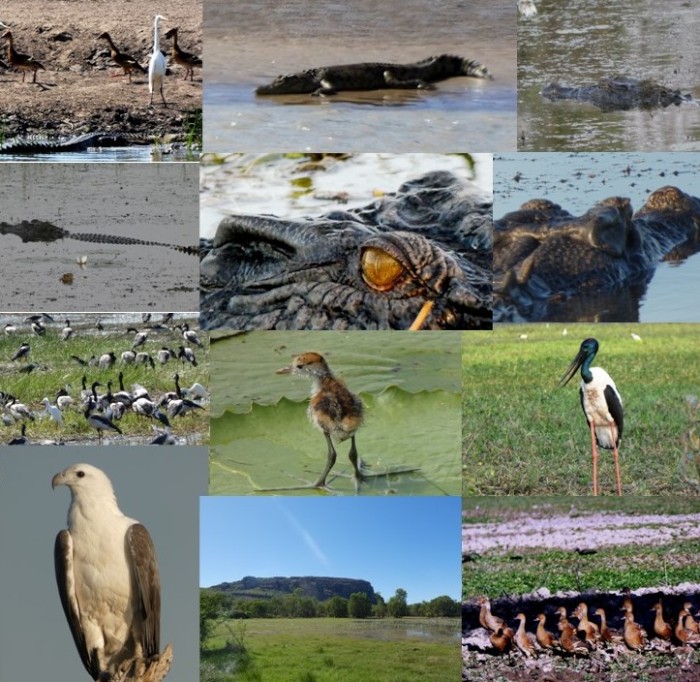
From left to right, row byrow:
Croc and egret observers at Fogg Dam near Humpty Doo, croc out on the bank at the South Alligator river, all other croc photos taken at Yellow Water;
Magpie geese at Fogg dam, jacana baby, jabiru (black necked stork;
White bellied sea eagle, Nourlangie Rock across Angbangban billabong, whistling ducks at Yellow Water.
We're back in Western Queensland on the way back to the boat after traversing the full length of the Northern Territory from Uluru / Kata Tjuta in the South to Darwin in the Top End. We squeezed in the long side trip to Uluru /Kata Tjuta after coming off the Larapinta Trail, then drove 1,000 km north to the thermal pools at Mataranka and into Nitmiluk / Katherine Gorge.
Birds seen between Alice and Katherine: by row, left to right:
Bee-eater, pink cockatoos, babbler,
Wedge-tailed eagle, corellas, willy wagtail,
Budgies, spinifex pigeon, emu.
The temperatures for the 6 day Jatbula Trail hike were decidedly unpromising, with maxima in the Gorge and nearby Katherine township forecast to be 36 to 37oC. No doubt it would have been a few more degrees higher on the exposed tableland where the first few days of the trail crosses, but we shouldered our backpacks once again, crossed the Gorge on the ferry and headed off for Edith Falls/ Leliyn where the trail ends and there is road access.
The trail was, like the Larapinta, unformed, and often only navigable because of the blue triangular trail markers, but it was not as strenuous as the Larapinta Trail in the West MacDonnells. The major challenge was the heat. By 10 a.m. it was already too hot to keep walking with a full backpack, but the trail was often so slow going that we didn't reach each day's campsite until after noon. Fortunately, every campsite was located close to delightful creeks, waterfalls, pools and cascades, so we spent the rest of the afternoon escaping the heat and the flies by swimming and sitting in the water! The last 2 days took us along the Edith River after descending from the Arnhem Land tableland - plenty of wildlife and..mosquitos, but there were lovely waterholes to cool off in all along the river, with some of the best left to the last just short of Leliyn.
Jatbula Trail, pics from left to right by row:
Jawoyn Country, Alison at Sandy Camp,
Crystal Creek, 17 Mile waterfall,
Both of us cooling off in the first waterhole on the Edith River,
Alison in the Edith river downstream, dingo, one of a pack of 8 near Sweetwater Pool.
Back off the trail at Leliyn we drove the 300 km up to Darwin where we had spent nearly 3 years teaching back in the late 90s. Darwin has of course grown considerably, even since 2008 when we were last in the city on Saraoni, but we were amused to note that the Dinah Beach Yacht Club where we were based most of the time had not changed at all - it was still the same ramshackle boatyard and boats too decadent to ever survive in the water.
For the final fling through the Top End we swung through Kakadu National Park, Australia's largest at 20,000 km2. We never had time to visit Kakadu in the dry season while living in Darwin and the wet season visits were always problematic.
The heart of Kakadu is the South Alligator River and its associated billabongs and wetlands. Kakadu protects the whole of the South Alligator's catchment from the Arnhem Land escarpment right through to the Van Diemen Gulf. Birds flock here in their hundreds of thousands when the dry season advances as there are always permanent wetlands for them to feed in.
We paid out for the famous Yellow Water tour by boat and were glad we did. The guide, a part Aboriginal guy from country NSW, loved these waters and the birds and provided great insight into Kakadu and the relationship between the land, its wild animals and plants and the indigenous people who used this area sustainably for over 40,000 years. And of course, there were plenty of crocodiles everywhere. We saw them in the Adelaide River, at Fogg Dam, in the South and East Alligator Rivers and many more in the Yellow Water billabongs.
From left to right, row byrow:
Croc and egret observers at Fogg Dam near Humpty Doo, croc out on the bank at the South Alligator river, all other croc photos taken at Yellow Water;
Magpie geese at Fogg dam, jacana baby, jabiru (black necked stork;
White bellied sea eagle, Nourlangie Rock across Angbangban billabong, whistling ducks at Yellow Water.
Hardcore Hiking Along the Larapinta Trail
20 May 2022 | Alice Springs, Northern Territory, Australia
Alison and Geoff Williams | Cold mornings, sunny, warm days
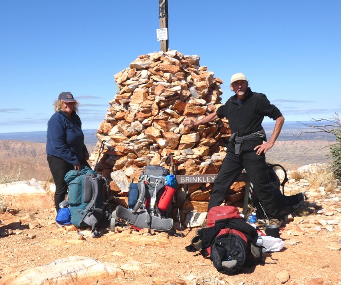
Photo shows us on Day 10 at Brinkley Bluff, the first major high point along the Larapinta Trail.
We are back in Alice Springs after hiking most, but not all, of the Larapinta Trail. The trail snakes its way along the tops of the arid ridges west of Alice, at times threading its way through narrow gorges or 'gaps', at others winding a route across the bumpy lower levels between the Chewings and Heavitree ranges.
The name of the trail comes from the Arrernte name for the Finke River, Larapinta (salty water). Like all the other rivers here in Central Australia, there is water almost always flowing below the sandy river beds while the beds themselves are dry. Occasionally, like this last La Niña summer, it actually does rain quite hard, usually because a monsoonal low has slipped further south into the desert than usual. Then the rivers really do flood, helping to shape the way the gorges rip through the ranges. The Finke is the major river in these parts, funneling summer rainfall into the Simpson Desert. In exceptional years (like this one), water gets as far as Lake Eyre in South Australia's desert north, where its journey ends. The waterholes do become more salty as water evaporates in the dry season, but tasted OK to us as we crossed over and camped on the Finke's tributaries!
Despite the name of the trail, it has no particular significance in the way it has been constructed, which is rather arbitrary. Arrernte people lived here for thousands of years before being turfed into mission stations by early colonists. It's hard to believe that they survived so well in this harsh land, making use of the numerous waterholes that dot the area, mostly in the gorges where there are permanent, deep pools.
Of the 223 km of the trail we managed about 170 over a three week period, including the two highest points of Brinkley Bluff and Mount Sonder. The trail was one of the hardest we have done, mainly because of the rocky nature of the landscape and the fact that the trail itself was 'unformed', basically consisting of a route marked by blue triangles without an actual path having been constructed. Each ridge and gorge seemed like an obstacle course and our progress was often down to a kilometer an hour, although where the trail was flatter we could pick up speed. The weather alternated between cold mornings and warm days to cool mornings and very hot days. On the hotter days, the flies were so bothersome that we donned fly nets and kept flapping. On a few occasions we diverted from the main trail to stumble down dry river beds where we camped in the sand near a waterhole or two, shared by invisible mammals and numbers of birds.
One disappointment was the lack of wildlife. It was only to be expected that life was hard out here, but despite the obvious signs in the sand of dingoes, euros (sort of half way between a wallaby and a kangaroo), rock wallabies, camels and feral cattle, we saw no mammal life except for mice, which were everywhere, although dingoes howled one early morning. The most common birds were little finches, ringneck parrots, honeyeaters, budgerigars and crows. Many of Australia's smaller marsupial populations have taken a huge hit from introduced predators, particulalrly feral cats and foxes. NT's Parks & Wildlife Commission laments that formerly bountiful parts of Larapinta country like Ghost Gum Flat once had possums, bilbies and bettongs. No more.
We are now heading south to take a look at two of Australia's most famous landmarks - Uluru and the Kata Tjutas, then back up north again to Katherine, closer to Darwin where we are going to heave the backpacks up again on the 6 day Jatbula Trail in Nitmiluk National Park. Katherine is a lot hotter than Alice Springs, so we will have to take advantage of the numerous streams and rivers across the path of the trail - a welcome change from Larapinta.
The Australian federal election is taking place as this blog is being posted, with all hopes for a change in government. The ALP, like many social democratic parties everywhere, is timid and disappointing, but still a better bet than the current mob who have done enough damage in Oz over the last 9 years.
Update - the ALP has won the federal election with the help of the rise in the Green vote and second preferences directed towards Labor. It's probably no wonder after back to back climate disasters and loss in faith with the Coalition that the election has taken a more progressive direction. Hopefully, Labor will only have a minority government and will be forced to act on its policy pledges by the federal crossbench and the balance of power that the Greens are likely to have in the Senate.
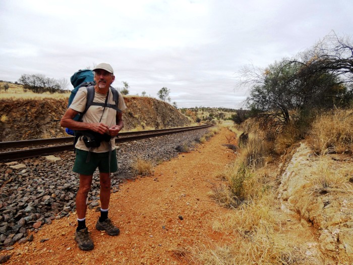
Day 1- Geoff crossing the Darwin to Adelaide railtrack just before the Ghan rolled past.
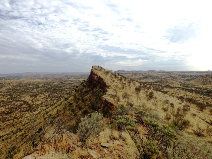
Euro Ridge appearing on Day 1. Yes, that's the trail clinging to the very top of the ridge!
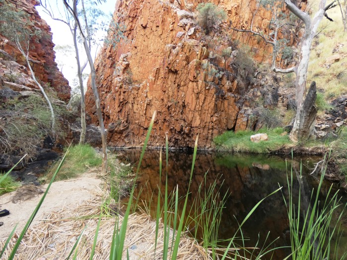
The cold waterhole at Bond Gap on Day 3
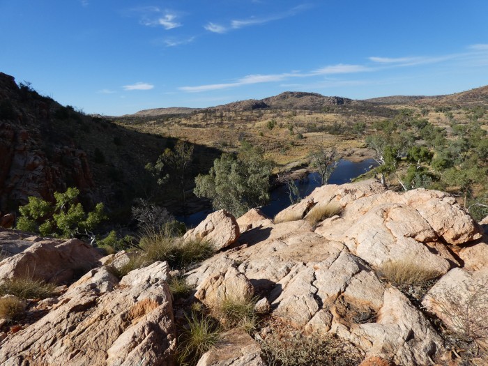
Overlooking Fish Hole in Jeay Creek - Day 6
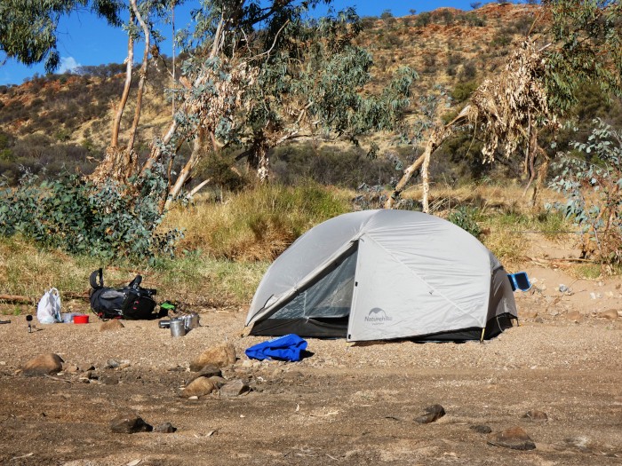
Camped in the river bed in Jeay Creek - Day 6
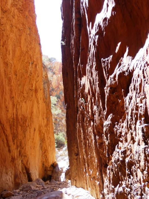
The chasm at Standley Chasm - Day 7
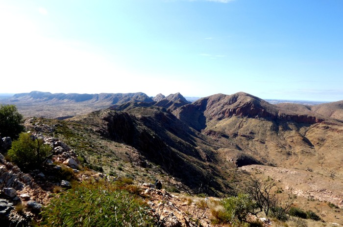
The view of the trail landscape leading up towards Brinkley Bluff. We camped on that narrow ridge top as wind and rain forced a swift and uncomfortable stop - Day 9.
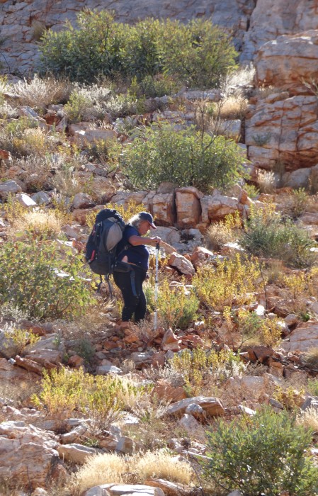
Alison descending Brinkley Bluff - Day 10.
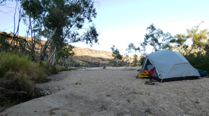
Camped in the river at Stuart's Gap - Day 10.
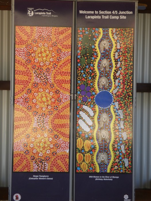
The secure (from mice) cupboard at the 4/5 Junction campsite shelter - Day 11.
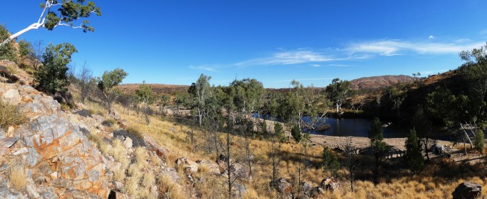
Birthday Waterhole near 4/5 Junction - Day 11.
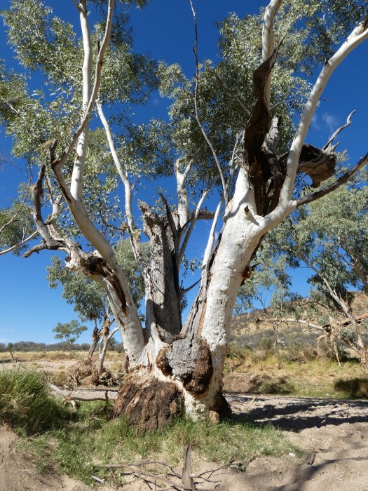
Ghost gum at Ghost Gum Flat between Hugh Gorge and Ellery Creek - Day 13.
Loo at Rocky Gully campsite - Day 13.
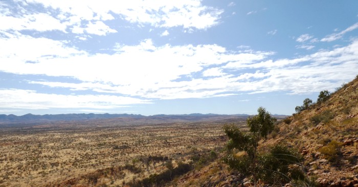
Lookout from the saddle on the Heavitree Range near Ellery Creek - Day 14. it took us two days to hike the low land from the distant Chewings Range.
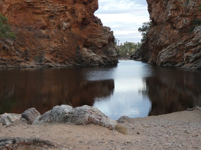
Ellery Creek South "Big Hole" - a popular swimming spot for Alice Springs residents and one place where an access road allows us to reprovision - Day 15.
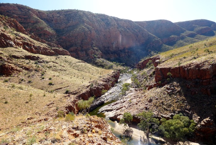
Ormiston Gorge - Day 17.
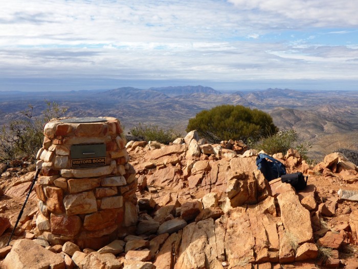
Mount Sonder at the end of Larapinta Trail highest point of the trail at 1320m - Day 20.
We are back in Alice Springs after hiking most, but not all, of the Larapinta Trail. The trail snakes its way along the tops of the arid ridges west of Alice, at times threading its way through narrow gorges or 'gaps', at others winding a route across the bumpy lower levels between the Chewings and Heavitree ranges.
The name of the trail comes from the Arrernte name for the Finke River, Larapinta (salty water). Like all the other rivers here in Central Australia, there is water almost always flowing below the sandy river beds while the beds themselves are dry. Occasionally, like this last La Niña summer, it actually does rain quite hard, usually because a monsoonal low has slipped further south into the desert than usual. Then the rivers really do flood, helping to shape the way the gorges rip through the ranges. The Finke is the major river in these parts, funneling summer rainfall into the Simpson Desert. In exceptional years (like this one), water gets as far as Lake Eyre in South Australia's desert north, where its journey ends. The waterholes do become more salty as water evaporates in the dry season, but tasted OK to us as we crossed over and camped on the Finke's tributaries!
Despite the name of the trail, it has no particular significance in the way it has been constructed, which is rather arbitrary. Arrernte people lived here for thousands of years before being turfed into mission stations by early colonists. It's hard to believe that they survived so well in this harsh land, making use of the numerous waterholes that dot the area, mostly in the gorges where there are permanent, deep pools.
Of the 223 km of the trail we managed about 170 over a three week period, including the two highest points of Brinkley Bluff and Mount Sonder. The trail was one of the hardest we have done, mainly because of the rocky nature of the landscape and the fact that the trail itself was 'unformed', basically consisting of a route marked by blue triangles without an actual path having been constructed. Each ridge and gorge seemed like an obstacle course and our progress was often down to a kilometer an hour, although where the trail was flatter we could pick up speed. The weather alternated between cold mornings and warm days to cool mornings and very hot days. On the hotter days, the flies were so bothersome that we donned fly nets and kept flapping. On a few occasions we diverted from the main trail to stumble down dry river beds where we camped in the sand near a waterhole or two, shared by invisible mammals and numbers of birds.
One disappointment was the lack of wildlife. It was only to be expected that life was hard out here, but despite the obvious signs in the sand of dingoes, euros (sort of half way between a wallaby and a kangaroo), rock wallabies, camels and feral cattle, we saw no mammal life except for mice, which were everywhere, although dingoes howled one early morning. The most common birds were little finches, ringneck parrots, honeyeaters, budgerigars and crows. Many of Australia's smaller marsupial populations have taken a huge hit from introduced predators, particulalrly feral cats and foxes. NT's Parks & Wildlife Commission laments that formerly bountiful parts of Larapinta country like Ghost Gum Flat once had possums, bilbies and bettongs. No more.
We are now heading south to take a look at two of Australia's most famous landmarks - Uluru and the Kata Tjutas, then back up north again to Katherine, closer to Darwin where we are going to heave the backpacks up again on the 6 day Jatbula Trail in Nitmiluk National Park. Katherine is a lot hotter than Alice Springs, so we will have to take advantage of the numerous streams and rivers across the path of the trail - a welcome change from Larapinta.
The Australian federal election is taking place as this blog is being posted, with all hopes for a change in government. The ALP, like many social democratic parties everywhere, is timid and disappointing, but still a better bet than the current mob who have done enough damage in Oz over the last 9 years.
Update - the ALP has won the federal election with the help of the rise in the Green vote and second preferences directed towards Labor. It's probably no wonder after back to back climate disasters and loss in faith with the Coalition that the election has taken a more progressive direction. Hopefully, Labor will only have a minority government and will be forced to act on its policy pledges by the federal crossbench and the balance of power that the Greens are likely to have in the Senate.
Day 1- Geoff crossing the Darwin to Adelaide railtrack just before the Ghan rolled past.
Euro Ridge appearing on Day 1. Yes, that's the trail clinging to the very top of the ridge!
The cold waterhole at Bond Gap on Day 3
Overlooking Fish Hole in Jeay Creek - Day 6
Camped in the river bed in Jeay Creek - Day 6
The chasm at Standley Chasm - Day 7
The view of the trail landscape leading up towards Brinkley Bluff. We camped on that narrow ridge top as wind and rain forced a swift and uncomfortable stop - Day 9.
Alison descending Brinkley Bluff - Day 10.
Camped in the river at Stuart's Gap - Day 10.
The secure (from mice) cupboard at the 4/5 Junction campsite shelter - Day 11.
Birthday Waterhole near 4/5 Junction - Day 11.
Ghost gum at Ghost Gum Flat between Hugh Gorge and Ellery Creek - Day 13.
Loo at Rocky Gully campsite - Day 13.
Lookout from the saddle on the Heavitree Range near Ellery Creek - Day 14. it took us two days to hike the low land from the distant Chewings Range.
Ellery Creek South "Big Hole" - a popular swimming spot for Alice Springs residents and one place where an access road allows us to reprovision - Day 15.
Ormiston Gorge - Day 17.
Mount Sonder at the end of Larapinta Trail highest point of the trail at 1320m - Day 20.
| Vessel Name: | Saraoni (1) and Sundari (2) |
| Vessel Make/Model: | South Coast 36 and Beneteau 473 respectively |
| Hailing Port: | Lamb Island, Australia |
| Crew: | Alison and Geoff Williams |
| About: | |
| Extra: | CONTACT DETAILS Telephone / SMS number +61 456 637 752 (Australian mobile no.) +64 28 432 5941 NZ mobile no.) Email yachtsundari@gmail.com (main email address) |
Saraoni (1) and Sundari (2)'s Photos - Main
.JPG) |
A collection of photos taken while teaching and cruising in PNG's Milne Bay Province
74 Photos
Created 29 April 2023
|
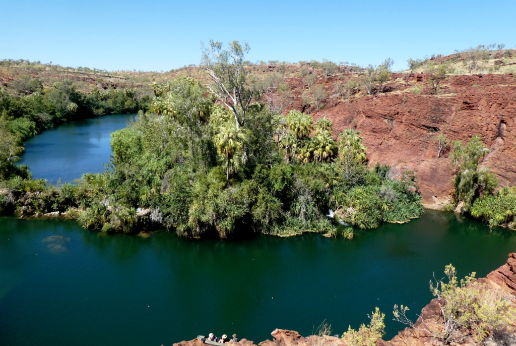 |
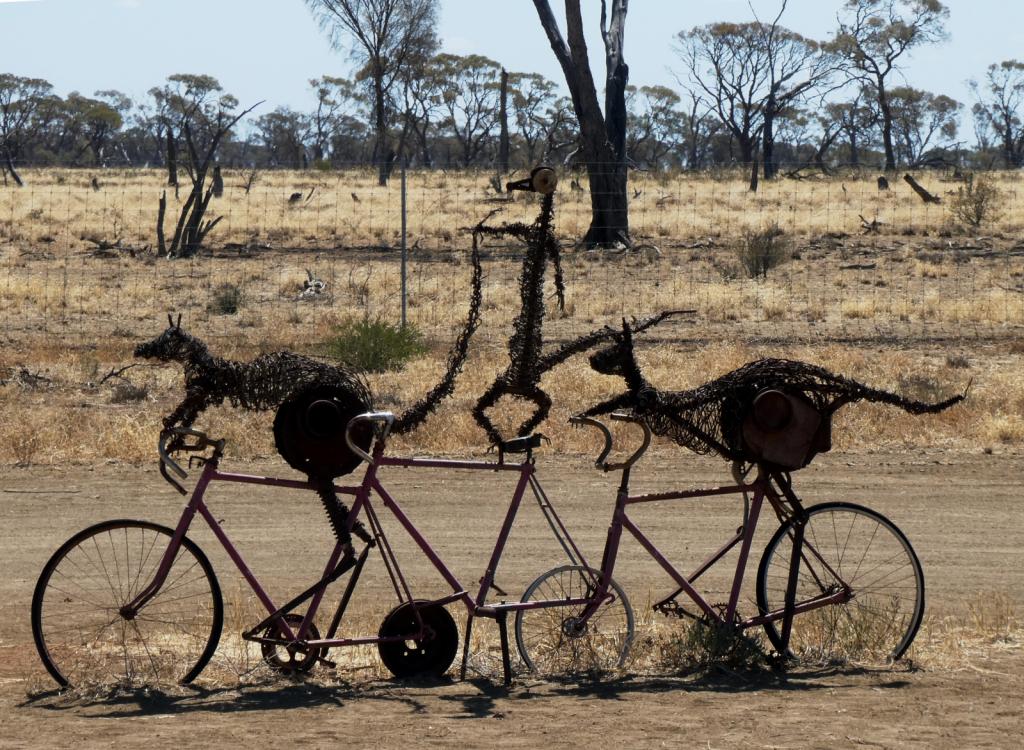 |
Some rather idiosyncratic metal sculptures in outback Queensland between Aramac and Lake Dunn
8 Photos
Created 27 September 2020
|
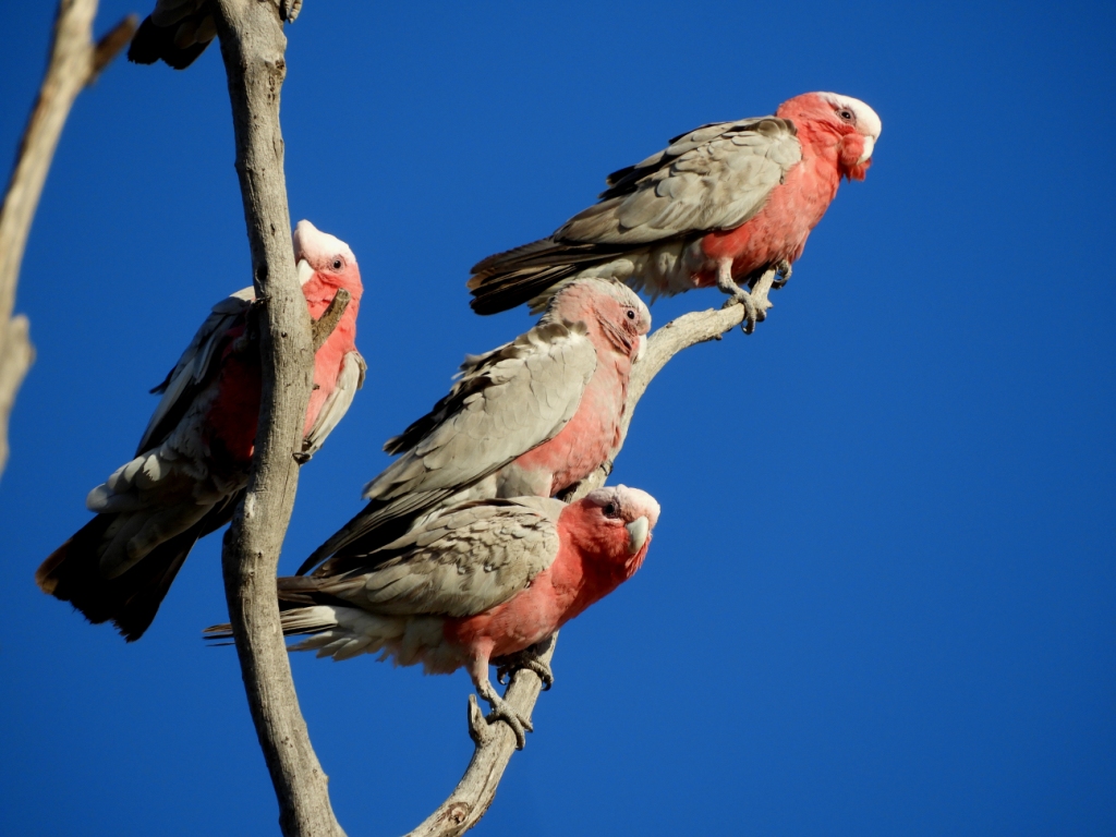 |
Birds and other critters on our Queensland inland safari
12 Photos
Created 27 September 2020
|
 |
A collection of photos taken during the Tiki Tour of the Southern half of the South Island, November / December 2019
40 Photos
Created 15 December 2019
|
 |
 |
Photos taken of Saraoni. All interior photos were taken in the last week.
10 Photos
Created 2 April 2019
|
 |
50 Photos
Created 27 June 2014
|
 |
The ABCs - Aruba, Bonaire and Curacao are mostly low lying dry, scrubby islands in the Western Caribbean near the Venezuelan coastline
15 Photos
Created 21 May 2014
|
 |
 |
 |
Images taken in and around Suriname's capital
40 Photos
Created 9 February 2014
|
 |
 |
Images of the 2 islands in the Cape Verde island group we visited on our way across the Atlantic in 2013 - Sao Vicente and Santo Antaao.
37 Photos
Created 26 December 2013
|
 |
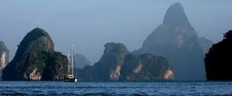 |
 |
 |
 |
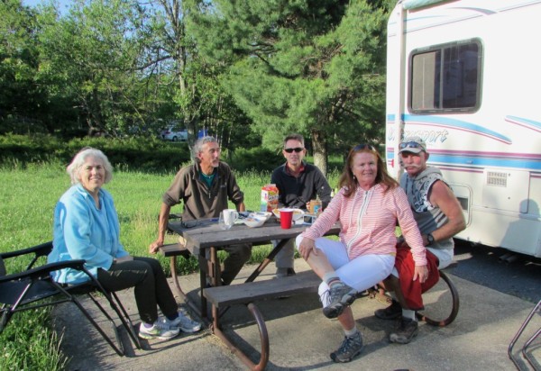 |
Unexpected meeting with old friends "in the woods".
6 Photos
Created 24 June 2013
|
 |
A brother found amongst the gorges of the Cevennes
5 Photos
Created 10 June 2013
|
 |
Photographic images of our long walk along the Appalachian mountains in the USA
26 Photos
Created 10 June 2013
|
 |
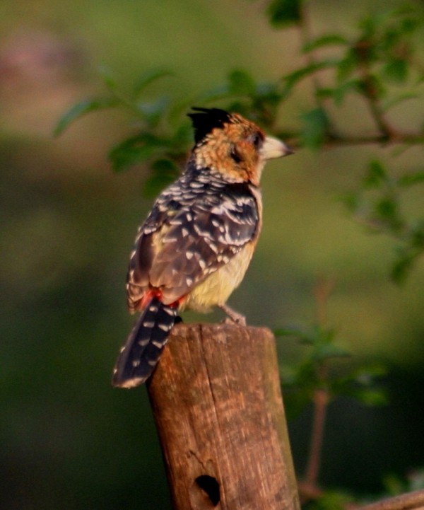 |
 |
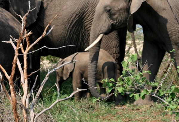 |
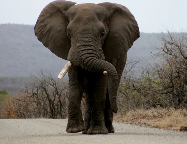 |
 |
 |
Greece is in the throes of a recession, but they still have the last laugh - never far from the sun, the sea, colour, culture and bags of history. The photos document our Aegean odyssey from May to September 2011
31 Photos
Created 17 December 2011
|
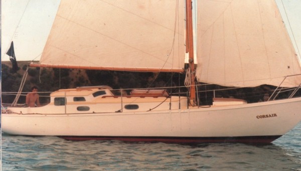 |
O.K. We're mad, but we somehow prefer a home on the sea to one on dry land.
12 Photos
Created 17 December 2011
|
 |
Kathmandu, Patan and Bhaktapur - the three ancient city states of the Kathmandu valley have mediaeval architectural wonders in their Durbars and old town areas - a meshing and merging of Hinduism, Buddhism and materialism
9 Photos
Created 17 December 2011
|
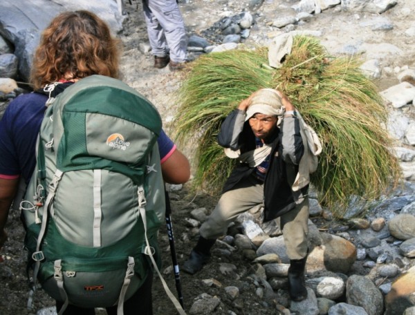 |
Some of the shots taken of us while on one of our 30 odd days on the three main mountain trails we walked in the Anapurnas and Helambu region of Nepal's side of the Himalayas
10 Photos
Created 15 December 2011
|
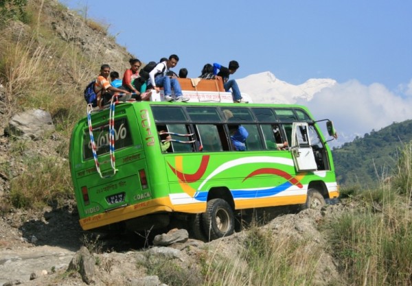 |
People make the Himalayas a unique place to walk through. From Hindu rice and buffalo farmers in the foothills to the Buddhist villages in the highlands so influenced by Tibetan ancestry and trade over the passes
16 Photos
Created 15 December 2011
|
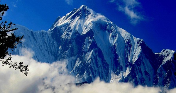 |
Nepal has ten of the world's highest mountains within its boundaries or shared with India and Tibet - these are truly giant peaks!
22 Photos
Created 15 December 2011
|
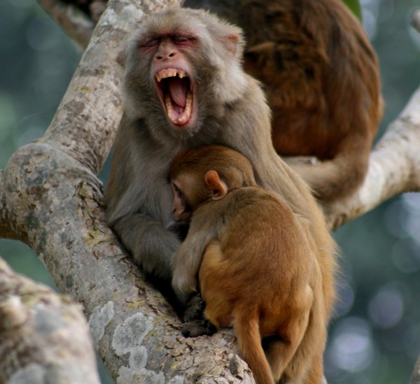 |
These were all photographed in the wilds of Chitwan and Bardia National Parks - which are two of the last havens of biodiversity in Nepal's low lying Terai district.
18 Photos
Created 14 December 2011
|
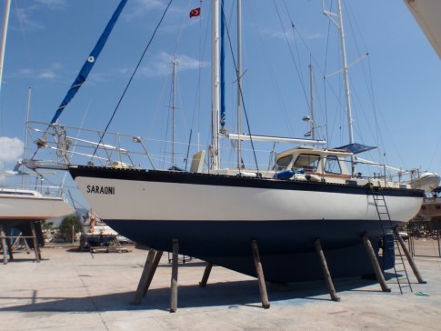 |
Saraoni hauled out on Finike's hardstand for biennial maintenance and painting
3 Photos
Created 26 April 2011
|
 |
 |
 |
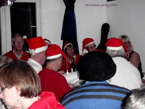 |
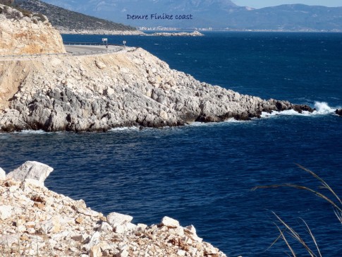 |
 |
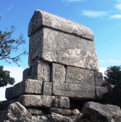 |
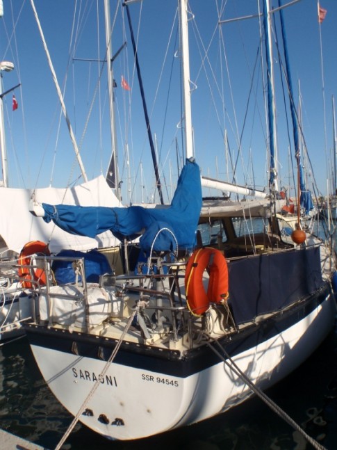 |
 |
The small rocky island of Kastellorizou is Greece's most remote island
7 Photos
Created 11 December 2010
|
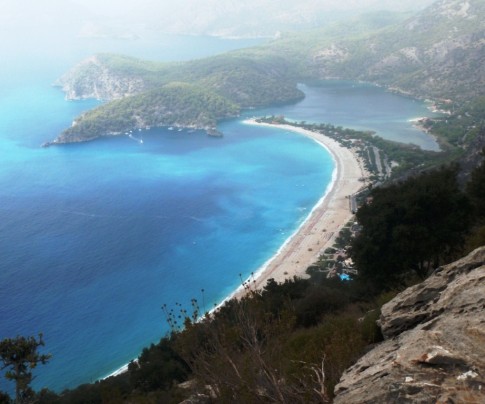 |
Cruising and walking Turkey's Lycian coast September and October 2010
19 Photos
Created 11 December 2010
|
 |
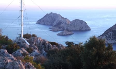 |
Images taken while walking sections of the 500 km Lycian Way or Lykia Yolu on the South West Mediterranean Coast of Turkey
11 Photos
Created 9 November 2010
|
Exploring as Much as We Can Until We Can't
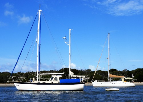
Who: Alison and Geoff Williams
Port: Lamb Island, Australia
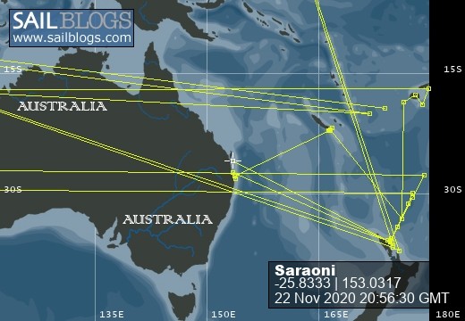
Blog Categories by Year
- 2023 Aust NZ
- 2022 Aust
- 2021 Aust
- 2020 Aust, NZ
- 2019 Aust, NZ
- 2018 New Cal Aust and NZ
- 2017 NZ, Aust, Tonga, Fiji, New Caledonia
- 2016 NZ Niue and Canada
- 2015 Pacific Crossing Panama to NZ, Galapagos, French Polynesia, Cooks, American Samoa and Tonga
- 2015 and 2014 Suriname Colombia Panama and Costa Rica
- 2014 U.S. Cycle trip
- 2014 Caribbean Islands Trinidad to Aruba
- 2014 Atlantic Crossing Cape Verdes to Suriname
- 2013 Cape Verdes, West Africa
- 2013 Canaries Post USA
- 2013 U.S.A. Hiking Trips Appalachians and Cascades
- 2013 Canaries Pre U.S.A.
- 2013 Morocco
- 2012 South Africa and Swaziland
- 2012 Mediterranean Spain and France
- 2012 Italy
- 2012 and 2011 Greece
- 2011 A Quarter Century on the Sea
- 2011 Nepal
- 2011 and 2010 Turkey
- 2010 Oman Yemen the Red Sea and Israel
- 2010 South Asia: India and Sri Lanka
- 2009 Malaysia and Thailand
- 2009 and 2008 Aust and SE Asia
- 2007 Australia
- 2006 NZ to New Caledonia and Australia
- A Tale of Three Boats
- 1978 to 2018 Perspectives on a Long Journey
SailBlogs Friends

