
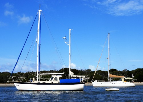
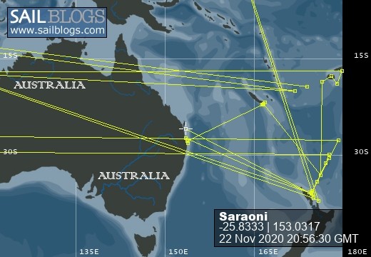
SVs Saraoni and Sundari
09 April 2024 | The Broadwater, Gold Coast, Australia
03 March 2024 | Hope Harbour marina, Gold Coast, Australia
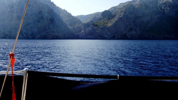
03 January 2024 | Karragarra Channel, South Moreton Bay Islands, Queensland
15 December 2023 | Riverheads, Mary River, Great Sandy Strait, Queensland
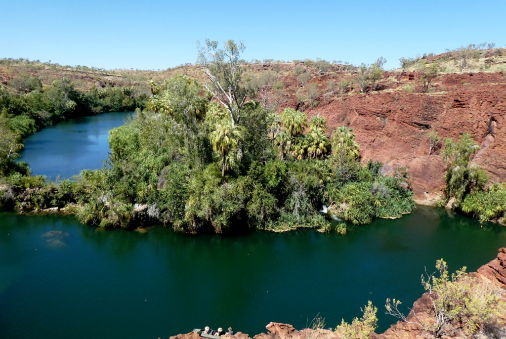
23 October 2023 | Great Keppel Island
07 August 2023 | Trinity Inlet, Cairns, North Queensland
23 July 2023 | Trinity Inlet, Cairns, Far North Queensland.
07 July 2023 | Cairns
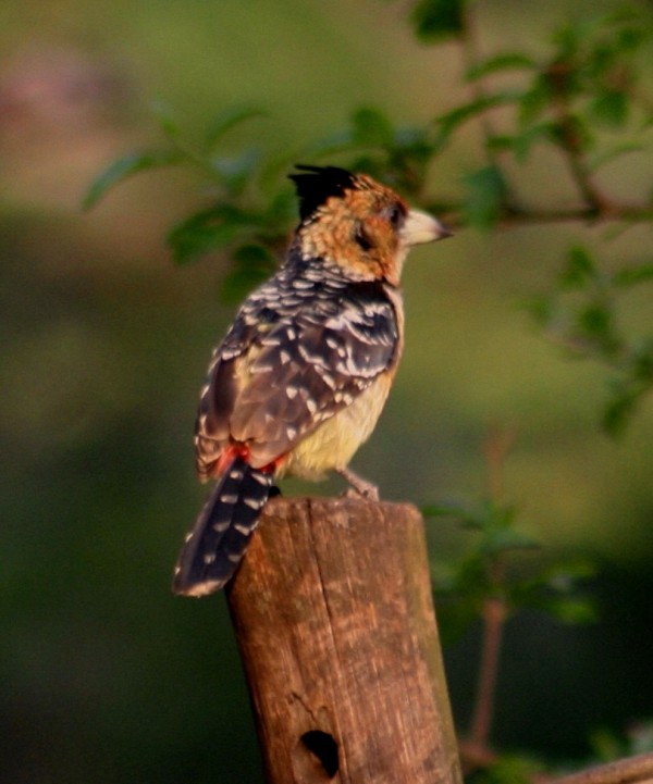
19 May 2023 | North West island, Capricornia Cays, Queensland
15 May 2023 | Burnett River, Bundaberg, Queensland.
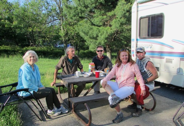
29 April 2023 | Manly marina, Moreton Bay, Queensland, Australia
04 March 2023 | South Auckland, New Zealand
18 January 2023 | Gold Coast Broadwater, Queensland
17 November 2022 | Collie, Southern WA, Australia
29 October 2022 | Albany, SW Australia
14 October 2022 | Augusta, WA, Australia
15 August 2022 | Karragarra Passage, Southern Moreton Bay, Queensland, Australia
14 July 2022 | Raby Bay, off Moreton Bay, Queensland
13 June 2022 | Camooweal, Far West Queensland
20 May 2022 | Alice Springs, Northern Territory, Australia
End game in the USA. The last leg of our PCT hike: Leg 4: Snoqualmie Pass to Stevens Pass
04 August 2013 | Seattle, Washington
Geoff and Alison, sunny
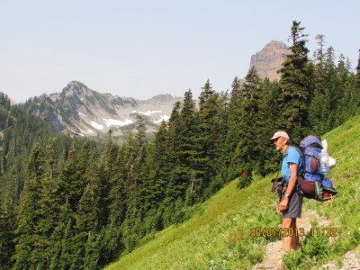
Photo shows Geoff overlooking high peaks in the Alpine Lakes Wilderness
For general PCT trail photos, click HERE.
For Camp Saraoni photos, click HERE.
For wildlife photos taken on our US trip, click HERE.
We finally completed our 500 km hike from the Columbia River Gorge on the Oregon / Washington border when we emerged from the forest at the end of the Deception Creek Trail at Highway 2 near Stevens Pass, a few miles East of the little town of Skykomish. We had been walking for 33 days with 2 extra days spent at Trout Lake and Packwood, resupplying for the trail. The busy highway was a bit of a shock after the quietness of the forest. We had seen few hikers, except for the parts close to Snoqualmie Pass, where weekenders from Seattle were active. We did get to enjoy the huckleberry harvest at last, after seeing the little blue berries mature from nothing at the start of the walk.
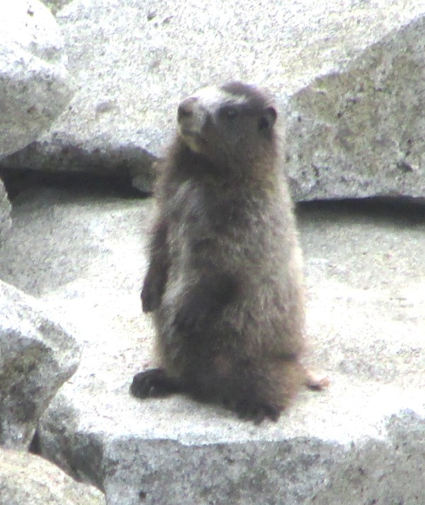
We never did get to see or even hear a grizzly as the last stretch of the walk through the Alpine Lakes Wilderness took us at first high up into alpine areas, where last remnants of snow and plenty of steep, slippery scree dominated. The little pikas and their larger relatives, the golden marmots were everywhere amongst the rocks and very tame. But larger mammals were strangely invisible.
The weather deteriorated a little on this leg as the deep blue skies and constant sunshine of the first 26 days turned to hazy skies and smoke from a large fire to the East. The mountains and lakes were magnificent along the way, but with thunderstorms forecast half way through we deviated off the PCT along lesser known trails through the forest and across several rivers which needed fording and along quiet lake sides.
We stayed a night in Skykomish and then managed to get a lift further down hill to the outer urban area of Seattle, where we have spent the last few days, shuttling across the city on the bus system and poking around the city centre. Seattle is the Pacific North West's largest city and we found it pleasant enough with a living, breathing CBD, close to Puget Sound. Seattle has many similarities with Auckland in N.Z. - the intricate geography of land and sea, good sailing so close by, the interminable freeway traffic jams at rush hour!
It's virtually impossible for any foreigner to gain a sensible impression of such a huge and diverse country as the U.S. in a few months and we have to admit our trip was somewhat lopsided in experiences. However, we felt the USA had shown perhaps its kindest and more beautiful face on our visit and perhaps the stereotyped images that the country so easily develops overseas were not so obvious to us.
We will be leaving tonight on a series of flights that will take us to Minneapolis, Washington D.C., New York, London and finally Las Palmas where our next target will be to get the boat ready for the Pacific crossing and earn some more money!
For general PCT trail photos, click HERE.
For Camp Saraoni photos, click HERE.
For wildlife photos taken on our US trip, click HERE.
We finally completed our 500 km hike from the Columbia River Gorge on the Oregon / Washington border when we emerged from the forest at the end of the Deception Creek Trail at Highway 2 near Stevens Pass, a few miles East of the little town of Skykomish. We had been walking for 33 days with 2 extra days spent at Trout Lake and Packwood, resupplying for the trail. The busy highway was a bit of a shock after the quietness of the forest. We had seen few hikers, except for the parts close to Snoqualmie Pass, where weekenders from Seattle were active. We did get to enjoy the huckleberry harvest at last, after seeing the little blue berries mature from nothing at the start of the walk.
We never did get to see or even hear a grizzly as the last stretch of the walk through the Alpine Lakes Wilderness took us at first high up into alpine areas, where last remnants of snow and plenty of steep, slippery scree dominated. The little pikas and their larger relatives, the golden marmots were everywhere amongst the rocks and very tame. But larger mammals were strangely invisible.
The weather deteriorated a little on this leg as the deep blue skies and constant sunshine of the first 26 days turned to hazy skies and smoke from a large fire to the East. The mountains and lakes were magnificent along the way, but with thunderstorms forecast half way through we deviated off the PCT along lesser known trails through the forest and across several rivers which needed fording and along quiet lake sides.
We stayed a night in Skykomish and then managed to get a lift further down hill to the outer urban area of Seattle, where we have spent the last few days, shuttling across the city on the bus system and poking around the city centre. Seattle is the Pacific North West's largest city and we found it pleasant enough with a living, breathing CBD, close to Puget Sound. Seattle has many similarities with Auckland in N.Z. - the intricate geography of land and sea, good sailing so close by, the interminable freeway traffic jams at rush hour!
It's virtually impossible for any foreigner to gain a sensible impression of such a huge and diverse country as the U.S. in a few months and we have to admit our trip was somewhat lopsided in experiences. However, we felt the USA had shown perhaps its kindest and more beautiful face on our visit and perhaps the stereotyped images that the country so easily develops overseas were not so obvious to us.
We will be leaving tonight on a series of flights that will take us to Minneapolis, Washington D.C., New York, London and finally Las Palmas where our next target will be to get the boat ready for the Pacific crossing and earn some more money!
Not Another Obstacle!
30 July 2013 | Pacific Crest Trail, WA,USA
Alison
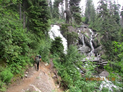
If snow, scree, steep drop offs were not enough, what about exceptionally narrow paths, raging rivers and screaming waterfalls. There is always a hazard to look out for on the PCT and it's certainly not wolves, grizzlies or cougars.
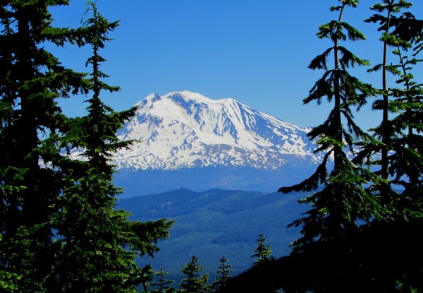
10 days in the Cascades around Mt Rainier - Leg 3: White Pass to Snoqualmie Pass
27 July 2013 | Snoqualmie Pass, Washington
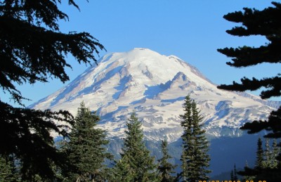
Photo shows Mt Rainier - a landmark visible all over Western Washington, and at over 14,400 feet, the highest mountain (a dormant volcano) west of the Rockies.
All is well on the Pacific Crest Trail. At the start of this leg, we were 23 miles down hill from the trail crossing at White Pass, as we had walked into the village of Packwood to resupply. We tried hitching for a couple of hours with few vehicles passing and then the real estate agent whose office we were thumbing outside said that she would take us up to the pass - a 46 mile diversion for her up a windy, mountain highway! We have met some great people while we have been in America - especially these little rural towns - where are all the rednecks?
We have completed 210 miles so far with fantastic weather - day after day of deep blue skies, great visibility and sunshine as we traversed around giant snow capped Mt Rainier. The big mountain looked like an oversized ice cream cone perched above the conifer forests.
We did have some scarier moments as the trail was often above the tree zone in scree, with steep drop offs on one side. Fortunately, this leg, despite going as high as the Mount Adams area, had very little snow to trouble us.
We saw lots of evidence of big mammals as we went through the Big Crow and Little Crow basin areas in the Norse Peak Wilderness - the elk trails were at least twice as wide as the PCT itself! We have already seen plenty of large mammal prints - mountain lion, bear, elk and deer, but actual sightings have been scarce. The rocky alpine areas have pika and marmot colonies and these little rodents have been squeaking and whistling as we carefully inched our way along.
We are now at Snoqualmie Pass - only 50 miles from downtown Seattle and there is a busy highway here. Tomorrow, we head into the Alpine Lakes Wilderness and start the last 80 miles of our hike. We leave behind the big volcanos, as this area has rugged, sharp peaks - and apparently grizzlies and wolves are reported to have moved south into this area too.
Walking through snow around giant Mount Adams - Leg 2: Trout Lake to White Pass
16 July 2013 | Packwood, Washington, USA
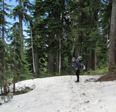
Photo shows Alison carefully plodding through a snow patch below Mount Adams. The trail here is clearly visible for once ahead of her.
We have spent the last week enjoying the remoteness of the high mountainous areas of the PCT between Trout Lake and White Pass - mostly in the Mt Adams Wilderness area. We were amazed at the kindness of the Trout Lake residents who take it in turn to help out hikers on the PCT - what there are of them. A list of these so called "trail angels" is kept at the Trout Lake store and at the Forest Service information centre and somebody will pick you up for free and take you to and from the trail head 13 miles up on the crest.
The PCT proved to be a good walking trail, although was often covered in snow, with creeks roaring underneath. Oregon's 11,000 foot Mt Hood disappeared into the distance and the 12,000 foot Mount Adams appeared on the horizon with the quietly active volcanic peak of Mount St Helens in the middle distance.
We decided to walk off the trail near Lake Walup, just as we entered the Goat Rocks Wilderness, as we learned of slippery and potentially treacherous conditions on a knife edge precipice that led above the Packwood Glacier on the slopes of Old Snowy Mountain. This meant two days walk down a gravelled forest road to the small village of Packwood on Highway 12. There was virtually no traffic down the road and it was actually a pleasant change from the snowy alpine area with a roaring river of its own and thick forests.
Packwood is a little town that used to make its living from forestry but now earns a buck from highway wayside cafes and a few motels. We paid 40 dollars for a room at the old Packwood Hotel and we got our clothes cleaned for the price. We have now walked the first 110 miles of our section of the trail. The next leg will take 10 days between White Pass and Snoqualmie pass and this will traverse Mount Rainier - Western USA's highest peak at over 14,000 feet.
Snow - will we get through? Leg 1: Columbia River to Trout Lake via the Indian Heaven Wilderness
08 July 2013 | Trout Lake, Washington, USA
Geoff and Alison, sunny
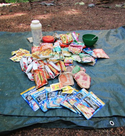
Photo shows 6 days food for 1 bought at the small, but convenient, Trout Lake Store.
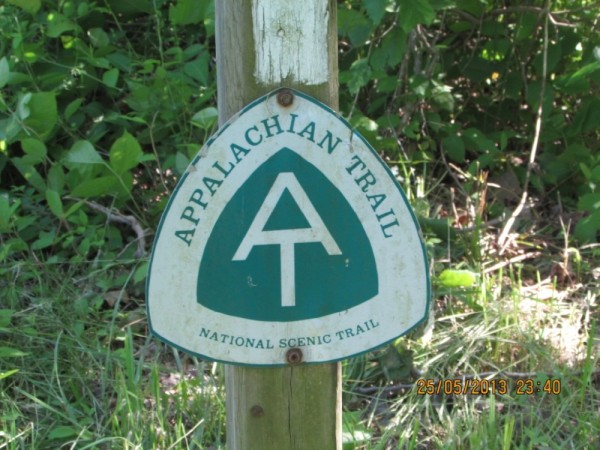
We have now been 6 days on the Pacific Crest Trail (PCT) in the U.S state of Washington. The PCT runs from the Mexican / California border to the Washington / Canadian border along the crest of the Californian Sierras and Cascade Mountains of Oregon and Washington. Like the better known Appalachian Trail in the Eastern States, the PCT has its annual collection of "thru hikers", who aim to complete the entire 2400 mile (3800 km) walk in a single season, mostly from South to North. There are fewer people walking the PCT and the terrain is more challenging - the trail reaches 13,000 feet or more in California and over 7,000 feet in Washington, with plenty of traverses through snow and ice, especially early and late in the season.
We aim to complete the 300 miles from the Columbia River Gorge on the Oregon / Washington border through to Stevens Pass / Interstate Highway 2, 80 miles North East of Seattle There would be only two possible stores directly en route - both garages or small grocery stores and a major problem or resupply would mean hitch hiking many miles on one of the three highways we would cross. We also realized that we were about a month earlier than recommended and expected to be slowed down by snow patches en route.
We started by taking a county transit bus from Vancouver, just over the Columbia River from Portland. This had a cheerful driver and only cost 2 dollars (!) for the 60 mile journey along the Washington side of the Columbia River - surely a USA transport bargain of the century. The driver told us his side of the story about the Sasquatch - the mythical Bigfoot primates, which were rumoured to live in the area.
We started walking from the Forest Service Pink Panther campground where the PCT intersected a road, carrying 12 days of food to take us up to Highway 12 - White Pass. We laterb found out that the little village of Trout Lake was only 13 miles off route along a sealed forest road half way along this section of the trail and it proved to be a fantastic stopover and resupply point. We walked and camped in the tall conifer forests, stopped by what seemed to be dozens of remote lakes, high mountains and plenty of snow. There were virtually no other hikers, except over July 4th, when we met a few people camping up by the lakes in the Indian Heaven Wilderness. The wilderness was named after the huge area of huckleberry bushes which drew local Indian tribesmen to easy pickings every August and September. Much of the route was in fact alongside alongside a large Indian owned area in the mountains, although we hardly saw anybody.
We have now been in Trout Lake Village in the town campsite and have bought what we need to take us up to White pass - 6 to 7 days away. Not sure if high snowy ridges over Old Snowy mountain and the Goat Rocks Wilderness area will force a detour and will listen to intelligence from anybody who has made it over this area from the North. We have already met one or two people who were determined to try this route, despite being a little early, but they are better equipped than us with ice axes and crampons. We will walk out to the small town of Packwood if necessary and rejoin the trail from there at White Pass.
Side Trip Along the Superb Oregon Coast
01 July 2013 | Portland, Oregon
Alison
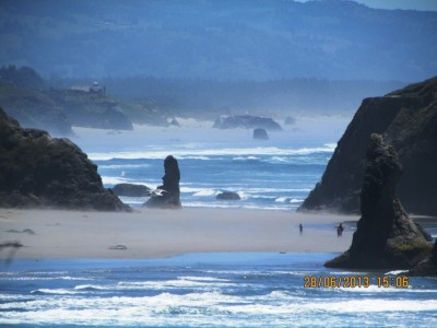
The coast of Oregon was on our doorstep, so we hired a car for a week to view a huge variety of marine and land wildlife. Starting with pelicans and elk in the North through to harbor seals, two grey whales and sea lions in the south. Everywhere there were thousands of sea birds, many of them having flown to the offshore islands off the coast to breed. We ambled along the beautiful coast camping in state forest campsites along the way. After reaching a few miles off the North California Coast we turned inland and wound our way through old growth conifer forests in the foothills of the Western Cascades.
At the moment it is over 90 degrees F in Portland and this heat wave is supposed to last for another week as a stationary high hovers over this part of the US. It means for us less cold temps in the mountains and hopefully no snow where we are going. Geoff is intent on having his birthday on the trail so off we go tomorrow not returning to real civilisation until 8th Aug.
At the moment it is over 90 degrees F in Portland and this heat wave is supposed to last for another week as a stationary high hovers over this part of the US. It means for us less cold temps in the mountains and hopefully no snow where we are going. Geoff is intent on having his birthday on the trail so off we go tomorrow not returning to real civilisation until 8th Aug.
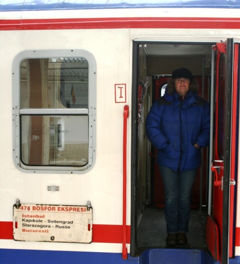
We Survived! Across the USA by bus in 3 days
17 June 2013 | Portland, Oregon
Geoff, hot and sunny
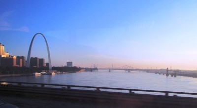
Photo shows the Mississippi crossing from the bus as we arrived in St Louis.
Arrived in Portland after a gruelling trip across the U.S.A. from Roanoke in Virginia to Portland. The cheapest way to cross the country was a non stop bus trip by Greyhound - an American icon, but now owned by Thatcher's child, U.K.'s First Network and is an absolute mess, exacerbated by the fact that Greyhound has a monopoly. Buses went "missing", paperwork for Oregon went missing, communication and good manners went missing, but at least we arrived - eventually.
The trip rolled through 12 of the lower 48 states - Virginia, Tennessee, Kentucky, Indiana, Illinois, Missouri, Kansas, Colorado, Wyoming, Utah, Idaho and finally Oregon. We left the green and verdant woods and pastures of the Eastern states, saw nothing of Kentucky through to Illinois as it was dark; drove over the Mississippi and then the Missouri on either side of St Louis.
We saw most of the Kansas plains and the several cordilleras of the Rockies and their intermontane basins, by which time it had got quite dry. We finally entered Oregon from the East. As we reached the western side of the Cascade Mountains via the Columbia River Gorge, everything went green again. Snow covered Mt Hood and Mt St Helens came into view as we neared Portland.
We are taking a week's R and R down the Oregon Coast while hopefully the snow melts on the Cascade traverses on our last walk - the 300 miles from the Columbia River to Stevens Pass in Washington state.
The "SeaBilly" Moment
13 June 2013 | Shenandoah National Park
Alison

Photo shows old yachtie friends unexpectedly meeting in the woods. For more photos click HERE
An unexpected email and a bout of flu that delayed us meant we had a get together with yachties we hadn't seen for at least two years and right on the edge of the AT. Dave and Judy who had owned the catamaran Freebird, sold by them in Sicily, are touring their own country on the music trail as well as visiting their grandchildren in Charlottesville Virginia. We sailed with them on and off from Darwin right through to Turkey, where we last saw them nearly three years ago. The seemed relaxed and happy with their new land based lifestyle.
Peter and Catherine from The Southern Cross had crossed the Atlantic last year and had berthed in a Maryland marina on the shores of Chesapeake Bay.
Rather to our initial shock, which later turned to amusement, the car hire firm that rented us a vehicle in Waynesboro ran out of small cars which we had ordered and we got a Ford F150 - a rather oversized black ute. When we complained that it would chew too much "gas" up, the rental company said that we could have whatever we wanted free! We weren't sure how to drive the monster as it didn't seem to have any gear stick or hand brake, but all was well in the end. The big, black truck caused a lot of laughs from the other seabillies.
Waynesboro - "It is what it is!"
10 June 2013 | Waynesboro, VA
Geoff - wet, hot and muggy
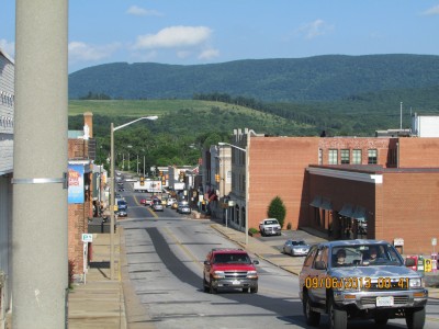
Photo above looks down Main Street, Waynesboro with the Appalachians looking rather like the South Downs with trees on behind.
Access Appalachian Trail photo gallery by clicking HERE
Holed up in the Quality Inn in the centre of Waynesboro where we came to escape the wrath of Andrea. We both have the flu, or more correctly, I am recovering, Alison is on temp highs and not a happy hiker. How the hell we picked up a flu bug in the woods is almost beyond belief - we've hardly had much close contact with anybody, but we'll have to wait till Alison's temp drops back down again. Best advice we got was from our kiwi mates on Quo Vadis in turbulent Turkey "Book into a 5 star for a couple of days and get better" Not that serious and an opportunity to explore a real unassuming upstate town.
Bill Bryson passed through here with his mate Katz nearly 20 years ago and gave the town a bad write up. He then made the mistake of having a promo for his book right here a little later after publication. Have had some rude comments made about Bryson by several people who perhaps know more about their own leg of the trail than he did. The guy who brought us into town said he remembered going to the meeting and telling him he'd sue him if he came to town again. All over a description of a supposedly wild walk to and from K Mart! Our friendly driver, who has lived here most of his life, said that Waynesboro was sort of average - "It is what it is!"
Actually, Bryson was a totally novice wilderness walker and his descriptions about the walk in the woods have kept us amused at night in the tent and have been pretty accurate.
As for Waynesboro, it is a really widely spread out sort of place with a small, older CBD. It's an effort keeping these old parts of town alive in car mad places but it seems that there has been a real effort here. Of course people just drive everywhere - the only ones who don't are the thru hikers.
We have a big pharmacy, hardware store, dollar stores (cheap stuff) and a large supermarket all within easy walking distance of where we are staying, so that must give the town some added points. The most depressing sight anywhere we have been in urban America is the obesity factor. There are a lot of seriously overweight people here. In fact, here in town, the leanest, healthiest people around (apart from those with flu of course) are those who have walked all the way from distant Georgia. Most of the thru hikers heading North left Springer Mountain in March and have been walking ever since.
200,000 steps through the Shenandoahs
08 June 2013 | Virginian Appalachians
Alison and Geoff
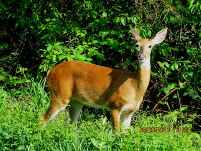
Photo is of a Virginia white tailed deer - fairly common in the Shenandoah NP
Access Appalachian Trail photo gallery by clicking HERE
Our Internet and phone connection were not that good so we were unaware of the closing in of tropical storm "Andrea" that cut a swathe of strong winds and flooding up the east coast. We were however rather wondering why the wind had turned north easterly and then a few hours later followed a 36 hour deluge which kept us confined to the tent for what seemed an endless period. Just about every named and unnamed bug was trying to shelter in our tiny tent as well.
Made a swift exit from the south entrance to Shenandoah National Park as Andrea was dowsing the Appalachians with persistent rain. We had spent a full day in the tent in the woods while the rain pelted down and didn't fancy another. Got a lift with a jeep after two hours on Skyline Drive - the only vehicle on a wet, soggy, misty day. Now in the small town of Waynesboro to wait for the storm to veer off to wards New York and out into the Atlantic and re stock.
The AT stretches a full 110 miles through the Shenandoah section of the Appalachians - that's 170 km. The nice thing about this part of the trail is that it continuously crosses and intersects with the Skyline Drive - the sealed road that runs the length of the ridge. We found it pleasant to walk the road in the cool and quiet of the morning and dive back onto the trail when the road either got too busy or too hot. The road often had superb views at lookouts either west towards the Alleghenies or East towards piedmont country. The other benefit was it was easier to see any wildlife with the wider viewing expanse and all of our black bear sightings were close to the road.
We are now 17 days southwards along the Appalachian Trail and both safe and fitter. Six bear sightings but hurried escapes by the animals deep into the woods prevented any good photos being taken. Plenty of deer, tortoises and bugs kept us busy as we ploughed our way southwards along the seemingly endless canopy of trees. Hikers passed us hurrying northwards to complete the challenge. We ambled along soaking up peaceful campsites and stunning vistas.
We have also noticed other subtle changes. Black locust trees, mountain laurels and others we don't know the names of have burst into bloom. The first spotted, gawky foals have started to appear - one we passed just before the rain started must have been born that day as it could hardly stagger off the trail.
We have met a far more varired cross section of hikers and other Americans and even a few Europeans - old and young, guys and girls, day, weekend, section and thru hikers. All have been friendly and ready to stop for a yak - especially the ones about our age. It's a great way to find out that not all Americans fit the international stereotyped image!
Messy Campsite with Room to Move
08 June 2013 | Shenandoah National Park
Alison
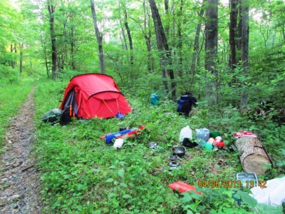
We are not the neatest of people and the AT allowed us to spread out all our worldly camping possessions as long as all edible items including toothpaste and soap were securely hoisted up a tree bough to avoid bears associating a food source with people.
Just an added comment on Sheldon's advice (bear stories abound in North America and we have listened to many - we even met a park worker who is confident he saw an Eastern Mountain Lion flit across the Skyline Drive).
We just follow accepted advice on bears wherever we go and as far as we know there is very little problem with bears in Shenandoah. We put up anthing that has food, trash, smelly stuff and packs if necessary up on a fine but strong line on a branch that can't support a bear's weight before evening. All the shelters have bear poles with hooks where hikers store their bags. The National Park campsites have heavy, secured bear bins which you have to use if you don't have a vehicle or arrive on a bike or motorbike.
The logic of having a huge, cavernous steel bin big enough to put a whole hiker tent in escapes us but guess somebody made a lot of money out of it!
We've also met thru hikers (the NoBos) who haven't seen a single bear since leaving Georgia. For us, they are the essence of the unpredictable North American wilds so we can't see enough of them - but they are not invited around for tea!
Magic along America's Oldest Hiking Trail
27 May 2013
Young male thru hikers (those who aim to walk the whole 2170 miles from Springer Mountain in Georgia to Mount Katahdin in Maine near the Canadian border in a single season) get excited at the generosity of local Virginians.
Later, just into the park when we were musing over whether anybody would notice us putting a tent on a fire road a guy came down the trail looking for hikers to hand out cold beer to!
Later, just into the park when we were musing over whether anybody would notice us putting a tent on a fire road a guy came down the trail looking for hikers to hand out cold beer to!
The Appalachian Trail, VA, First 100 kms along the "Long Green Tunnel"
27 May 2013 | Front Royal, Virginia, USA
Alison and Geoff
Access Appalachian Trail photo gallery by clicking HERE
Day 1 to 7 of the Appalachian Trail
Harpers Ferry to Edward Lesser shelter 11 miles (17.7 km's)
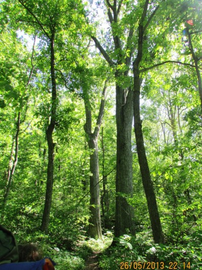
After 6 1/2 days on the famed Appalachian trail that extends 2,176 miles (3300 km) from Georgia to Maine, it wasn't quite the broad, well maintained trail that we expected. It is like many Turkish trails - rugged and rocky in places - but differs because the light of day was barely seen as we walked "in the woods" as described by Bill Bryson. In fact it is like walking through a never ending long green tunnel - the trail's unofficial nickname.
Fortunately, as the trail is nearly 100 years old, a shelter system has been put in place at about 13 km intervals but only three sided. We prefer to pitch a tent. The first day took us 17.7 km to a campsite in the forest near to the Edward Lesser shelter. The first day was sweltering - at over 32 degrees it was much hotter than we expected and a real slog with a 10 min walk to the spring. The shelters all have access to spring water but it appears rarely close to any shelter. A rather annoying walk down and back up a steep slope. You might guess who has that job!!!!
The second day took us a further 18 km - an unending slog up and down in the low thirties through the seemingly endless green tunnel with unfortunately intermittent water supplies. We met many hikers along the way, but none overtook us, hooray! It seems we are two of the few going south. Many of these are testing their speed skills along the way going north mostly in their early 20's and many on their own and mostly young men. It seems that these young Americans are either testing their endurance skills or staking their claim on their country. Not to say there aren't any older ones - there certainly are. The Bears Den Hostel was very welcoming and after having put up our tent on the lawn they suggested we came in to the hostel at no additional cost as their was a severe thunderstorm warning. It did rain heavily as predicted but we did have a peaceful night.
Day 3 Bears Den to remote campsite 12 km on
A public holiday, Memorial Day, was coming up, so walked a short distance in rugged territory very similar to New Zealand with thick forest and countless streams and ridges. The only wildlife spotted so far has been squirrels and the occasional white tailed deer. No one has passed us yet but we have seen about 15 hikers route marching in the opposite direction, mostly trying to get to their destination as fast as possible. Heard some mammal noises in the evening so put all food slung around a branch to prevent bears coming near the tent. several t/storms went through in the afternoon and torrential rain.
Day 4 to Dick's Dome Shelter 17 km
Completed what is called the "roller coaster" - 10 ups and downs. Much less rugged than nz walking territory, though. No animals sighted and went through sky meadows state park. The sweltering temps dropped dramatically to near freezing (!), so less water required. No animal sightings. Passed some older than average hikers to day. also some section hikers as it was the memorial day holiday so more people around.
Camped in cool conditions 0.2 km from shelter in rugged forest. All the miles seem long and the vegetation has little variation. The track was better today than any other day.
Day 5 Dick's Dome to Jim & Molly Denton shelter 16 km
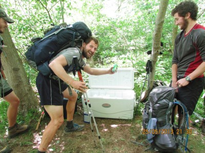
Many ups and downs today but more gradual than the roller coaster. no mammals sighted and very few birds, plenty of green woodland, hikers going north and two lots of trail magic. These are coolers placed where the at crosses the road and well wishers leave cool bins with sodas, fruit and trail bars. A tradition it seems common along the A.T., especially in the summer heat. However the last 2 days have been far cooler than the first two. We have been wearing light fleeces instead of t-shirts and running out of water has not been a problem.
Our first experience of trail magic today. We had read about it but didn't think about it until someone told us that there was some coolers by the roadside where the track crosses the highway. and so there was in fact 4 coolers of iced sodas apples and snack bags. Over the next hill there was another cooler padlocked to a fence with the photo of the 2 people that were the generous donators.
Most of the hikers we have met are going north and are 18 to 30, some packing in 25 miles a day!. it must be one of those macho things that young men do. A small % are women - say around 20% - that are hiking the 2000+ miles of the trail.
Day 1 to 7 of the Appalachian Trail
Harpers Ferry to Edward Lesser shelter 11 miles (17.7 km's)
After 6 1/2 days on the famed Appalachian trail that extends 2,176 miles (3300 km) from Georgia to Maine, it wasn't quite the broad, well maintained trail that we expected. It is like many Turkish trails - rugged and rocky in places - but differs because the light of day was barely seen as we walked "in the woods" as described by Bill Bryson. In fact it is like walking through a never ending long green tunnel - the trail's unofficial nickname.
Fortunately, as the trail is nearly 100 years old, a shelter system has been put in place at about 13 km intervals but only three sided. We prefer to pitch a tent. The first day took us 17.7 km to a campsite in the forest near to the Edward Lesser shelter. The first day was sweltering - at over 32 degrees it was much hotter than we expected and a real slog with a 10 min walk to the spring. The shelters all have access to spring water but it appears rarely close to any shelter. A rather annoying walk down and back up a steep slope. You might guess who has that job!!!!
The second day took us a further 18 km - an unending slog up and down in the low thirties through the seemingly endless green tunnel with unfortunately intermittent water supplies. We met many hikers along the way, but none overtook us, hooray! It seems we are two of the few going south. Many of these are testing their speed skills along the way going north mostly in their early 20's and many on their own and mostly young men. It seems that these young Americans are either testing their endurance skills or staking their claim on their country. Not to say there aren't any older ones - there certainly are. The Bears Den Hostel was very welcoming and after having put up our tent on the lawn they suggested we came in to the hostel at no additional cost as their was a severe thunderstorm warning. It did rain heavily as predicted but we did have a peaceful night.
Day 3 Bears Den to remote campsite 12 km on
A public holiday, Memorial Day, was coming up, so walked a short distance in rugged territory very similar to New Zealand with thick forest and countless streams and ridges. The only wildlife spotted so far has been squirrels and the occasional white tailed deer. No one has passed us yet but we have seen about 15 hikers route marching in the opposite direction, mostly trying to get to their destination as fast as possible. Heard some mammal noises in the evening so put all food slung around a branch to prevent bears coming near the tent. several t/storms went through in the afternoon and torrential rain.
Day 4 to Dick's Dome Shelter 17 km
Completed what is called the "roller coaster" - 10 ups and downs. Much less rugged than nz walking territory, though. No animals sighted and went through sky meadows state park. The sweltering temps dropped dramatically to near freezing (!), so less water required. No animal sightings. Passed some older than average hikers to day. also some section hikers as it was the memorial day holiday so more people around.
Camped in cool conditions 0.2 km from shelter in rugged forest. All the miles seem long and the vegetation has little variation. The track was better today than any other day.
Day 5 Dick's Dome to Jim & Molly Denton shelter 16 km
Many ups and downs today but more gradual than the roller coaster. no mammals sighted and very few birds, plenty of green woodland, hikers going north and two lots of trail magic. These are coolers placed where the at crosses the road and well wishers leave cool bins with sodas, fruit and trail bars. A tradition it seems common along the A.T., especially in the summer heat. However the last 2 days have been far cooler than the first two. We have been wearing light fleeces instead of t-shirts and running out of water has not been a problem.
Our first experience of trail magic today. We had read about it but didn't think about it until someone told us that there was some coolers by the roadside where the track crosses the highway. and so there was in fact 4 coolers of iced sodas apples and snack bags. Over the next hill there was another cooler padlocked to a fence with the photo of the 2 people that were the generous donators.
Most of the hikers we have met are going north and are 18 to 30, some packing in 25 miles a day!. it must be one of those macho things that young men do. A small % are women - say around 20% - that are hiking the 2000+ miles of the trail.
Off For a Walk in the Woods
21 May 2013 | Harper's Ferry, Maryland / West Virginia border, USA

Arrived in the USA last week. We just about managed to pick out the Statue of Liberty in the New York murk, walked from Battery Point up to Times Square in Manhattan, camped in a wood in Brooklyn and then we headed to Washington DC to visit Alison's aunt who has lived in Maryland for many years.
We are just about to start our walking journey for 5 weeks on the Appalachian Trail starting from Harper's Ferry, which is an old, historical settlement on the Potomac River on the border of Maryland and West Virginia. We have been surprised about the amount of beautiful deciduous woodland we have seen everywhere since leaving New York.
We are just about to start our walking journey for 5 weeks on the Appalachian Trail starting from Harper's Ferry, which is an old, historical settlement on the Potomac River on the border of Maryland and West Virginia. We have been surprised about the amount of beautiful deciduous woodland we have seen everywhere since leaving New York.
| Vessel Name: | Saraoni (1) and Sundari (2) |
| Vessel Make/Model: | South Coast 36 and Beneteau 473 respectively |
| Hailing Port: | Lamb Island, Australia |
| Crew: | Alison and Geoff Williams |
| About: | |
| Extra: | CONTACT DETAILS Telephone / SMS number +61 456 637 752 (Australian mobile no.) +64 28 432 5941 NZ mobile no.) Email yachtsundari@gmail.com (main email address) |
Saraoni (1) and Sundari (2)'s Photos - Main
.JPG) |
A collection of photos taken while teaching and cruising in PNG's Milne Bay Province
74 Photos
Created 29 April 2023
|
 |
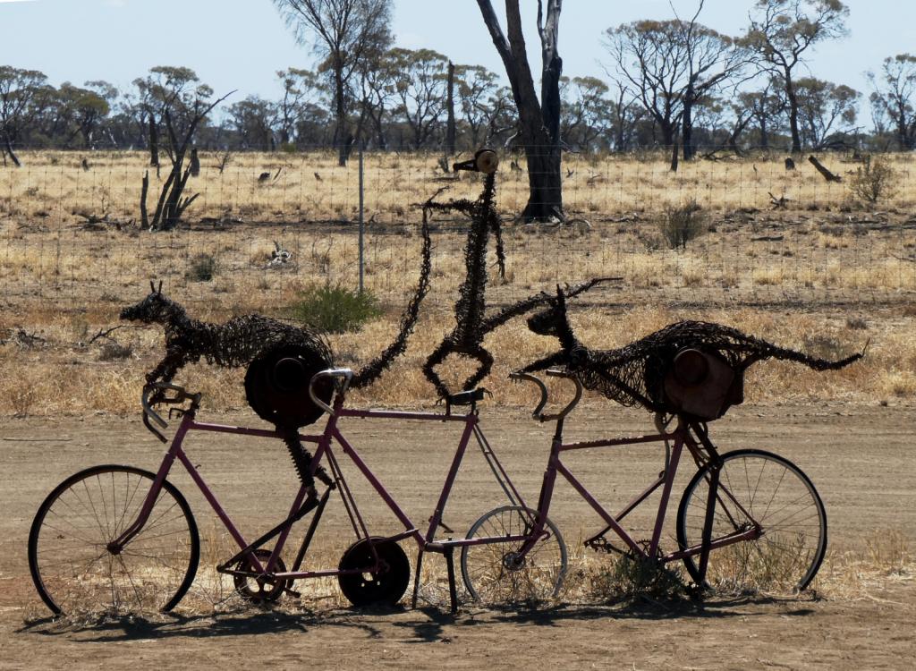 |
Some rather idiosyncratic metal sculptures in outback Queensland between Aramac and Lake Dunn
8 Photos
Created 27 September 2020
|
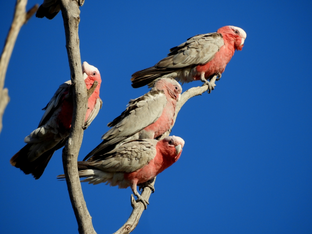 |
Birds and other critters on our Queensland inland safari
12 Photos
Created 27 September 2020
|
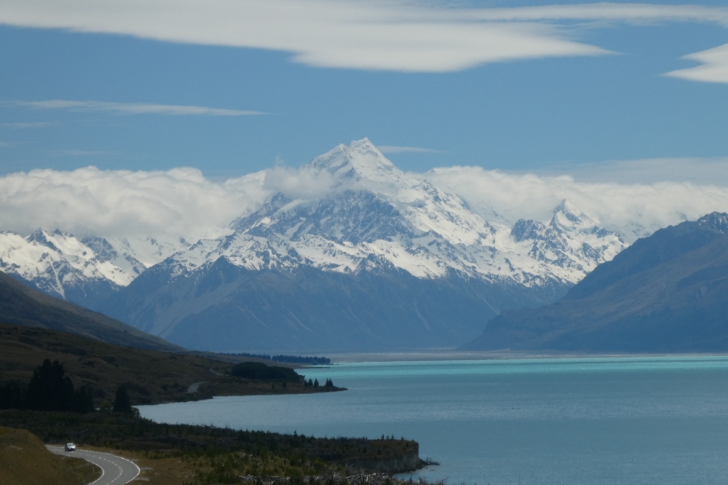 |
A collection of photos taken during the Tiki Tour of the Southern half of the South Island, November / December 2019
40 Photos
Created 15 December 2019
|
 |
 |
Photos taken of Saraoni. All interior photos were taken in the last week.
10 Photos
Created 2 April 2019
|
 |
50 Photos
Created 27 June 2014
|
 |
The ABCs - Aruba, Bonaire and Curacao are mostly low lying dry, scrubby islands in the Western Caribbean near the Venezuelan coastline
15 Photos
Created 21 May 2014
|
 |
 |
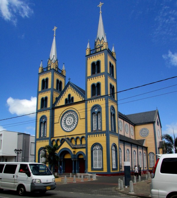 |
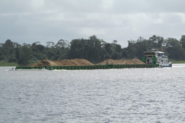
Images taken in and around Suriname's capital
40 Photos
Created 9 February 2014
|
 |
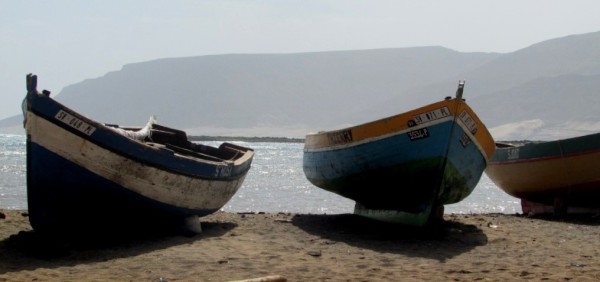 |
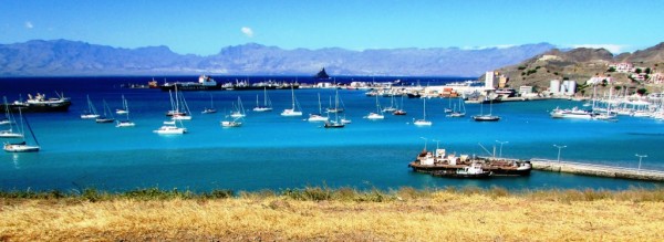
Images of the 2 islands in the Cape Verde island group we visited on our way across the Atlantic in 2013 - Sao Vicente and Santo Antaao.
37 Photos
Created 26 December 2013
|
 |
 |
 |
 |
 |
 |
Unexpected meeting with old friends "in the woods".
6 Photos
Created 24 June 2013
|
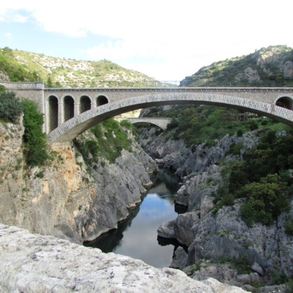 |
A brother found amongst the gorges of the Cevennes
5 Photos
Created 10 June 2013
|
 |
Photographic images of our long walk along the Appalachian mountains in the USA
26 Photos
Created 10 June 2013
|
 |
 |
 |
 |
 |
 |
 |
Greece is in the throes of a recession, but they still have the last laugh - never far from the sun, the sea, colour, culture and bags of history. The photos document our Aegean odyssey from May to September 2011
31 Photos
Created 17 December 2011
|
 |
O.K. We're mad, but we somehow prefer a home on the sea to one on dry land.
12 Photos
Created 17 December 2011
|
 |
Kathmandu, Patan and Bhaktapur - the three ancient city states of the Kathmandu valley have mediaeval architectural wonders in their Durbars and old town areas - a meshing and merging of Hinduism, Buddhism and materialism
9 Photos
Created 17 December 2011
|
 |
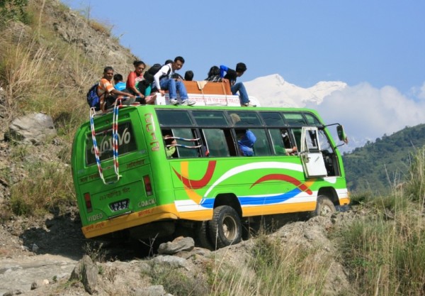
Some of the shots taken of us while on one of our 30 odd days on the three main mountain trails we walked in the Anapurnas and Helambu region of Nepal's side of the Himalayas
10 Photos
Created 15 December 2011
|
 |
People make the Himalayas a unique place to walk through. From Hindu rice and buffalo farmers in the foothills to the Buddhist villages in the highlands so influenced by Tibetan ancestry and trade over the passes
16 Photos
Created 15 December 2011
|
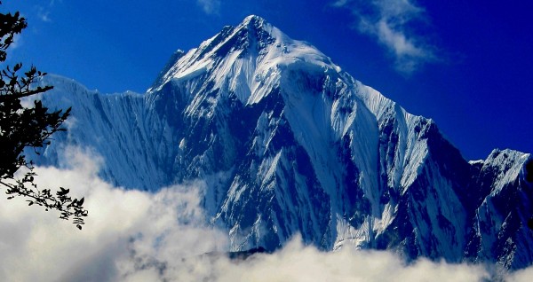 |
Nepal has ten of the world's highest mountains within its boundaries or shared with India and Tibet - these are truly giant peaks!
22 Photos
Created 15 December 2011
|
 |
These were all photographed in the wilds of Chitwan and Bardia National Parks - which are two of the last havens of biodiversity in Nepal's low lying Terai district.
18 Photos
Created 14 December 2011
|
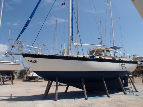 |
Saraoni hauled out on Finike's hardstand for biennial maintenance and painting
3 Photos
Created 26 April 2011
|
 |
 |
 |
 |
 |
 |
 |
 |
 |
The small rocky island of Kastellorizou is Greece's most remote island
7 Photos
Created 11 December 2010
|
 |
Cruising and walking Turkey's Lycian coast September and October 2010
19 Photos
Created 11 December 2010
|
 |
 |
Images taken while walking sections of the 500 km Lycian Way or Lykia Yolu on the South West Mediterranean Coast of Turkey
11 Photos
Created 9 November 2010
|
Exploring as Much as We Can Until We Can't
Who: Alison and Geoff Williams
Port: Lamb Island, Australia
Blog Categories by Year
- 2023 Aust NZ
- 2022 Aust
- 2021 Aust
- 2020 Aust, NZ
- 2019 Aust, NZ
- 2018 New Cal Aust and NZ
- 2017 NZ, Aust, Tonga, Fiji, New Caledonia
- 2016 NZ Niue and Canada
- 2015 Pacific Crossing Panama to NZ, Galapagos, French Polynesia, Cooks, American Samoa and Tonga
- 2015 and 2014 Suriname Colombia Panama and Costa Rica
- 2014 U.S. Cycle trip
- 2014 Caribbean Islands Trinidad to Aruba
- 2014 Atlantic Crossing Cape Verdes to Suriname
- 2013 Cape Verdes, West Africa
- 2013 Canaries Post USA
- 2013 U.S.A. Hiking Trips Appalachians and Cascades
- 2013 Canaries Pre U.S.A.
- 2013 Morocco
- 2012 South Africa and Swaziland
- 2012 Mediterranean Spain and France
- 2012 Italy
- 2012 and 2011 Greece
- 2011 A Quarter Century on the Sea
- 2011 Nepal
- 2011 and 2010 Turkey
- 2010 Oman Yemen the Red Sea and Israel
- 2010 South Asia: India and Sri Lanka
- 2009 Malaysia and Thailand
- 2009 and 2008 Aust and SE Asia
- 2007 Australia
- 2006 NZ to New Caledonia and Australia
- A Tale of Three Boats
- 1978 to 2018 Perspectives on a Long Journey
SailBlogs Friends

