
SVs Saraoni and Sundari
09 April 2024 | The Broadwater, Gold Coast, Australia
03 March 2024 | Hope Harbour marina, Gold Coast, Australia
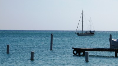
03 January 2024 | Karragarra Channel, South Moreton Bay Islands, Queensland
15 December 2023 | Riverheads, Mary River, Great Sandy Strait, Queensland
23 October 2023 | Great Keppel Island
07 August 2023 | Trinity Inlet, Cairns, North Queensland
23 July 2023 | Trinity Inlet, Cairns, Far North Queensland.
07 July 2023 | Cairns
19 May 2023 | North West island, Capricornia Cays, Queensland
15 May 2023 | Burnett River, Bundaberg, Queensland.
29 April 2023 | Manly marina, Moreton Bay, Queensland, Australia
04 March 2023 | South Auckland, New Zealand
18 January 2023 | Gold Coast Broadwater, Queensland
17 November 2022 | Collie, Southern WA, Australia
29 October 2022 | Albany, SW Australia
14 October 2022 | Augusta, WA, Australia
15 August 2022 | Karragarra Passage, Southern Moreton Bay, Queensland, Australia
14 July 2022 | Raby Bay, off Moreton Bay, Queensland
13 June 2022 | Camooweal, Far West Queensland
20 May 2022 | Alice Springs, Northern Territory, Australia
Now we've learned ALL our ABCs!
26 September 2014 | Oranjestad, Aruba
Alison and Geoff; guess what: windy and hot!
Saraoni anchored at the airport anchorage in Aruba
After spending two full days cleaning green goop off the boat at Royal Marine, we decided to slosh some antifouling on the hull asap and get away from the refinery area on Curacao before we got coated again.
The last week has been a great weather window for sailing westwards towards Panama and as we had two days of it left, we got up at the crack of dawn to slip out of the Piscadera's narrow entrance as soon as we had enough light and time to get to the OLD refinery anchorage on the SE side of Aruba, nearly 60 miles away.
Once we had left Curacao far behind the old refinery structure on Aruba came into sight. We peered earnestly through the binoculars in the hope that we were right that it had closed. No nasty, yellowy-green smoke could be spotted and it made a good landmark to head for!
The weather wasn't as forecast and there was barely enough wind to sail, but we still managed the distance motor sailing in calm seas and arrived well before dusk right in front of the refinery at Roger's beach. We spotted Venezuela's mainland in the Maracaibo headland region 15 miles away and thunderstorms were starting to develop but no where near us. Funnily enough we experienced a light headwind for an hour just as we sailed under a dark band of cloud - the first westerly we had experienced in the Caribbean.
We are now anchored not far from Aruba's airport at the Surfside anchorage. Clearance into Aruba was the easiest into anywhere we have been and there were no costs involved, despite what it said in the Aruba Cruising Guide and 'Noonsite' which is invariably out of date anyway. We were asked to tie up at a spot in the port with our ropes taken kindly by departing Aussie yacht Pannikin's crew. Immigration and Customs were already here with a couple of forms which were filled in quickly and we were off. The only downside is that the spot for tying up could be a nuisance in stronger winds, but we don't expect the next weather window until at least another week, when we have to repeat the procedure for outbound clearance.
We are now 130 miles from the first Colombian anchorage, 350 miles from Cartagena and about 500 from the San Blas islands in Panama - 4 days sailing if we do the trip in one hit, but we will stop on the way if the weather allows - for the next week or more the wind is going back up to its old ways - 25 -30 knots day and night right around from the ABCs to Cartagena.
We have plenty of time to get to Panama because we won't be passing through the canal until late January or early February next year unless we can see some value in exploring the Pacific coasts of Panama and Costa Rica before that. The passage from Golfito in Costa Rica to the Galapagos actually cuts down some of the mileage, so it is worth thinking about and Golfito is close to the fascinating Corcovado area in Costa Rica.
So far, Aruba seems a nice easy place to hang out for a while and make some money while there are reefs and beaches to explore.
While Curacao has its amazing 'salinas' (aka 'marsas'), Aruba has its stretches of barrier reef with narrow lagoons behind which provide excellent protection. The Surfside anchorage where we are now is close to shore and good holding in sand. Nearby is a park with dozens of iguanas and this area has pelicans, turtles and of course, plenty of tourists!


Life's a beach in Aruba!
Aruba has long parted company from its Netherlands Antillean siblings and is planning to be totally energy sustainable from wind and solar by 2020 - an easy feat given the amount of wind and sun these islands get! The island makes its money from providing lovely, white sand beaches and places to spend money for visitors from North America, Europe and South America, but prices here seem to be higher than either Curacao or Bonaire. The architecture still has picturesque Dutch influence like Willemstad in Curacao, but otherwise there is little Dutch influence and most signs are in English. Papiamento is the local language as in the other ABCs, and Spanish is as widely spoken as English.
After spending two full days cleaning green goop off the boat at Royal Marine, we decided to slosh some antifouling on the hull asap and get away from the refinery area on Curacao before we got coated again.
The last week has been a great weather window for sailing westwards towards Panama and as we had two days of it left, we got up at the crack of dawn to slip out of the Piscadera's narrow entrance as soon as we had enough light and time to get to the OLD refinery anchorage on the SE side of Aruba, nearly 60 miles away.
Once we had left Curacao far behind the old refinery structure on Aruba came into sight. We peered earnestly through the binoculars in the hope that we were right that it had closed. No nasty, yellowy-green smoke could be spotted and it made a good landmark to head for!
The weather wasn't as forecast and there was barely enough wind to sail, but we still managed the distance motor sailing in calm seas and arrived well before dusk right in front of the refinery at Roger's beach. We spotted Venezuela's mainland in the Maracaibo headland region 15 miles away and thunderstorms were starting to develop but no where near us. Funnily enough we experienced a light headwind for an hour just as we sailed under a dark band of cloud - the first westerly we had experienced in the Caribbean.
We are now anchored not far from Aruba's airport at the Surfside anchorage. Clearance into Aruba was the easiest into anywhere we have been and there were no costs involved, despite what it said in the Aruba Cruising Guide and 'Noonsite' which is invariably out of date anyway. We were asked to tie up at a spot in the port with our ropes taken kindly by departing Aussie yacht Pannikin's crew. Immigration and Customs were already here with a couple of forms which were filled in quickly and we were off. The only downside is that the spot for tying up could be a nuisance in stronger winds, but we don't expect the next weather window until at least another week, when we have to repeat the procedure for outbound clearance.
We are now 130 miles from the first Colombian anchorage, 350 miles from Cartagena and about 500 from the San Blas islands in Panama - 4 days sailing if we do the trip in one hit, but we will stop on the way if the weather allows - for the next week or more the wind is going back up to its old ways - 25 -30 knots day and night right around from the ABCs to Cartagena.
We have plenty of time to get to Panama because we won't be passing through the canal until late January or early February next year unless we can see some value in exploring the Pacific coasts of Panama and Costa Rica before that. The passage from Golfito in Costa Rica to the Galapagos actually cuts down some of the mileage, so it is worth thinking about and Golfito is close to the fascinating Corcovado area in Costa Rica.
So far, Aruba seems a nice easy place to hang out for a while and make some money while there are reefs and beaches to explore.
While Curacao has its amazing 'salinas' (aka 'marsas'), Aruba has its stretches of barrier reef with narrow lagoons behind which provide excellent protection. The Surfside anchorage where we are now is close to shore and good holding in sand. Nearby is a park with dozens of iguanas and this area has pelicans, turtles and of course, plenty of tourists!
Life's a beach in Aruba!
Aruba has long parted company from its Netherlands Antillean siblings and is planning to be totally energy sustainable from wind and solar by 2020 - an easy feat given the amount of wind and sun these islands get! The island makes its money from providing lovely, white sand beaches and places to spend money for visitors from North America, Europe and South America, but prices here seem to be higher than either Curacao or Bonaire. The architecture still has picturesque Dutch influence like Willemstad in Curacao, but otherwise there is little Dutch influence and most signs are in English. Papiamento is the local language as in the other ABCs, and Spanish is as widely spoken as English.
Back home to Saraoni
22 September 2014 | Piscadera, Curacao, ABC islands, Caribbean
Alison: hot and a bit humid

Photo shows one of San Francisco's iconic cable cars carrying a car load of tourists down towards Fisherman's Wharf. SF certainly has some interesting hills for cycling around!
Arrived back at the boat today after an overnight stop in Miami. The boat has green muck all down the windward side and is in a bit of a muddle. The wind has certainly abated here a bit, at least today and is actually a pleasant sailing breeze for a change! We will try and get the boat cleaned up and painted asap and then get off the hardstand at Royal Marine and back into the water ready for the next leg of the Caribbean through to Panama. We are not sure what will be our next port of call, probably Aruba.
We were able to deposit our American (well.. Chinese) bikes at an organisation for the homeless just around the corner from the hotel in SF - they have certainly got their work cut out with the many homeless and dispossessed in that city! We saw quite a bit of the city in between searching for things to take back to Saraoni - the cable cars, Chinatown, Pier 39 and the sea lions as well as a ferry ride across the bay to Oakland. Then flew to Washington D.C. to see Alison's Aunt Anne, who certainly appeared in good health at nearly 91.
Enjoyed meeting quite a number of people while hanging around Anne's Bethesda home especially the Bolivian American family who have known Anne for over 20 years and who invited us all for a salmon BBQ. Gabriel, one of the two sons is young and energetic and rushes around a bit like us doing difficult things like climbing mountains and recently trying out his fishing skills in the Chesapeake. He has just come back from an attempt on Argentina's Mt. Aconcagua - South America's highest mountain and is planning on climbing Tanzania's Kilimanjaro next year. He whisked us and "Miss Annita" off to his place before a hint of protest could get past our lips. The other son was a polite young man with an endless smile. Elena, their mum, is lucky to have such enthusiastic sons.
Our 2 year old Slovakian made bikes we bought in Heraklion, Crete looked very sad and rusty when we got back to the boat and we will certainly miss our Chinese made but trusty two wheeled friends!
We will now have some more computer power and time to supplement the photos and blogs that have been a bit bare so far! The internet signal we have here in the boatyard is easily the best we've had since.... we were here 9 weeks ago!

Alcatraz island

Chinatown street

Sealion on Pier 39

The Oakland Bridge from the Bay ferry
Arrived back at the boat today after an overnight stop in Miami. The boat has green muck all down the windward side and is in a bit of a muddle. The wind has certainly abated here a bit, at least today and is actually a pleasant sailing breeze for a change! We will try and get the boat cleaned up and painted asap and then get off the hardstand at Royal Marine and back into the water ready for the next leg of the Caribbean through to Panama. We are not sure what will be our next port of call, probably Aruba.
We were able to deposit our American (well.. Chinese) bikes at an organisation for the homeless just around the corner from the hotel in SF - they have certainly got their work cut out with the many homeless and dispossessed in that city! We saw quite a bit of the city in between searching for things to take back to Saraoni - the cable cars, Chinatown, Pier 39 and the sea lions as well as a ferry ride across the bay to Oakland. Then flew to Washington D.C. to see Alison's Aunt Anne, who certainly appeared in good health at nearly 91.
Enjoyed meeting quite a number of people while hanging around Anne's Bethesda home especially the Bolivian American family who have known Anne for over 20 years and who invited us all for a salmon BBQ. Gabriel, one of the two sons is young and energetic and rushes around a bit like us doing difficult things like climbing mountains and recently trying out his fishing skills in the Chesapeake. He has just come back from an attempt on Argentina's Mt. Aconcagua - South America's highest mountain and is planning on climbing Tanzania's Kilimanjaro next year. He whisked us and "Miss Annita" off to his place before a hint of protest could get past our lips. The other son was a polite young man with an endless smile. Elena, their mum, is lucky to have such enthusiastic sons.
Our 2 year old Slovakian made bikes we bought in Heraklion, Crete looked very sad and rusty when we got back to the boat and we will certainly miss our Chinese made but trusty two wheeled friends!
We will now have some more computer power and time to supplement the photos and blogs that have been a bit bare so far! The internet signal we have here in the boatyard is easily the best we've had since.... we were here 9 weeks ago!
Alcatraz island
Chinatown street
Sealion on Pier 39
The Oakland Bridge from the Bay ferry
Nasty smells, annoying dinghy tube leak and curious iguanas
13 July 2014 | Royal Marine Cracao's Boatyard, Piscadera
Alison and Geoff; hot, windy and smelly
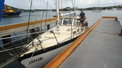
Photo shows Saraoni in Royal Marine Curacao's travelift pen
One day to go before flying to Salt Lake City. The last week has been dogged with nasty smells from the century old oil refinery and an air leak in our inflatable dinghy. We were suspicious when we dropped the anchor that the clouds of smoky air wafting around us would be annoying and so they have been in the last week. We can't wait to get out!
We held our breath when we weighed anchor to steer into the travelift pen afraid that the early morning 20 knotter would make negotiation near impossible but it went like a dream. The boatyard owner and his travel lift driver carefully hauled out the yacht, no problem at all. Very professional!!The Internet works well. There are iguanas scurrying around beneath our feet and troupials and other native birds around, but the smell from the refinery 5 km away is FOUL.
Seemingly, due to its age, pre first world war, collecting sulphur dioxide before emitting it has never been on the owner's agenda. The refinery saga is a long one here on Curacao and not a pretty one, enmeshed in dirty politics, dirty capitalists, and well... just dirty smoke! Curacao does not have its own oil but takes whatever it can get from the oil fields off the South American coast. This means that those living downwind of the plant have been suffering for generations. The wind rarely changes direction so there is no reprieve.
Supposedly, the refinery is going to close later this year to be replaced by a "world class eco resort", a concept which sounds unlikely to say the least, although Aruba's refinery has already closed. Curacao, we have learned, is making more money these days offering big business a base to operate from at a lower tax rate than elsewhere. The refinery is not economic, so has to go. The sooner the better, as far as we're concerned!

Up and out!
Despite 24 hour security and spotlights we took all the sails down to protect them from the contaminated refinery pollutants which engrain the boatyard.
Next has been the dinghy problem. A small but annoying air leak in one of the seams needed repairing. We decided we wouldn't be able to fix it well and to our great surprise no one else is game to either so we had to have a go with the best 2 pack PVC glue available. As expected no luck. So we will have to try again when we get back from the USA. Maybe we can spend a day or 2 looking for some super super PVC glue. Everything else is okay, at least. No noticeable dreaded pox below the waterline and no corrosion in the engine intake valve that always looks green from the inside. Just the dinghy, our lifeline to the shore.

These iguanas don't seem to mind the smell of the oil refinery and nor do the native birds.

When we explored the windward side of the island a couple of weeks ago, we were greeted by a fantastic show of blow holes in Shete Boka NP

There are some very picturesque coves on the west coast of Curacao, with lovely clear water at a perfect temperature.
One day to go before flying to Salt Lake City. The last week has been dogged with nasty smells from the century old oil refinery and an air leak in our inflatable dinghy. We were suspicious when we dropped the anchor that the clouds of smoky air wafting around us would be annoying and so they have been in the last week. We can't wait to get out!
We held our breath when we weighed anchor to steer into the travelift pen afraid that the early morning 20 knotter would make negotiation near impossible but it went like a dream. The boatyard owner and his travel lift driver carefully hauled out the yacht, no problem at all. Very professional!!The Internet works well. There are iguanas scurrying around beneath our feet and troupials and other native birds around, but the smell from the refinery 5 km away is FOUL.
Seemingly, due to its age, pre first world war, collecting sulphur dioxide before emitting it has never been on the owner's agenda. The refinery saga is a long one here on Curacao and not a pretty one, enmeshed in dirty politics, dirty capitalists, and well... just dirty smoke! Curacao does not have its own oil but takes whatever it can get from the oil fields off the South American coast. This means that those living downwind of the plant have been suffering for generations. The wind rarely changes direction so there is no reprieve.
Supposedly, the refinery is going to close later this year to be replaced by a "world class eco resort", a concept which sounds unlikely to say the least, although Aruba's refinery has already closed. Curacao, we have learned, is making more money these days offering big business a base to operate from at a lower tax rate than elsewhere. The refinery is not economic, so has to go. The sooner the better, as far as we're concerned!
Up and out!
Despite 24 hour security and spotlights we took all the sails down to protect them from the contaminated refinery pollutants which engrain the boatyard.
Next has been the dinghy problem. A small but annoying air leak in one of the seams needed repairing. We decided we wouldn't be able to fix it well and to our great surprise no one else is game to either so we had to have a go with the best 2 pack PVC glue available. As expected no luck. So we will have to try again when we get back from the USA. Maybe we can spend a day or 2 looking for some super super PVC glue. Everything else is okay, at least. No noticeable dreaded pox below the waterline and no corrosion in the engine intake valve that always looks green from the inside. Just the dinghy, our lifeline to the shore.
These iguanas don't seem to mind the smell of the oil refinery and nor do the native birds.
When we explored the windward side of the island a couple of weeks ago, we were greeted by a fantastic show of blow holes in Shete Boka NP
There are some very picturesque coves on the west coast of Curacao, with lovely clear water at a perfect temperature.
In Piscadera, Curacao-hot and sunny
06 July 2014
Alison
Photo shows the narrow winding entrance to the Piscadera.
We have finally made the move from Spanish Waters, not far off the windiest place on earth! The wind never dropped below 15 knots and most of the time it was blowing between 20 and 30, day and night. Good for wind power and moderately good for solar power as with all the wind there is plenty of sun too.
The 10 miles down to the inlet where we are hauling Saraoni out for 10 weeks while cycling in the US was easy with the wind being at its least in nearly 7 weeks. Not quite the wild weather that the Belgian yacht 'Boxing Kangaroo' experienced a few days earlier when the gusts reached gale force off Willemstadt, Curacao's capital.
The entrance into the Piscadera is narrow and not charted so we steered a course directly down the middle having already checked out the area with locals.
Piscadera is an undeveloped, landlocked harbour. A much quieter and less windy option to Spanish Waters. The only downside is it's sometimes down wind of the oil refinery. Pooh! Royal Marine, the boat yard looks OK with good security.
The year to come.
Another year has passed with no trouble at all
We have crossed a big ocean with our heads held tall
We have heard the howlers call and the parrots squall
We have swum with the turtles - what a ball!
What comes next we never really know
We hope to see some grizzlies with very large toes!
What we know is that weather's neither friend nor foe.
We had no trouble until we came here
Where the wind has whistled without any fear.
Let's hope the new year brings seas that are calm
Enough wind to sail the Pacific without alarm.
For now we will go on a long bike trip
We hope to see some animals and keep fit.
Its Flag Day in Curaçao and Time for us to Fly Away for a Couple of Months!!
27 June 2014 | Spanish Waters, Curaçao - still!
Alison
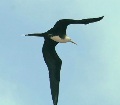
Photo is of a female, magnificent frigate bird - the agile pirate of the tropics - and very common everywhere in the Caribbean. Despite their amazing aerial acrobatics over water, these birds cannot swim.
It rarely rains in Curaçao (until this morning when it poured down!) but the wind always blows and we were rather wondering if we will ever get the anchor up after being in the same place for more than 6 weeks! We don't think we have been anywhere in the world where such a strong wind has blown for so long.
All that surplus sun and wind is a great alternative energy supply, though - it's a bit of a contradiction that Curaçao's economy relies so much on flogging Venezuela's fossil fuels!
We will soon need to up anchor and move 9 miles up the coast to where Saraoni will stay up on dry land, while we have a break for a couple of months.
July 2nd in Curaçao is "Flag Day" and a public holiday marking..er.. its flag? We're not sure about the significance of Flag Day and several people we have talked to who have probably been here too long have never heard of it!
Curaçao and the other old relics of Holland's Caribbean dominion - Bonaire, Aruba, St. Maarten, Saba and St. Eustatius have a confusing relationship with the mother country - so much so that many visitors and some residents still wrongly refer to the islands as "Dutch" or the "Dutch Antilles." Curaçao, Aruba, St. Maarten and the Netherlands itself are supposedly four separate and equal countries within the Kingdom of the Netherlands, while Bonaire and the other little scraps of the Caribbean hundreds of miles way - Saba and St. Eustatius are municipalities of the Netherlands. Get it? Hmmm...
Anyway, Curaçao, unlike New Zealand, at least has a flag which makes sense and is evocative of the island's location - the blue for the sea and the sky, the yellow for the hot sun, two stars for the larger island of Curaçao itself and the smaller island of Klein Curaçao.

Curaçao's unique flag - blowing in the constant wind!
To mark the day we have put all the flags of the places that we have been to since we started on this watery quest below - all 50 of them in the order that we visited them!
We estimate that we still have another 10 to go before we return to NZ. Not all of these places have we been with Saraoni as we might have visited them on terra firma and some of the flags belong to islands that have their own flags, but are still part of another country. Probably missed a few, too.

Click HERE to see which flag is which.
Click HERE to make the flags blow in the wind!
Doesn't work? Try taking your computer outside!
It rarely rains in Curaçao (until this morning when it poured down!) but the wind always blows and we were rather wondering if we will ever get the anchor up after being in the same place for more than 6 weeks! We don't think we have been anywhere in the world where such a strong wind has blown for so long.
All that surplus sun and wind is a great alternative energy supply, though - it's a bit of a contradiction that Curaçao's economy relies so much on flogging Venezuela's fossil fuels!
We will soon need to up anchor and move 9 miles up the coast to where Saraoni will stay up on dry land, while we have a break for a couple of months.
July 2nd in Curaçao is "Flag Day" and a public holiday marking..er.. its flag? We're not sure about the significance of Flag Day and several people we have talked to who have probably been here too long have never heard of it!
Curaçao and the other old relics of Holland's Caribbean dominion - Bonaire, Aruba, St. Maarten, Saba and St. Eustatius have a confusing relationship with the mother country - so much so that many visitors and some residents still wrongly refer to the islands as "Dutch" or the "Dutch Antilles." Curaçao, Aruba, St. Maarten and the Netherlands itself are supposedly four separate and equal countries within the Kingdom of the Netherlands, while Bonaire and the other little scraps of the Caribbean hundreds of miles way - Saba and St. Eustatius are municipalities of the Netherlands. Get it? Hmmm...
Anyway, Curaçao, unlike New Zealand, at least has a flag which makes sense and is evocative of the island's location - the blue for the sea and the sky, the yellow for the hot sun, two stars for the larger island of Curaçao itself and the smaller island of Klein Curaçao.
Curaçao's unique flag - blowing in the constant wind!
To mark the day we have put all the flags of the places that we have been to since we started on this watery quest below - all 50 of them in the order that we visited them!
We estimate that we still have another 10 to go before we return to NZ. Not all of these places have we been with Saraoni as we might have visited them on terra firma and some of the flags belong to islands that have their own flags, but are still part of another country. Probably missed a few, too.
Click HERE to see which flag is which.
Click HERE to make the flags blow in the wind!
Doesn't work? Try taking your computer outside!
Time For Plan B?
12 June 2014 | Curacao, ABC Islands, South Central Caribbean
Geoff: hot, hazy and very windy
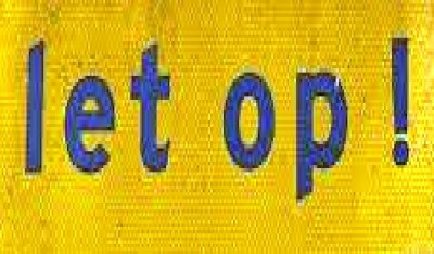
Wij Wensen de Bloedige Wind Zou Laten Up!!
OK. So the Let Op! signs refer to the bumps in the road or other hazards and the sign means Beware! in Dutch. Funny.....thought it referred to the infernal wind around here. It hasn't 'let op' since we've been here and with the GRIB files showing more of the same for the next week or two and the first tropical storm of the year slowly whirling into action up off the Belize coast it's time to consider plan B.
All good sailors, or anyone having much to do with the outdoors for that matter, has to have a plan B. We have had a good look at the boatyard in the Piskadera - another remarkable Curacaoan marsa 10 miles up the coast from here and may pull the boat out while we head back to the woods....
The main aim this year was to reach Panama then spend some time in the States before sorting out messy business in Aotearoa and generally getting fit after being cooped up on the boat for so long. The pilot charts and anecdotal evidence from those who have sailed in these waters before indicates that October and November are the best months to head on and around to Panama.
Hauling out here in Curacao certainly has some advantages - although no cheaper, it is a lot drier and close to good services. Lighter weather (at least a let op! or two) would allow us to sail more leisurely round the bulge and along the South American coast towards the canal. We won't be going through the canal until later on in February so there is plenty of time to see something of Panama and elsewhere in Central America (we do want to make a return trip to Corcovado on the Osa peninsula in Costa Rica) before making the Panama canal transit.
As for those woods... we are now planning our next uncomfortable adventure in the wilds. We intend to fly in to Salt lake City in Utah, buy a couple of cheap bikes (Walmart!), ride up into the Greater Yellowstone area where at last we will be in big animal territory... moose, bison, grizzlies..tourists....yeah!... and then continue into Idaho and Oregon and then down the California North Coast and on to San Francisco. We expect to cycle across the Golden Gate Bridge in mid September so watch this space....
Curaçaouch!!
26 May 2014 | Spanish Waters, Curaçao
Geoff: hot and very windy
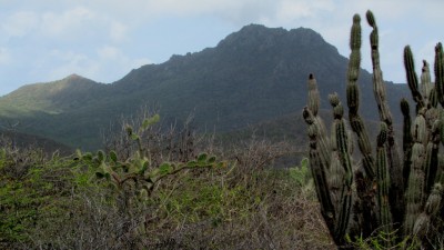
Mt Christoffel above prickly cacti
Curaçao, with its background of industry and its belching refinery, may not be the obvious place for a tourist, but there strangely seem to be plenty of them here. Perhaps they won the booby prize? There certainly seem to be plenty of other Caribbean islands with better beaches, prettier scenery or quainter culture than here. We are here because the wind has done nothing else but howl incessantly since we arrived with no obvious let-up in sight. Aruba, the last of the three ex Dutch Antilles, before we turn the corner along the Colombian coast seems to be even windier than here. While the anchorage in Spanish Waters is a safe, albeit wet, refuge and we have plenty to keep us busy we will exert patience, wait and explore what we can.
We are nearly 500 miles west of Grenada's Prickly Bay - a strange name for a rather unprickly place! Here in the ABCs there are certainly plenty of prickles which make any foray off the tarmac a potentially painful experience. As usual we have delved into the bush looking for whatever lives here. The Acacia thorn trees with their small wattle like yellow flowers have enormous thorns; everywhere there are cacti of several species: all equally spiny. Under the sparse, dry vegetation lies a mass of jagged, eroded pinnacles of upraised coral rock. Ouch!! The combination of these natural features makes a suit of armour, preferably air conditioned, a useful item of clothing.

Small cactus and sharp, jagged coral outcrop. Ouch!
The buses here are regular and cheap - perhaps the only things that are cheap in fact, so its easy to explore the island. Each of the three islands has dedicated a part of its interior to conservation and here on Curaçao it's the Christoffel National Park in the North. There are white tailed deer here, although we haven't seen them, apparently brought to the island by Arawak Indians hundreds of years ago. There are also thousands of lizards of several types, skittering away through the bush, the largest being the ubiquitous green iguanas. There are also a surprising number of birds; bright yellow and black troupials, a type of oriole; green and yellow parakeets; curious grey mockingbirds and tiny humming birds.
At Christoffel's headquarters, under the gaze of Curaçao's largest hill, Mt.Christoffel, are the well preserved remains of old plantation buildings - amazingly, in this dry environment, peanuts and sorghum were grown with the help of slaves. In fact, Curaçao made its money in those days as a market for tens of thousands of slaves in transit between West Africa and South America. Deep wells were dug for water. The wells are still there with water in them - and more remarkable still - several large live iguanas - how did they get there?
The anchorage here in Spanish Waters is filling up a little as yachties further North seek locations out of the hurricane belt. Several are plying the same route as us: hoping to spend time in the San Blas Islands of Panama. We still hope to get there by the end of June.

Photos from top left clockwise: iguana, troupial, Boka Grandi beach and Mt Christoffel, iguanas in old,deep well, mini komodo(!), chuchubi / mocking bird. More photos in ABC photo gallery, click HERE.
Curaçao, with its background of industry and its belching refinery, may not be the obvious place for a tourist, but there strangely seem to be plenty of them here. Perhaps they won the booby prize? There certainly seem to be plenty of other Caribbean islands with better beaches, prettier scenery or quainter culture than here. We are here because the wind has done nothing else but howl incessantly since we arrived with no obvious let-up in sight. Aruba, the last of the three ex Dutch Antilles, before we turn the corner along the Colombian coast seems to be even windier than here. While the anchorage in Spanish Waters is a safe, albeit wet, refuge and we have plenty to keep us busy we will exert patience, wait and explore what we can.
We are nearly 500 miles west of Grenada's Prickly Bay - a strange name for a rather unprickly place! Here in the ABCs there are certainly plenty of prickles which make any foray off the tarmac a potentially painful experience. As usual we have delved into the bush looking for whatever lives here. The Acacia thorn trees with their small wattle like yellow flowers have enormous thorns; everywhere there are cacti of several species: all equally spiny. Under the sparse, dry vegetation lies a mass of jagged, eroded pinnacles of upraised coral rock. Ouch!! The combination of these natural features makes a suit of armour, preferably air conditioned, a useful item of clothing.
Small cactus and sharp, jagged coral outcrop. Ouch!
The buses here are regular and cheap - perhaps the only things that are cheap in fact, so its easy to explore the island. Each of the three islands has dedicated a part of its interior to conservation and here on Curaçao it's the Christoffel National Park in the North. There are white tailed deer here, although we haven't seen them, apparently brought to the island by Arawak Indians hundreds of years ago. There are also thousands of lizards of several types, skittering away through the bush, the largest being the ubiquitous green iguanas. There are also a surprising number of birds; bright yellow and black troupials, a type of oriole; green and yellow parakeets; curious grey mockingbirds and tiny humming birds.
At Christoffel's headquarters, under the gaze of Curaçao's largest hill, Mt.Christoffel, are the well preserved remains of old plantation buildings - amazingly, in this dry environment, peanuts and sorghum were grown with the help of slaves. In fact, Curaçao made its money in those days as a market for tens of thousands of slaves in transit between West Africa and South America. Deep wells were dug for water. The wells are still there with water in them - and more remarkable still - several large live iguanas - how did they get there?
The anchorage here in Spanish Waters is filling up a little as yachties further North seek locations out of the hurricane belt. Several are plying the same route as us: hoping to spend time in the San Blas Islands of Panama. We still hope to get there by the end of June.
Photos from top left clockwise: iguana, troupial, Boka Grandi beach and Mt Christoffel, iguanas in old,deep well, mini komodo(!), chuchubi / mocking bird. More photos in ABC photo gallery, click HERE.
Colourful Curaçao
19 May 2014 | Spanish Waters, Curaçao, Western Caribbean
Alison - hot and very windy
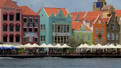
Photo shows Punda waterfront in Willemstadt, Curaçao
For general ABC island photos, click HERE.
After a week in Bonaire we thought it would be better to move on as there was a one day break in the incessant strong winds that have been blowing around the ABCs. The 37 mile passage was quite bumpy compared to the run from Grenada with a short, uncomfortable quartering sea so we rushed on hoping to get into the enclosed Spaanse (Spanish) Waters before the expected increase in wind. The anchorage is in what looks like a Sudanese marsa with a narrow, winding channel into a wide expanse of inland sea. The channel was easier than we had expected as it was a Sunday and there were plenty of boats zooming around so all we had to do was follow their wake through the reefs on either side of the channel!
Spaanse Waters is like nothing we had seen in the Caribbean so far. The inland sea is surrounded by neat, modern properties and the water was packed with just about every type of watercraft and their occupants. To say the least it was complete bedlam that Sunday afternoon - like Tauranga harbour or the Broadwater at the weekend! A stroll through the upmarket suburb of Jan Thiel that afternoon revealed that it was almost entirely Dutch expat oriented.
We have picked one of the spots on the map assigned as a yacht anchorage by Curaçao authorities who have to try and please everybody who wants a piece of the protected waterway. The anchorage is very secure and has no swell and is blessedly far from the sound of night clubs that we had experienced moored on Bonaire's esplanade. It is dry and very windy, with a very wet dinghy ride back to the boat from the shore!
We took the local bus into colourful Willemstadt to clear in with customs, immigration and the harbour master. It is a mixture of old and new with decrepit looking suburbs on the Punda outskirts, as well as the two halves of the city on each side of the access channel to the Schottegat - an inlet similar to Spaanse Waters, home to Curaçao's huge oil refinery. The two halves - Punda and Otrobanda are joined by a remarkable floating bridge as well as a very high bridge across Sint Anna Baai, the access channel. All the bridges are named after Dutch Queens.


Otrobanda from the Punda waterfront with the Queen Emma floating bridge withdrawn in front. This bridge connects the two halves of the town but has to be withdrawn every time a ship (or yacht!) needs to proceed up the channel and into the Schottegat where the refinery and the boatyard are located.
Like nearby wealthier Aruba, Curaçao is a hub for the Venezualan oil industry and the town has a fair mix of different languages and ethnic groups. Many people seem to speak Spanish or Curaçao Papiamento, which sounds a bit like pidgin Spanish, although it is a mix of Spanish, Portuguese, Dutch and African languages and like many Caribbean Creole languages dates from the time slaves were first brought here. Dutch and Papiamento are considered the main languages, but like Bonaire everyone (apart from the Venezuelans) seems to speak English. The architecture stands out more than anything else, with many Dutch boxed shaped buildings attached to each other and painted in clean, colourful colours.


Most of the fresh fruit and veggies are brought over from nearby Venezuela by boat and sold alongside the Waiigat - an extension of Sint Anna Baai.
For general ABC island photos, click HERE.
After a week in Bonaire we thought it would be better to move on as there was a one day break in the incessant strong winds that have been blowing around the ABCs. The 37 mile passage was quite bumpy compared to the run from Grenada with a short, uncomfortable quartering sea so we rushed on hoping to get into the enclosed Spaanse (Spanish) Waters before the expected increase in wind. The anchorage is in what looks like a Sudanese marsa with a narrow, winding channel into a wide expanse of inland sea. The channel was easier than we had expected as it was a Sunday and there were plenty of boats zooming around so all we had to do was follow their wake through the reefs on either side of the channel!
Spaanse Waters is like nothing we had seen in the Caribbean so far. The inland sea is surrounded by neat, modern properties and the water was packed with just about every type of watercraft and their occupants. To say the least it was complete bedlam that Sunday afternoon - like Tauranga harbour or the Broadwater at the weekend! A stroll through the upmarket suburb of Jan Thiel that afternoon revealed that it was almost entirely Dutch expat oriented.
We have picked one of the spots on the map assigned as a yacht anchorage by Curaçao authorities who have to try and please everybody who wants a piece of the protected waterway. The anchorage is very secure and has no swell and is blessedly far from the sound of night clubs that we had experienced moored on Bonaire's esplanade. It is dry and very windy, with a very wet dinghy ride back to the boat from the shore!
We took the local bus into colourful Willemstadt to clear in with customs, immigration and the harbour master. It is a mixture of old and new with decrepit looking suburbs on the Punda outskirts, as well as the two halves of the city on each side of the access channel to the Schottegat - an inlet similar to Spaanse Waters, home to Curaçao's huge oil refinery. The two halves - Punda and Otrobanda are joined by a remarkable floating bridge as well as a very high bridge across Sint Anna Baai, the access channel. All the bridges are named after Dutch Queens.
Otrobanda from the Punda waterfront with the Queen Emma floating bridge withdrawn in front. This bridge connects the two halves of the town but has to be withdrawn every time a ship (or yacht!) needs to proceed up the channel and into the Schottegat where the refinery and the boatyard are located.
Like nearby wealthier Aruba, Curaçao is a hub for the Venezualan oil industry and the town has a fair mix of different languages and ethnic groups. Many people seem to speak Spanish or Curaçao Papiamento, which sounds a bit like pidgin Spanish, although it is a mix of Spanish, Portuguese, Dutch and African languages and like many Caribbean Creole languages dates from the time slaves were first brought here. Dutch and Papiamento are considered the main languages, but like Bonaire everyone (apart from the Venezuelans) seems to speak English. The architecture stands out more than anything else, with many Dutch boxed shaped buildings attached to each other and painted in clean, colourful colours.
Most of the fresh fruit and veggies are brought over from nearby Venezuela by boat and sold alongside the Waiigat - an extension of Sint Anna Baai.
Beautiful Bonaire
16 May 2014 | Kralendijk, Bonaire, Western Caribbean
Alison - hot and windy
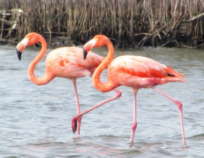
Photo shows flamingos in shallow saline water at Lac on the East coast of Bonaire.
For general ABC island photos, click HERE.
We're nearing the end of our stay in Bonaire. Despite the title of this blog, the island itself is not exactly beautiful! In fact, it is rather scruffy with lots of tall cacti, acacia scrub, feral goats and donkeys and the constant, howling wind, but there is plenty of wildlife here and not just in the protected marine park. Large iguanas scuttle away into the dry leaves as do other smaller lizards, yellow headed parrots shriek from the tree tops, pink flamingos strut their stuff in the saline wetlands and brown pelicans and boobies dive for fish.

Iguana near the waterfront

Pelican taking time off at Lac Cai

Moray eel hiding in a coral bommie at 1000 steps
Of course, the main attraction here is the diving with a steep reef drop off within metres of most of the shore line. The snorkelling has proved to be a little more disappointing because the submerged reef flat has little coral growth - most of it is down the slope and only accessible to divers. However, there are still plenty of fish and the odd turtle. Tomorrow we will take the boat over to Klein Bonaire which is supposed to have some lovely snorkelling. Other yachties have been able to take their dinghies over to the island, but the wind here has just not abated since we arrived.
For general ABC island photos, click HERE.
We're nearing the end of our stay in Bonaire. Despite the title of this blog, the island itself is not exactly beautiful! In fact, it is rather scruffy with lots of tall cacti, acacia scrub, feral goats and donkeys and the constant, howling wind, but there is plenty of wildlife here and not just in the protected marine park. Large iguanas scuttle away into the dry leaves as do other smaller lizards, yellow headed parrots shriek from the tree tops, pink flamingos strut their stuff in the saline wetlands and brown pelicans and boobies dive for fish.
Iguana near the waterfront
Pelican taking time off at Lac Cai
Moray eel hiding in a coral bommie at 1000 steps
Of course, the main attraction here is the diving with a steep reef drop off within metres of most of the shore line. The snorkelling has proved to be a little more disappointing because the submerged reef flat has little coral growth - most of it is down the slope and only accessible to divers. However, there are still plenty of fish and the odd turtle. Tomorrow we will take the boat over to Klein Bonaire which is supposed to have some lovely snorkelling. Other yachties have been able to take their dinghies over to the island, but the wind here has just not abated since we arrived.
Bonaire Arrival
12 May 2014 | Kralendijk, Bonaire, ABCs
Alison - hot and windy
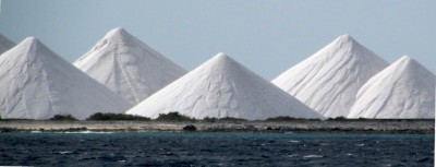
Pyramids of salt on the way in to Bonaire
Arrived at Bonaire on schedule just after dawn. The wind picked up as we rounded the point but with flat seas in the lee of the island we had a nice beam reach past the slave huts and salt stacks we had seen on our 1982 visit.

Slave huts have been tarted up but resonate from dark, days in Bonaire's past
Bonaire makes its living from diving tourism these days as well as a hand out from the Dutch government. The entire shoreline of the main island as well as smaller Klein Bonaire right down to the 60 m mark is protected marine park with no anchoring. We took a mooring right off the centre of town with about 20 other yachts nearby. The boat is suspended over the reef drop off with plenty of fish around although the coral has taken a knock from tropical storms. Just behind the stern of the boat, two or three huge tuna jumped out of the water propelling a large shoal of small fish to skitter across the surface while a frigate dived in pursuit. Nice to see what happens to fish life when they are not fished!

Fish swarm under the jetties strung out along Bonaire's west coast
Bonaire is an interesting island with plenty of nature to keep us busy so we will be here for a week before moving on to nearby Curacao (the C of the ABC - the A is Aruba). Each of the three islands have a similar Dutch colonial history but have rapidly gone their own separate ways. Bonaire and Curacao are both technically part of the Netherlands, but here in Bonaire, just about everything is in English, the locals speak Papiamento, which is similar to the patois spoken in the Verdes on the opposite side of the Atlantic, the official currency is the U.S. dollar and boats are measured in feet, while other measurements are metric. Generally, Bonaire appears somewhat more first world than Grenada or the other islands in the Eastern Caribbean.
We still have our old 1982/83 diary so have some interesting comments recorded on our 5 day stay when we hired a VW and camped wild on the beach or in the scrub. Here's an extract which we have remembered vividly since that night:
"We camped at Playa Grandi, (in Washington Slagbaai National park), where large crabs attack our pots. 3 of them try to steal a pot, lid and plate. but they were recovered after a tussle. Roll up water container attacked in the night and top taken." We are determined to revisit Playa Grandi with an aluminium pot or two to see if we can entice these crabs' descendants out of the bush for a re-enactment!
Arrived at Bonaire on schedule just after dawn. The wind picked up as we rounded the point but with flat seas in the lee of the island we had a nice beam reach past the slave huts and salt stacks we had seen on our 1982 visit.
Slave huts have been tarted up but resonate from dark, days in Bonaire's past
Bonaire makes its living from diving tourism these days as well as a hand out from the Dutch government. The entire shoreline of the main island as well as smaller Klein Bonaire right down to the 60 m mark is protected marine park with no anchoring. We took a mooring right off the centre of town with about 20 other yachts nearby. The boat is suspended over the reef drop off with plenty of fish around although the coral has taken a knock from tropical storms. Just behind the stern of the boat, two or three huge tuna jumped out of the water propelling a large shoal of small fish to skitter across the surface while a frigate dived in pursuit. Nice to see what happens to fish life when they are not fished!
Fish swarm under the jetties strung out along Bonaire's west coast
Bonaire is an interesting island with plenty of nature to keep us busy so we will be here for a week before moving on to nearby Curacao (the C of the ABC - the A is Aruba). Each of the three islands have a similar Dutch colonial history but have rapidly gone their own separate ways. Bonaire and Curacao are both technically part of the Netherlands, but here in Bonaire, just about everything is in English, the locals speak Papiamento, which is similar to the patois spoken in the Verdes on the opposite side of the Atlantic, the official currency is the U.S. dollar and boats are measured in feet, while other measurements are metric. Generally, Bonaire appears somewhat more first world than Grenada or the other islands in the Eastern Caribbean.
We still have our old 1982/83 diary so have some interesting comments recorded on our 5 day stay when we hired a VW and camped wild on the beach or in the scrub. Here's an extract which we have remembered vividly since that night:
"We camped at Playa Grandi, (in Washington Slagbaai National park), where large crabs attack our pots. 3 of them try to steal a pot, lid and plate. but they were recovered after a tussle. Roll up water container attacked in the night and top taken." We are determined to revisit Playa Grandi with an aluminium pot or two to see if we can entice these crabs' descendants out of the bush for a re-enactment!
Bird Paradise in Los Roques
11 May 2014 | Los Roques, Venezuela
Alison and Geoff
Sarqui island in the Los Roques group in Venezuela
As we approached the Venezuelan islands of Los Roques, yacht masts appeared on the horizon at various anchorages around Gran Roque. It was of no surprise to us that we could actually use the last remaining bit of Digicel data credit to check our email on global roaming. As we weren't sure of entry formalities for the marine park we decided it was tactful to bypass the main island. The islands were tempting for a stop so we dropped the anchor for a few hours at the western end of the group at the island of Sarqui, had a swim and noted the vast amount of birdlife on the shores. Pelicans were seen rising from the ground and then diving for fish followed by laughing gulls who are typical sea bludgers - after whatever the pelican chooses to spit out. There were several different species of boobies who love to stalk fishing lures and it was only through blasts on the fog horn and the whistle that we could keep them away.

Gran Roque - the main island in the los Roques archipelago starkly standing out behind Isla Sarqui.
Despite the falling Venezuelan currency and the fact that these islands are 80 miles out from Caracas there were still plenty of weekenders out in nice looking powerboats and charter yachts. These offshore islands of Venezuela reminded us more of the remote and natural islands off the Queensland coast of Australia than the crowded Eastern Caribbean - most of them are national parks and protected as much as anything is protected in Venezuela at the moment. Our weather window precludes any island hopping, which anyway would have had to be "under the radar" without a stop for a visa on the mainland.

Fun at the seaside - picknickers out for the weekend from Caracas - 150 km South!
Now we are on the last overnight to Bonaire, hoping to arrive at first light. Not much wind to speak of but a metre or so of northerly swell. We will be taking extra care as we pass South of the Aves group in the middle of the night. It was on the Eastern Barlovento reefs where unfortunate NZ yacht Chinook Wind foundered as they sailed between Grenada and Bonaire two years ago. What went wrong we don't know - too close, too sleepy? - the yacht was stuck on the reef with the crew evacuated by Venezuelan coastguard and the yacht ransacked by the time they could return. These short open sea passages are actually worse in many ways than the longer ones as it is hard to get used to the motion of the boat in such a short time.
As we approached the Venezuelan islands of Los Roques, yacht masts appeared on the horizon at various anchorages around Gran Roque. It was of no surprise to us that we could actually use the last remaining bit of Digicel data credit to check our email on global roaming. As we weren't sure of entry formalities for the marine park we decided it was tactful to bypass the main island. The islands were tempting for a stop so we dropped the anchor for a few hours at the western end of the group at the island of Sarqui, had a swim and noted the vast amount of birdlife on the shores. Pelicans were seen rising from the ground and then diving for fish followed by laughing gulls who are typical sea bludgers - after whatever the pelican chooses to spit out. There were several different species of boobies who love to stalk fishing lures and it was only through blasts on the fog horn and the whistle that we could keep them away.
Gran Roque - the main island in the los Roques archipelago starkly standing out behind Isla Sarqui.
Despite the falling Venezuelan currency and the fact that these islands are 80 miles out from Caracas there were still plenty of weekenders out in nice looking powerboats and charter yachts. These offshore islands of Venezuela reminded us more of the remote and natural islands off the Queensland coast of Australia than the crowded Eastern Caribbean - most of them are national parks and protected as much as anything is protected in Venezuela at the moment. Our weather window precludes any island hopping, which anyway would have had to be "under the radar" without a stop for a visa on the mainland.
Fun at the seaside - picknickers out for the weekend from Caracas - 150 km South!
Now we are on the last overnight to Bonaire, hoping to arrive at first light. Not much wind to speak of but a metre or so of northerly swell. We will be taking extra care as we pass South of the Aves group in the middle of the night. It was on the Eastern Barlovento reefs where unfortunate NZ yacht Chinook Wind foundered as they sailed between Grenada and Bonaire two years ago. What went wrong we don't know - too close, too sleepy? - the yacht was stuck on the reef with the crew evacuated by Venezuelan coastguard and the yacht ransacked by the time they could return. These short open sea passages are actually worse in many ways than the longer ones as it is hard to get used to the motion of the boat in such a short time.
Balmy nights and calm seas
10 May 2014 | 45 miles from the the Venezuelan island of Blanquilla
Alison
The wind as predicted started at about 11 knots from Grenada and slowly decreased during the day with slight seas. Plenty of passing ships, some dolphins, a lot of bird life including boobies, terns and frigates, but no fish on the line. Expecting to pass the first Venezuelan offshore islands of Los Hermanos and Blanquilla at 10.30 am but probably won't stop until the Los Roques group on Sunday morning. Hoping to go close to a large bird colony at the Aves islands 40 miles this side of Bonaire, but will probably be passing them at night!.
The Cloud has Lifted
10 May 2014 | 140 miles from Bonaire
Alison
We have been heading towards Bonaire for almost 48 hours now amidst thick cloud cover, light wind and occasional drizzle. It appears that the weather is due to a tropical wave passing through the area, mostly affecting the northernmost Windwards and the Leeward Islands. Yachties from Dominica right through to the US Virgins have reported heavy rain, nasty squalls and even westerly winds and swells on the daily Coconut Telegraph radio net. This is no doubt the first real sign that the weather is changing. These tropical waves will become more common as summer advances and will probably send quite a few more yachts scurrying for their summer haulouts and hideyholes in Grenada, Trinidad, Curacao or the U.S. Northern states.
Meanwhile,we have safely transited northwards of the the island of Margerita, a well known pirate haven. It used to be a regular stopover for yachts visiting Venezuela but the increase in serious armed crime has just about closed down yacht tourism in Venezuela. Only a few daring individuals make landfall, attracted by the good Bolivar to US dollar rate.
We should be passing Grand Roque at dawn but probably won't stop as we don't have a cruising permit and if approached it could cost $300. Anyway, there is plenty to see in the ABCs,
Leaving Grenada for the ABCs
09 May 2014
Alison
The Carenage in St. George's, Grenada
A weather window has finally opened up and as they are rare on the 377 mile passage to the island of Bonaire we are taking advantage of it. The hurricane season is not far off so we need to get moving. We hope to take 3 days or less, arriving on Monday morning.
We have spent the last few days in Grenada sorting out teeth (Alison) and doing some long walks. it is easy to meet ordinary Grenadians - all you have to do is jump on a minibus, invariably crowded, as it tears around the countryside. Grenadians are very polite and a little old fashioned. Even the most rasta looking and rascally young man greets a middle aged mama as she heaves herself onto the bus stating she is "certainly NOT going to squeeze onto the back seat". Our visit to the Eastern Caribbean has helped to fill a cultural vacuum ever since our time living in London. Britain has a large population of people from the Caribbean and it has been interesting to see where these people might have lived and how the way they behaved and talked has had its origin here.
Our first recent walk was from Grand Etang in the centre of the island down to the waterfalls in the Concord valley. The weather was hot and the track was relentlessly rugged - more rugged than any track we have been on since Stewart Island in New Zealand! it is surprising how much of Grenada is not occupied by humanity. The forest has been badly damaged by the two hurricanes in 2004/5, but the Concord valley was in relatively good shape with a lovely clear tumbling stream which got larger as we followed it downwards and some nice rainforest giants though nothing like those in St. Vincent. We had spent several days back in 1982 camping and wandering around in neglected nutmeg and cocoa plantations in the upper valley eating fallen mangos and pawpaws. The plantations have also been devastated by the hurricanes and are still in the process of recovering. Grenada has developed an important industry aimed at catering for yachts in the hurricane season, but this all gets seriously shaken up when the odd severe hurricane sweeps through.

Upper Concord waterfall
The second walk took us right up by bus to Sauteres at the North end of the island and then we walked round to Bathways Beach via Levera - the beach where the leatherbacks are currently nesting. This was to prove a long, hot walk, although the lovely, mostly deserted beaches were a bonus. We met D'Oliver, a Grenadian artist near Sauteres. He had an incredible collection of sculptures made out of scrap material depicting island activities and showed us a first world war musket and other strange objects in the tin shack he called home. It seems his objets d'arts should have been better recognized by the tourism industry as D'Oliver is struggling to get by but he isn't too interested in commercializing his activities.

D'Oliver's art gallery

Levera beach by daylight!
A weather window has finally opened up and as they are rare on the 377 mile passage to the island of Bonaire we are taking advantage of it. The hurricane season is not far off so we need to get moving. We hope to take 3 days or less, arriving on Monday morning.
We have spent the last few days in Grenada sorting out teeth (Alison) and doing some long walks. it is easy to meet ordinary Grenadians - all you have to do is jump on a minibus, invariably crowded, as it tears around the countryside. Grenadians are very polite and a little old fashioned. Even the most rasta looking and rascally young man greets a middle aged mama as she heaves herself onto the bus stating she is "certainly NOT going to squeeze onto the back seat". Our visit to the Eastern Caribbean has helped to fill a cultural vacuum ever since our time living in London. Britain has a large population of people from the Caribbean and it has been interesting to see where these people might have lived and how the way they behaved and talked has had its origin here.
Our first recent walk was from Grand Etang in the centre of the island down to the waterfalls in the Concord valley. The weather was hot and the track was relentlessly rugged - more rugged than any track we have been on since Stewart Island in New Zealand! it is surprising how much of Grenada is not occupied by humanity. The forest has been badly damaged by the two hurricanes in 2004/5, but the Concord valley was in relatively good shape with a lovely clear tumbling stream which got larger as we followed it downwards and some nice rainforest giants though nothing like those in St. Vincent. We had spent several days back in 1982 camping and wandering around in neglected nutmeg and cocoa plantations in the upper valley eating fallen mangos and pawpaws. The plantations have also been devastated by the hurricanes and are still in the process of recovering. Grenada has developed an important industry aimed at catering for yachts in the hurricane season, but this all gets seriously shaken up when the odd severe hurricane sweeps through.
Upper Concord waterfall
The second walk took us right up by bus to Sauteres at the North end of the island and then we walked round to Bathways Beach via Levera - the beach where the leatherbacks are currently nesting. This was to prove a long, hot walk, although the lovely, mostly deserted beaches were a bonus. We met D'Oliver, a Grenadian artist near Sauteres. He had an incredible collection of sculptures made out of scrap material depicting island activities and showed us a first world war musket and other strange objects in the tin shack he called home. It seems his objets d'arts should have been better recognized by the tourism industry as D'Oliver is struggling to get by but he isn't too interested in commercializing his activities.
D'Oliver's art gallery
Levera beach by daylight!
Prehistoric Magic Under a Starry, Caribbean Sky
29 April 2014 | St. George's. Grenada
Alison windy
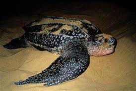
Levera leatherback -in no mood to hurry
Of all the world's turtle species, the leatherback is the largest and probably the most endangered. The largest leatherback ever recorded - over 3 m long -was rather strangely found washed up on a Welsh beach. Apparently they roam as far as the Arctic Circle in search of jellyfish and salps. Like other turtles they face the double whammy of devastation at their nesting sites as well as being hunted or caught in fishing nets on the ocean. Because they eat jellyfish they also unwittingly eat plastic bags which do them no good at all. Many die with clogged stomachs.
There are a few success stories. Here in Grenada, the northernmost beach of Levera - a small strip of white sand backed by scrub - is a leatherback nesting site from March to August and is reasonably well protected by a small group of park rangers, volunteers and turtle researchers who monitor the nesting activity and hide the tracks and the nests every night after the turtles have laid their eggs. Around 1,000 nests are laid each year, with most of the females laying twice or three times in a season.
Despite having seen many turtles around the world and seeing their tracks on the beach after nesting, especially in Northern Australia, the only time we have ever seen turtles nesting was in Costa Rica - on a moonlit night on Naranjo Beach on the Pacific Coast. We watched 5 leatherbacks laboriously haul themselves out of the surf, dig out a hole in the sand above the high tide line and deposit their cache of 100 - 200 eggs. A magic, prehistoric experience made especially memorable because we were the only ones on the beach.
We made the trip up to Levera in company with a motley group of yachties - Scottish, Austrian and American along the windy, narrow crowded coastal road - and followed a Park Ranger out on to the beach in pitch darkness with only the light from the stars and a small infra red torch to see where we were walking. At this latitude, the Plough, Polaris and the Southern Cross are all visible at the same time. A turtle had hauled out at the far end and the researchers who counted and measured each female were careful to make sure that visitors did not frighten her off before she started to dig her nest. As soon as turtles are ready to lay their eggs they go into a trance and seem to be oblivious to their surroundings.
This female was the 300th to nest this season. She was certainly in no hurry. After the 167th egg, she spread sand all over the hole, then very slowly clambered down the beach back into the sea. Although untagged, she was around 50 years old, so had no doubt made this trip many times before but we are not sure if it would be at the same beach though.
Return to Grenada
22 April 2014 | Prickly Bay, Grenada
Geoff

The not so rolly anchorage near St.George's in Grenada!
We're back in rolly Prickly Bay, Grenada, after a pleasant and easy reach down from the Northern Grenadines and waiting for the wind to die a little further west. That means the ABC islands, where it has been blowing well over 20 -30 knots for far too long and at a time of year when the trades are normally supposed to ease more frequently.
We have now been living on a boat for nearly 28 years. That's a fair length of time. We wouldn't like to count exactly how many of those days we've been sitting on the boat waiting for the weather to change so that we can move on. To be fair, a lot of the time we've lived on a boat we've been working - the boat was simply a floating home. Now, at least, while we wait for weather, we can make money. There never seems to be enough of the stuff anyway! Rather to our surprise, we have managed to keep writing for anonymous businesses all round the world wherever we've been for the last three years now, ever since the abortive 'work' trip to England in 2011. Even over Easter, work pours in. It all drops off when we are away from civilization but seems to rebound quickly as soon as we start getting an internet signal again!
From here it is only 380 nm to Bonaire then a hop skip and a jump through to Aruba, then a further 200 nm around the bulge of Colombia before tracking down to the Panamanian coast. We were hoping to be able to island hop through the Venezuelan offshore islands which by all accounts are lovely, but the only 'legal' way of doing that is to visit the Venezuelan mainland first. Venezuela hasn't exactly been cruisers' flavour of the month in recent years as there has been an explosion in violent crime, not just in large cities like Caracas, which have always been crime ridden, but in what used to be favourite yachtie haunts, particularly close to the Paria Peninsula and Isla Margarita. A stop off in Puerto La Cruz, west of Margarita is an option that we are still tossing a coin over.
We want to have the boat on the hard stand at Panamarina, near Colon, by the end of August so that we can take off for a few months away from the stodginess of sitting on the boat and do some walking while being assured that by checking and doing some maintenance on the hull that it will withstand the 5,000 mile crossing of the Pacific Ocean in early 2015.
Plan A is to walk part of the Te Araroa trail and sort out some of our business back in the Land of the Long White Cloud. Theoretically, we are mostly out of the hurricane belt between here and Panama but the longer it takes for us to get west the more likely the wet season will take hold with more variable winds and plenty of rain and thunderstorms.
We anchored in Prickly Bay to catch up with friends - it's an uncomfortable place when the wind shifts more to the east or south east with a continuous, annoying, beam roll. There's a surprising number of yachts here despite the roll. Many of them just hanging around - there are plenty of yachties from all round the world that anchor here. We will explore the rest of the bays to the east of here and then sail back to the anchorage off St. George's at the end of Grand Anse Beach - a prettier and more comfortable anchorage. Meantime we have plenty of boat and computer related work to keep us occupied while Alison's teeth are seen to and the winds hopefully become more to our liking.
In Search of the St Vincent Parrot
12 April 2014 | Bequia, St Vincent and the Grenadines
Alison, hot and windy
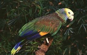
Photo shows an endemic St Vincent parrot - not our photo this time, though!
We have been on easy going Bequia for nearly a week, the Northernmost of the Grenadines with one of the best anchorages. It was time to go and see another island, but this time by ferry. There is no better reason for exploring a place than if there is something unique about it and St Vincent island has an endemic parrot called, not surprisingly, the St Vincent parrot.
We hadn't at this point in time any intention on sailing to the island due to a lack of good anchorages and the fact that the island has a reputation for crime. It's a place that invariably yachties give a wide berth to although there is a charter base in the Blue Lagoon, South East of the "capital" of Kingstown.
The crime stories didn't deter us and we hadn't yet been confronted by any evil criminals on very benign, yacht friendly Bequia, some 10 miles away, so we weren't exactly quivering with fear on the 1 hour ferry ride. We quivered as soon as we hit the swell in the channel between St Vincent and Bequia, however, which was a bit of a beam - on bone shaker on the old Dutch ferry.
The early morning ferry was aiming for Kingstown at the same time as a Thomson Cruise ship was docking. We hadn't seen a cruise ship since Grenada, as most of the islands only have small wharfs - not large enough for those enormous flotels.
Once off the ferry we were greeted by a flurry of activity as market vendors were setting up their stalls and an array of large supermarkets and hardware shops were opening their doors. There was a clear absence of souvenir shops and roadside cafes to entertain the cruise ship customers. We were rather wondering what they would find to spend their pocket money on.
We had a quick walkabout and thought it was a good place to stock up on necessities which we intended to do at the end of the day.
We next located a minibus to take us to the village of Vermont. We didn't have to wait the same length of time as in Grenada and we were soon off squealing and screeching along the narrow winding roads which are so characteristic of these Eastern Caribbean islands. After an hour or so we got off the minibus at what seemed to be the bread bowl of St Vincent - lush green gardens growing all manner of tropical vegetables, mixed in with an array of bananas, breadfruit and mango trees. To add to that, there was a crystal clear river running through the valley. It was the Caribbean equivalent of Santo Antaao on the other side of the Atlantic.
We strolled up the road. Roads or tracks always go up and rarely down when we are trying to get anywhere. We passed a sign describing the Vermont Nature Trail as a European Union backed initiative hence the well sealed road to the entrance. We paid $5EC each and took the marked trail up the mountainside into the luxuriant rainforest - a small remnant and reminder of St Vincent three centuries ago. There were some enormous buttressed trees emerging from the forest floor - the largest we have seen since seeing Oregon pines in the USA almost a year ago. Even a nature reserve in Suriname couldn't dish out something as magnificent as this forest. It looks as if this part of the Windward islands has been spared the effects of vicious hurricanes which have devastated the rainforests of Grenada and Tobago.
As we climbed up the distinct trail to Parrot Lookout we heard a lot of parrots. Being an Amazonian parrot they were extremely noisy and boisterous and were certainly not going to stop to pose for a photo or two. We at last got a glimpse of this spectacular parrot at the highest point on the trail. It is a pity that there are no more than 500 remaining on the island.
We arrived back in Kingstown a couple of hours before the return ferry, so we managed to stock up with some basics at a fraction of the price of Bequia. Our ferry fare was paid for by the savings we made!
There was a group of noisy school kids from Guadaloupe on the return ferry trip who just about managed to cling on in the swells. We were rather wondering if a cell phone or two was going to go overboard.
We are now looking for a weather window to take us 400 miles west to the island of Bonaire - the B of the three ABC islands. The area around these islands and west around Colombia's bulge is notoriously windy. It has been blowing a full gale around there for the last few weeks, despite April being the month when the wind is supposed to start to relent.
We will probably sail back down towards Grenada rather than bash ever further North up the chain, which means it would be further to go where we want. Every little island in the chain is a separate political entity and despite the similar culture and history, it means clearing in and clearing out before going to the next island. One plus is our cheap Grenada Digicel sim card and 7 day data package, which we use for internet as we have discovered that it can be used wherever we are in these islands although the signal is pretty slow.
Swimming with the Turtles
03 April 2014 | Tobago Cays, St. Vincent and the Grenadines
Geoff and Alison. calm, hot
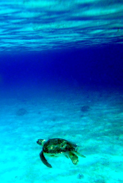
Photo shows one of dozens of green turtles off the beach at Baradal Cay in the Grenadines. Two others can be seen in the hazy background.
It's hard to find the right weather to anchor at reef anchorages, so when a couple of days of light winds appeared we set sail from Carriacou for the next island group Northwards - St. Vincent and the Grenadines, making a brief overnight stop at Clifton - the tiny "capital" of Union Island and then threading our way through the reefs to anchor in calm water behind Horseshoe reef in the Tobago Cays. These little islands are inaptly named, because only one - Petit Tabac - is truly a cay, the others being small, rocky islands with white sandy beaches. At first sight the little group of islands - a marine park - seemed a little unprepossessing - an island group surrounded by reefs like hundreds of others we'd seen in the Pacific, but here there is something special!
Off one of the little islands - Baradal Cay - a sandy sea floor has growing on it what must be the caviar of sea grasses, attracting dozens of green turtles which graze contentedly all day and night long on slender shoots of a particular species of marine plant. With many others we were able to snorkel and swim with these graceful animals, marvelling at how tame they were. We have often seen turtles of various species before when swimming, but not so close with so many. Fantastic!

Another green turtle swimming off Baradal Cay
In the same seagrass bed there were also many large sea stars and huge trochus shells - these were alive unlike many others elsewhere we have seen sitting lifeless on a seawall.
The coral on the nearby protecting Horseshoe reef has had a bad time with hurricane damage. Corals everywhere in the world are having a hard time of it, with increasing siltation, climate change, coral bleaching and slow but steady acidification of the sea, preventing what would be normal processes of repair and regeneration amongst the reefs. But here, at least, the water was clear and we saw plenty of fish, especially large parrotfish, a ray and many typical reef fish, butterfly fish, surgeons, triggerfish, box fish, wrasses and damsels.

We are in the middle of the Grenadines here - to the immediate West is Mayreau, to the North East is Canouan and in the distance, Mustique and Bequia. St. Vincent itself, the same size, but higher than Grenada, appeared briefly in the morning light 35 nautical miles further up the chain.

Photo shows Petite Tabac cay on the other side of Horseshoe Reef.
It's hard to find the right weather to anchor at reef anchorages, so when a couple of days of light winds appeared we set sail from Carriacou for the next island group Northwards - St. Vincent and the Grenadines, making a brief overnight stop at Clifton - the tiny "capital" of Union Island and then threading our way through the reefs to anchor in calm water behind Horseshoe reef in the Tobago Cays. These little islands are inaptly named, because only one - Petit Tabac - is truly a cay, the others being small, rocky islands with white sandy beaches. At first sight the little group of islands - a marine park - seemed a little unprepossessing - an island group surrounded by reefs like hundreds of others we'd seen in the Pacific, but here there is something special!
Off one of the little islands - Baradal Cay - a sandy sea floor has growing on it what must be the caviar of sea grasses, attracting dozens of green turtles which graze contentedly all day and night long on slender shoots of a particular species of marine plant. With many others we were able to snorkel and swim with these graceful animals, marvelling at how tame they were. We have often seen turtles of various species before when swimming, but not so close with so many. Fantastic!
Another green turtle swimming off Baradal Cay
In the same seagrass bed there were also many large sea stars and huge trochus shells - these were alive unlike many others elsewhere we have seen sitting lifeless on a seawall.
The coral on the nearby protecting Horseshoe reef has had a bad time with hurricane damage. Corals everywhere in the world are having a hard time of it, with increasing siltation, climate change, coral bleaching and slow but steady acidification of the sea, preventing what would be normal processes of repair and regeneration amongst the reefs. But here, at least, the water was clear and we saw plenty of fish, especially large parrotfish, a ray and many typical reef fish, butterfly fish, surgeons, triggerfish, box fish, wrasses and damsels.
We are in the middle of the Grenadines here - to the immediate West is Mayreau, to the North East is Canouan and in the distance, Mustique and Bequia. St. Vincent itself, the same size, but higher than Grenada, appeared briefly in the morning light 35 nautical miles further up the chain.
Photo shows Petite Tabac cay on the other side of Horseshoe Reef.
There is More to Carriacou than Sandy beaches
01 April 2014
Alison

Photo shows red footed tortoise in the scrub forest on the slopes of Chapeau Carre
We never just sit all day on the boat admiring the scenery. If we see a hill nearby, we try to walk up it. So today we walked up the hill overlooking Tyrell Bay called Chapeau Carre, after discovering a link on the Internet that described the trail.
It started by the village's Anglican church, which being Sunday had quite a substantial following, with music and song bursting through the open doors. The next point of interest was the village school which had been rebuilt by US aid after cyclone Ivan in 2004 devastated the island group. The road then disappeared and a rough track took over for a kilometre or so winding its way up the 1000 foot hill. We turned off into the forest and followed the now faint trail for an hour or so up to the peak. To our great delight we saw 4 beautiful red legged tortoises at different points along the trail. It's a bit of a mystery how these tortoises got to the Caribbean islands - their native home is South America. One theory is that they were brought in as a source of food in the seventeenth century. If so, this particular population has survived alright!

Arriving at the top of the hill revealed dramatic scenery of the surrounding islands.
On our way down we noticed that many of the nice houses were unoccupied and they had orange trees awash with fruit ready to be picked, but no one to pick them. You can't even buy any fruit here, except overpriced US apples. We were rather surprised that an enterprising Carriacouan hadn't jumped over the wall, piled them into a dinghy and sold them to us yachties who are all suffering from the early signs of scurvy. We still have some rather green bananas that haven't yet ripened and were sold to us over a week ago. Not much vitamin C in them.

Oranges - or are they lemons(?) - everywhere on the ground in the gardens of empty Carriacou houses.
The wind is due to ease a little tomorrow so we intend to move north into the St Vincent and Grenadines where the famed island of Mustique lies as the holiday destination for those whose pockets are lined with gold. There is a small island group called the Tobago Cays that we may visit too. At this stage we hope to get to Martinique before retreating to the Colombian coast and Panama before the storm season starts.
We never just sit all day on the boat admiring the scenery. If we see a hill nearby, we try to walk up it. So today we walked up the hill overlooking Tyrell Bay called Chapeau Carre, after discovering a link on the Internet that described the trail.
It started by the village's Anglican church, which being Sunday had quite a substantial following, with music and song bursting through the open doors. The next point of interest was the village school which had been rebuilt by US aid after cyclone Ivan in 2004 devastated the island group. The road then disappeared and a rough track took over for a kilometre or so winding its way up the 1000 foot hill. We turned off into the forest and followed the now faint trail for an hour or so up to the peak. To our great delight we saw 4 beautiful red legged tortoises at different points along the trail. It's a bit of a mystery how these tortoises got to the Caribbean islands - their native home is South America. One theory is that they were brought in as a source of food in the seventeenth century. If so, this particular population has survived alright!
Arriving at the top of the hill revealed dramatic scenery of the surrounding islands.
On our way down we noticed that many of the nice houses were unoccupied and they had orange trees awash with fruit ready to be picked, but no one to pick them. You can't even buy any fruit here, except overpriced US apples. We were rather surprised that an enterprising Carriacouan hadn't jumped over the wall, piled them into a dinghy and sold them to us yachties who are all suffering from the early signs of scurvy. We still have some rather green bananas that haven't yet ripened and were sold to us over a week ago. Not much vitamin C in them.
Oranges - or are they lemons(?) - everywhere on the ground in the gardens of empty Carriacou houses.
The wind is due to ease a little tomorrow so we intend to move north into the St Vincent and Grenadines where the famed island of Mustique lies as the holiday destination for those whose pockets are lined with gold. There is a small island group called the Tobago Cays that we may visit too. At this stage we hope to get to Martinique before retreating to the Colombian coast and Panama before the storm season starts.
Caribbean Jewels: Time Out in the Grenadines
26 March 2014 | 12 27.41’N:61 29.39’W
Geoff and Alison, warm and windy
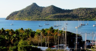
Photo shows Tyrell Bay on Carriacou. Saraoni is at the back of the pack.
We left the anchorage at the North end of Grenada's Grand Anse beach two days ago in lightish conditions and are now anchored in the large, but well sheltered Tyrell Bay on Grenada's smaller and slower paced sibling, Carriacou. This is not the first time we have been on these little islands that span the gap between Grenada and its poorer neighbor to the North, St. Vincent. We hopped from island to island back in 1982 with loaded backpacks and found the islands far too expensive for our budget and mostly camped wild by a beach or on a cliff top.
The islands are still expensive, even with our strong NZ dollars. Prices in Carriacou's little minimarkets and veggie / fruit stalls are around 50% up from St. George's and probably double the prices in the Canaries. How do the locals survive? There are certainly plenty of them as these islands seem packed with humanity. Never mind. Being here by yacht allows us to explore these little parched gems embedded in their azure sea in a more relaxed and unhurried way than we did so many years ago and what we pay more for in food and drink is balanced by the free accommodation and sun and wind power!
With the orientation of the island chain between Grenada and Martinique, going northbound means sailing hard on the wind with the help of the engine (back to Med. 'sailing'?) or plenty of tacks, taking into account the swift currents between the islands. As we emerged from the top end of Grenada, we found the current taking us westwards. It did mean that the wave action was very comfortable with a flat sea, but we had to steer more into the wind to keep away from the exclusion zone around Kick 'Em Jenny - the underwater submarine volcano that sporadically becomes active.
Today, we took a minibus over the hill to the island capital of Hillsborough and then walked along the leeward, Western coastline into the island scrub zone and High North National Park. We were surprised at the number of twittering birds around considering how dry the environment was. There were hundreds of lizards skittering through the leaves away from us, too - including some large, green iguanas which looked just like their cousins on the Galapagos Islands we had seen also on the 1982 visit.

Photo shows a green iguana trying to hide up a tree in the scrub near Anse La Roche on Carriacou's North West coast.
We dropped through the scrub to an isolated beach - Anse La Roche, where we were the only occupants - for a while. We snorkelled off the beach around the reef and rocks - it was great to see life under the water surface. We haven't been expecting anything spectacular in the Caribbean. After nearly 10 years in and around Papua New Guinea's much more diverse and pristine reefs we have become a bit spoiled, but after the Med with its lifeless waters, even a nondescript experience in the Caribbean is a pleasure.
After the beach, we sauntered on around the top end of the island - with a fantastic view North towards nearby Union Island , which belongs to St. Vincent and in the distance, Mayreau, the Tobago Cays, Canouan, the infamously elite Mustique and Bequia. As we rounded the top, the little twin islands of Petite St. Vincent and Petite Martinique came into view and the offlying reefs off the windward coast of Carriacou. Traditional boatbuilders still build wooden boats in the carvel fashion here, but we jumped on a minibus as we reached civilization and were back on the beach at Tyrell Bay in an hour or two after another search around Hillsborough's little supermarkets to see if there was a bargain to be had.

Back at the beach at Tyrell Bay
Tomorrow we will up anchor and take a mooring at Sandy Island, around the corner from here. It's in a marine protected area, meant to protect the reefs and mangroves from exploitation. Grenada is trying its best to protect what little natural it has left and there are signs everywhere admonishing the citizenry to put rubbish in the right place, look after the fisheries and not take turtle eggs.

Sandy Island above is a sand cay in Carriacou's Marine Protected Area. Good snorkelling, but a pretty windy anchorage. Union Island is in the background.
We're not sure at this stage how far North we will go as the further North we get, the greater the distance to the ABC islands of Bonaire, Curacao and Aruba that will be on our path as we sail towards Panama - where we expect to leave the boat during the hurricane season.
We left the anchorage at the North end of Grenada's Grand Anse beach two days ago in lightish conditions and are now anchored in the large, but well sheltered Tyrell Bay on Grenada's smaller and slower paced sibling, Carriacou. This is not the first time we have been on these little islands that span the gap between Grenada and its poorer neighbor to the North, St. Vincent. We hopped from island to island back in 1982 with loaded backpacks and found the islands far too expensive for our budget and mostly camped wild by a beach or on a cliff top.
The islands are still expensive, even with our strong NZ dollars. Prices in Carriacou's little minimarkets and veggie / fruit stalls are around 50% up from St. George's and probably double the prices in the Canaries. How do the locals survive? There are certainly plenty of them as these islands seem packed with humanity. Never mind. Being here by yacht allows us to explore these little parched gems embedded in their azure sea in a more relaxed and unhurried way than we did so many years ago and what we pay more for in food and drink is balanced by the free accommodation and sun and wind power!
With the orientation of the island chain between Grenada and Martinique, going northbound means sailing hard on the wind with the help of the engine (back to Med. 'sailing'?) or plenty of tacks, taking into account the swift currents between the islands. As we emerged from the top end of Grenada, we found the current taking us westwards. It did mean that the wave action was very comfortable with a flat sea, but we had to steer more into the wind to keep away from the exclusion zone around Kick 'Em Jenny - the underwater submarine volcano that sporadically becomes active.
Today, we took a minibus over the hill to the island capital of Hillsborough and then walked along the leeward, Western coastline into the island scrub zone and High North National Park. We were surprised at the number of twittering birds around considering how dry the environment was. There were hundreds of lizards skittering through the leaves away from us, too - including some large, green iguanas which looked just like their cousins on the Galapagos Islands we had seen also on the 1982 visit.
Photo shows a green iguana trying to hide up a tree in the scrub near Anse La Roche on Carriacou's North West coast.
We dropped through the scrub to an isolated beach - Anse La Roche, where we were the only occupants - for a while. We snorkelled off the beach around the reef and rocks - it was great to see life under the water surface. We haven't been expecting anything spectacular in the Caribbean. After nearly 10 years in and around Papua New Guinea's much more diverse and pristine reefs we have become a bit spoiled, but after the Med with its lifeless waters, even a nondescript experience in the Caribbean is a pleasure.
After the beach, we sauntered on around the top end of the island - with a fantastic view North towards nearby Union Island , which belongs to St. Vincent and in the distance, Mayreau, the Tobago Cays, Canouan, the infamously elite Mustique and Bequia. As we rounded the top, the little twin islands of Petite St. Vincent and Petite Martinique came into view and the offlying reefs off the windward coast of Carriacou. Traditional boatbuilders still build wooden boats in the carvel fashion here, but we jumped on a minibus as we reached civilization and were back on the beach at Tyrell Bay in an hour or two after another search around Hillsborough's little supermarkets to see if there was a bargain to be had.
Back at the beach at Tyrell Bay
Tomorrow we will up anchor and take a mooring at Sandy Island, around the corner from here. It's in a marine protected area, meant to protect the reefs and mangroves from exploitation. Grenada is trying its best to protect what little natural it has left and there are signs everywhere admonishing the citizenry to put rubbish in the right place, look after the fisheries and not take turtle eggs.
Sandy Island above is a sand cay in Carriacou's Marine Protected Area. Good snorkelling, but a pretty windy anchorage. Union Island is in the background.
We're not sure at this stage how far North we will go as the further North we get, the greater the distance to the ABC islands of Bonaire, Curacao and Aruba that will be on our path as we sail towards Panama - where we expect to leave the boat during the hurricane season.
| Vessel Name: | Saraoni (1) and Sundari (2) |
| Vessel Make/Model: | South Coast 36 and Beneteau 473 respectively |
| Hailing Port: | Lamb Island, Australia |
| Crew: | Alison and Geoff Williams |
| About: | |
| Extra: | CONTACT DETAILS Telephone / SMS number +61 456 637 752 (Australian mobile no.) +64 28 432 5941 NZ mobile no.) Email yachtsundari@gmail.com (main email address) |
Saraoni (1) and Sundari (2)'s Photos - Main
.JPG) |
A collection of photos taken while teaching and cruising in PNG's Milne Bay Province
74 Photos
Created 29 April 2023
|
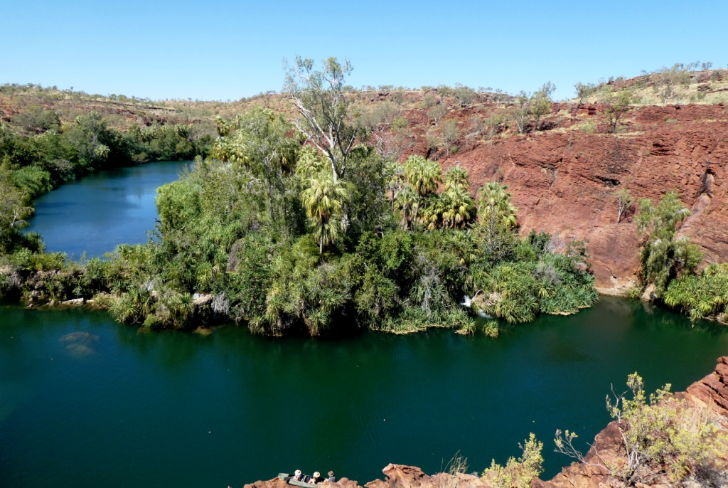 |
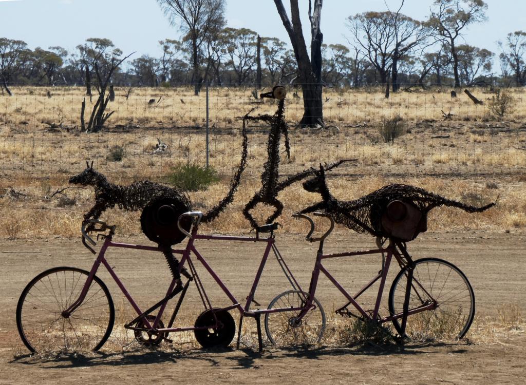 |
Some rather idiosyncratic metal sculptures in outback Queensland between Aramac and Lake Dunn
8 Photos
Created 27 September 2020
|
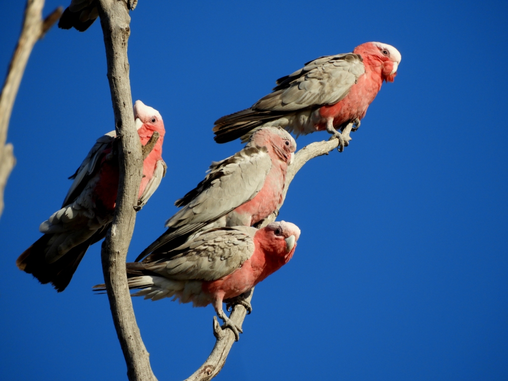 |
Birds and other critters on our Queensland inland safari
12 Photos
Created 27 September 2020
|
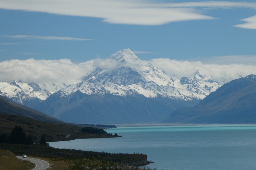 |
A collection of photos taken during the Tiki Tour of the Southern half of the South Island, November / December 2019
40 Photos
Created 15 December 2019
|
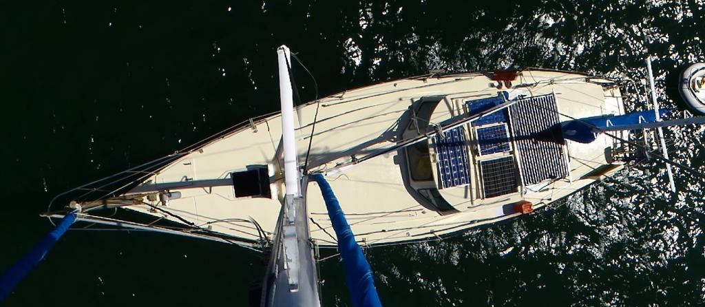 |
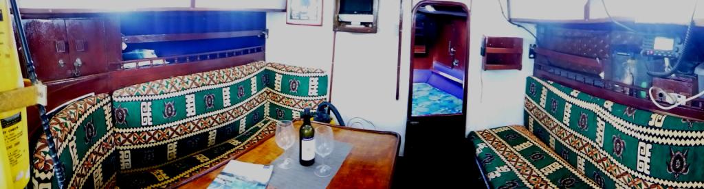 |
Photos taken of Saraoni. All interior photos were taken in the last week.
10 Photos
Created 2 April 2019
|
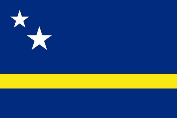 |
50 Photos
Created 27 June 2014
|
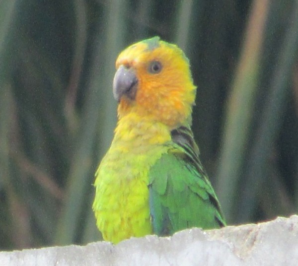 |
The ABCs - Aruba, Bonaire and Curacao are mostly low lying dry, scrubby islands in the Western Caribbean near the Venezuelan coastline
15 Photos
Created 21 May 2014
|
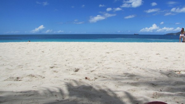 |
 |
 |
Images taken in and around Suriname's capital
40 Photos
Created 9 February 2014
|
 |
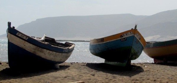 |
Images of the 2 islands in the Cape Verde island group we visited on our way across the Atlantic in 2013 - Sao Vicente and Santo Antaao.
37 Photos
Created 26 December 2013
|
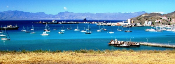 |
 |
 |
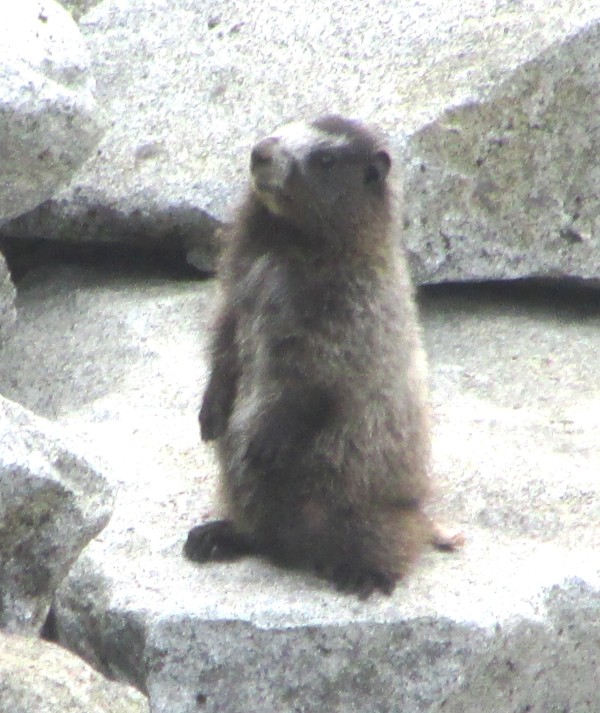 |
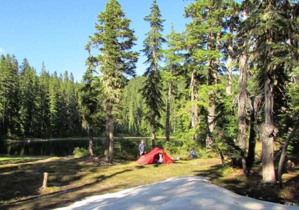 |
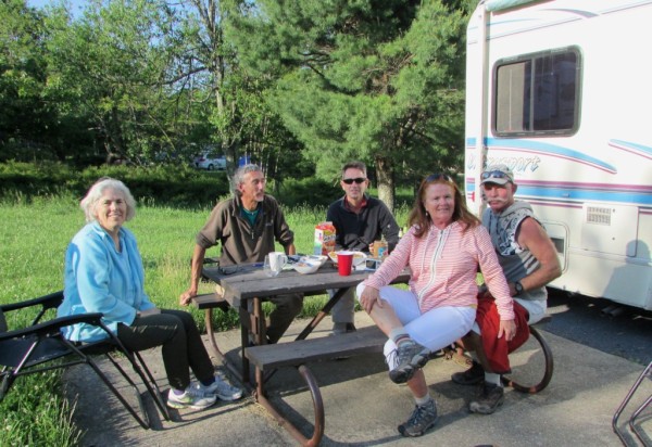 |
Unexpected meeting with old friends "in the woods".
6 Photos
Created 24 June 2013
|
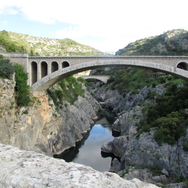 |
A brother found amongst the gorges of the Cevennes
5 Photos
Created 10 June 2013
|
 |
Photographic images of our long walk along the Appalachian mountains in the USA
26 Photos
Created 10 June 2013
|
 |
 |
 |
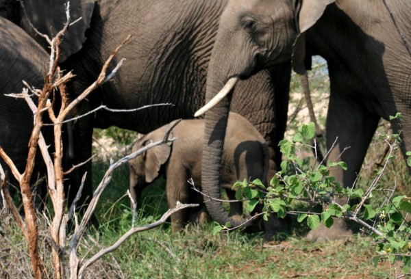 |
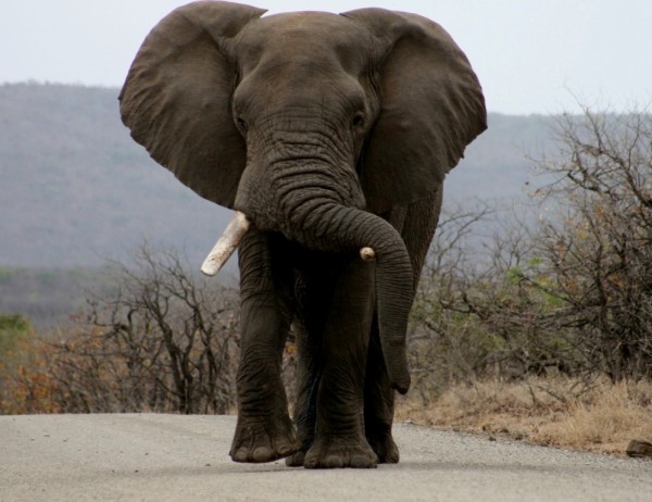 |
 |
 |
Greece is in the throes of a recession, but they still have the last laugh - never far from the sun, the sea, colour, culture and bags of history. The photos document our Aegean odyssey from May to September 2011
31 Photos
Created 17 December 2011
|
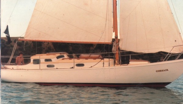 |
O.K. We're mad, but we somehow prefer a home on the sea to one on dry land.
12 Photos
Created 17 December 2011
|
 |
Kathmandu, Patan and Bhaktapur - the three ancient city states of the Kathmandu valley have mediaeval architectural wonders in their Durbars and old town areas - a meshing and merging of Hinduism, Buddhism and materialism
9 Photos
Created 17 December 2011
|
 |
Some of the shots taken of us while on one of our 30 odd days on the three main mountain trails we walked in the Anapurnas and Helambu region of Nepal's side of the Himalayas
10 Photos
Created 15 December 2011
|
 |
People make the Himalayas a unique place to walk through. From Hindu rice and buffalo farmers in the foothills to the Buddhist villages in the highlands so influenced by Tibetan ancestry and trade over the passes
16 Photos
Created 15 December 2011
|
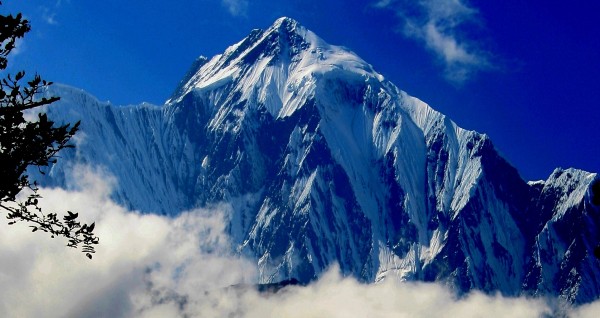 |
Nepal has ten of the world's highest mountains within its boundaries or shared with India and Tibet - these are truly giant peaks!
22 Photos
Created 15 December 2011
|
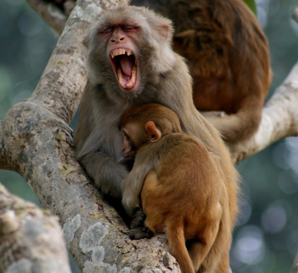 |
These were all photographed in the wilds of Chitwan and Bardia National Parks - which are two of the last havens of biodiversity in Nepal's low lying Terai district.
18 Photos
Created 14 December 2011
|
 |
Saraoni hauled out on Finike's hardstand for biennial maintenance and painting
3 Photos
Created 26 April 2011
|
 |
 |
 |
 |
 |
 |
 |
 |
 |
The small rocky island of Kastellorizou is Greece's most remote island
7 Photos
Created 11 December 2010
|
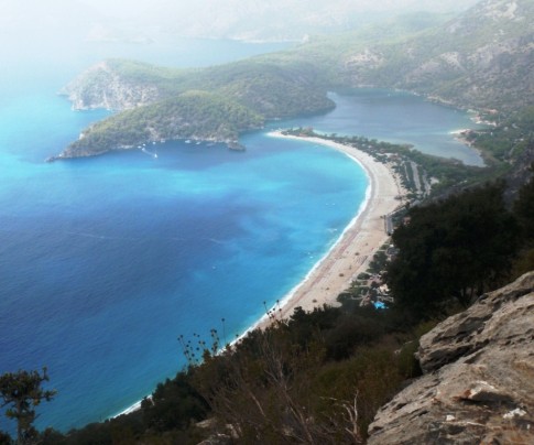 |
Cruising and walking Turkey's Lycian coast September and October 2010
19 Photos
Created 11 December 2010
|
 |
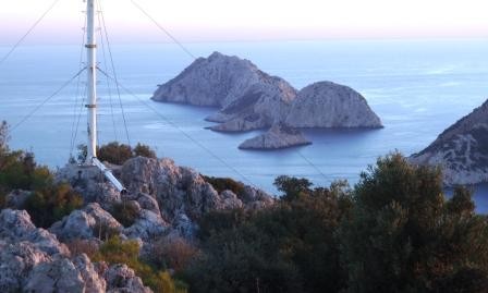 |
Images taken while walking sections of the 500 km Lycian Way or Lykia Yolu on the South West Mediterranean Coast of Turkey
11 Photos
Created 9 November 2010
|
Exploring as Much as We Can Until We Can't
Who: Alison and Geoff Williams
Port: Lamb Island, Australia
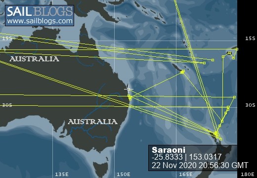
Blog Categories by Year
- 2023 Aust NZ
- 2022 Aust
- 2021 Aust
- 2020 Aust, NZ
- 2019 Aust, NZ
- 2018 New Cal Aust and NZ
- 2017 NZ, Aust, Tonga, Fiji, New Caledonia
- 2016 NZ Niue and Canada
- 2015 Pacific Crossing Panama to NZ, Galapagos, French Polynesia, Cooks, American Samoa and Tonga
- 2015 and 2014 Suriname Colombia Panama and Costa Rica
- 2014 U.S. Cycle trip
- 2014 Caribbean Islands Trinidad to Aruba
- 2014 Atlantic Crossing Cape Verdes to Suriname
- 2013 Cape Verdes, West Africa
- 2013 Canaries Post USA
- 2013 U.S.A. Hiking Trips Appalachians and Cascades
- 2013 Canaries Pre U.S.A.
- 2013 Morocco
- 2012 South Africa and Swaziland
- 2012 Mediterranean Spain and France
- 2012 Italy
- 2012 and 2011 Greece
- 2011 A Quarter Century on the Sea
- 2011 Nepal
- 2011 and 2010 Turkey
- 2010 Oman Yemen the Red Sea and Israel
- 2010 South Asia: India and Sri Lanka
- 2009 Malaysia and Thailand
- 2009 and 2008 Aust and SE Asia
- 2007 Australia
- 2006 NZ to New Caledonia and Australia
- A Tale of Three Boats
- 1978 to 2018 Perspectives on a Long Journey
SailBlogs Friends

