
SVs Saraoni and Sundari
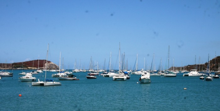
09 April 2024 | The Broadwater, Gold Coast, Australia
03 March 2024 | Hope Harbour marina, Gold Coast, Australia
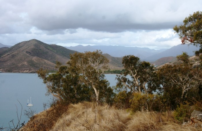
03 January 2024 | Karragarra Channel, South Moreton Bay Islands, Queensland
15 December 2023 | Riverheads, Mary River, Great Sandy Strait, Queensland
23 October 2023 | Great Keppel Island
07 August 2023 | Trinity Inlet, Cairns, North Queensland
23 July 2023 | Trinity Inlet, Cairns, Far North Queensland.
07 July 2023 | Cairns
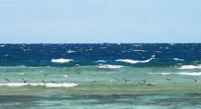
19 May 2023 | North West island, Capricornia Cays, Queensland
15 May 2023 | Burnett River, Bundaberg, Queensland.
29 April 2023 | Manly marina, Moreton Bay, Queensland, Australia
04 March 2023 | South Auckland, New Zealand
18 January 2023 | Gold Coast Broadwater, Queensland
17 November 2022 | Collie, Southern WA, Australia
29 October 2022 | Albany, SW Australia
14 October 2022 | Augusta, WA, Australia
15 August 2022 | Karragarra Passage, Southern Moreton Bay, Queensland, Australia
14 July 2022 | Raby Bay, off Moreton Bay, Queensland
13 June 2022 | Camooweal, Far West Queensland
20 May 2022 | Alice Springs, Northern Territory, Australia
The 40 Days of Christmas
25 December 2017 | Port Ouenghi marina, New Caledonia
Alison and Geoff, hot and calm
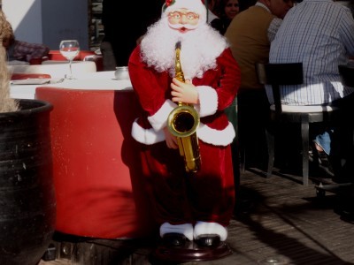
Photo of a Moroccan Santa snapped from Saraoni on Christmas day in Agadir, Morocco, 2012.
There has been a lot of soul searching about whether Christmas is worth it in the media recently. Maybe there is every year, but we haven't noticed it as much as this year. Because all of us either endure or enjoy Christmas, whether we like it or not, we thought we might as well add our 5 Pacific francs worth!
What do you do about Christmas when you a) are not a Christian, b) think God is a hoax c) can't stand commercialism, d) have no kids, d) are far away from family or friends, e) are in the southern hemisphere at the hottest time of the year, f) want to get to the shops or get something fixed?
Christmas is sometimes very enjoyable, but at other times it's just a pain in the arse. It's nice to see people giving up their Christmas time to boost the morale of those at the bottom of the heap, though. It makes up for all the selfish Trumps of this world!
We've done some counting and reckon we have had 40 Christmases together since we first met. The first one was in 1978 in a tent, perched above a small bay in the Coromandel, hidden amongst the manuka. We had bought a chicken to cook in Whitianga, but had no way of cooking it, so ended up swigging our way through a large flagon of red wine instead. Not sure what happened to the chicken.
Some thoughts about those 40 days of Christmas:
• 30 of them we've spent just by ourselves; we have had Christmas with family only three times (in London) and friends 7 times, the most recently with the French /Canadian crew of Arbutus last year.
• We've spent Christmas in 12 different countries;
• The most Christmases have been spent in Australia (10); NZ (9) and PNG (7).
• We spent one Christmas in a cyclone (Thursday Island, 1993)
• The least Christmassy Christmas was spent in Kaş, Turkey, 2009. No sign of a Turkish Santa anywhere! The funny thing was that Saint Nicholas, the Greek guy whose love of kids contributed to the Santa Claus myth, spent almost his entire life in the very next town along the coast (Demre).
• The most remote Christmas was spent by the Paya River in the Darien Gap, between Colombia and Panama in 1982. We were days away from civilisation in the middle of the jungle. Christmas dinner was a bit skimpy (a handful of nuts and raisins) but we didn't even know it was Christmas! Actually, we didn't even know where we were or whether we would see anyone else ever again!
• The worst Christmas ever was the first of many Christmases we spent in Port Moresby, PNG, in 1988. We had no money, no food and certainly no booze; it was wet and stormy and we were bitten all over by mosquitoes day and night.

The Darien Gap, Christmas 1982!
And as for our Christmas this year, we are in Ouenghi marina. The marina has been busy with French boaties going out to the islands for the Christmas break, but it is quiet today. We were going to go out to an island on the main barrier reef, but the tide was too low in the early morning, so we didn't bother. It's like being on holiday for us here, being able to turn on a water tap and walk ashore whenever we like!
We have drunk all our booze already, except for one bottle of wine, eaten the chicken, and the shops are closed in the nearby village of Boulouparis, so we can't buy any baguettes. Like most days, we have been busy tapping away on the computers making money. Today, it's been a focus on suing U.S. cities for negligence.
The sun is blazing hot in the middle of the day, almost windless, but it cools down nicely at night. Tomorrow we will catch the bus to Parc Riviere Bleue and walk for 4 days through the kaori forest and up through the mountains behind Noumea. If we are lucky, we might see a flightless cagou, the New Caledonian national emblem.
A cagou - there aren't many left - will we see one?
As Christmases go, our 40th is a pretty average one. Happy Christmas everyone!
Saraoni tucked up in Ouenghi marina Christmas Day 2017!
There has been a lot of soul searching about whether Christmas is worth it in the media recently. Maybe there is every year, but we haven't noticed it as much as this year. Because all of us either endure or enjoy Christmas, whether we like it or not, we thought we might as well add our 5 Pacific francs worth!
What do you do about Christmas when you a) are not a Christian, b) think God is a hoax c) can't stand commercialism, d) have no kids, d) are far away from family or friends, e) are in the southern hemisphere at the hottest time of the year, f) want to get to the shops or get something fixed?
Christmas is sometimes very enjoyable, but at other times it's just a pain in the arse. It's nice to see people giving up their Christmas time to boost the morale of those at the bottom of the heap, though. It makes up for all the selfish Trumps of this world!
We've done some counting and reckon we have had 40 Christmases together since we first met. The first one was in 1978 in a tent, perched above a small bay in the Coromandel, hidden amongst the manuka. We had bought a chicken to cook in Whitianga, but had no way of cooking it, so ended up swigging our way through a large flagon of red wine instead. Not sure what happened to the chicken.
Some thoughts about those 40 days of Christmas:
• 30 of them we've spent just by ourselves; we have had Christmas with family only three times (in London) and friends 7 times, the most recently with the French /Canadian crew of Arbutus last year.
• We've spent Christmas in 12 different countries;
• The most Christmases have been spent in Australia (10); NZ (9) and PNG (7).
• We spent one Christmas in a cyclone (Thursday Island, 1993)
• The least Christmassy Christmas was spent in Kaş, Turkey, 2009. No sign of a Turkish Santa anywhere! The funny thing was that Saint Nicholas, the Greek guy whose love of kids contributed to the Santa Claus myth, spent almost his entire life in the very next town along the coast (Demre).
• The most remote Christmas was spent by the Paya River in the Darien Gap, between Colombia and Panama in 1982. We were days away from civilisation in the middle of the jungle. Christmas dinner was a bit skimpy (a handful of nuts and raisins) but we didn't even know it was Christmas! Actually, we didn't even know where we were or whether we would see anyone else ever again!
• The worst Christmas ever was the first of many Christmases we spent in Port Moresby, PNG, in 1988. We had no money, no food and certainly no booze; it was wet and stormy and we were bitten all over by mosquitoes day and night.
The Darien Gap, Christmas 1982!
And as for our Christmas this year, we are in Ouenghi marina. The marina has been busy with French boaties going out to the islands for the Christmas break, but it is quiet today. We were going to go out to an island on the main barrier reef, but the tide was too low in the early morning, so we didn't bother. It's like being on holiday for us here, being able to turn on a water tap and walk ashore whenever we like!
We have drunk all our booze already, except for one bottle of wine, eaten the chicken, and the shops are closed in the nearby village of Boulouparis, so we can't buy any baguettes. Like most days, we have been busy tapping away on the computers making money. Today, it's been a focus on suing U.S. cities for negligence.
The sun is blazing hot in the middle of the day, almost windless, but it cools down nicely at night. Tomorrow we will catch the bus to Parc Riviere Bleue and walk for 4 days through the kaori forest and up through the mountains behind Noumea. If we are lucky, we might see a flightless cagou, the New Caledonian national emblem.
A cagou - there aren't many left - will we see one?
As Christmases go, our 40th is a pretty average one. Happy Christmas everyone!
Saraoni tucked up in Ouenghi marina Christmas Day 2017!
Joyeux Noel to All
21 December 2017 | Ouenghi Marina, New Caledonia
Alison and Geoff, calm and clear
Joyeux Noel to All
Small Island, Big Fish
19 December 2017 | Isle Ducos, Baie de St Vincent, New Caledonia
Alison and Geoff, hot and windy

Small Island - Isle Signal. The "signal" is the limestone tower just visible at the right hand end of the island.
The Southern lagoon of New Caledonia stretches for a hundred nautical miles from its southern extremity near the Isle of Pines to La Foa in the North. The lagoon is protected to the west by an almost continuous barrier of coral and to the East the main island of Grande Terre. The barrier recommences further north, south of the town of Koumac, and then encloses the Northern lagoon, much bigger and more remote, a place we hope to explore next year. The east coast also has its own barrier reefs and lagoons, although the barrier is broken and in some places sunk below sea level.
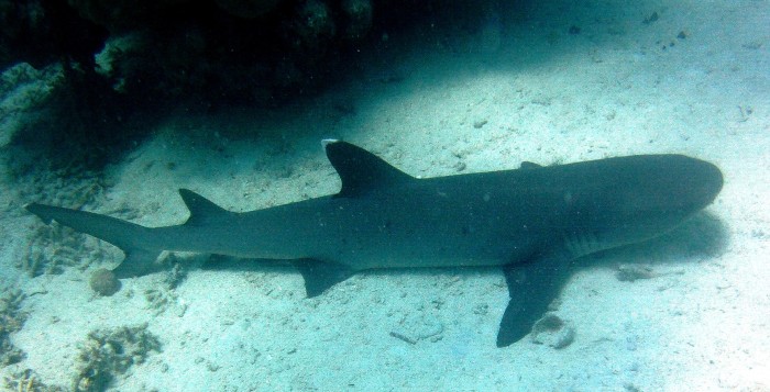
Big fish: a white tipped reef shark, having a nap on the sea bed near Isle Signal.
Within the southern lagoon lie 40 odd vegetated coral islands, each with encircling white coral sand beaches. The islands look a bit on the scruffy side, with dry scrub and trees, no palm trees here! The little cays near Noumea are marine reserves and the government has put in free moorings for use by boats to protect the fringing coral reefs and sea grass beds.
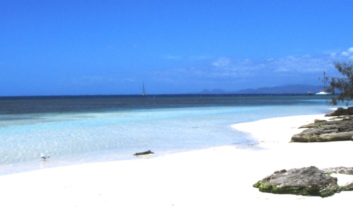
Saraoni just visible beyond Signal's dazzling white sand beach.
We spent 24 hours at Isle Signal yesterday, the umpteenth cay we have been to on this trip. It's called Signal because of the limestone tower that was erected in the nineteenth century. Ships approaching the outer barrier reef could safely enter one of the passes (Dumbea) near Noumea by holding the tower in transect with a hill on the mainland. It was soon replaced by the much higher Amadee lighthouse and ships switched to the Passe de Boulari instead.
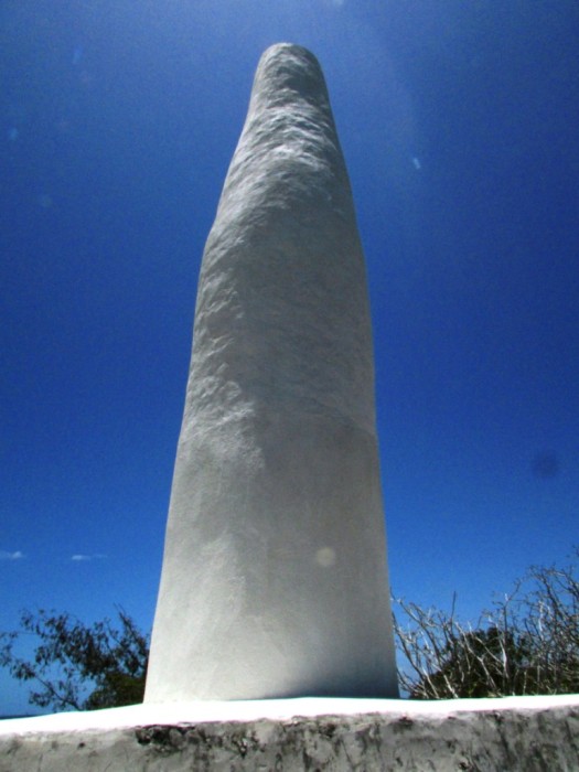
What looks like some weird French phallic symbol is Isle Signal's nineteenth century built limestone "signal"!
These marine reserves show just how soon marine life can become prolific with protection, as has happened at Goat Island and the Poor Knights in NZ. It's great to see big fish lurking on the reef edge, coral trout, rock cod, sweetlips, big trevally and the odd shark. It's just a pity that there aren't more reserves like these.
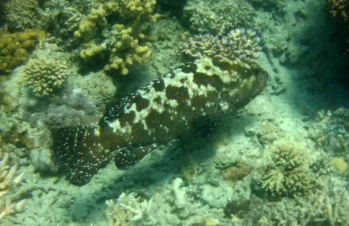
rock cod

another rock cod, different species
Isle Signal is the breeding home for hundreds of wedge tailed shearwaters, who make burrows all over the sandy soil covered island. Silver gulls have finished nesting already, but seemed to be pretty annoyed at our presence yesterday when we went walkabout. White capped noddy terns and sooty terns were everywhere, getting ready to breed.

Sooty terns in courtship mode
Each of these little islands seems to have a resident pair of ospreys with their young. The islands are also home to hundreds of tricot rayes, banded sea snakes, which use the islands to warm up in the winter months and breed in season. We've seen only a few of them on this trip, perhaps because of the temperature. They are in the water looking for tiny fish and other tasty tidbits to eat. Click here to see a tricot raye, or ketuali, we saw in the water in Niue last year.
We are now in the huge Baie de St Vincent, 30 miles north of Noumea. It's as big as the Bay of Islands and it has its own islands, too, although it is a bleak and barren sort of place. Port Ouenghi marina is in the extreme north of the bay, but we are the only ones around. Perhaps everyone is getting ready for Christmas? We are planning a 4 day hike on the GR1 in the mountains behind Noumea, then a 10 day circuit of the main island on our new bikes. We've swapped plans (yet again), intending to fly to Hobart at the end of January for two months away from the boat, cycling and walking in Tasmania. We expect to be in the South Island next summer.
Watch this space! Christmas message coming soon!
The Southern lagoon of New Caledonia stretches for a hundred nautical miles from its southern extremity near the Isle of Pines to La Foa in the North. The lagoon is protected to the west by an almost continuous barrier of coral and to the East the main island of Grande Terre. The barrier recommences further north, south of the town of Koumac, and then encloses the Northern lagoon, much bigger and more remote, a place we hope to explore next year. The east coast also has its own barrier reefs and lagoons, although the barrier is broken and in some places sunk below sea level.
Big fish: a white tipped reef shark, having a nap on the sea bed near Isle Signal.
Within the southern lagoon lie 40 odd vegetated coral islands, each with encircling white coral sand beaches. The islands look a bit on the scruffy side, with dry scrub and trees, no palm trees here! The little cays near Noumea are marine reserves and the government has put in free moorings for use by boats to protect the fringing coral reefs and sea grass beds.
Saraoni just visible beyond Signal's dazzling white sand beach.
We spent 24 hours at Isle Signal yesterday, the umpteenth cay we have been to on this trip. It's called Signal because of the limestone tower that was erected in the nineteenth century. Ships approaching the outer barrier reef could safely enter one of the passes (Dumbea) near Noumea by holding the tower in transect with a hill on the mainland. It was soon replaced by the much higher Amadee lighthouse and ships switched to the Passe de Boulari instead.
What looks like some weird French phallic symbol is Isle Signal's nineteenth century built limestone "signal"!
These marine reserves show just how soon marine life can become prolific with protection, as has happened at Goat Island and the Poor Knights in NZ. It's great to see big fish lurking on the reef edge, coral trout, rock cod, sweetlips, big trevally and the odd shark. It's just a pity that there aren't more reserves like these.
rock cod
another rock cod, different species
Isle Signal is the breeding home for hundreds of wedge tailed shearwaters, who make burrows all over the sandy soil covered island. Silver gulls have finished nesting already, but seemed to be pretty annoyed at our presence yesterday when we went walkabout. White capped noddy terns and sooty terns were everywhere, getting ready to breed.
Sooty terns in courtship mode
Each of these little islands seems to have a resident pair of ospreys with their young. The islands are also home to hundreds of tricot rayes, banded sea snakes, which use the islands to warm up in the winter months and breed in season. We've seen only a few of them on this trip, perhaps because of the temperature. They are in the water looking for tiny fish and other tasty tidbits to eat. Click here to see a tricot raye, or ketuali, we saw in the water in Niue last year.
We are now in the huge Baie de St Vincent, 30 miles north of Noumea. It's as big as the Bay of Islands and it has its own islands, too, although it is a bleak and barren sort of place. Port Ouenghi marina is in the extreme north of the bay, but we are the only ones around. Perhaps everyone is getting ready for Christmas? We are planning a 4 day hike on the GR1 in the mountains behind Noumea, then a 10 day circuit of the main island on our new bikes. We've swapped plans (yet again), intending to fly to Hobart at the end of January for two months away from the boat, cycling and walking in Tasmania. We expect to be in the South Island next summer.
Watch this space! Christmas message coming soon!
Prisoners in Paradise
10 December 2017 | Baie de Kuto, Isle des Pins, New Caledonia
Alison and Geoff, hot and (relatively) calm
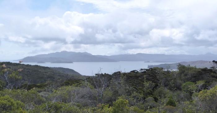
Photo above taken from Pic Nga, the highest point on the Isle of Pines. The peninsula shown separates Kuto bay with the yacht anchorage and wharf on the right from equally pretty Kanumera bay on the left. Caledonian pines are the tall trees in the picture.
We are in Kuto Bay at the Isle of Pines, 35 nm south east of the main island of New Caledonia. The weather has been great after the bash down here against the ever present trade wind. Light winds, blue skies and calm seas - couldn't be better!
The island is one of those Caledonian contradictions. In the late nineteenth century when France, like much of Europe, was going through the turmoil associated with the introduction of laissez faire capitalism, with all its negative social consequences, the idea of dumping surplus convicts as well as the uppity revolutionaries involved in the Paris Commune seemed a good one.
New Cal. was just one place in the French overseas empire that seemed a particularly good dumping ground. Thousands of communards were exiled to five separate locations on the Isle of Pines. They weren't expected to participate in hard labour like the hard core convicts (those who'd dared to steal a loaf of bread in some grotty Parisian street) but must have peered out of their cells in disbelief at the scene outside. They were prisoners in paradise! Many of them died, however, during the relatively brief exile period but eventually the survivors were pardoned and they were shipped back to freedom in La Metropole.

2,800 Communards were dumped in these prisons after demanding that France's wealth should be for the "many, not the few". They experienced the flip side of paradise! The few, meanwhile, seem to be doing even better than ever, at the expense of the many, 150 years later!
The Isle of Pines is one of New Cal.'s gems. This is our fourth visit. We came here first on the ferry from Noumea in 1985 and hiked and camped all along the west coast up to the Bay of Crabs. The island hasn't changed a lot since then. The boulangerie near Kuto has moved a bit up the road; there are more cars and cellphone coverage is good, the roads have been sealed and a few more gites have popped up, but there is very little sign of commercialism here. The Kunies (island kanaks) have gained control over the island in terms of development and besides the swanky Meridien hotel on the east coast, island life is pretty laid back.
Kuto Bay is also the first place we slipped into flying our yellow flag after leaving the Bay of Islands in 2006 at the start of what was to be a 9 and a half year circumnavigation. Check out the photos on this blog entry. They are very similar to the ones shown below!
We bought two bikes in Noumea as we left our NZ ones behind in Opua, so have been able to ride around the very quiet island road network. People here (nearly all Melanesian) are like anywhere we have been on this trip in the rural Pacific - friendly and seemingly content with life.
We have a few more days of calm weather before it gets windy again. We should be in Ouenghi marina in a week's time, plotting our cyclone season travel plans!
Kuto beach

Pic Nga, 228 m high, behind Kuto Bay's anchorage
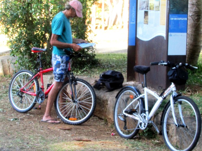
We're at it again! Can't keep away from bikes! Planning a road trip on them around Grande Terre in Jan. before we fly out.
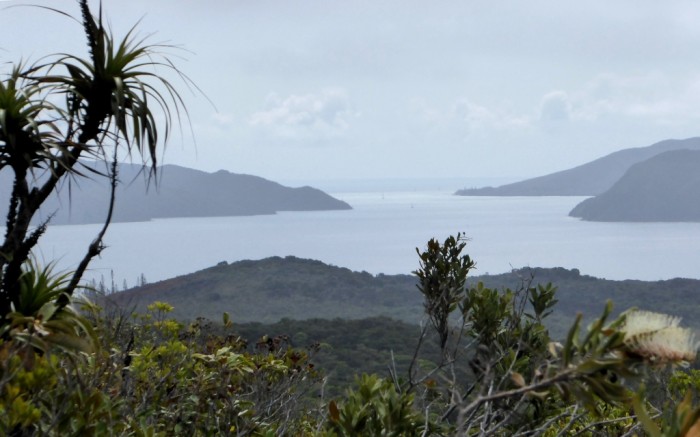
Ilot Brosse in the background looks just like a hair brush from Pic Nga!

The beach at Ilot Brosse. When we were there today, a tricot raye (sea krait) slithered up the beach while 6 black tipped sharks patrolled the reef flat as the tide came in.
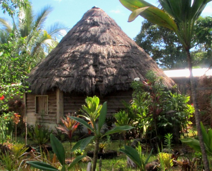
There are still a few traditionally round, thatched Kanak huts left on the island probably with a SUV parked outside!

Sailing pirogue on the beach at Baie St Joseph near Vao
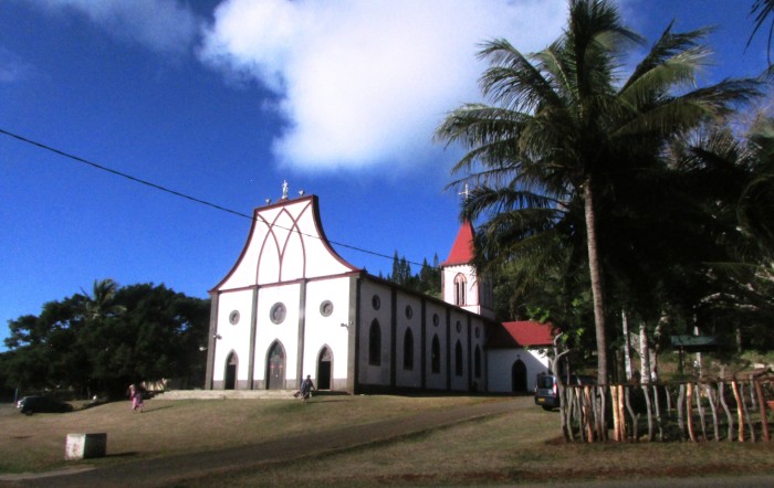
Catholic church at Vao, the sleepy capital of Isle des Pins, which also has the Mairie, 1 shop, a school and not much else!
We are in Kuto Bay at the Isle of Pines, 35 nm south east of the main island of New Caledonia. The weather has been great after the bash down here against the ever present trade wind. Light winds, blue skies and calm seas - couldn't be better!
The island is one of those Caledonian contradictions. In the late nineteenth century when France, like much of Europe, was going through the turmoil associated with the introduction of laissez faire capitalism, with all its negative social consequences, the idea of dumping surplus convicts as well as the uppity revolutionaries involved in the Paris Commune seemed a good one.
New Cal. was just one place in the French overseas empire that seemed a particularly good dumping ground. Thousands of communards were exiled to five separate locations on the Isle of Pines. They weren't expected to participate in hard labour like the hard core convicts (those who'd dared to steal a loaf of bread in some grotty Parisian street) but must have peered out of their cells in disbelief at the scene outside. They were prisoners in paradise! Many of them died, however, during the relatively brief exile period but eventually the survivors were pardoned and they were shipped back to freedom in La Metropole.
2,800 Communards were dumped in these prisons after demanding that France's wealth should be for the "many, not the few". They experienced the flip side of paradise! The few, meanwhile, seem to be doing even better than ever, at the expense of the many, 150 years later!
The Isle of Pines is one of New Cal.'s gems. This is our fourth visit. We came here first on the ferry from Noumea in 1985 and hiked and camped all along the west coast up to the Bay of Crabs. The island hasn't changed a lot since then. The boulangerie near Kuto has moved a bit up the road; there are more cars and cellphone coverage is good, the roads have been sealed and a few more gites have popped up, but there is very little sign of commercialism here. The Kunies (island kanaks) have gained control over the island in terms of development and besides the swanky Meridien hotel on the east coast, island life is pretty laid back.
Kuto Bay is also the first place we slipped into flying our yellow flag after leaving the Bay of Islands in 2006 at the start of what was to be a 9 and a half year circumnavigation. Check out the photos on this blog entry. They are very similar to the ones shown below!
We bought two bikes in Noumea as we left our NZ ones behind in Opua, so have been able to ride around the very quiet island road network. People here (nearly all Melanesian) are like anywhere we have been on this trip in the rural Pacific - friendly and seemingly content with life.
We have a few more days of calm weather before it gets windy again. We should be in Ouenghi marina in a week's time, plotting our cyclone season travel plans!
Kuto beach
Pic Nga, 228 m high, behind Kuto Bay's anchorage
We're at it again! Can't keep away from bikes! Planning a road trip on them around Grande Terre in Jan. before we fly out.
Ilot Brosse in the background looks just like a hair brush from Pic Nga!
The beach at Ilot Brosse. When we were there today, a tricot raye (sea krait) slithered up the beach while 6 black tipped sharks patrolled the reef flat as the tide came in.
There are still a few traditionally round, thatched Kanak huts left on the island probably with a SUV parked outside!
Sailing pirogue on the beach at Baie St Joseph near Vao
Catholic church at Vao, the sleepy capital of Isle des Pins, which also has the Mairie, 1 shop, a school and not much else!
We Swap Plan Sea for Plan C!
02 December 2017 | Baie d'Orphelinat, Noumea, New Caledonia
Alison and Geoff, cloudy, 20 knot ESE wind
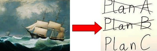
It's good to have a plan B, whatever you do in life. It's even better to have a plan C, if you can think of one that is practical. Grotty yachties definitely always need a plan B while mooching around in a boat and a plan C helps if you just happen to be afloat in the cyclone season!
With our plan A and plan B looking increasingly dodgy, we've focused on plan C. Plan C is to leave the boat here in New Cal. while we exit stage left, enjoying being as far away from the sea and boats as possible. Through the yachtie grapevine (more specifically, the Mag Net) we learned of a small marina up the west coast that still had spaces left. The marinas here in Noumea are all full to bursting point through the cyclone season and no foreign boats have a chance of getting a berth.
The little marina we will leave Saraoni in while we go walking in the South Island is a bit out of the way, but is very sheltered, surrounded by shallow mud flats and mangroves. Like Port Moselle, as we discovered in 2006 when cyclone Xavier was born in the Southern Solomons, Port Ouenghi has a plan in case a cyclone barrels down the west coast. One did in April this year (the same one that we were warned about in Whangarei, just after leaving the hard stand.) According to the marina managers, although a lot of trees were damaged nearby, the marina itself experienced quiet conditions. Roger and Sasha, who we first met in the San Blas with sister Sue, have left their Aussie yacht, Edn Bal, on the same pontoon as us.
Now, at least, we can give up all the tedious weather watching, enjoy some time out at the Isle of Pines and do some exploring and walking on Grande Terre before we fly down to NZ at the end of January.
We aim to be back on the boat in April next year and when the safe sailing season begins again in May complete a leisurely circumnavigation of Grande Terre and a side trip to the Loyalties and Vanuatu before looking for a good passage to NZ, preferably earlier rather than later, like we tried to do this year.
Saraoni’s Last Moana?
27 November 2017 | Noumea, New Caledonia
Alison and Geoff, hot and windy
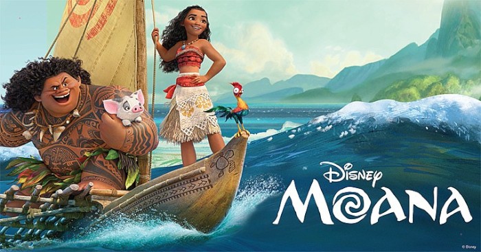
Pic shows one of Disney's blurbs for the animated film "Moana" released last year. The actors behind the Disneyesque pan Polynesian mythical melodrama come from Hawai'i, Samoa and N.Z. The big moko covered guy, Maui, has been credited with fishing the North Island of N.Z. (Te Ika o Maui) from his waka, the South Island, but maybe that's just a load of Maui bullshit!
We are anchored back in Noumea and planning what was supposed to be the crossing of Saraoni's last moana (ocean). Our plan was to retire Saraoni to its lovely spot beside the penguin rocks in Tutukaka while we searched for a bigger, more comfortable and faster boat.
We bought Saraoni nearly 20 years ago and wrested it from its Aussie home to share a heap of adventures with us. Saraoni was a solidly built coastal cruiser, with lots of room for what is a relatively small boat. There were over 40 South Coasts built in the 1980s and 1990s and it still remains a well recognised boat model on the NSW and Queensland coast. Saraoni was fitted out by a retired BP worker from Nowra who was almost as cack handed as us. Despite, or perhaps because of, our own admittedly inept efforts, Saraoni's interior has been falling apart almost as fast as we have been trying to keep it intact.
It's time to move on, but we now have a little weather problem, not something unusual in our 31 years of sailing! The Pacific has moved from neutral to a mild La Niña (opposite of El Niño). This has shifted the axis of the stream of high pressure zones southwards, unusually early. That's fine if you are sailing from Tonga, or even eastern Fiji, to NZ, but sailing hell from Noumea, because the winds spiralling out of those highs direct south east winds from the Bay of Islands and even further south right up to New Cal. It's not impossible to make the passage, but you have to contend with sailing into 20 to 25 knots and tacking for nigh on 800 miles.
The last good passage down to NZ across the moana that separates us was in the third week of October. As the SW Pacific warms up with the start of summer, small lows, troughs and storms are popping up everywhere like land mines surfacing in an old war zone.
We are not the only ones here. Noumea, of course, has hundreds. possibly thousands, of boats on moorings, or in the (relative) security of the city's 3 or 4 marinas. There is also a small fleet of German boats that are waiting to return south together with a sprinkling of other yachts that didn't want to bash south last week and prefer to spend the cyclone season in NZ rather than Oz, because it is relatively easy getting back to the islands again next year.
Some of the hundreds of boats that chance the cyclone season in Noumea. These boats are on moorings in Baie d'Orphelinat

Port Laguerre, an indent 10 miles north of Noumea seen from the slopes of Mont Mou. Just visible is a small mangrove creek, which is a cyclone refuge for Noumea based boats, but it fills up quick!
Baie Maa near Port Laguerre is a perfect refuge when the trade winds are blowing strongly.
We have a choice to confront the cyclone season, officially lasting from 1st December through to the end of April, and just wait for a window to track south so we can leave Saraoni in the penguin pad, or do a long diversion via Oz.
From here to the Queensland coast it's a relatively easy 800 miles downwind, but allowance has to be made for the possibility of summer troughs and storms drifting off the coast on arrival.
From South Queensland we could make our way to Tasmania where we had planned to go hiking anyway early next year, then make our way back across the Tasman to NZ at the end of summer. It's a long shot, as the final trans Tasman crossing may seem one moana too many! If we come to a grinding halt, Saraoni might just be on the market in the land of its birth!
We are anchored back in Noumea and planning what was supposed to be the crossing of Saraoni's last moana (ocean). Our plan was to retire Saraoni to its lovely spot beside the penguin rocks in Tutukaka while we searched for a bigger, more comfortable and faster boat.
We bought Saraoni nearly 20 years ago and wrested it from its Aussie home to share a heap of adventures with us. Saraoni was a solidly built coastal cruiser, with lots of room for what is a relatively small boat. There were over 40 South Coasts built in the 1980s and 1990s and it still remains a well recognised boat model on the NSW and Queensland coast. Saraoni was fitted out by a retired BP worker from Nowra who was almost as cack handed as us. Despite, or perhaps because of, our own admittedly inept efforts, Saraoni's interior has been falling apart almost as fast as we have been trying to keep it intact.
It's time to move on, but we now have a little weather problem, not something unusual in our 31 years of sailing! The Pacific has moved from neutral to a mild La Niña (opposite of El Niño). This has shifted the axis of the stream of high pressure zones southwards, unusually early. That's fine if you are sailing from Tonga, or even eastern Fiji, to NZ, but sailing hell from Noumea, because the winds spiralling out of those highs direct south east winds from the Bay of Islands and even further south right up to New Cal. It's not impossible to make the passage, but you have to contend with sailing into 20 to 25 knots and tacking for nigh on 800 miles.
The last good passage down to NZ across the moana that separates us was in the third week of October. As the SW Pacific warms up with the start of summer, small lows, troughs and storms are popping up everywhere like land mines surfacing in an old war zone.
We are not the only ones here. Noumea, of course, has hundreds. possibly thousands, of boats on moorings, or in the (relative) security of the city's 3 or 4 marinas. There is also a small fleet of German boats that are waiting to return south together with a sprinkling of other yachts that didn't want to bash south last week and prefer to spend the cyclone season in NZ rather than Oz, because it is relatively easy getting back to the islands again next year.
Some of the hundreds of boats that chance the cyclone season in Noumea. These boats are on moorings in Baie d'Orphelinat
Port Laguerre, an indent 10 miles north of Noumea seen from the slopes of Mont Mou. Just visible is a small mangrove creek, which is a cyclone refuge for Noumea based boats, but it fills up quick!
Baie Maa near Port Laguerre is a perfect refuge when the trade winds are blowing strongly.
We have a choice to confront the cyclone season, officially lasting from 1st December through to the end of April, and just wait for a window to track south so we can leave Saraoni in the penguin pad, or do a long diversion via Oz.
From here to the Queensland coast it's a relatively easy 800 miles downwind, but allowance has to be made for the possibility of summer troughs and storms drifting off the coast on arrival.
From South Queensland we could make our way to Tasmania where we had planned to go hiking anyway early next year, then make our way back across the Tasman to NZ at the end of summer. It's a long shot, as the final trans Tasman crossing may seem one moana too many! If we come to a grinding halt, Saraoni might just be on the market in the land of its birth!
Phare Amedee - Lonely Sentinel of the Caledonian Barrier Reef
14 November 2017 | Baie d'Orphelinat, Noumea, New Caledonia
Alison and Geoff, light SE trades

Phare Amedee on the coral island of the same name at dawn
Of all the tiny coral cays that are scattered around the lagoons around New Caledonia, easily the best known is Ilot Amedee. It sits just inside Passe de Boulari, the main pass into the Southern Lagoon if you are heading for Noumea, but what makes it special is the lighthouse on it. It is one of the Southern hemisphere's tallest lighthouses and is very well looked after by the French authorities. It's only open when the tour boat disgorges its load, which it does most days. With 247 steps that climb around and around the twisty staircase the views from the top are amazing!
The other attraction at Amedee is that like many of the cays and patch reefs around Noumea, it's a marine reserve. The coral growth is not that special, but the fish life is very healthy, with a lot of large fish: remoras, emperors, humphead parrot fish, rock cod and the odd white tipped shark. Green turtles at Amedee are extraordinarily tame, like those at Galapagos. They come in close to the beach where there is good growth of sea grass.
We're now back in Noumea to pick up our new $2,000 windlass. We're looking at weather windows down to the Land of the Long White Cloud, but they are not good. The high pressure systems are well into a late summer pattern, unusually south for this time of the year, with east to south east winds all the way down to NZ, with the odd subtropical low making things interesting between New Cal and NZ from time to time. It's easier going from Tonga to NZ and from here to Oz! We'll leave it until the end of November and then have to make a decision as the cyclone season is galloping along towards us!

Saraoni on a mooring at Amedee

The outer barrier and Passe de Boulari from the top of the lighthouse
Noddy terns in a brisk trade wind on the Amedee windward reef edge

Green turtle at Amedee

Phare Amedee
Of all the tiny coral cays that are scattered around the lagoons around New Caledonia, easily the best known is Ilot Amedee. It sits just inside Passe de Boulari, the main pass into the Southern Lagoon if you are heading for Noumea, but what makes it special is the lighthouse on it. It is one of the Southern hemisphere's tallest lighthouses and is very well looked after by the French authorities. It's only open when the tour boat disgorges its load, which it does most days. With 247 steps that climb around and around the twisty staircase the views from the top are amazing!
The other attraction at Amedee is that like many of the cays and patch reefs around Noumea, it's a marine reserve. The coral growth is not that special, but the fish life is very healthy, with a lot of large fish: remoras, emperors, humphead parrot fish, rock cod and the odd white tipped shark. Green turtles at Amedee are extraordinarily tame, like those at Galapagos. They come in close to the beach where there is good growth of sea grass.
We're now back in Noumea to pick up our new $2,000 windlass. We're looking at weather windows down to the Land of the Long White Cloud, but they are not good. The high pressure systems are well into a late summer pattern, unusually south for this time of the year, with east to south east winds all the way down to NZ, with the odd subtropical low making things interesting between New Cal and NZ from time to time. It's easier going from Tonga to NZ and from here to Oz! We'll leave it until the end of November and then have to make a decision as the cyclone season is galloping along towards us!
Saraoni on a mooring at Amedee
The outer barrier and Passe de Boulari from the top of the lighthouse
Noddy terns in a brisk trade wind on the Amedee windward reef edge
Green turtle at Amedee
Phare Amedee
Prony - Bay of Refuge
07 November 2017 | Taioae Bay, Ouen Island, New Caledonia
Alison and Geoff, mild NE winds,
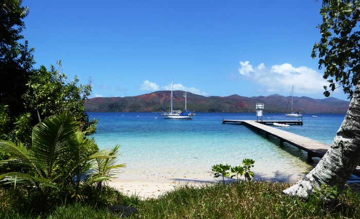
Photo shows Saraoni moored just off the Isle Casy jetty in the Baie du Prony.
Few yachties who make it to New Caledonia miss out on at least a few days in the huge bay at the southern end of Grand Terre. Its numerous well protected anchorages and mooring fields allow a refuge when it gets too blustery out in the little islands of the Southern Lagoon. Many yachts tuck in here after a passage from Vila or Lautoka before heading on to Noumea for clearance through Canal Woodin. It's also used when heading to the Isle of Pines, 35 nm away into the trade wind. Swing in to Bonne Anse and wait for the wind to allow you fair passage!
Baie du Prony from Cap Ndua

The view down towards Havannah Pass from Cap Ndua. It's the main entrance point for yachties from Vanuatu and Fiji into the lagoon!
Canal Woodin, between Ouen Island and Grande Terre, is on the West side of Prony.
We've spent a lot of time in Prony in the past, tucked up in Bonne Anse, below the humpback whale observatory near the Cap Ndua Lighthouse, anchored off pretty little Isle Casy or right up in the Carenage. The Carenage is this part of New Cal's only natural cyclone hole, but a fine place to visit in its own right. The GR1 starts here, ambles over scarred, bleak plains and mountains, through the Plaine des Lacs and Parc Riviere Bleue before it ends 6 days later at the back of the Dumbea Valley west of Noumea.
Prony is at first sight an unprepossessing place. The land is totally devoid of human habitation; grim mountains all around look down on a bizarre deforested and scarred landscape. Sitting like a great blot on the landscape, the Goro nickel and cobalt mine, New Cal's biggest, occupies the Rade du Nord Est, but keep one eye closed and you can forget its existence.

The Lac de Yate, behind the headwaters of Prony, is dammed to supply the Yate hydrostation, which supplies Noumea with power. Note the arid, bizarre landscape, so different to anywhere else in the SW Pacific. It's more like the Australian outback!
Prony was the site of one of France's first offshore convict dumping grounds. The old prison, like the other grim prison on Ile du Diable, the island that Steve McQueen made famous in the film "Papillon" off the coast of French Guiana, is now a tourist attraction, at least for the locals.
Tall, stately Caledonian pines, Araucarias, relatives of Queensland's mighty bunyas, dot the foreshores. The scarred landscape is slowly recovering under maquis miniere, a diverse scrub zone, with grevilleas in abundance and honeyeater birds trilling amongst them. Casy's emerging forest has cycads and fig trees with amazing convoluted strangling roots. In the whale season, humpbacks come right into the bay like they do off Vava'u in Tonga.
This part of the Pacific is getting quieter. Many non French yachts have already bashed their way down to N.Z. or wafted over to Queensland. There are still several of us left. We have to pick up a new anchor winch being sent up from Auckland, then look for a weather window to get down south. We'll probably jump off from the isle of Pines,but it might just as well be good old Prony!

Casy island's only resident. Is it Moose, Monsieur le Chien or Brownie?
The legend goes that as the only hotel was being abandoned on Casy twelve years ago now, one of the workers had a puppy called Moose. The puppy kept escaping and swimming back to the island. Its owner got so exasperated he left it there. The now much older dog is still there and has apparently survived on a menu of crabs, fish, beche de mer and anything and everything that boaties bring it. It loves visitors and often takes them round the island's circular walking track. We brought Moose / Brownie some food and topped up his freshwater supply, but he wasn't interested in coming for a walk with us! It was too doggone hot!
Update: On our second visit to Casy, not long before Christmas, the old hotel was being demolished by a team of workers and the wharf out of bounds. Moose was in bad shape and very thirsty. It looked as if he was being shooed away from the hotel ruins and wharf. Not sure what effect that was having on him, but it's a tough life all by yourself on a small island when you are an old dog.
Few yachties who make it to New Caledonia miss out on at least a few days in the huge bay at the southern end of Grand Terre. Its numerous well protected anchorages and mooring fields allow a refuge when it gets too blustery out in the little islands of the Southern Lagoon. Many yachts tuck in here after a passage from Vila or Lautoka before heading on to Noumea for clearance through Canal Woodin. It's also used when heading to the Isle of Pines, 35 nm away into the trade wind. Swing in to Bonne Anse and wait for the wind to allow you fair passage!
Baie du Prony from Cap Ndua
The view down towards Havannah Pass from Cap Ndua. It's the main entrance point for yachties from Vanuatu and Fiji into the lagoon!
Canal Woodin, between Ouen Island and Grande Terre, is on the West side of Prony.
We've spent a lot of time in Prony in the past, tucked up in Bonne Anse, below the humpback whale observatory near the Cap Ndua Lighthouse, anchored off pretty little Isle Casy or right up in the Carenage. The Carenage is this part of New Cal's only natural cyclone hole, but a fine place to visit in its own right. The GR1 starts here, ambles over scarred, bleak plains and mountains, through the Plaine des Lacs and Parc Riviere Bleue before it ends 6 days later at the back of the Dumbea Valley west of Noumea.
Prony is at first sight an unprepossessing place. The land is totally devoid of human habitation; grim mountains all around look down on a bizarre deforested and scarred landscape. Sitting like a great blot on the landscape, the Goro nickel and cobalt mine, New Cal's biggest, occupies the Rade du Nord Est, but keep one eye closed and you can forget its existence.
The Lac de Yate, behind the headwaters of Prony, is dammed to supply the Yate hydrostation, which supplies Noumea with power. Note the arid, bizarre landscape, so different to anywhere else in the SW Pacific. It's more like the Australian outback!
Prony was the site of one of France's first offshore convict dumping grounds. The old prison, like the other grim prison on Ile du Diable, the island that Steve McQueen made famous in the film "Papillon" off the coast of French Guiana, is now a tourist attraction, at least for the locals.
Tall, stately Caledonian pines, Araucarias, relatives of Queensland's mighty bunyas, dot the foreshores. The scarred landscape is slowly recovering under maquis miniere, a diverse scrub zone, with grevilleas in abundance and honeyeater birds trilling amongst them. Casy's emerging forest has cycads and fig trees with amazing convoluted strangling roots. In the whale season, humpbacks come right into the bay like they do off Vava'u in Tonga.
This part of the Pacific is getting quieter. Many non French yachts have already bashed their way down to N.Z. or wafted over to Queensland. There are still several of us left. We have to pick up a new anchor winch being sent up from Auckland, then look for a weather window to get down south. We'll probably jump off from the isle of Pines,but it might just as well be good old Prony!
Casy island's only resident. Is it Moose, Monsieur le Chien or Brownie?
The legend goes that as the only hotel was being abandoned on Casy twelve years ago now, one of the workers had a puppy called Moose. The puppy kept escaping and swimming back to the island. Its owner got so exasperated he left it there. The now much older dog is still there and has apparently survived on a menu of crabs, fish, beche de mer and anything and everything that boaties bring it. It loves visitors and often takes them round the island's circular walking track. We brought Moose / Brownie some food and topped up his freshwater supply, but he wasn't interested in coming for a walk with us! It was too doggone hot!
Update: On our second visit to Casy, not long before Christmas, the old hotel was being demolished by a team of workers and the wharf out of bounds. Moose was in bad shape and very thirsty. It looked as if he was being shooed away from the hotel ruins and wharf. Not sure what effect that was having on him, but it's a tough life all by yourself on a small island when you are an old dog.
The Caledonian Conundrum
28 October 2017 | Noumea, New Caledonia
Alison and Geoff, hot and dry
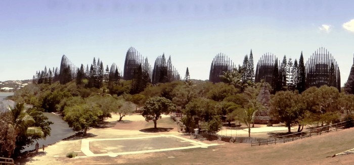
Photo shows the Tjibaou Cultural Centre in Noumea. It's named after the 1980s kanak resistance leader, Jean-Claude Tjibaou, who was assassinated in 1989. The centre was meant to showcase kanak culture, as an appeasement gesture after violence had torn New Cal. apart in the mid 1980s. The structures are meant to resemble traditional kanak houses, deliberately incomplete to symbolise the fact that kanak society is in transition.
New Caledonia / Nouvelle Caledonie is one of the Pacific Ocean's and the world's last colonial outposts. It is, at least for now, a sort-of French overseas territory with limited autonomy. With 25% of the world's nickel reserves and 29% of its population ethnic French, there's an understandable reluctance to loosen the grip on La Metropole's apron strings, as well as its handy 25% subsidy. The only stumbling block is the fact that 40% of the population is kanak / indigenous Melanesians and the majority of them don't want to be French.
There's a new referendum next year on independence, but it's easy to see that there's a gulf between the two main communities here. The French, both Caldoches (Caledonian born French) and metros (from the metropole) have the Paciifc's highest standard of living, propped up by the nickel mining industry and French subsidies, while the kanaks, especially the young, have the lowest.
France colonised the territory 160 odd years ago and what happened next followed a familiar pattern. The kanaks lost a lot of their land, disease decimated their population, insurrection was put down, discrimination saw immigrant Polynesians and South East Asians get the majority of the unskilled and semi skilled jobs while the French monopolised the highest paid, managerial and supervisory roles.
The seventies and eighties saw a revival of kanak resistance. Not long after our 1985 and 1987 visits gendarmes were killed and kept hostage, kanak militants were killed, too. Things have calmed down since two accords were signed, the latest in 1998, guaranteeing a move towards independence via a referendum in 2018. France has poured money in to schools and health facilities, but there's still a 40% unemployment rate amongst kanak youth who, like many Maori youth in NZ, are disoriented and feel neither a part of the European world or their traditional past, with inevitable consequences easy to observe around Noumea in the form of almost wall to wall graffitti.
New Caledonia is a beautiful country and we always enjoy visiting it. It's got first world facilities we enjoy, like marine reserves, hiking trails and camping facilities. Our red, EU passports give us "unlimited time" here as long as Brexit is staved off and until Nouvelle Caledonie becomes Kanakie. It will be high on our list for a re visit but it's hard to say what the future holds for this fractured community.
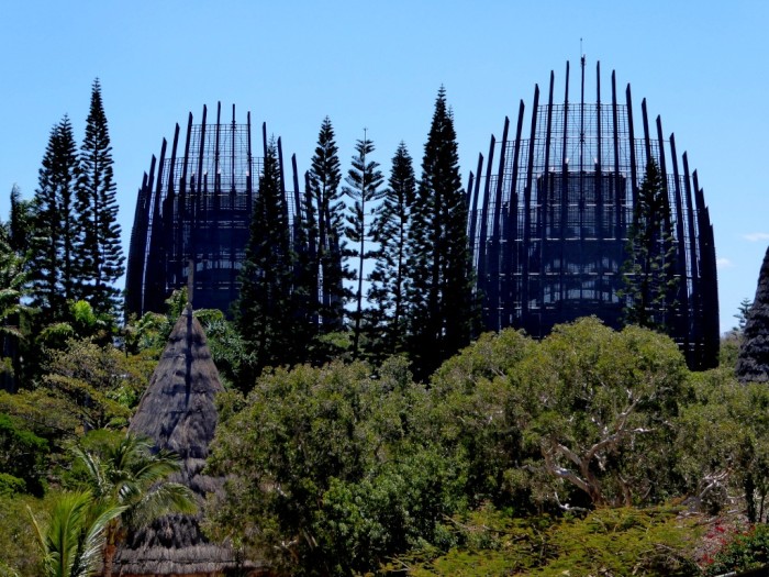
Two of the Tjibaou Cultural Centre's "cases", with a model traditional kanak house in the foreground.
The Noumea peninsula from 800m Mt Dore

Looking South towards Isle Ouen and the Southern lagoon from Mt Dore. New Cal. has some good hiking opportunities, including the 6 day GR1, complete with the familiar red and white GR striped balises
New Caledonia / Nouvelle Caledonie is one of the Pacific Ocean's and the world's last colonial outposts. It is, at least for now, a sort-of French overseas territory with limited autonomy. With 25% of the world's nickel reserves and 29% of its population ethnic French, there's an understandable reluctance to loosen the grip on La Metropole's apron strings, as well as its handy 25% subsidy. The only stumbling block is the fact that 40% of the population is kanak / indigenous Melanesians and the majority of them don't want to be French.
There's a new referendum next year on independence, but it's easy to see that there's a gulf between the two main communities here. The French, both Caldoches (Caledonian born French) and metros (from the metropole) have the Paciifc's highest standard of living, propped up by the nickel mining industry and French subsidies, while the kanaks, especially the young, have the lowest.
France colonised the territory 160 odd years ago and what happened next followed a familiar pattern. The kanaks lost a lot of their land, disease decimated their population, insurrection was put down, discrimination saw immigrant Polynesians and South East Asians get the majority of the unskilled and semi skilled jobs while the French monopolised the highest paid, managerial and supervisory roles.
The seventies and eighties saw a revival of kanak resistance. Not long after our 1985 and 1987 visits gendarmes were killed and kept hostage, kanak militants were killed, too. Things have calmed down since two accords were signed, the latest in 1998, guaranteeing a move towards independence via a referendum in 2018. France has poured money in to schools and health facilities, but there's still a 40% unemployment rate amongst kanak youth who, like many Maori youth in NZ, are disoriented and feel neither a part of the European world or their traditional past, with inevitable consequences easy to observe around Noumea in the form of almost wall to wall graffitti.
New Caledonia is a beautiful country and we always enjoy visiting it. It's got first world facilities we enjoy, like marine reserves, hiking trails and camping facilities. Our red, EU passports give us "unlimited time" here as long as Brexit is staved off and until Nouvelle Caledonie becomes Kanakie. It will be high on our list for a re visit but it's hard to say what the future holds for this fractured community.
Two of the Tjibaou Cultural Centre's "cases", with a model traditional kanak house in the foreground.
The Noumea peninsula from 800m Mt Dore
Looking South towards Isle Ouen and the Southern lagoon from Mt Dore. New Cal. has some good hiking opportunities, including the 6 day GR1, complete with the familiar red and white GR striped balises
In Port Moselle Marina, Noumea
23 October 2017 | Noumea, Nouvelle-Calédonie,
Alison and Geoff
The last time we were here was 2006 the first port of call on our circumnavigation. Surprisingly not much has changed except there are at least 3 times the number of yachts here preparing for their cyclone holes in NZ or Australia. Nothing seems to stop adventurers on the water growing in numbers despite economic recessions, the rise in global unemployment and credit card debts peope from all walks of life, old people, young people and families continue to take up ocean adventuring.
Nous Sommes Arrivee a Nouvelle-Caledonie
22 October 2017 | Havannah Passage, Grande Terre, Nouvelle-Calédonie
Alison and Geoff
Just passing through the main pass into New Caledonia's Southern Lagoon after a 200 mile passage from Aneityum via the island of Mare in the Loyalty Islands. Lovely weather. 35 nm to Noumea
Vanuatu Interlude
15 October 2017 | Anelcowhat Bay, Aneityum Island, Southern Vanuatu
Alison and Geoff, windy and wet
Photo shows Anelgowhat Bay, Aneityum
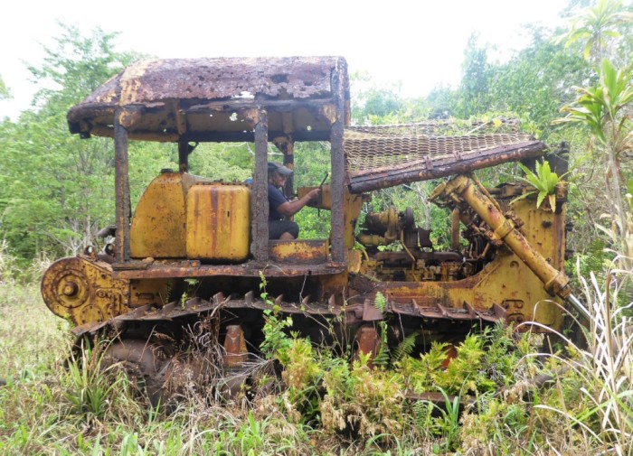
We are anchored in the well protected bay at Anelcowhat, the main village on Vanuatu's most southern island, Aneityum. There are no roads on the island, no vehicles except a single van and wrecks of bulldozers from old logging days. Aneityum is to us a reminder of our many years in Papua New Guinea, at the other end of the chain of Melanesian island nations. Vanuatu, the Solomons and PNG are all quite similar culturally in many ways. Fiji and New Caledonia's indigenous inhabitants are also Melanesian but influenced by Polynesian custom (Fiji anyway) and modern Western lifestyle much more than their Melanesian neighbours.
We were able to check in with immigration and biosecurity officers and supposedly a customs guy is here too, to check on the cruise ship coming in tomorrow. There is also a small bank here (no ATM), two run down schools, three small stores and sim cards (!) for sale, although the internet is only 2G.
We were last in these islands when Britain and France were jointly in charge, in one of the world's most bizarre colonial agreements. The Condominium of the New Hebrides, as it was called then, had been depopulated in the nineteenth century by "blackbirders", kidnappers from Australia who took islanders over to Queensland in conditions little more than slavery to work in the sugar cane fields. Disease and despondency followed colonisation. Vanuatu has been independent for thirty years now but it is significantly poorer than its two immediate neighbours (Fiji and New Caledonia).
Island kids arrive on the "bus"
Most of the inhabitants here live in small bush materials houses made of pandanus, timber from the Aneityum forest, coconut palm fronds and grass. It takes 2 or 3 months to build a new house, considerably less burden than for a western would-be house buyer (looking at you, Auckland!). Land is communally as well as individually owned. People mostly live in small scattered hamlets rather than large villages. This is similar to coastal PNG.
Bush materials houses and hamlets, Anelgowhat.
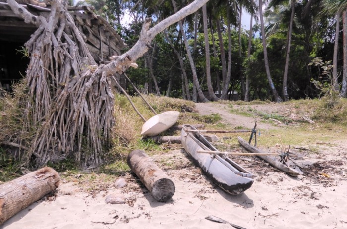
Simple dugout canoe
Everyone has been shyly friendly to us. There are many local languages in Vanuatu, mutually unintelligible, so the government has adopted Bislama, similar to PNG's Tok Pisin, as the national language together with English. Some villagers still speak French but it is disappearing.
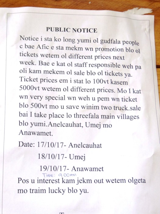
Tree side notice about a local promotion in Bislama, Vanuatu's pidgin English national language
Vanuatu is definitely worth visiting again with much more time. We've run out of it and must move on to Noumea in New Caledonia at the end of the week and then start thinking about the 7 day trip down to New Zealand.
Rumble in the Jungle: Girls and their toys!
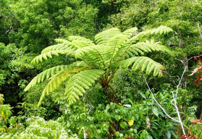
Gondwana connection: plenty of tree ferns in the Aneityum rainforest together with groves of kauri trees!
We are anchored in the well protected bay at Anelcowhat, the main village on Vanuatu's most southern island, Aneityum. There are no roads on the island, no vehicles except a single van and wrecks of bulldozers from old logging days. Aneityum is to us a reminder of our many years in Papua New Guinea, at the other end of the chain of Melanesian island nations. Vanuatu, the Solomons and PNG are all quite similar culturally in many ways. Fiji and New Caledonia's indigenous inhabitants are also Melanesian but influenced by Polynesian custom (Fiji anyway) and modern Western lifestyle much more than their Melanesian neighbours.
We were able to check in with immigration and biosecurity officers and supposedly a customs guy is here too, to check on the cruise ship coming in tomorrow. There is also a small bank here (no ATM), two run down schools, three small stores and sim cards (!) for sale, although the internet is only 2G.
We were last in these islands when Britain and France were jointly in charge, in one of the world's most bizarre colonial agreements. The Condominium of the New Hebrides, as it was called then, had been depopulated in the nineteenth century by "blackbirders", kidnappers from Australia who took islanders over to Queensland in conditions little more than slavery to work in the sugar cane fields. Disease and despondency followed colonisation. Vanuatu has been independent for thirty years now but it is significantly poorer than its two immediate neighbours (Fiji and New Caledonia).
Island kids arrive on the "bus"
Most of the inhabitants here live in small bush materials houses made of pandanus, timber from the Aneityum forest, coconut palm fronds and grass. It takes 2 or 3 months to build a new house, considerably less burden than for a western would-be house buyer (looking at you, Auckland!). Land is communally as well as individually owned. People mostly live in small scattered hamlets rather than large villages. This is similar to coastal PNG.
Bush materials houses and hamlets, Anelgowhat.
Simple dugout canoe
Everyone has been shyly friendly to us. There are many local languages in Vanuatu, mutually unintelligible, so the government has adopted Bislama, similar to PNG's Tok Pisin, as the national language together with English. Some villagers still speak French but it is disappearing.
Tree side notice about a local promotion in Bislama, Vanuatu's pidgin English national language
Vanuatu is definitely worth visiting again with much more time. We've run out of it and must move on to Noumea in New Caledonia at the end of the week and then start thinking about the 7 day trip down to New Zealand.
Rumble in the Jungle: Girls and their toys!
Gondwana connection: plenty of tree ferns in the Aneityum rainforest together with groves of kauri trees!
Sailing to Vanuatu Day 3
11 October 2017 | South West Pacific Ocean
Alison and Geoff, windy from the south east

Photo shows Aneityum Island a few miles off
Should be off the entrance to Anelghowhat anchorage, Aneityum, tomorrow morning. Varying conditions on this passage from very pleasant sailing to very uncomfortable. Have reefed right down now so that we reach the anchorage in the daylight.
A rusty looking Chinese fishing boat has just passed our stern a mile or two off. Have seen hardly any marine life on this passage so far. Strong winds expected for a few days next week, so will have to decide whether to hang on at Aneityum and then make a beeline for Noumea via Mare in the Loyalties or sail to We on Lifou before the winds start.
It's 120 miles from Aneityum to Mare, 140 to Lifou and 200 to Havannah Pass, the main Eastern entrance to New Caledonia's Southern Lagoon. The closest point between New Caledonia and New Zealand is 765 miles between Isle d'Pins and North Cape, but Australia's Norfolk Island is about half way in case of bad weather.
Sailing to Vanuatu
10 October 2017 | South West Pacific Ocean
Alison and Geoff, south east trades
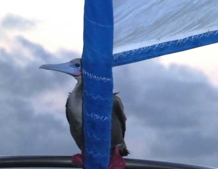
Photo shows red footed booby successfully getting a free ride on our bow!
200 nm to Aneityum, Vanuatu. Should get to Anelghowhat anchorage, Aneityum, on Friday morning. The island is home to 500 people and cruise ships visit frequently to enjoy the sandy beaches for a day. Some are on cruises from the US coast to Sydney while others do a circuit of the islands and back to Australia. We have been given permission to stop by the Vanuatu authorities. There was a fair bit of rain last night but it's all cleared now. We haven't seen any ships or even fishing boats. Being in the Pacific Rim of Fire who knows we may see a new island pop out of the ocean.
200 nm to Aneityum, Vanuatu. Should get to Anelghowhat anchorage, Aneityum, on Friday morning. The island is home to 500 people and cruise ships visit frequently to enjoy the sandy beaches for a day. Some are on cruises from the US coast to Sydney while others do a circuit of the islands and back to Australia. We have been given permission to stop by the Vanuatu authorities. There was a fair bit of rain last night but it's all cleared now. We haven't seen any ships or even fishing boats. Being in the Pacific Rim of Fire who knows we may see a new island pop out of the ocean.
Nice sailing to Vanuatu
10 October 2017 | South West Pacific Ocean
Alison and Geoff
350 nm to Aneityum, Vanuatu. The uncomfortable slop after exiting Navula Pass has ended and we now have great beam sailing conditions in a relatively flat sea with sunny weather. Wind is expected to pick up towards the end of the week. Should get to Anelghowhat anchorage, Aneityum, on Friday morning.
On the way to Vanuatu and New Caledonia
08 October 2017
Alison and Geoff
After a lot of discussion we finally decided to head on to Aneityum, the southernmost island in the Vanuatu chain. It will take 3.5 days so hope to be there on the 13th on my birthday (Alison). Aneityum is also right on the rhumb line for the Loyalty Islands, just East of the main New Caledonian island of Grande Terre. We are heading to New Caledonia eventually and then in a few weeks back to NZ.
This is the month for decisions as yachts and their owners have to decide whether to stay in the tropics for the cyclone season or head south.
With climate change as one of the most talked about subjects who knows whether that's the reason for the last round of Caribbean cyclones but there is this sort of gut reaction that you just don't want to be forced into finding a safe haven in a cyclone because you decided not to move out of the area.
FIRE!
05 October 2017 | Lautoka, Fiji
Alison and Geoff, sunny and very hot
Photo shows Suva's dramatic mountainous skyline across the city
It's been some time since the last post so here goes! We are anchored off the city of Lautoka on the sunny western side of Viti Levu.
We have had some exciting days since we checked into Vuda Point Marina near here, nearly two weeks ago to take on fresh water and stores before leaving for Noumea in New Caledonia, 600 miles away to the west. Most exciting was a small fire that started in Saraoni's engine room. We're not sure how it started but suspect it was a fault in the connection to the MPPT solar controller that controls the charging of our batteries.
Although the fire was small, it sure did a lot of damage! Nearly every single wire in the engine room was shredded by the heat, plus a lot of smoke and black soot. A bloody mess, in fact. We have spent the last week cleaning, painting, buying and fitting new wiring, which in some ways was a good thing as at least we now know what the wires are!
We last posted a blog from Kadavu. Since then, we have sailed up to Fiji's capital, Suva, which like every where else is now a lot bigger and busier since we were last there in 1979. From there we sailed to Beqa (Mbengga), a smaller version of Kadavu and very Fijian. Then a rolly old sail along the exposed southern coast of Viti Levu to Denarau, near Nadi and to Vuda Point where the fire happened. This western side of Viti Levu is quite different to everywhere else in Fiji. There are many more tourists and small and large resorts on the offshore Mamanuca Islands.

Some of Fiji's hotel accommodation leaves something to be desired.
Suva market
old and new Fiji
Beqa Island
Namaka island near Beqa with Viti Levu in the backgrond
We are clearing Customs tomorrow for New Cal., a trip that should take 5 days. There seems to have been a big outflow of boats heading to NZ just in the last week or so. Not sure why as it still seems too early, but maybe it's a reaction to the terrible cyclone season in the Caribbean. Hundreds of yachts got smashed in the BVIs, USVIs and St Maarten amongst other badly damaged islands. Too many yacht and boat owners getting complacent after a spell without too much cyclone activity and leaving their boats in the danger zone. We've done it too, so can't really criticise them.
NZ in the meantime is in the throws of European style delays after the recent general election which has the left and right blocks unable to govern without forming a coalition with a minor populist party that no-one really wants to have as a partner. The joys of MMP!
It's been some time since the last post so here goes! We are anchored off the city of Lautoka on the sunny western side of Viti Levu.
We have had some exciting days since we checked into Vuda Point Marina near here, nearly two weeks ago to take on fresh water and stores before leaving for Noumea in New Caledonia, 600 miles away to the west. Most exciting was a small fire that started in Saraoni's engine room. We're not sure how it started but suspect it was a fault in the connection to the MPPT solar controller that controls the charging of our batteries.
Although the fire was small, it sure did a lot of damage! Nearly every single wire in the engine room was shredded by the heat, plus a lot of smoke and black soot. A bloody mess, in fact. We have spent the last week cleaning, painting, buying and fitting new wiring, which in some ways was a good thing as at least we now know what the wires are!
We last posted a blog from Kadavu. Since then, we have sailed up to Fiji's capital, Suva, which like every where else is now a lot bigger and busier since we were last there in 1979. From there we sailed to Beqa (Mbengga), a smaller version of Kadavu and very Fijian. Then a rolly old sail along the exposed southern coast of Viti Levu to Denarau, near Nadi and to Vuda Point where the fire happened. This western side of Viti Levu is quite different to everywhere else in Fiji. There are many more tourists and small and large resorts on the offshore Mamanuca Islands.
Some of Fiji's hotel accommodation leaves something to be desired.
Suva market
old and new Fiji
Beqa Island
Namaka island near Beqa with Viti Levu in the backgrond
We are clearing Customs tomorrow for New Cal., a trip that should take 5 days. There seems to have been a big outflow of boats heading to NZ just in the last week or so. Not sure why as it still seems too early, but maybe it's a reaction to the terrible cyclone season in the Caribbean. Hundreds of yachts got smashed in the BVIs, USVIs and St Maarten amongst other badly damaged islands. Too many yacht and boat owners getting complacent after a spell without too much cyclone activity and leaving their boats in the danger zone. We've done it too, so can't really criticise them.
NZ in the meantime is in the throws of European style delays after the recent general election which has the left and right blocks unable to govern without forming a coalition with a minor populist party that no-one really wants to have as a partner. The joys of MMP!
Kadavu – Island of Parrots, Tree Ferns, Friendly People and Rain
11 September 2017 | Kavala Bay, Kadavu Island, Fiji
Alison and Geoff, drizzly and cloudy
Photo shows the anchorage at Kavala Bay in Kadavu
We have been in and around the island of Kadavu for the last few days. It's Fiji's 3rd largest island, 40 km or so long and home to 10,000 people and a lot of endemic birds like the Kadavu musk parrot. Kadavu is actually pronounced Kandavu, a strange Fijian spelling anomaly (the nearby island of Beqa is pronounced Mbengga!).
Kadavu is very Fiijian. We haven't seen any Indo-Fijians here or any other ethnic group for that matter. The locals call their island "little New Zealand" and it certainly looks a lot like Great Barrier or the Sounds with the misty, bush covered hills. There are tree ferns in their hundreds here and it rains a lot, too! But to us it's a lot more like Papua New Guinea, especially the way people live.
There are 5 villages in the bay we are in (Kavala). All the houses are made of modern materials, but a bit shacky. When Geoff came here in 1973 most of the houses would have been bush materials. There are very few roads. In fact there aren't any around here. There is only one vehicle, a tractor belonging to the secondary school, which looks just like the first government secondary school we taught at in Papua New Guinea, Ihu High School. Even though there aren't any cars or roads, there are quite a few fibreglass banana boats. They have become the "family car" although not every family has one.
The Fijian family car in Kavala Bay
The villages here are served by a once weekly ferry cum cargo boat from Suva, 80 km to the North. There is an airstrip at Vunisea, the island "capital" and the odd store. There's a very good one near where we are anchored. It has a hell of a lot of stuff in it but everything is behind a grill so you can't tell what's for sale. You just have to ask. Of course like just about everywhere in the world these days there is cell phone and internet coverage, courtesy of a tower perched on a nearby hill top.

The Liohana II, Kavala's once a week link with the big smoke.
We did our "sevusevu" ceremony with the chief (turanga) of the nearest village. He is SDA, so doesn't drink kava (yaqona) but still accepted our gift and gave a speech in Fijian. He said he exchanges the yaqona sevusevu gifts he gets from visitors with the principal of the secondary school.

Vunivaivai, the village where we did our sevusevu. The village Methodist church is full to capacity on Sunday but the chief is not Methodist. He's Seventh Day Adventist (SDA) so has to walk several kilometres to his own church or hitch a ride on someone else's boat.
We've also been down to the East end of Kadavu to swim / snorkel the Naigoro Pass - one of the passes through the Astrolabe Lagoon's barrier reef. While in Kavala Bay we've walked for hours along village trails through the bush and looked for some of the island's unique birds - the Kadavu musk parrot which is red green and blue and very noisy and the barking pigeons.

The Kadavu musk parrot

Quiet anchorage near the Naigoro Pass
We are off to Suva, Fiji's capital, tomorrow and are mindful that the sailing season is beginning to fade. We still intend sailing to New Caledonia as the distance to North Cape is less from there than from Fiji, but there is still plenty to see in Fiji. Not for once in our later lives, we've realised we need another life time to see everything we want to see!
We have been in and around the island of Kadavu for the last few days. It's Fiji's 3rd largest island, 40 km or so long and home to 10,000 people and a lot of endemic birds like the Kadavu musk parrot. Kadavu is actually pronounced Kandavu, a strange Fijian spelling anomaly (the nearby island of Beqa is pronounced Mbengga!).
Kadavu is very Fiijian. We haven't seen any Indo-Fijians here or any other ethnic group for that matter. The locals call their island "little New Zealand" and it certainly looks a lot like Great Barrier or the Sounds with the misty, bush covered hills. There are tree ferns in their hundreds here and it rains a lot, too! But to us it's a lot more like Papua New Guinea, especially the way people live.
There are 5 villages in the bay we are in (Kavala). All the houses are made of modern materials, but a bit shacky. When Geoff came here in 1973 most of the houses would have been bush materials. There are very few roads. In fact there aren't any around here. There is only one vehicle, a tractor belonging to the secondary school, which looks just like the first government secondary school we taught at in Papua New Guinea, Ihu High School. Even though there aren't any cars or roads, there are quite a few fibreglass banana boats. They have become the "family car" although not every family has one.
The Fijian family car in Kavala Bay
The villages here are served by a once weekly ferry cum cargo boat from Suva, 80 km to the North. There is an airstrip at Vunisea, the island "capital" and the odd store. There's a very good one near where we are anchored. It has a hell of a lot of stuff in it but everything is behind a grill so you can't tell what's for sale. You just have to ask. Of course like just about everywhere in the world these days there is cell phone and internet coverage, courtesy of a tower perched on a nearby hill top.
The Liohana II, Kavala's once a week link with the big smoke.
We did our "sevusevu" ceremony with the chief (turanga) of the nearest village. He is SDA, so doesn't drink kava (yaqona) but still accepted our gift and gave a speech in Fijian. He said he exchanges the yaqona sevusevu gifts he gets from visitors with the principal of the secondary school.
Vunivaivai, the village where we did our sevusevu. The village Methodist church is full to capacity on Sunday but the chief is not Methodist. He's Seventh Day Adventist (SDA) so has to walk several kilometres to his own church or hitch a ride on someone else's boat.
We've also been down to the East end of Kadavu to swim / snorkel the Naigoro Pass - one of the passes through the Astrolabe Lagoon's barrier reef. While in Kavala Bay we've walked for hours along village trails through the bush and looked for some of the island's unique birds - the Kadavu musk parrot which is red green and blue and very noisy and the barking pigeons.
The Kadavu musk parrot
Quiet anchorage near the Naigoro Pass
We are off to Suva, Fiji's capital, tomorrow and are mindful that the sailing season is beginning to fade. We still intend sailing to New Caledonia as the distance to North Cape is less from there than from Fiji, but there is still plenty to see in Fiji. Not for once in our later lives, we've realised we need another life time to see everything we want to see!
Jacindamania.....in New Zealand!
08 September 2017 | Vurulevu Island, Astrolabe Lagoon, Fiji
Alison and Geoff, calm and sunny

Photo: Jacinda Ardern, on the campaign trail.
NZ's turning red at long last, with a green tinge - and a sprinkle of stardust? We like the colour blue, but only in the sea and sky! It's general election time in NZ with just over two weeks to go. Like other elections around the world, little, faraway NZ has been experiencing a mood for change. NZ Labour's Jacinda Ardern is no Corbyn, or even a Bernie Sanders, but she's a damn sight younger, as well as smart and compassionate.
It's one more manifestation of a sometimes incoherent worldwide generational change that is chipping away at the legacy of the last 30 years of neo-liberalism. For us, the removal of the 9 year National led coalitions can't come too soon. National is up to its usual dirty tricks campaign, but with MMP in NZ it will be hard to know which way it will go. We hope that when we sail back to NZ, it will have a politically more progressive government, preferably a Labour / Greens coalition.
Onto a less overtly political theme now, we have moved down to Ka(n)davu again. Kadavu is Fiji's 3rd largest island and still has a lot of forest left untouched. We tried to find the mantas again yesterday and this morning, but they weren't obliging us with their presence, although a large eagle ray turned up at the bommie near the top of Vurulevu Island where many fish, including the mantas, go to get themselves a massage and clean up job by the little blue and white cleaner wrasse that hang out there. (check the Tui of Split Rock photo to see a cleaner wrasse homing in on a moray eel) It's a classic symbiotic win-win situation for the larger fish and the little wrasse. More about Kadavu in the next blog.
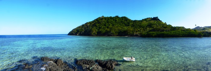
Lovely calm weather on the east coast of Kadavu Island near the Naigoro Pass
NZ's turning red at long last, with a green tinge - and a sprinkle of stardust? We like the colour blue, but only in the sea and sky! It's general election time in NZ with just over two weeks to go. Like other elections around the world, little, faraway NZ has been experiencing a mood for change. NZ Labour's Jacinda Ardern is no Corbyn, or even a Bernie Sanders, but she's a damn sight younger, as well as smart and compassionate.
It's one more manifestation of a sometimes incoherent worldwide generational change that is chipping away at the legacy of the last 30 years of neo-liberalism. For us, the removal of the 9 year National led coalitions can't come too soon. National is up to its usual dirty tricks campaign, but with MMP in NZ it will be hard to know which way it will go. We hope that when we sail back to NZ, it will have a politically more progressive government, preferably a Labour / Greens coalition.
Onto a less overtly political theme now, we have moved down to Ka(n)davu again. Kadavu is Fiji's 3rd largest island and still has a lot of forest left untouched. We tried to find the mantas again yesterday and this morning, but they weren't obliging us with their presence, although a large eagle ray turned up at the bommie near the top of Vurulevu Island where many fish, including the mantas, go to get themselves a massage and clean up job by the little blue and white cleaner wrasse that hang out there. (check the Tui of Split Rock photo to see a cleaner wrasse homing in on a moray eel) It's a classic symbiotic win-win situation for the larger fish and the little wrasse. More about Kadavu in the next blog.
Lovely calm weather on the east coast of Kadavu Island near the Naigoro Pass
Blowing Bubbles in the Astrolabe Lagoon
06 September 2017 | Nagara Bay, Ono Island, Fiji
Alison and Geoff, 10-15 kn, warm but cloudy

Photo shows Geoff blowing bubbles at Alacrity Rocks. See - no hands!
We are anchored in Nagara Bay at the top of Ono Island in the Astrolabe Lagoon. It's been blowing hard all night, and the boat has been bouncing around as the wind has swung around to the east from which direction this bay is more exposed to. The anchorages in Fiji are often very deep and here it is 24m. We have a nylon rope down together with a few metres of chain and our smaller anchor, as our ancient sick anchor winch is, well, sick and would probably suffer from a 12v D.C. heart attack if we asked it to haul full chain and anchor up from that depth. We would probably suffer a heart attack if we had to manually do it, too! The nylon warp and the anchor came from our first boat Corsair which we left in Port Moresby (PNG) in 1998. We used it all the time there for exactly the same reason and it's never failed us....yet!
We have been to the top of Ono and near its bottom too over the last few days. The first job, though, was to call in at Nagara Village and pay respects to the chief. He was busy doing village stuff, so we just paid respects to anyone we saw and deposited our offering of yaqona (kava) to an empty committee room. We are going in again tomorrow to check out the church solar panel system and help a villager figure out his. Fijians in their traditional villages have almost everything they need - plenty of land for growing healthy stuff, the sea and all its seafood at their doorstep, the bush and forest for buildings and always close-by family. The rub is that it's not easy to make money without abandoning it all and heading to the town to get a job.
Ono is mostly covered in thick scrub and pine trees which were planted back in the late 70s. There are footpaths through the bush between the island villages and to villagers' farm plots where they grow taro, breadfruit, tapioca (cassava) and anything else they can think of. One steep track winds its way up to one of the highest hills on the island, Qilia, which has a Vodafone tower perched on it, 360m up. It was quite a struggle finding the track and even more of a struggle getting to the top, but the views all around once we got there were fantastic. To the South we could see the length of Kadavu Island, to the north, Beqa and Viti Levu, while close at hand was the full stretch of the Astrolabe lagoons, the barrier reefs and scattering of islands.
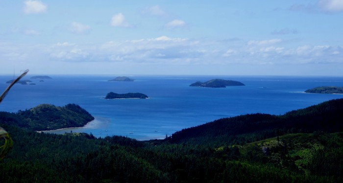
View of the Astrolabe Lagoon from Qilia hill on Ono Island
Just to complement the climb we arranged for a dive with Ono based and Fijian managed Mai Dive to take us out to the network of bommies, pinnacles, caves and canyons around Alacrity Pass. The two dives turned out to be the best we've done (not that we've done enough to be expert judges!)with a very professional divemaster in charge. We swam through tunnels and caves and around huge underwater mountains. The photos we took mostly 15 - 20 m down seem to be a pale record of the underwater beauty. The colours are all removed, except blue!
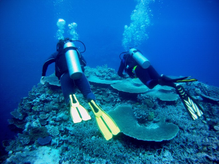
Alison and Maika, the divemaster, heading into the blue.

Alison and Maika swimming through a canyon at Alacrity Rocks
There are manta rays that come close by to where we are anchored and several people we know have jumped into the water to swim with them but we haven't caught up with them yet!
We've been watching the parade of cyclones (hurricanes) in the Atlantic in awe. Another one is forming behind nasty Irma, the one that is battering the Northern Caribbean right now. Is it coincidence that an unprecedented row of severe storms develops in the first year of Donald Chump's presidency, climate change denier in chief?
We are anchored in Nagara Bay at the top of Ono Island in the Astrolabe Lagoon. It's been blowing hard all night, and the boat has been bouncing around as the wind has swung around to the east from which direction this bay is more exposed to. The anchorages in Fiji are often very deep and here it is 24m. We have a nylon rope down together with a few metres of chain and our smaller anchor, as our ancient sick anchor winch is, well, sick and would probably suffer from a 12v D.C. heart attack if we asked it to haul full chain and anchor up from that depth. We would probably suffer a heart attack if we had to manually do it, too! The nylon warp and the anchor came from our first boat Corsair which we left in Port Moresby (PNG) in 1998. We used it all the time there for exactly the same reason and it's never failed us....yet!
We have been to the top of Ono and near its bottom too over the last few days. The first job, though, was to call in at Nagara Village and pay respects to the chief. He was busy doing village stuff, so we just paid respects to anyone we saw and deposited our offering of yaqona (kava) to an empty committee room. We are going in again tomorrow to check out the church solar panel system and help a villager figure out his. Fijians in their traditional villages have almost everything they need - plenty of land for growing healthy stuff, the sea and all its seafood at their doorstep, the bush and forest for buildings and always close-by family. The rub is that it's not easy to make money without abandoning it all and heading to the town to get a job.
Ono is mostly covered in thick scrub and pine trees which were planted back in the late 70s. There are footpaths through the bush between the island villages and to villagers' farm plots where they grow taro, breadfruit, tapioca (cassava) and anything else they can think of. One steep track winds its way up to one of the highest hills on the island, Qilia, which has a Vodafone tower perched on it, 360m up. It was quite a struggle finding the track and even more of a struggle getting to the top, but the views all around once we got there were fantastic. To the South we could see the length of Kadavu Island, to the north, Beqa and Viti Levu, while close at hand was the full stretch of the Astrolabe lagoons, the barrier reefs and scattering of islands.
View of the Astrolabe Lagoon from Qilia hill on Ono Island
Just to complement the climb we arranged for a dive with Ono based and Fijian managed Mai Dive to take us out to the network of bommies, pinnacles, caves and canyons around Alacrity Pass. The two dives turned out to be the best we've done (not that we've done enough to be expert judges!)with a very professional divemaster in charge. We swam through tunnels and caves and around huge underwater mountains. The photos we took mostly 15 - 20 m down seem to be a pale record of the underwater beauty. The colours are all removed, except blue!
Alison and Maika, the divemaster, heading into the blue.
Alison and Maika swimming through a canyon at Alacrity Rocks
There are manta rays that come close by to where we are anchored and several people we know have jumped into the water to swim with them but we haven't caught up with them yet!
We've been watching the parade of cyclones (hurricanes) in the Atlantic in awe. Another one is forming behind nasty Irma, the one that is battering the Northern Caribbean right now. Is it coincidence that an unprecedented row of severe storms develops in the first year of Donald Chump's presidency, climate change denier in chief?
| Vessel Name: | Saraoni (1) and Sundari (2) |
| Vessel Make/Model: | South Coast 36 and Beneteau 473 respectively |
| Hailing Port: | Lamb Island, Australia |
| Crew: | Alison and Geoff Williams |
| About: | |
| Extra: | CONTACT DETAILS Telephone / SMS number +61 456 637 752 (Australian mobile no.) +64 28 432 5941 NZ mobile no.) Email yachtsundari@gmail.com (main email address) |
Saraoni (1) and Sundari (2)'s Photos - Main
.JPG) |
A collection of photos taken while teaching and cruising in PNG's Milne Bay Province
74 Photos
Created 29 April 2023
|
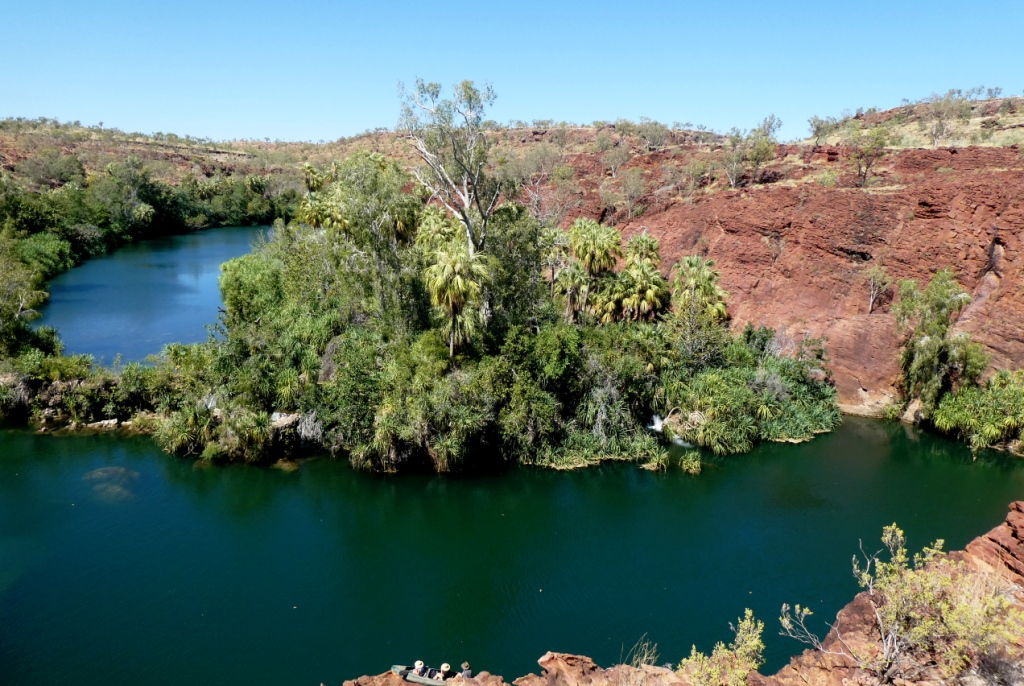 |
 |
Some rather idiosyncratic metal sculptures in outback Queensland between Aramac and Lake Dunn
8 Photos
Created 27 September 2020
|
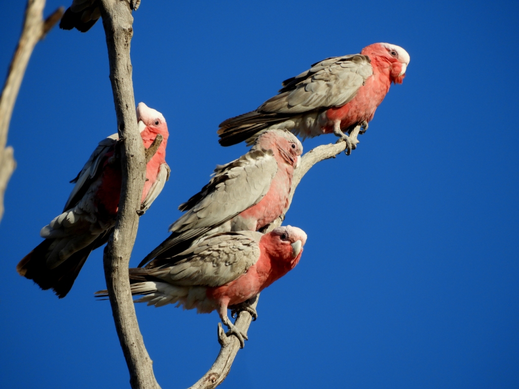 |
Birds and other critters on our Queensland inland safari
12 Photos
Created 27 September 2020
|
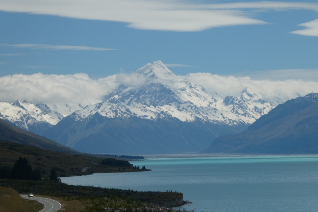 |
A collection of photos taken during the Tiki Tour of the Southern half of the South Island, November / December 2019
40 Photos
Created 15 December 2019
|
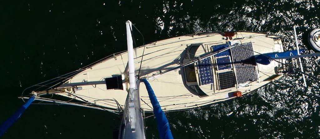 |
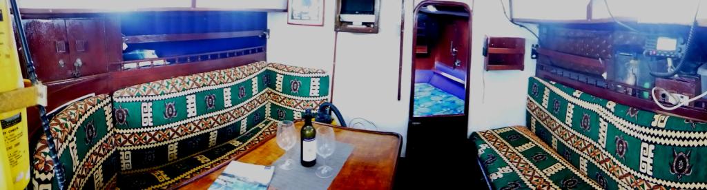 |
Photos taken of Saraoni. All interior photos were taken in the last week.
10 Photos
Created 2 April 2019
|
 |
50 Photos
Created 27 June 2014
|
 |
The ABCs - Aruba, Bonaire and Curacao are mostly low lying dry, scrubby islands in the Western Caribbean near the Venezuelan coastline
15 Photos
Created 21 May 2014
|
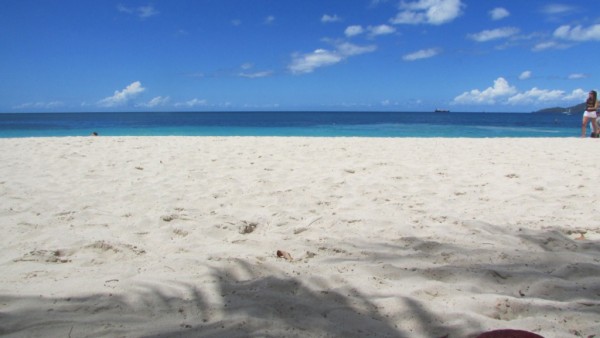 |
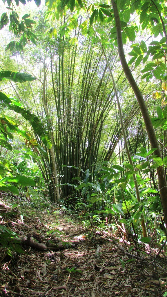 |
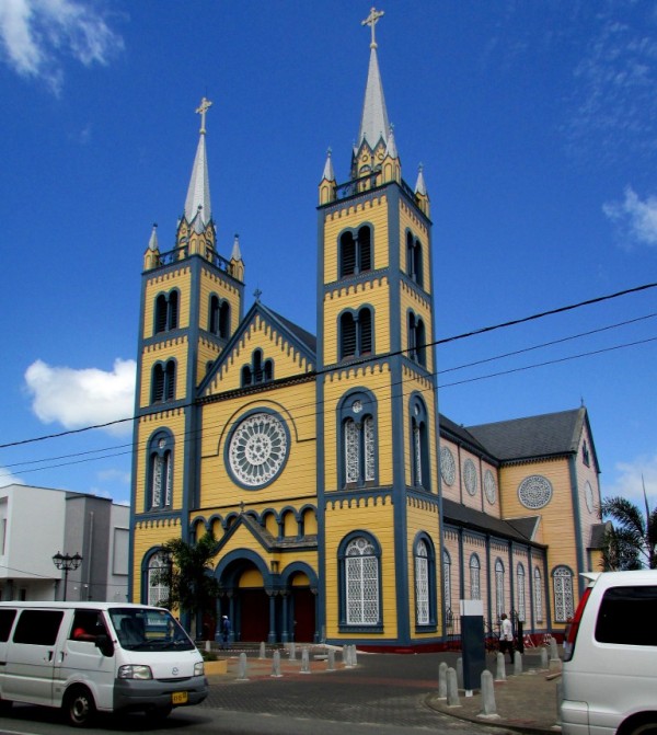 |
Images taken in and around Suriname's capital
40 Photos
Created 9 February 2014
|
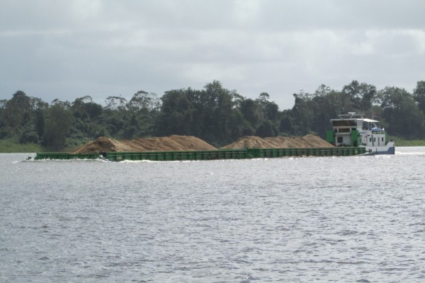 |
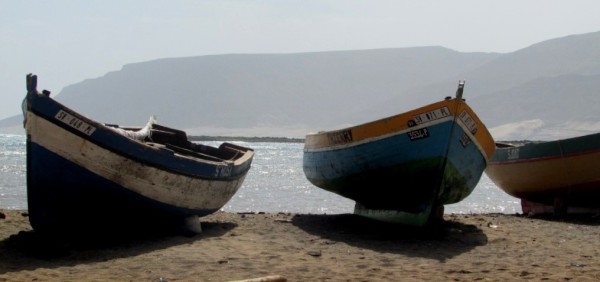 |
Images of the 2 islands in the Cape Verde island group we visited on our way across the Atlantic in 2013 - Sao Vicente and Santo Antaao.
37 Photos
Created 26 December 2013
|
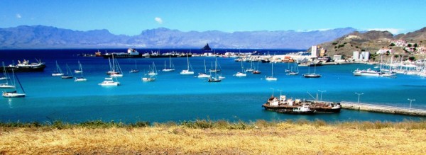 |
 |
 |
 |
 |
 |
Unexpected meeting with old friends "in the woods".
6 Photos
Created 24 June 2013
|
 |
A brother found amongst the gorges of the Cevennes
5 Photos
Created 10 June 2013
|
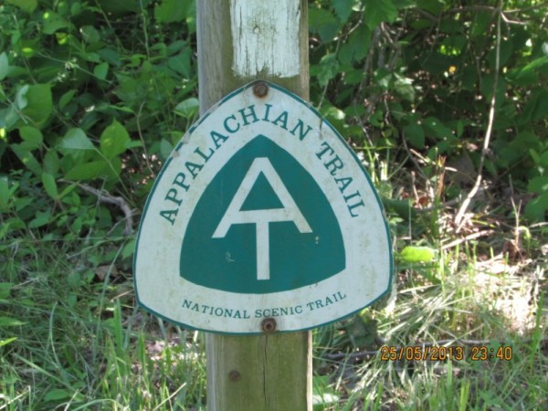 |
Photographic images of our long walk along the Appalachian mountains in the USA
26 Photos
Created 10 June 2013
|
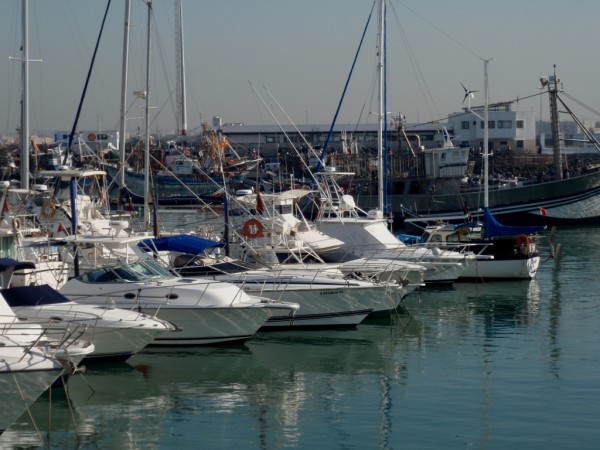 |
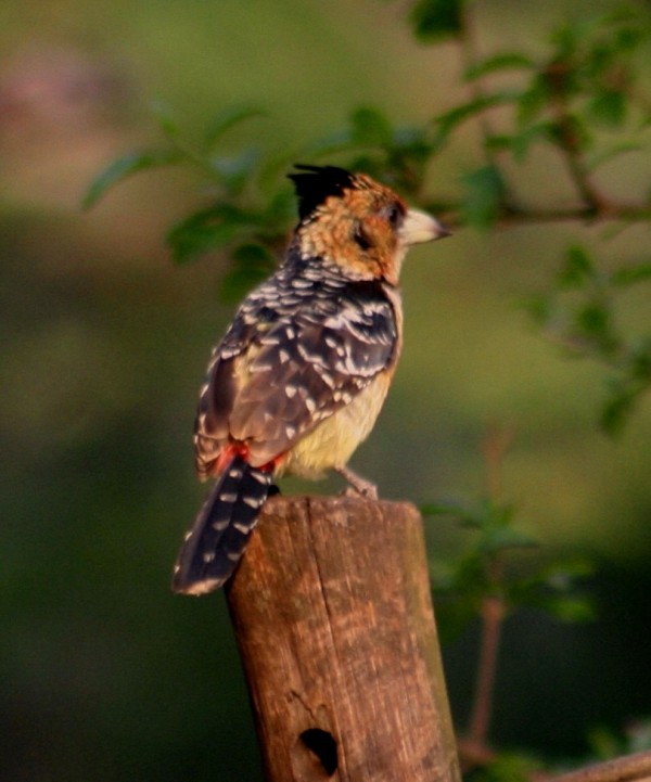 |
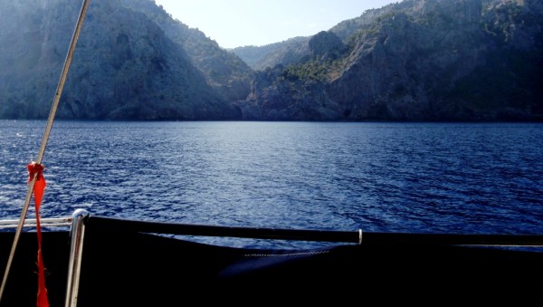 |
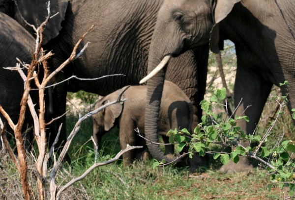 |
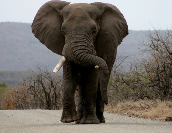 |
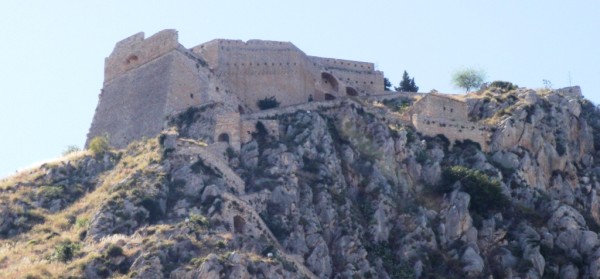 |
 |
Greece is in the throes of a recession, but they still have the last laugh - never far from the sun, the sea, colour, culture and bags of history. The photos document our Aegean odyssey from May to September 2011
31 Photos
Created 17 December 2011
|
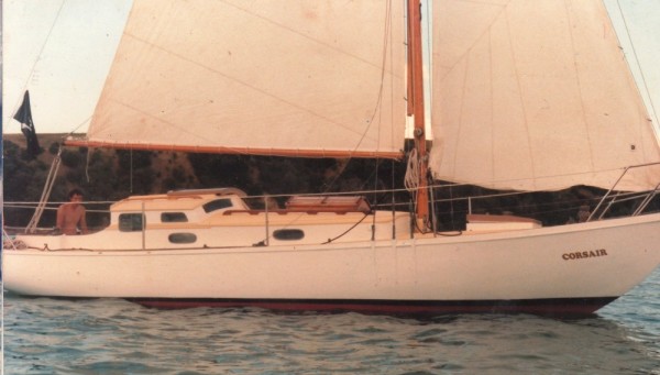 |
O.K. We're mad, but we somehow prefer a home on the sea to one on dry land.
12 Photos
Created 17 December 2011
|
 |
Kathmandu, Patan and Bhaktapur - the three ancient city states of the Kathmandu valley have mediaeval architectural wonders in their Durbars and old town areas - a meshing and merging of Hinduism, Buddhism and materialism
9 Photos
Created 17 December 2011
|
 |
Some of the shots taken of us while on one of our 30 odd days on the three main mountain trails we walked in the Anapurnas and Helambu region of Nepal's side of the Himalayas
10 Photos
Created 15 December 2011
|
 |
People make the Himalayas a unique place to walk through. From Hindu rice and buffalo farmers in the foothills to the Buddhist villages in the highlands so influenced by Tibetan ancestry and trade over the passes
16 Photos
Created 15 December 2011
|
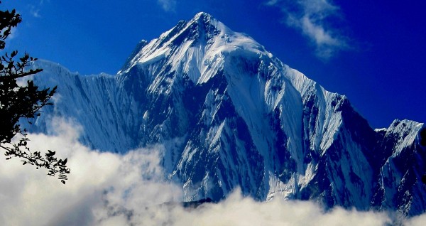 |
Nepal has ten of the world's highest mountains within its boundaries or shared with India and Tibet - these are truly giant peaks!
22 Photos
Created 15 December 2011
|
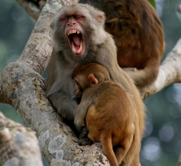 |
These were all photographed in the wilds of Chitwan and Bardia National Parks - which are two of the last havens of biodiversity in Nepal's low lying Terai district.
18 Photos
Created 14 December 2011
|
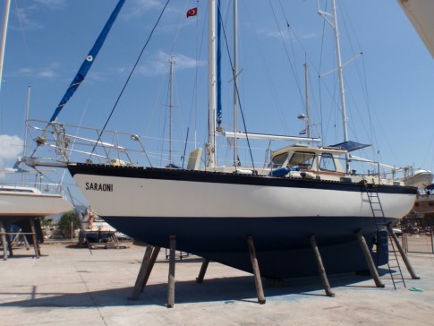 |
Saraoni hauled out on Finike's hardstand for biennial maintenance and painting
3 Photos
Created 26 April 2011
|
 |
 |
 |
 |
 |
 |
 |
 |
 |
The small rocky island of Kastellorizou is Greece's most remote island
7 Photos
Created 11 December 2010
|
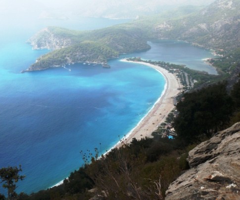 |
Cruising and walking Turkey's Lycian coast September and October 2010
19 Photos
Created 11 December 2010
|
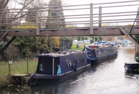 |
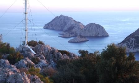 |
Images taken while walking sections of the 500 km Lycian Way or Lykia Yolu on the South West Mediterranean Coast of Turkey
11 Photos
Created 9 November 2010
|
Exploring as Much as We Can Until We Can't
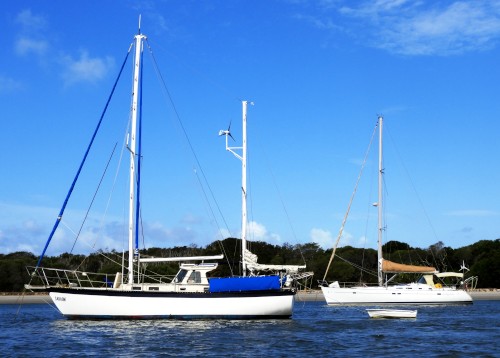
Who: Alison and Geoff Williams
Port: Lamb Island, Australia
Blog Categories by Year
- 2023 Aust NZ
- 2022 Aust
- 2021 Aust
- 2020 Aust, NZ
- 2019 Aust, NZ
- 2018 New Cal Aust and NZ
- 2017 NZ, Aust, Tonga, Fiji, New Caledonia
- 2016 NZ Niue and Canada
- 2015 Pacific Crossing Panama to NZ, Galapagos, French Polynesia, Cooks, American Samoa and Tonga
- 2015 and 2014 Suriname Colombia Panama and Costa Rica
- 2014 U.S. Cycle trip
- 2014 Caribbean Islands Trinidad to Aruba
- 2014 Atlantic Crossing Cape Verdes to Suriname
- 2013 Cape Verdes, West Africa
- 2013 Canaries Post USA
- 2013 U.S.A. Hiking Trips Appalachians and Cascades
- 2013 Canaries Pre U.S.A.
- 2013 Morocco
- 2012 South Africa and Swaziland
- 2012 Mediterranean Spain and France
- 2012 Italy
- 2012 and 2011 Greece
- 2011 A Quarter Century on the Sea
- 2011 Nepal
- 2011 and 2010 Turkey
- 2010 Oman Yemen the Red Sea and Israel
- 2010 South Asia: India and Sri Lanka
- 2009 Malaysia and Thailand
- 2009 and 2008 Aust and SE Asia
- 2007 Australia
- 2006 NZ to New Caledonia and Australia
- A Tale of Three Boats
- 1978 to 2018 Perspectives on a Long Journey
SailBlogs Friends

