Sequitur
Michael & Edi have headed out on a slow, thorough exploration of the globe.
| Vessel Name: | Sequitur and Zonder Zorg |
| Vessel Make/Model: | 2007 Hunter 49 and 1908 Wildschut Skûtsje |
| Hailing Port: | Vancouver, Canada |
| Crew: | Michael Walsh & Edi Gelin |
| About: | For our current location click, on Map & Tracking, then on the Google Earth logo. |
| Extra: | Follow us on Twitter: Follow @YachtSequitur |
| Social: |
 |
13 January 2014
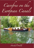
Another New Book Released
I am delighted to announce that my new book: Carefree on the European Canals is now in print and is available on Amazon.com, Amazon.ca [...]
26 April 2013
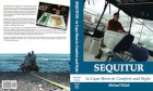
New Book Released
The proof copy of my new book arrived by courier today. I have approved it and it is now listed on Amazon for pre-order, with a publication date of 30 April. It is a rather large book at 680 pages in an 8.5 by 11 inch format with 315,000 words illustrated by over 2400 colour photos, charts and maps. [...]
24 April 2013
One Year Out of Brazil
One year ago today we sailed Sequitur out of Brazil after enduring more than six weeks in the least-friendly country that we had experienced during our three-year voyage. In the early evening of 24 April 2012 we crossed the line on the chart dividing Brazil from French Guyana and breathed a huge sigh [...]
27 October 2012 | Harlingen, Friesland
Planing a Metamorphosis
We have added a new post to the Zonder Zorg blog at: Planing a Metamorphosis.
29 September 2012 | Sneek, Netherlands
Onward to Friesland
We have arrived in Friesland and have added a new post to the skûtsje's blog at: Onward to Friesland
19 September 2012 | Hoorn, Netherlands
North From Aalsmeer
We have moved northward from Aalsmeer and I have added two new posts: Heading North From Aalsmeer and North From Amsterdam
13 September 2012 | Aalsmeer, Netherlands
Taking Possession
We are back in the Netherlands, and I have added some new posts to the ZonderZorg blog at: Taking Possession and Settling-In and Making Plans

20 August 2012 | Sequitur: St Augustine, USA - Michael & Edi: Vancouver, Canada - Nieuwe Zorg: Aalsmeer, Netherlands
Added a New Website
We have added a new website: Skûtsje ZonderZorg. Zonder zorg in Dutch means without worry. Our intention with the site is to provide a place to share some of the history, geography and culture of the skûtsje as we discover it. We will also use this place to document [...]
11 August 2012 | Sequitur: St Augustine, USA - Michael & Edi: Vancouver, Canada - Nieuwe Zorg: Aalsmeer, Netherlands
Still More Skûtsje History
We continued to attempt to track-down Douwe Albert Visser, who was the owner of Nieuwe Zorg in 1941 when she was re-registered. One of the problems we repeatedly encountered in our online searches was the effect of currently having Albert Visser and two Douwe Vissers as very competitive skûtsje racers, [...]
10 August 2012 | Sequitur: St Augustine, USA - Michael & Edi: Vancouver, Canada - Nieuwe Zorg: Aalsmeer, Netherlands
Some More Skûtsje History
While I was researching the history of Nieuwe Zorg, I finally found her first registration details obscured by an apparent typographical error in a transcribed online spreadsheet. She was listed as having been built in 1901 instead of 1908. I emailed the webmaster of the [...]
After Cape Horn

On Saturday morning our house bank was at 87%, which with the lack of solar input was ample to see us through until Monday afternoon or evening. All the electrical connections on Micalvi were in use, and there was a backlog of requests for any that became available, so unless the sun came out and stayed out, we would have to depend on the generator.

After dinner on Sunday evening, the battery was at 71%, and I decided to run the generator to bring it back into the upper 80s. I switched it to its start cycle and it failed to start. I tried again with the same results, and again, and again. It was late, so I deferred action until morning. I was out of bed and head-down into the Fischer-Panda by 0700 on Monday, with the house bank at 63%.
I checked the fuses, drained the water separator, changed the fuel filter, tested the fuel pump, bled the fuel lines and still no start. I changed the glow plug relay; still no start. I cleaned the air filter; still no start. I sprayed WD-40 into the air intake and got a kick or two, but no start. I waited a few minutes and tried it again; same results. Ten minutes later, at 0954, I tried it again and it started and ran perfectly. We brought the bank up to 87% and relaxed.

The snow had come down to within 200 metres of sea level, it was a cold, blustery and rainy midsummer day; we cocooned inside. As we relaxed and unwound, we reflected on where we were and where we had been. According to Wikipedia: "Owing to the remoteness of the location and the hazards there, a rounding of Cape Horn is widely considered to be the yachting equivalent of climbing Mount Everest, and so many sailors seek it out for its own sake."
Reflecting on our passage to this point, we saw clearly that it would have been much easier and simpler for us to have waited at anchor on the south side of Golfo de Penas for the appropriate weather window. From there we could have made a down-wind and with-the-current three-day run to the Horn, round it and run with the wind and current northward into the Atlantic to north of 50º. That would have saved us six weeks and dozens of tenuous anchorages. We chose instead the more wild and scenic route.

Looking into the discovery of the Cape, we found that in the early 17th century the Dutch East India Company had a monopoly on all Dutch trade with the Orient via the Cape of Good Hope and the Straits of Magellan, then the only known sea routes. Seeking an alternate route, Isaac Le Maire a prosperous Amsterdam merchant and Willem Schouten, a ship's master of the town of Hoorn formed a joint venture and received additional financial support from merchants of Hoorn. Two ships, the 360-ton Eendracht and the 110-ton Hoorn left Holland in June 1615. Hoorn was destroyed by fire while burning-off barnacles on the Argentine coast, and the expedition continued in Eendracht.

A 1600 map by Matthias Quad showed the contemporary view of the area now known as Cape Horn. The top map, in a flat projection, shows the Strait of Magellan dividing Patagonia from Terra Australis, or the unknown southern land. The bottom map shows Terra Australis on a polar projection, with four peninsulas. The one facing Patagonia is the subject of the upper map.
In late January 1616 Eendracht sailed southward of known land, and later recorded: "In the evening 25 January 1616 the winde was South West, and that night wee went South with great waves or billowes out of the southwest, and very blew water, whereby wee judged, and held for certaine that ... it was the great South Sea, whereat we were exceeding glad to thinke that wee had discovered a way, which until that time, was unknowne to men, as afterward wee found it to be true. ... on 29 January 1616 we saw land againe lying north west and north northwest from us, which was the land that lay South from the straights of Magelan which reacheth Southward, all high hillie lande covered over with snow, ending with a sharpe point which wee called Kaap Hoorn."
It is interesting to reflect that Kaap Hoorn was named after the Dutch town of Hoorn, not far from where Edi was born. It later had its name corrupted by the English to Cape Horn because of its shape, and in Chile it is known by and charted as Cabo de Hornos (Cape of Ovens).

When it was discovered, the Horn was thought to be the southernmost point of Tierra del Fuego. The highly unpredictable violence of the area's weather and sea conditions made exploration difficult, and it wasn't until 1624 that it was realized that Kaap Hoorn was on a separate island. As late as 1635, new maps such as this one by Willem Blaeu of Amsterdam were depicting Kaap Hoorn as the southern tip of Magellanica, or Tierra del Fuego.

Nearly two centuries of use as a major shipping route, and hundreds of shipwrecks would pass before the discovery of Antarctica, only 400 miles across the Drake Passage from the Horn. A 1635 map by Jodocus Hondius of Amsterdam showed for the first time Kaap Hoorn on an island south of Tierra del Fuego. The map also showed for the first time the western portion of Tierra del Fuego broken-up into islands.

A sailor who had rounded the Horn was traditionally entitled to wear a gold loop earring in his left ear, the one which had faced the Horn on a typical east-about passage. He was also entitled to show-off a tattoo of a full-rigged ship and was allowed to dine with one foot on the table. Edi said absolutely not to the foot on the table, she didn't like the idea of a tattoo, but she thought that the earring might be OK.

We hauled-out our sophisticated surgical equipment for the piercing, which consisted of a sail stitching awl, a wine cork and a rubber mallet. With rather quick work, I had a ring in my ear. To reduce the risk scaring the crew with the sight of blood, I wore my red jacket. To reduce the risk of infection and the possibility of pain, I resorted to a more modern technique: Photoshop.

There is still obvious tension between Chile and Argentina concerning their national boundaries. They very nearly went to war in 1978 over disputed possession of islands in the eastern entrance to the Beagle Channel. The dispute simmered, heated, cooled and heated again until the Treaty of Peace and Friendship of 1984. This drew the Beagle Channel boundaries and then extended them to seaward to divide their territorial seas and zones of economic interest. After some bends, the boundary runs south into Drake Passage along the meridian of Cape Horn.

Chile's claim on a large wedge of Antarctica extends northward from the South Shetland Islands to the midpoint of Drake Passage, from where it runs west to the meridian of Cape Horn to intersect the 1984 line.
On our onward passage, once we exit the Beagle Channel, we intend standing 15 miles or so south of Isla Tierra del Fuego, and rather than transiting the Straits of Le Maire, we intend passing to the south of Isla de los Estados and around its eastern end. Descriptions in the pilots of strong tidal currents, up to 10 metre standing waves and dangerous overfalls in the Straits of Le Maire persuaded me to avoid that passage. Similarly, at the eastern end of los Estados, the confused seas, the tidal rips, the overfalls and the strong landward set make it prudent to be well to seaward there. We need a two or three day fair weather window to get past Isla de los Estados and well out into the Atlantic to its northeast, where we can expect to find increasingly stable weather.

As we sat waiting for the weather, so did many others. On Sunday there were three rafts of six boats each along Micalvi's west side, blocking the channel at low tide. Her eastern side was chock-a-block with a mix of near-derelicts and other long-term moorage boats. Because there was no more room, there were several boats at anchor in the seno.

On Monday there was a major shuffle of boats, as several headed westward to begin their long treks up the canals toward Puerto Montt, and one, Polonius, the little Polish steel sloop with eight men aboard, which we had seen in Ushuaia, headed for Antarctica. The commercial operators appeared to be wrapping-up their season and preparing their boats for a long hibernation. The transient boats were down to seven, two French, two Belgique, a German, a New Zealander and a Canadian.

In the early afternoon on Tuesday we took a walk around the head of the seno and along an old logging road that follows the ridge. We found a trail down to the beach at the point opposite Micalvi and from there we walked the beach back around. It was heavily overcast and a bit dark for midday, which is likely why we spotted a juvenile garza bruja, a black-crowned night heron wading in the shallows. It probably thought it was night.

Once we were back around the seno, we continued into the centre of town, walking through the Armada residential area to the almacen. The sad-looking carrots were still there, as were the overripe avocados and the two lemons, but there were some decently fresh tomatoes in the top bin and three new bags of potatoes on the floor. Our stock of tomatoes and potatoes was already more than adequate, so we were not tempted. We did; however, buy two more kilos of frozen pangasius fillets and two dozen more of the hockey puck rolls.

Tuesday morning's grib showed more positively the weather window we have been watching. The forecasts appeared to show some usable weather beginning early on Friday morning, that by maintaining 7.5 knots sailing and motor-sailing, should allow us to make the eastern point of Isla de los Estados by sunset. From there, 20 to 25 knot northwest and north-northwest winds should give us a fast reach, possibly a run toward the southern side of the Falklands.

The winds are predicted to back to west on Sunday and gradually increase to 30 knots, allowing us to run around the eastern side of the Falklands and shape a more northerly course toward Cape Town. Of course, these are nothing but computer-generated predictions, and we will need to update and monitor them closely before applying for a zarpe.
The barometer had been fluctuating in a low range for days. It was 983.9 when we arrived back from the Horn, down to 974.2 on Saturday morning, up to 980.0 Sunday afternoon, up further to 986.6 Monday morning, back down to 977.0 Tuesday morning, quickly up to 990.1 Tuesday midnight and up further to 995.2 at Wednesday noon. During this period, the winds in the marina had blown from every quarter and from every Force, 0 through 8 with gusts into Force 9. It rained, the sun shone, it hailed, the stars came out, there were squalls and then totally blue skies and it snowed on the hills just above us. In the process, we observed Midsummer's Day in Puerto Williams.

Wednesday afternoon's grib predicted an earlier easing of the northerly winds between Isla de los Estados and the Falklands, with the winds at 10 knots and below by noon on Friday as a high builds west of the Falklands.

The high is then predicted to move rapidly east leaving to the south of its path, and on our proposed course, 20 to 25 knot northerly winds into Saturday. These should allow us to make good speed eastward across to, and around the south side of the Falklands, and then hopefully into more stable weather to the northeast. Again we need to remember that these gribs offer machine-made predictions without human adjustments, so we use them as planning tools, always mindful of the rapidly changing and near unpredictable weather of this region.
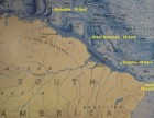
It is about 4400 miles from Puerto Williams to Cape Town. With following winds and currents for a major portion of the way, we can expect to make an average of better than 150 miles per day, so the passage might take 30 days. Mike Harker in his circumnavigation with his Hunter 49 made many 200-mile days crossing the South Pacific and the Indian Oceans, and he had a 1398-mile week. He averaged 157 miles per day for the complete circuit.

On Thursday morning, the 9th of February, the gribs showed a system with 45 and 50 knot winds building northwest of the Falklands midday on Sunday and then moving southeast to about where we would be with an early Friday departure. We re-examined the gribs and our options, and we quickly decided to apply for a zarpe to Cape Town for a mid-afternoon departure on Thursday.
About & Links