SV Sereine
Cruising on a Whitby 42 based in Maine
| Vessel Name: | sereine |
| Vessel Make/Model: | Whitby 42 |
| Hailing Port: | Georgetown. Maine |
| Crew: | Marilyn, Charlie and Wil |
| About: |
30 April 2021
The Last Episode
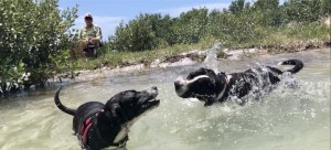
We contnued our stay at Gulfport and practiced being sailors and cruisers. A big part of cruising is meeting people. We met many, warm and genuine folk who deftly added brush strokes to our Gulf Coast canvas.
19 April 2021 | Gulfport, FL
Back to Basics
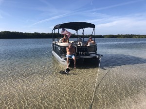
We found everything we wanted in Punta Gorda. Rented a car, and drove to Miami Airport to pick up Pippin, another rescue dog from Virgin Gorda, BVI. She and Charlie are like two peas in a pod.
02 April 2021 | Punta Gorda
The five yard line
We left Salty Sam's Marina early on March 22. We kept our speed under 5 knots, averaging less than 3.5 knots. This is our new normal. There was the usual traffic along the ICW, including the usual wake.
21 March 2021 | Salty Sam's Marina San Carlos
The downhill run
We left the southern end of Sanibel Island back tracking up San Carlos Bay, and running NE along a stretch of the ICW to the Caloosahatchee River, which delivers us to the Sanibel Causeway Bridge. This is how we made our way to Fort Myers Beach. The mooring reservation came through and we enjoyed two [...]
11 March 2021 | Pelican Bay
Cayo Costa
It was a calm and sunny morning on March 1 when we hauled anchors and said our goodbyes to Marco Island. The outgoing current was significant despite being within 2 hours of low. I set the throttle to the lowest possible, and we were traveling at 5.5 knots. Itw as good to get outside of the shoals [...]
Anchors Away
It was anticipated that we would take about 24 hours to get east of Provincetown on the Cape, and another partial day to get southeast of Nantucket where we would have a straight shoot to the Outer Banks. It was anticipated that we would have an engine available...
It was a little over three days to get to that point SE of Nantucket. The time from NE of P town to this mystical point SE of Nantucket involved tacking back and forth for a day and a half in light winds in our nose. The tacking was shallow due to the currents and lightness of the wind. Shoaling in this area created a tacking funnel as we headed south. There was also the shipping lane from Boston to our west. It is two lanes with a buffer in between. Width is about four nautical miles. With our speed over ground (SOG) often less than one knot, that would be four hours to cross. Remember that arcade game, FROGGER...
Memorable moments: Porpoises really close to our barely moving boat in a glass-like sea. Nothing like looking a porpoise and her calf in the eye.
The above magic waypoint was #315 in my MFD. N 041 03.584' W 069 11.197'
A noteworthy observation: Once we lost the VHF weather from Maine, we were unable to get any intelligible reception from the Cape. PredictWind would have provided the weather info we needed to make decisions, but the SAT phone modem was not returning any data, just chewing up minutes. So we sailed forth blind and ignorant.
While we are sizing things up, the 24-7 attention to navigation is slightly increasing the fuzz factor, where thinking takes longer and judgement is questionable. Oh wait, that is my normal.
At 2300h on 09/29/20, we chose a course of 233M and traveled 32 miles to reach the edge the shoal waters befoe the Hudson Canyon and the NY Shipping lanes. The weather radio started working during that night. It informed us of a gale working up the coast from NJ, NY and on through the Cape and up to 20 miles off shore. We were 85 miles, which I felt was safe. The morning brings surprises to those who feel safe.
As we approached the shipping lanes, 13 miles across where we were, the seas were already 10 feet and climbing due to the 25 -30 knot winds. Initially, I thought we could continue in a SW direction to get closer to shore, yet skirt the significant parts of the gale. That was folly after an eye opening hour. The winds drove us more W than SW. Tacking we were driven more E than S. The waves were preventing us from gaining any appreciable speed, thereby reducing our ability to point into the wind. So once again were were in a no win situation. our velocity made good (VMG) sucked. We could check out anytime, but we could never leave.
After a long morning of tacking in an attempt to not go to far W or E, AND to survive the speed bumps that were systematically ripping sails and breaking whatever they could, we had been driven back to the same point on the edge of the greater Nantucket shoals where we greeted the dawn. It was also curious that our speed had dropped to less than 2 knots during this retreat, and now we were virtually dead in the water. Seemed strange even for me. We were in about 150 feet of water. Looking at what might be a problem on the boat, I glanced at the bow that was all but obscured by the dinghy on the fore deck. Something was missing. The anchor had been dislodged and the retaining line had broken. Too many times burying the bow in these seas. I turned on the power for the windlass, and ran to the front, The bow was continuing to rise and sink below the waves. I tried to wind in the anchor, but it was holding fast. At this point, the plow anchor had all 150 feet of chain played out. I had no choice but to cut the line. I then secured our only anchor, a Fortress we bought in the Bahamas after loosing our other Fortress while leaving Biscayne Bay in 2019.
It did not take long to pick up speed. The shortened main sail was more of a hindrance than a help, so I dropped it and tied her down, providing more opportunity for a tired sailor to dance a jig on a spinnng deck. Once the theatrics were done, we were sailing with just a slightly shortened Genoa, and we were doing7 knots in a direction somewhat resembling the one we wanted. We sailed 66 NM at 171M until 0700h. That put us 226 NM off mid-coast NJ. It also put us into the Gulf Stream, which would stay with us for many days.
30 hours later we had covered only 46 NM. Doing the math, I realized this was not good. We actually were doing less than 1 NM. 10 hours later, we had covered another 42 NM, so things were looking up. We maintained this course until 1530h 10/3. By this time the desire to get out of the Gulf Stream was everything. We enjoyed the 79 degree water temp and 80 degree air temp, but sleep was beckoning. Tomorrow will bring excitement.
 |