SV Sereine
Cruising on a Whitby 42 based in Maine
| Vessel Name: | sereine |
| Vessel Make/Model: | Whitby 42 |
| Hailing Port: | Georgetown. Maine |
| Crew: | Marilyn, Charlie and Wil |
| About: |
30 April 2021
The Last Episode
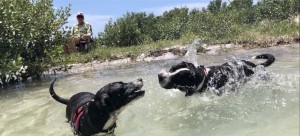
We contnued our stay at Gulfport and practiced being sailors and cruisers. A big part of cruising is meeting people. We met many, warm and genuine folk who deftly added brush strokes to our Gulf Coast canvas.
19 April 2021 | Gulfport, FL
Back to Basics
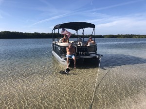
We found everything we wanted in Punta Gorda. Rented a car, and drove to Miami Airport to pick up Pippin, another rescue dog from Virgin Gorda, BVI. She and Charlie are like two peas in a pod.
02 April 2021 | Punta Gorda
The five yard line
We left Salty Sam's Marina early on March 22. We kept our speed under 5 knots, averaging less than 3.5 knots. This is our new normal. There was the usual traffic along the ICW, including the usual wake.
21 March 2021 | Salty Sam's Marina San Carlos
The downhill run
We left the southern end of Sanibel Island back tracking up San Carlos Bay, and running NE along a stretch of the ICW to the Caloosahatchee River, which delivers us to the Sanibel Causeway Bridge. This is how we made our way to Fort Myers Beach. The mooring reservation came through and we enjoyed two [...]
11 March 2021 | Pelican Bay
Cayo Costa
It was a calm and sunny morning on March 1 when we hauled anchors and said our goodbyes to Marco Island. The outgoing current was significant despite being within 2 hours of low. I set the throttle to the lowest possible, and we were traveling at 5.5 knots. Itw as good to get outside of the shoals [...]
The Lions at the Gate
Our usual 0630 - 0730 departure. We had high hopes of making anchorge beyond Beaufort, GA, as that is one of two bridges before Thunderbolt Marine that need to open for us to pass. In particular, this one only opens on the hour. Timing that opening makes a bg difference at the end of the day.
Despite making good time, and twice getting slightly grounded, we did not make the bridge. We did anchor off Brickyard Point at 1530, allowing some daylight while anchored, and positioning us one hour from the bridge. This was a tipcally nice anchorage, as we were still in these masive marshlands, water was shallow enough, and there was so much room.
The next day we made excellent time aided almost 100 % of the time by the ebbing and flooding tide. Hilton Head was a rush. If you blinked really fast you could make out individual trees, otherwise it was a blur of green and brown ;*). I could explain it all using Einstein's formulae, but why bother.
We sail tight lanes a lot on the ICW. During those times, the chart plotter is zoomed in. You find yourself not seeing the Forest for the trees. We were at the Savannah River before I realized it. Docked at Thunderbolt Marine 1530, leaving lots of time to go to the marine supply and grab a bite at Tubby's restaurant.
Normally we get fuel and water first, but there was this boat... It was a gorgeous 75 foot sloop from Maui, Hawaii. She was taking on diesel. Shee had 3000 gallons of tankage! We fueled in the morning, right after Hal the dock master delivered the complimentary Krispey Kreme donuts!
Thunderbolt to Doboy Island is 73 miles. We actually made it at sunset, after racing another boat the last couple of miles. We were hindered by this boat going through the tight lanes. When we acheieved the sound, we passed, or tried to. We finally out sped her, thereby avoiding the use of the canons.
Leaving Doboy in pea soup the next morning. It was so reminiscent of Maine, except we were going down tight streets. This went on for a couple hours, then cleared and we had the best whether of the entire five years it took to get here from Maine. Jekyl Sound is large and shallow. After that it was more confining passages.
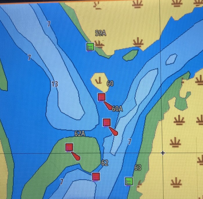
Eventually, around 1630, were were in the home stretch to St Marys, GA. As we came down a length we needed to turn to starboard. Looking at the chart, I beheldeth a WTF situation (see image). We were coming from the upper left in the pic. The space between the upper green and the sandbar was not much more than the beam of Sereine. Maybe I was tired, or maybe I was me. I first decided to try between the unamed red marker and the green sand, thn I changed my mind and headed to 59A. We just nicked the sand north of 60. Some nice gentlemen tugged us off with their speed boat, then tossed the long bow line in the water for me to retrieve. Needless to say the bow line was in eminent danger of wrapping around the drive shaft. Of course in the 15 feet of confined water, we needed the prop to keep us from running aground yet again. I sprinted to the bow (yes I can sprint), and retrieve the line as fast as I coud. Then back to help Marilyn steer. She did an excellent job without me, and I contemplated catching the next flight back to Georgetown International Jetport.
Almost immediately after regainng a navigable course, we were enveloped in a fog bank.
We are in St A, and it is raining.
 |