
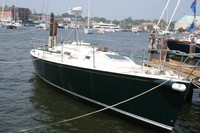
Welcome to Shazam
30 July 2013 | Alanya
06 July 2013 | 36 33.547'N:031 56.881'E, Turkey
12 June 2013 | 36 46.204'N:034 34.170'E, Turkey
31 May 2013 | 36 46.204'N:034 34.170'E, Mersin
05 June 2011 | Cartegena
31 May 2011 | Gibraltar
02 May 2011
23 August 2010 | 37 06.6'N:008 40.5'W, Portugal
25 July 2010 | 38 31.9'N: 28 37.5'W, Azores
10 June 2010 | 32 22.45'N:64 40.05.0'W, Bermuda
04 May 2010 | 18 25.6'N:064 36.6'W, British Virgin Islands
30 April 2010 | 18 25.6'N:064 36.6'W, British Virgin Islands
28 March 2010 | 18 25.6'N:064 36.6'W, British Virgin Islands
13 March 2010 | 18 25.6'N:064 36.6'W, British Virgin Islands
13 December 2009 | 18 28.8'N:064 38.1'W, British Virgin Islands
02 December 2009 | 18 25.6'N:064 36.6'W, Tortola, British Virgin Islands
27 November 2009 | 37 1.7'N:076 20.6'W, Hampton VA
18 October 2009 | 44 17.9'N:068 16.9'W, Updated Itinerary
17 August 2009 | 44 17.9'N:068 16.9'W, Mount Desert
15 July 2009 | 41 11.1'N:071 34.8'W, Block Island
The trip to the BVI
02 December 2009 | 18 25.6'N:064 36.6'W, Tortola, British Virgin Islands
John & Mary
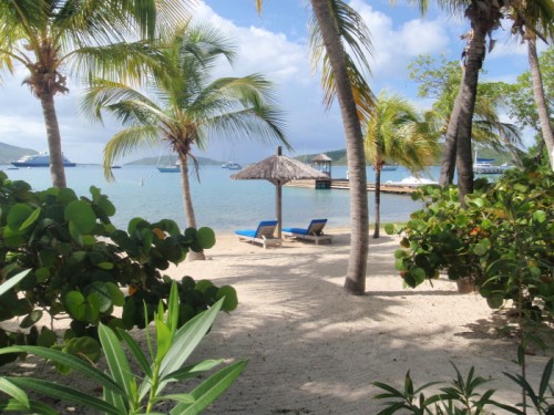
The Bitter End, Virgin Gorda, British Virgin Islands.
The event that we had been planning for over the last 6 months had finally arrived. We woke up early and after saying good bye to friends we had met in Hampton we cast off our lines and headed out into the Chesapeake Bay for the start of the Caribbean 1500 Rally. The weather forecast was for winds to be 30 knots from the North East and increasing over the next few days which would mean a rough Gulf Stream Crossing.
The sixty rally boats gathered at the mouth of the bay for the noon start and within the first hour, all the boats had passed through the Bay Bridge Tunnel and headed out into the North Atlantic. We decided to creep down the Virginia coastline to Cape Hatteras where we hoped to cross the Gulf Stream at its narrowest point and its closest point to land.
As we sailed into darkness along the Virginia coast, the 60-boat fleet had started to disperse with only about 10 boats taking the same course as us.
During the first night, we passed Cape Hatteras and watched the lights on the US mainland disappear into the distance. As we closed in on the Gulf Stream, we could see the water temperature rapidly increase from 58 degrees Farenheight at Cape Hatteras to 80 degrease as we entered the stream and all within a few miles. The wind was now blowing 30+ knots and the waves were steep. The boat handled the conditions well although the concentration on steering the boat was very tiring as we changed from surfing down the waves to weaving around the biggest waves. It only took a few hours to cross the stream and then the seas settled down. The wind stayed around 30 knots but the seas were not as steep and had a much greater period between peaks which made them easier to handle. By day light on the second day we could no longer see another rally boat. We headed just south of the rhumb line to make use of a favorable current. The winds continued at 25 - 35 knots for the next night and then gradually dropped on the third day down to 10- 15 knots which gave us the opportunity to clean up the boat and do some boat maintenance. However this lighter weather did not last for long and the winds soon picked back up to 30+ knots. The strong winds and large seas then stayed with us for the next few days. By the sixth day at sea we were starting to feel very tired having had very little sleep in the rough conditions so we decided to heave-to for one night so that we could catch up on sleep. This turned out to be a wise call as the boat handled the waves fine and we got some much needed sleep through until dawn the next day. The next two days continued with winds around 25 knots and then slowly dropping to around 20 knots on the last night at sea as we approached the Virgin Islands.
Seven days and 9 hours after we left Hampton, VA we were able to see land again as the island of St. Thomas in the US Virgin Islands appeared in the moon light on our starboard side. It was not much longer before the British Virgin Islands (BVI) could be seen ahead. After passing the island of Jost Van Dyke to port we headed across to Tortola and crossed the finishing line seven days 14.5 hours after leaving the US. Although we both felt extremely tired it was a great feeling of accomplishment.
We dropped the sails in the dark and motored into Soper's hole to find a mooring outside the customs office. We then dinghied into the Customs office early the next day and, after an hour in the office filling out various forms, we were finally cleared into the BVI and could now make our way around to Nanny Cay Marina on the south side of Tortola that was to be the home of the rally boats until the 14th Nov.
Nanny Cay Marina was a great location to meet up with all the other boats and share stories as well as a great place to reprovision and make repairs.
Comments
| Vessel Name: | Shazam |
| Vessel Make/Model: | J130 |
| Hailing Port: | Annapolis, MD USA |
| Crew: | John & Mary Driver |
| About: | Living the Dream |
| Extra: |
Gallery not available
General Information
Who: John & Mary Driver
Port: Annapolis, MD USA