
Our Ever-Changing Backyard

14 April 2024 | Zakinthos to Sounion, Greece
27 January 2024 | Preveza to Zakinthos Island, Greece
15 December 2023 | Sarandë, Albania to Preveza, Greece
27 November 2023 | Himarë, Albania
13 November 2023 | Orikum, Albania
30 October 2023 | Durrës, Albania
29 October 2023 | Porto Montenegro to Athens, Greece
22 August 2023 | Montenegro
21 August 2023 | Montenegro
08 August 2023 | Montenegro
02 August 2023
27 July 2023 | Montenegro
04 May 2023
18 April 2023 | Monopoli, Italy - Zadar, Croatia
09 April 2023 | Korčula, Croatia
01 April 2023 | Otok Badija, near Korcula, Croatia
15 March 2023 | Mljet National Park, Croatia
11 December 2022 | Uvala Przina, Pelješac Peninsula, Croatia
20 November 2022 | Uvala Podškolj, Croatia
05 November 2022 | Lopud, Croatia
A hidden reef, a Bedouin tent, and dinghy surfing
15 July 2015 | Punta Chivato
Vandy
We left Bahia Santo Domingo Tuesday, July 14, after five great days in this anchorage. We like it here; it's well-protected from wind and waves from many directions, has beautifully clear water, and lots to see. I enjoyed looking down through the clear water, either from SCOOTS' deck or from our kayak, spying on the goings-on beneath the surface. One day I saw five-inch-long seahorse scooting along the bottom!
We had Telcel service here, by virtue of being close enough to some cell tower across the bay in Mulege, and some frustratingly slow Internet for a couple of days. We made some calls and waded the Internet - it was too slow to call it "surfing."
But we were ready to move on, to experience some new places further north.
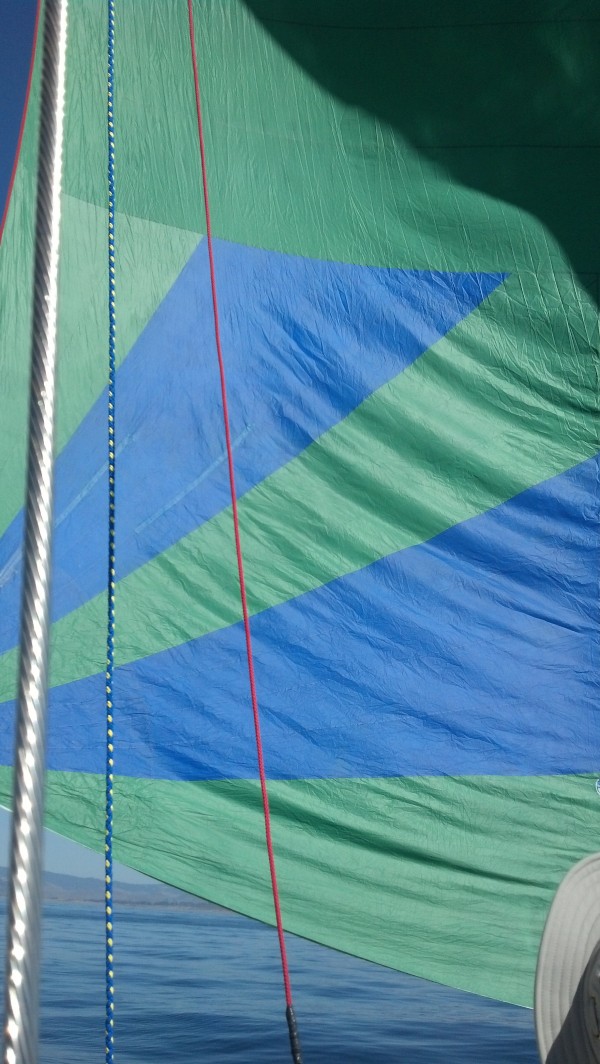
We'd decided to leave on Tuesday morning, when the winds were forecast to increase to about 11-14 knots from the east - so that we could sail, rather than motor, to our next destination. The night before, based on the forecast for moderate winds, and expecting pretty calm seas, we'd decided to leave our canvas sun shade up, with the sides rolled up so that we could see better, sailing with just our headsail, and tow our dinghy, to the north side of Punta Chivato, about eighteen miles north up the coast. We usually travel with our dinghy motor mounted on the stern rail and the dinghy lashed onto the foredeck, and our sun shade packed away in its bag, but we figured with these moderate winds and a shortish coastal trip, we could afford to be a little lazy. I'll bet you know where this is going...
At just after 9 am, the winds came up just a little, pimping us into leaving. We motored out of the anchorage, put up our Code 0 (light-wind sail), and the wind died, leaving us bobbing around just outside the anchorage. Hmm.
As we were bobbing around, I looked east, out across the Sea, and saw some whitecaps in the distance. "Hey Eric," I said, "I think we're going to get some wind. I see whitecaps out there."
Eric took a look. "Those aren't whitecaps," he said. They're probably just tide rips."
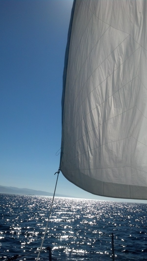
The wind arrived about five minutes later. First, a gentle breeze from the east. We put up our Code 0 and started to move forward. Hooray! About a minute later, the wind was up to 10 knots. Time to take the Code 0 down and put up the Genoa jib (our heavier headsail). The wind soon rose to 15 knots (okay, this is quite enough), then continued on up to 20 (oh boy, this is gonna be a ride).
The waves, which had had lots of time and wind and real estate to build up (this is called "fetch"), soon arrived. We were suddenly sloshing around in 3-foot pointy wind waves, coming at us on our starboard beam every five seconds or so, which wouldn't have been much of a concern, had our dinghy been stowed on deck.
And so we headed north toward Punta Chivato, cruising along at about 6 knots under jib alone, our mainsail tucked away beneath the sun shade, and our dinghy bouncing and surfing along behind us, both of us wishing we had chosen to put the sun shade and dinghy away.
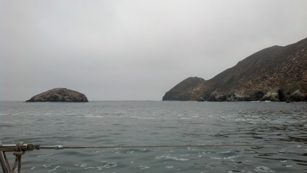
Punta Chivato is a headland with anchorages on both its south and north sides. While the southern anchorage is the more protected and popular one, it is open to the east southest, and southeast, the directions from which some stronger winds were forecast to come over the next couple of days. We were headed toward the northern anchorage, which, though it has the entire landmass of Punta Chivato to block the forecast wind and waves, is not very protected, and open to the north and east.
A couple of miles off the coast of Punta Chivato lie three low islands, the Islas Santa Inez. They are sandy and rock-strewn, surrounded by a large area of shallow water (18 feet or less), which is similarly sandy and rock-strewn. Our route to the anchorage took us between these islands and the shore of Punta Chivato, which we knew would require us to cross a mile or more of relatively shallow water (20-30 feet deep), but was certainly navigable.
Here the plot thickens. Somewhere between these islands and Punta Chivato lies a concealed reef, Santa Inez Reef, about a quarter of a mile long. I say "somewhere" because it isn't shown or labeled correctly on any of our electronic navigation charts; it might have been visible on our Google Earth chart, though that area of the photo is dotted with clouds, so it's hard to tell if there are any rocks there. The only place it's shown is in one of our cruising guides (NOT the Shawn and Heather one that is our usual go-to guide for these sorts of things), an oval patch labeled "reef," drawn about halfway between Punta Chivato and the islands, in a sketch of the area.
So, with accurate GPS coordinates for our position, three different navigation systems showing three different pictures, two guidebook sketches, pointy beam seas, 20 knot wind, a bouncing dinghy in tow, and a flapping sun shade, we headed toward the passage. Soon the depth began to rise and the water color changed from way-deep-enough dark turquoise to hey-it's-pretty-shallow-here light turquoise. We expected that, but it's still a bit unnerving to be passing through it, especially when you know a reef might be lurking somewhere nearby.
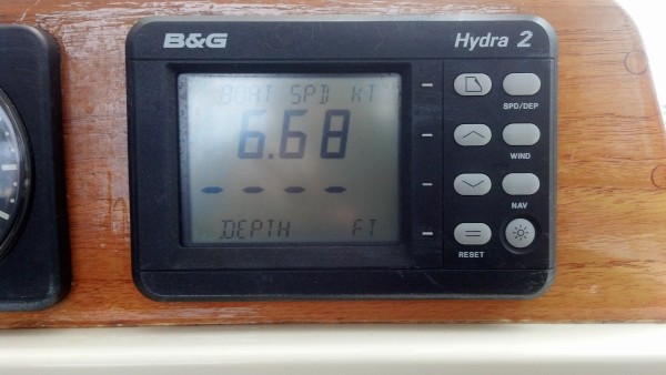
While Eric kept a close eye on the navigation systems and the depth - which rose quickly from 45 feet to 30 to 25 and then to 21 feet, where it held for awhile - and steered a course that considered all of the data, I went to the bow to watch for rocks. I can tell you that there were rocks - they show up as dark areas against the light-colored sand, and in this clear water they look like they're just below the surface - but they were all too deep to cause us any concern, just as our charts had indicated.
Our guidebook sketches included the lat-lon lines for the area, which proved useful for figuring out our position in relation to the items in the sketches. We also knew that if we were in 18 feet of water, we were too close to the islands. We had no idea at what depth the hidden reef might be, just that it was somewhere off to our left, closer to shore.
After about twenty tense minutes, the depth started to rise again, and our GPS location indicated that we should be past the shallow water and well north and east of the hidden reef. Whew.
When we rounded the point, the wind continued to blow hard and the waves got taller and pointier, sloshing us around even more. Hey! Our dinghy surfed from one wavetop to the next, and the sun shade was flapping like a bedouin tent in a sandstorm. The white sand beach that marked our anchorage beckoned up ahead. We hoped that the waves would lay down a bit, as we got closer to shore.
They did. We dropped the anchor in 20 feet of water and relaxed. I think it will be a long time before we choose to sail without our dinghy and sun shade being stowed properly.
We had Telcel service here, by virtue of being close enough to some cell tower across the bay in Mulege, and some frustratingly slow Internet for a couple of days. We made some calls and waded the Internet - it was too slow to call it "surfing."
But we were ready to move on, to experience some new places further north.
We'd decided to leave on Tuesday morning, when the winds were forecast to increase to about 11-14 knots from the east - so that we could sail, rather than motor, to our next destination. The night before, based on the forecast for moderate winds, and expecting pretty calm seas, we'd decided to leave our canvas sun shade up, with the sides rolled up so that we could see better, sailing with just our headsail, and tow our dinghy, to the north side of Punta Chivato, about eighteen miles north up the coast. We usually travel with our dinghy motor mounted on the stern rail and the dinghy lashed onto the foredeck, and our sun shade packed away in its bag, but we figured with these moderate winds and a shortish coastal trip, we could afford to be a little lazy. I'll bet you know where this is going...
At just after 9 am, the winds came up just a little, pimping us into leaving. We motored out of the anchorage, put up our Code 0 (light-wind sail), and the wind died, leaving us bobbing around just outside the anchorage. Hmm.
As we were bobbing around, I looked east, out across the Sea, and saw some whitecaps in the distance. "Hey Eric," I said, "I think we're going to get some wind. I see whitecaps out there."
Eric took a look. "Those aren't whitecaps," he said. They're probably just tide rips."
The wind arrived about five minutes later. First, a gentle breeze from the east. We put up our Code 0 and started to move forward. Hooray! About a minute later, the wind was up to 10 knots. Time to take the Code 0 down and put up the Genoa jib (our heavier headsail). The wind soon rose to 15 knots (okay, this is quite enough), then continued on up to 20 (oh boy, this is gonna be a ride).
The waves, which had had lots of time and wind and real estate to build up (this is called "fetch"), soon arrived. We were suddenly sloshing around in 3-foot pointy wind waves, coming at us on our starboard beam every five seconds or so, which wouldn't have been much of a concern, had our dinghy been stowed on deck.
And so we headed north toward Punta Chivato, cruising along at about 6 knots under jib alone, our mainsail tucked away beneath the sun shade, and our dinghy bouncing and surfing along behind us, both of us wishing we had chosen to put the sun shade and dinghy away.
Punta Chivato is a headland with anchorages on both its south and north sides. While the southern anchorage is the more protected and popular one, it is open to the east southest, and southeast, the directions from which some stronger winds were forecast to come over the next couple of days. We were headed toward the northern anchorage, which, though it has the entire landmass of Punta Chivato to block the forecast wind and waves, is not very protected, and open to the north and east.
A couple of miles off the coast of Punta Chivato lie three low islands, the Islas Santa Inez. They are sandy and rock-strewn, surrounded by a large area of shallow water (18 feet or less), which is similarly sandy and rock-strewn. Our route to the anchorage took us between these islands and the shore of Punta Chivato, which we knew would require us to cross a mile or more of relatively shallow water (20-30 feet deep), but was certainly navigable.
Here the plot thickens. Somewhere between these islands and Punta Chivato lies a concealed reef, Santa Inez Reef, about a quarter of a mile long. I say "somewhere" because it isn't shown or labeled correctly on any of our electronic navigation charts; it might have been visible on our Google Earth chart, though that area of the photo is dotted with clouds, so it's hard to tell if there are any rocks there. The only place it's shown is in one of our cruising guides (NOT the Shawn and Heather one that is our usual go-to guide for these sorts of things), an oval patch labeled "reef," drawn about halfway between Punta Chivato and the islands, in a sketch of the area.
So, with accurate GPS coordinates for our position, three different navigation systems showing three different pictures, two guidebook sketches, pointy beam seas, 20 knot wind, a bouncing dinghy in tow, and a flapping sun shade, we headed toward the passage. Soon the depth began to rise and the water color changed from way-deep-enough dark turquoise to hey-it's-pretty-shallow-here light turquoise. We expected that, but it's still a bit unnerving to be passing through it, especially when you know a reef might be lurking somewhere nearby.
While Eric kept a close eye on the navigation systems and the depth - which rose quickly from 45 feet to 30 to 25 and then to 21 feet, where it held for awhile - and steered a course that considered all of the data, I went to the bow to watch for rocks. I can tell you that there were rocks - they show up as dark areas against the light-colored sand, and in this clear water they look like they're just below the surface - but they were all too deep to cause us any concern, just as our charts had indicated.
Our guidebook sketches included the lat-lon lines for the area, which proved useful for figuring out our position in relation to the items in the sketches. We also knew that if we were in 18 feet of water, we were too close to the islands. We had no idea at what depth the hidden reef might be, just that it was somewhere off to our left, closer to shore.
After about twenty tense minutes, the depth started to rise again, and our GPS location indicated that we should be past the shallow water and well north and east of the hidden reef. Whew.
When we rounded the point, the wind continued to blow hard and the waves got taller and pointier, sloshing us around even more. Hey! Our dinghy surfed from one wavetop to the next, and the sun shade was flapping like a bedouin tent in a sandstorm. The white sand beach that marked our anchorage beckoned up ahead. We hoped that the waves would lay down a bit, as we got closer to shore.
They did. We dropped the anchor in 20 feet of water and relaxed. I think it will be a long time before we choose to sail without our dinghy and sun shade being stowed properly.
Comments
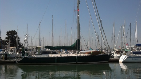
| Vessel Name: | Awildian, previously SCOOTS (2012-2021) |
| Vessel Make/Model: | Leopard 48 |
| Hailing Port: | San Francisco, CA |
| Crew: | Eric and Vandy Shrader |
| About: | We've been living aboard full time since September 2014. We sailed our Able Apogee 50, SCOOTS, from 2012-2021, and are now aboard our Leopard 48, Awildian, since March 2022. |
| Social: |
|
Awildian, previously SCOOTS (2012-2021)'s Photos - Main
 |
|
|
|
|
|
|
|
|
|
 |
|
|
|
|
|
|
|
|
|
|
|
|
|
|
|
|
|
|
|
|
|
|
|
|
|
|
|
|
|
|
|
|
|
|
|
|
|
|
|
|
|
|
|
|
|
|
|
|
|
|
|
|
|
|
|
|
|
|
|
|
|
|
|
|
|
|
|
|
|
|
|
|
|
|
|
|
 |
 |
 |
 |
 |
 |
|
 |
 |
 |
 |
 |
 |
 |
 |
 |
 |
 |
 |
 |
 |
 |
 |
 |
 |
 |
 |
 |
Pics from our trip time aboard Scoots in July 2013.
23 Photos
Created 7 July 2013
|
 |
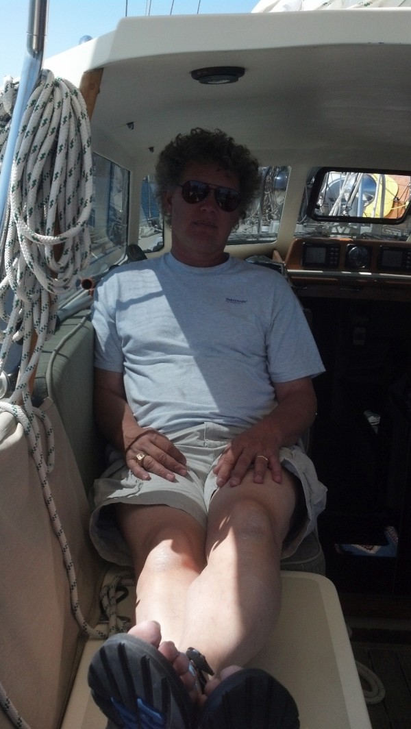
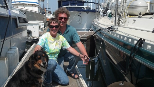
Who: Eric and Vandy Shrader
Port: San Francisco, CA