
Our Ever-Changing Backyard

14 April 2024 | Zakinthos to Sounion, Greece
27 January 2024 | Preveza to Zakinthos Island, Greece
15 December 2023 | Sarandë, Albania to Preveza, Greece
27 November 2023 | Himarë, Albania
13 November 2023 | Orikum, Albania
30 October 2023 | Durrës, Albania
29 October 2023 | Porto Montenegro to Athens, Greece
22 August 2023 | Montenegro
21 August 2023 | Montenegro
08 August 2023 | Montenegro
02 August 2023
27 July 2023 | Montenegro
04 May 2023
18 April 2023 | Monopoli, Italy - Zadar, Croatia
09 April 2023 | Korčula, Croatia
01 April 2023 | Otok Badija, near Korcula, Croatia
15 March 2023 | Mljet National Park, Croatia
11 December 2022 | Uvala Przina, Pelješac Peninsula, Croatia
20 November 2022 | Uvala Podškolj, Croatia
05 November 2022 | Lopud, Croatia
PPJ Day 10 Weather, or not?
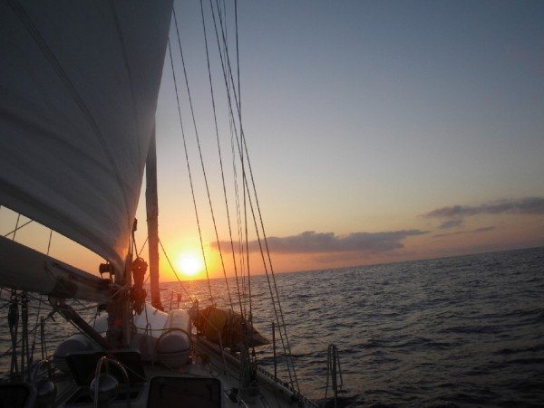
12 April 2016 | The Pacific Ocean
Vandy
Weather prediction is an important element of safe cruising. On board SCOOTS, we use many different weather products every day, to try to tease out what is the most likely weather that we'll see (wind, squalls, etc.) and to determine the best course (fastest, most comfortable, etc.) to take, based on all the data that is available to us.
Eric did a rundown of our weather products in an email to a friend today, which I'll repost here, as it covers it quite well.
In order to figure the weather out we use: A twice daily tropical discussion sheet from The National Hurricane Center, number AXPZ20 that we download over the SSB radio.
GRIBS (Gridded binary data) for wind data (also downloaded over the SSB) which we look at and put into a program called Qtvlm which, using our boat speed info, predicts the best course to take for the next 12 days. You can play with the program ZYGRIB if you like to see these. It will download the gribs directly for an area if you are on the net.
GRIBS for ocean current (OSCAR) data downloaded over the SSB from NOAA every few days.
Weather fax charts from the National Weather Service over the shortwave from Point Reyes.
A satellite receiver that downloads cloud information (IR and visible) in real time (when the satellite is overhead) about three times a day. The image is processed to indicate likely convective energy. Information from other boats that are out here. We have a radio net every morning and boats report position and weather info. We started kinda late so most boats are ahead of us so we can see what the weather is where we are going.
RADAR shows squall activity within 36 miles and we track squalls forming, dissipating and moving so we can try to move around them. That part is like a video game and you get soaked when you lose.
Eyeballs: is that rain I see? let's turn on the RADAR.
Vandy's intuition...
Crossing the Equator requires a special bit of planning around a thing called the ITCZ (InterTropical Convergence Zone). Also known as "the doldrums," the ITCZ is the area near the Equator where the Northern Hemisphere weather(NE tradewinds,etc.) mixes with the Southern Hemisphere weather(SE tradewinds, etc.), spawning squalls and large windless areas. Like water spiralling down a drain, weather also tends to rotate in opposite directions on either side of the Equator, so you can see that the place where they converge might be a bit unruly. It's a place you don't want to linger, as you sail from north to south, so all sailors try to figure out the best strategy for getting across quickly.
To add another level of fun, the ITCZ moves around continuously. It shifts east and west, it shifts north and south; gaps form and close; sometimes there are two ITCZ's, one in each hemisphere, for double the fun. I think the ITCZ is about 60 miles wide, so you can't just step across. How do we know where it is? The Tropical Discussion and Tropical Surface Analysis that we download twice a day give locations for the ITCZ at the time of the report.
When these faxes came in yesterday, we were astonished to see that a gap had formed in the ITCZ RIGHT WHERE WE WERE! No kidding! We were traveling through 8N 122W, which formed the eastern edge of the gap. We were able to maintain our course and sail throughout the night on good winds, heading SW through the gap. Of course, this morning's discussion said that the gap had moved west a bit; the Tropical Analysis showed the ITCZ as a solid line, still in our vicinity. Hmph, weather.
What did we do? We maintained our course to the SW, which would take us either below the new ITCZ location OR keep us in the new gap.
Some cruisers hire a professional weather router to collect, distill, interpret and condense all the weather data into a concise text or email that they send to the cruiser at pre-arranged intervals. We may use a professional weather router at some point, but for now, Eric and I enjoy trying to make sense of all the different pieces, and to use them to our best advantage as we make our way across the ocean. So far, we've been doing okay.
Comments
| Vessel Name: | Awildian, previously SCOOTS (2012-2021) |
| Vessel Make/Model: | Leopard 48 |
| Hailing Port: | San Francisco, CA |
| Crew: | Eric and Vandy Shrader |
| About: | We've been living aboard full time since September 2014. We sailed our Able Apogee 50, SCOOTS, from 2012-2021, and are now aboard our Leopard 48, Awildian, since March 2022. |
| Social: |
|
Awildian, previously SCOOTS (2012-2021)'s Photos - Main
 |
|
|
|
|
|
|
|
|
|
 |
|
|
|
|
|
|
|
|
|
|
|
|
|
|
|
|
|
|
|
|
|
|
|
|
|
|
|
|
|
|
|
|
|
|
|
|
|
|
|
|
|
|
|
|
|
|
|
|
|
|
|
|
|
|
|
|
|
|
|
|
|
|
|
|
|
|
|
|
|
|
|
|
|
|
|
|
 |
 |
 |
 |
 |
 |
|
 |
 |
 |
 |
 |
 |
 |
 |
 |
 |
 |
 |
 |
 |
 |
 |
 |
 |
 |
 |
 |
Pics from our trip time aboard Scoots in July 2013.
23 Photos
Created 7 July 2013
|
 |

Who: Eric and Vandy Shrader
Port: San Francisco, CA