
Our Ever-Changing Backyard

14 April 2024 | Zakinthos to Sounion, Greece
27 January 2024 | Preveza to Zakinthos Island, Greece
15 December 2023 | Sarandë, Albania to Preveza, Greece
27 November 2023 | Himarë, Albania
13 November 2023 | Orikum, Albania
30 October 2023 | Durrës, Albania
29 October 2023 | Porto Montenegro to Athens, Greece
22 August 2023 | Montenegro
21 August 2023 | Montenegro
08 August 2023 | Montenegro
02 August 2023
27 July 2023 | Montenegro
04 May 2023
18 April 2023 | Monopoli, Italy - Zadar, Croatia
09 April 2023 | Korčula, Croatia
01 April 2023 | Otok Badija, near Korcula, Croatia
15 March 2023 | Mljet National Park, Croatia
11 December 2022 | Uvala Przina, Pelješac Peninsula, Croatia
20 November 2022 | Uvala Podškolj, Croatia
05 November 2022 | Lopud, Croatia
Racing to Athens - Zakinthos to Sounion
14 April 2024 | Zakinthos to Sounion, Greece
Vandy Shrader
May 11-27, 2023
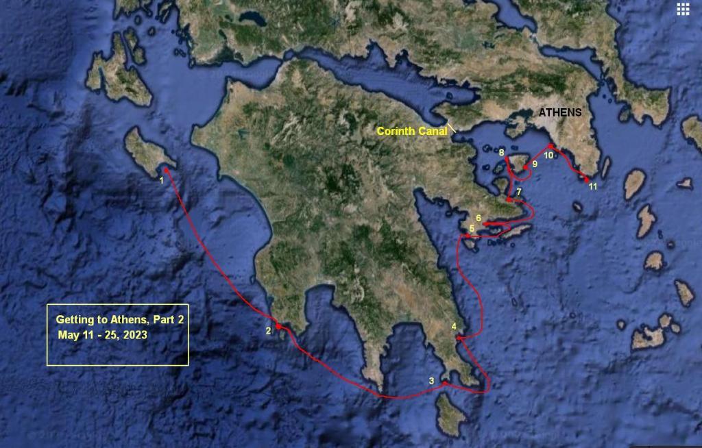
Key to the Map:
1. Laganas 2. Methoni 3. Elafonisos
4. Kremmidhi 5.Porto Cheli 6. Kapari
7. Poros 8. Aegina anchorage 9. Portes
10. Voula 11. Sounion
Pedal to the Metal
The second two weeks of May were pretty much like the first. We continued our trek toward Athens, scooting around the southern end of the Peloponnese Peninsula. A much shorter route, through the Corinth Canal in the northern part of the peninsula, wasn't an option for us, as it was closed for repairs due to a big landslide, and wasn't scheduled to reopen until June 1.
As we headed south, and then east, we watched the weather carefully. The wind can really pick up around here, roaring around the Peloponnese from the east or from the west, and we didn't want to experience any of that. For the time being, the wind was mellow, and in fact we had to motor most of the way. We didn't dally, but kept our pace up, so that if the weather did change and kept us in one place for awhile, we'd still be near Athens by the time that Kelly and Daniel would arrive on May 27.
Methoni
Our first stop, after a 68-mile trip from Zakinthos, was the anchorage at Methoni, on the tip of the first "finger" of the peninsula. The aptly-named, and really interesting-looking, Methoni Castle welcomed us to the anchorage, but since we were arriving late in the day, and had plans to leave early the next morning, we didn't check it out.
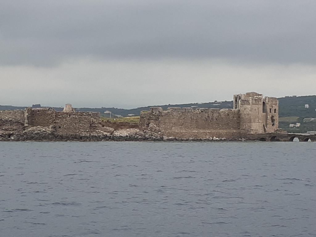
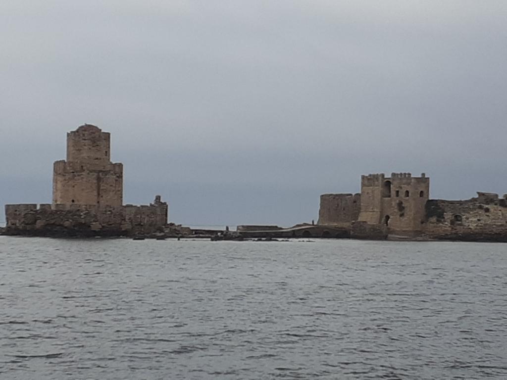
As with most of our anchorages on this part of our travels, we hoped to come back another time when we'd have a chance to really explore.
Elafonisos Island
The next day, seventy miles and about ten hours after we left Methoni, we dropped anchor in a beautiful bay on the south coast of Elafonisos Island.
This anchorage was beautiful, with a crescent of white sand on shore, and clear, turquoise water.
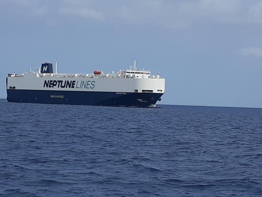
With the Corinth Canal closed until June 1, any shipping traffic had to come around the bottom of the Peloponnese, as we were doing. There was plenty of traffic. All those ships gave us something to look at along the way, and some obstacles to avoid.
After Elafonisos, we dipped around the southernmost finger of the Peloponnese Peninsula and turned north. This was a shorter trip, only about 33 miles, taking us along the rugged coast, past the sixth-century town of Monemvasia, perched on the end of a short, rocky peninsula (another place we hoped to explore another time). We considered anchoring at one of the two anchorages near the town, but decided to continue a bit farther north to anchor in Ormos Kremmidhi.
Ormos Kremmedhi
Ormos Kremmidhi's white-rock cliffs provided good protection from the forecast north wind, and its sandy bottom, shining through the clear water, held Obama snugly.
Since we'd arrived in the early afternoon, we had time to take the dinghy around the headland to a cute little restaurant at the Annema Hotel, where we enjoyed a tasty and inexpensive Greek dinner. Since we were the only two customers, our waiter sat down to chat with us for awhile.
Porto Cheli
When we arrived at Porto Cheli the following day, we did a little happy dance. Why? We'd achieved our goal of being within ferry distance from Athens. From now until Kelly and Daniel arrived in Athens in about two weeks, no matter where we happened to be between here and there, they could easily get to us. Taking our foot off our virtual accelerator, we allowed ourselves to enjoy a couple of days in Porto Cheli. In addition to having a cute town, and a marina, Porto Cheli's anchorage is a well-known hurricane hole, where boats can shelter from strong winds and waves within its large, nearly-enclosed bay, with its bottom of thick, anchor-holding mud.
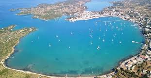
Photo from MarinaTips.com
Meandering to Athens
Our goal having been reached, we continued moving toward Athens, though at a much more leisurely pace. Our next stop was Ormos Kapari, a mere 15 miles away, near the town of Ermione. We arrived here during the afternoon thermal period (AKA sea breeze), and dropped anchor near the lovely beach. We did a bit of boat maintenance and spent one night there.
Poros
The next day we traveled to Poros, a quaint Greek town that we'd heard a lot about from our cruising friends. Poros didn't disappoint: from the moment that we rounded the eastern end of the island, motoring along the narrow channel, passing dozens of sailboats moored along the town quay, with the town providing a picturesque backdrop, we were charmed. We returned to Poros five or six times during the summer.
Photo from SailingIssues.com
Rather than jockeying for a spot along the crowded town quay, we continued past the town and dropped anchor in pretty little Neoriou Bay. Quiet, uncrowded, and ringed with a white sand beach, Neoriou was a relaxing place to hang out for a couple of days, watching the parade of sailboats heading away from Poros every morning, and toward Poros every afternoon. It was convenient, too: from here, it was just a five-minute dinghy ride to the town quay.
Friends of ours had told us that "the best chandlery in the world" was located in Poros. We were looking for a particular boat part, a line clutch, to replace one that had broken, so we visited this chandlery to find out if they had it. Our opinion: it may in fact be the best chandlery in the world.
The walls of the small, narrow shop were filled with all kinds of boat parts, from the floor all the way up to the ceiling. Eric and I had a look around, and then, completely overwhelmed by the collection of items on display, none of them the one we wanted, showed a picture of the part we were looking for, to the shop keeper. He didn't speak much English, but he held up a finger and said, "Wait." Getting a ladder, he climbed up to the top, reached his hand up to a high shelf, where he felt around and retrieved something. When he came down the ladder, he was holding the exact model of line clutch that we'd needed.
Unlike what we were used to in the rest of the world, in Greece, diesel isn't usually sold at fuel docks. Instead, tanker trunks deliver it to boats at the town quay. Awildian needed his diesel tanks filled, so we got the number of the local tank truck and gave him a call. The price per liter was about the same as the price as at the gas station pumps, which surprised us, considering that it was being delivered.
Since Awildian wasn't staying on the town quay, we'd need to bring him there to get filled. Though packed like sardines by late afternoon, most boats left by 9 or 10 in the morning, on their way to their next destination, leaving empty spots on the quay. On the morning that we were going to buy diesel, we scanned the quay through our binoculars. A big gap had opened up - big enough to tie Awildian alongside, rather than stern-to. Perfect!
We pulled up our anchor, motored over to the quay, tied Awildian to the wall, called the diesel guy, and told him where we were. He came along in a few minutes and filled Awildian's tanks. A half hour later we were on our way, with less money but more diesel.
Aegina
Months earlier, while we were still in Montenegro planning our trip to Greece, we'd decided to have Kelly and Daniel take a ferry from Athens, and meet us on the island of Aegina. When we left Poros, we headed to Aegina. Though we still had more than a week until they arrived, we wanted to get there, check out the anchorage, and do some exploring. We also had to have our "transit log" stamped by the port police there, as we'd listed Aegina as our destination, when we'd left Preveza. We chose the anchorage closest to the port where the ferries docked, and where the bulk of the main town lay. The anchorage was open to the entire western sector, on a broad shelf of sand and weeds in shallow water. The comments on Navily mentioned, and Google Earth showed, a submerged stone wall that bisected the anchorage, with a depth of less than one meter. We made sure to avoid that area when we were anchoring.
We put our dinghy in the water and zipped over to the port, checking out the submerged rock wall along the way, and tying up among some small fishing boats in the marina.
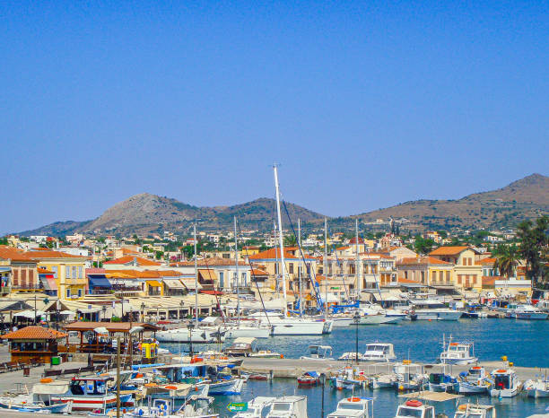
Photo from iStock.com
Walking into town, we found the port police office and had our transit log stamped. For our next destination, we listed the island of Kythnos, since we hoped to get there with Kelly and Daniel. We checked out the small grocery stores, and discovered another chandlery, which is also now in the running for the best chandlery in the world.
Why?
For months, we'd been looking for some 2-inch (50 mm) sanitation hose, to replace the hoses of that size in Awildian. (Yeah, I know, the cruising life is all glamour, all the time.) These were the only sanitation hoses we hadn't yet replaced, because we hadn't been able to find any. Eric had looked online, in Montenegrin chandleries, in Greek chandleries...no luck. The Best Chandlery in the World in Poros hadn't had any. So we weren't hopeful when he asked the man in the small, cluttered Aegina chandlery whether he had some 50 mm sanitation hose. To our surprise, instead of telling us no, he asked us how much we needed.
"Six meters," Eric told him. The man nodded and disappeared into the back room. A few minutes later he returned with a coil of hose. Was it...yes it was! He happened to have a piece of 50 mm sanitation hose that was just shy of 6 meters long! Halleluia!
Figuring that he was on a roll, Eric then asked the man if he had a grease gun (something else we hadn't been able to find anywhere). He walked to a shelf, reached into a box, and pulled out a grease gun.
It was really too bad that we didn't have a lottery ticket to buy.
Aegina, it turns out, is famous for its pistachios. We discovered this when, on our way back to our dinghy, we bumped into a small wooden booth that sold pistachios. The extremely enthusiastic woman who was in the booth offered us some pistachios to try. They were really good, and we said so.
Without missing a beat, she then held out a tiny spoon to each of us, loaded with a dollop of tan paste:
"Try some pistachio butter," (we did),
then another loaded spoon: "try some pistachio cream" (we did),
then a small plastic cup: "try some pistachio liquor" (we did),
then a napkin with a small bit of something nutty "try some pistachio roll" (we did).
We stopped sampling after that, content to leave with a kilogram of roasted pistachios and a couple of pistachio rolls. I don't know what was different about those pistachios, but they were the best we'd ever had.
During the night, waves began to roll into our anchorage from the northwest. At first small and polite, they became larger and more noticeable as time went on, so that by morning, they were truly annoying. At first we thought they were ferry wakes, but we soon realized that they continued even after the ferries were tucked into port. The wind was calm, and Awildian was turned beam-on to these suckers. Being a catamaran, he wasn't rolling with the nausea-inducing, metronomic gusto of the monohull who was anchored nearby, but it was still unpleasant enough that we decided to move on after breakfast.
Portes Cove
Since the waves were coming from the northwest, we scooted around the southern end of Aegina, and about halfway up the eastern side, until we came to a pretty little indentation in the shoreline called Portes Cove. We enjoyed one sunny afternoon, and a clear, starry night here, the only boat in the place.
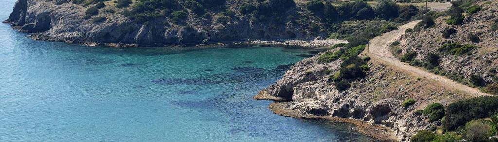
Photo from EcoTourismGreece.com
Since we still had a few days before Kelly and Daniel came, and we preferred not to hang out in the Aegina anchorage, we decided to move closer to Athens, and find a good place to meet them.
Voula Beach
The Voula Beach anchorage looked promising. On the west coast of the Attic Peninsula, in the outskirts of the Athenian suburbs, it provided good protection from the forecast wind, and might be a good place to stage for Kelly and Daniel's arrival. The busy shipping lanes running north and south between Aegina and the peninsula provided us some focus, as we navigated west to east across them, carefully avoiding the steel behemoths. Arriving at Voula, we found a big sand patch among the fields of weeds, and buried Obama in it. Again, we were the only boat.
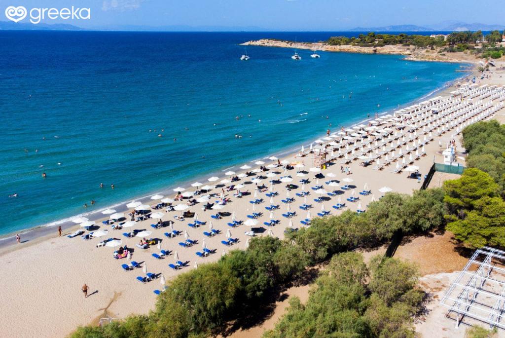
Photo by Greeka.com
It was time to do some reconnaissance. On shore were several sandy beaches, bristling with beach umbrellas, and packed with people. This was just down the road from Athens, after all. It looked like this particular beach area had seen better days, as several of the buildings sported graffiti, and some were boarded up. Some of the beachgoers were walking along the beach and disappearing up a path toward the main road. There didn't seem to be any good places to park and lock a dinghy along there, so we took our dinghy and scouted further south along the shore. Here, we found some large culverts with criss-crossed rebar blocking their seaward openings, and a set of stairs going up to a parking lot. It was sketchy, but it would do for now.
We locked our dinghy to one of the rebar gates, walked down the beach, and up the stairs to the road. Kelly and Daniel could take a taxi to here from the airport, if we decided to meet them here. Across the street, we could see a small grocery store. We crossed the road, bought some items, and returned to our dinghy...which was now getting doused with waves from the afternoon sea breeze. Ugh. We unlocked the dinghy, turned it around, climbed in, and pushed it out away from the rocky shore.
Even though Voula Beach was convenient to the Athens Airport, it really wasn't going to work as a place to pick up Kelly and Daniel. Maneuvering their luggage down the stairs, across the beach, to the skanky drainage pipes, was far less than ideal. Also, since we were hoping to get Kelly and Daniel to the island of Kythnos during the three days they'd be with us, we wanted to find a starting place that was closer to the Cyclades.
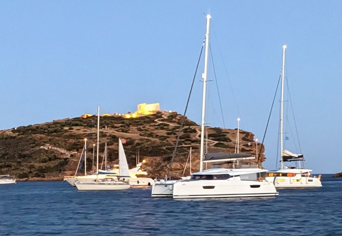
Sounion
And we found one. At the very southern tip of the Attica Peninsula, presided over by the Temple of Poseidon from high on a bluff, was a big, lovely anchorage called Sounion.
We anchored Awildian on the western side of the bay, away from the bluff, and the glut of charter boats that for some reason preferred to anchor on that side. We dinghied to shore, and enjoyed lunch at one of the two small seafood restaurants there. This would be a great spot to pick up Kelly and Daniel!
Two days later, Kelly and Daniel's taxi pulled up to the restaurant. After hugs all around, we helped them bring their luggage down to our dinghy, which zipped us back to Awildian, beginning three fabulous days together.
Key to the Map:
1. Laganas 2. Methoni 3. Elafonisos
4. Kremmidhi 5.Porto Cheli 6. Kapari
7. Poros 8. Aegina anchorage 9. Portes
10. Voula 11. Sounion
Pedal to the Metal
The second two weeks of May were pretty much like the first. We continued our trek toward Athens, scooting around the southern end of the Peloponnese Peninsula. A much shorter route, through the Corinth Canal in the northern part of the peninsula, wasn't an option for us, as it was closed for repairs due to a big landslide, and wasn't scheduled to reopen until June 1.
As we headed south, and then east, we watched the weather carefully. The wind can really pick up around here, roaring around the Peloponnese from the east or from the west, and we didn't want to experience any of that. For the time being, the wind was mellow, and in fact we had to motor most of the way. We didn't dally, but kept our pace up, so that if the weather did change and kept us in one place for awhile, we'd still be near Athens by the time that Kelly and Daniel would arrive on May 27.
Methoni
Our first stop, after a 68-mile trip from Zakinthos, was the anchorage at Methoni, on the tip of the first "finger" of the peninsula. The aptly-named, and really interesting-looking, Methoni Castle welcomed us to the anchorage, but since we were arriving late in the day, and had plans to leave early the next morning, we didn't check it out.
As with most of our anchorages on this part of our travels, we hoped to come back another time when we'd have a chance to really explore.
Elafonisos Island
The next day, seventy miles and about ten hours after we left Methoni, we dropped anchor in a beautiful bay on the south coast of Elafonisos Island.
This anchorage was beautiful, with a crescent of white sand on shore, and clear, turquoise water.
With the Corinth Canal closed until June 1, any shipping traffic had to come around the bottom of the Peloponnese, as we were doing. There was plenty of traffic. All those ships gave us something to look at along the way, and some obstacles to avoid.
After Elafonisos, we dipped around the southernmost finger of the Peloponnese Peninsula and turned north. This was a shorter trip, only about 33 miles, taking us along the rugged coast, past the sixth-century town of Monemvasia, perched on the end of a short, rocky peninsula (another place we hoped to explore another time). We considered anchoring at one of the two anchorages near the town, but decided to continue a bit farther north to anchor in Ormos Kremmidhi.
Ormos Kremmedhi
Ormos Kremmidhi's white-rock cliffs provided good protection from the forecast north wind, and its sandy bottom, shining through the clear water, held Obama snugly.
Since we'd arrived in the early afternoon, we had time to take the dinghy around the headland to a cute little restaurant at the Annema Hotel, where we enjoyed a tasty and inexpensive Greek dinner. Since we were the only two customers, our waiter sat down to chat with us for awhile.
Porto Cheli
When we arrived at Porto Cheli the following day, we did a little happy dance. Why? We'd achieved our goal of being within ferry distance from Athens. From now until Kelly and Daniel arrived in Athens in about two weeks, no matter where we happened to be between here and there, they could easily get to us. Taking our foot off our virtual accelerator, we allowed ourselves to enjoy a couple of days in Porto Cheli. In addition to having a cute town, and a marina, Porto Cheli's anchorage is a well-known hurricane hole, where boats can shelter from strong winds and waves within its large, nearly-enclosed bay, with its bottom of thick, anchor-holding mud.
Photo from MarinaTips.com
Meandering to Athens
Our goal having been reached, we continued moving toward Athens, though at a much more leisurely pace. Our next stop was Ormos Kapari, a mere 15 miles away, near the town of Ermione. We arrived here during the afternoon thermal period (AKA sea breeze), and dropped anchor near the lovely beach. We did a bit of boat maintenance and spent one night there.
Poros
The next day we traveled to Poros, a quaint Greek town that we'd heard a lot about from our cruising friends. Poros didn't disappoint: from the moment that we rounded the eastern end of the island, motoring along the narrow channel, passing dozens of sailboats moored along the town quay, with the town providing a picturesque backdrop, we were charmed. We returned to Poros five or six times during the summer.
Photo from SailingIssues.com
Rather than jockeying for a spot along the crowded town quay, we continued past the town and dropped anchor in pretty little Neoriou Bay. Quiet, uncrowded, and ringed with a white sand beach, Neoriou was a relaxing place to hang out for a couple of days, watching the parade of sailboats heading away from Poros every morning, and toward Poros every afternoon. It was convenient, too: from here, it was just a five-minute dinghy ride to the town quay.
Friends of ours had told us that "the best chandlery in the world" was located in Poros. We were looking for a particular boat part, a line clutch, to replace one that had broken, so we visited this chandlery to find out if they had it. Our opinion: it may in fact be the best chandlery in the world.
The walls of the small, narrow shop were filled with all kinds of boat parts, from the floor all the way up to the ceiling. Eric and I had a look around, and then, completely overwhelmed by the collection of items on display, none of them the one we wanted, showed a picture of the part we were looking for, to the shop keeper. He didn't speak much English, but he held up a finger and said, "Wait." Getting a ladder, he climbed up to the top, reached his hand up to a high shelf, where he felt around and retrieved something. When he came down the ladder, he was holding the exact model of line clutch that we'd needed.
Unlike what we were used to in the rest of the world, in Greece, diesel isn't usually sold at fuel docks. Instead, tanker trunks deliver it to boats at the town quay. Awildian needed his diesel tanks filled, so we got the number of the local tank truck and gave him a call. The price per liter was about the same as the price as at the gas station pumps, which surprised us, considering that it was being delivered.
Since Awildian wasn't staying on the town quay, we'd need to bring him there to get filled. Though packed like sardines by late afternoon, most boats left by 9 or 10 in the morning, on their way to their next destination, leaving empty spots on the quay. On the morning that we were going to buy diesel, we scanned the quay through our binoculars. A big gap had opened up - big enough to tie Awildian alongside, rather than stern-to. Perfect!
We pulled up our anchor, motored over to the quay, tied Awildian to the wall, called the diesel guy, and told him where we were. He came along in a few minutes and filled Awildian's tanks. A half hour later we were on our way, with less money but more diesel.
Aegina
Months earlier, while we were still in Montenegro planning our trip to Greece, we'd decided to have Kelly and Daniel take a ferry from Athens, and meet us on the island of Aegina. When we left Poros, we headed to Aegina. Though we still had more than a week until they arrived, we wanted to get there, check out the anchorage, and do some exploring. We also had to have our "transit log" stamped by the port police there, as we'd listed Aegina as our destination, when we'd left Preveza. We chose the anchorage closest to the port where the ferries docked, and where the bulk of the main town lay. The anchorage was open to the entire western sector, on a broad shelf of sand and weeds in shallow water. The comments on Navily mentioned, and Google Earth showed, a submerged stone wall that bisected the anchorage, with a depth of less than one meter. We made sure to avoid that area when we were anchoring.
We put our dinghy in the water and zipped over to the port, checking out the submerged rock wall along the way, and tying up among some small fishing boats in the marina.
Photo from iStock.com
Walking into town, we found the port police office and had our transit log stamped. For our next destination, we listed the island of Kythnos, since we hoped to get there with Kelly and Daniel. We checked out the small grocery stores, and discovered another chandlery, which is also now in the running for the best chandlery in the world.
Why?
For months, we'd been looking for some 2-inch (50 mm) sanitation hose, to replace the hoses of that size in Awildian. (Yeah, I know, the cruising life is all glamour, all the time.) These were the only sanitation hoses we hadn't yet replaced, because we hadn't been able to find any. Eric had looked online, in Montenegrin chandleries, in Greek chandleries...no luck. The Best Chandlery in the World in Poros hadn't had any. So we weren't hopeful when he asked the man in the small, cluttered Aegina chandlery whether he had some 50 mm sanitation hose. To our surprise, instead of telling us no, he asked us how much we needed.
"Six meters," Eric told him. The man nodded and disappeared into the back room. A few minutes later he returned with a coil of hose. Was it...yes it was! He happened to have a piece of 50 mm sanitation hose that was just shy of 6 meters long! Halleluia!
Figuring that he was on a roll, Eric then asked the man if he had a grease gun (something else we hadn't been able to find anywhere). He walked to a shelf, reached into a box, and pulled out a grease gun.
It was really too bad that we didn't have a lottery ticket to buy.
Aegina, it turns out, is famous for its pistachios. We discovered this when, on our way back to our dinghy, we bumped into a small wooden booth that sold pistachios. The extremely enthusiastic woman who was in the booth offered us some pistachios to try. They were really good, and we said so.
Without missing a beat, she then held out a tiny spoon to each of us, loaded with a dollop of tan paste:
"Try some pistachio butter," (we did),
then another loaded spoon: "try some pistachio cream" (we did),
then a small plastic cup: "try some pistachio liquor" (we did),
then a napkin with a small bit of something nutty "try some pistachio roll" (we did).
We stopped sampling after that, content to leave with a kilogram of roasted pistachios and a couple of pistachio rolls. I don't know what was different about those pistachios, but they were the best we'd ever had.
During the night, waves began to roll into our anchorage from the northwest. At first small and polite, they became larger and more noticeable as time went on, so that by morning, they were truly annoying. At first we thought they were ferry wakes, but we soon realized that they continued even after the ferries were tucked into port. The wind was calm, and Awildian was turned beam-on to these suckers. Being a catamaran, he wasn't rolling with the nausea-inducing, metronomic gusto of the monohull who was anchored nearby, but it was still unpleasant enough that we decided to move on after breakfast.
Portes Cove
Since the waves were coming from the northwest, we scooted around the southern end of Aegina, and about halfway up the eastern side, until we came to a pretty little indentation in the shoreline called Portes Cove. We enjoyed one sunny afternoon, and a clear, starry night here, the only boat in the place.
Photo from EcoTourismGreece.com
Since we still had a few days before Kelly and Daniel came, and we preferred not to hang out in the Aegina anchorage, we decided to move closer to Athens, and find a good place to meet them.
Voula Beach
The Voula Beach anchorage looked promising. On the west coast of the Attic Peninsula, in the outskirts of the Athenian suburbs, it provided good protection from the forecast wind, and might be a good place to stage for Kelly and Daniel's arrival. The busy shipping lanes running north and south between Aegina and the peninsula provided us some focus, as we navigated west to east across them, carefully avoiding the steel behemoths. Arriving at Voula, we found a big sand patch among the fields of weeds, and buried Obama in it. Again, we were the only boat.
Photo by Greeka.com
It was time to do some reconnaissance. On shore were several sandy beaches, bristling with beach umbrellas, and packed with people. This was just down the road from Athens, after all. It looked like this particular beach area had seen better days, as several of the buildings sported graffiti, and some were boarded up. Some of the beachgoers were walking along the beach and disappearing up a path toward the main road. There didn't seem to be any good places to park and lock a dinghy along there, so we took our dinghy and scouted further south along the shore. Here, we found some large culverts with criss-crossed rebar blocking their seaward openings, and a set of stairs going up to a parking lot. It was sketchy, but it would do for now.
We locked our dinghy to one of the rebar gates, walked down the beach, and up the stairs to the road. Kelly and Daniel could take a taxi to here from the airport, if we decided to meet them here. Across the street, we could see a small grocery store. We crossed the road, bought some items, and returned to our dinghy...which was now getting doused with waves from the afternoon sea breeze. Ugh. We unlocked the dinghy, turned it around, climbed in, and pushed it out away from the rocky shore.
Even though Voula Beach was convenient to the Athens Airport, it really wasn't going to work as a place to pick up Kelly and Daniel. Maneuvering their luggage down the stairs, across the beach, to the skanky drainage pipes, was far less than ideal. Also, since we were hoping to get Kelly and Daniel to the island of Kythnos during the three days they'd be with us, we wanted to find a starting place that was closer to the Cyclades.
Sounion
And we found one. At the very southern tip of the Attica Peninsula, presided over by the Temple of Poseidon from high on a bluff, was a big, lovely anchorage called Sounion.
We anchored Awildian on the western side of the bay, away from the bluff, and the glut of charter boats that for some reason preferred to anchor on that side. We dinghied to shore, and enjoyed lunch at one of the two small seafood restaurants there. This would be a great spot to pick up Kelly and Daniel!
Two days later, Kelly and Daniel's taxi pulled up to the restaurant. After hugs all around, we helped them bring their luggage down to our dinghy, which zipped us back to Awildian, beginning three fabulous days together.
Continuing toward Athens: Preveza to Zakinthos Island - the Levkas Canal, a rare sighting, Kastos Island, sickened honeybees, Zakinthos Island
27 January 2024 | Preveza to Zakinthos Island, Greece
Vandy Shrader

May 9, 2023
Preveza anchorage to Nisaki Sarakiniko, Kastos Island
28.7nm
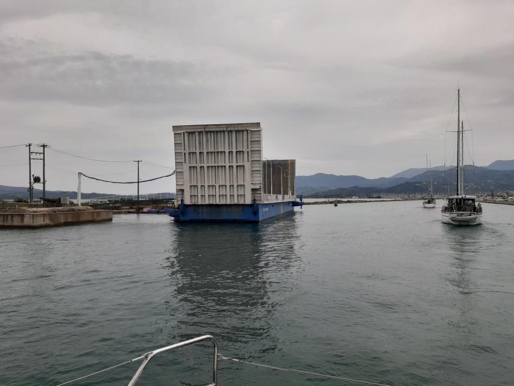
The Levkas Canal
As soon as we got back to Awildian with our exit paperwork, we rushed to leave. With less than an hour to travel the 8 miles to the northern entrance of the Levkas Canal, with its floating bridge that opened on the hour, we were in a hurry. If we missed this opening, we'd have to mill around for an hour, wasting time while we waited for the next one. We pulled Obama up out of the mud, tucked him into his spot under the foredeck, and headed out.
We made it, arriving just as four or five boats who'd been milling around outside the entrance began making their way toward the narrow channel.
You don't want to cut corners here
Levkas Canal, north entry
Old castle at the north entry
The floating bridge is really neat! It's basically a rectangular barge whose short ends consist of hinged ramps that, when they're down, form part of the road that crosses the canal. To open the canal, the floating bridge rotates and moves out of the way, lying parallel to the shore until the last boat passes through. But not a second longer.
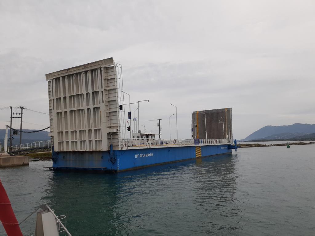
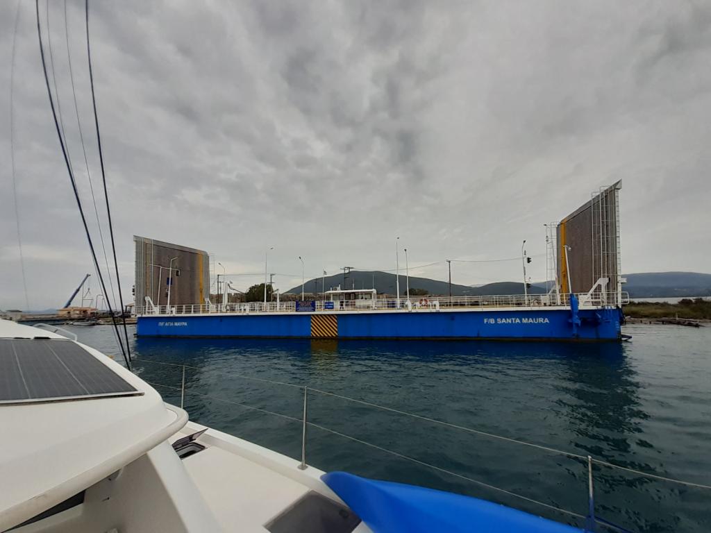
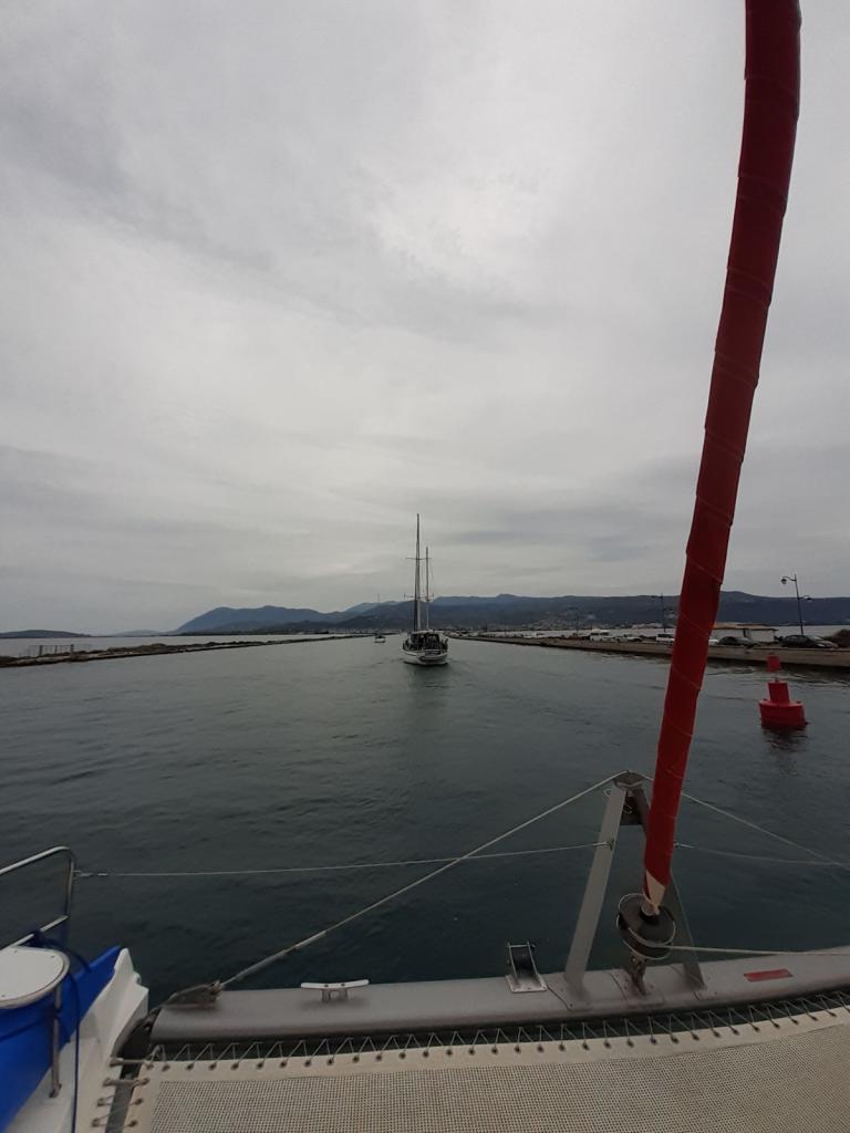
Transiting the Levkas Canal, at a leisurely 5 knots, took most of an hour. Along the way, we enjoyed looking at the scenery.
Levkas Canal
The Canal has been around for a long time, having been dug in the 7th Century BC, separating the island of Lefkada from the mainland. It's still hard for us to get our heads around the age of some of the construction in this part of the world.
Eric was steering, and he was careful to stay inside the markers - just outside was a sunken wall of corrugated steel, whose top was just inches below the surface and could inflict a lot of damage to a boat's hull.
A Rare Sighting
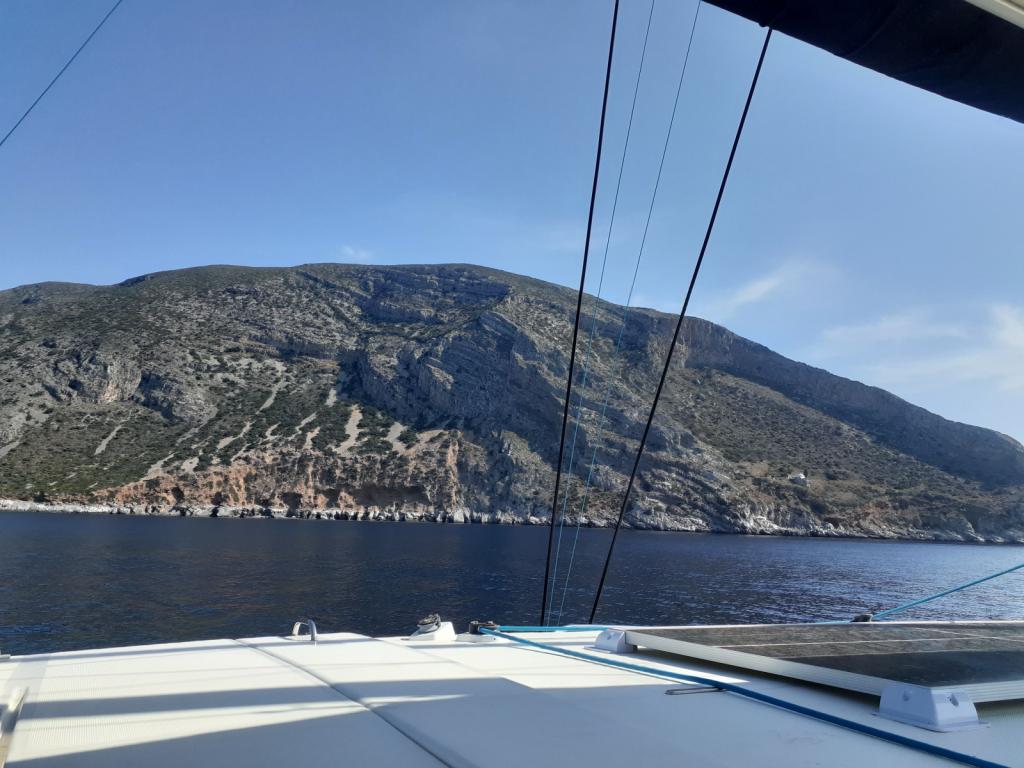
Beyond the Canal, the waterway opened up again, with the Greek mainland (the Peloponnese Peninsula) and its huge mountains to our left, and numerous islands to our right. After the relative exposure of the Albanian coastline, I was glad to be back among islands again, with the shelter they offer.
The wind was calm, and the water was flat and glassy, as Awildian made his way south. Up ahead, breaking the surface of the water, I saw what might have been a log floating in the water. But then it moved! Grabbing my binoculars, I had a look. I saw a long rounded section, and a smaller round section that had a bulbous snout and big, black, soulful eyes. It was a seal! A seal?! I didn't know that seals lived in the Med. Apparently they do, well, one species at least: the Mediterranean monk seal (Monachus monachus), though there aren't many of them. In 2015 their population was estimated to be fewer than 700 individuals. I always feel thrilled when I see a seal; I felt honored to have seen a Mediterranean monk seal.
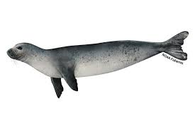
A Mediterranean monk seal, image from NOAA
Anchoring at Kastos Island
The rest of our afternoon was uneventful. Along the way, we'd perused the selection of nearby anchorages listed on Navily and chosen one that looked good, on the western shore of Kalamos Island. When we arrived, we agreed with the reviews that it was beautiful, and we were charmed by the goats cavorting on the hillsides, but we found the anchoring area to be a bit too small for our comfort. So we consulted Navily again and pushed on to another anchorage a few miles farther along, called Nisaki Sarakiniko, on the west side of Kastos Island.
This anchorage suited us better: it was a lot bigger, with more swinging room; was shallow enough to anchor a good distance from shore; had lovely scenery, including a cute little island in the middle;
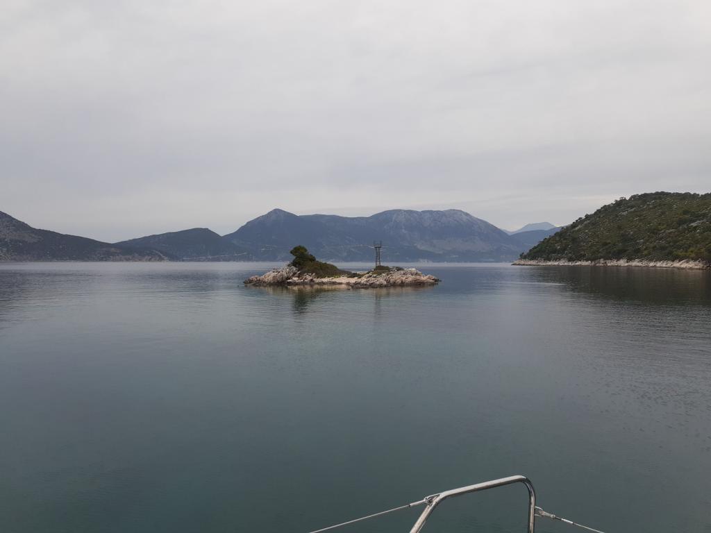
and yes, there were even goats on the beach. There was a small pier, some nice houses, and a shiny Airstream camper on shore.
We dropped Obama in 28 feet of clear water onto sand, and relaxed.
May 10, 2023
Nisaki Sarakiniko to "Keri" anchorage, Kólpos Lagana, Zakinthos Island
61.5nm
Honeybees
I want to talk about the honeybees I encountered yesterday and today. It's not unusual for honeybees to come to visit: over the years in our travels, we've hosted many of the gentle insects when they stop for a rest during their flights across the water. I'll soak one end of a Q-tip (cotton bud) in water and the other in honey, and put it near them so they can have a drink or snack. Usually, they'll have some sips of one or both and then, refreshed, continue on to wherever they'd been heading.
What was notable about these honeybees was that they completely ignored my offerings, stumbling around as if they were blind or disoriented, occasionally buzzing their wings but not lifting off. They kept trying to "clean" their antennae, their eyes, and their protruding tongues, rubbing them continually with their forelegs. I wondered if they had been poisoned by something. They wandered around for hours, even after darkness fell. In the morning, some had died; others continued their dazed meanderings until they, too, perished. It made me sad, to see them in such a state. I thought of reporting this to some authority, but I had no idea where to begin, how to bridge the language gap, or if they would even care.
Traveling to Zakinthos Island
Our night in the Kastos Island anchorage was serene; silent, except for the soft, rhythmic hoots of a tiny scops owl (Otus scops) from somewhere on shore. We had a long way to go today, to the anchorage where we'd chosen to stop for the night, so we left relatively early, at 8:15 am. Along the way we had a smorgasbord of wind and sea conditions: no wind, 18 knots of wind, flat seas, lumpy seas, beam-on seas...No rain, though, which was nice. We sailed, we motored, we motor-sailed.
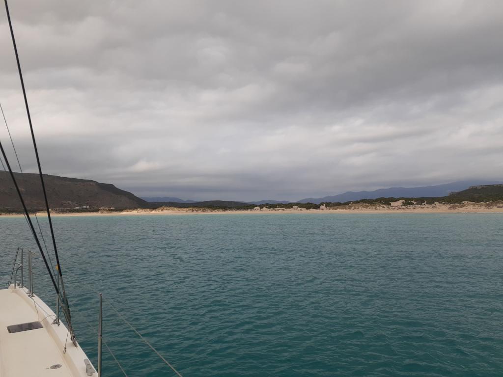
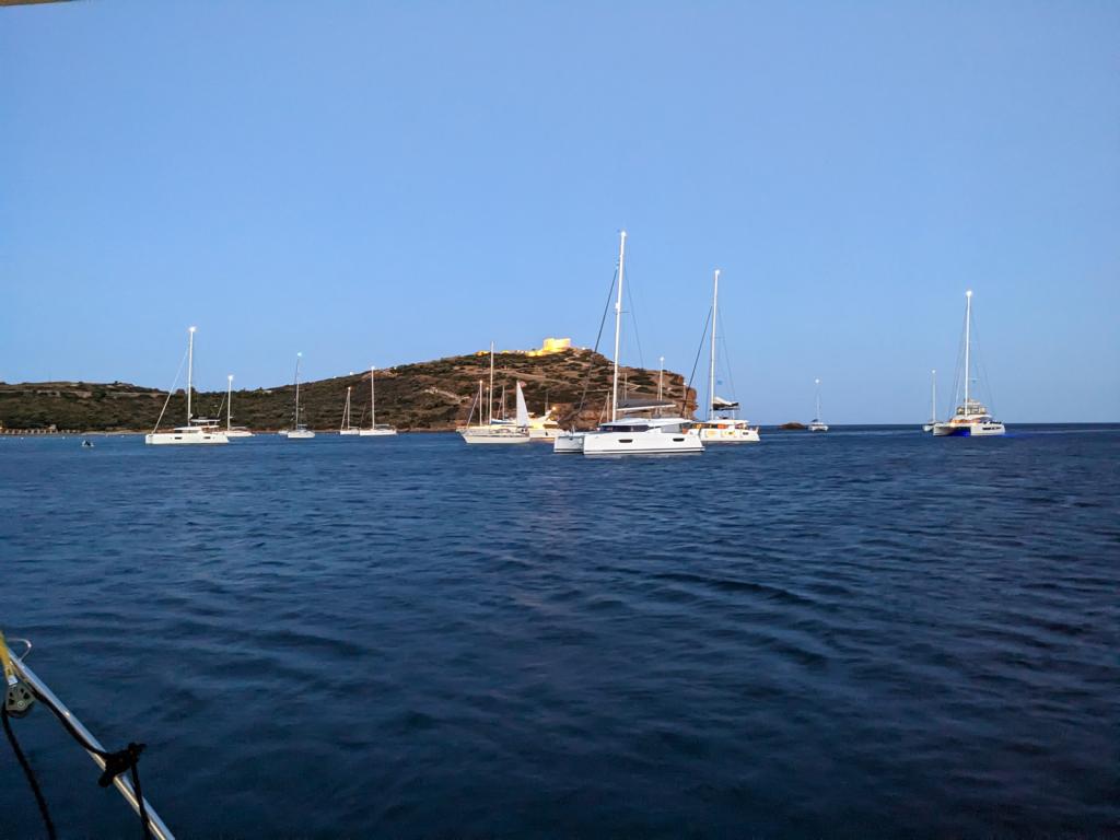
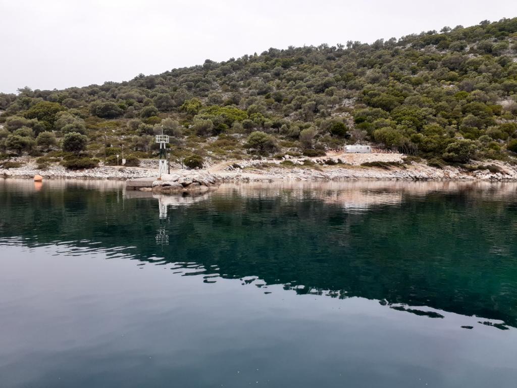
We arrived at Kólpos Lagana in the late afternoon.
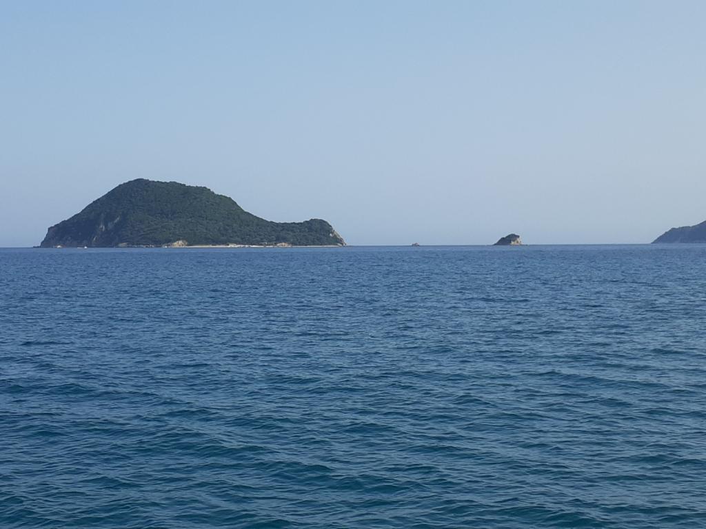
Islands in Kólpos Lagana
Kólpos means "gulf." The gulf, which is a sea turtle sanctuary, is divided into zones with varying levels of restrictions: Zone A, Zone B, and Zone C. The entire place has a 6 knot speed limit, which we adhered to. It was ignored by the tourist boats that went zipping around with their paying customers, who were hoping to view turtles (while hopefully not chopping them up with their props).
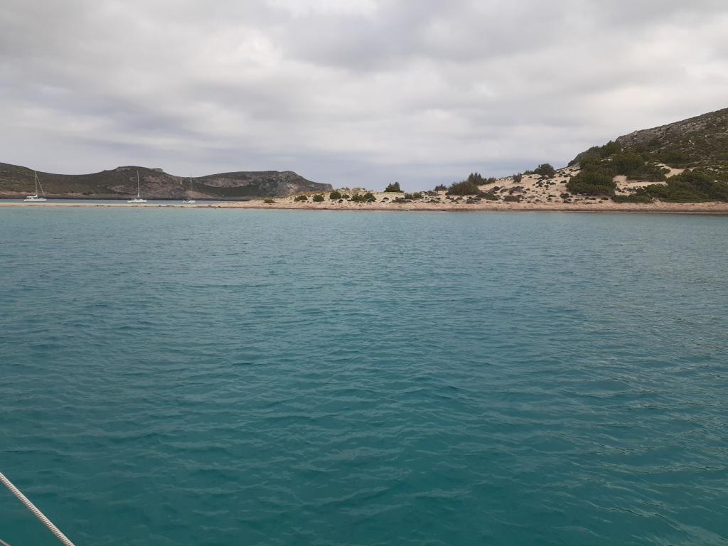
We chose a spot off a beautiful sandy beach to the west of the Cameo Island Beach Bar, with its fanciful fabric sculpture that wafted lazily in the breeze.
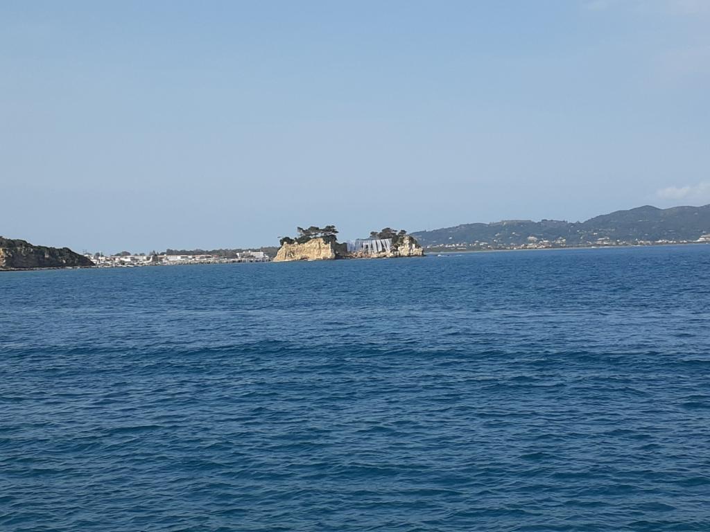
Cameo Island Beach Bar
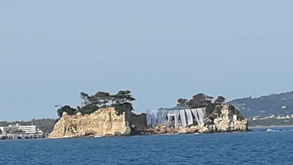
Closeup of the beach bar
It took Obama two tries to sink his point deeply into the sandy bottom, but eventually he did. Other Navily users had mentioned having a hard time getting their anchors to bite here; some who had dived to the bottom found a thin layer of sand over rock in some places, which would explain Obama's difficulty.
We didn't see any turtles while we were anchored at Kólpos Lagana, but to be fair, we were only there overnight, with most of our stay in the dark. It would be nice to come back here again when we have some more time to explore and enjoy the place. This was true of all the places we'd visit on our way to Athens.
Preveza anchorage to Nisaki Sarakiniko, Kastos Island
28.7nm
The Levkas Canal
As soon as we got back to Awildian with our exit paperwork, we rushed to leave. With less than an hour to travel the 8 miles to the northern entrance of the Levkas Canal, with its floating bridge that opened on the hour, we were in a hurry. If we missed this opening, we'd have to mill around for an hour, wasting time while we waited for the next one. We pulled Obama up out of the mud, tucked him into his spot under the foredeck, and headed out.
We made it, arriving just as four or five boats who'd been milling around outside the entrance began making their way toward the narrow channel.
You don't want to cut corners here
Levkas Canal, north entry
Old castle at the north entry
The floating bridge is really neat! It's basically a rectangular barge whose short ends consist of hinged ramps that, when they're down, form part of the road that crosses the canal. To open the canal, the floating bridge rotates and moves out of the way, lying parallel to the shore until the last boat passes through. But not a second longer.
Transiting the Levkas Canal, at a leisurely 5 knots, took most of an hour. Along the way, we enjoyed looking at the scenery.
Levkas Canal
The Canal has been around for a long time, having been dug in the 7th Century BC, separating the island of Lefkada from the mainland. It's still hard for us to get our heads around the age of some of the construction in this part of the world.
Eric was steering, and he was careful to stay inside the markers - just outside was a sunken wall of corrugated steel, whose top was just inches below the surface and could inflict a lot of damage to a boat's hull.
A Rare Sighting
Beyond the Canal, the waterway opened up again, with the Greek mainland (the Peloponnese Peninsula) and its huge mountains to our left, and numerous islands to our right. After the relative exposure of the Albanian coastline, I was glad to be back among islands again, with the shelter they offer.
The wind was calm, and the water was flat and glassy, as Awildian made his way south. Up ahead, breaking the surface of the water, I saw what might have been a log floating in the water. But then it moved! Grabbing my binoculars, I had a look. I saw a long rounded section, and a smaller round section that had a bulbous snout and big, black, soulful eyes. It was a seal! A seal?! I didn't know that seals lived in the Med. Apparently they do, well, one species at least: the Mediterranean monk seal (Monachus monachus), though there aren't many of them. In 2015 their population was estimated to be fewer than 700 individuals. I always feel thrilled when I see a seal; I felt honored to have seen a Mediterranean monk seal.
A Mediterranean monk seal, image from NOAA
Anchoring at Kastos Island
The rest of our afternoon was uneventful. Along the way, we'd perused the selection of nearby anchorages listed on Navily and chosen one that looked good, on the western shore of Kalamos Island. When we arrived, we agreed with the reviews that it was beautiful, and we were charmed by the goats cavorting on the hillsides, but we found the anchoring area to be a bit too small for our comfort. So we consulted Navily again and pushed on to another anchorage a few miles farther along, called Nisaki Sarakiniko, on the west side of Kastos Island.
This anchorage suited us better: it was a lot bigger, with more swinging room; was shallow enough to anchor a good distance from shore; had lovely scenery, including a cute little island in the middle;
and yes, there were even goats on the beach. There was a small pier, some nice houses, and a shiny Airstream camper on shore.
We dropped Obama in 28 feet of clear water onto sand, and relaxed.
May 10, 2023
Nisaki Sarakiniko to "Keri" anchorage, Kólpos Lagana, Zakinthos Island
61.5nm
Honeybees
I want to talk about the honeybees I encountered yesterday and today. It's not unusual for honeybees to come to visit: over the years in our travels, we've hosted many of the gentle insects when they stop for a rest during their flights across the water. I'll soak one end of a Q-tip (cotton bud) in water and the other in honey, and put it near them so they can have a drink or snack. Usually, they'll have some sips of one or both and then, refreshed, continue on to wherever they'd been heading.
What was notable about these honeybees was that they completely ignored my offerings, stumbling around as if they were blind or disoriented, occasionally buzzing their wings but not lifting off. They kept trying to "clean" their antennae, their eyes, and their protruding tongues, rubbing them continually with their forelegs. I wondered if they had been poisoned by something. They wandered around for hours, even after darkness fell. In the morning, some had died; others continued their dazed meanderings until they, too, perished. It made me sad, to see them in such a state. I thought of reporting this to some authority, but I had no idea where to begin, how to bridge the language gap, or if they would even care.
Traveling to Zakinthos Island
Our night in the Kastos Island anchorage was serene; silent, except for the soft, rhythmic hoots of a tiny scops owl (Otus scops) from somewhere on shore. We had a long way to go today, to the anchorage where we'd chosen to stop for the night, so we left relatively early, at 8:15 am. Along the way we had a smorgasbord of wind and sea conditions: no wind, 18 knots of wind, flat seas, lumpy seas, beam-on seas...No rain, though, which was nice. We sailed, we motored, we motor-sailed.
We arrived at Kólpos Lagana in the late afternoon.
Islands in Kólpos Lagana
Kólpos means "gulf." The gulf, which is a sea turtle sanctuary, is divided into zones with varying levels of restrictions: Zone A, Zone B, and Zone C. The entire place has a 6 knot speed limit, which we adhered to. It was ignored by the tourist boats that went zipping around with their paying customers, who were hoping to view turtles (while hopefully not chopping them up with their props).
We chose a spot off a beautiful sandy beach to the west of the Cameo Island Beach Bar, with its fanciful fabric sculpture that wafted lazily in the breeze.
Cameo Island Beach Bar
Closeup of the beach bar
It took Obama two tries to sink his point deeply into the sandy bottom, but eventually he did. Other Navily users had mentioned having a hard time getting their anchors to bite here; some who had dived to the bottom found a thin layer of sand over rock in some places, which would explain Obama's difficulty.
We didn't see any turtles while we were anchored at Kólpos Lagana, but to be fair, we were only there overnight, with most of our stay in the dark. It would be nice to come back here again when we have some more time to explore and enjoy the place. This was true of all the places we'd visit on our way to Athens.
Sarandë, Albania to Preveza, Greece: clearing out, a leisurely trip, a questionable bottom, clearing in, dinner with friends, retsina, sheet sets!
15 December 2023 | Sarandë, Albania to Preveza, Greece
Vandy Shrader
May 7-8, 2023.
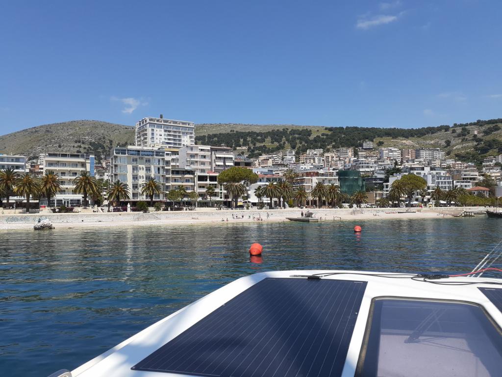
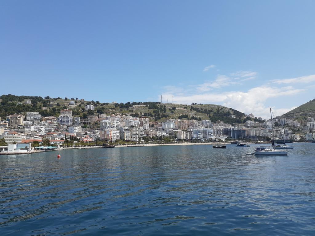
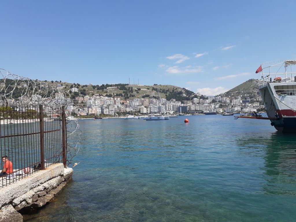
We left Himarë for Sarandë, about 20 miles south, enjoying a pleasant motoring trip along the Albanian coast. From now until we reached our goal of being "someplace within ferry range of Athens" - where we needed to be by the last week of May - we wouldn't be dallying in any anchorage longer than we had to. As we neared Sarandë, I called the port control officer on VHF Ch 11, to request permission for Awildian to enter the port. Just as in Dürres, I was treated to a friendly interaction. He welcomed us to Sarandë, and told me that Awildian was free to enter.
Some views of Sarandë's beachfront
As soon as we'd dropped Awildian's anchor (named Obama, remember?) in the bay, I contacted our agent, Jelja Serani, to let her know that we'd arrived. She arranged to meet us "at the dinghy dock near the Customs building, by the pink ferry terminal." These were easy to spot, along the shoreline, among the boxy apartments.
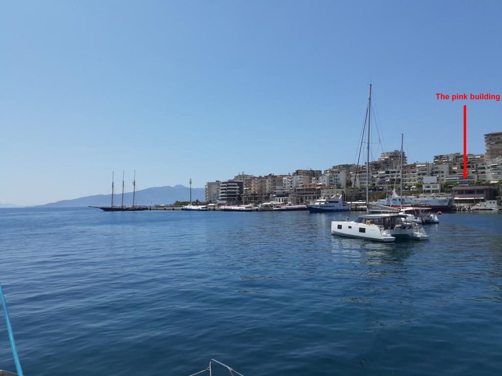
The meeting place
A few minutes and a short dinghy ride later, we met Jelja, who took us through the building and up the street to her office at Saranda Summer Tours. While there, she showed us points of interest on a photocopied map of Sarandë - the locations of grocery stores, a bank, a produce market, an old Jewish synagogue, a couple of nice restaurants. All of those would have been handy to know about, if we'd been staying longer, but we wanted to leave at first light. Sadly, we'd be leaving Albania without barely scratching the surface of this interesting and anachronistic nation. Maybe another time, when we weren't in a hurry to get somewhere, we could come back and do a proper exploration.
Awildian hanging out in the anchorage
We returned to Awildian with Jelja's promise to contact us around 7:30 pm with our signed exit paper. There was still some ambiguity around whether the port captain would check us out of Albania tonight (a Sunday) and allow us to leave in the morning. We had our fingers crossed.
It was warm in Sarandë! I pulled some of my shorts out of storage and swapped them for my blue jeans. The first time I was in shorts this year! I hung a load of laundry on the lifelines and waved at the passengers of a big "Pirates of the Caribbean"-themed boat, who were dancing to the thumping music as it passed close to Awildian. There was nothing else to do but enjoy the rest of the day, while we waited for Jelja to do her magic.
Jelja called us at 7:15pm, to tell us that our exit paper was ready. She confirmed that passports aren't stamped in Albania anymore, at least not for boat passengers; I don't know about air passengers. Eric went to shore with a bar of dark chocolate, to thank Jelja for working for us on a Sunday. He came back with our exit paper and the go-ahead for leaving in the morning. Perfect!
The next morning, we were up at 4:30am, and after waking up with some coffee, and allowing the sky to lighten a bit, were pulling Obama up by 5:10am. I called the port control officer, to let him know that we wanted to leave. Once again, I received a friendly and professional interaction, followed by his wish for us to "have a safe journey." Nice people, those Albanian port control officers.
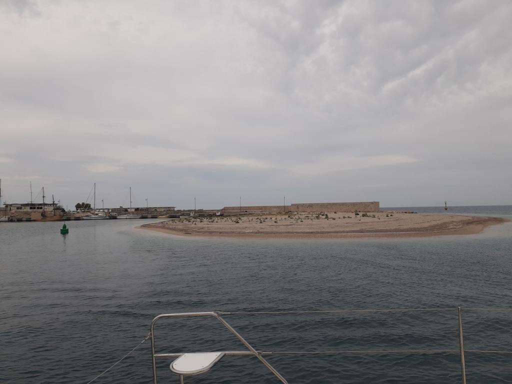
It was about 70 miles to Preveza, Greece, our intended destination.
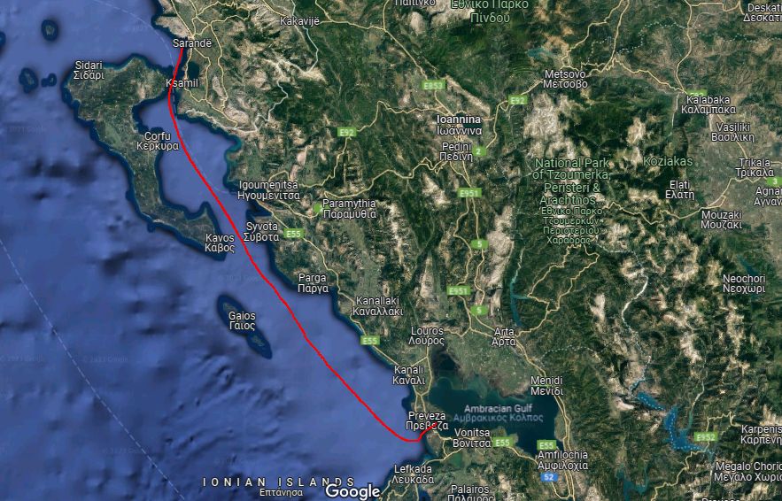
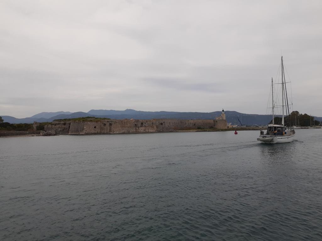
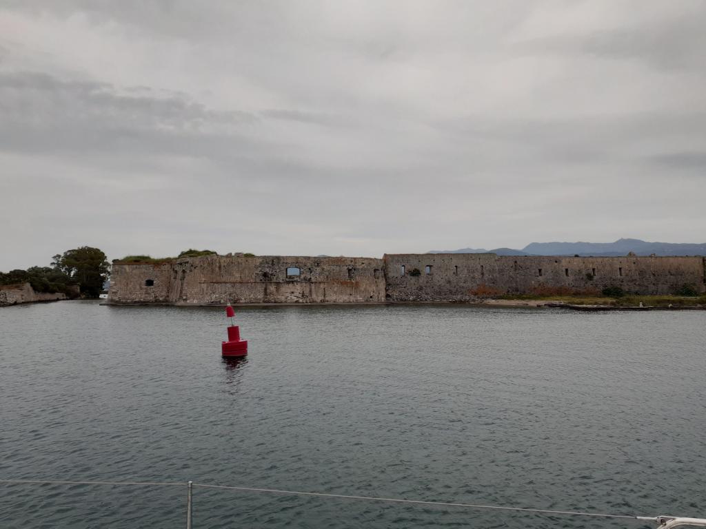
We motored all day, sometimes with the jib up when there was enough wind to make it worth our while, arriving at the buoyed channel outside Preveza at 3pm. We navigated the channel, passed Preveza Marina, and entered the anchorage just beyond.
We initially had a bit of trouble getting anchored. The water was a dark green, and so murky that we couldn't see the bottom, even in less than ten feet of water.
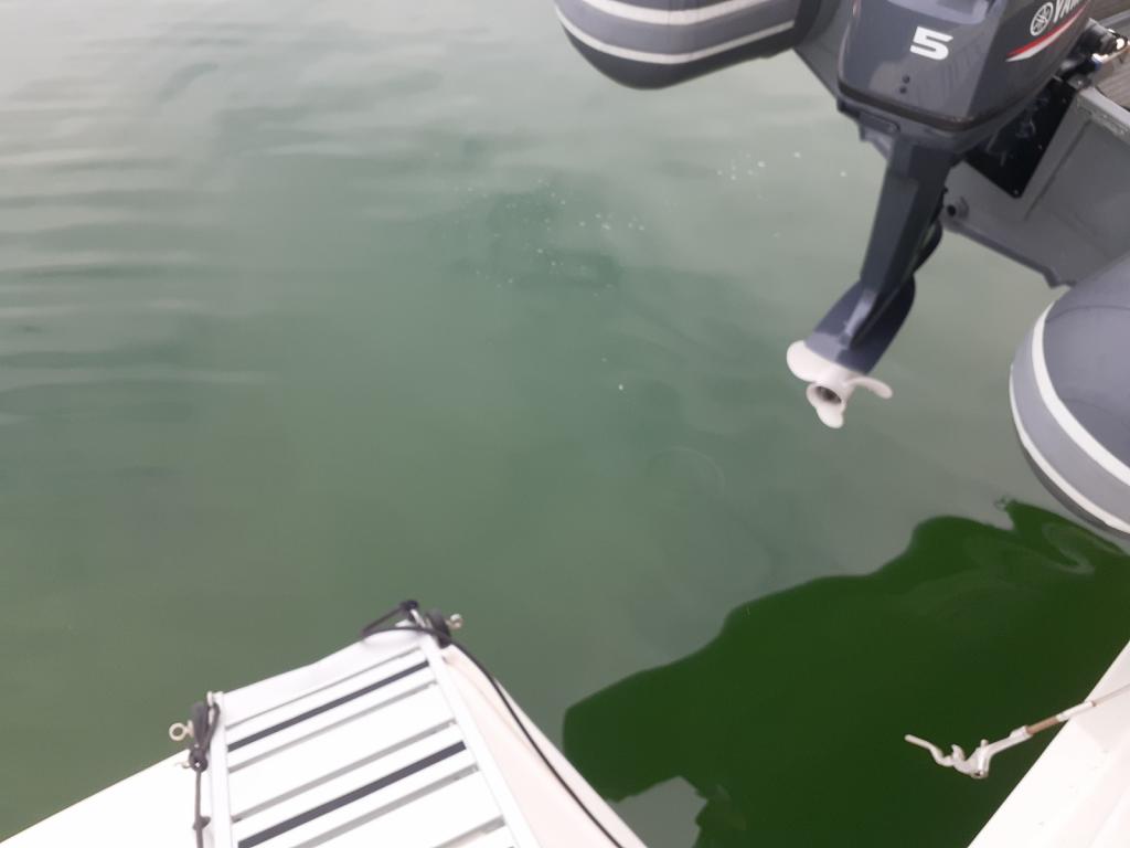
No chance of seeing what's down there
It was all supposed to be mud, so it should have been straightforward for Obama to dig in. The first place we dropped the anchor, in about 9 feet of water, Obama couldn't grab onto anything, and went skipping along the bottom as we backed up. This was telegraphed through the chain as what I call "chattering," as it dragged across something rough. If Obama couldn't get a good grip, then this clearly wasn't a suitable spot to anchor. So we pulled Obama up and drove around the anchorage some more, looking for a better place, never fun when you've been up since sparrow's fart and traveling all day. Eventually we found a likely spot a bit farther from the marina, in about ten feet of water. We still couldn't see the bottom, but Obama dug in immediately, and held when we backed up. That was more like it!
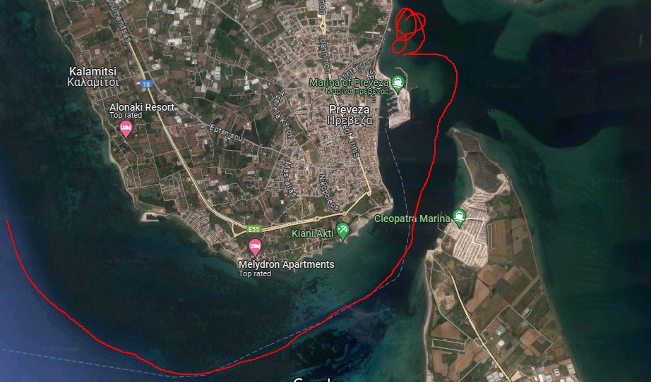
Anchoring
Eric took the dinghy into the small fishermen's harbor, where he tied it to the quay and took our boat documents to our agent's office, to start the clearing-in process for Greece. Though agents aren't required for clearing into Greece, as they are in Albania, we'd decided to use Sofia Gravani at All About Yacht, who would speed up the process, a multi-faceted task requiring trips to several different government offices. Eric returned a little while later, with only a part of the clearing-in finished; Sofia told him that the rest would have to be done the next day.
We contacted our friends, Seb and Suzanne (remember them from our time in Albania), who were now in Preveza Marina on board Racoon 2. They were in the process of getting long-term Greek visas; Preveza Marina would be their base. We met up and enjoyed a nice dinner with them, in one of the restaurants on the waterfront (only 10 euro for an entire grilled sea bream!). It was here that we first tried retsina, a Greek variety of white wine that's fermented with pieces of Aleppo pine mixed in, giving it a taste and aroma reminiscent of Pine-Sol. It was good to try retsina, because it wasn't our favorite, and we could avoid it the rest of the time we were in Greece. (Though one time I picked up some by accident, not having read the word "retsina" that was clearly written on the label in Greek: ρετσίνα. Silly me.)
The next morning, we met Seb and Suzanne at Sofia's office, where we all piled into her tiny car for the short ride to the government building. While Sofia had long conversations in Greek with the various officials, we hung out in the hallway. About a half hour, Sofia emerged, and gave us all a ride back to her office. We walked over to the post office with one of her coworkers, to pay for our tepai (Greek tourist tax) for the three months we intended to be there, and then went back to All About Yacht. (You can pay for your tepai online, but we hadn't this time.)
Sofia told us to come back at 4pm to pick up our transit log, which we're required to carry with us while cruising in Greece (more on transit logs later). When we told her that we'd hoped to leave Preveza earlier than that, she suggested that we call her in an hour and a half.
In the meantime, Eric and I wandered around Preveza.
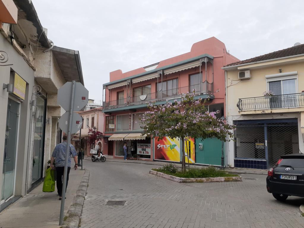
We got a Cosmote SIM card for my phone (Cosmote and Vodafone being our options), bought some really good-looking tomatoes and other veggies from a sidewalk produce market, and stopped into a linen store that had...SHEET SETS.
The linen shop!
You might be wondering why I'd be so excited about sheet sets. Here's why: before we left Montenegro, we'd shopped for sheet sets. We wanted some nice, new sheets for our guest bed, for all the guests who would be joining us in the summer. In the US, sheet sets always have a fitted sheet, a flat sheet, and two pillow cases. So that's what we were looking for. You can't buy them like that in Montenegro. All we could find, after visiting many stores, were a few sets, and these included only a fitted sheet and two pillow cases. No top sheet. Which is apparently how they're sold, in Montenegro. We'd bought two of these sets and were planning to use our current, white top sheets along with them.
So when we encountered a linen shop in Preveza that had shelves and shelves of sheet sets, in lots of different colors and patterns, we were stoked! I asked the proprietor if the sets had TWO sheets in them. He said yes, but they had two flat sheets, and no fitted sheet. OK, I thought, I can definitely work with that. In fact, on a boat like ours, where the mattresses are funky shapes and you can't walk all the way around the bed, having a fitted sheet isn't all that great, anyway. So we each chose a pattern that we liked and bought them. Score!
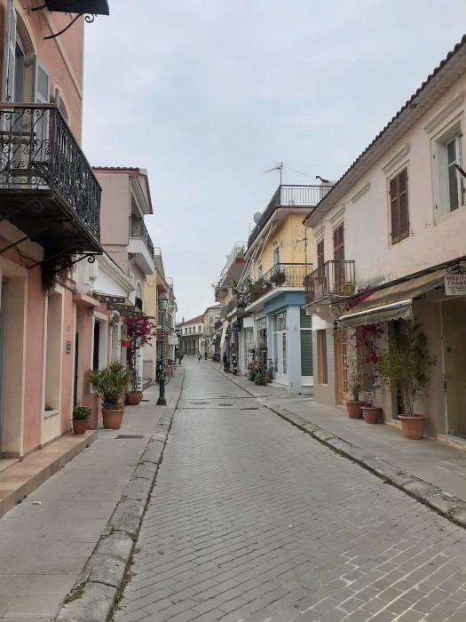
Next, we went in search of lunch. Like Croatia and Montenegro, and probably other places we haven't been to yet, many of the cafes served drinks only. We could get coffee, or ouzo, but no food. After a bit of a wander along Preveza's pretty cobblestoned streets,
we ended up at the waterfront, where we found a restaurant that served food. While we were there, our friend, Trevor, whom we knew from Porto Montenegro, walked by, and stopped for a chat. It always amuses us, that we can be anywhere and run into people we know from other places.
After lunch, we walked back to Sofia's office, where she handed us our transit log. The final piece of our clearing-in paperwork now procured, we paid her fee, thanked her and headed quickly back to Awildian, hoping to make it to the northern terminus of the Levkas Canal in time for its next opening, on the hour.
We left Himarë for Sarandë, about 20 miles south, enjoying a pleasant motoring trip along the Albanian coast. From now until we reached our goal of being "someplace within ferry range of Athens" - where we needed to be by the last week of May - we wouldn't be dallying in any anchorage longer than we had to. As we neared Sarandë, I called the port control officer on VHF Ch 11, to request permission for Awildian to enter the port. Just as in Dürres, I was treated to a friendly interaction. He welcomed us to Sarandë, and told me that Awildian was free to enter.
Some views of Sarandë's beachfront
As soon as we'd dropped Awildian's anchor (named Obama, remember?) in the bay, I contacted our agent, Jelja Serani, to let her know that we'd arrived. She arranged to meet us "at the dinghy dock near the Customs building, by the pink ferry terminal." These were easy to spot, along the shoreline, among the boxy apartments.
The meeting place
A few minutes and a short dinghy ride later, we met Jelja, who took us through the building and up the street to her office at Saranda Summer Tours. While there, she showed us points of interest on a photocopied map of Sarandë - the locations of grocery stores, a bank, a produce market, an old Jewish synagogue, a couple of nice restaurants. All of those would have been handy to know about, if we'd been staying longer, but we wanted to leave at first light. Sadly, we'd be leaving Albania without barely scratching the surface of this interesting and anachronistic nation. Maybe another time, when we weren't in a hurry to get somewhere, we could come back and do a proper exploration.
Awildian hanging out in the anchorage
We returned to Awildian with Jelja's promise to contact us around 7:30 pm with our signed exit paper. There was still some ambiguity around whether the port captain would check us out of Albania tonight (a Sunday) and allow us to leave in the morning. We had our fingers crossed.
It was warm in Sarandë! I pulled some of my shorts out of storage and swapped them for my blue jeans. The first time I was in shorts this year! I hung a load of laundry on the lifelines and waved at the passengers of a big "Pirates of the Caribbean"-themed boat, who were dancing to the thumping music as it passed close to Awildian. There was nothing else to do but enjoy the rest of the day, while we waited for Jelja to do her magic.
Jelja called us at 7:15pm, to tell us that our exit paper was ready. She confirmed that passports aren't stamped in Albania anymore, at least not for boat passengers; I don't know about air passengers. Eric went to shore with a bar of dark chocolate, to thank Jelja for working for us on a Sunday. He came back with our exit paper and the go-ahead for leaving in the morning. Perfect!
The next morning, we were up at 4:30am, and after waking up with some coffee, and allowing the sky to lighten a bit, were pulling Obama up by 5:10am. I called the port control officer, to let him know that we wanted to leave. Once again, I received a friendly and professional interaction, followed by his wish for us to "have a safe journey." Nice people, those Albanian port control officers.
It was about 70 miles to Preveza, Greece, our intended destination.
We motored all day, sometimes with the jib up when there was enough wind to make it worth our while, arriving at the buoyed channel outside Preveza at 3pm. We navigated the channel, passed Preveza Marina, and entered the anchorage just beyond.
We initially had a bit of trouble getting anchored. The water was a dark green, and so murky that we couldn't see the bottom, even in less than ten feet of water.
No chance of seeing what's down there
It was all supposed to be mud, so it should have been straightforward for Obama to dig in. The first place we dropped the anchor, in about 9 feet of water, Obama couldn't grab onto anything, and went skipping along the bottom as we backed up. This was telegraphed through the chain as what I call "chattering," as it dragged across something rough. If Obama couldn't get a good grip, then this clearly wasn't a suitable spot to anchor. So we pulled Obama up and drove around the anchorage some more, looking for a better place, never fun when you've been up since sparrow's fart and traveling all day. Eventually we found a likely spot a bit farther from the marina, in about ten feet of water. We still couldn't see the bottom, but Obama dug in immediately, and held when we backed up. That was more like it!
Anchoring
Eric took the dinghy into the small fishermen's harbor, where he tied it to the quay and took our boat documents to our agent's office, to start the clearing-in process for Greece. Though agents aren't required for clearing into Greece, as they are in Albania, we'd decided to use Sofia Gravani at All About Yacht, who would speed up the process, a multi-faceted task requiring trips to several different government offices. Eric returned a little while later, with only a part of the clearing-in finished; Sofia told him that the rest would have to be done the next day.
We contacted our friends, Seb and Suzanne (remember them from our time in Albania), who were now in Preveza Marina on board Racoon 2. They were in the process of getting long-term Greek visas; Preveza Marina would be their base. We met up and enjoyed a nice dinner with them, in one of the restaurants on the waterfront (only 10 euro for an entire grilled sea bream!). It was here that we first tried retsina, a Greek variety of white wine that's fermented with pieces of Aleppo pine mixed in, giving it a taste and aroma reminiscent of Pine-Sol. It was good to try retsina, because it wasn't our favorite, and we could avoid it the rest of the time we were in Greece. (Though one time I picked up some by accident, not having read the word "retsina" that was clearly written on the label in Greek: ρετσίνα. Silly me.)
The next morning, we met Seb and Suzanne at Sofia's office, where we all piled into her tiny car for the short ride to the government building. While Sofia had long conversations in Greek with the various officials, we hung out in the hallway. About a half hour, Sofia emerged, and gave us all a ride back to her office. We walked over to the post office with one of her coworkers, to pay for our tepai (Greek tourist tax) for the three months we intended to be there, and then went back to All About Yacht. (You can pay for your tepai online, but we hadn't this time.)
Sofia told us to come back at 4pm to pick up our transit log, which we're required to carry with us while cruising in Greece (more on transit logs later). When we told her that we'd hoped to leave Preveza earlier than that, she suggested that we call her in an hour and a half.
In the meantime, Eric and I wandered around Preveza.
We got a Cosmote SIM card for my phone (Cosmote and Vodafone being our options), bought some really good-looking tomatoes and other veggies from a sidewalk produce market, and stopped into a linen store that had...SHEET SETS.
The linen shop!
You might be wondering why I'd be so excited about sheet sets. Here's why: before we left Montenegro, we'd shopped for sheet sets. We wanted some nice, new sheets for our guest bed, for all the guests who would be joining us in the summer. In the US, sheet sets always have a fitted sheet, a flat sheet, and two pillow cases. So that's what we were looking for. You can't buy them like that in Montenegro. All we could find, after visiting many stores, were a few sets, and these included only a fitted sheet and two pillow cases. No top sheet. Which is apparently how they're sold, in Montenegro. We'd bought two of these sets and were planning to use our current, white top sheets along with them.
So when we encountered a linen shop in Preveza that had shelves and shelves of sheet sets, in lots of different colors and patterns, we were stoked! I asked the proprietor if the sets had TWO sheets in them. He said yes, but they had two flat sheets, and no fitted sheet. OK, I thought, I can definitely work with that. In fact, on a boat like ours, where the mattresses are funky shapes and you can't walk all the way around the bed, having a fitted sheet isn't all that great, anyway. So we each chose a pattern that we liked and bought them. Score!
Next, we went in search of lunch. Like Croatia and Montenegro, and probably other places we haven't been to yet, many of the cafes served drinks only. We could get coffee, or ouzo, but no food. After a bit of a wander along Preveza's pretty cobblestoned streets,
we ended up at the waterfront, where we found a restaurant that served food. While we were there, our friend, Trevor, whom we knew from Porto Montenegro, walked by, and stopped for a chat. It always amuses us, that we can be anywhere and run into people we know from other places.
After lunch, we walked back to Sofia's office, where she handed us our transit log. The final piece of our clearing-in paperwork now procured, we paid her fee, thanked her and headed quickly back to Awildian, hoping to make it to the northern terminus of the Levkas Canal in time for its next opening, on the hour.
Himarë, Albania: an old town, a visit from a policeman, and chillin' on the Albanian Riviera
27 November 2023 | Himarë, Albania
Vandy Shrader
May 5-7, 2023
The downwind ride to Himarë was loud, educational, and expensive. The wind, which was from behind us, built throughout the day, to a peak of about 25 knots in the afternoon. The waves were about 1 meter, not that big, but they were choppy and on our stern quarter. They introduced themselves to Awildian's hulls with bangs and bumps every few seconds. This, along with the whining of the wind in Awildian's rigging, was the "loud." But hey, we were sailing, which was something of a novelty for us, here in the Med.
The "educational" was our opportunity to try several maneuvers with Awildian - reefing while underway, sailing downwind in strong wind, and turning him upwind through the strong wind - that we hadn't done with him before.
The "expensive" was making the decision to buy an additional headsail for Awildian, probably a Code 0, that would allow us to fly two headsails wing on wing (with no mainsail) when going downwind, like we did on SCOOTS. For more than a year, we'd been considering whether we wanted to deal with the expense of buying the sail, bowsprit, and compression post, but this downwind trip solidified it for us.
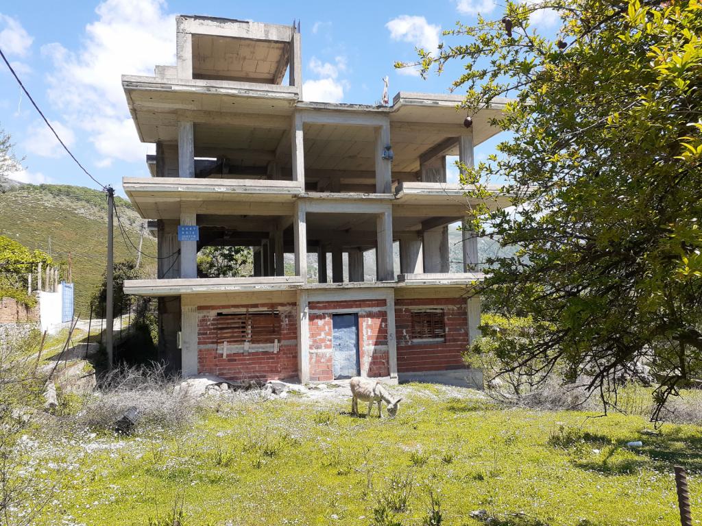
As we skimmed along the coast, we passed long white beaches, with lots of new hotel and apartment construction going on behind them, all in the boxy "Soviet bloc" style. This part of the coastline, known as the Albanian Riviera, is apparently a popular tourist destination. Himarë, where we were headed, is the most popular spot along the Riviera.
Here's more info about the Albanian Riviera. Albanian Riviera
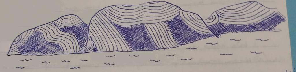
The mountains behind the beaches were stunning, ranging from tall, pointy peaks that promised katabatic winds, to some shorter, green-and-white, rounded mountains that sported parallel lines of what looked to be layers of sedimentation that had been morphed and molded during the formation of the mountains. They were a really interesting geological feature that I hadn't seen before. I didn't take any photos, but I made this sketch which looks exactly like them. Haha
The town of Himarë (known in ancient times as Chimaera) occupies a pretty cove, lined with white sand beaches. In the hills overlooking the modern town is the Old Town, featuring Himarë Castle. The water was very clear, and I could see areas of sand scattered among the grass, even in the late afternoon, when we arrived. We dropped Obama in a big sand patch just off the town, enjoyed an arrival beer, and relaxed.
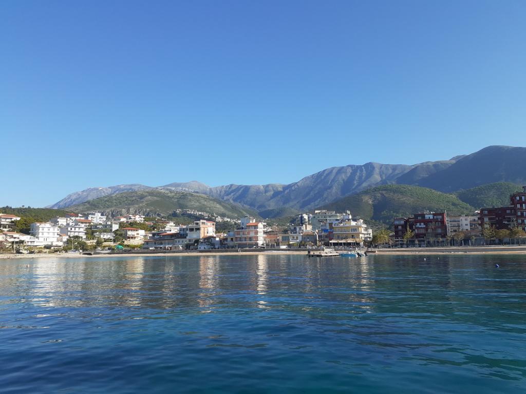
Himarë looking northwest
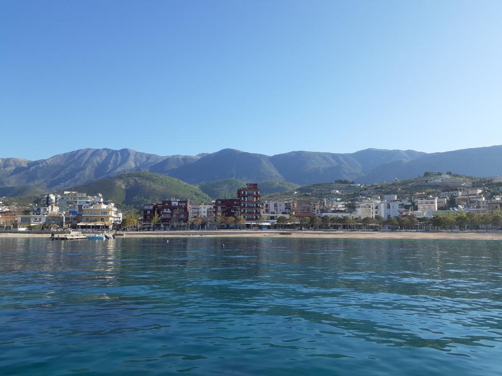
Himarë looking southwest
Shortly after we arrived, a small motorboat ferried Himarë's port captain over to us. He asked to see our paperwork, and then, convinced that we were legit, went on his way.
The next day, we took our dinghy to the very nice concrete dock and walked into town, intent on finding a taxi to take us up the hill to explore the old castle. No Foreign Land, one of the cruising apps we use, indicated a taxi stand in the middle of town, which we found easily. But there were no taxis anywhere in evidence. We waited around for awhile, and then walked to a nearby hotel - the ritzy-looking Hotel Chimaera - to see if the desk clerk would call us a taxi. She was happy to do so, but even she had to call four different drivers before one agreed to pick us up.
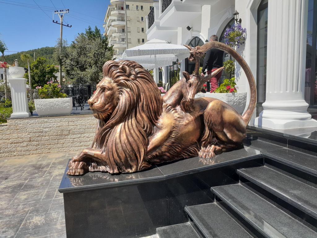
Hotel Chimaera's fancy sculpture
We rode up the steep, winding road to the castle (very glad that we'd decided to hire a taxi rather than walk!), and walked over to the entry kiosk. The attendant asked us if we were "pensioni" = retired = old people. I'm not sure why he thought that we were old. Anyway, since we are retired, we said yes, whereupon he proceeded to sell us geezer tickets for 90 lekë instead of the usual 100 lekë (about 1 euro). Such a bargain!
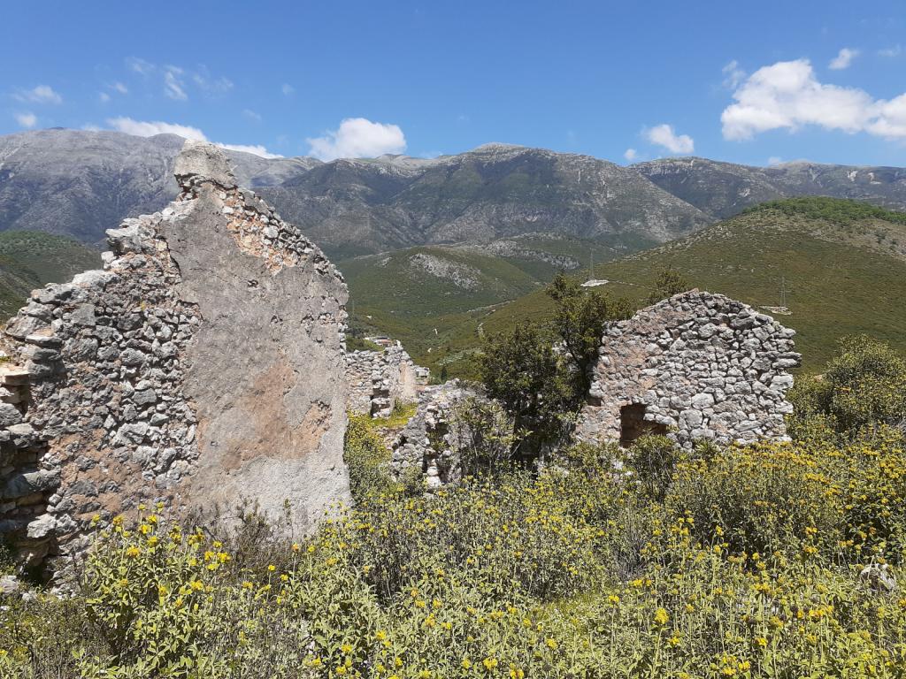
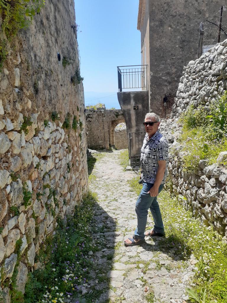
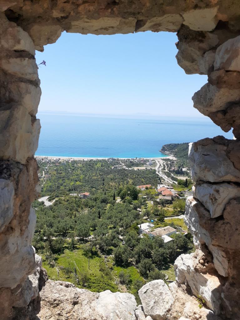
The castle, whose walls and buildings comprise the Old Town, stands on the cliff known as Barbaka, rising 240 meters above the sparkling sea.
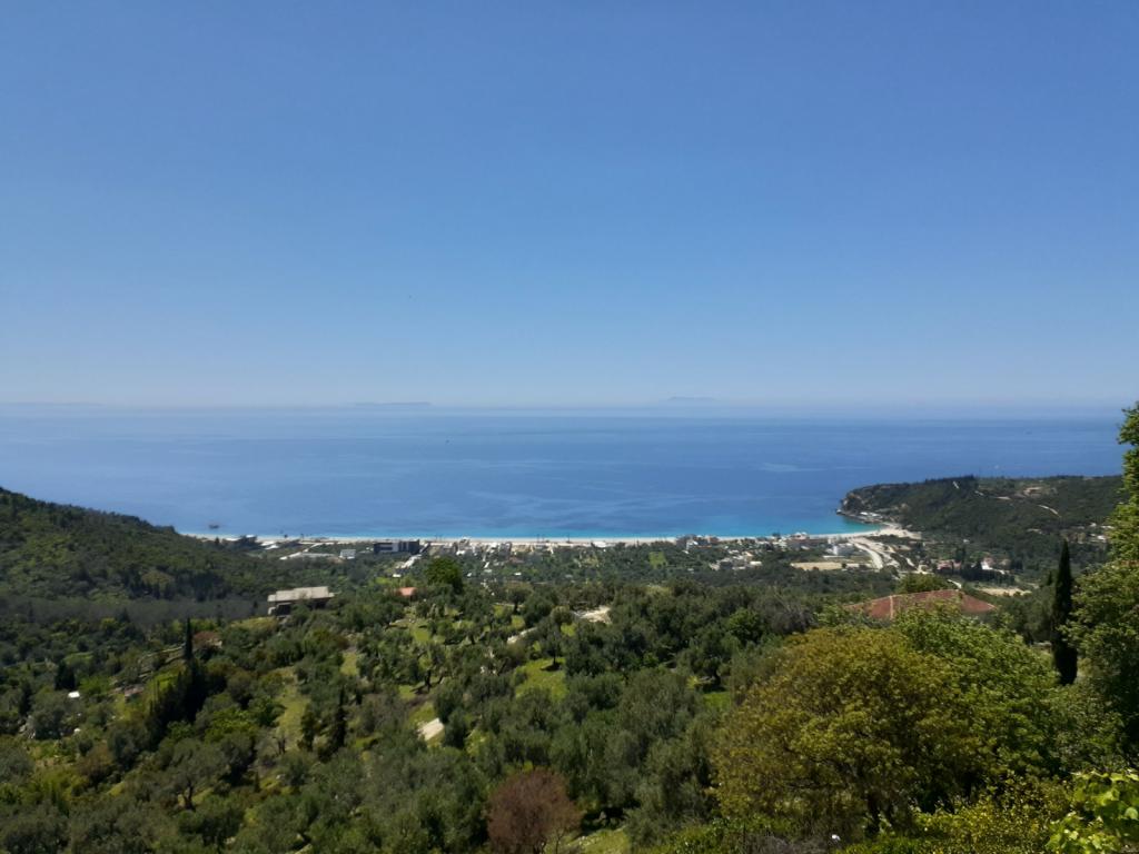
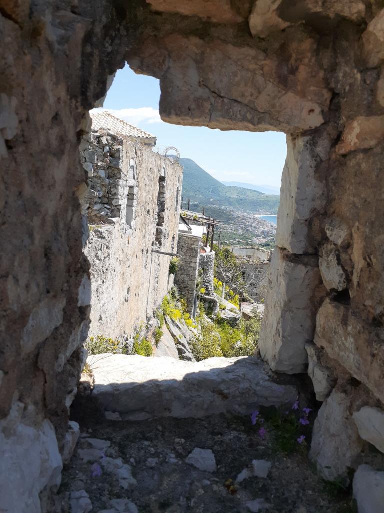
Though much of the Old Town's structures, whose construction began in the 8th Century BC, are ruined,
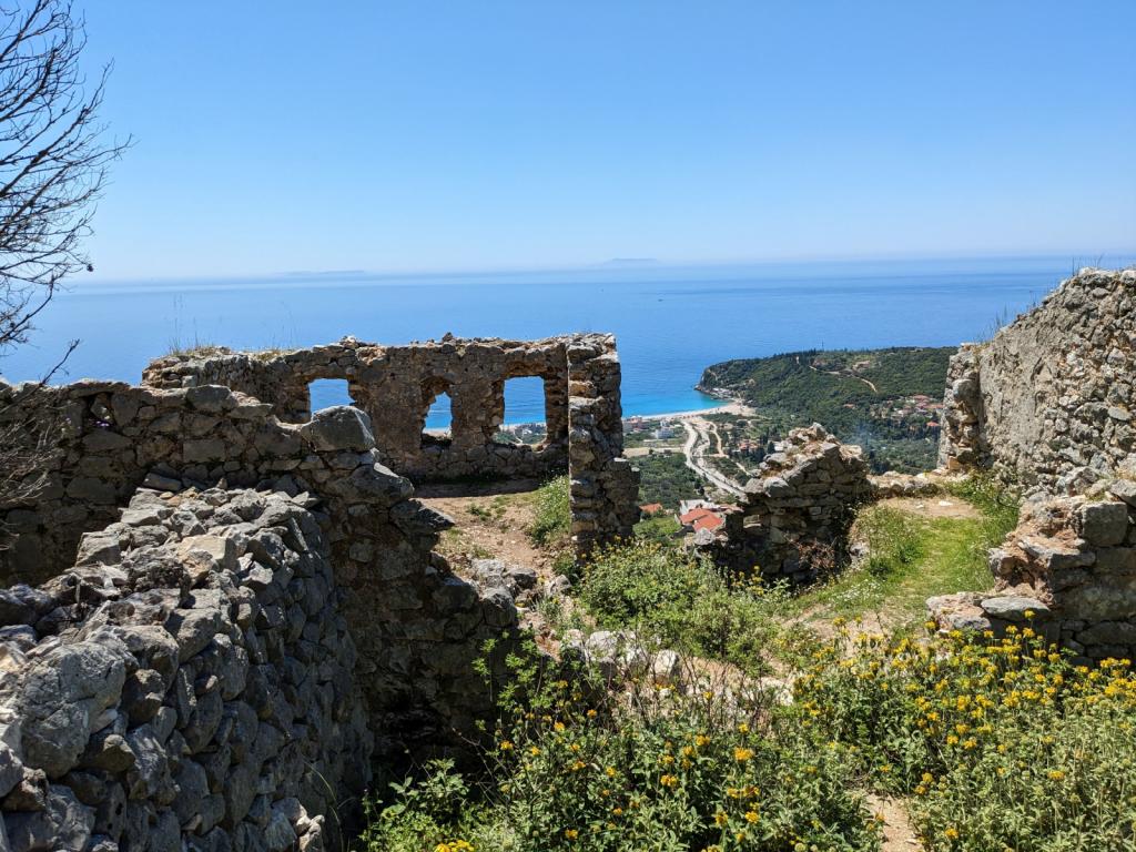
some buildings have been renovated, and people are still living in them.
https://www.sailblogs.com/sbgallery/pics/svscoots_gmail_com/sbde6bh6b/w/PXL_20230506_102728843.jpg
https://www.sailblogs.com/sbgallery/pics/svscoots_gmail_com/sbde6bh6b/w/20230506_123404.jpg
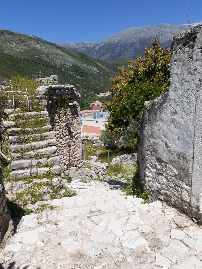
You could probably identify the people who live in the Old Town if you saw them, because they must have huge leg muscles, from walking up the hill to their home, from the closest carpark. Carrying groceries must be quite an athletic feat.
Sharing the picturesque Old Town with the humans were some big, shaggy goats, who stared at us suspiciously whenever we encountered each other.
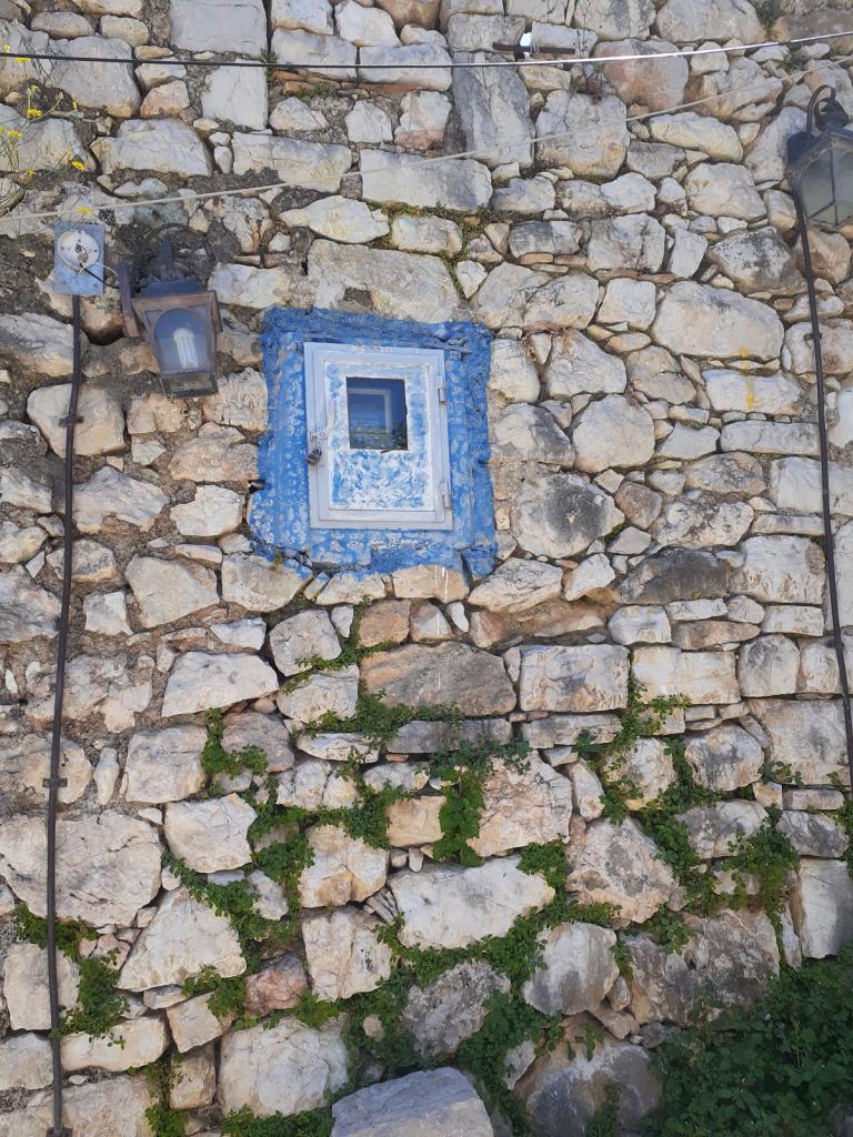
We enjoyed wandering along the stone paths of the town,
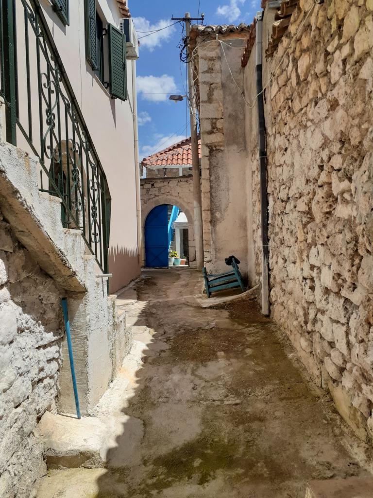
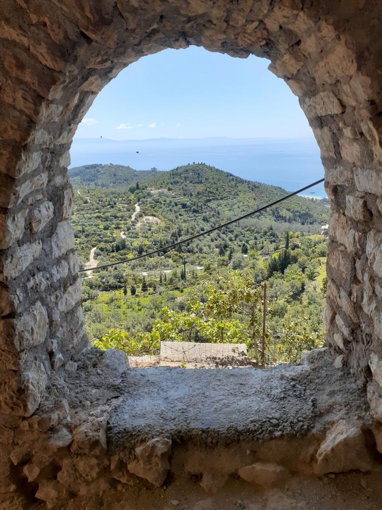
peering through windows at the sea or wildflower-covered hillsides,
and exploring an old Byzantine church.
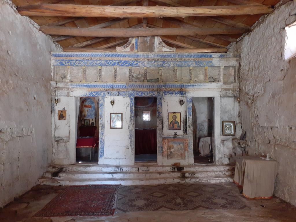
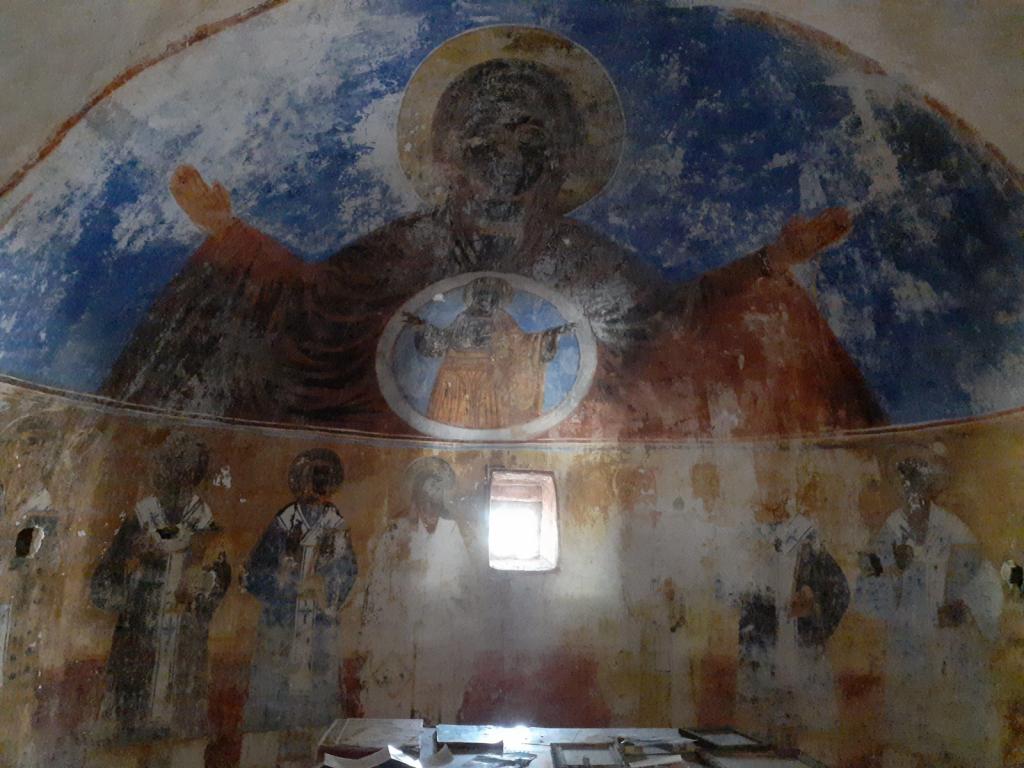
Not much of a view anymore
It was a really cool, really old place, and a warm, sunny day as well.
An Albanian castle cat
Afterwards, we walked the 2.5km back downhill, past this petrol station with an interesting name,
and some buildings either slowly being built or slowly decaying,
to modern Himarë's beachfront,
where we enjoyed lunch while gazing at the beautiful turquoise cove, where Awildian was floating placidly on the calm sea.
While we were eating, we noticed that a lot of people were walking past the restaurant, gathering at a place just down the beach from us. Every so often, someone would say, "Check, check" (in English, oddly enough) over a sound system. Hundreds of folding chairs had been set up, each one with a small Albanian flag in it.
Then we noticed a police boat out in the cove, hanging out near Awildian. Humph, we thought, don't the police talk to the port captain? When we finished our lunch, we dinghied back to Awildian. The police boat came right over to us. We figured the policeman was going to want to see our paperwork, too, but he didn't. Instead of the usual queries, he asked,
"Were you on land?"
"Yes," we replied honestly. Surely, he'd noticed us leaving the dinghy dock.
"Are you staying on the boat now?" he asked.
"Yes."
"Good," he said. "Please stay on your boat for the rest of the day. We have something on land."
"All right," we said. "No problem."
Only then did he motor away from Awildian, but he continued to hang out in the cove, not far offshore from the place where people were gathering. We wondered what this "something" was.
A little while later, all the chairs were full, and many more people were standing nearby. Some music started to play, and over the PA a man made an announcement that sounded like an introduction. People cheered and clapped and waved their miniature Albanian flags exuberantly. Clearly, the "something" was about to happen. Soon, a man came to the podium and, when the audience had finished clapping and cheering, he began to speak. Though he was speaking in Albanian, his presentation sounded a lot like a political speech. Curious, I Googled "Albanian elections 2023," and learned that Albanian's national election was the following weekend. Yep, a campaign speech. We never did figure out who the man was, but his audience loved him.
It was no wonder then, that the police were cruising in the cove. We're not sure whether they wanted to make sure that we stayed on Awildian because they were concerned for the candidate's safety, or for ours. When the speech was over, and the people began to disperse, the police boat left the cove.
With everything quiet again, we enjoyed drinks while sitting on Awildian's front porch, watching the sunset. The next morning we would leave for Sarandë, about 20 miles to the south, where we would meet up with the immigration agent we'd contacted, and clear out of Albania.
The downwind ride to Himarë was loud, educational, and expensive. The wind, which was from behind us, built throughout the day, to a peak of about 25 knots in the afternoon. The waves were about 1 meter, not that big, but they were choppy and on our stern quarter. They introduced themselves to Awildian's hulls with bangs and bumps every few seconds. This, along with the whining of the wind in Awildian's rigging, was the "loud." But hey, we were sailing, which was something of a novelty for us, here in the Med.
The "educational" was our opportunity to try several maneuvers with Awildian - reefing while underway, sailing downwind in strong wind, and turning him upwind through the strong wind - that we hadn't done with him before.
The "expensive" was making the decision to buy an additional headsail for Awildian, probably a Code 0, that would allow us to fly two headsails wing on wing (with no mainsail) when going downwind, like we did on SCOOTS. For more than a year, we'd been considering whether we wanted to deal with the expense of buying the sail, bowsprit, and compression post, but this downwind trip solidified it for us.
As we skimmed along the coast, we passed long white beaches, with lots of new hotel and apartment construction going on behind them, all in the boxy "Soviet bloc" style. This part of the coastline, known as the Albanian Riviera, is apparently a popular tourist destination. Himarë, where we were headed, is the most popular spot along the Riviera.
Here's more info about the Albanian Riviera. Albanian Riviera
The mountains behind the beaches were stunning, ranging from tall, pointy peaks that promised katabatic winds, to some shorter, green-and-white, rounded mountains that sported parallel lines of what looked to be layers of sedimentation that had been morphed and molded during the formation of the mountains. They were a really interesting geological feature that I hadn't seen before. I didn't take any photos, but I made this sketch which looks exactly like them. Haha
The town of Himarë (known in ancient times as Chimaera) occupies a pretty cove, lined with white sand beaches. In the hills overlooking the modern town is the Old Town, featuring Himarë Castle. The water was very clear, and I could see areas of sand scattered among the grass, even in the late afternoon, when we arrived. We dropped Obama in a big sand patch just off the town, enjoyed an arrival beer, and relaxed.
Himarë looking northwest
Himarë looking southwest
Shortly after we arrived, a small motorboat ferried Himarë's port captain over to us. He asked to see our paperwork, and then, convinced that we were legit, went on his way.
The next day, we took our dinghy to the very nice concrete dock and walked into town, intent on finding a taxi to take us up the hill to explore the old castle. No Foreign Land, one of the cruising apps we use, indicated a taxi stand in the middle of town, which we found easily. But there were no taxis anywhere in evidence. We waited around for awhile, and then walked to a nearby hotel - the ritzy-looking Hotel Chimaera - to see if the desk clerk would call us a taxi. She was happy to do so, but even she had to call four different drivers before one agreed to pick us up.
Hotel Chimaera's fancy sculpture
We rode up the steep, winding road to the castle (very glad that we'd decided to hire a taxi rather than walk!), and walked over to the entry kiosk. The attendant asked us if we were "pensioni" = retired = old people. I'm not sure why he thought that we were old. Anyway, since we are retired, we said yes, whereupon he proceeded to sell us geezer tickets for 90 lekë instead of the usual 100 lekë (about 1 euro). Such a bargain!
The castle, whose walls and buildings comprise the Old Town, stands on the cliff known as Barbaka, rising 240 meters above the sparkling sea.
Though much of the Old Town's structures, whose construction began in the 8th Century BC, are ruined,
some buildings have been renovated, and people are still living in them.
https://www.sailblogs.com/sbgallery/pics/svscoots_gmail_com/sbde6bh6b/w/PXL_20230506_102728843.jpg
https://www.sailblogs.com/sbgallery/pics/svscoots_gmail_com/sbde6bh6b/w/20230506_123404.jpg
You could probably identify the people who live in the Old Town if you saw them, because they must have huge leg muscles, from walking up the hill to their home, from the closest carpark. Carrying groceries must be quite an athletic feat.
Sharing the picturesque Old Town with the humans were some big, shaggy goats, who stared at us suspiciously whenever we encountered each other.
We enjoyed wandering along the stone paths of the town,
peering through windows at the sea or wildflower-covered hillsides,
and exploring an old Byzantine church.
Not much of a view anymore
It was a really cool, really old place, and a warm, sunny day as well.
An Albanian castle cat
Afterwards, we walked the 2.5km back downhill, past this petrol station with an interesting name,
and some buildings either slowly being built or slowly decaying,
to modern Himarë's beachfront,
where we enjoyed lunch while gazing at the beautiful turquoise cove, where Awildian was floating placidly on the calm sea.
While we were eating, we noticed that a lot of people were walking past the restaurant, gathering at a place just down the beach from us. Every so often, someone would say, "Check, check" (in English, oddly enough) over a sound system. Hundreds of folding chairs had been set up, each one with a small Albanian flag in it.
Then we noticed a police boat out in the cove, hanging out near Awildian. Humph, we thought, don't the police talk to the port captain? When we finished our lunch, we dinghied back to Awildian. The police boat came right over to us. We figured the policeman was going to want to see our paperwork, too, but he didn't. Instead of the usual queries, he asked,
"Were you on land?"
"Yes," we replied honestly. Surely, he'd noticed us leaving the dinghy dock.
"Are you staying on the boat now?" he asked.
"Yes."
"Good," he said. "Please stay on your boat for the rest of the day. We have something on land."
"All right," we said. "No problem."
Only then did he motor away from Awildian, but he continued to hang out in the cove, not far offshore from the place where people were gathering. We wondered what this "something" was.
A little while later, all the chairs were full, and many more people were standing nearby. Some music started to play, and over the PA a man made an announcement that sounded like an introduction. People cheered and clapped and waved their miniature Albanian flags exuberantly. Clearly, the "something" was about to happen. Soon, a man came to the podium and, when the audience had finished clapping and cheering, he began to speak. Though he was speaking in Albanian, his presentation sounded a lot like a political speech. Curious, I Googled "Albanian elections 2023," and learned that Albanian's national election was the following weekend. Yep, a campaign speech. We never did figure out who the man was, but his audience loved him.
It was no wonder then, that the police were cruising in the cove. We're not sure whether they wanted to make sure that we stayed on Awildian because they were concerned for the candidate's safety, or for ours. When the speech was over, and the people began to disperse, the police boat left the cove.
With everything quiet again, we enjoyed drinks while sitting on Awildian's front porch, watching the sunset. The next morning we would leave for Sarandë, about 20 miles to the south, where we would meet up with the immigration agent we'd contacted, and clear out of Albania.
A few days in Orikum
13 November 2023 | Orikum, Albania
Vandy Shrader
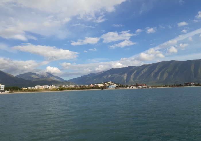
On the hook again
From Dürres, we headed south to Orikum, a town near the south end of Vlorë Bay, about 60nm away, where we planned to anchor for a few days during a strong southerly blow.
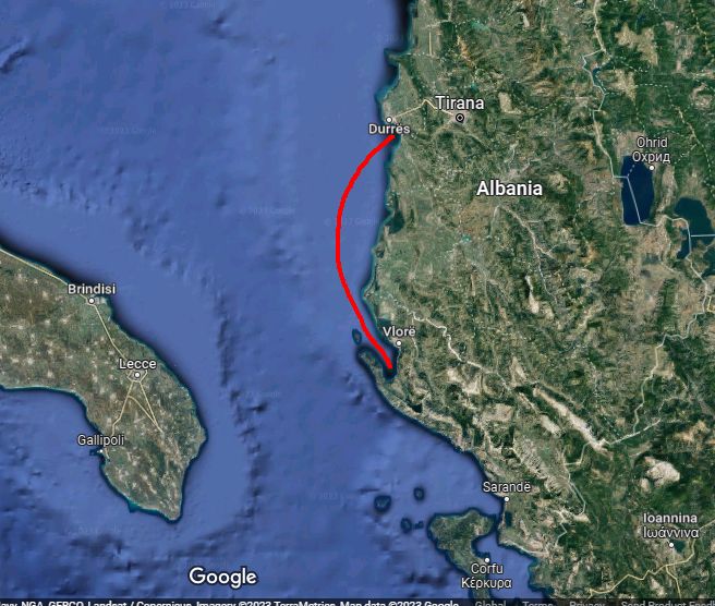
The big picture
Though most of Albania's ports offer scant shelter for boats, Vlorë Bay provides protection from every direction except for north, so for us it would be perfect.
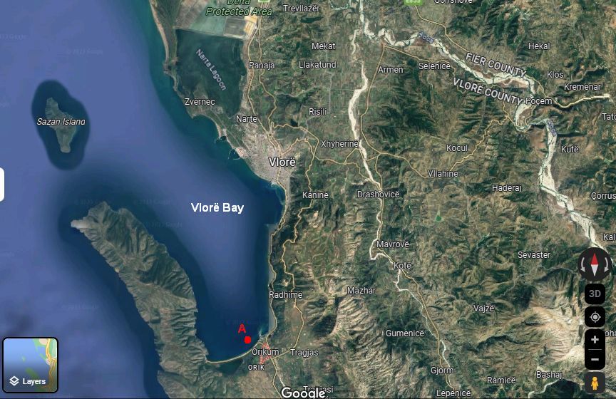
Good protection from the south
We had a lovely trip to Orikum, even sailing for a few hours, going 7-9 knots on calm water. Believe me, here in the Med, sailing is not always a given. Some people even say that "MED" is an acronym for "motor every day," which isn't far from the truth. Awildian's new feathering props slide silently through the water when he's sailing, causing very little drag, and his hull is clean, clean, clean, all of which make for a faster, more enjoyable sail.
Our new Sarca Excel anchor made its debut in Orikum, passing its first two tests - setting and resetting - with flying colors. Setting is when we deploy the anchor with an appropriate amount of chain for the depth, and it grabs the ground and holds. Resetting is when the anchor has to turn, due to a shift in the wind or current, and then resets itself and holds. We'd named this anchor Obama, as in "No Drama Obama," because "no drama" is what we want from our anchor.
We enjoyed being back on anchor, rocked to sleep with the gentle movement of the sea, and waking to the sounds of songbirds, roosters, and the shoosh of the waves on the sandy beach. We were also happy that all the modifications we'd made during the winter were working well, and made Awildian an even more comfortable and energy efficient home than he had been before.
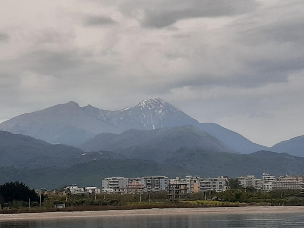
Orikum's beautiful mountain backdrop
Playing with friends
During our time in Orikum, we enjoyed exploring and socializing. Seb and Suzanne of Racoon II, and Sarah and Peter of Flying Fish, had also arrived from Dürres, and another boat from Porto Montenegro, Venere, home to Tim and Laura, and their two young sons, Miles and Aidan, was anchored farther south in the bay.
Seb and Suzanne invited us over to sample some local Albanian white wines and beers. Albanian wines are sold in 1.5l plastic bottles, like those you'd buy bottled water in. Though their packaging was initially a bit off-putting for those of us accustomed to wine in bottles or even boxes, the wines were good, as were the beers.
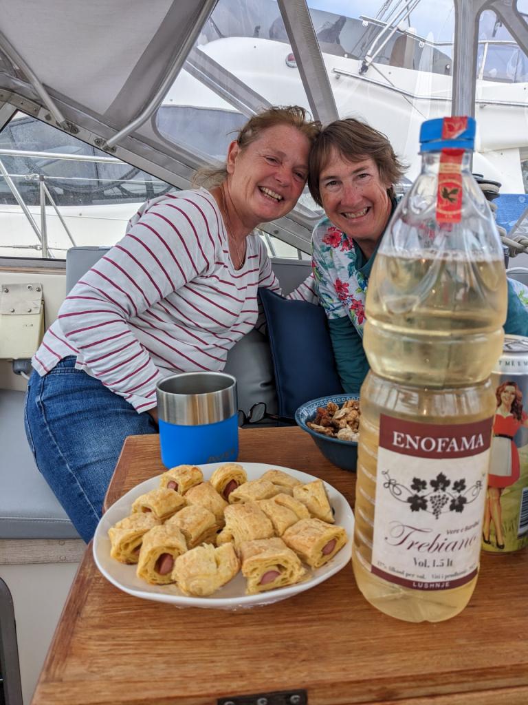
Lonely Planet warns that "the local red wines are universally bad" so we didn't sample any of those.
One afternoon, Tim brought his energetic boys over to Awildian for a visit. The boys had a great time jumping on Awildian's trampoline (a novelty, since Venere is a monohull), while we chatted with Tim.
On another day, we went for a walk with Sarah, Seb and Suzanne, to stretch our legs and see the sights around Orikum. Turning right out of the marina, we walked along the paved road that led to town. The sights included lots of boxy, shabby, Soviet-bloc-style apartment buildings; a shepherd with his small flock of shaggy sheep (and one goat);
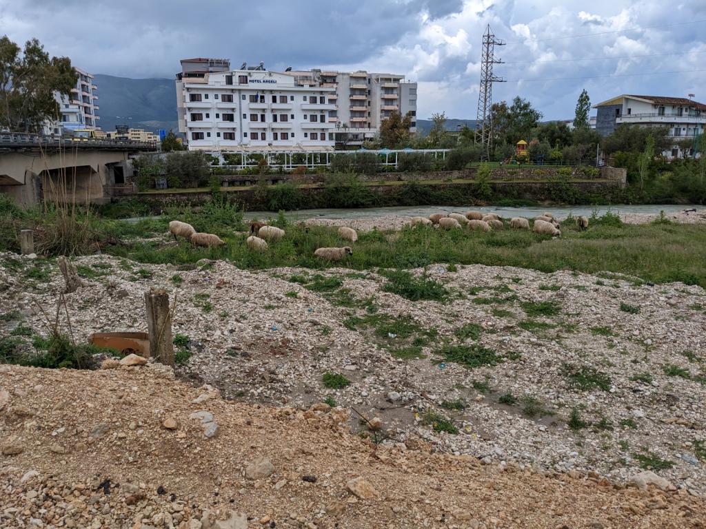
the concrete skeleton of an unfinished building, whose ground floor was occupied by a bunch of goats;
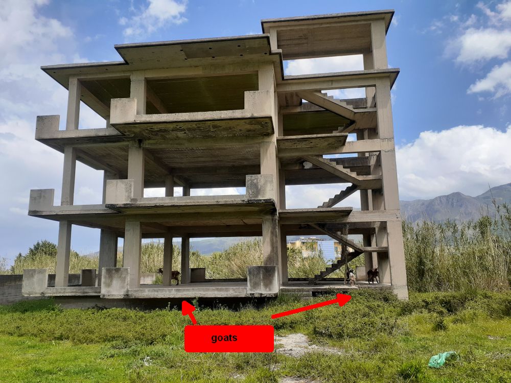
a narrow, crumbling bridge over a shallow river strewn with trash, and a long sandy beach.
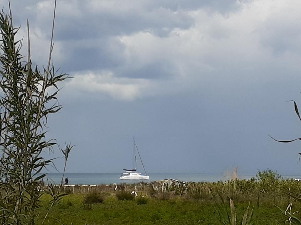
Awildian hanging out off the beach
We were heading for a restaurant called Oriku, arriving for lunch just as the sky opened up. Fortunately, the rain didn't last long, and we were able to walk back to the marina after a delicious lunch, without getting wet.
An impromptu visit from friends
While at Orikum, we enjoyed an overnight visit from our German friends Andi and Kerstin, with whom we'd sailed in Croatia and Montenegro the previous autumn.
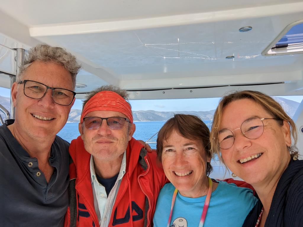
They were driving their van and boat trailer to Greece, where they'd left their boat, Venus. As Albania was on the way, they made a detour to the coast, to meet up with us. We had a great time catching up with them.
When they arrived at Orikum Marina, Andi parked the van and trailer in the carpark. He and Kerstin got out and began walking toward the marina docks, where Eric was waiting with the dinghy. The security guard who was stationed at the marina entrance approached Andi and spoke to him, probably telling him that he couldn't park the van and trailer there, but Andi couldn't know for sure, as it was in Albanian.
Andi smiled in a friendly way and replied - in German - that he was meeting a friend at the marina, and kept walking toward the docks.
The guard again spoke to him in Albanian. Andi again smiled and replied to him in German, and kept walking.
The police, who have a small outpost at the marina, came over to see what was happening. They spoke with the security guard, and then with Andi, in Albanian. Andi continued to smile disarmingly and reply in German, now also pointing at the dinghy, as he and Kerstin kept walking to where Eric was waiting.
The police then spoke with Eric, whose understanding of Albanian was no better than Andi's. All he could do was smile and tell them, in English, that he didn't speak Albanian. With the police and guard still talking, Kerstin and Andi - who was still smiling in a friendly way - climbed into the dinghy, and Eric whisked them off to Awildian.
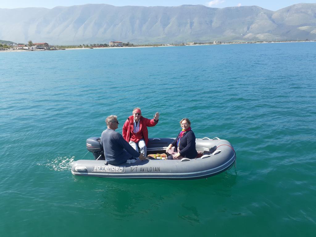
The next morning, when Eric brought Andi and Kerstin back to the marina, the police and guards came over and again spoke with Andi in Albanian. Andi smiled and told them in German that he was going to move his van and trailer now. They followed Kerstin and Andi back to their van and watched as they climbed in, and, with some help from the guard to maneuver out of the carpark, drove away.
It would have been nice to do some more exploring inland from Orikum, but we were on a schedule and needed to keep moving. And so, soon after Andi and Kerstin were on their way, we moved to the beach town of Himarë, about 40 miles to the south.
From Dürres, we headed south to Orikum, a town near the south end of Vlorë Bay, about 60nm away, where we planned to anchor for a few days during a strong southerly blow.
The big picture
Though most of Albania's ports offer scant shelter for boats, Vlorë Bay provides protection from every direction except for north, so for us it would be perfect.
Good protection from the south
We had a lovely trip to Orikum, even sailing for a few hours, going 7-9 knots on calm water. Believe me, here in the Med, sailing is not always a given. Some people even say that "MED" is an acronym for "motor every day," which isn't far from the truth. Awildian's new feathering props slide silently through the water when he's sailing, causing very little drag, and his hull is clean, clean, clean, all of which make for a faster, more enjoyable sail.
Our new Sarca Excel anchor made its debut in Orikum, passing its first two tests - setting and resetting - with flying colors. Setting is when we deploy the anchor with an appropriate amount of chain for the depth, and it grabs the ground and holds. Resetting is when the anchor has to turn, due to a shift in the wind or current, and then resets itself and holds. We'd named this anchor Obama, as in "No Drama Obama," because "no drama" is what we want from our anchor.
We enjoyed being back on anchor, rocked to sleep with the gentle movement of the sea, and waking to the sounds of songbirds, roosters, and the shoosh of the waves on the sandy beach. We were also happy that all the modifications we'd made during the winter were working well, and made Awildian an even more comfortable and energy efficient home than he had been before.
Orikum's beautiful mountain backdrop
Playing with friends
During our time in Orikum, we enjoyed exploring and socializing. Seb and Suzanne of Racoon II, and Sarah and Peter of Flying Fish, had also arrived from Dürres, and another boat from Porto Montenegro, Venere, home to Tim and Laura, and their two young sons, Miles and Aidan, was anchored farther south in the bay.
Seb and Suzanne invited us over to sample some local Albanian white wines and beers. Albanian wines are sold in 1.5l plastic bottles, like those you'd buy bottled water in. Though their packaging was initially a bit off-putting for those of us accustomed to wine in bottles or even boxes, the wines were good, as were the beers.
Lonely Planet warns that "the local red wines are universally bad" so we didn't sample any of those.
One afternoon, Tim brought his energetic boys over to Awildian for a visit. The boys had a great time jumping on Awildian's trampoline (a novelty, since Venere is a monohull), while we chatted with Tim.
On another day, we went for a walk with Sarah, Seb and Suzanne, to stretch our legs and see the sights around Orikum. Turning right out of the marina, we walked along the paved road that led to town. The sights included lots of boxy, shabby, Soviet-bloc-style apartment buildings; a shepherd with his small flock of shaggy sheep (and one goat);
the concrete skeleton of an unfinished building, whose ground floor was occupied by a bunch of goats;
a narrow, crumbling bridge over a shallow river strewn with trash, and a long sandy beach.
Awildian hanging out off the beach
We were heading for a restaurant called Oriku, arriving for lunch just as the sky opened up. Fortunately, the rain didn't last long, and we were able to walk back to the marina after a delicious lunch, without getting wet.
An impromptu visit from friends
While at Orikum, we enjoyed an overnight visit from our German friends Andi and Kerstin, with whom we'd sailed in Croatia and Montenegro the previous autumn.
They were driving their van and boat trailer to Greece, where they'd left their boat, Venus. As Albania was on the way, they made a detour to the coast, to meet up with us. We had a great time catching up with them.
When they arrived at Orikum Marina, Andi parked the van and trailer in the carpark. He and Kerstin got out and began walking toward the marina docks, where Eric was waiting with the dinghy. The security guard who was stationed at the marina entrance approached Andi and spoke to him, probably telling him that he couldn't park the van and trailer there, but Andi couldn't know for sure, as it was in Albanian.
Andi smiled in a friendly way and replied - in German - that he was meeting a friend at the marina, and kept walking toward the docks.
The guard again spoke to him in Albanian. Andi again smiled and replied to him in German, and kept walking.
The police, who have a small outpost at the marina, came over to see what was happening. They spoke with the security guard, and then with Andi, in Albanian. Andi continued to smile disarmingly and reply in German, now also pointing at the dinghy, as he and Kerstin kept walking to where Eric was waiting.
The police then spoke with Eric, whose understanding of Albanian was no better than Andi's. All he could do was smile and tell them, in English, that he didn't speak Albanian. With the police and guard still talking, Kerstin and Andi - who was still smiling in a friendly way - climbed into the dinghy, and Eric whisked them off to Awildian.
The next morning, when Eric brought Andi and Kerstin back to the marina, the police and guards came over and again spoke with Andi in Albanian. Andi smiled and told them in German that he was going to move his van and trailer now. They followed Kerstin and Andi back to their van and watched as they climbed in, and, with some help from the guard to maneuver out of the carpark, drove away.
It would have been nice to do some more exploring inland from Orikum, but we were on a schedule and needed to keep moving. And so, soon after Andi and Kerstin were on their way, we moved to the beach town of Himarë, about 40 miles to the south.
Goodbye Montenegro, Hello Albania!
30 October 2023 | Durrës, Albania
Vandy Shrader
Late April, early May 2023
As April drew to a close, and our marina contracts were set to expire at the end of the month, the winter cruising community at Porto Montenegro began to disperse. One by one, boats left to continue their Mediterranean meanderings. Some went west to southern Italy, some went north to Croatia and Venice, some went south to Albania or Greece.
Awildian was included in this last group: we had to be near to Athens, Greece, by the end of May, when our daughter, Kelly, and her boyfriend, Daniel, would arrive to spend a few days with us. We'd decided to make some stops in Albania along the way, to see a bit of this anachronistic country, and to delay our entry into Greece, which would start the clock on our 90 day Schengen visas. The trip to the Athens area would be about 500 miles, taking us around the bottom of the Peloponnese Peninsula. We had to take "the long way," since the Corinth Canal, which cuts across the top of the Peloponnese Peninsula, creating a shortcut between the Ionian Sea to the west and the Saronic Gulf to the east near Athens, wouldn't open until June 1.
Like everyone else, we began making our final preparations: buying extra groceries, filling our water tanks, checking the weather, saying our goodbyes. For us, it also included another trip over the mountains to Podgorica, to submit our applications for Croatian citizenship - with their reams of supporting documents - at the Croatian Embassy. Application accomplished, we focused on clearing out of Montenegro.
The first leg of our trip would be 90 miles, from Porto Montenegro to the port of Durrës, Albania, which we could do either as a long day trip or an overnighter. We chose to do the day trip, which meant that we'd have to leave very early in the morning, which then meant that we'd need to start clearing out of Montenegro the day before.
Clearing out of Montenegro involves a trip to the harbormaster (during business hours), who makes sure that our tourist taxes have been paid, and issues us a one-day "vignette" (basically a cruising permit), for 47 euro, that allows us to legally move Awildian from his slip in the marina to the Customs dock next door. The rest of the process, which is done with Customs and the port police, can be done at any time since they operate 24/7.
The day before we planned to leave, Eric went with Miloš (pronounced Mee-losh), one of the two Yacht Assist agents who are named Miloš, to visit the harbormaster, returning with our vignette. Next, we walked to the marina office, checked out of the marina, said goodbye to the helpful women who work there, and left them with some chocolates as thanks for all their help during the winter.
When our alarm went off at 4 am the next morning, we got up and had some coffee. By 4:30 am we were ready to go. The sun wasn't quite up yet, but between the marina lights and the brightening sky, we could see well enough. We put our headsets on, released Awildian's lines, and motored over to the Customs dock. Eric took our documents to the Customs building to get our passports stamped and complete the checking out process. A little while later he returned with the goods. We were ready to go. As we left the dock and motored toward the mouth of the Boka, I waved goodbye to Montenegro and said, "See you in the Fall."
The trip to Durrës was blissfully uneventful. The sun shone, the air was warmish, the sea offered up only minimal waves. With a breeze behind us, Awildian scooted along at 8 to 8.5 knots, propelled by the Things and, sometimes, a sail or two. From the water, Albania looks a lot like Montenegro. But once you get closer, or dig deeper, the similarities stop.
For instance. Along the northern Albanian coast, our chart plotter had some odd icons on it. When we looked them up, we discovered they were mines, as in, anti-ship mines. Hmm. That's something we hadn't seen before. Along with the icons, the chart had two notes:
"The sea area represented on this chart in front of Albania was formerly mined. Although this area was cleared, anchoring, fishing and diving as well as any other activity on the sea bottom are potentially dangerous."
"The area reported in this chart is dangerous because of former mined area. Vessels should navigate only during daylight hours and follow the recommended tracks shown on chart."
We didn't quite tiptoe through the area, but it did make us wonder about how conscientious the mine clearers had been. Fortunately, the mines had been cleared decades ago, so we weren't likely to bump into one they might have missed.
Also, all along the coast, everywhere we looked, igloo-shaped cement bunkers were perched on the headlands. More about these later.
By 4:30 pm we were in the channel approaching Durrës Harbour. We'd expected to anchor out, but Ilir Gjergji, our agent, texted that we should bring Awildian into the marina. Yachts are required to use a local agent, to clear into Albania, and Ilir had come highly recommended by other cruisers. Rightly so, it turned out. When I called on VHF Ch 16, the Durrës port control operator was extremely helpful and friendly, welcoming us to Albania, directing us where to tie up, and wishing us a pleasant stay.
Ilir and a few burly dudes were waiting when we arrived, ready to catch our lines and tie Awildian to the dock. The dock being a crumbling concrete quay, with rebar sticking out here and there, and some old tires slung alongside at intervals to provide a modicum of cushioning (as well as creating black abstract art wherever they touched the hull).
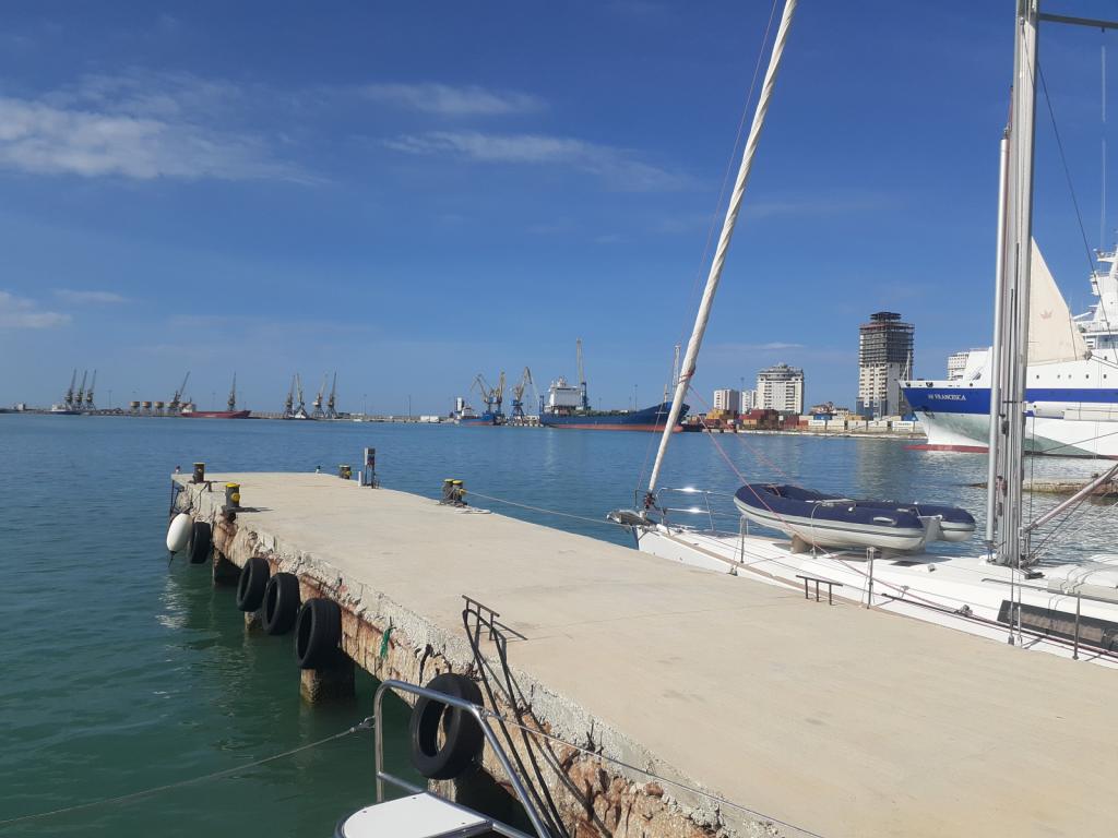
The dock in Durrës
Ilir welcomed us to Albania and came aboard. While I was busy adding more fenders between Awildian and the dock, Ilir told Eric a bit about Albania, and wrote down some useful Albanian phrases for us. Then he took our boat paperwork, and some money for fees (euros were accepted, if you don't happen to have any Albanian lekë handy); he returned later, having checked us into Albania. Fun fact: your passports don't get stamped when you enter Albania by boat. I don't know whether they do if you fly in.
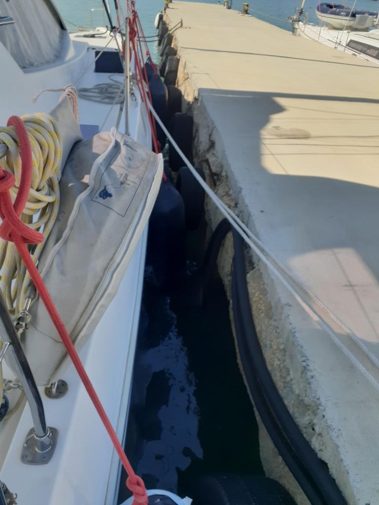
Awildian tied to the dock
Soon after Ilir left, we saw a pair of our friends, Seb and Suzanne, walking along the dock toward us. Wait...Seb and Suzanne had left on their boat, Racoon II, the day before, heading for Preveza, Greece. What were they doing here in Durrës? What they were doing was recovering from a very uncomfortable trip, having been bounced around all night long in lots of wind and steep, confused seas out in the Adriatic. Eventually they'd made the decision to abort their trip to Greece and head for the shelter of Durrës Harbor. A decision that they were quite happy with. They were able to contact Ilir during the night and he'd set everything up for them in the marina prior to their arrival.
A little while later, some of our other friends from Porto Montenegro, Sarah and Peter, arrived on Flying Fish. Sarah docked their boat directly in front of us. Ilir took their paperwork and went off to clear them in.
The six of us then convened on Awildian's front porch for drinks and snacks, to celebrate our safe arrival into Albania, mark the beginning of a new cruising season, and to share the details of our passages.
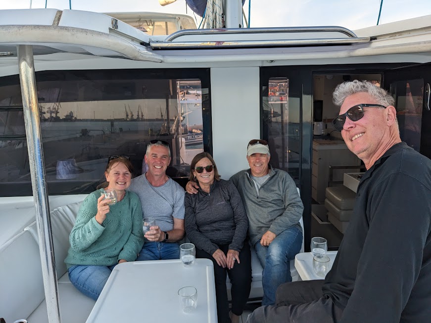
A reunion in Durrës
Seb and Suzanne's was by far the most dramatic. Here we all were, in a shabby but sheltered marina in Albania, a country that we knew almost nothing about, and couldn't have located on a map a year ago. But that's part of the fun of cruising.
The next morning, after Flying Fish continued south, Ilir gave the four of us a lift into Durrës. Along the way, he told us about life in Albania: for instance, no one was allowed to own a car until 1991. Just one of the many edicts of Albania's controlling, paranoid, and bat-shit-crazy dictator, Enver Hoxha, who was in power from the mid-40s until his death in 1985.
In addition to banning private cars, Hoxha also outlawed the practice of religion and "purged" many members of the clergy. His "purges" extended far beyond the clergy, encompassing his political rivals, aristocrats, old high school friends, intellectuals, and apparently anyone else who happened to cross his mind.
One aspect of Hoxha's paranoia was his constant fear that Albania would be invaded by any number of countries, and so he ordered the construction of more than 750,000 concrete bunkers, a policy known as "bunkerization." Many of these bunkers are still around, their domed lids popping up seemingly everywhere you look in Albania, a tribute to Hoxha's unbridled paranoia. Though most are decaying slowly in the elements, some bunkers have been repurposed as art objects, restaurants, or even B&Bs.
Some examples of bunkers, images from the web:
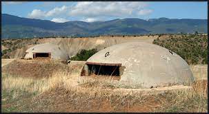
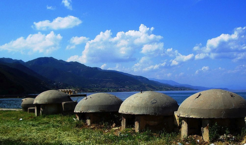
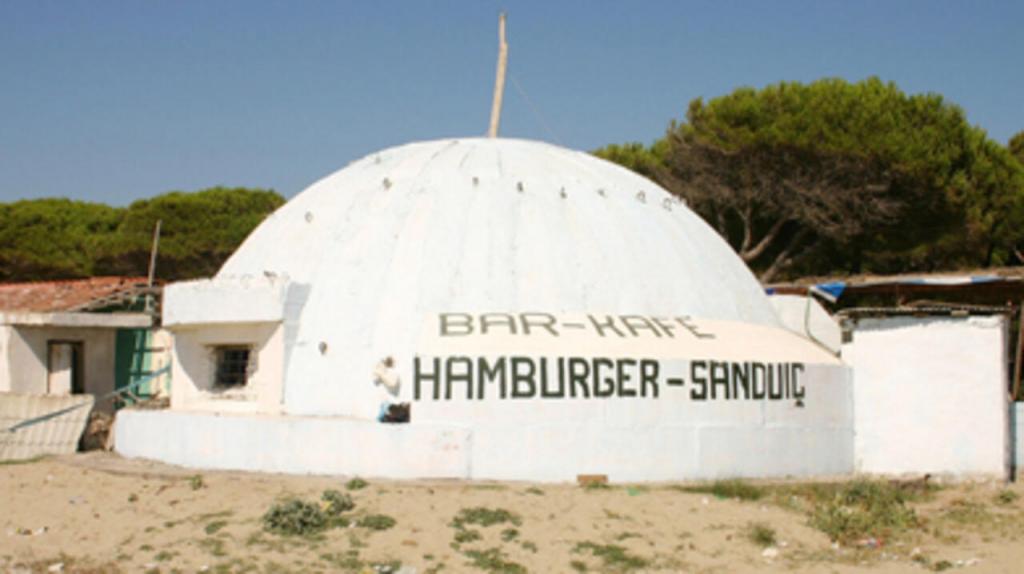
You can read more about the transformation of some of Albania's bunkers here:
Albanian bunkers
Hoxha was apparently so impressed with the design of the bunkers that he went to visit the engineer who'd designed them, Josif Zagali, and asked whether the bunkers could withstand a tank assault. When Zagali proudly confirmed that they could, Hoxha ordered him to go inside one of the bunkers, and then had a tank shoot it with an artillery shell. The bunker held up perfectly and Zagali emerged unscathed - except maybe for his hearing, and the need for a new pair of trousers. Zagali later fell victim to one of Hoxha's "purges"; he was arrested and thrown in prison for eight years.
The population of Albania was essentially isolated and held hostage by a deranged politician for forty years. There's a lot more information out there, about Hoxha and his policies, as well as life in Albania during his rule and after. It's some crazy stuff. I'll leave it for you to explore more if you'd like.
On our day out in Durrës, Eric, Seb, Suzanne, and I explored an ancient Roman amphitheater that's located right in the middle of the city.
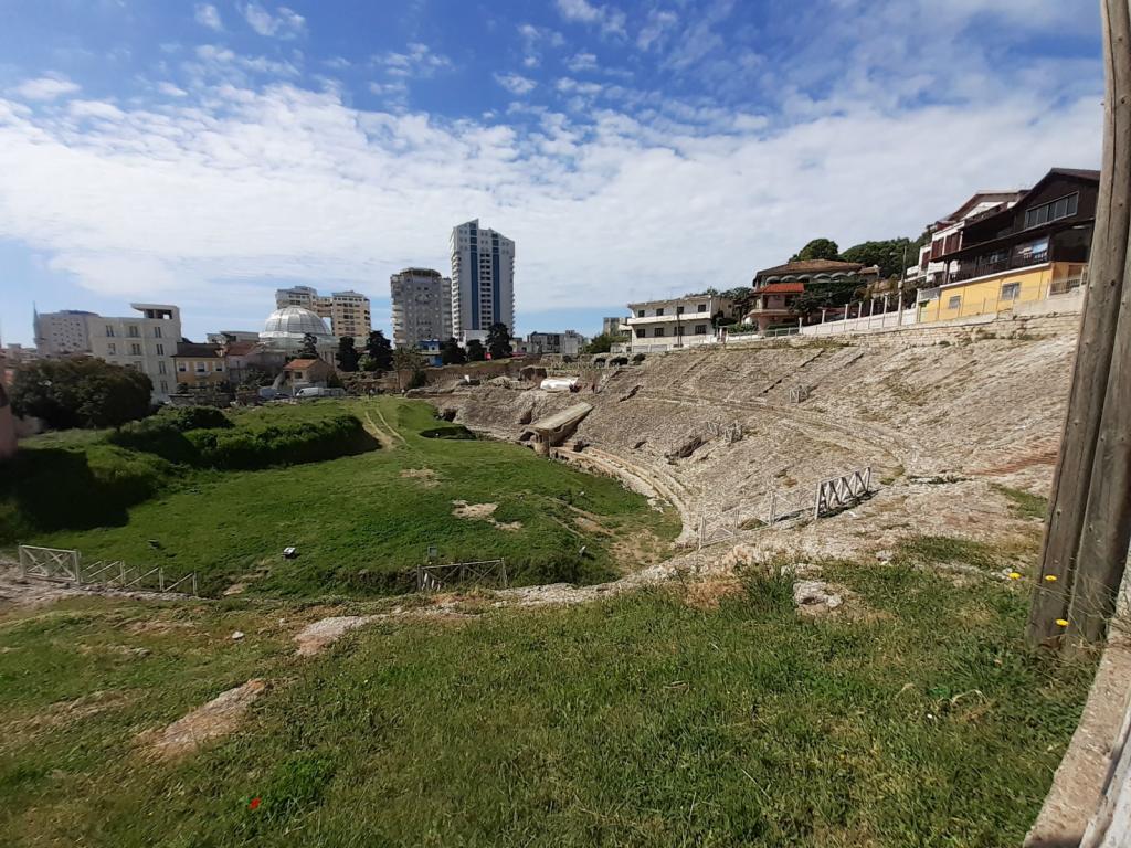
Only discovered in 1966, it's been partially excavated; the rest will have to wait as there are entire modern neighborhoods built on top of it. We paid our 200 lekë apiece (about 2 euro), and had a wander around the grounds. It was very interesting. There were tunnels under the spectator stands, just like in a modern stadium, and pens where combatants were kept. We could almost imagine the lions and gladiators waiting there, before their entry into the arena to satisfy the bloodlust of the audience.
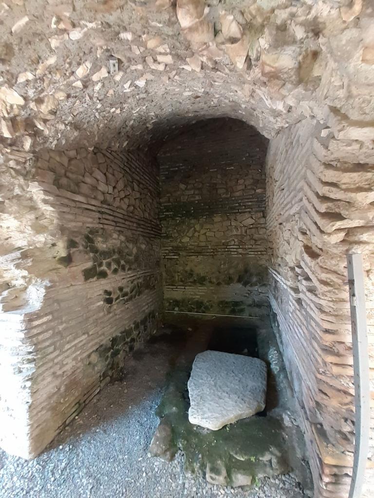
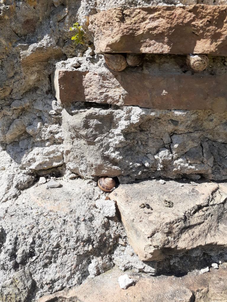
Modern snails, ancient walls
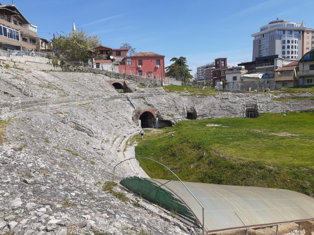
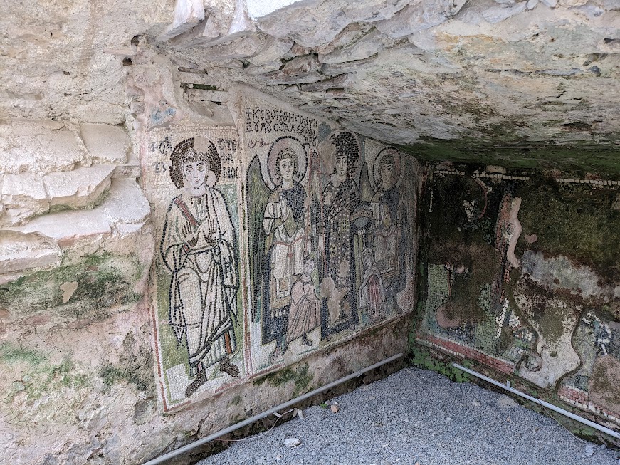
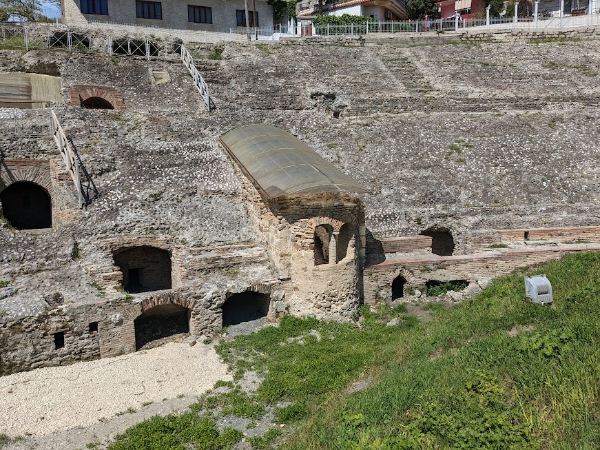
After leaving the ancient amphitheater, we strolled through modern Durrës - which is an interesting blend of old, really old, and new - arriving at a seaside promenade.
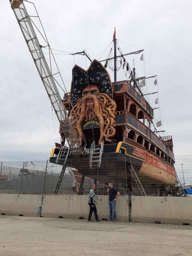
Davey Jones in dry dock.
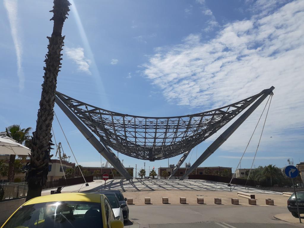
Sculpture at the port
Why is it, that we cruisers, though we spend most of our time on the water, still gravitate to it, when given the opportunity to walk on land? We strolled along the wide paved path, past occasional sculptures, and beside a flotsam-littered beach.
Beachside sculpture
Vendors hawked their wares - sunglasses, jewelry, balloons - and locals sat on benches, enjoying the sunny day. We climbed a concrete "ziggurat," and sat there for awhile, chatting and watching the waves.
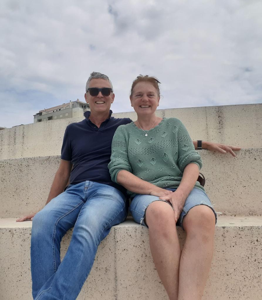
Seb and Suzanne on the ziggurat
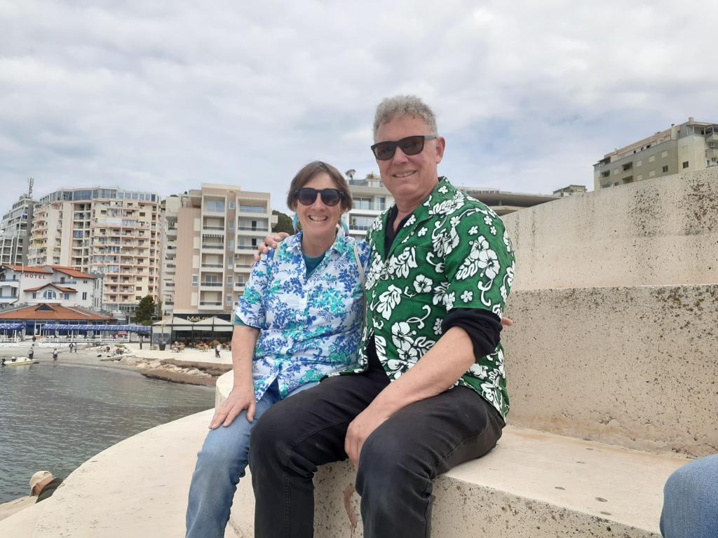
Van and Eric on the ziggurat
Then we found a beachside restaurant and had some lunch. The local beer, Korça, was very refreshing.
After lunch, we walked back to the marina and looked at the next day's weather forecast, confirming that it still looked good for us all to head to Orikum, about 60 miles south.
The view out the window. Not a good look!
As April drew to a close, and our marina contracts were set to expire at the end of the month, the winter cruising community at Porto Montenegro began to disperse. One by one, boats left to continue their Mediterranean meanderings. Some went west to southern Italy, some went north to Croatia and Venice, some went south to Albania or Greece.
Awildian was included in this last group: we had to be near to Athens, Greece, by the end of May, when our daughter, Kelly, and her boyfriend, Daniel, would arrive to spend a few days with us. We'd decided to make some stops in Albania along the way, to see a bit of this anachronistic country, and to delay our entry into Greece, which would start the clock on our 90 day Schengen visas. The trip to the Athens area would be about 500 miles, taking us around the bottom of the Peloponnese Peninsula. We had to take "the long way," since the Corinth Canal, which cuts across the top of the Peloponnese Peninsula, creating a shortcut between the Ionian Sea to the west and the Saronic Gulf to the east near Athens, wouldn't open until June 1.
Like everyone else, we began making our final preparations: buying extra groceries, filling our water tanks, checking the weather, saying our goodbyes. For us, it also included another trip over the mountains to Podgorica, to submit our applications for Croatian citizenship - with their reams of supporting documents - at the Croatian Embassy. Application accomplished, we focused on clearing out of Montenegro.
The first leg of our trip would be 90 miles, from Porto Montenegro to the port of Durrës, Albania, which we could do either as a long day trip or an overnighter. We chose to do the day trip, which meant that we'd have to leave very early in the morning, which then meant that we'd need to start clearing out of Montenegro the day before.
Clearing out of Montenegro involves a trip to the harbormaster (during business hours), who makes sure that our tourist taxes have been paid, and issues us a one-day "vignette" (basically a cruising permit), for 47 euro, that allows us to legally move Awildian from his slip in the marina to the Customs dock next door. The rest of the process, which is done with Customs and the port police, can be done at any time since they operate 24/7.
The day before we planned to leave, Eric went with Miloš (pronounced Mee-losh), one of the two Yacht Assist agents who are named Miloš, to visit the harbormaster, returning with our vignette. Next, we walked to the marina office, checked out of the marina, said goodbye to the helpful women who work there, and left them with some chocolates as thanks for all their help during the winter.
When our alarm went off at 4 am the next morning, we got up and had some coffee. By 4:30 am we were ready to go. The sun wasn't quite up yet, but between the marina lights and the brightening sky, we could see well enough. We put our headsets on, released Awildian's lines, and motored over to the Customs dock. Eric took our documents to the Customs building to get our passports stamped and complete the checking out process. A little while later he returned with the goods. We were ready to go. As we left the dock and motored toward the mouth of the Boka, I waved goodbye to Montenegro and said, "See you in the Fall."
The trip to Durrës was blissfully uneventful. The sun shone, the air was warmish, the sea offered up only minimal waves. With a breeze behind us, Awildian scooted along at 8 to 8.5 knots, propelled by the Things and, sometimes, a sail or two. From the water, Albania looks a lot like Montenegro. But once you get closer, or dig deeper, the similarities stop.
For instance. Along the northern Albanian coast, our chart plotter had some odd icons on it. When we looked them up, we discovered they were mines, as in, anti-ship mines. Hmm. That's something we hadn't seen before. Along with the icons, the chart had two notes:
"The sea area represented on this chart in front of Albania was formerly mined. Although this area was cleared, anchoring, fishing and diving as well as any other activity on the sea bottom are potentially dangerous."
"The area reported in this chart is dangerous because of former mined area. Vessels should navigate only during daylight hours and follow the recommended tracks shown on chart."
We didn't quite tiptoe through the area, but it did make us wonder about how conscientious the mine clearers had been. Fortunately, the mines had been cleared decades ago, so we weren't likely to bump into one they might have missed.
Also, all along the coast, everywhere we looked, igloo-shaped cement bunkers were perched on the headlands. More about these later.
By 4:30 pm we were in the channel approaching Durrës Harbour. We'd expected to anchor out, but Ilir Gjergji, our agent, texted that we should bring Awildian into the marina. Yachts are required to use a local agent, to clear into Albania, and Ilir had come highly recommended by other cruisers. Rightly so, it turned out. When I called on VHF Ch 16, the Durrës port control operator was extremely helpful and friendly, welcoming us to Albania, directing us where to tie up, and wishing us a pleasant stay.
Ilir and a few burly dudes were waiting when we arrived, ready to catch our lines and tie Awildian to the dock. The dock being a crumbling concrete quay, with rebar sticking out here and there, and some old tires slung alongside at intervals to provide a modicum of cushioning (as well as creating black abstract art wherever they touched the hull).
The dock in Durrës
Ilir welcomed us to Albania and came aboard. While I was busy adding more fenders between Awildian and the dock, Ilir told Eric a bit about Albania, and wrote down some useful Albanian phrases for us. Then he took our boat paperwork, and some money for fees (euros were accepted, if you don't happen to have any Albanian lekë handy); he returned later, having checked us into Albania. Fun fact: your passports don't get stamped when you enter Albania by boat. I don't know whether they do if you fly in.
Awildian tied to the dock
Soon after Ilir left, we saw a pair of our friends, Seb and Suzanne, walking along the dock toward us. Wait...Seb and Suzanne had left on their boat, Racoon II, the day before, heading for Preveza, Greece. What were they doing here in Durrës? What they were doing was recovering from a very uncomfortable trip, having been bounced around all night long in lots of wind and steep, confused seas out in the Adriatic. Eventually they'd made the decision to abort their trip to Greece and head for the shelter of Durrës Harbor. A decision that they were quite happy with. They were able to contact Ilir during the night and he'd set everything up for them in the marina prior to their arrival.
A little while later, some of our other friends from Porto Montenegro, Sarah and Peter, arrived on Flying Fish. Sarah docked their boat directly in front of us. Ilir took their paperwork and went off to clear them in.
The six of us then convened on Awildian's front porch for drinks and snacks, to celebrate our safe arrival into Albania, mark the beginning of a new cruising season, and to share the details of our passages.
A reunion in Durrës
Seb and Suzanne's was by far the most dramatic. Here we all were, in a shabby but sheltered marina in Albania, a country that we knew almost nothing about, and couldn't have located on a map a year ago. But that's part of the fun of cruising.
The next morning, after Flying Fish continued south, Ilir gave the four of us a lift into Durrës. Along the way, he told us about life in Albania: for instance, no one was allowed to own a car until 1991. Just one of the many edicts of Albania's controlling, paranoid, and bat-shit-crazy dictator, Enver Hoxha, who was in power from the mid-40s until his death in 1985.
In addition to banning private cars, Hoxha also outlawed the practice of religion and "purged" many members of the clergy. His "purges" extended far beyond the clergy, encompassing his political rivals, aristocrats, old high school friends, intellectuals, and apparently anyone else who happened to cross his mind.
One aspect of Hoxha's paranoia was his constant fear that Albania would be invaded by any number of countries, and so he ordered the construction of more than 750,000 concrete bunkers, a policy known as "bunkerization." Many of these bunkers are still around, their domed lids popping up seemingly everywhere you look in Albania, a tribute to Hoxha's unbridled paranoia. Though most are decaying slowly in the elements, some bunkers have been repurposed as art objects, restaurants, or even B&Bs.
Some examples of bunkers, images from the web:
You can read more about the transformation of some of Albania's bunkers here:
Albanian bunkers
Hoxha was apparently so impressed with the design of the bunkers that he went to visit the engineer who'd designed them, Josif Zagali, and asked whether the bunkers could withstand a tank assault. When Zagali proudly confirmed that they could, Hoxha ordered him to go inside one of the bunkers, and then had a tank shoot it with an artillery shell. The bunker held up perfectly and Zagali emerged unscathed - except maybe for his hearing, and the need for a new pair of trousers. Zagali later fell victim to one of Hoxha's "purges"; he was arrested and thrown in prison for eight years.
The population of Albania was essentially isolated and held hostage by a deranged politician for forty years. There's a lot more information out there, about Hoxha and his policies, as well as life in Albania during his rule and after. It's some crazy stuff. I'll leave it for you to explore more if you'd like.
On our day out in Durrës, Eric, Seb, Suzanne, and I explored an ancient Roman amphitheater that's located right in the middle of the city.
Only discovered in 1966, it's been partially excavated; the rest will have to wait as there are entire modern neighborhoods built on top of it. We paid our 200 lekë apiece (about 2 euro), and had a wander around the grounds. It was very interesting. There were tunnels under the spectator stands, just like in a modern stadium, and pens where combatants were kept. We could almost imagine the lions and gladiators waiting there, before their entry into the arena to satisfy the bloodlust of the audience.
Modern snails, ancient walls
After leaving the ancient amphitheater, we strolled through modern Durrës - which is an interesting blend of old, really old, and new - arriving at a seaside promenade.
Davey Jones in dry dock.
Sculpture at the port
Why is it, that we cruisers, though we spend most of our time on the water, still gravitate to it, when given the opportunity to walk on land? We strolled along the wide paved path, past occasional sculptures, and beside a flotsam-littered beach.
Beachside sculpture
Vendors hawked their wares - sunglasses, jewelry, balloons - and locals sat on benches, enjoying the sunny day. We climbed a concrete "ziggurat," and sat there for awhile, chatting and watching the waves.
Seb and Suzanne on the ziggurat
Van and Eric on the ziggurat
Then we found a beachside restaurant and had some lunch. The local beer, Korça, was very refreshing.
After lunch, we walked back to the marina and looked at the next day's weather forecast, confirming that it still looked good for us all to head to Orikum, about 60 miles south.
The view out the window. Not a good look!
| Vessel Name: | Awildian, previously SCOOTS (2012-2021) |
| Vessel Make/Model: | Leopard 48 |
| Hailing Port: | San Francisco, CA |
| Crew: | Eric and Vandy Shrader |
| About: | We've been living aboard full time since September 2014. We sailed our Able Apogee 50, SCOOTS, from 2012-2021, and are now aboard our Leopard 48, Awildian, since March 2022. |
| Social: |
|
Awildian, previously SCOOTS (2012-2021)'s Photos - Ague Verde


Who: Eric and Vandy Shrader
Port: San Francisco, CA