Sirius Sailin'
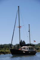
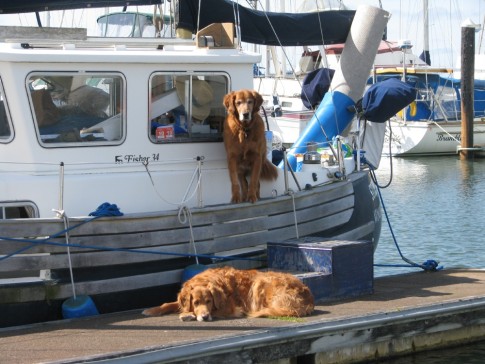
| Vessel Name: | Storm Petrel |
| Vessel Make/Model: | Fisher 34 |
| Hailing Port: | Winchester Bay, Oregon |
| Crew: | Fraser and Jeff |
| About: | Additional Crew: Zac and Indy |
| Extra: | Storm Petrel is a 1977 Pilothouse ketch. She has sailed the Oregon/Washington coast since 1999, now home port is Pleasant Harbor, WA. |
30 September 2023
uly 24 - 25 A Rollicking Ride Down Hecate Strait to Cumshewa Inlet & Gordon Cove (53° 02.5’N, 132° 01.6’W) First Quarter Moon
The early morning was gorgeous! We got underway at 05:35 under thin, broken overcast skies with very light wind. The "Sleeping Beauty," a profile of a supine female form seen in the configuration of the mountain tops to the NW appeared navy blue in the early morning light. The gauzy white overcast was [...]
30 September 2023
July 23– Daajing Giids, Bearskin Bay, Queen Charlotte Harbor (53° 15.1’N, 132° 4.7’W) Waxing Cresent Moon
We left the marina by midafternoon with the intention of repositioning to the fuel dock adjacent to the marina in time to meet the attendant’s hours, 16:00-20:00 to this time of year. Before casting off the lines, we realized that the external regulator was not powered. Jeff did some troubleshooting [...]
30 September 2023
uly 21 – 22 Daajing Giids, Queen Charlotte Harbor (53° 15.2’N, 132° 4.4’W)
Although Jeff and I prefer to anchor out, being at a marina has advantages. It is easier to walk Zac and Indy at any time, engage in boat repairs and maintenance, explore the surrounding area, and of course, it is always nice to have a hot shower with plentiful water, that is, if one has enough “Loonies” [...]
Rounding Brooks Peninsula and Solander Island
We were underway to round the Brooks Peninsula at 10:00 after receiving the best weather forecast in several days. Earlier that morning the South Brooks buoy registered a wind speed of 6 knots and a swell height of 2.1 meters (about 7 feet). Environment Canada predicted that the sea state would diminish to 1-2 meters (3-6 feet) by early afternoon and that a west wind of 5-15 knots could be expected until late afternoon, when it would back to SE 10-15 knots. By early the next day, the forecast was for gale force winds of 25-35 knots, escalating to 35-45 knots by afternoon. Today was our "weather window."
A bald eagle flew overhead just after we weighed anchor as if escorting us through the gorge to Klaskish Inlet. The inlet was smooth with a low swell until we reached McDougal Island near the entrance to Brooks Bay, when the seas began to build. By the time we were parallel to Clerke Reefs, about halfway to Cape Cook, the sea state was probably 2-3 meters, bigger than expected but consisting of fairly organized swell and waves. The motion wasn't too uncomfortable from our positions in the pilothouse, although Fraser had to postpone having a second cup of tea. Storm Petrel rode the sea with confidence, her mainsail raised to provide stability rather than power in the light, west wind. Muscling through the swells, we listened to the humorous, "A Prairie Home Companion" on NPR, followed by Jimmy Buffet tunes and classical music on Sirius Radio. Our selections seemed to compliment the lively cadence of the swells.
Just off Clerke Reefs, as we were still becoming accustomed to the sea state and wondering if it might intensify off Cape Cook, we saw a sea otter in the typical backstroke position--paws crossed on tummy and feet held high-- floating calmly on the waves. The otter was completely at home, unruffled by the lumpy seas. Somehow, seeing the laid-back otter in Brooks Bay was reassuring.
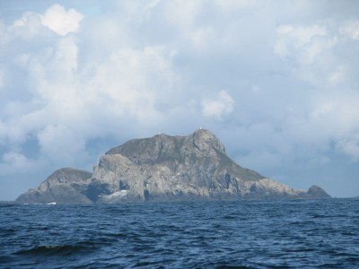
According to our guidebooks, the only time to sail around Brooks is in favorable weather conditions. The Waggoner Cruising Guide states that the "Brooks Peninsula and the waters off Cape Cook are, together with Cape Scott, the most hostile on the west coast of Vancouver Island." Mountains, some over 2,000 feet rise from the 6-mile long peninsula. Solander Island is a 300-foot tall, formidable rock that lies off Cape Cook. We gave the rock a wide berth. As we rounded Cape Cook, the sun was shining and gave Solander Island a starkly beautiful countenance.
Although the sea state continued in the 2-meter range, it grew more organized and seemed more kindly as we rounded Cape Cook and headed southeast. Relief at seeing this impressive piece of geography slip to stern, the warmth of the sun, having the wind abeam, and Jeff's call of "fish on" as a lovely salmon took his hoochie (a squid-like lure trailed behind a flasher) influenced our impressions, no doubt. The Coho was 29 inches and about 15 pounds, enough to enjoy for about a week.
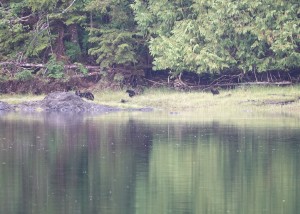
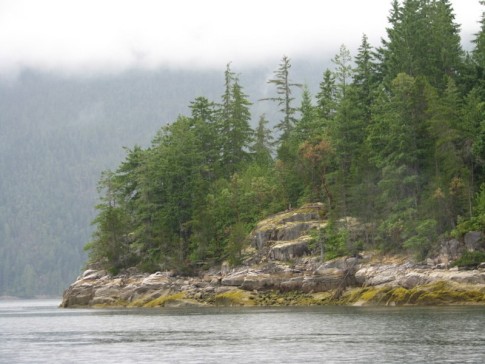
After passing Clerke Point on the southwest tip of the Brooks Peninsula, it was an easy downhill ride all the way to the wild and picturesque Bunsby Islands. The view of sea stacks, reefs, and tree-covered islands is quite dramatic on the approach from seaward. We found a well-protected cove with a suitable dog islet on Big Bunsby Island and settled in to await the gale force winds due the next day. We celebrated the exciting day with barbequed salmon enjoyed by candlelight. Standing in the cockpit late that night, we stood in awe of the zillions of glittering stars and Milky Way overhead.
 |
 |
 |