
Journey Aboard Interlude
14 May 2014
02 May 2014
20 April 2014
09 June 2013 | Kekova Roads
25 May 2013 | Ece Saray Marina, Fethiye
18 May 2013 | Kas
17 May 2013 | Kalkan Harbor
13 May 2013 | Tomb Bay, Skopea Limani
05 May 2013 | Ekincik Koyu
29 April 2013 | Marti Marina, Gulf of Hisaronu
25 April 2013 | Kuraca Bucu
23 April 2013
22 April 2013
19 April 2013 | Bodrum, Turkey
08 November 2012 | Paris, France
27 October 2012 | Turgutreis Marina
24 October 2012 | Gumusluk
13 October 2012
11 October 2012
10 October 2012 | Amazon Creek (Kuçuk Gunluk Koyu)
Trip thru the Corinth Canal
13 August 2012 | Korfos
Dan 32 degrees C, 1011mb, party cloudy with occasional sprinkles

After a long travel day yesterday, we're spending today at anchor in Korfos, a relaxed seaside community situated on a protected bay in the Saronic Gulf. All of us needed a day of downtime after the adventure we had in getting here.
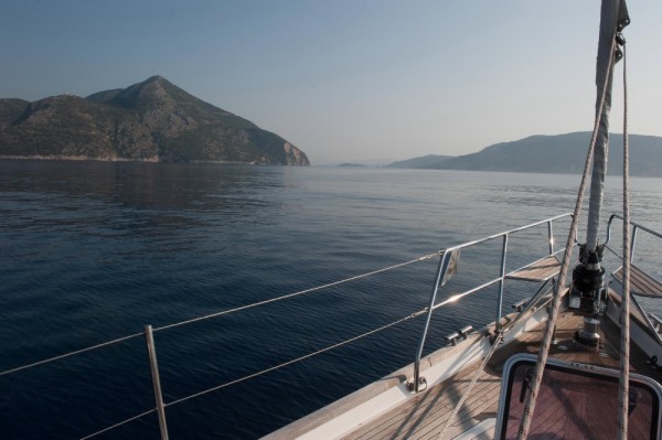
We left Itea yesterday around 11am, intending to spend the evening in Corinth and then transit the Canal early the following day. The Gulf of Corinth was as calm and flat as any inland lake and the water was a deep deep blue. Definitely not sailing weather so we let the autopilot do the work while we took in the spectacular scenery. The Gulf of Corinth is a bit like a big alpine lake with mountains around the perimeter and it was a very pleasant calm trip over to Corinth. The only bit of excitement was when I decided to "unpickle" the water maker and noticed a considerable flow of seawater coming into the engine room down by the propeller shaft. The main bilge pump was kicking on about every 3 minutes ... clearly able to handle the inflow, but running far more often than I would have liked. It took me longer than it should have, but I eventually confirmed that the water was NOT coming in through the opening where the shaft exits the hull. Hidden out of sight was the intake hose which feeds the water maker and it had somehow slipped out of position and was sitting on top of the shaft. The friction from the rapidly spinning shaft had worn a hole in the hose which is why the water appeared to be coming in there. After shutting off the feeder valve at the manifold, the inflow of water stopped immediately. Duh ... that should have been the first thing I checked since we hadn't had any problems until I began commissioning the water maker. Another lesson learned and, thankfully, no harm done. And maybe the bilge is just a little bit cleaner now as well!
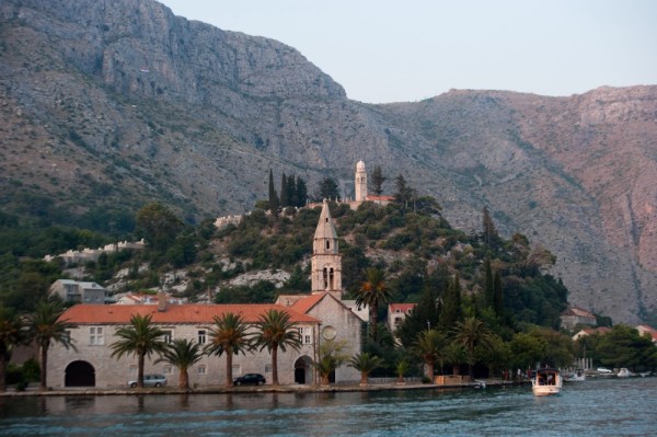
We tied up at marina in Corinth, Greece's second largest city. It's a small marina filled mostly with local boats and, with no staff in sight or responding via radio, we just backed in alongside the nearest pier. Chris and Ty went ashore to look for a supermarket and came back 20 minutes later somewhat "spooked". They passed a roving pack of dogs, many vacant and boarded up buildings and everything was covered in graffiti. Tyler said it was "very sketchy" and it was clear that neither of them relished the thought of spending the evening there. So after talking about it for a few minutes, we made the decision to leave and transit the Corinth Canal, knowing that it would be close to dark before we could get anyplace suitable on the other side.
The Corinth Canal is 3.2 miles long, 25 meters wide and cut through limestone which rises 79 meters above sea level at the highest point. There are two hydraulic bridges at either end which are lowered down into the water to allow boats to pass thru. The ancients used to drag ships across the isthmus on a paved road, parts of which can still be seen on the N side. Various Greek and Roman rulers envisioned different schemes for the canal, but Nero was the only one to start digging. Even with 6,000 Jewish slaves at work on the project, he didn't get very far and eventually abandoned the effort. The present canal was completed in 1893. During WWII, the retreating German army pushed railcars over the side and used explosives to block passage. Once the war ended, it took the Greeks five years to clear the rubble and re-open it.
Our trip through was a definite milestone. It took less than 30 minutes and we had the entire canal to ourselves. The transit was calm, but there was 15-20 knots of wind once we arrived at the east side where we had to tie up to pay our transit fee. Our fee for a 16.7 meter, 31 gross ton recreational sailboat was 344 euros ... or about $400 USD. Perhaps the steep price is one reason why we had the entire canal to ourselves!
It was now after 6 pm and we only had a few hours of daylight left. Once we decided to head for Korfos, I began looking closely at the route on the chart plotter. That's when I realized that our electronic navigational charts only cover the "Central Mediterranean." We were now entering the Eastern Med and our charts didn't cover this area. Great move Dan. It's getting dark soon, we have Force 5 winds/waves on the nose and no charting detail on either of our Raymarine chart plotters. Although I have paper charts onboard that we could have used, this was a perfect time to use my iPad, loaded with Navionics charts covering all of Europe. With radar images on the Raymarine displays and our GPS position and charting detail on the iPad, we navigated along the coast and past a couple of islands while punching through and over 4-6 foot waves for a couple of hours. It was an overcast evening and the sun set behind us around 8:20 PM. By the time we entered Korfos Bay at 9:15 it was dark and Tyler stood on the bow with our spotlight while we searched for a suitable place to anchor. The quiet and calm inside the bay were a dramatic contrast to the noise and motion we had experienced during the previous few hours. We dropped 45m of chain in 8m of water and, although tired, opted to head ashore for dinner and a drink or two. We found a great place where the owner kindly brought HIS iPad and Navionics charts to show us where we should visit over the coming week. So we've got a rough plan mapped out and will be on the go again tomorrow. But, to quote my son, today we're "just chilling".
We left Itea yesterday around 11am, intending to spend the evening in Corinth and then transit the Canal early the following day. The Gulf of Corinth was as calm and flat as any inland lake and the water was a deep deep blue. Definitely not sailing weather so we let the autopilot do the work while we took in the spectacular scenery. The Gulf of Corinth is a bit like a big alpine lake with mountains around the perimeter and it was a very pleasant calm trip over to Corinth. The only bit of excitement was when I decided to "unpickle" the water maker and noticed a considerable flow of seawater coming into the engine room down by the propeller shaft. The main bilge pump was kicking on about every 3 minutes ... clearly able to handle the inflow, but running far more often than I would have liked. It took me longer than it should have, but I eventually confirmed that the water was NOT coming in through the opening where the shaft exits the hull. Hidden out of sight was the intake hose which feeds the water maker and it had somehow slipped out of position and was sitting on top of the shaft. The friction from the rapidly spinning shaft had worn a hole in the hose which is why the water appeared to be coming in there. After shutting off the feeder valve at the manifold, the inflow of water stopped immediately. Duh ... that should have been the first thing I checked since we hadn't had any problems until I began commissioning the water maker. Another lesson learned and, thankfully, no harm done. And maybe the bilge is just a little bit cleaner now as well!
We tied up at marina in Corinth, Greece's second largest city. It's a small marina filled mostly with local boats and, with no staff in sight or responding via radio, we just backed in alongside the nearest pier. Chris and Ty went ashore to look for a supermarket and came back 20 minutes later somewhat "spooked". They passed a roving pack of dogs, many vacant and boarded up buildings and everything was covered in graffiti. Tyler said it was "very sketchy" and it was clear that neither of them relished the thought of spending the evening there. So after talking about it for a few minutes, we made the decision to leave and transit the Corinth Canal, knowing that it would be close to dark before we could get anyplace suitable on the other side.
The Corinth Canal is 3.2 miles long, 25 meters wide and cut through limestone which rises 79 meters above sea level at the highest point. There are two hydraulic bridges at either end which are lowered down into the water to allow boats to pass thru. The ancients used to drag ships across the isthmus on a paved road, parts of which can still be seen on the N side. Various Greek and Roman rulers envisioned different schemes for the canal, but Nero was the only one to start digging. Even with 6,000 Jewish slaves at work on the project, he didn't get very far and eventually abandoned the effort. The present canal was completed in 1893. During WWII, the retreating German army pushed railcars over the side and used explosives to block passage. Once the war ended, it took the Greeks five years to clear the rubble and re-open it.
Our trip through was a definite milestone. It took less than 30 minutes and we had the entire canal to ourselves. The transit was calm, but there was 15-20 knots of wind once we arrived at the east side where we had to tie up to pay our transit fee. Our fee for a 16.7 meter, 31 gross ton recreational sailboat was 344 euros ... or about $400 USD. Perhaps the steep price is one reason why we had the entire canal to ourselves!
It was now after 6 pm and we only had a few hours of daylight left. Once we decided to head for Korfos, I began looking closely at the route on the chart plotter. That's when I realized that our electronic navigational charts only cover the "Central Mediterranean." We were now entering the Eastern Med and our charts didn't cover this area. Great move Dan. It's getting dark soon, we have Force 5 winds/waves on the nose and no charting detail on either of our Raymarine chart plotters. Although I have paper charts onboard that we could have used, this was a perfect time to use my iPad, loaded with Navionics charts covering all of Europe. With radar images on the Raymarine displays and our GPS position and charting detail on the iPad, we navigated along the coast and past a couple of islands while punching through and over 4-6 foot waves for a couple of hours. It was an overcast evening and the sun set behind us around 8:20 PM. By the time we entered Korfos Bay at 9:15 it was dark and Tyler stood on the bow with our spotlight while we searched for a suitable place to anchor. The quiet and calm inside the bay were a dramatic contrast to the noise and motion we had experienced during the previous few hours. We dropped 45m of chain in 8m of water and, although tired, opted to head ashore for dinner and a drink or two. We found a great place where the owner kindly brought HIS iPad and Navionics charts to show us where we should visit over the coming week. So we've got a rough plan mapped out and will be on the go again tomorrow. But, to quote my son, today we're "just chilling".
Comments
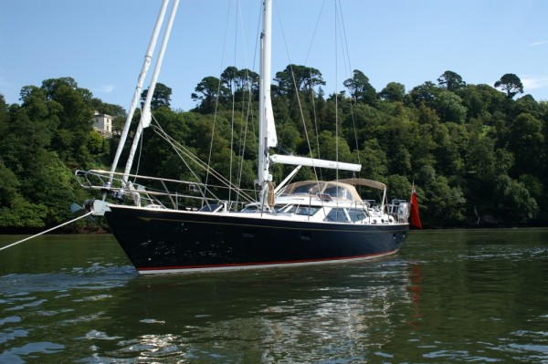
| Vessel Name: | Interlude |
| Vessel Make/Model: | Discovery 55 |
| Hailing Port: | Annapolis, MD |
| Crew: | Dan, Christine & Tyler Rice |
| About: | |
| Extra: |
Interlude's Photos - Main
 |
This album contains selected best pics from our time in Greece this year.
38 Photos
Created 13 August 2012
|
 |
 |
About Us....
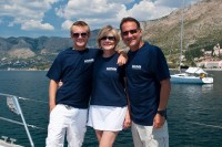
Who: Dan, Christine & Tyler Rice
Port: Annapolis, MD
SailBlogs Friends

