Sequoia Changing Latitudes
30 August 2023 | St. Helens, Oregon
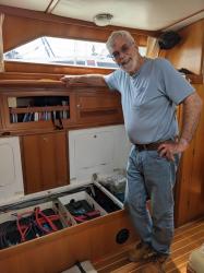
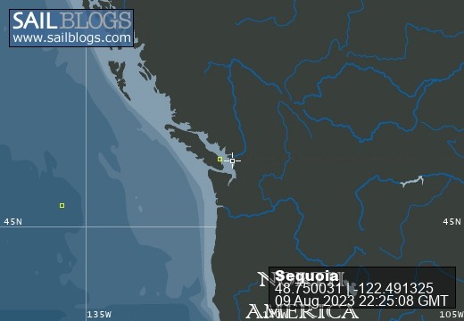
09 August 2023 | Bellingham, Washington
21 July 2023 | Boat: Bellingham; C&B: Scappoose
10 July 2023 | Egmont, Sunshine Coast, B.C., Canada
02 July 2023 | Walsh Cove, Desolation Sound, B.C., Canada
23 June 2023 | Westview/Powell River B.C.
18 June 2023 | Ganges, Saltspring Island, B.C., Canada
22 June 2019 | Scappoose, Oregon
27 May 2019 | Back home in Oregon
09 May 2019 | Villas Alturas Hotel, Costa Rica
02 May 2019 | San Vito, Costa Rica
23 April 2019 | Golfito, Costa Rica
11 April 2019 | Panama City, Panama
04 April 2019 | Shelter Bay Marina, Colon, Panama
22 March 2019 | Jamaica
11 March 2019 | Zar Par Marina, Boca Chica, Dominican Republic
18 February 2019 | Culebra Island, Puerto Rico
31 January 2019 | Simpson Bay Lagoon, Sint Maarten
21 January 2019 | Nelson's Dockyard, English Harbour, Antigua
04 January 2019 | Portsmouth, Dominica
Cruising the Sacramento Delta
23 September 2010 | Scappoose, OR
September 23, 2010
Scappoose, Oregon
Dear friends and family:
It had been my hope, by now, to have the bugs worked out in a 21st century email distribution system. But such was not to be! At least I have deleted all the non-working addresses from my distribution list, updated some addresses, and added more people who may want to receive these emails. If anyone getting this email doesn't want to receive them from us from time to time, please let me know, and I'll take you off the list!
In my previous email, I wrote about our trip down the coast, and our arrival in San Francisco Bay. Most recently, after a few weeks aboard the boat in San Francisco Bay, we returned by plane to Oregon for a few wonderful reasons: To rehearse and perform Beethoven's 9th in Newport; and to travel to Germany for our former exchange student's wedding. I'm also working very hard to understand and learn to use "Dreamweaver" so that I can update www.svsequoia.com
!
But before we go any further down the road, I want to tell you about some of the fun we had while in the Bay Area. Most notably we cruised to the Sacramento River Delta during our time in the Bay Area. After all, we are supposed to be "cruising," not just getting the boat ready to cruise, and making deliveries.
One of the astonishing things about Facebook (of which I am a sometimes-reluctant adherent) is that there are all these people from past lives, who read my Facebook posts. So when I announced that we had arrived in the Bay Area, various people wrote to say that we should get together. A Seattle friend was in San Francisco for a medical conference. One high school friend invited me to her house in Napa Valley (unfortunately we were unable to make it...) Another friend, whom I have known since before the mists of toddlerhood, invited us to dinner (and that dinner was delightful). We also got together with family, including my sister, Marcela and nieces Erika and Gaby. We spent quite a bit of time with Craig's Dad, going out to dinner, discussing the political news and current ball games, pressing his washer and drier into service, and frightening the neighbors who weren't aware we'd be there - sometimes in his absence.
The highlight of our time in SF Bay was the trip up the Sacramento and San Joaquin Rivers. In Alameda (where we were tied up for most of our stay, and where the boat now is), the fog was always lurking, just behind San Francisco, or just in front of San Francisco, or over us in the sky, or even all around us. But as we sailed north towards San Pablo Bay, we left the fog behind. We were reminded why there are so many sailors in San Francisco Bay. 20 knots of wind, almost no waves, and we were scooting along at 8, sometimes 9 knots. (We had one reef in the main, and used the staysail, not the genoa). There was a wind shadow behind Angel Island, but the wind ramped up again quickly on the other side. It was a weekday, so not too many sailboats were out, but lots of commercial shipping, and passenger ferries. We were passed several times by one ferry that seems to go from San Francisco and up the Napa River to Vallejo.
Although my father had an L-39 sailboat in SF Bay when we were teenagers, we always sailed west from Berkeley - sometimes as far as Angel Island - but never further north than the Richmond-San Rafael bridge. His primary focus was racing. Our primary focus is cruising. So for us, it was all new territory once we passed under the Richmond-San Rafael bridge. That is to say, the view from the water was new. Some things you never see from land. There was the East Brother light station with delightful old coast guard buildings. (http://ebls.org
) There was a guano-covered rock next to it ("West Brother"?), with the cormorants evenly spaced out over the top of it (we asked each other: "if there were more birds, would they stand closer together, or would they just cover down the sides of the rock at the same spacing?)
Past The Brothers, I saw the old Standard Oil (now Chevron/Texaco?) Rod & Gun Club, where my high school friend, Lynn Weber, was able to invite friends for parties, etc. (Her father worked at Standard Oil).
Heading northeast, we approached the Carquinez Strait (increased winds, increased boat traffic). Just under the Carquinez Bridge (now "bridges") the old C & H Sugar plant still stands, and apparently still operates. I remember as a kid how thrilling it was (why?) to know that the "C" stood for California and the "H" stood for Hawaii, and that this was the "C" part, right before my very eyes. As we passed it, Craig asked, "Do they refine sugar beets?" I was astonished, incredulous, "Don't you know, 'pure cane sugar from Hawaii'?" Obviously he didn't listen to those ads quite as carefully as I did in our respective childhoods. And there it was, on the sign: "Pure Cane Sugar From Hawaii." An interesting postscript, observed as we passed this time, there was a rusty looking ship tied up to the dock there. The name: The Cinnamon. Makes me wonder: do they have a "Nutmeg"? An "Allspice"? Perhaps a "Chocolate"?
Coming up soon on the north side of the river was Benicia, where we decided to stay for the night. They have a nice marina, with a dredge parked in the entrance (was that a bad sign?) We made it in, found a funky burger joint ashore, and walked 10 blocks or so to the Safeway store. Seems like Benicia might be a nice place to spend more time. There is a real sense of history, with lots of signs and sidewalk tile art commemorating past events and people. Also, a variety of small, interesting restaurants, with lots of varied and delicious aromas emanating out the open doors.
The next morning we faced the three Benicia bridges, one of which had a clearance of only 70 feet. Our mast-to-water height is 67 feet. Even a very high bridge looks, from the deck of the boat, as though it's going to take the top off our mast. This one was ten times worse. What if the chart's wrong? What if we're off by a few feet in knowing the height of our mast? What if this is an extra high tide? Craig tried calling the bridge tender to confirm the chart's measurement, but there was no answer. We made it under, going dead slow, holding our breaths.
Next up: Port Chicago Naval Weapons Station. They told us in Benicia that if a ship was at the dock, we'd be required to pass outside the navigation buoys - but not very far outside, because it gets shallow very quickly. Indeed, as we approached Port Chicago, a little Coast Guard RIB, with blue police lights flashing, and a fellow on the bow tending a machine gun, approached us and warned us by megaphone to stay outside the buoys. The little RIB motored alongside us, but just inside the buoys, until we were well past the ship. I have no doubt that we are now in some database, photographs and all, of boats that come near the Weapons Station.
We passed Pittsburg, then Antioch. When I was a kid, my father had some architectural job that took him frequently to Antioch. Maybe he was inspecting some construction project? I found myself wondering which of those ashore buildings it might have been. (None seem particularly inspiring from an architectural standpoint, although I now realize that Antioch extends substantially inland). (About the same time my father was working in Antioch, he was also traveling with some regularity to Entiat, Washington, where his father was in poor health. I remember being quite confused about where he was really going, and why, because the first syllable of the two towns is pronounced identically.)
Once we were under the Antioch bridge, we entered the only stretch of the river where the wind wasn't behind us. We had a brief upwind sail, and then entered the winding channels of the Delta. We took the sails down, as the winds became alternately gusty and ephemeral, varying in direction. Our destination was "Potato Slough" which various folks had told us was a good destination for cruising sailboats in the Delta. The channel makes several big loops, with islands in the ends of the loops providing good shelter for protected anchorages. The first loop is called (by boaters) "bedroom one" and the second one is "bedrooom two." We dropped the anchor in "bedroom two," the only sailboat among a dozen or so small-to-large motor cruisers and a couple of crusty looking houseboats. Opposite on the small, swampy island was the "Ding-A-Ling Club" a private resort, "KEEP OUT."
We stayed in Potato Slough three nights. Two of the days were part of the Labor Day weekend, and the "personal watercraft" buzzed around us like a frenzy of loud, crazed mosquitos. At dusk the real mosquitos came out, and we deployed our bug nets to good effect. It reached 90 degrees during the day, and the sunsets (and sunrises) were gorgeous. We swam every afternoon (water 77 degrees) and enjoyed leisurely, delicious home-cooked dinners. Each day we got more boat tasks done, deploying the sewing machine for some, the computer for others, and lots of elbow grease. Made a cover for the anchor windlass, inventoried more lockers, and swabbed the v-berth locker with chlorine bleach. Inventoried the medical kit, and thought about the S/V Sequoia website.
Astonishingly - at least to us - was the realization that the big "islands" (with farms, roads, electric transmission lines, etc.) were all at least ten feet below the level of the water in the channels. They have rip-rap or earthen dikes built up around them, and there were occasionally trucks driving on the dikes. What happens if there is a big earthquake? (Earthquakes in California?! No! Who would ever think such a thing?) We later learned that possible breaches of the dikes are a real concern, and that the City of Sacramento is below the river level, much like New Orleans... There's a precedent to think about!
Our last day in Potato Slough was the Tuesday after Labor Day. Most of the boats had cleared out, and our neighbors were now two other sailboats and one crusty looking houseboat (which apparently stays there much of the time). The Ding-A-Ling docks were empty. No personal watercraft. But we needed to get back to Alameda, so we upped anchor and motored out. By the time we reached the winds of the main channel, they were very much against us, so we motorsailed most of the way. There was still a ship at Port Chicago, so a little gun-wielding Coast Guard RIB appeared to escort us along the buoys. We once again held our breaths going under the Benicia railway bridge, but there was no slowing down, because the current was boiling along at about 3 knots.
We stayed for a second time at the Benicia Marina. The dredge was at work this time, and we eased our way past, between the bamboo stakes. The next morning, a zero tide, we found ourselves aground, or at least slurping around on the muddy bottom. We couldn't get off the dock, so we concluded that the keel had dug itself a hole as the tide dropped. So much for leaving at slack tide. A couple of hours later, we did get off the dock, attracted the dredge's attention so he'd move aside a bit, and went out into the channel. The tide was now in full flood, and we had nearly three knots of current against us - something that held true all the way to mid-bay. About that time, the tide changed again, and we fought an ebb current all the way back to Alameda.
I've said way more than I intended about our time in SF Bay. We'll be back there in about three weeks, and I'll write more at that time. Maybe by then, I can also figure out how to update the website! In the meantime, come hear us play Beethoven's 9th in Newport on Sept. 25!
Best wishes to all!
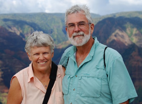
Craig & Barbara Johnston
S/V Sequoia
Scappoose, Oregon
Dear friends and family:
It had been my hope, by now, to have the bugs worked out in a 21st century email distribution system. But such was not to be! At least I have deleted all the non-working addresses from my distribution list, updated some addresses, and added more people who may want to receive these emails. If anyone getting this email doesn't want to receive them from us from time to time, please let me know, and I'll take you off the list!
In my previous email, I wrote about our trip down the coast, and our arrival in San Francisco Bay. Most recently, after a few weeks aboard the boat in San Francisco Bay, we returned by plane to Oregon for a few wonderful reasons: To rehearse and perform Beethoven's 9th in Newport; and to travel to Germany for our former exchange student's wedding. I'm also working very hard to understand and learn to use "Dreamweaver" so that I can update www.svsequoia.com
!
But before we go any further down the road, I want to tell you about some of the fun we had while in the Bay Area. Most notably we cruised to the Sacramento River Delta during our time in the Bay Area. After all, we are supposed to be "cruising," not just getting the boat ready to cruise, and making deliveries.
One of the astonishing things about Facebook (of which I am a sometimes-reluctant adherent) is that there are all these people from past lives, who read my Facebook posts. So when I announced that we had arrived in the Bay Area, various people wrote to say that we should get together. A Seattle friend was in San Francisco for a medical conference. One high school friend invited me to her house in Napa Valley (unfortunately we were unable to make it...) Another friend, whom I have known since before the mists of toddlerhood, invited us to dinner (and that dinner was delightful). We also got together with family, including my sister, Marcela and nieces Erika and Gaby. We spent quite a bit of time with Craig's Dad, going out to dinner, discussing the political news and current ball games, pressing his washer and drier into service, and frightening the neighbors who weren't aware we'd be there - sometimes in his absence.
The highlight of our time in SF Bay was the trip up the Sacramento and San Joaquin Rivers. In Alameda (where we were tied up for most of our stay, and where the boat now is), the fog was always lurking, just behind San Francisco, or just in front of San Francisco, or over us in the sky, or even all around us. But as we sailed north towards San Pablo Bay, we left the fog behind. We were reminded why there are so many sailors in San Francisco Bay. 20 knots of wind, almost no waves, and we were scooting along at 8, sometimes 9 knots. (We had one reef in the main, and used the staysail, not the genoa). There was a wind shadow behind Angel Island, but the wind ramped up again quickly on the other side. It was a weekday, so not too many sailboats were out, but lots of commercial shipping, and passenger ferries. We were passed several times by one ferry that seems to go from San Francisco and up the Napa River to Vallejo.
Although my father had an L-39 sailboat in SF Bay when we were teenagers, we always sailed west from Berkeley - sometimes as far as Angel Island - but never further north than the Richmond-San Rafael bridge. His primary focus was racing. Our primary focus is cruising. So for us, it was all new territory once we passed under the Richmond-San Rafael bridge. That is to say, the view from the water was new. Some things you never see from land. There was the East Brother light station with delightful old coast guard buildings. (http://ebls.org
) There was a guano-covered rock next to it ("West Brother"?), with the cormorants evenly spaced out over the top of it (we asked each other: "if there were more birds, would they stand closer together, or would they just cover down the sides of the rock at the same spacing?)
Past The Brothers, I saw the old Standard Oil (now Chevron/Texaco?) Rod & Gun Club, where my high school friend, Lynn Weber, was able to invite friends for parties, etc. (Her father worked at Standard Oil).
Heading northeast, we approached the Carquinez Strait (increased winds, increased boat traffic). Just under the Carquinez Bridge (now "bridges") the old C & H Sugar plant still stands, and apparently still operates. I remember as a kid how thrilling it was (why?) to know that the "C" stood for California and the "H" stood for Hawaii, and that this was the "C" part, right before my very eyes. As we passed it, Craig asked, "Do they refine sugar beets?" I was astonished, incredulous, "Don't you know, 'pure cane sugar from Hawaii'?" Obviously he didn't listen to those ads quite as carefully as I did in our respective childhoods. And there it was, on the sign: "Pure Cane Sugar From Hawaii." An interesting postscript, observed as we passed this time, there was a rusty looking ship tied up to the dock there. The name: The Cinnamon. Makes me wonder: do they have a "Nutmeg"? An "Allspice"? Perhaps a "Chocolate"?
Coming up soon on the north side of the river was Benicia, where we decided to stay for the night. They have a nice marina, with a dredge parked in the entrance (was that a bad sign?) We made it in, found a funky burger joint ashore, and walked 10 blocks or so to the Safeway store. Seems like Benicia might be a nice place to spend more time. There is a real sense of history, with lots of signs and sidewalk tile art commemorating past events and people. Also, a variety of small, interesting restaurants, with lots of varied and delicious aromas emanating out the open doors.
The next morning we faced the three Benicia bridges, one of which had a clearance of only 70 feet. Our mast-to-water height is 67 feet. Even a very high bridge looks, from the deck of the boat, as though it's going to take the top off our mast. This one was ten times worse. What if the chart's wrong? What if we're off by a few feet in knowing the height of our mast? What if this is an extra high tide? Craig tried calling the bridge tender to confirm the chart's measurement, but there was no answer. We made it under, going dead slow, holding our breaths.
Next up: Port Chicago Naval Weapons Station. They told us in Benicia that if a ship was at the dock, we'd be required to pass outside the navigation buoys - but not very far outside, because it gets shallow very quickly. Indeed, as we approached Port Chicago, a little Coast Guard RIB, with blue police lights flashing, and a fellow on the bow tending a machine gun, approached us and warned us by megaphone to stay outside the buoys. The little RIB motored alongside us, but just inside the buoys, until we were well past the ship. I have no doubt that we are now in some database, photographs and all, of boats that come near the Weapons Station.
We passed Pittsburg, then Antioch. When I was a kid, my father had some architectural job that took him frequently to Antioch. Maybe he was inspecting some construction project? I found myself wondering which of those ashore buildings it might have been. (None seem particularly inspiring from an architectural standpoint, although I now realize that Antioch extends substantially inland). (About the same time my father was working in Antioch, he was also traveling with some regularity to Entiat, Washington, where his father was in poor health. I remember being quite confused about where he was really going, and why, because the first syllable of the two towns is pronounced identically.)
Once we were under the Antioch bridge, we entered the only stretch of the river where the wind wasn't behind us. We had a brief upwind sail, and then entered the winding channels of the Delta. We took the sails down, as the winds became alternately gusty and ephemeral, varying in direction. Our destination was "Potato Slough" which various folks had told us was a good destination for cruising sailboats in the Delta. The channel makes several big loops, with islands in the ends of the loops providing good shelter for protected anchorages. The first loop is called (by boaters) "bedroom one" and the second one is "bedrooom two." We dropped the anchor in "bedroom two," the only sailboat among a dozen or so small-to-large motor cruisers and a couple of crusty looking houseboats. Opposite on the small, swampy island was the "Ding-A-Ling Club" a private resort, "KEEP OUT."
We stayed in Potato Slough three nights. Two of the days were part of the Labor Day weekend, and the "personal watercraft" buzzed around us like a frenzy of loud, crazed mosquitos. At dusk the real mosquitos came out, and we deployed our bug nets to good effect. It reached 90 degrees during the day, and the sunsets (and sunrises) were gorgeous. We swam every afternoon (water 77 degrees) and enjoyed leisurely, delicious home-cooked dinners. Each day we got more boat tasks done, deploying the sewing machine for some, the computer for others, and lots of elbow grease. Made a cover for the anchor windlass, inventoried more lockers, and swabbed the v-berth locker with chlorine bleach. Inventoried the medical kit, and thought about the S/V Sequoia website.
Astonishingly - at least to us - was the realization that the big "islands" (with farms, roads, electric transmission lines, etc.) were all at least ten feet below the level of the water in the channels. They have rip-rap or earthen dikes built up around them, and there were occasionally trucks driving on the dikes. What happens if there is a big earthquake? (Earthquakes in California?! No! Who would ever think such a thing?) We later learned that possible breaches of the dikes are a real concern, and that the City of Sacramento is below the river level, much like New Orleans... There's a precedent to think about!
Our last day in Potato Slough was the Tuesday after Labor Day. Most of the boats had cleared out, and our neighbors were now two other sailboats and one crusty looking houseboat (which apparently stays there much of the time). The Ding-A-Ling docks were empty. No personal watercraft. But we needed to get back to Alameda, so we upped anchor and motored out. By the time we reached the winds of the main channel, they were very much against us, so we motorsailed most of the way. There was still a ship at Port Chicago, so a little gun-wielding Coast Guard RIB appeared to escort us along the buoys. We once again held our breaths going under the Benicia railway bridge, but there was no slowing down, because the current was boiling along at about 3 knots.
We stayed for a second time at the Benicia Marina. The dredge was at work this time, and we eased our way past, between the bamboo stakes. The next morning, a zero tide, we found ourselves aground, or at least slurping around on the muddy bottom. We couldn't get off the dock, so we concluded that the keel had dug itself a hole as the tide dropped. So much for leaving at slack tide. A couple of hours later, we did get off the dock, attracted the dredge's attention so he'd move aside a bit, and went out into the channel. The tide was now in full flood, and we had nearly three knots of current against us - something that held true all the way to mid-bay. About that time, the tide changed again, and we fought an ebb current all the way back to Alameda.
I've said way more than I intended about our time in SF Bay. We'll be back there in about three weeks, and I'll write more at that time. Maybe by then, I can also figure out how to update the website! In the meantime, come hear us play Beethoven's 9th in Newport on Sept. 25!
Best wishes to all!
Craig & Barbara Johnston
S/V Sequoia
Comments
| Vessel Name: | Sequoia |
| Vessel Make/Model: | Outbound 44 |
| Hailing Port: | Portland, Or |
| Crew: | Craig & Barbara Johnston |
| About: | |
| Extra: |
Sequoia's Photos - Main
 |
Photos from the beginning of our summer cruise to B.C.
11 Photos
Created 18 June 2023
|
 |
Photos from the beginning of our summer cruise to B.C.
No Photos
Created 18 June 2023
|
|
Putting Sequoia aboard the M/V Merwedegracht in Victoria, B.C.
3 Photos
Created 29 March 2017
|
|
Photos of our preparations to have Sequoia shipped by freighter from Victoria to Europe.
6 Photos
Created 13 March 2017
|
Who we are...
Who: Craig & Barbara Johnston
Port: Portland, Or
Gallery