Sequoia Changing Latitudes
30 August 2023 | St. Helens, Oregon
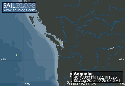
09 August 2023 | Bellingham, Washington
21 July 2023 | Boat: Bellingham; C&B: Scappoose
10 July 2023 | Egmont, Sunshine Coast, B.C., Canada
02 July 2023 | Walsh Cove, Desolation Sound, B.C., Canada
23 June 2023 | Westview/Powell River B.C.
18 June 2023 | Ganges, Saltspring Island, B.C., Canada
22 June 2019 | Scappoose, Oregon
27 May 2019 | Back home in Oregon
09 May 2019 | Villas Alturas Hotel, Costa Rica
02 May 2019 | San Vito, Costa Rica
23 April 2019 | Golfito, Costa Rica
11 April 2019 | Panama City, Panama
04 April 2019 | Shelter Bay Marina, Colon, Panama
22 March 2019 | Jamaica
11 March 2019 | Zar Par Marina, Boca Chica, Dominican Republic
18 February 2019 | Culebra Island, Puerto Rico
31 January 2019 | Simpson Bay Lagoon, Sint Maarten
21 January 2019 | Nelson's Dockyard, English Harbour, Antigua
04 January 2019 | Portsmouth, Dominica
Dartmouth to Jersey, Part I
03 July 2018 | St. Malo, Brittany, France
Craig & Barbara/warm but cloudy with threatening rain
If you're wondering why it's been so long since I last wrote about our trip, it's because we've been having too much fun. Yet I'm constantly aware that if I don't commit some words to the blog, I'm likely to forget some of the wonderful experiences we've been having. So I'm writing for those who like to hear about our trip, but I'm mostly writing for me, to remember these wonderful experiences.
When I last wrote, we were in Plymouth, celebrating our 50th anniversary. The plan had been to get as far west as Falmouth, but the winds and weather weren't cooperating. So in the end we decided to return to Dartmouth as a staging-place for crossing the Channel in a single-day, all daylight passage. The goal was Guernsey, where we knew our son, David, would be waiting for us on June 21.
In Dartmouth we did some grocery shopping, checked out some other restaurants, and took a ferry up the Dart River to see Agatha Christie's summer house. This was the house where "Dead Man's Folly" was set. I decided to order the book for my kindle, and I must say it has been fun reading the book, and now knowing exactly the places where the action was taking place. The house and extensive gardens have been beautifully maintained. In the house's library, there is a frieze along the top of all the walls, depicting scenes from World War II. Apparently a US coast guard division was stationed in the river there, and the house was used in part by officers. On of them painted that frieze. Miss Christie declined to have them removed or painted over, so there they still are. While we were touring the house, one of the docents sat down at the well-maintained Steinway and played the theme music from the British Poirot TV series. What fun!
Above: The library at Agatha Christie's house
While we were waiting for the ferry up the river to the Agatha Christie house, we ordered some take-out fish & chips, and sat down on a bench to eat. The seagulls were flying all around, and it wasn't long before one them attacked Craig's carton, right in his hands, in a moment that he was distracted. Quite obviously, the gulls have become accustomed to plentiful offerings from tourists. (And there are lots of tourists in Dartmouth). Our other experience with gulls in Dartmouth was their ongoing use of the docks as a surface against which they fling their shellfish. The shells break upon impact, and then the gulls swoop in to gobble out of the now-open shells. Every day there is a new load of mussel and crab shells on the docks. This practice particularly got my ire when one gull missed the dock and landed his mussel shell on Sequoia's side deck. It made a huge "thunk" and sprayed mussel innards all across the deck.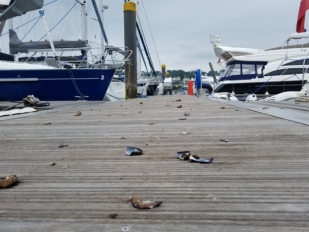
Above: Seagull leavings on the docks at Dartmouth
We left Dartmouth for Guernsey on June 21 and had a relatively uneventful crossing. There was a lot of planning on Craig's part, considering not just the weather, but also tides. The tidal range in this part of the world can be from 8m in the U.K. to more than 10m (33 feet) in France. That means strong flood and ebb currents changing direction every 6 hours. The strongest tides are the spring tides, which despite the name occurs two days after each new or full moon. In between are the neap tides, about half as strong. Our channel crossing started at 0735 and we pulled into Guernsey's St. Peter Port at 1920. We had a pleasant North wind of about 13 kn for sailing, although it dropped until we motor-sailed the last part. But during the 12 hour passage the current was about 1 kn sideways, first one way, then the other. Turns out the best strategy is just to aim at your destination, with allowance for the net average current, and stay on a constant heading. And avoid the many large ships, of course. It worked out okay!
The Channel Islands are a fascinating mixture of British and French culture. Located close to France between Normandy and Brittany, they are loyal to the English crown and granted self-government. They are NOT part of the U.K or the EU, nor are they in the Schengen zone. Predominantly English speaking, they also historically spoke a patois of French origin. The names of the streets, neighborhoods, towns and cities are mostly in French.
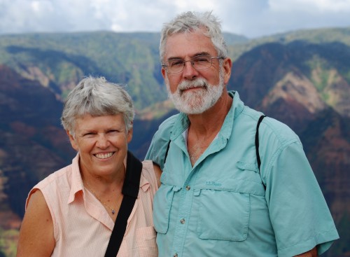
We met our son David at the dock, shortly after we arrived in St. Peter Port, Guernsey. He joined us in the Channel Islands rather than another leg of our voyage because he had a particular agenda: He is writing a science fiction novel set on a fictional island not unlike Sark. Sark is a much smaller island than Guernsey or Jersey, with a more agrarian culture. We bought tickets for an all-day excursion to Sark by ferry for a couple of days after our arrival.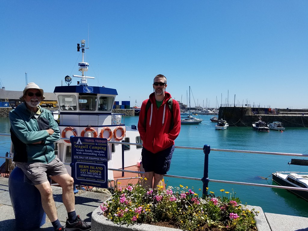
Above: Craig and David on the docks at St. Peter Port.
The first day in Guernsey we spent walking around St. Peter Port, and David found the Priaulx Library, which is a repository of all sorts of information about the Channel Islands.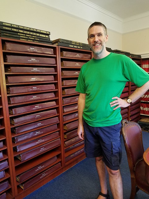
Above: David at the Priaulx Library, about to dig into the bound volumes of old newspapers.
Initially we docked in the outer portion of the St. Peter Port harbor. It is subject to the extremes of the tides, which can have a change of up to 12 meters. But there is no electricity or water on the outer docks, and we've become spoiled. So we inquired about the possibility of entering the inner harbor, which is behind a cill (like an underwater wall). You need high water to get in or out. When the tide drops, water is trapped behind the cill, maintaining a depth of 2.1 meters in at least some parts of the harbor. Sequoia's draft (the part that is below the water) is 2.1 meters, so the harbor staff thought we'd be fine. So in we went with a fleet of other boats, and the harbormaster directed us toward "the best slip in the harbor." As the tide went out, and we saw the cill become a waterfall, we also watched our depth sounder. Before long it showed that we should be touching bottom. If so, it was a pretty soft bottom, because we never felt any bumping.
The next day we took the ferry to Sark. There are no cars on Sark. If you want mechanized transport, there are tractors, including ones that pull passenger carts of various sorts. Beyond that there are bicycles and horses. We opted for bicycles. We biked to both ends of the island, seeing cannons that had been set up for defense at various times in the past 500 years. One at the south end had been blown apart, apparently when there was an attempt to use it to celebrate the coronation of Queen Elizabeth in 1952. The particular one we saw at the north end appeared to be relatively intact and much older.
Above: At the beginning of a footpath on Little Sark

Above: Cannon on the south coast of Little Sark
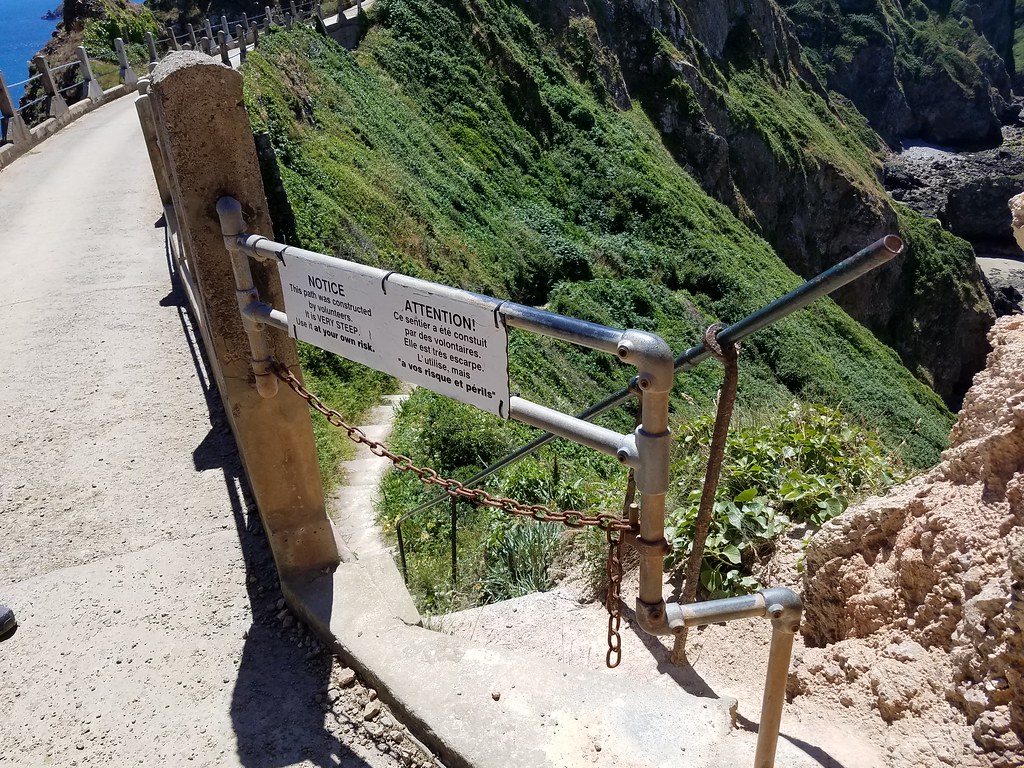
The land at the south end of Sark is almost a separate island called "Little Sark". It is connected to the main part of Sark by a narrow isthmus called La Coupee. Now the road across La Coupee is paved and there are railings, protecting walkers from a drop of hundreds of feet. But we heard stories about how, in the earlier part of the 20th century, school children were forced to crawl across La Coupee on their hands and knees to avoid being blown off by the strong winds. The paved road and railings were built by the Nazis during World War II, using forced laborers.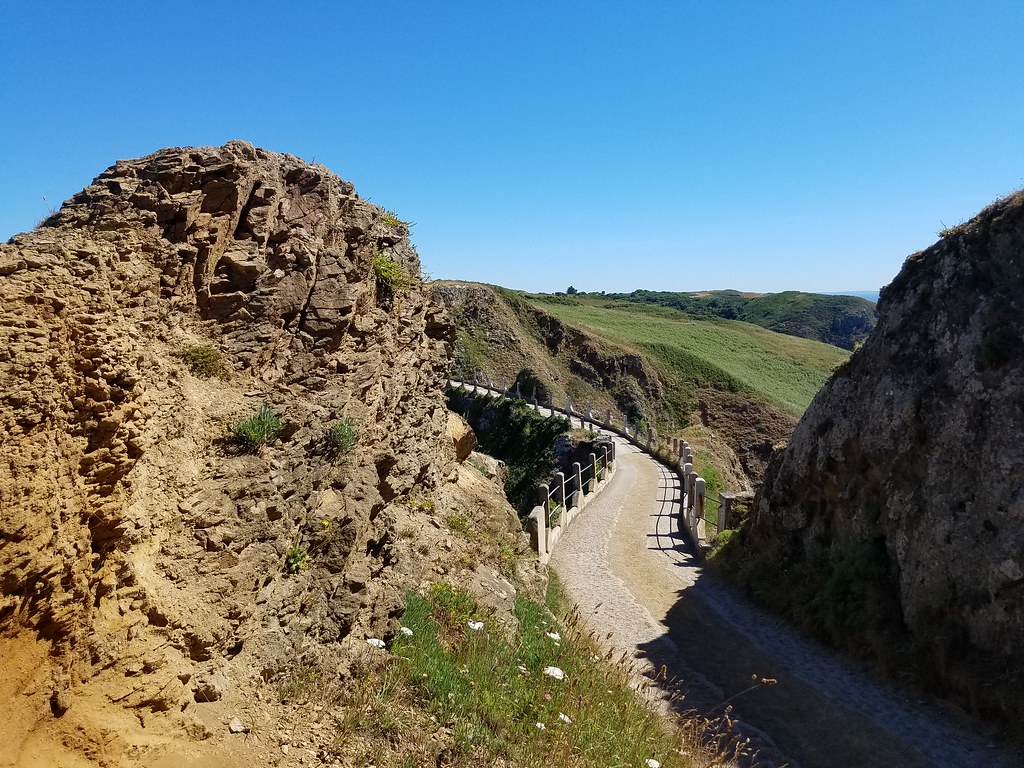
Above: La Coupee
Above and below: View down from La Coupee

The Nazi occupation during World War II is a horrific and important part of the Channel Islands history. Its evidence appears everywhere. Gun emplacements, tunnels, museums, public memorials, books and tourist souvenirs help everyone remember. Later in our Guernsey stay we visited the Occupation Museum, saw the newly released movie, The Guernsey Literary and Potato Peel Pie Society (about the occupation) and saw a historic reenactment at the Castle Cornet.
For the rest of this blog, see Dartmouth to Jersey, Part II
See also photos at my Flickr album.
When I last wrote, we were in Plymouth, celebrating our 50th anniversary. The plan had been to get as far west as Falmouth, but the winds and weather weren't cooperating. So in the end we decided to return to Dartmouth as a staging-place for crossing the Channel in a single-day, all daylight passage. The goal was Guernsey, where we knew our son, David, would be waiting for us on June 21.
In Dartmouth we did some grocery shopping, checked out some other restaurants, and took a ferry up the Dart River to see Agatha Christie's summer house. This was the house where "Dead Man's Folly" was set. I decided to order the book for my kindle, and I must say it has been fun reading the book, and now knowing exactly the places where the action was taking place. The house and extensive gardens have been beautifully maintained. In the house's library, there is a frieze along the top of all the walls, depicting scenes from World War II. Apparently a US coast guard division was stationed in the river there, and the house was used in part by officers. On of them painted that frieze. Miss Christie declined to have them removed or painted over, so there they still are. While we were touring the house, one of the docents sat down at the well-maintained Steinway and played the theme music from the British Poirot TV series. What fun!
Above: The library at Agatha Christie's house
While we were waiting for the ferry up the river to the Agatha Christie house, we ordered some take-out fish & chips, and sat down on a bench to eat. The seagulls were flying all around, and it wasn't long before one them attacked Craig's carton, right in his hands, in a moment that he was distracted. Quite obviously, the gulls have become accustomed to plentiful offerings from tourists. (And there are lots of tourists in Dartmouth). Our other experience with gulls in Dartmouth was their ongoing use of the docks as a surface against which they fling their shellfish. The shells break upon impact, and then the gulls swoop in to gobble out of the now-open shells. Every day there is a new load of mussel and crab shells on the docks. This practice particularly got my ire when one gull missed the dock and landed his mussel shell on Sequoia's side deck. It made a huge "thunk" and sprayed mussel innards all across the deck.
Above: Seagull leavings on the docks at Dartmouth
We left Dartmouth for Guernsey on June 21 and had a relatively uneventful crossing. There was a lot of planning on Craig's part, considering not just the weather, but also tides. The tidal range in this part of the world can be from 8m in the U.K. to more than 10m (33 feet) in France. That means strong flood and ebb currents changing direction every 6 hours. The strongest tides are the spring tides, which despite the name occurs two days after each new or full moon. In between are the neap tides, about half as strong. Our channel crossing started at 0735 and we pulled into Guernsey's St. Peter Port at 1920. We had a pleasant North wind of about 13 kn for sailing, although it dropped until we motor-sailed the last part. But during the 12 hour passage the current was about 1 kn sideways, first one way, then the other. Turns out the best strategy is just to aim at your destination, with allowance for the net average current, and stay on a constant heading. And avoid the many large ships, of course. It worked out okay!
The Channel Islands are a fascinating mixture of British and French culture. Located close to France between Normandy and Brittany, they are loyal to the English crown and granted self-government. They are NOT part of the U.K or the EU, nor are they in the Schengen zone. Predominantly English speaking, they also historically spoke a patois of French origin. The names of the streets, neighborhoods, towns and cities are mostly in French.
We met our son David at the dock, shortly after we arrived in St. Peter Port, Guernsey. He joined us in the Channel Islands rather than another leg of our voyage because he had a particular agenda: He is writing a science fiction novel set on a fictional island not unlike Sark. Sark is a much smaller island than Guernsey or Jersey, with a more agrarian culture. We bought tickets for an all-day excursion to Sark by ferry for a couple of days after our arrival.
Above: Craig and David on the docks at St. Peter Port.
The first day in Guernsey we spent walking around St. Peter Port, and David found the Priaulx Library, which is a repository of all sorts of information about the Channel Islands.
Above: David at the Priaulx Library, about to dig into the bound volumes of old newspapers.
Initially we docked in the outer portion of the St. Peter Port harbor. It is subject to the extremes of the tides, which can have a change of up to 12 meters. But there is no electricity or water on the outer docks, and we've become spoiled. So we inquired about the possibility of entering the inner harbor, which is behind a cill (like an underwater wall). You need high water to get in or out. When the tide drops, water is trapped behind the cill, maintaining a depth of 2.1 meters in at least some parts of the harbor. Sequoia's draft (the part that is below the water) is 2.1 meters, so the harbor staff thought we'd be fine. So in we went with a fleet of other boats, and the harbormaster directed us toward "the best slip in the harbor." As the tide went out, and we saw the cill become a waterfall, we also watched our depth sounder. Before long it showed that we should be touching bottom. If so, it was a pretty soft bottom, because we never felt any bumping.
The next day we took the ferry to Sark. There are no cars on Sark. If you want mechanized transport, there are tractors, including ones that pull passenger carts of various sorts. Beyond that there are bicycles and horses. We opted for bicycles. We biked to both ends of the island, seeing cannons that had been set up for defense at various times in the past 500 years. One at the south end had been blown apart, apparently when there was an attempt to use it to celebrate the coronation of Queen Elizabeth in 1952. The particular one we saw at the north end appeared to be relatively intact and much older.
Above: At the beginning of a footpath on Little Sark
Above: Cannon on the south coast of Little Sark
The land at the south end of Sark is almost a separate island called "Little Sark". It is connected to the main part of Sark by a narrow isthmus called La Coupee. Now the road across La Coupee is paved and there are railings, protecting walkers from a drop of hundreds of feet. But we heard stories about how, in the earlier part of the 20th century, school children were forced to crawl across La Coupee on their hands and knees to avoid being blown off by the strong winds. The paved road and railings were built by the Nazis during World War II, using forced laborers.
Above: La Coupee
Above and below: View down from La Coupee
The Nazi occupation during World War II is a horrific and important part of the Channel Islands history. Its evidence appears everywhere. Gun emplacements, tunnels, museums, public memorials, books and tourist souvenirs help everyone remember. Later in our Guernsey stay we visited the Occupation Museum, saw the newly released movie, The Guernsey Literary and Potato Peel Pie Society (about the occupation) and saw a historic reenactment at the Castle Cornet.
For the rest of this blog, see Dartmouth to Jersey, Part II
See also photos at my Flickr album.
Comments
| Vessel Name: | Sequoia |
| Vessel Make/Model: | Outbound 44 |
| Hailing Port: | Portland, Or |
| Crew: | Craig & Barbara Johnston |
| About: | |
| Extra: |
Sequoia's Photos - Main
 |
Photos from the beginning of our summer cruise to B.C.
11 Photos
Created 18 June 2023
|
 |
Photos from the beginning of our summer cruise to B.C.
No Photos
Created 18 June 2023
|
|
Putting Sequoia aboard the M/V Merwedegracht in Victoria, B.C.
3 Photos
Created 29 March 2017
|
|
Photos of our preparations to have Sequoia shipped by freighter from Victoria to Europe.
6 Photos
Created 13 March 2017
|
Who we are...
Who: Craig & Barbara Johnston
Port: Portland, Or
Gallery