Sailing with Wings
The sometimes stories of sailing with Dee and Molly on SV Wings

06 December 2023 | St Pete
16 October 2023 | Ardrossan
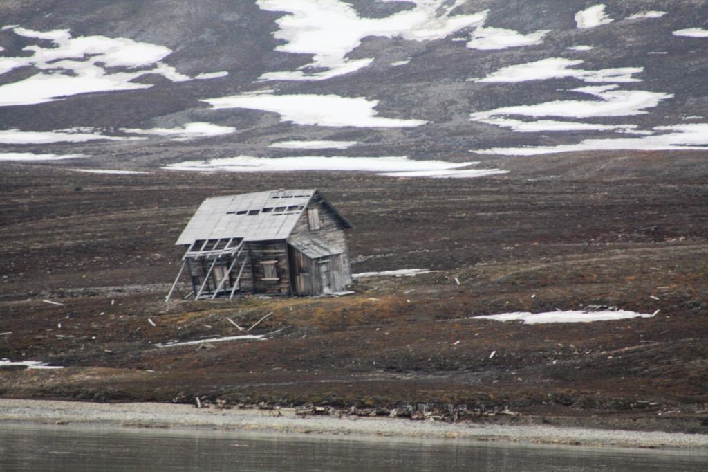
28 August 2023 | Stromness
14 August 2023 | Kristiansund
23 July 2023 | Tromso
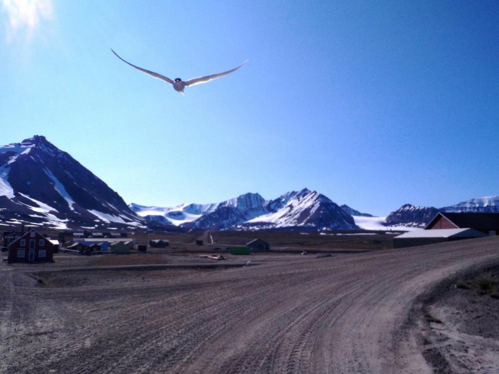
13 July 2023 | Longyearbyen
14 June 2023 | Tromso
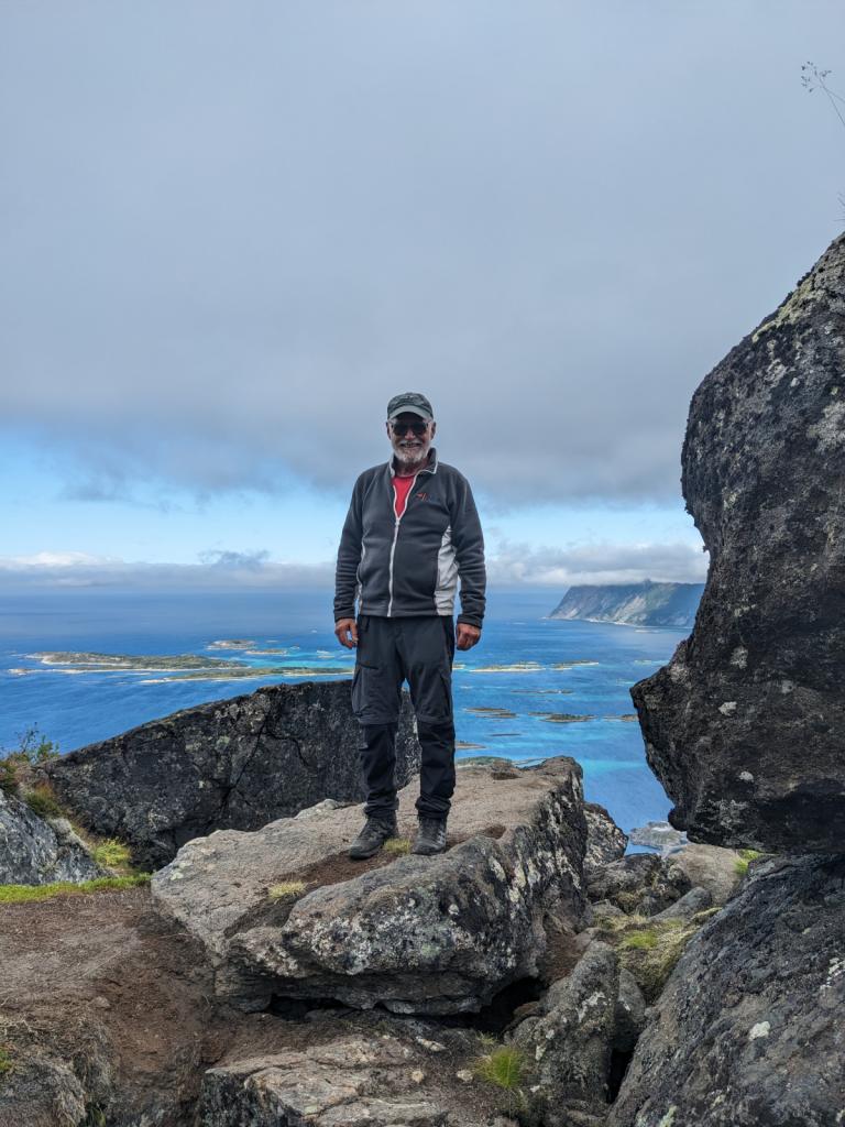
23 May 2023 | Lovund, Norway
31 October 2022 | Ardrossan
13 August 2022 | Floro Norway
12 July 2022 | Bodo
08 July 2022 | Rodoya, Nroway
01 June 2022 | Inverness
11 May 2022 | Oban, Scotland
01 May 2022 | Isle of Islay, Scotland
21 November 2021 | Grand Canyon
12 November 2021
29 October 2021 | Yellowstone WY
18 October 2021 | Grand Teton National Park
29 September 2021 | Back home in St Pete
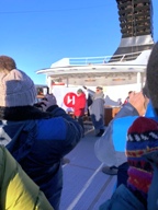
A Ride on the Hurtigruten
06 December 2023 | St Pete
Dee
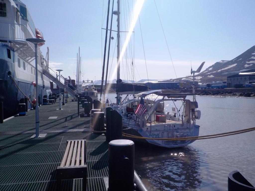
The haul out for Wings went smoothly and we spent the last few days finishing the winterizing process and getting her all set up for her winter rest.
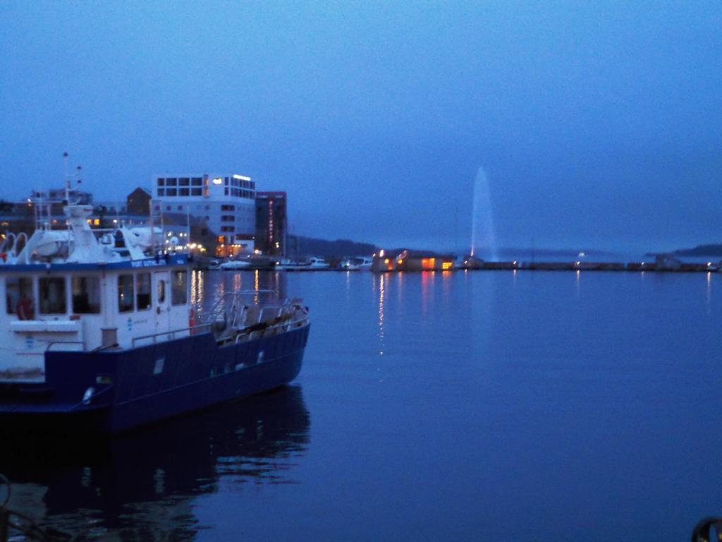
Lest anyone think that we are not completely enamored with Norway, we scheduled another visit, although this time we would be passengers instead of crew. We had seen the Hurtigruten ferries all over Norway during our travels there and they are a coastal ferry service, now in their 130th year and are a grand Norway tradition. Hurtigruten is Norwegian for fast route and they do really move up and down the coast with daily service between Bergen in the south all the way to Kerkenes at the Russian border and many stops in between.
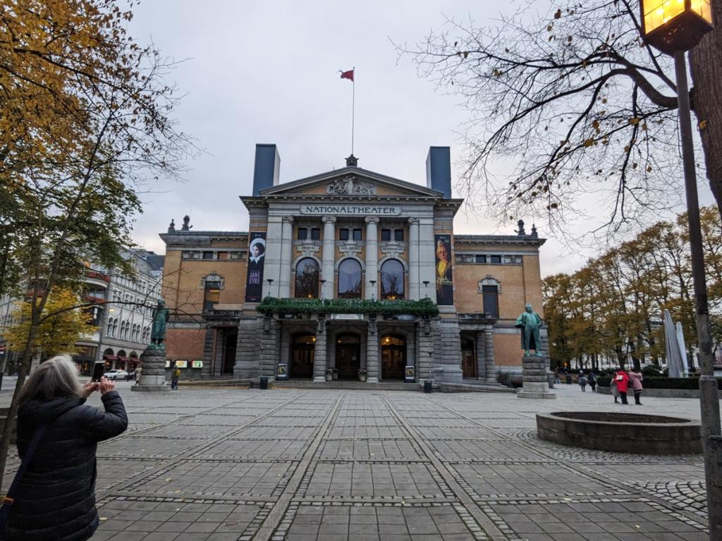
We booked a ride from Bergen to Kerkenes and back and planned some sight seeing between Oslo and Bergen beforehand. The adventure started with a flight from Glascow to Amsterdam and onto Oslo and despite some last minute cancelations due to foggy conditions in Amsterdam, we made it to Oslo, and caught the train to the city center, where we spent a wonderful night.


After a luxurious breakfast buffet, we boarded the Bergen Railway train for a very scenic run up into the mountains and transferred to the Flam Railway and down into Flam for the night.
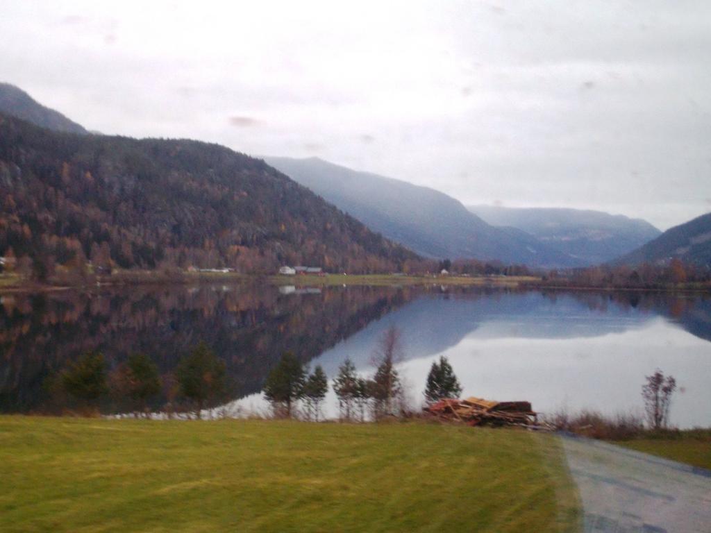
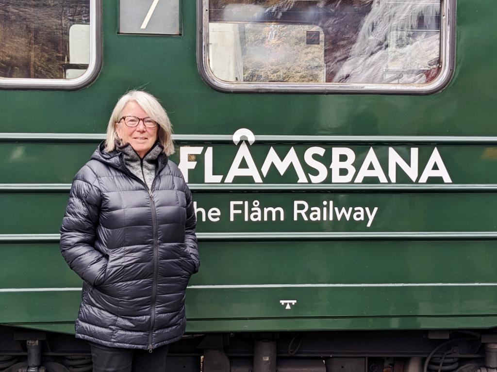


The Flam railway was created to connect the Sognefiord area to the larger cities of Oslo and Bergen and many of the tunnels for the railway were dug by hand through solid rock. Progress of one meter was considered a good day's work.
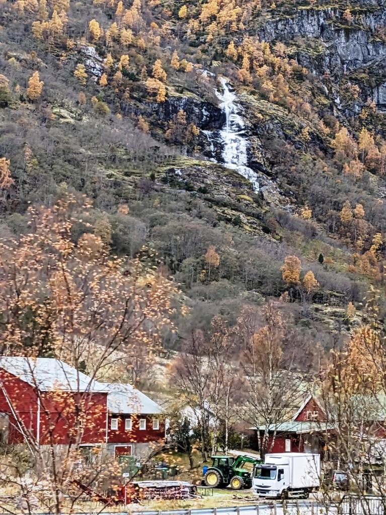
We had a quick visit to the Flam area this past summer, when we sailed up this way, but now we were seeing a completely different perspective in the cold season. After a relaxing night at the Flamsbrygga Hotel we boarded a boat to tour the Aurlands and Naero Fiords.

 We disembarked at and boarded a bus for the ride to Voss, a ski town in the mountains.
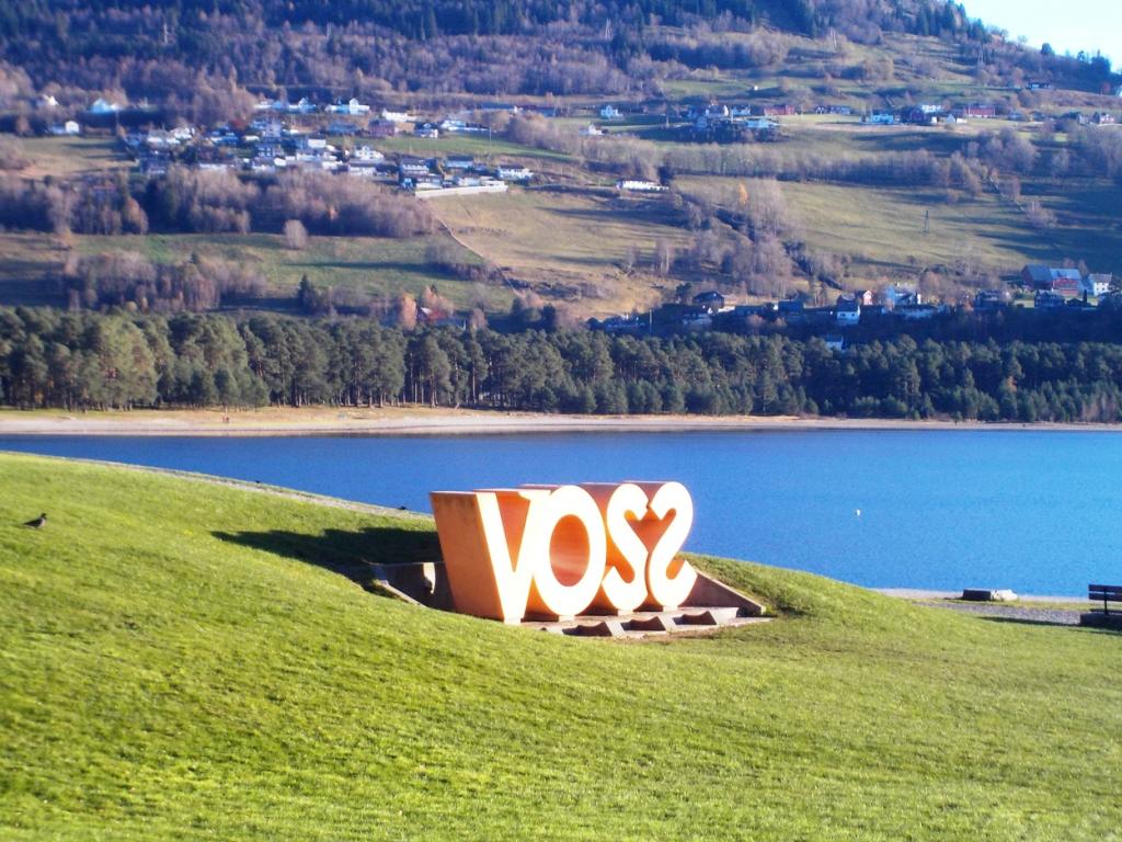

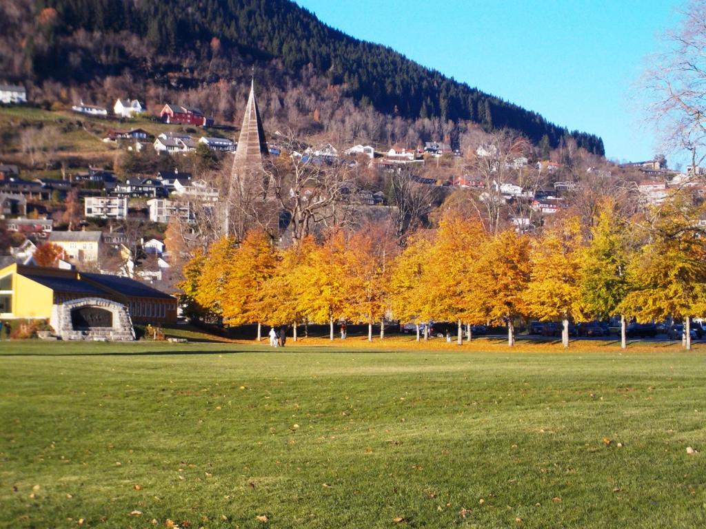 The season was early enough that the slopes were barren and the gondola was getting some repairs, but we did some nice walks in the area and saw an impressive slot canyon, reminiscent of those in the SW US, but much lusher.
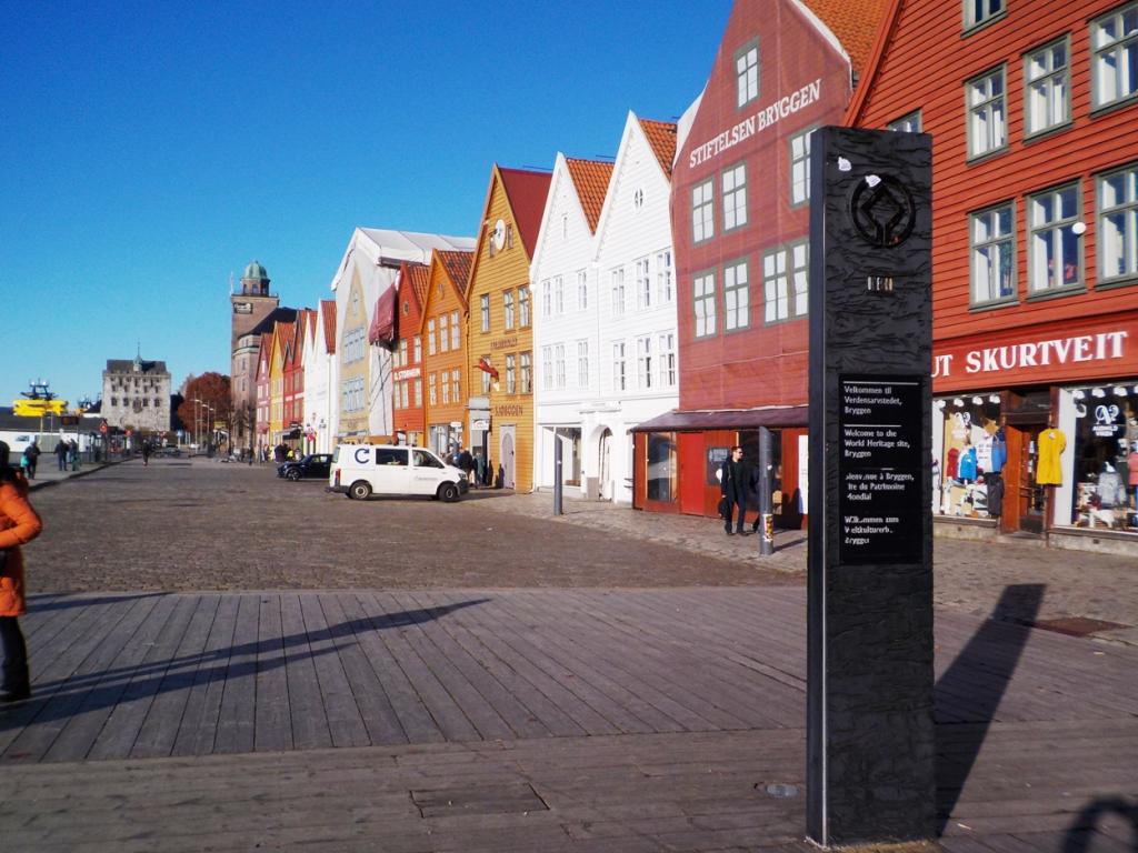
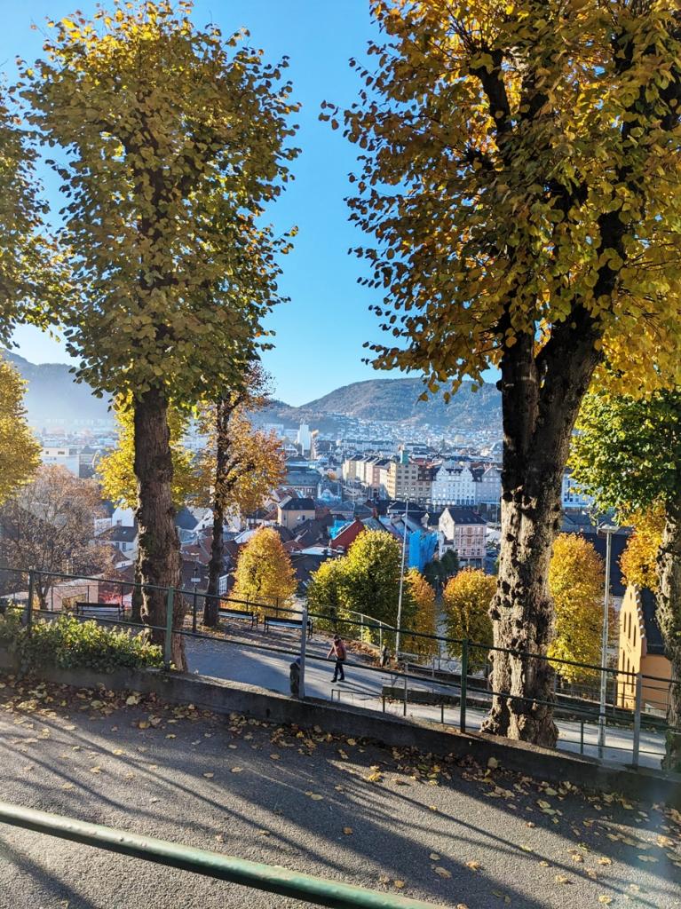
The next day we boarded the train into Bergen and had an overnight in the city center and some exploration of the town, including the famous fish market.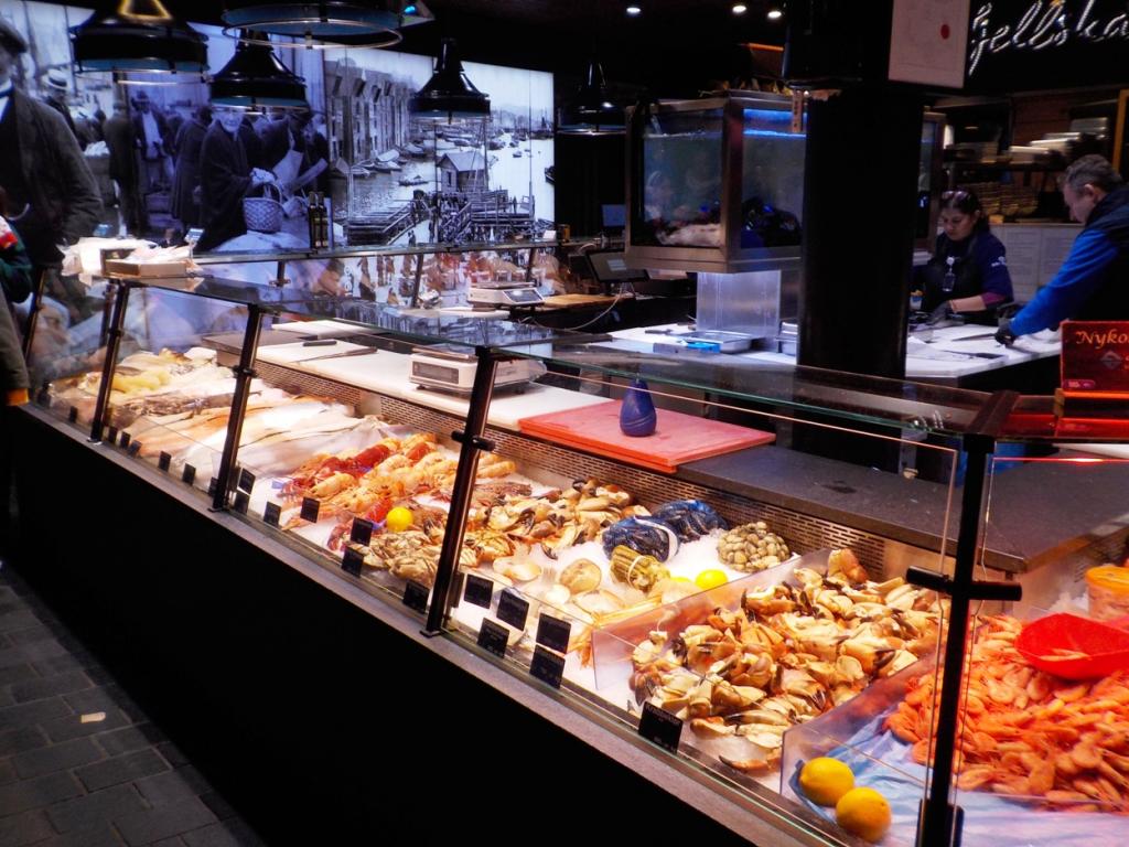
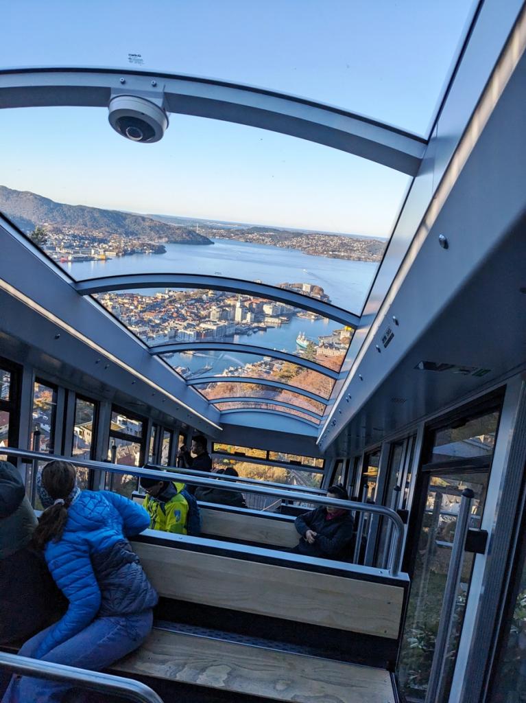
 The next morning we toured the old merchant's wharves and warehouses and took a ride up the tram to the mountaintop for some spectacular views,
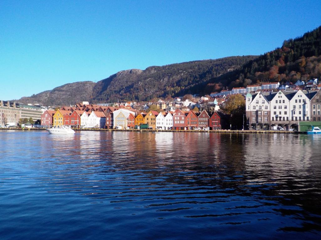


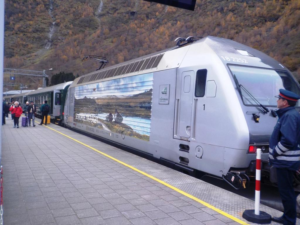
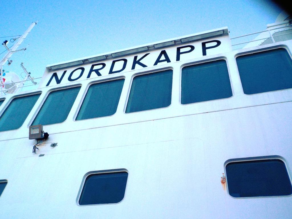
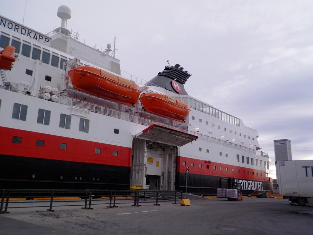
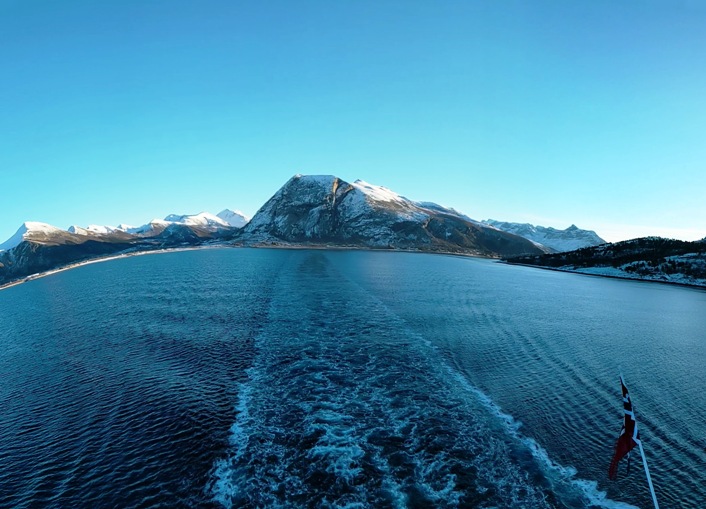
 Then we boarded the Hutigruten ferry, MS Nordkapp.
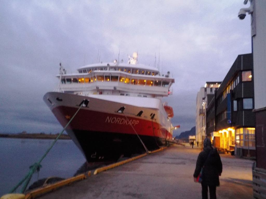
 We left that evening, heading northbound.
 The ferry makes many short stops at various towns and villages to drop and pick up mail, cargo, and passengers. There was a sizable contingent of passengers like us who were just along for the ride.
The accommodations were great, not as plush as a cruise ship and there is no entertainment, but there are some informative lectures about the areas we pass through, and some excursions can be booked at locations where the ferry is docked for longer times. Our fare included a breakfast and lunch buffet, and a sit down three course dinner every day of the trip.
The next day, we entered the Fiord, south of Alesund, and had a stop at Urke, where we hiked up Mt Saksa a couple of years ago. We decided to stay aboard and enjoy the views,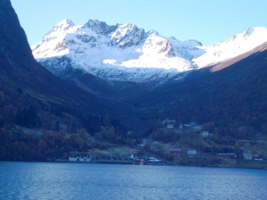
 and then that evening we made a stop at Alesund, where we got off and stretched our legs with a walk through this familiar town.
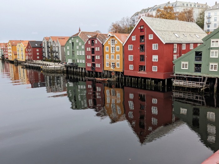
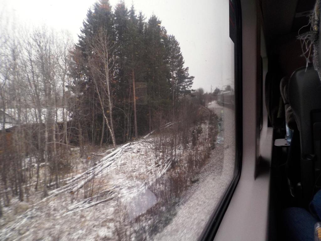
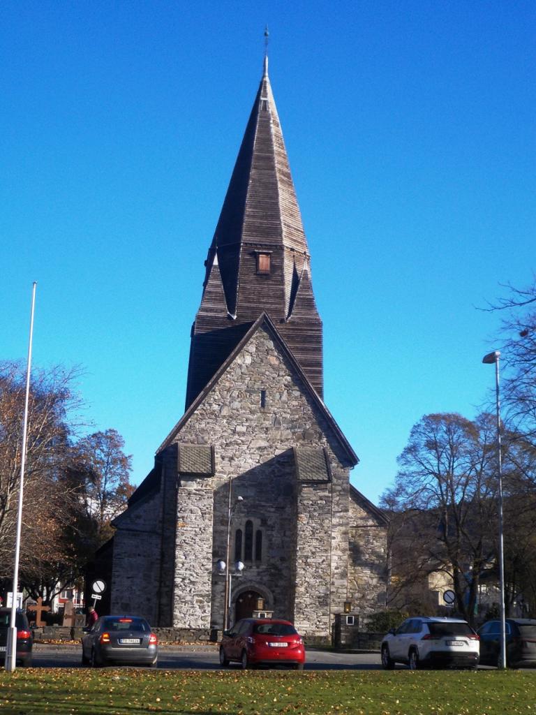
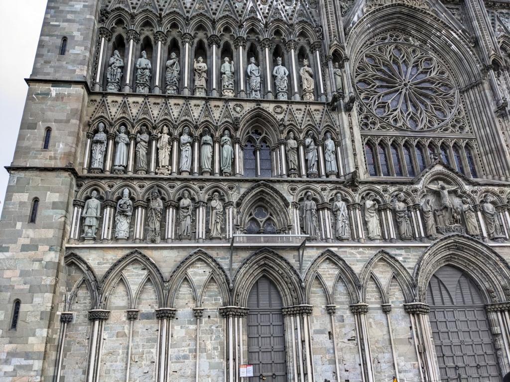
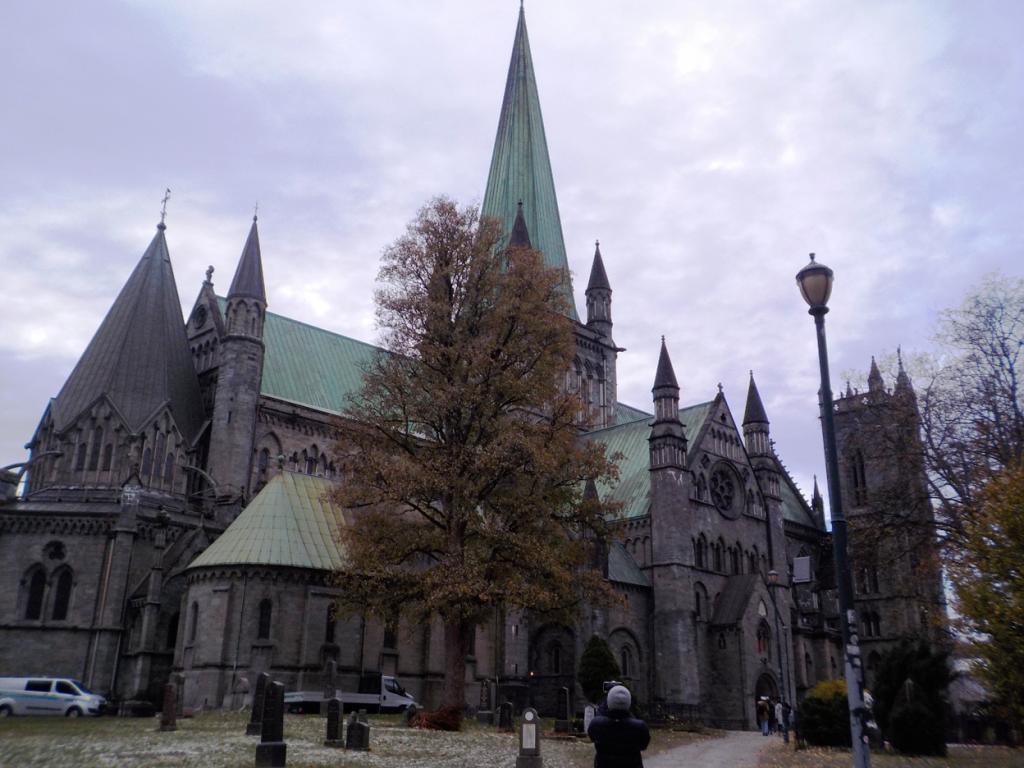
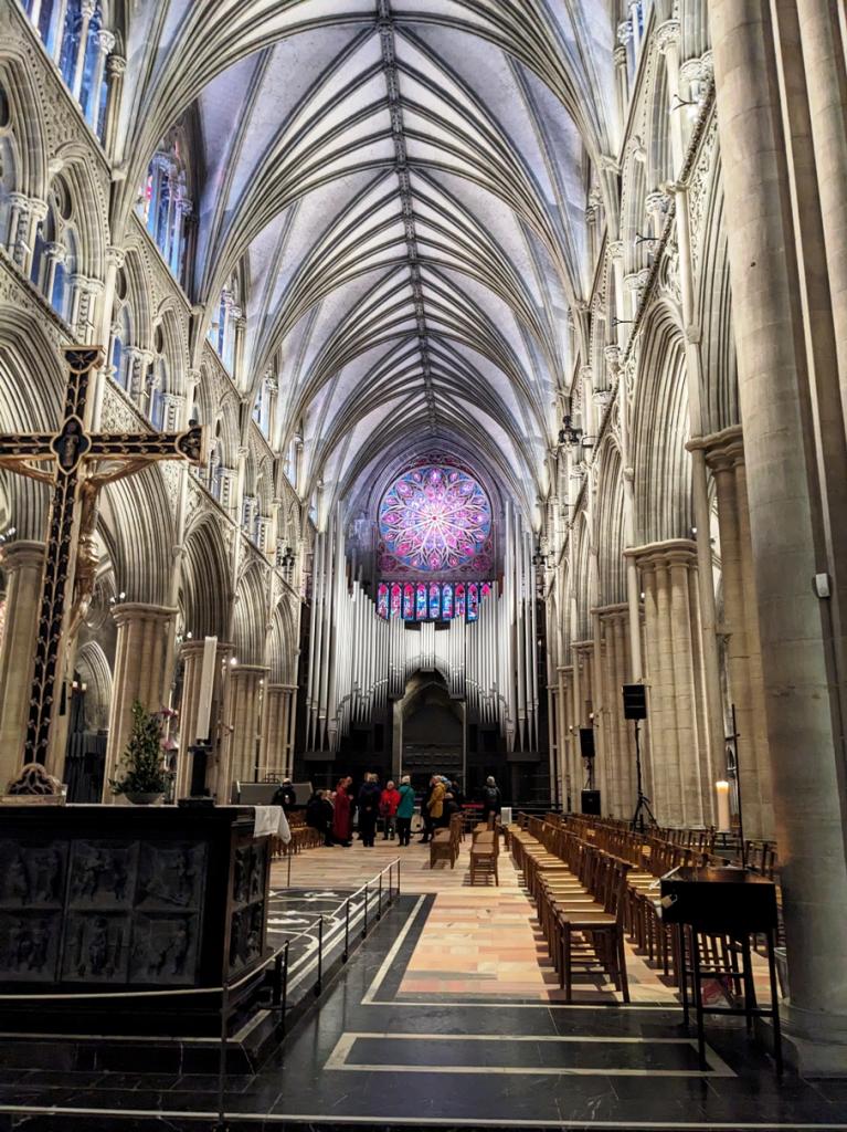
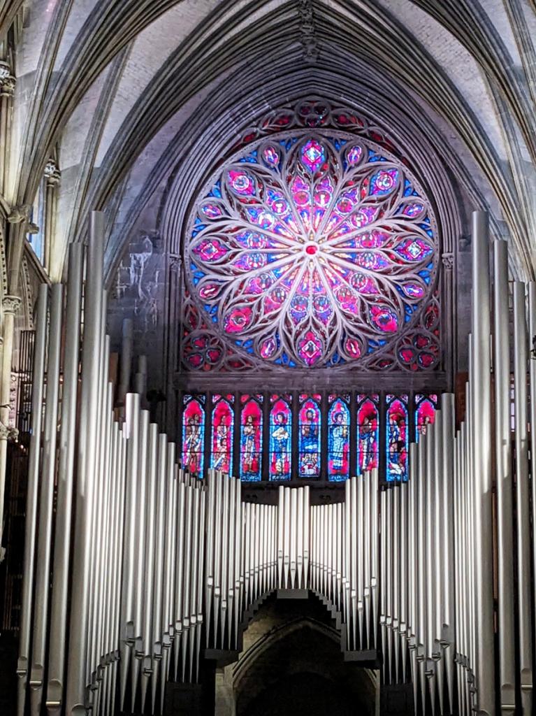
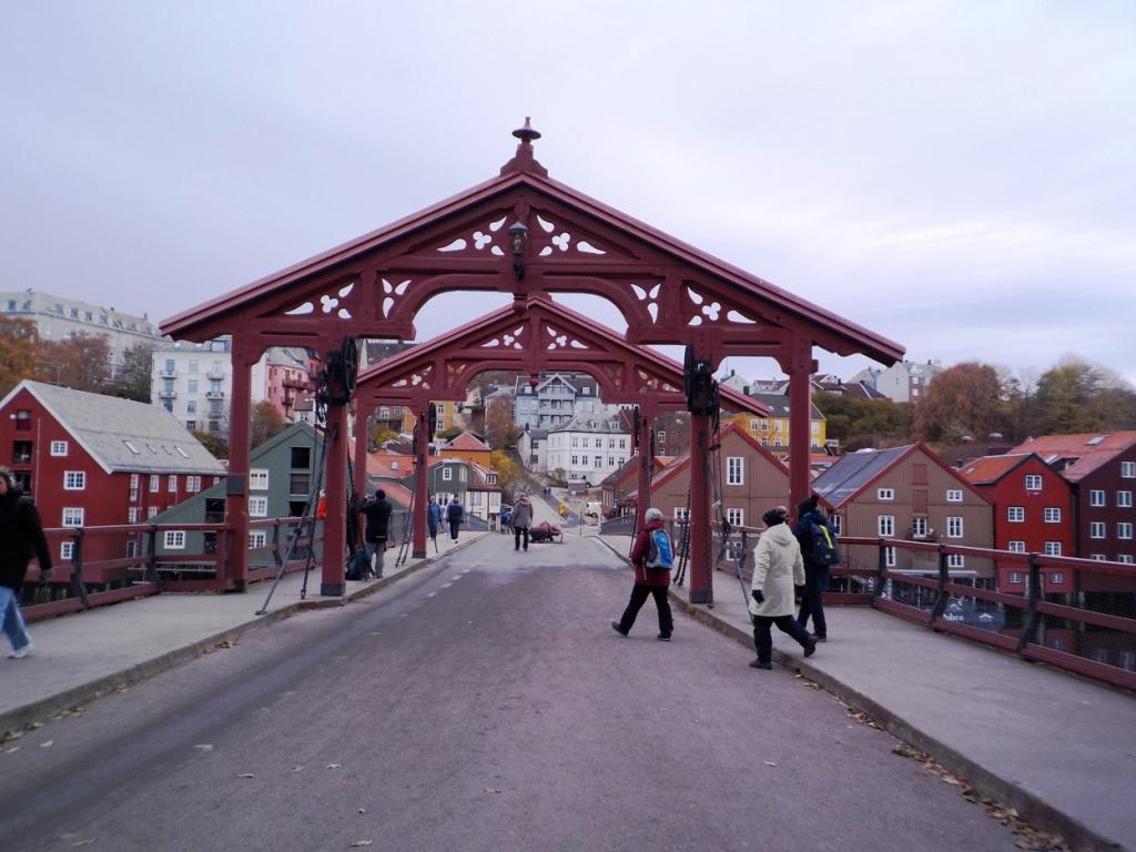
We continued north overnight, and the next day found us at Trondhiem, a place new to us. We had booked a city walk and toured the magnificent cathedral, the old town center, walked across the bridge to happiness and saw the old wharfs and warehouses.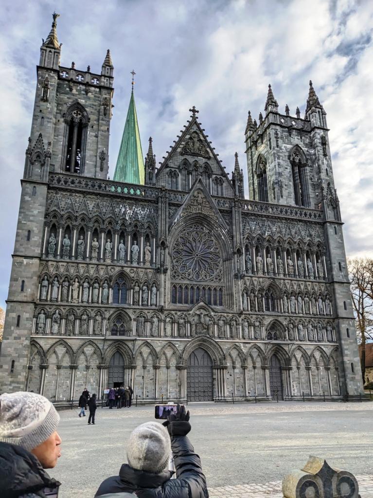

 These stops are fairly quick on the ferry, the longest being 2-3 hours, but are long enough for a taste of the area visiting.
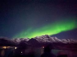
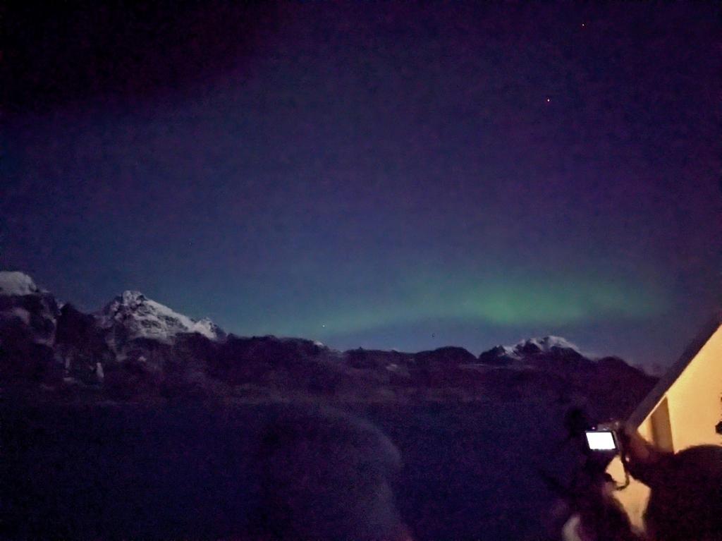
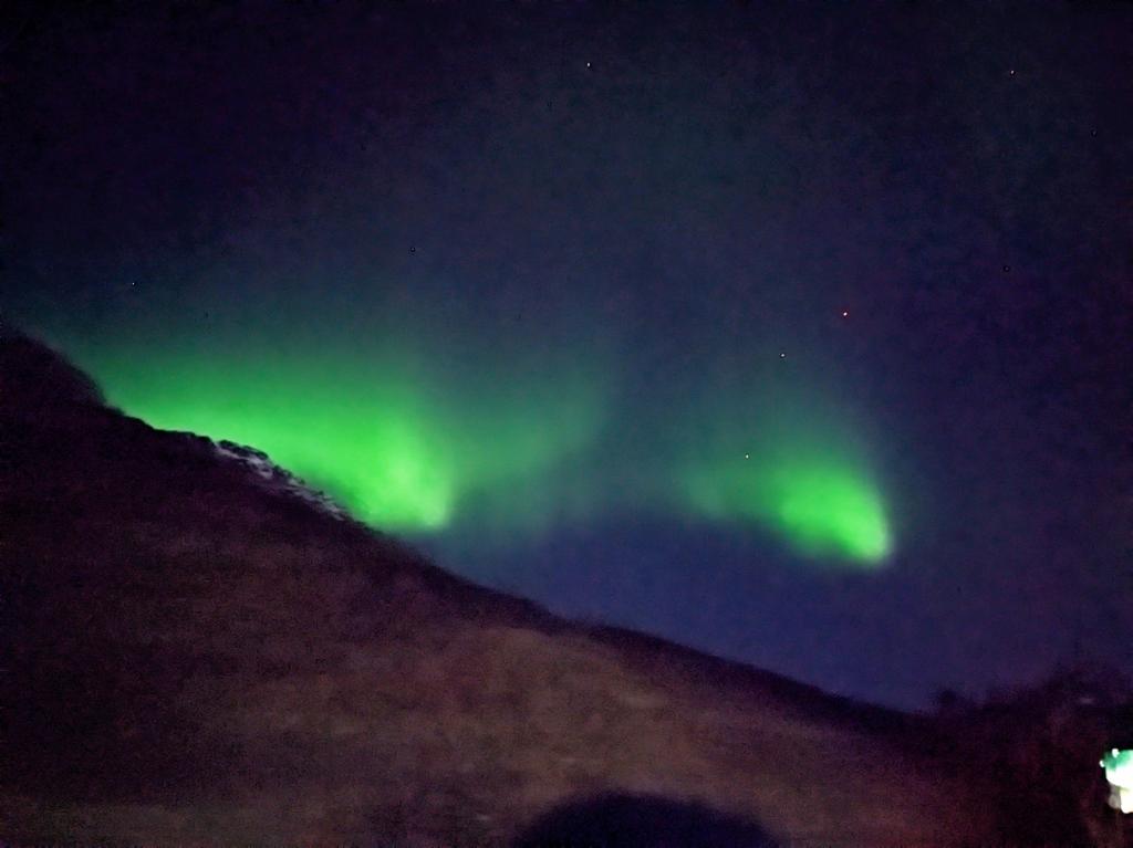
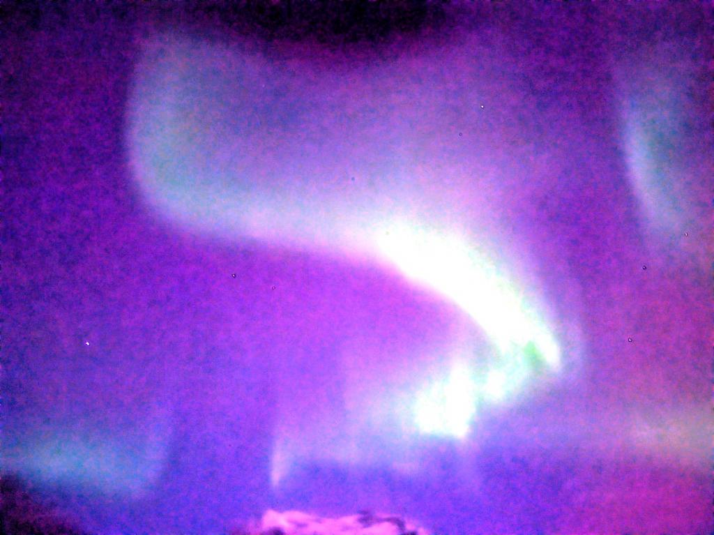
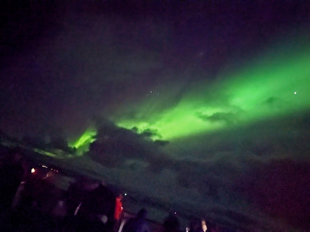
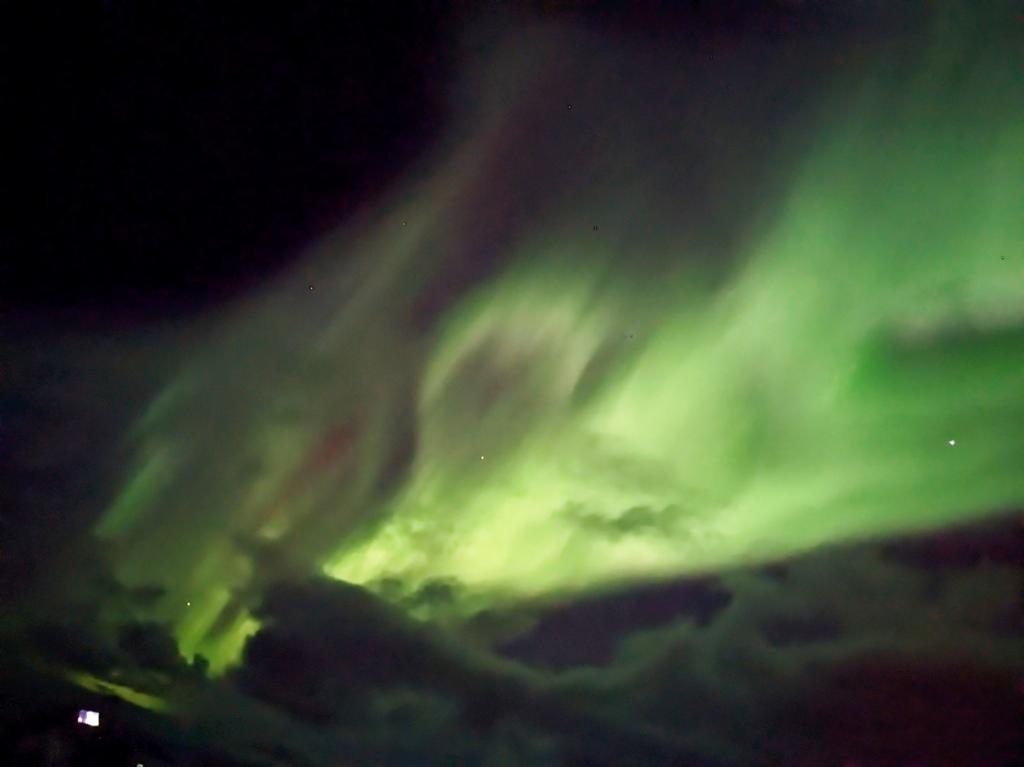
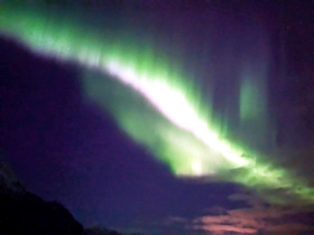
We continued northbound and during the night mother nature put on her light show with a wonderful display of Aurora Borealis, one of the main reasons we had for this trip. In the morning we crossed the Arctic Circle and had a celebration (ice down the back). There had been a contest to guess the time of the Arctic Circle transit and I had the dubious honor of having guessed the closest time and so was first in line for the ice down the back tradition.


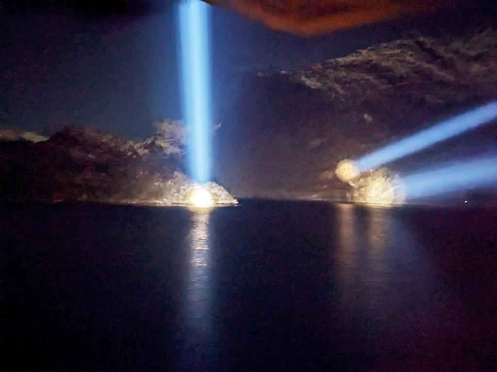
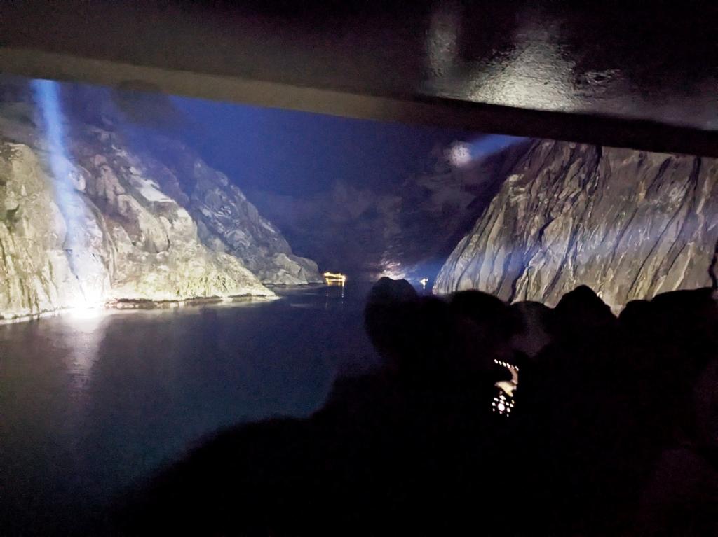
We then continued north, with short stops along the way and a long stop at Bodo, very familiar to us, but allowed a walk around town to stretch our legs. Then it was across the Vestfiorden to the Lofotons. We went up the Raftsundent and into the Troll Fiord at night, with the spot lights ablaze. It is a masterful piece of manuvering to get in, turn around, and get out in a ship this big in the daylight, let alone at night. The skies were alight with the Aurora Borealis again this night and made for a memorable experience.

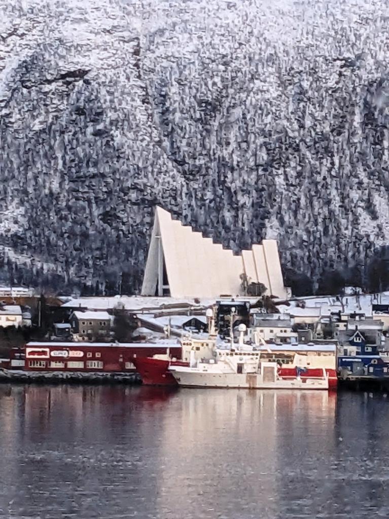
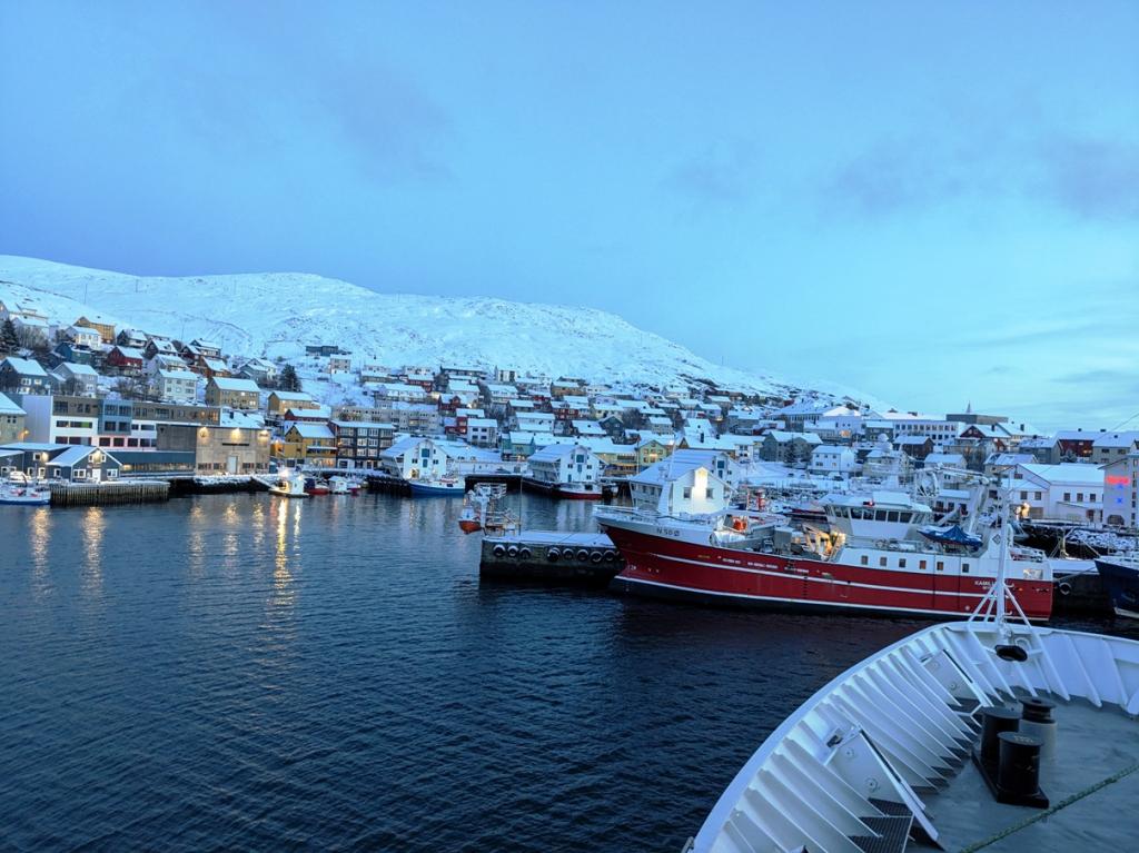
We continued north overnight and had a long stop in Tromso, were we wandered the familiar town and did some shopping. As we've continued our northward progression, the temps have plummeted, the snow accumulated and the days gotten much shorter. In Tromso, sunset was at 2:30 in the afternoon. Not too long before it will be dark all day.
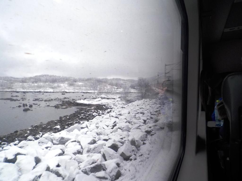
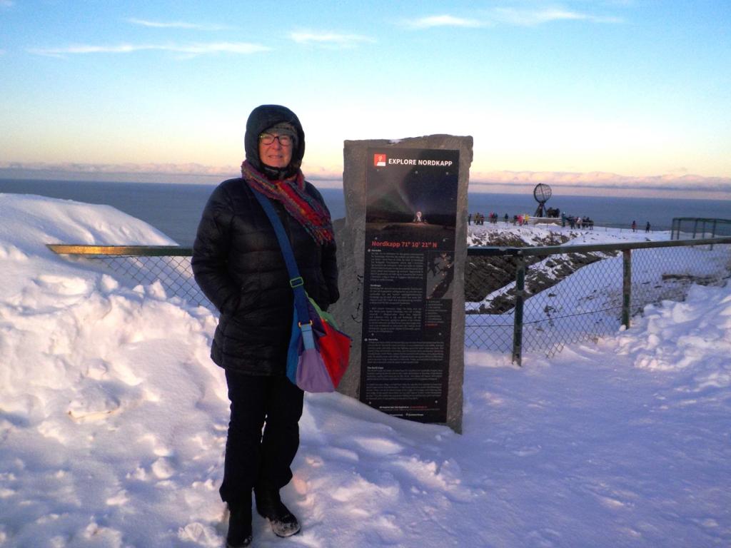
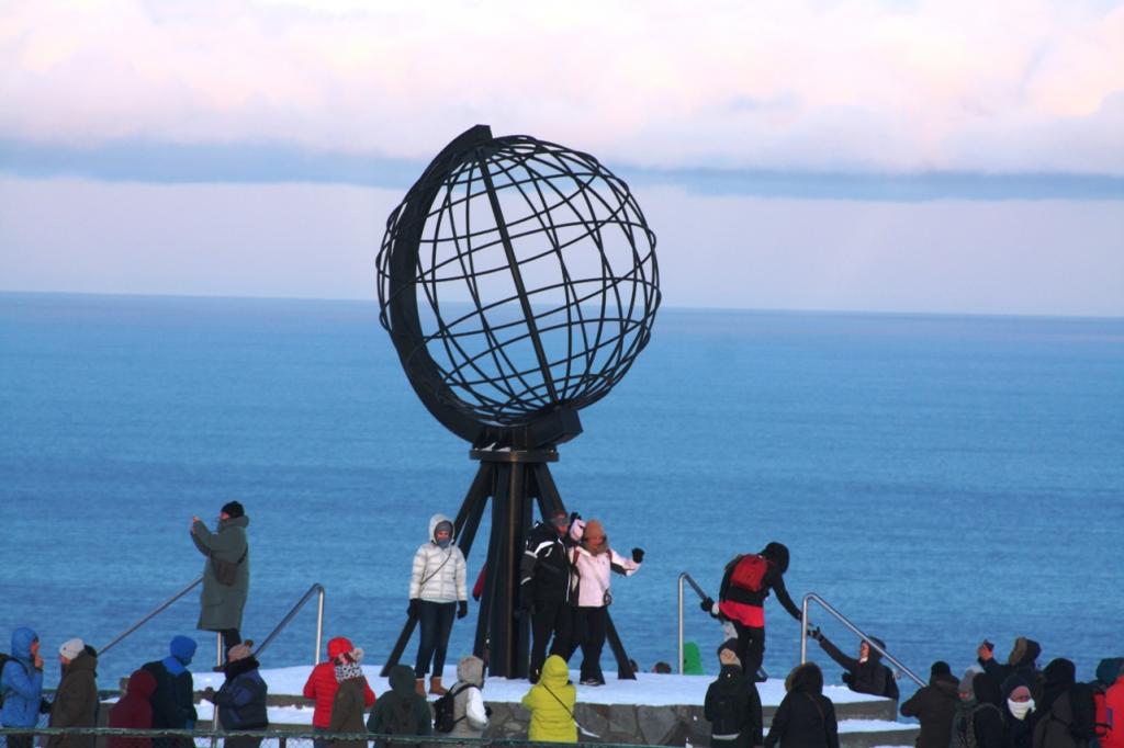
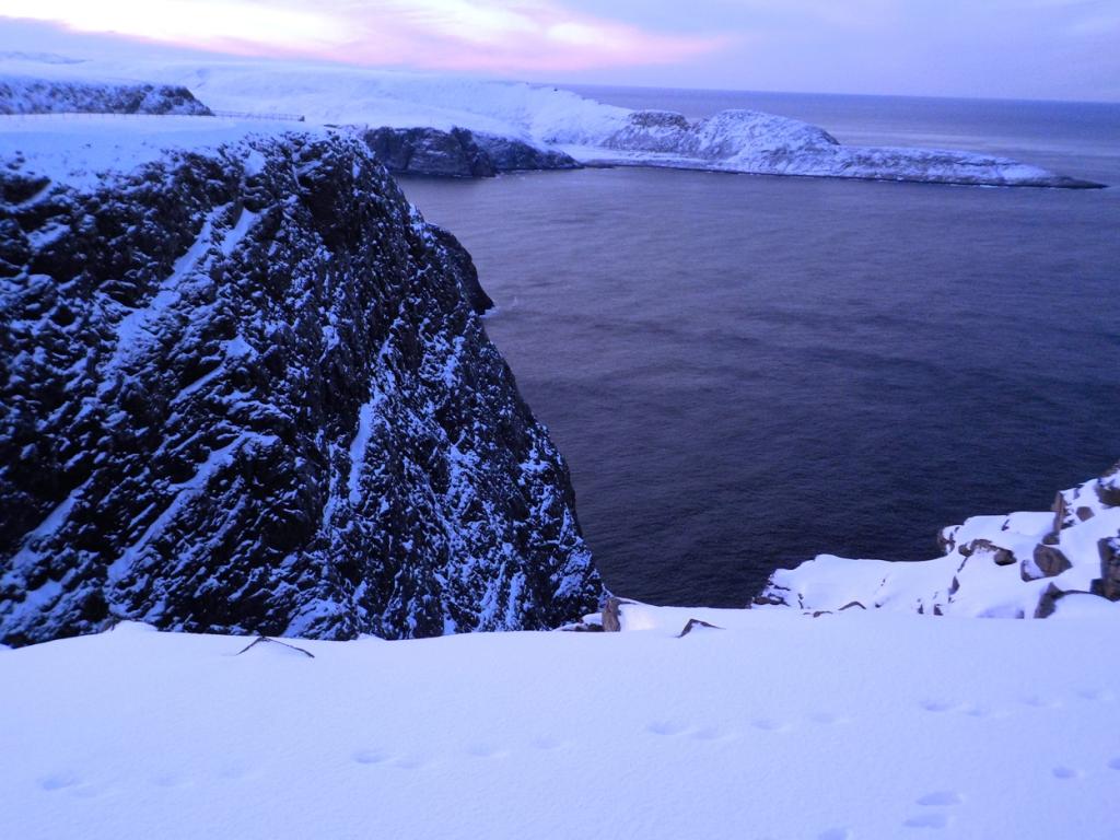
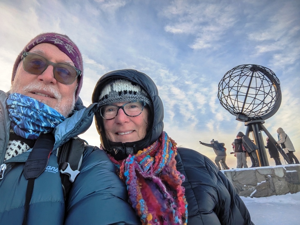
We continued north and then east to Honningsvag, and took a bus ride up to the North Kapp, the most northern point in Europe. It was cold, snowy, and beautiful. There are no trees this far north and has a stark beauty that reminded us of Svalbard.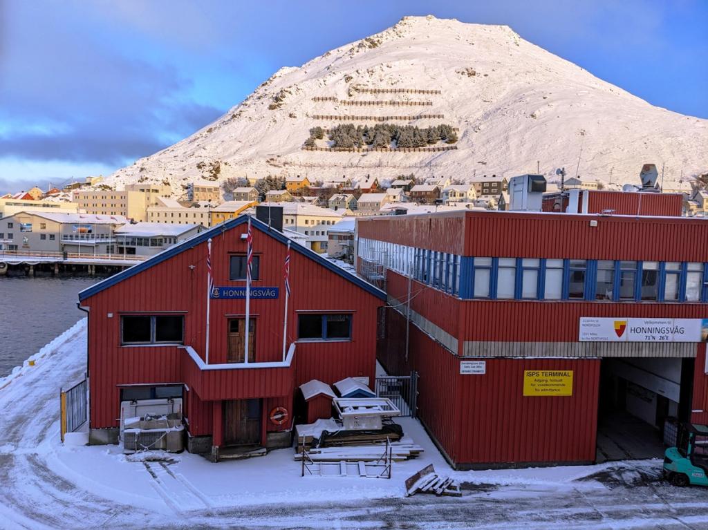


Then we were off to Kirkenes, the eastern most town in Norway and at the Russian Border. We took a bus ride out to the border and to a look. We were warned not do any stupid things while there even though we wanted to give them the raspberries. Molly made a new friend there.


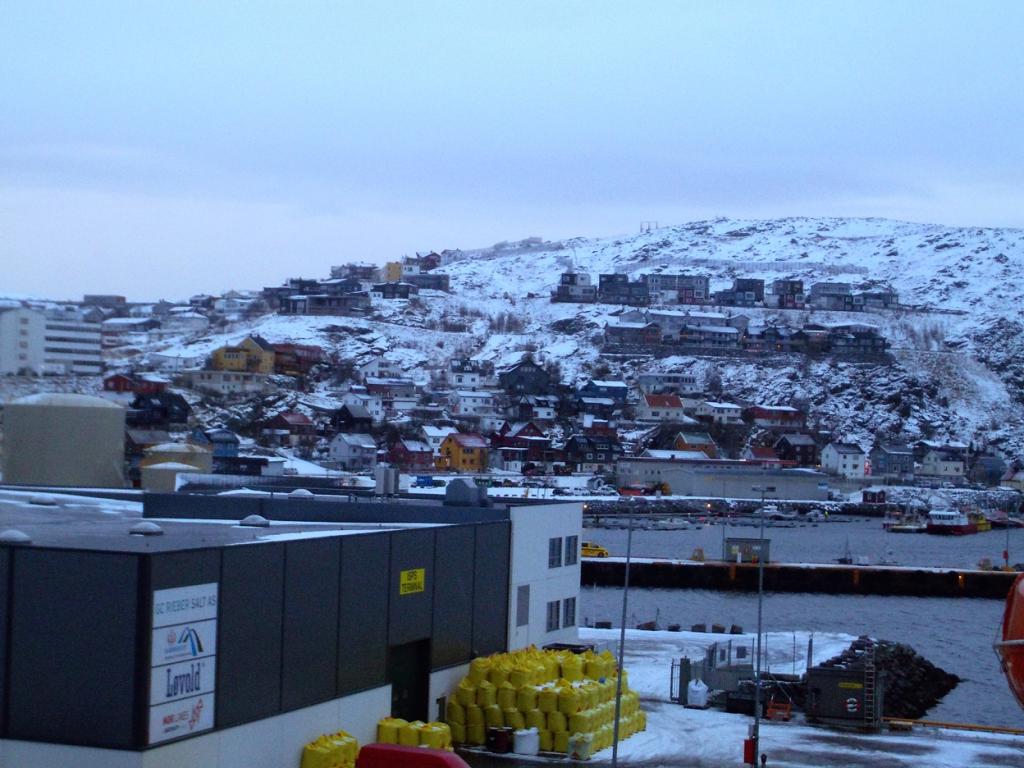
This was our turn around and we started back south repeating the stops along the way, although many of those middle of the night stops on the northbound leg were made now in the daytime. Our next stop was Hammerfest, considered the northernmost city in Europe.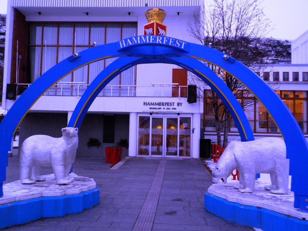

The ride south continued back to the Lofotons and another ride up into the Troll Fiord and another nighttime light show by Mother nature. We had a quick stop in Svolvaer, another favorite of ours. We made a fairly long stop at Bronnoysund, the exact middle of the Norwegian Coast, and got a chance to stretch our legs once again.


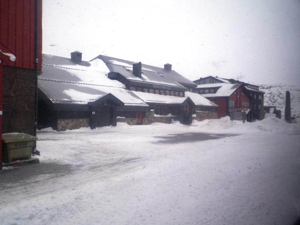
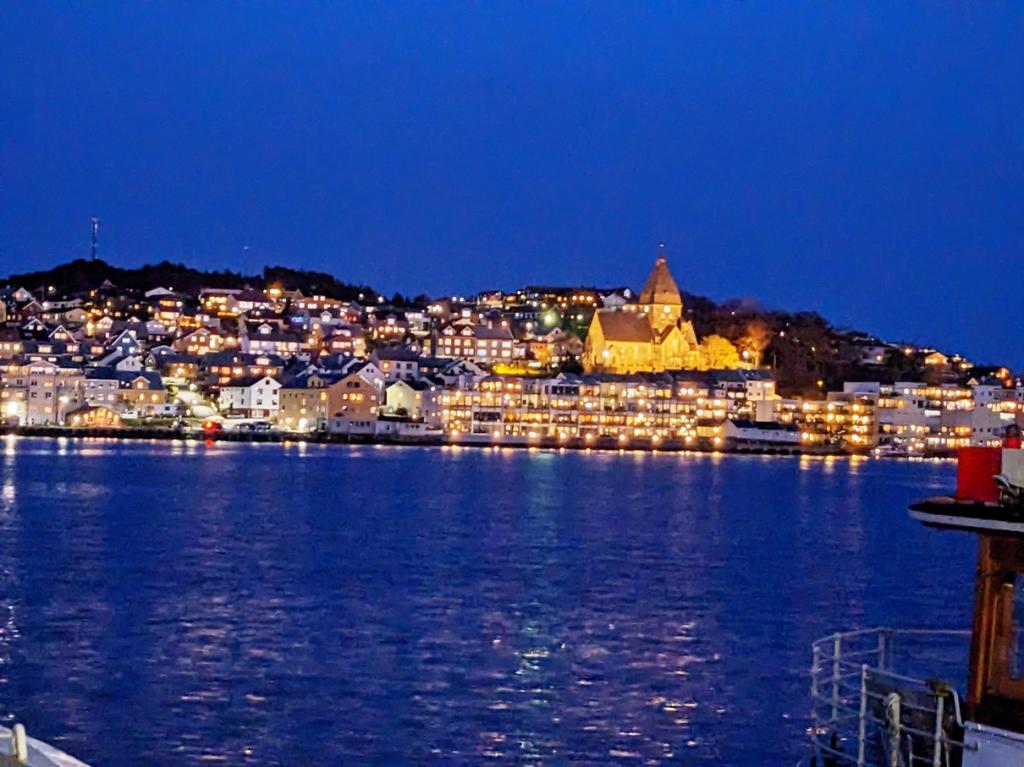
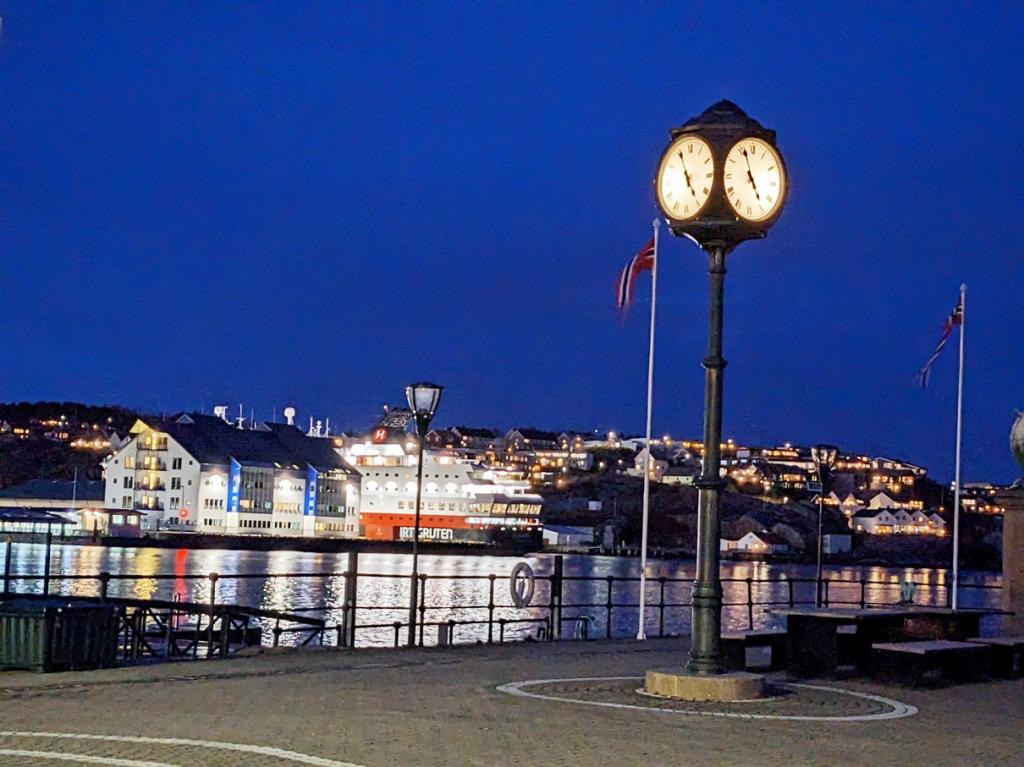
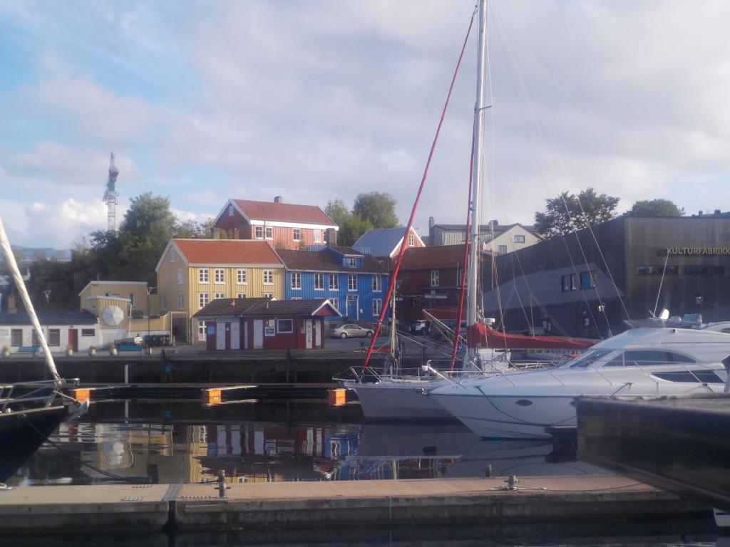
Then in the morning we were back in Trondhiem, another chance for a walk around town, and as we continued south a stop at Kristiansund and then in the morning back to Bergen.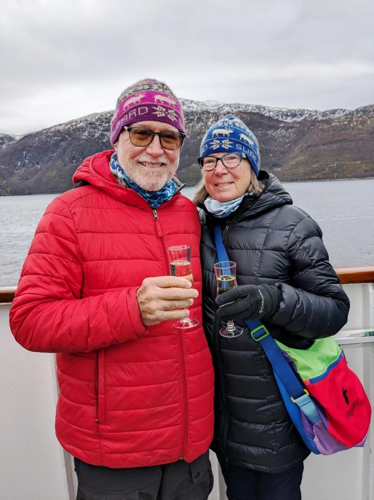

The Hurtigruten staff make the disembarkation process very efficient and we were off to the airport to catch our flight to London. We came into Gatwick and bussed over to Heathrow to stay the night at the airport hotel and then caught our flight the next day to Tampa and back home.
This turned out to be a wonderful trip and, although not really our style of travel, would be a great way to get a quick experience of Norway. We normally like to move slowly and spend time experiencing people and places, but for those without the luxury of time, this is a good option. We especially appreciated the Coastal Kitchen program they have for the food service, which provides local cuisine of the area in which you are trveling and most of the food is sourced locally as well. Our increasing waist lines can attest to the fact that the food was very good.
We are now set for the winter here at home in St Pete, although it may be hard to sit still that long. The plan is to head back to Scotland in March, so until then Happy Holidays and All the Best in the New Year!
Lest anyone think that we are not completely enamored with Norway, we scheduled another visit, although this time we would be passengers instead of crew. We had seen the Hurtigruten ferries all over Norway during our travels there and they are a coastal ferry service, now in their 130th year and are a grand Norway tradition. Hurtigruten is Norwegian for fast route and they do really move up and down the coast with daily service between Bergen in the south all the way to Kerkenes at the Russian border and many stops in between.
We booked a ride from Bergen to Kerkenes and back and planned some sight seeing between Oslo and Bergen beforehand. The adventure started with a flight from Glascow to Amsterdam and onto Oslo and despite some last minute cancelations due to foggy conditions in Amsterdam, we made it to Oslo, and caught the train to the city center, where we spent a wonderful night.
After a luxurious breakfast buffet,
we boarded the Bergen Railway train for a very scenic run up into the mountains and transferred to the Flam Railway and down into Flam for the night.The Flam railway was created to connect the Sognefiord area to the larger cities of Oslo and Bergen and many of the tunnels for the railway were dug by hand through solid rock. Progress of one meter was considered a good day's work.
We had a quick visit to the Flam area this past summer, when we sailed up this way, but now we were seeing a completely different perspective in the cold season. After a relaxing night at the Flamsbrygga Hotel
we boarded a boat to tour the Aurlands and Naero Fiords. We disembarked at and boarded a bus for the ride to Voss, a ski town in the mountains. The season was early enough that the slopes were barren and the gondola was getting some repairs, but we did some nice walks in the area and saw an impressive slot canyon, reminiscent of those in the SW US, but much lusher.The next day we boarded the train into Bergen and had an overnight in the city center and some exploration of the town, including the famous fish market.
The next morning we toured the old merchant's wharves and warehouses and took a ride up the tram to the mountaintop for some spectacular views, Then we boarded the Hutigruten ferry, MS Nordkapp. We left that evening, heading northbound. The ferry makes many short stops at various towns and villages to drop and pick up mail, cargo, and passengers. There was a sizable contingent of passengers like us who were just along for the ride.The accommodations were great, not as plush as a cruise ship and there is no entertainment, but there are some informative lectures about the areas we pass through, and some excursions can be booked at locations where the ferry is docked for longer times. Our fare included a breakfast and lunch buffet, and a sit down three course dinner every day of the trip.
The next day, we entered the Fiord, south of Alesund, and had a stop at Urke, where we hiked up Mt Saksa a couple of years ago. We decided to stay aboard and enjoy the views,
and then that evening we made a stop at Alesund, where we got off and stretched our legs with a walk through this familiar town.We continued north overnight, and the next day found us at Trondhiem, a place new to us. We had booked a city walk and toured the magnificent cathedral, the old town center, walked across the bridge to happiness and saw the old wharfs and warehouses.
These stops are fairly quick on the ferry, the longest being 2-3 hours, but are long enough for a taste of the area visiting.We continued northbound and during the night mother nature put on her light show with a wonderful display of Aurora Borealis, one of the main reasons we had for this trip. In the morning we crossed the Arctic Circle and had a celebration (ice down the back). There had been a contest to guess the time of the Arctic Circle transit and I had the dubious honor of having guessed the closest time and so was first in line for the ice down the back tradition.
We then continued north, with short stops along the way and a long stop at Bodo, very familiar to us, but allowed a walk around town to stretch our legs. Then it was across the Vestfiorden to the Lofotons. We went up the Raftsundent and into the Troll Fiord at night, with the spot lights ablaze. It is a masterful piece of manuvering to get in, turn around, and get out in a ship this big in the daylight, let alone at night. The skies were alight with the Aurora Borealis again this night and made for a memorable experience.
We continued north overnight and had a long stop in Tromso, were we wandered the familiar town and did some shopping. As we've continued our northward progression, the temps have plummeted, the snow accumulated and the days gotten much shorter. In Tromso, sunset was at 2:30 in the afternoon. Not too long before it will be dark all day.
We continued north and then east to Honningsvag, and took a bus ride up to the North Kapp, the most northern point in Europe. It was cold, snowy, and beautiful. There are no trees this far north and has a stark beauty that reminded us of Svalbard.
Then we were off to Kirkenes, the eastern most town in Norway and at the Russian Border. We took a bus ride out to the border and to a look. We were warned not do any stupid things while there even though we wanted to give them the raspberries. Molly made a new friend there.
This was our turn around and we started back south repeating the stops along the way, although many of those middle of the night stops on the northbound leg were made now in the daytime. Our next stop was Hammerfest, considered the northernmost city in Europe.
The ride south continued back to the Lofotons and another ride up into the Troll Fiord and another nighttime light show by Mother nature. We had a quick stop in Svolvaer, another favorite of ours. We made a fairly long stop at Bronnoysund, the exact middle of the Norwegian Coast, and got a chance to stretch our legs once again.
Then in the morning we were back in Trondhiem, another chance for a walk around town, and as we continued south a stop at Kristiansund and then in the morning back to Bergen.
The Hurtigruten staff make the disembarkation process very efficient and we were off to the airport to catch our flight to London. We came into Gatwick and bussed over to Heathrow to stay the night at the airport hotel and then caught our flight the next day to Tampa and back home.
This turned out to be a wonderful trip and, although not really our style of travel, would be a great way to get a quick experience of Norway. We normally like to move slowly and spend time experiencing people and places, but for those without the luxury of time, this is a good option. We especially appreciated the Coastal Kitchen program they have for the food service, which provides local cuisine of the area in which you are trveling and most of the food is sourced locally as well. Our increasing waist lines can attest to the fact that the food was very good.
We are now set for the winter here at home in St Pete, although it may be hard to sit still that long. The plan is to head back to Scotland in March, so until then Happy Holidays and All the Best in the New Year!
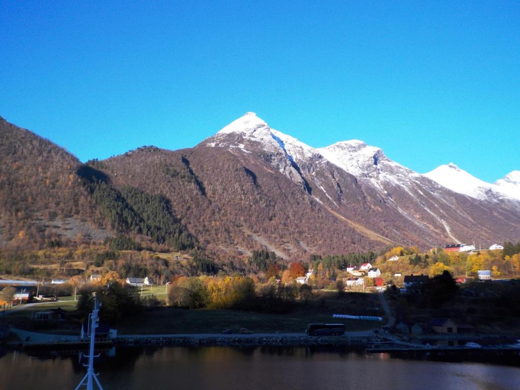
Back to Ardrossan
16 October 2023 | Ardrossan
Dee
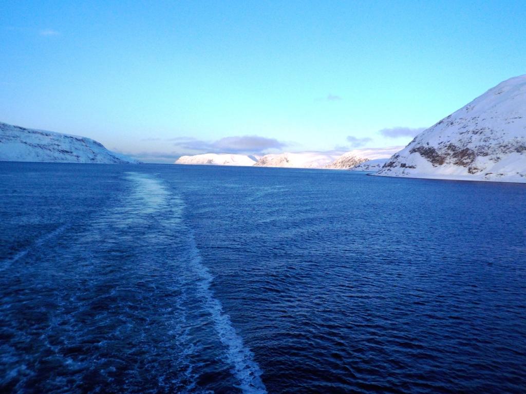
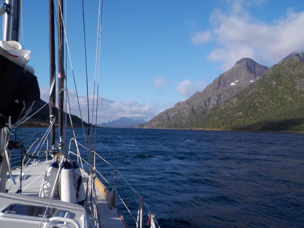
We left Floro at 6:30 AM local time with a good weather window to head southwest across the North Sea. The wind started on the nose and we were motorsailing closehauled, but by the end of the afternoon it had clocked around and we were sailing on a brisk broad reach in 25 knots.
We had decided this time to skip Lerwick and the Shetlands and to pass north of them and run down the western side and then on down to Stromness in the southwestern Orkneys. We began to see the oil platforms before dark and between them and the wind farms, it was like we were in a city all night. We were able to pretty much hold our course and only had to dodge a couple of the platforms.
Dawn found us of the north end of the Shetlands and the wind backed as predicted more into the north and then northeast as we ran down the western side. The wind held up nicely overnight and we pulled into Stromness around noon on the third day. It was a bit of culture shock seeing the grey stone buildings of Stromness after the colorful villages of Norway, but it was made up by the warmth and friendliness of the people. We enjoyed a dinner at the Ferry Inn, one of our favorite pubs.
Then we were off to catch the tide at around 11 AM, again watching the weather, trying to avoid some nastiness. We motorsailed off and on most of the day and then the wind filled in and we sailed around Cape Wrath at the NW tip of mainland Scotland just at dark. The wind was holding up for us so we decided to carry on as long as possible, passing by a lot of potential anchorages.
Dawn found us approaching the north end of the Isle of Skye and we sailed down the east side and under the bridge and then into the Kyle of Lochalsh. We kept on moving but hit the last of the adverse tide at Kyle Rhea and had to test the engine to motor against the current. We finally broke free and anchored in a favorite spot on the north side of Loch Hourne with only the seals for company.
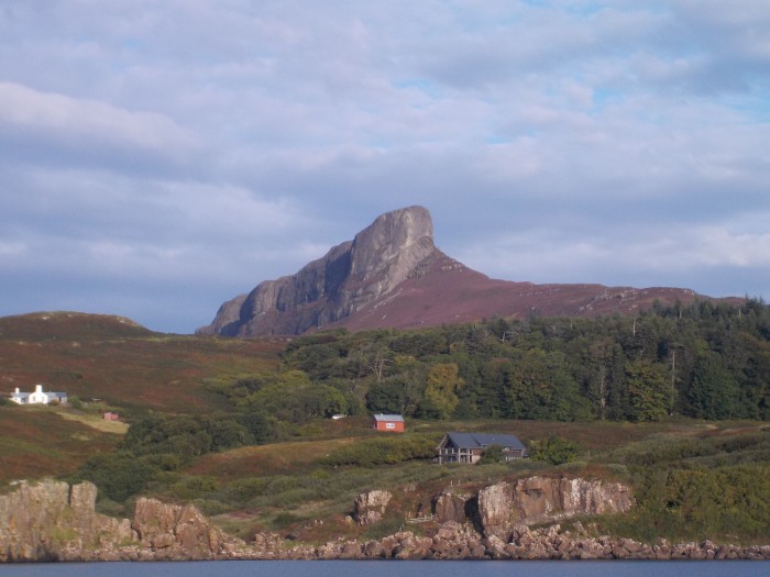
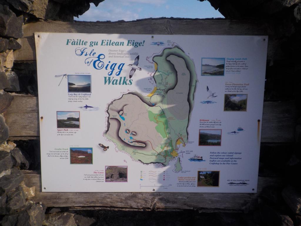
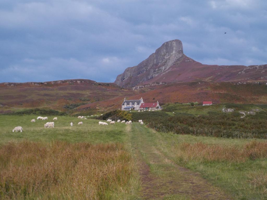
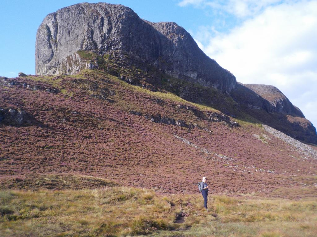
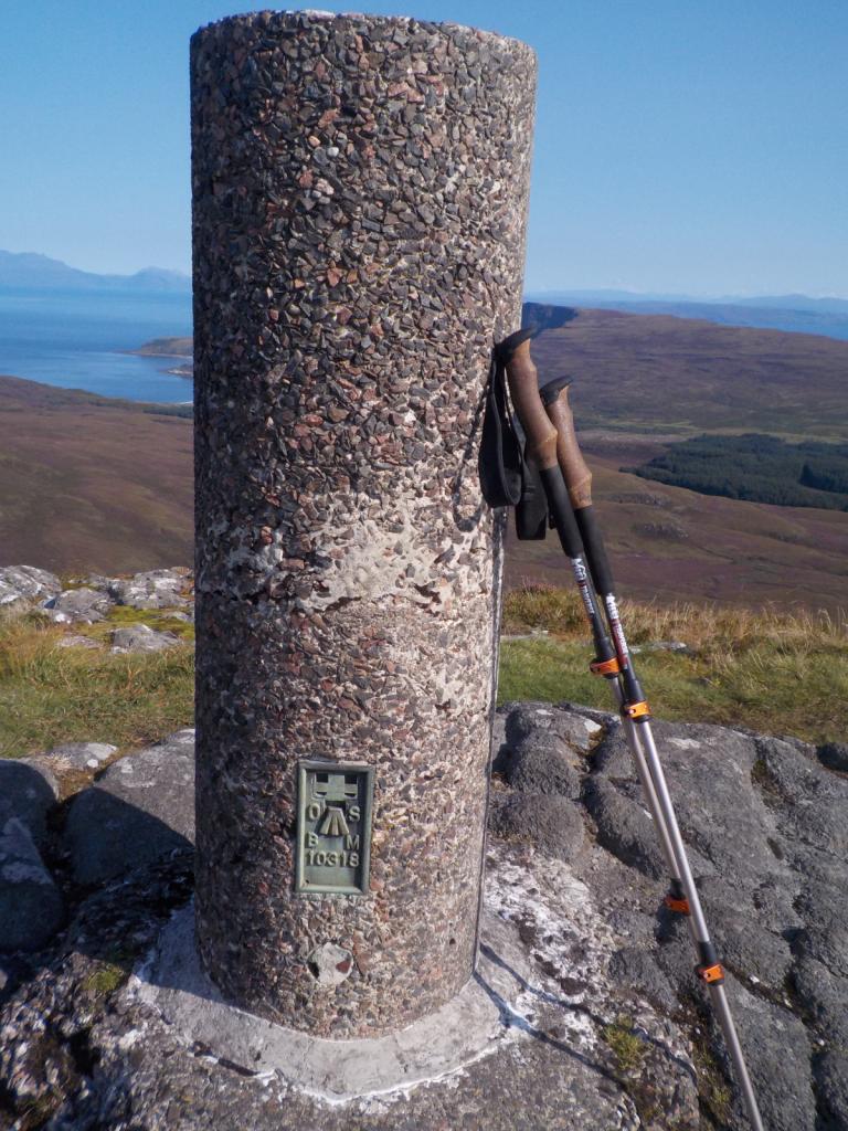
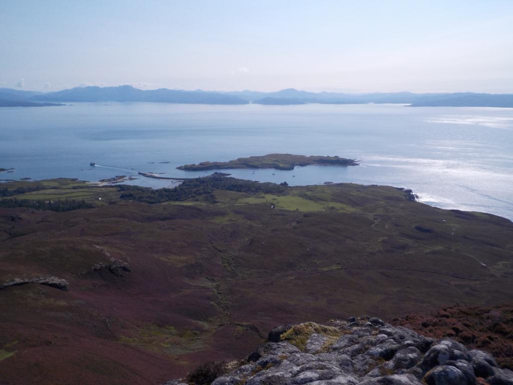
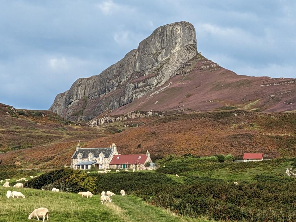
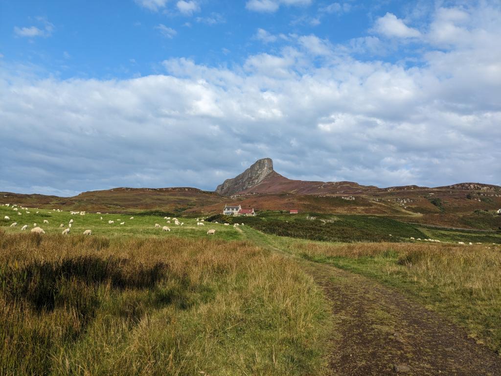
Then we headed a bit further south to one of the so called Small Isles called Eigg. We wanted to hike to the top of an interesting rock formation called the Sgurr of Eigg. We were here last year but didn't do the hike because my knee was acting up. This formation is a lava flow which filled a valley and then the surrounding structure eroded away leaving this huge rock edifice. The heather was in full bloom and we had a great day for the hike.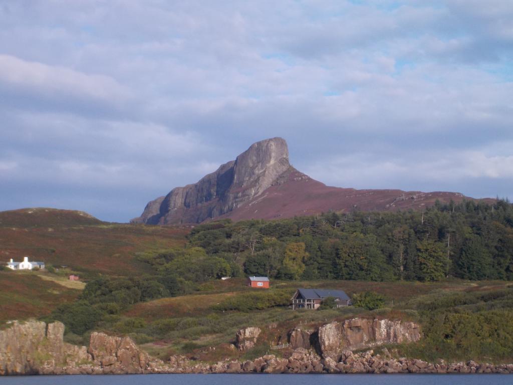

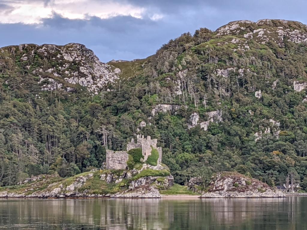
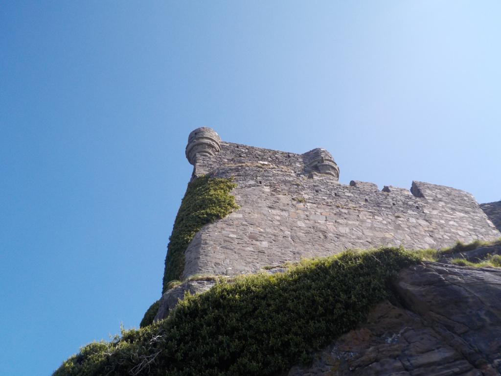
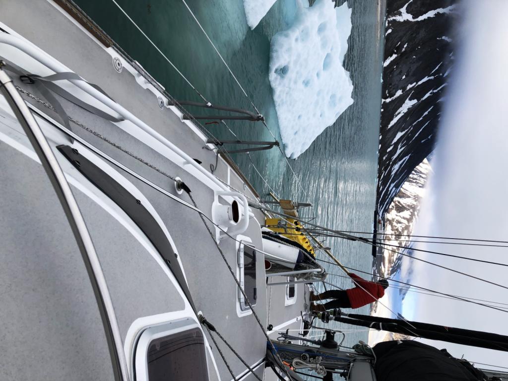
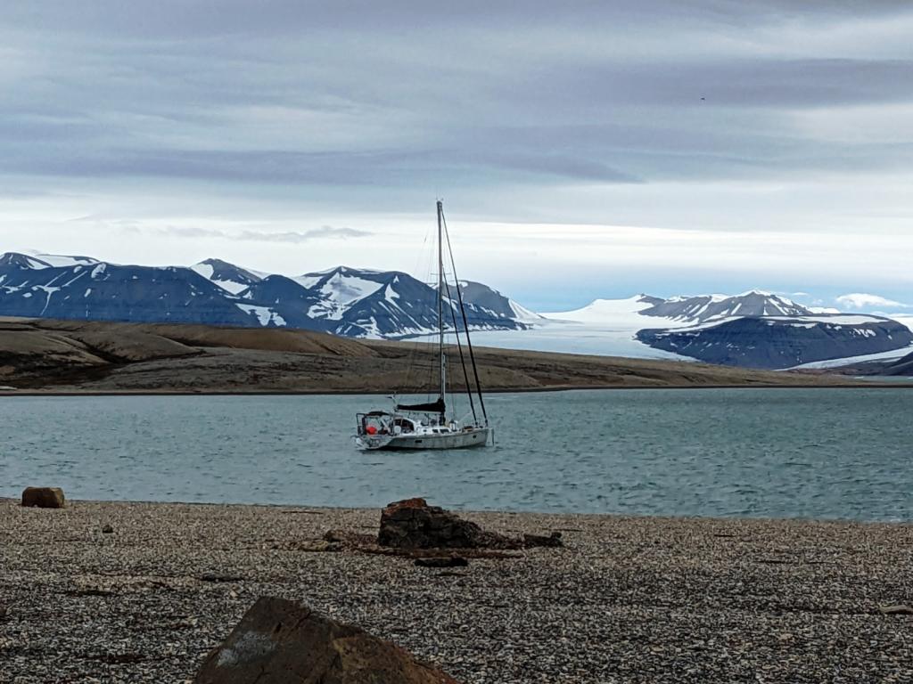
We were on a mission to get to Oban to send off the recalcitrant isolation transformer, which had given up on us early in the trip. It was still under warranty and hopefully will be repaired or replaced. We moved on down quickly stopping at Loch Drambui and Loch Aline and then on to Oban. We picked up a mooring and sorted out the logistics of sending off the transformer, replenished our groceries, and enjoyed another dinner out. Then we headed back north of the point of Ardnamurchan and to Loch Moidart, one of the most scenic spots in one of the most scenic parts of the world. We passed this guy with the wind blowing in the 30's, and he had full sail and was flying along.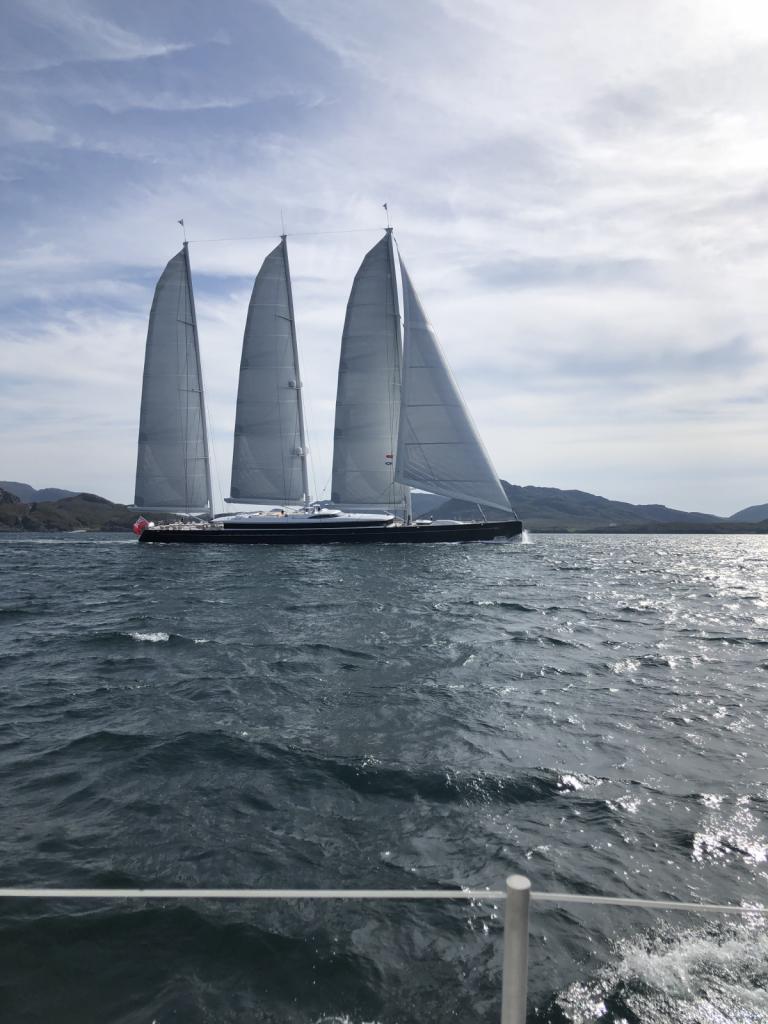 We took a couple of days to rest and relax and explore the Castle Tioram.
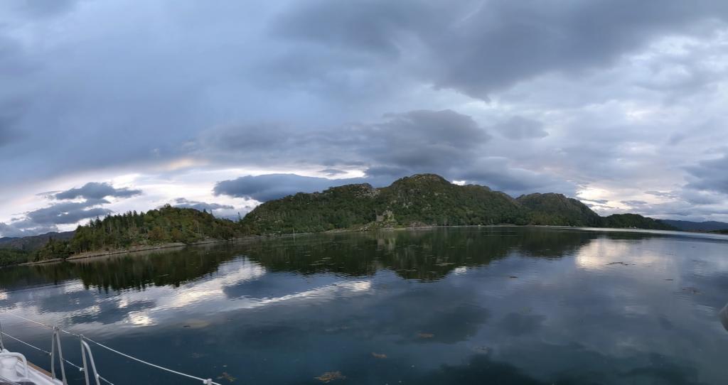


Then we resumed our path south stopping in Tobermory, Loch Aline and Oban before winding up in Ardfern. Then someone flipped the weather switch and we had five days of nastiness, with wind gusting as high as 45-50 knots at one point. We finally decided to bail out and head on further down through the Crinan Canal.
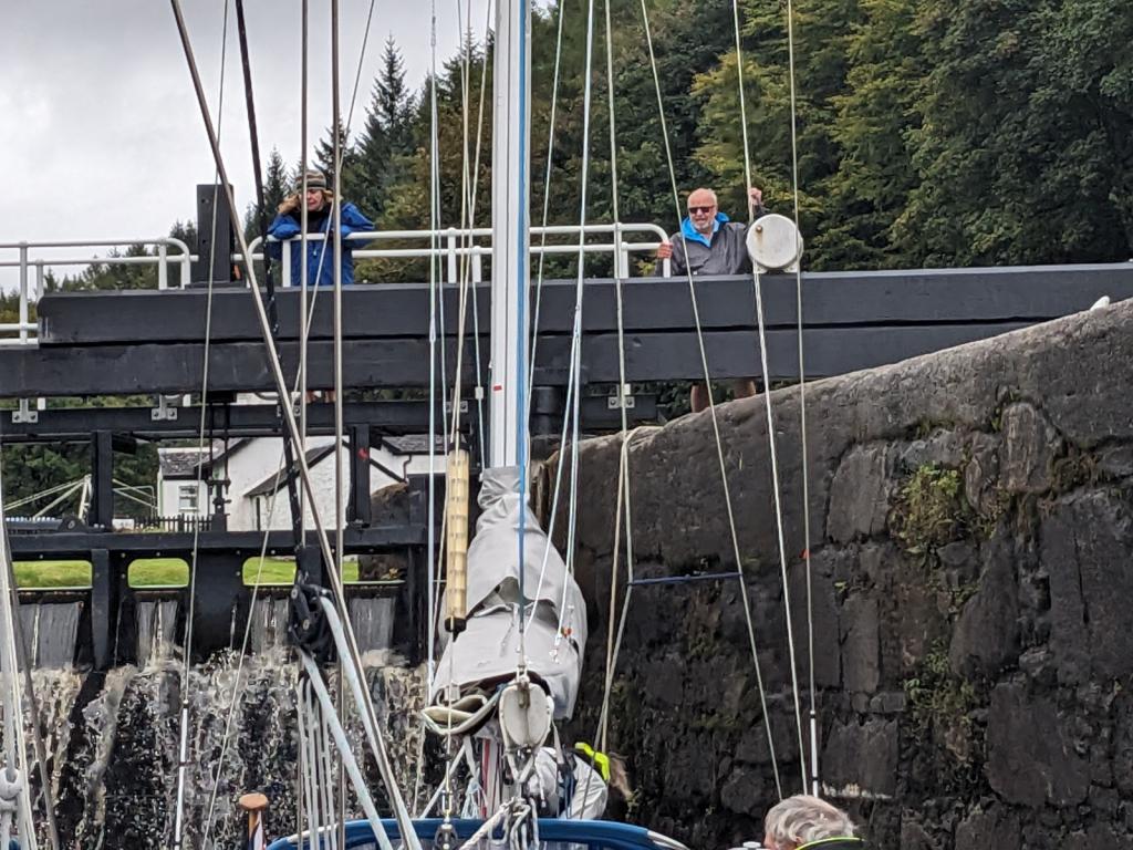
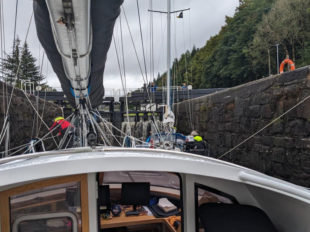
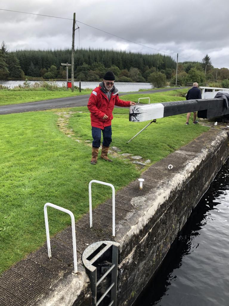
This canal dug back in the 1800's is a shortcut from the Firth of Clyde to the Sound of Jura, bypassing the Mull of Kyntire, which can be a nasty piece of water due to tides and wind. Similar to the Caledonian canal, you buy a license which gives you 4 days of time on the canal. This one is short and can be passed in one day but we decided to take our time and use the dockage to avoid the weather. Even though it may be blowing hard on the open water, things are pretty quiet on the canal.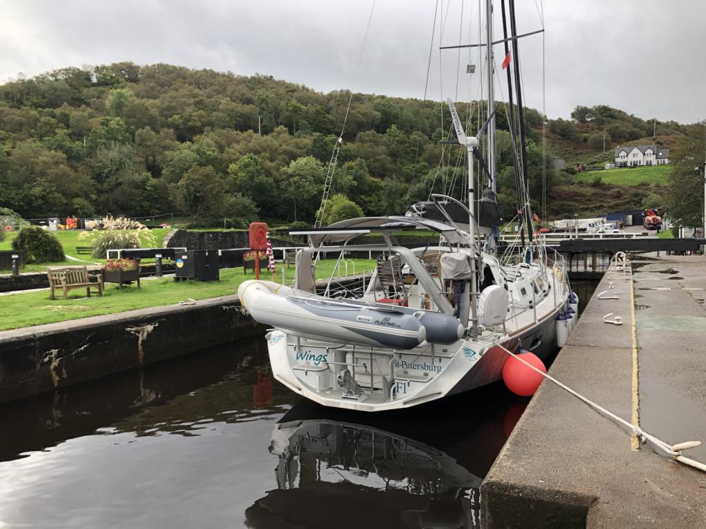

One issue with the Crinan is that the locks are manual and the sluices and gates must be opened by the boat crews. There are lock keepers and they offer assistance when needed. We were fortunate to hook up with another boat with extra crew on the second day to get through most of the locks. Locking up was the most difficult and coming down was much easier. There are a total of 15 locks including the 2 sea locks and of those 13 are manual.
We stopped the first night at Bellanoch Bridge, since we were pretty late getting in to the canal.


 The estuary adjacent to the canal is the Moine Mhor, home to many birds and other wildlife. We then went through locks 13-5 with the other boat crews help, and spent the night at Cairnbaan.

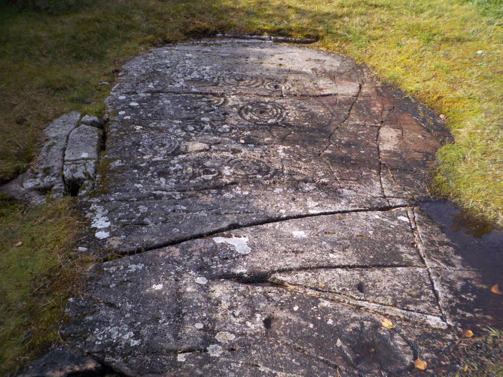
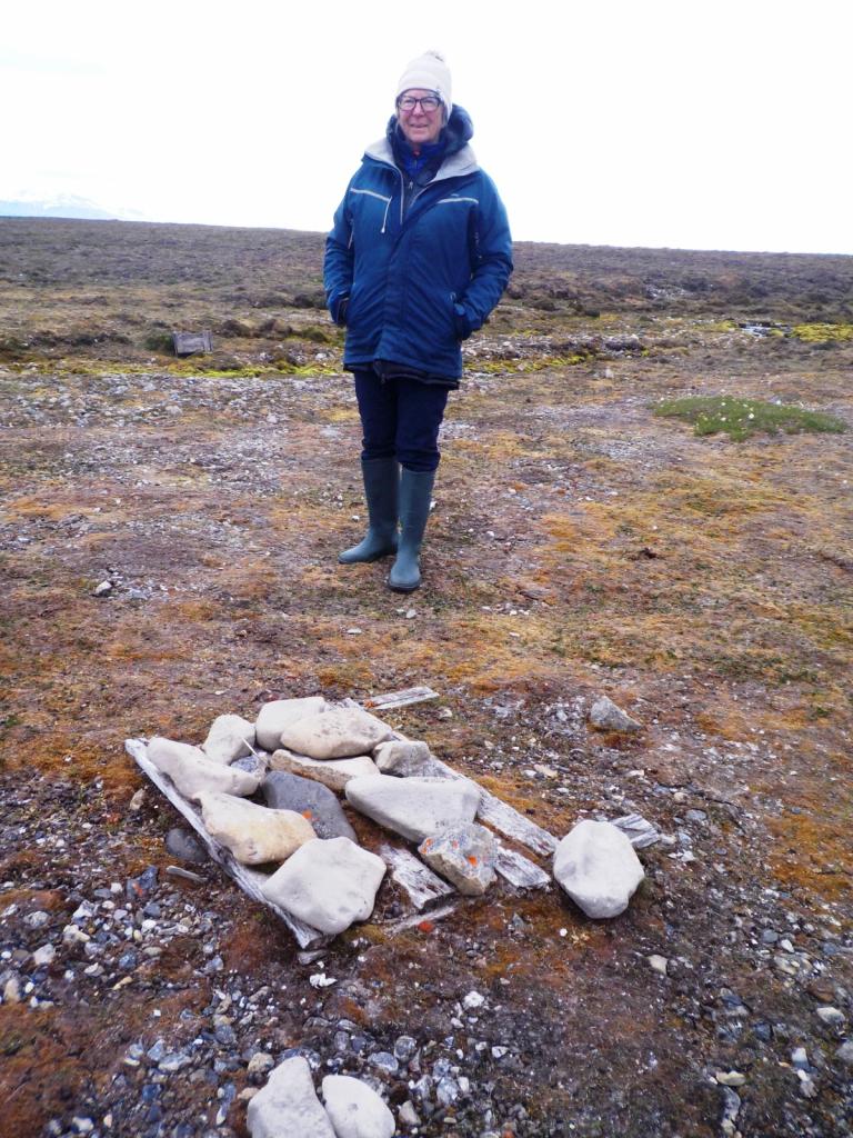
 This area is rich in history and there are many Standing Stones and rock carvings from many years ago and dating back to the first settlement of the area around 4,500 years ago.
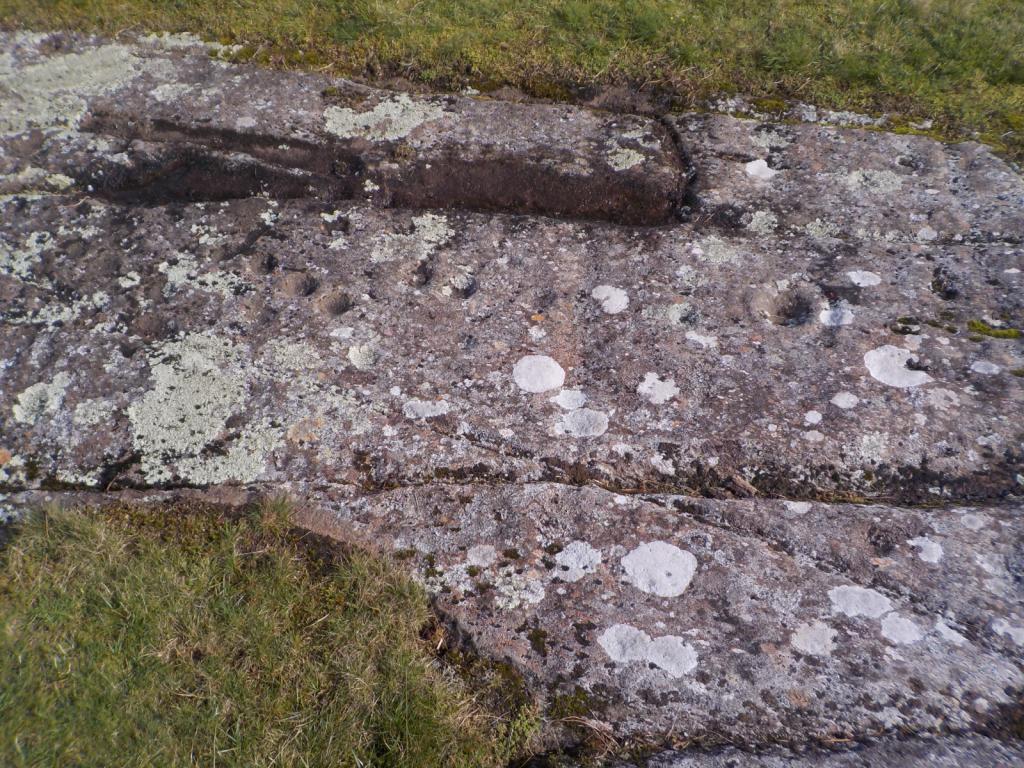
The next day we went on down to Ardrishaig, the southern terminus and passed through 3 more locks going down. We spent a couple of nights on the pontoon there waiting again for the weather.
 The remnants of Hurricane Leo blew through, although we were very protected in the basin inside the sealock.
Once things settled down a bit, we headed out to the north end of the Isla of Butte and spent a couple of days in the Burnt Isles, but the weather was so bad we didn't get off the boat. Then it was down to the Isle of Arran, and we picked up a free mooring at Brodick and had a nice day to explore the town and get propane and groceries. We'd planned some hikes for Arran, especially to the top of the mountain there, but the weather wouldn't cooperate. We save that one for next year.
We then moved around to Lamlash Bay and anchored for a few days. We did have one nice day for a hike up into the woods and to a cairn at Meallach's Grave.

 There's also an excellent coffee shop near the pier for coffee and a cinnamon bun after the walk.
We had fought the weather enough and the calendar had come to October so we decided to go into the marina at Ardrossan and get Wings ready for her winter hibernation. We had heard that the transformer had been repaired and it was shipped back to us at the marina, so I reinstalled it and we got the sails and running rigging down and stored. We are bagging up all our clothes and cleaning things and finishing a few projects and then she'll be ready for the hard.
We've decided to go back to Norway to explore more of the southern part and to take the Hurtigruten coastal ferry north from Bergen to the Russian border. It will be different not to have to worry about weather, cooking, navigation etc., and we can just enjoy the scenery and hopefully see some Northern Lights. More on all that next time.
We had decided this time to skip Lerwick and the Shetlands and to pass north of them and run down the western side and then on down to Stromness in the southwestern Orkneys. We began to see the oil platforms before dark and between them and the wind farms, it was like we were in a city all night. We were able to pretty much hold our course and only had to dodge a couple of the platforms.
Dawn found us of the north end of the Shetlands and the wind backed as predicted more into the north and then northeast as we ran down the western side. The wind held up nicely overnight and we pulled into Stromness around noon on the third day. It was a bit of culture shock seeing the grey stone buildings of Stromness after the colorful villages of Norway, but it was made up by the warmth and friendliness of the people. We enjoyed a dinner at the Ferry Inn, one of our favorite pubs.
Then we were off to catch the tide at around 11 AM, again watching the weather, trying to avoid some nastiness. We motorsailed off and on most of the day and then the wind filled in and we sailed around Cape Wrath at the NW tip of mainland Scotland just at dark.
The wind was holding up for us so we decided to carry on as long as possible, passing by a lot of potential anchorages. Dawn found us approaching the north end of the Isle of Skye and we sailed down the east side and under the bridge and then into the Kyle of Lochalsh. We kept on moving but hit the last of the adverse tide at Kyle Rhea and had to test the engine to motor against the current. We finally broke free and anchored in a favorite spot on the north side of Loch Hourne with only the seals for company.
Then we headed a bit further south to one of the so called Small Isles called Eigg. We wanted to hike to the top of an interesting rock formation called the Sgurr of Eigg. We were here last year but didn't do the hike because my knee was acting up. This formation is a lava flow which filled a valley and then the surrounding structure eroded away leaving this huge rock edifice. The heather was in full bloom and we had a great day for the hike.
We were on a mission to get to Oban to send off the recalcitrant isolation transformer, which had given up on us early in the trip. It was still under warranty and hopefully will be repaired or replaced. We moved on down quickly stopping at Loch Drambui and Loch Aline and then on to Oban. We picked up a mooring and sorted out the logistics of sending off the transformer, replenished our groceries, and enjoyed another dinner out. Then we headed back north of the point of Ardnamurchan and to Loch Moidart, one of the most scenic spots in one of the most scenic parts of the world. We passed this guy with the wind blowing in the 30's, and he had full sail and was flying along.
We took a couple of days to rest and relax and explore the Castle Tioram.Then we resumed our path south stopping in Tobermory,
Loch Aline and Oban before winding up in Ardfern. Then someone flipped the weather switch and we had five days of nastiness, with wind gusting as high as 45-50 knots at one point. We finally decided to bail out and head on further down through the Crinan Canal. This canal dug back in the 1800's is a shortcut from the Firth of Clyde to the Sound of Jura, bypassing the Mull of Kyntire, which can be a nasty piece of water due to tides and wind. Similar to the Caledonian canal, you buy a license which gives you 4 days of time on the canal. This one is short and can be passed in one day but we decided to take our time and use the dockage to avoid the weather. Even though it may be blowing hard on the open water, things are pretty quiet on the canal.
One issue with the Crinan is that the locks are manual and the sluices and gates must be opened by the boat crews. There are lock keepers and they offer assistance when needed. We were fortunate to hook up with another boat with extra crew on the second day to get through most of the locks. Locking up was the most difficult and coming down was much easier. There are a total of 15 locks including the 2 sea locks and of those 13 are manual.
We stopped the first night at Bellanoch Bridge, since we were pretty late getting in to the canal.
The estuary adjacent to the canal is the Moine Mhor, home to many birds and other wildlife. We then went through locks 13-5 with the other boat crews help, and spent the night at Cairnbaan. This area is rich in history and there are many Standing Stones and rock carvings from many years ago and dating back to the first settlement of the area around 4,500 years ago.The next day we went on down to Ardrishaig, the southern terminus and passed through 3 more locks going down. We spent a couple of nights on the pontoon there waiting again for the weather.
The remnants of Hurricane Leo blew through, although we were very protected in the basin inside the sealock.Once things settled down a bit, we headed out to the north end of the Isla of Butte and spent a couple of days in the Burnt Isles, but the weather was so bad we didn't get off the boat. Then it was down to the Isle of Arran, and we picked up a free mooring at Brodick and had a nice day to explore the town and get propane and groceries. We'd planned some hikes for Arran, especially to the top of the mountain there, but the weather wouldn't cooperate. We save that one for next year.
We then moved around to Lamlash Bay and anchored for a few days. We did have one nice day for a hike up into the woods and to a cairn at Meallach's Grave.
There's also an excellent coffee shop near the pier for coffee and a cinnamon bun after the walk.We had fought the weather enough and the calendar had come to October so we decided to go into the marina at Ardrossan and get Wings ready for her winter hibernation. We had heard that the transformer had been repaired and it was shipped back to us at the marina, so I reinstalled it and we got the sails and running rigging down and stored. We are bagging up all our clothes and cleaning things and finishing a few projects and then she'll be ready for the hard.
We've decided to go back to Norway to explore more of the southern part and to take the Hurtigruten coastal ferry north from Bergen to the Russian border. It will be different not to have to worry about weather, cooking, navigation etc., and we can just enjoy the scenery and hopefully see some Northern Lights. More on all that next time.
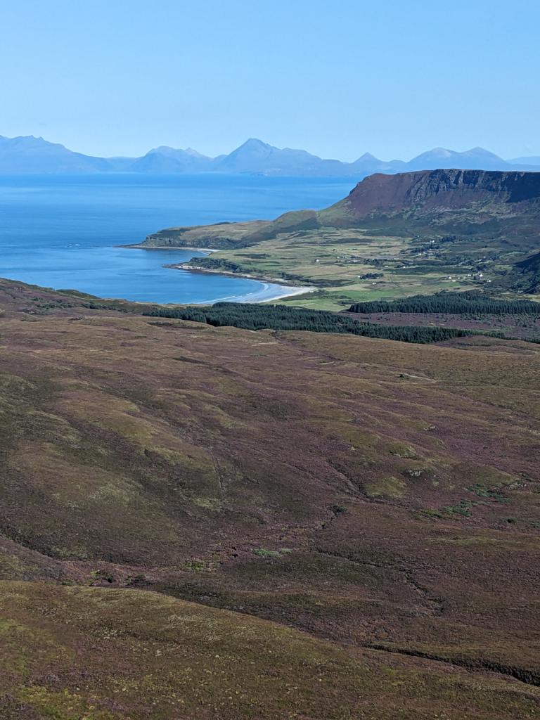
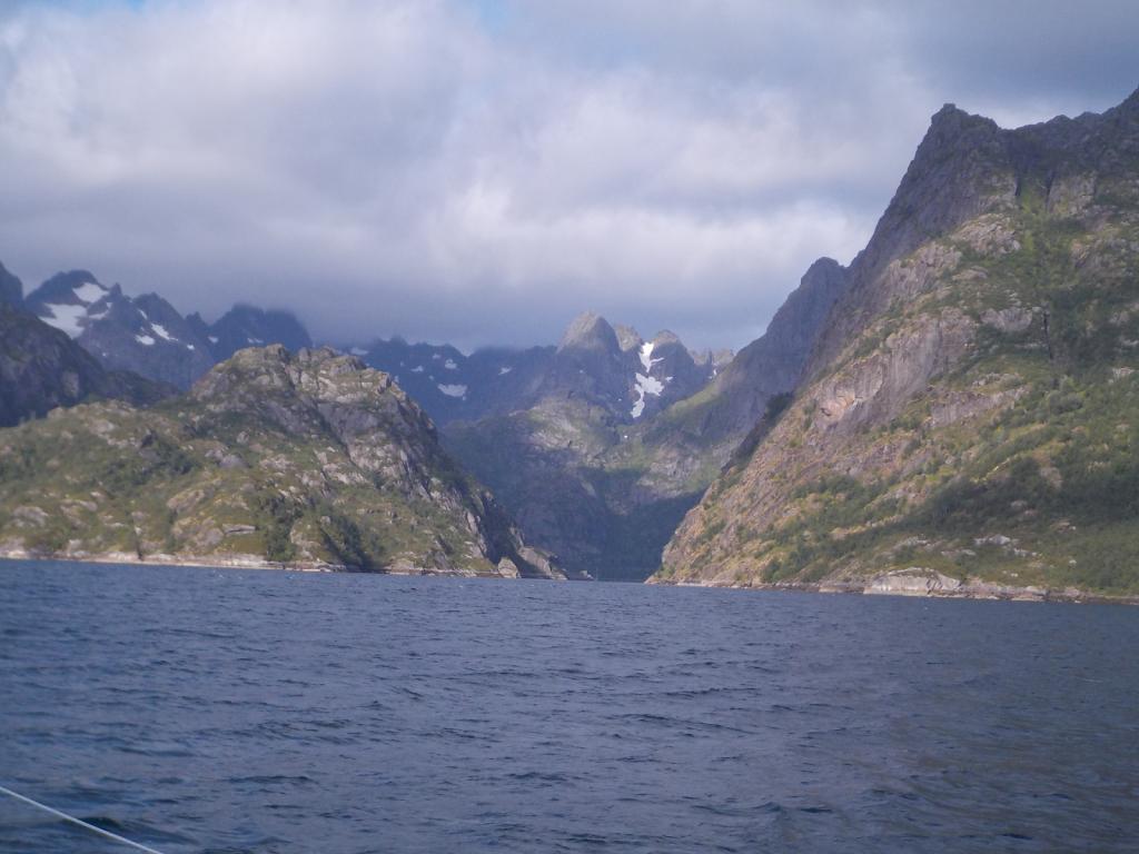
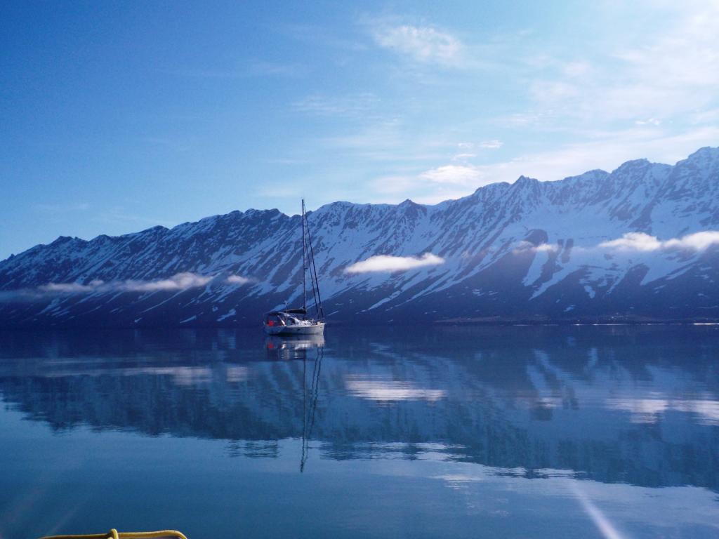
Heading South
28 August 2023 | Stromness
Dee

We had originally planned to go from Svalbard to Iceland and on to Greenland and Canada this year. Some boat issues and the desire to do some hiking in northern Norway changed our minds and so we returned to Tromso and checked back into Norway, planning to spend another winter in Scotland for the boat.
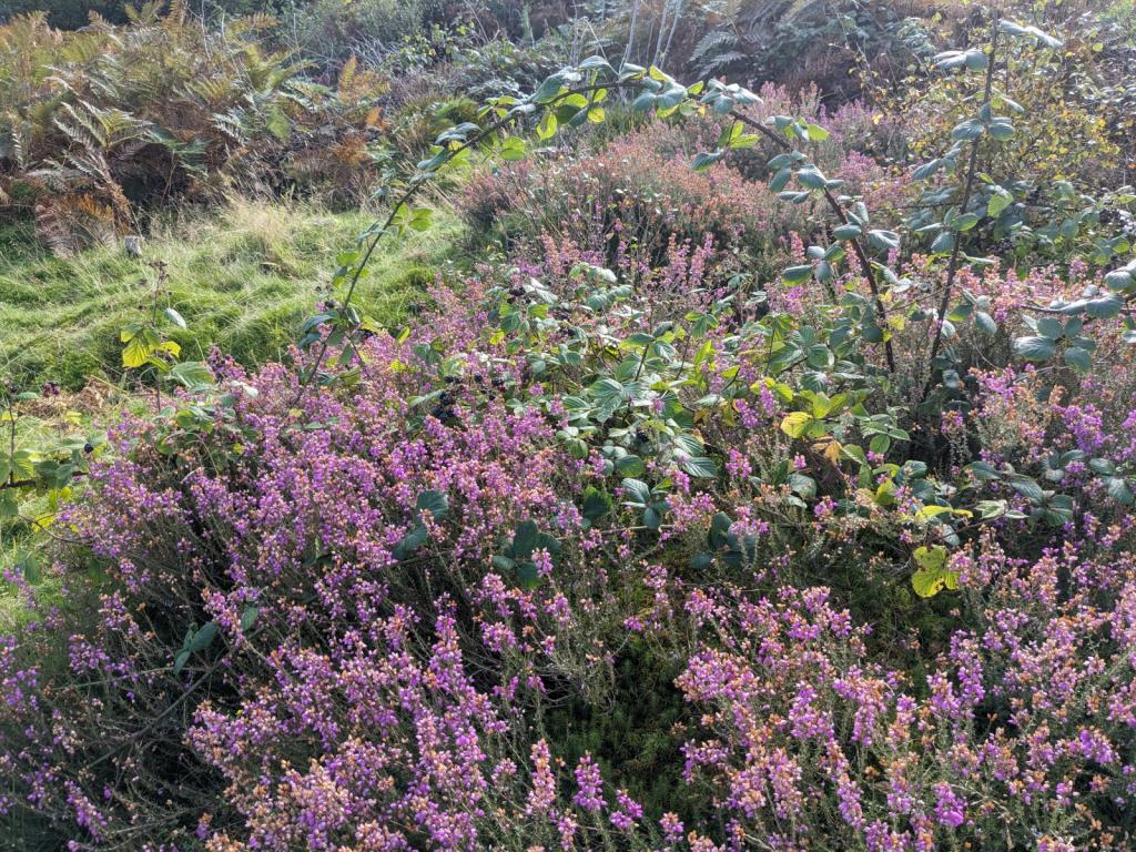
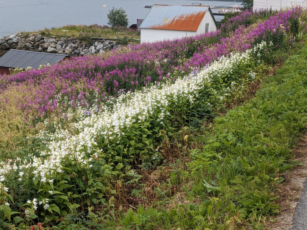
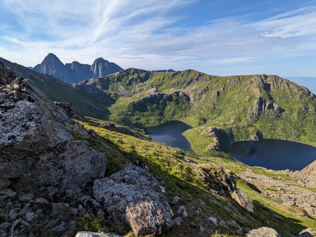
After a few days in Tromso, we moved back over to Finsness and did a marathon wash day and oil change for the boat. We talked to the tourist office in town about hiking in Senja, as we had gotten a taste on the way up, but the snow was still deep enough to prevent us from getting very high. Senja is a large island indented with many fiords and covered with high mountains. The hiking in Senja was calling us and so we called at Stonglandseidet and did a first hike up to the top of the mountain over looking the harbor. The wild flowers were in full bloom.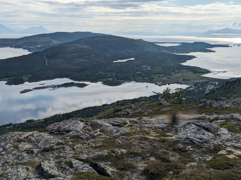

Then we moved up to Torsken on a really foggy day and didn't see anything until we entered the harbor and tied up to the dock. The fog eventually lifted and showed the surrounding peaks, all very majestic. The next morning, we hiked up to Ravnfloya, and into the cloud.

Next was a move up to Gryllefiord and an even more spectacular hike up to Glaeret and Middagstinden.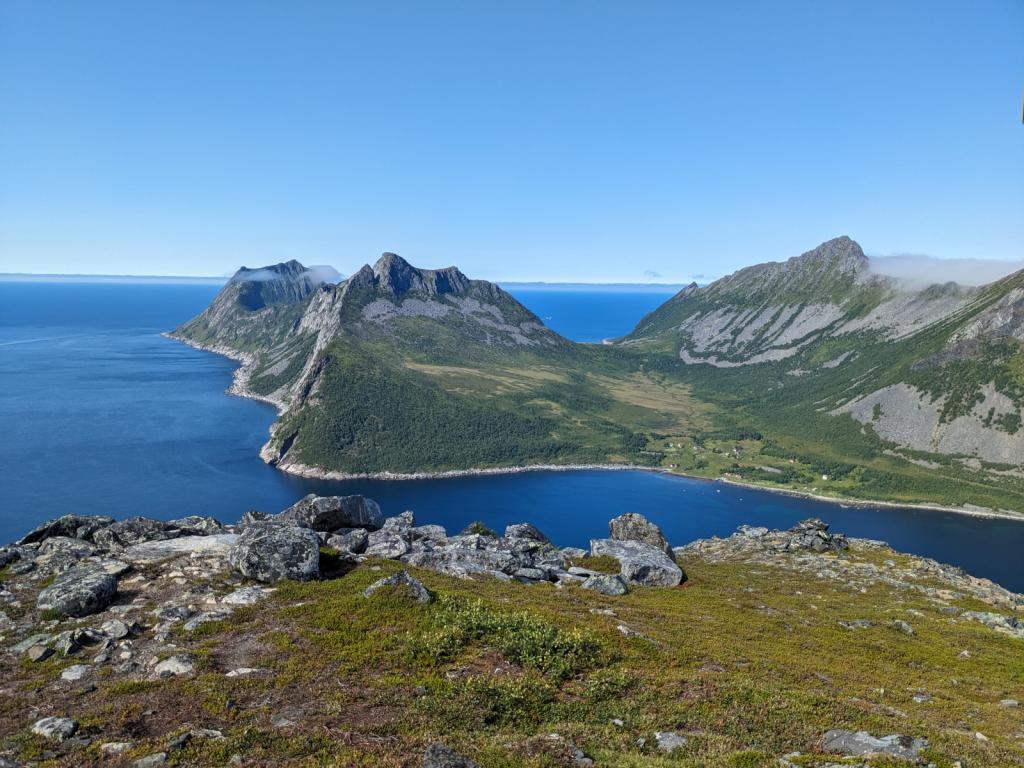


 Here's a rock snake that the local kids made in the marina.
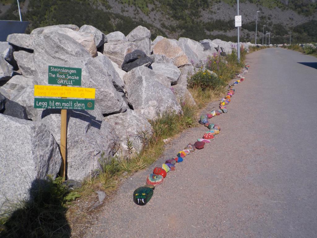
Our final Senja destination was Hamm and the dock at the resort, Hamm I Senja. We took a walk up to Sukkertoppen (Sugartop in English). A very spectacular hike and followed that with a spectacular dinner at the resort that night.

We headed further south, down to the island of Langoya and made a stop for the night at Tranesvagen and then on to Sto.

Here was the most challenging hike of our plan, the Queen's Path, which crosses along the crest of the ridge from Sto to Nyksund and then along the coast to return to Sto. There's a lot of climbing and up and down, but it's one of the most spectacular hikes I've done.


We then headed to Skipnes, a restored fishing village which now is home to a collection of summer homes and rentals for vacationers. We took a walk to Tinden, an old trading post which has also been restored and now is controlled by a trust. It was closed while we were there, but in a beautiful spot.

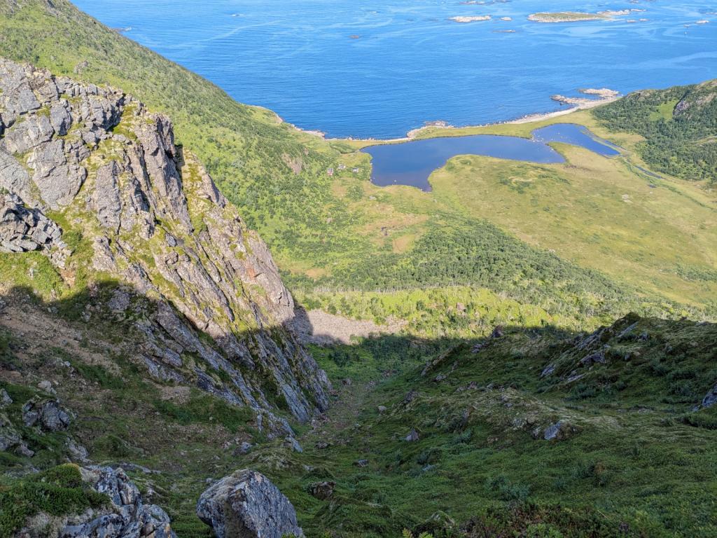
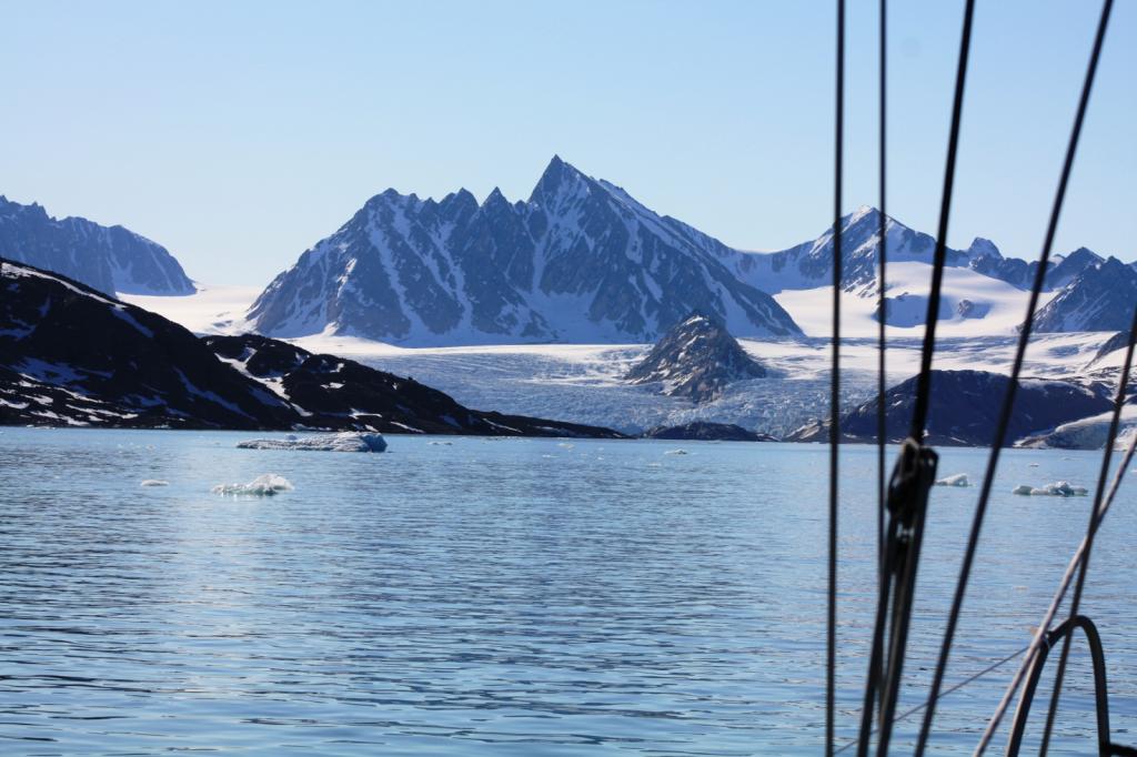
We left Skipnes on an early run down to Nordvagen, a beautiful cove anchorage and then on to Melbu to stop for groceries. We then made a run down Raftsundet, one of the passes through the Lofoton island chain, and a dramatic fiord with cliffs reaching for the sky.

With the wind in our face and getting stronger, we tacked south and west to Kabelvag for the night, where it just so happened a celebration concert was going on related to the end of a plan to drill for oil in the Lofotons.

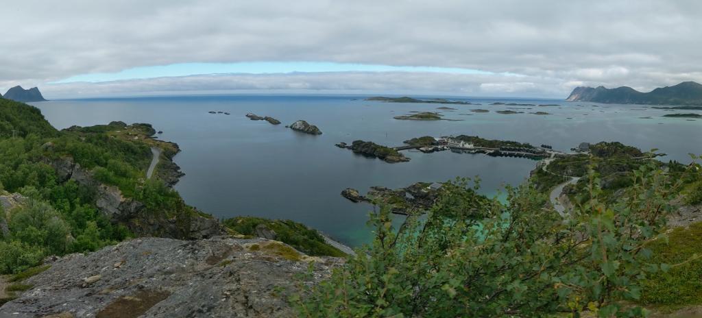
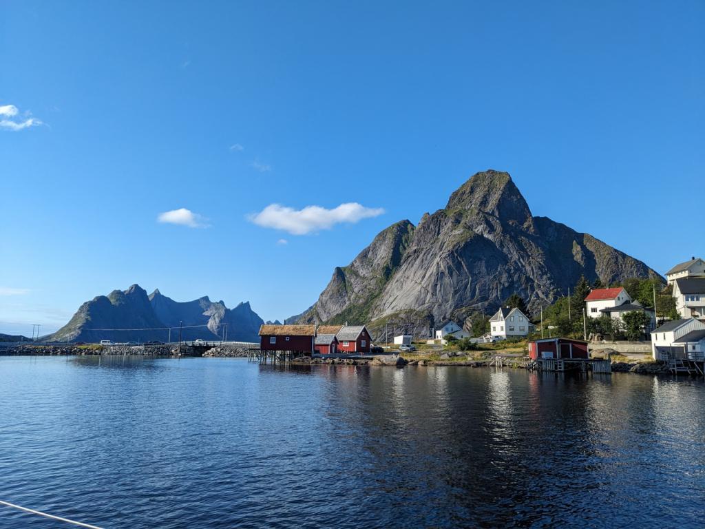
The next day we headed out close hauled to Reine and anchored in what has been voted Norway's most scenic spot.


The next morning we were up early for a 5 AM departure and said goodbye to the Lofotons and were heading south down to Rodoya and the Klokkergarden using a brisk northeasterly wind, but only to anchor for the night this time. We were off early the next morning again heading south, trying to stay ahead of the weather, with strong easterly's forecast. The wind is notoriously fickle in the fiords and we started with a good 15-20 knot reach, but the wind died and then instantly became 30 knots, and then as high as 56 knots as we crossed the mouth of another fiord. It was a long day of dealing with the strong wind and sailing under staysail alone most of the time. We pulled into the island of Igeroya and settled in for a couple of nights to let the wind blow itself out. We had a chance to do a walk up to the top of a hill and almost got blown away.

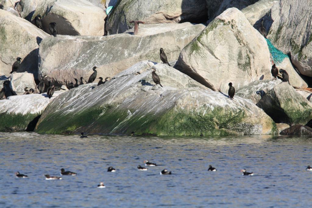
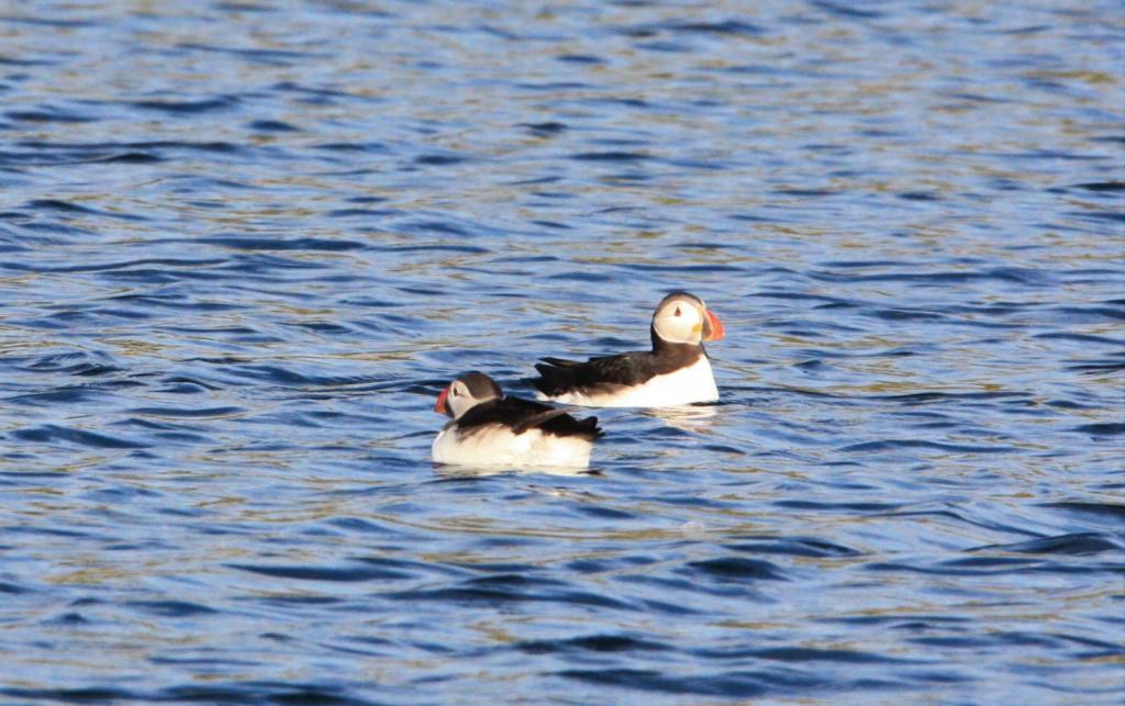
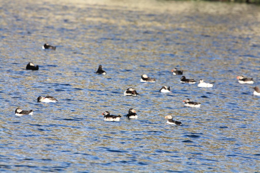
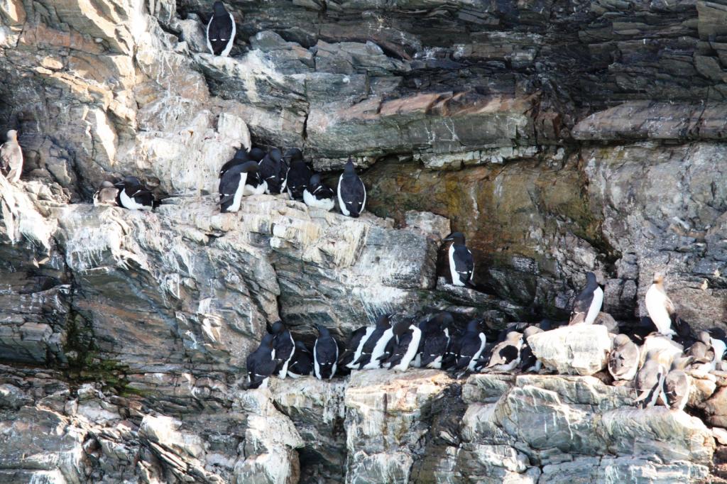
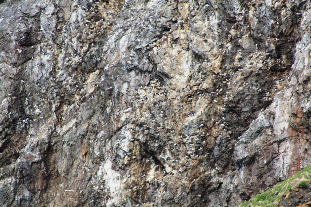
Then it was off to Sklinna, an island off the coast which is now a bird sanctuary. There is a protected harbor there with three moorings available to use. While there we took a look around the lighthouse, but there are restrictions because of the nesting birds. There were a group of folks there doing research on some of the birds. We saw many puffins and cormerants.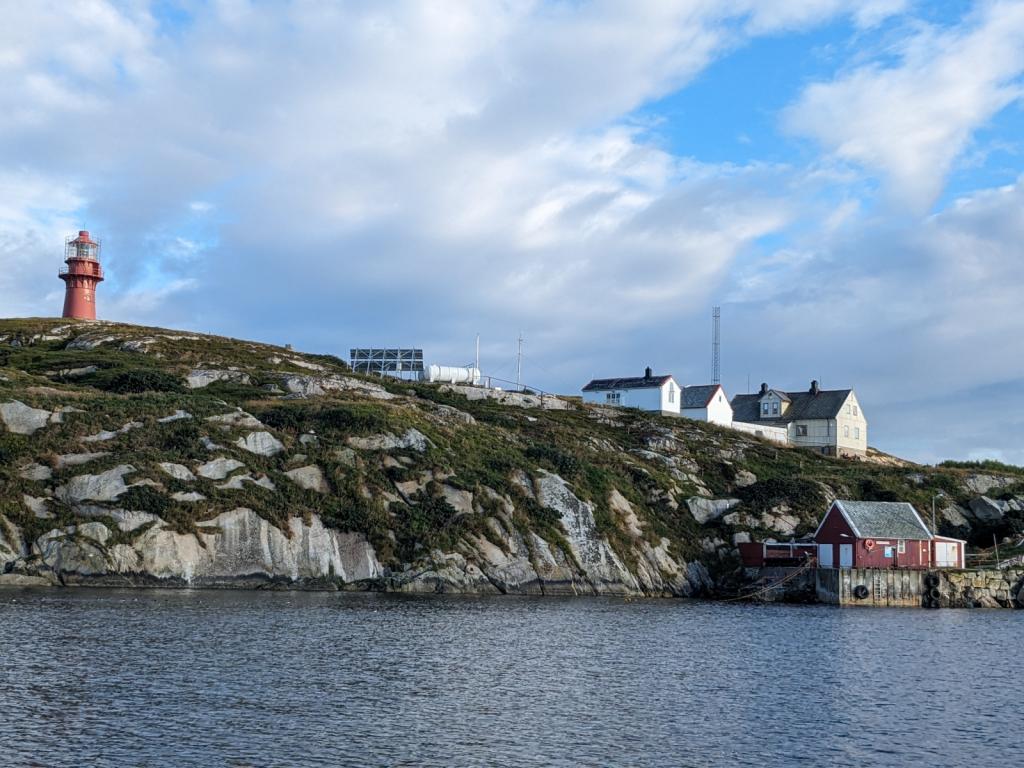
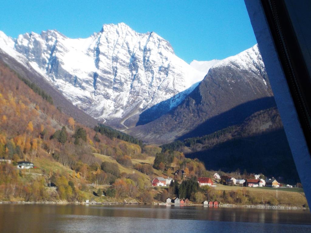
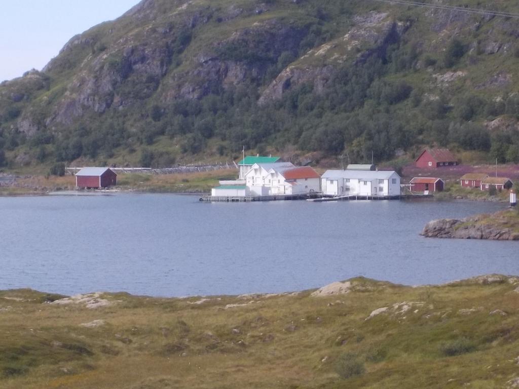
We made a couple of stops while quickly moving down the coast at Grisvagen and Rostoya, both picturesque anchorages and then back to Kristiansund with a stop for fuel and groceries.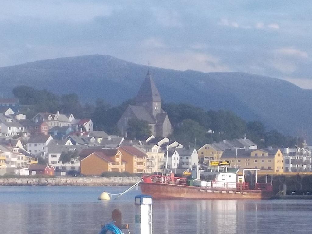
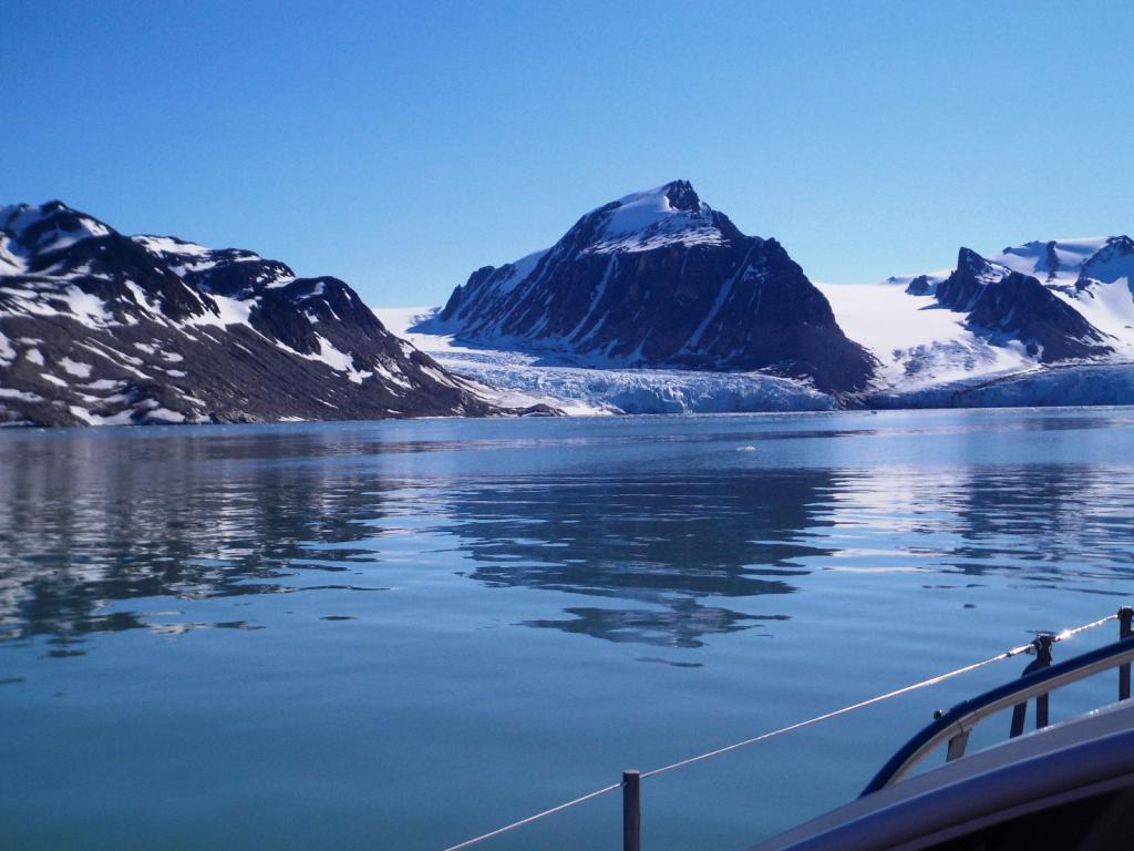
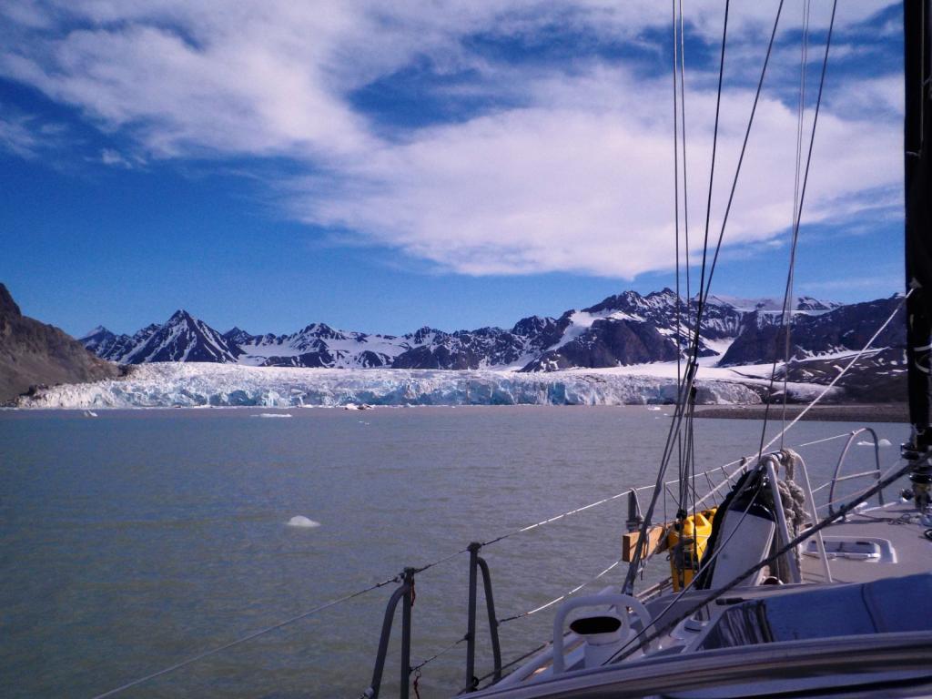
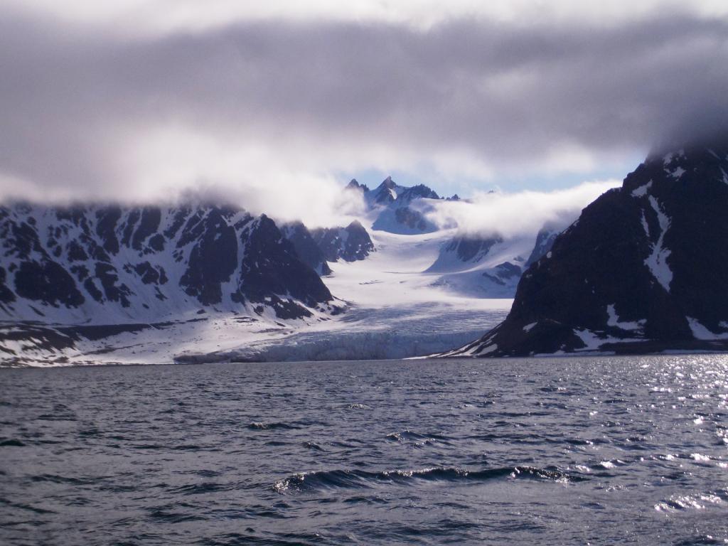
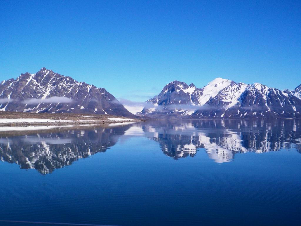
An early start got us underway all the way down to Storensetsouth of Alesund and then on to Floro. We spent a couple of days there, planning to do a quick trip into the Sognafjord, the longest fiord in Norway and second in the world.
We headed down to the mouth of the fiord and spent a night at Medholmen, and then the next day bashed our way up the fiord against a 25 knot easterly wind, finally getting to a wonderful anchorage at Kvansoy. The island there is the smallest to have its own church, dating from the 1300's.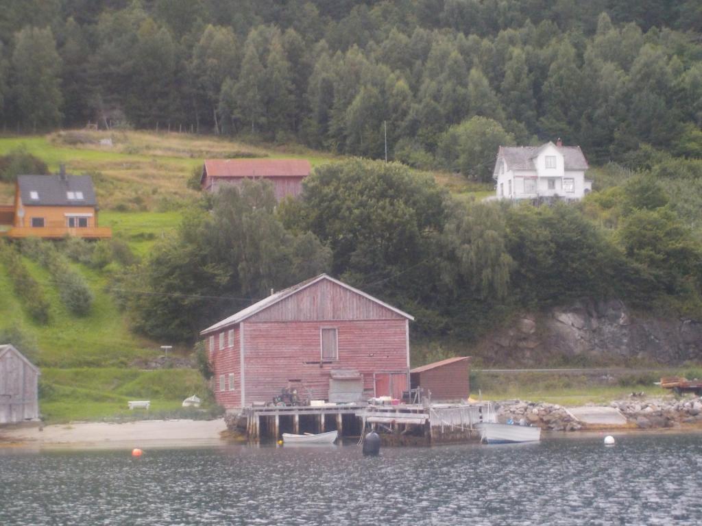

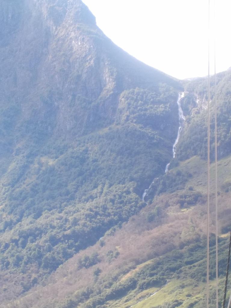
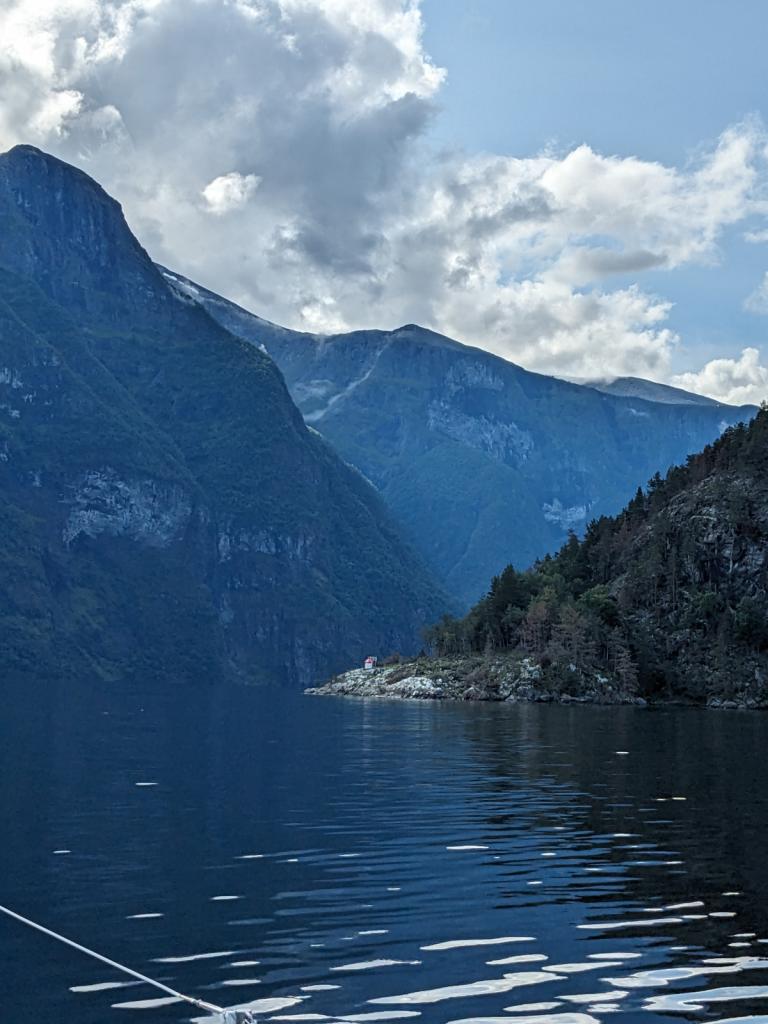
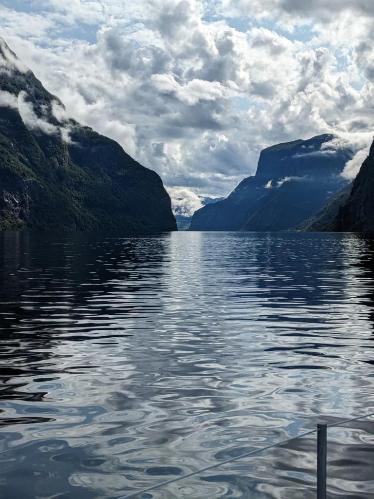
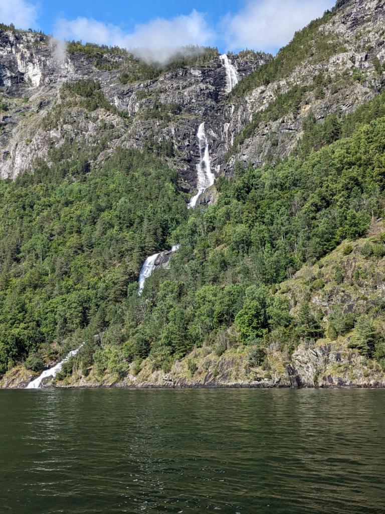
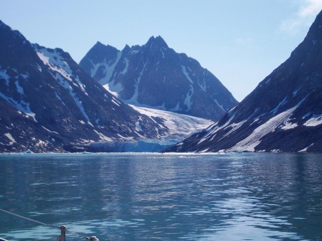
Then we went further into the fiord and into Naeroyfjorden and Aurlandsfjorden. The Naeroyfiord is one of the narrowest , with walls going up thousands of feet and many waterfalls cascading down.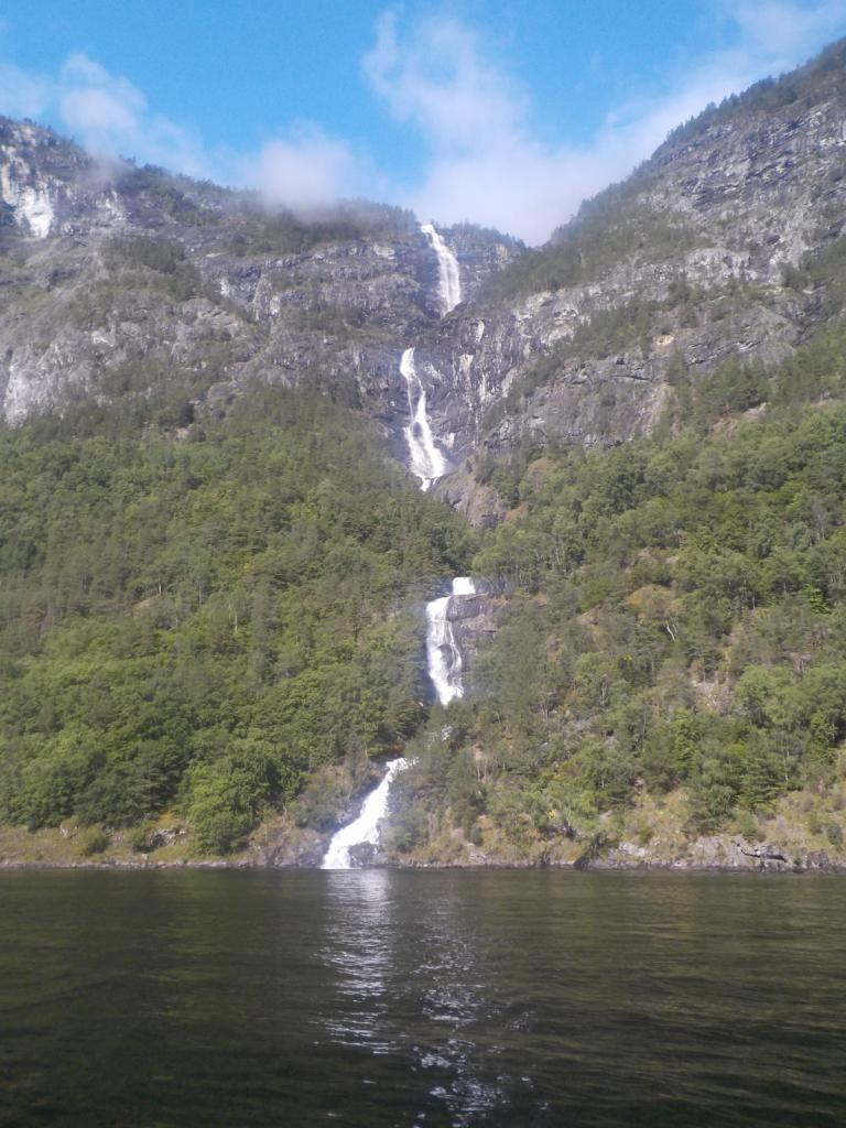
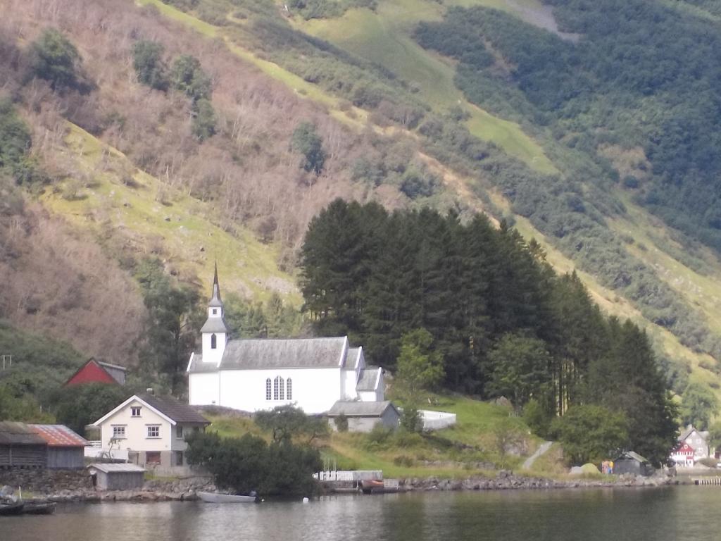
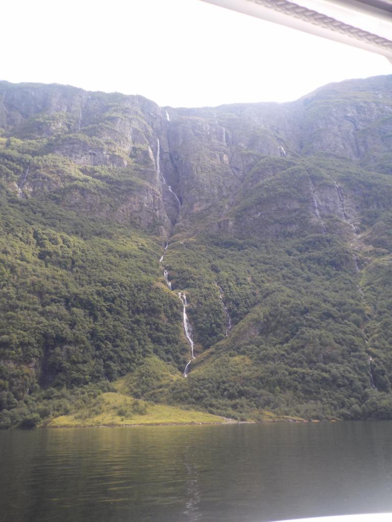
![]() src="/sbgallery/pics/rstrick7022_gmail_com/sbdr3gqz9/w/56.JPG" alt="" />
src="/sbgallery/pics/rstrick7022_gmail_com/sbdr3gqz9/w/56.JPG" alt="" />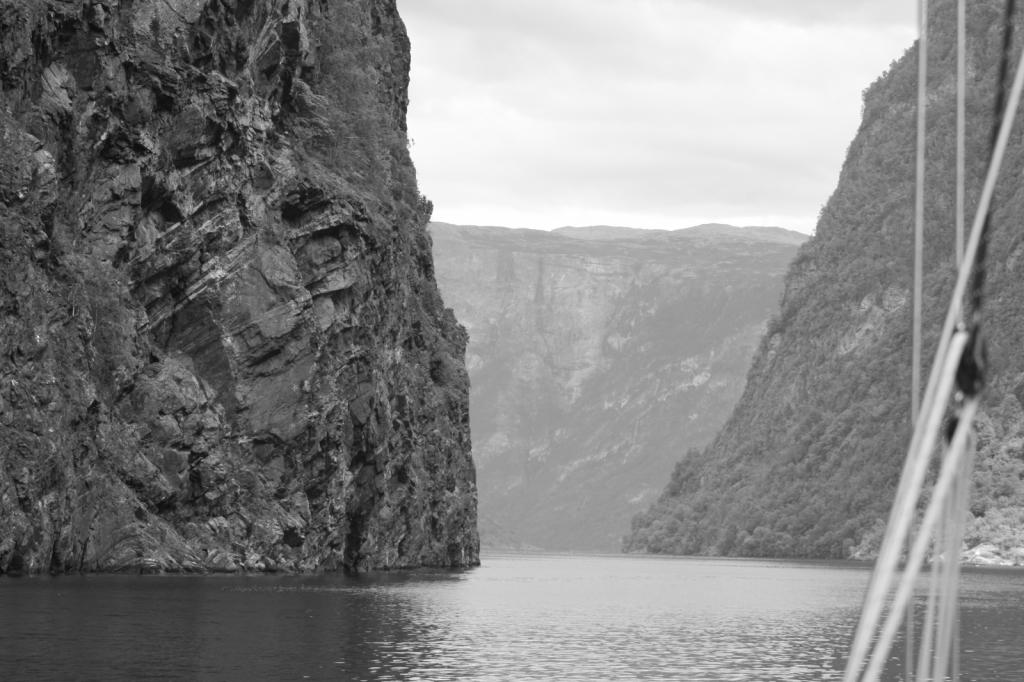


We spent the night at the guest dock in Aurlands, and enjoyed dinner out at the local pub.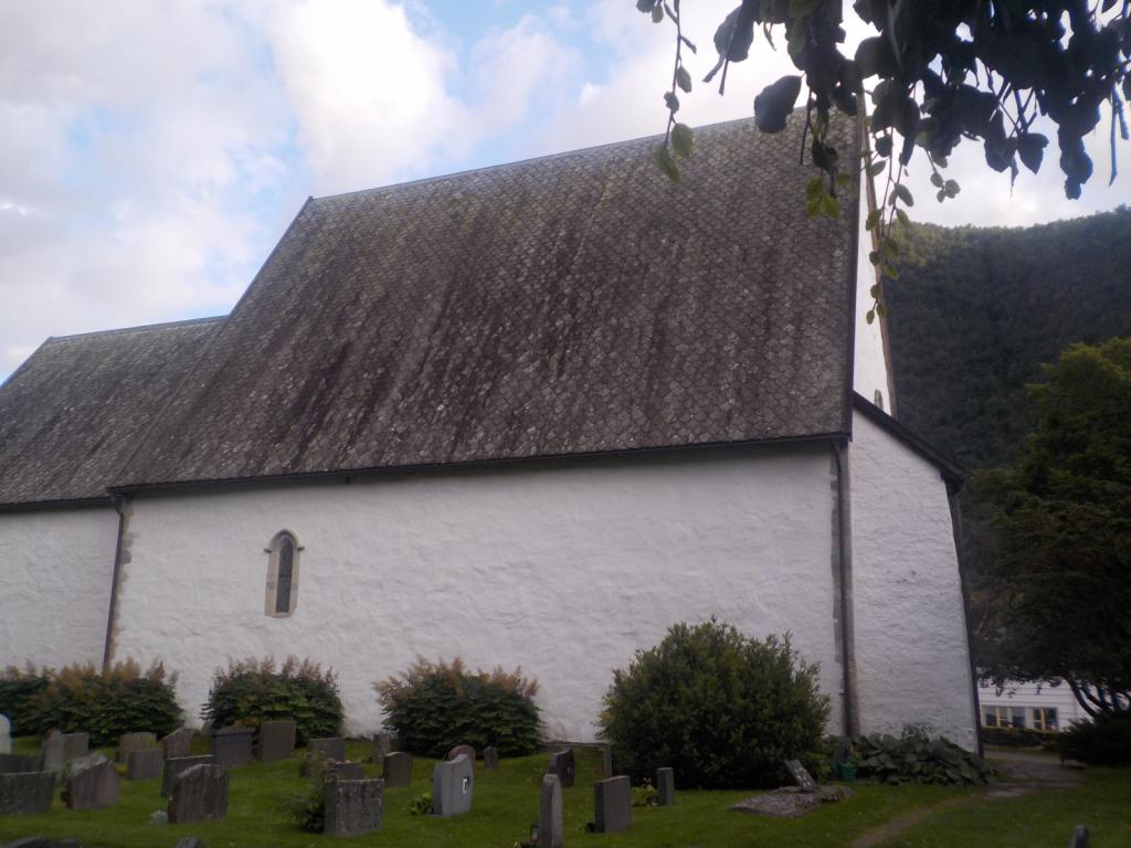


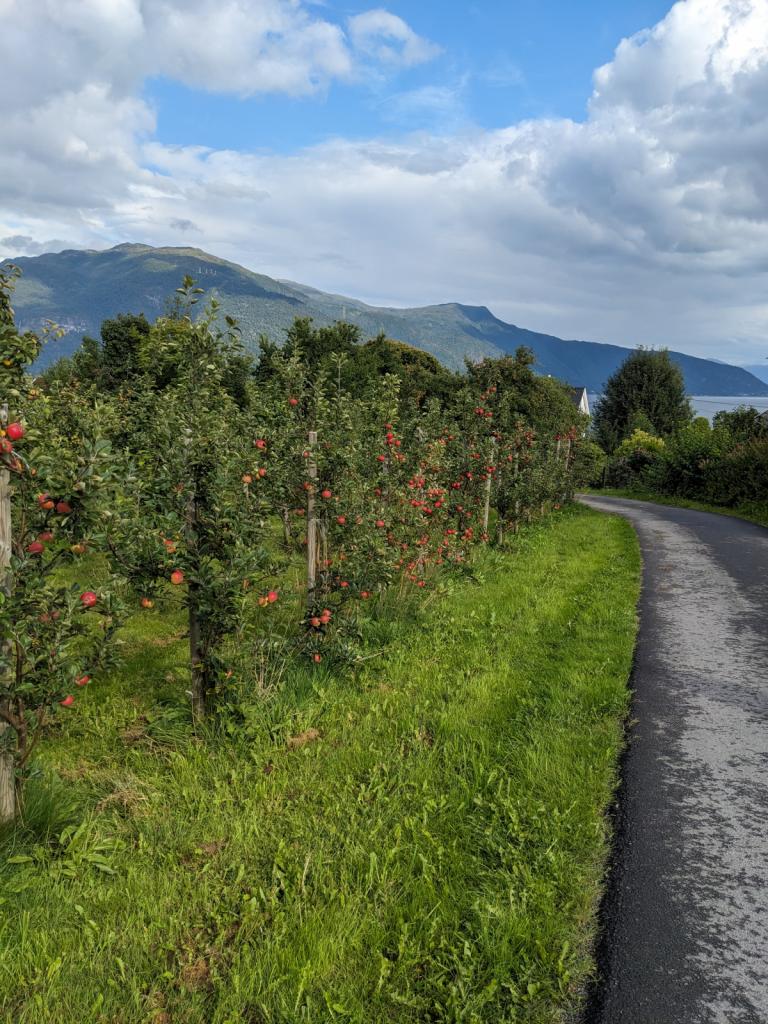
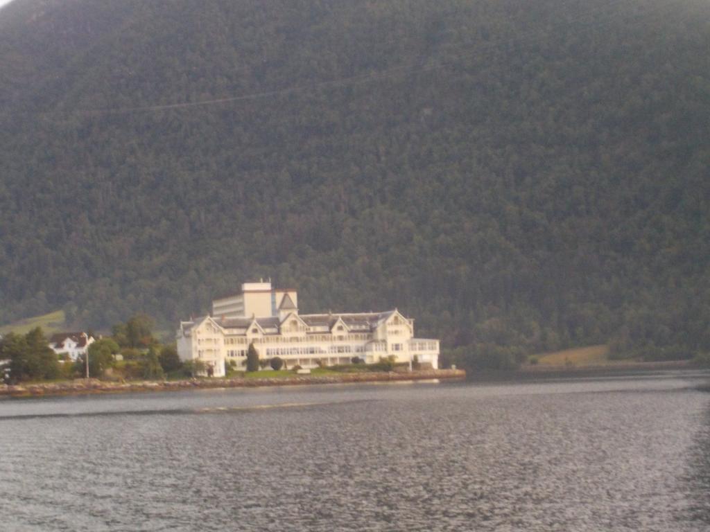
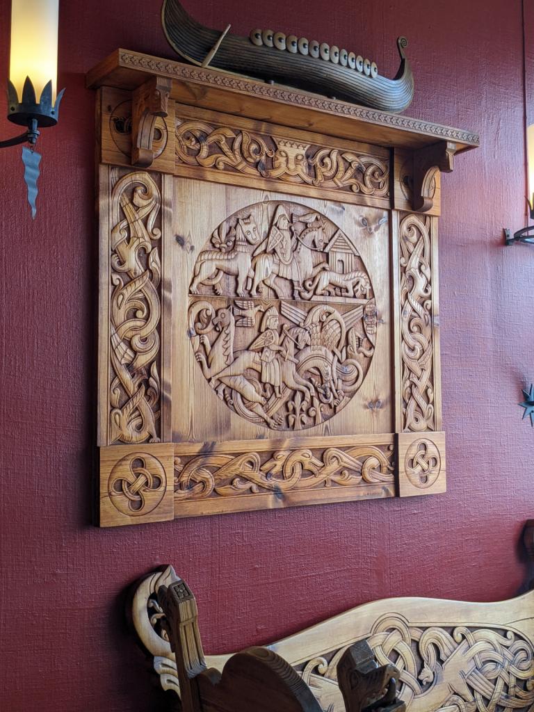
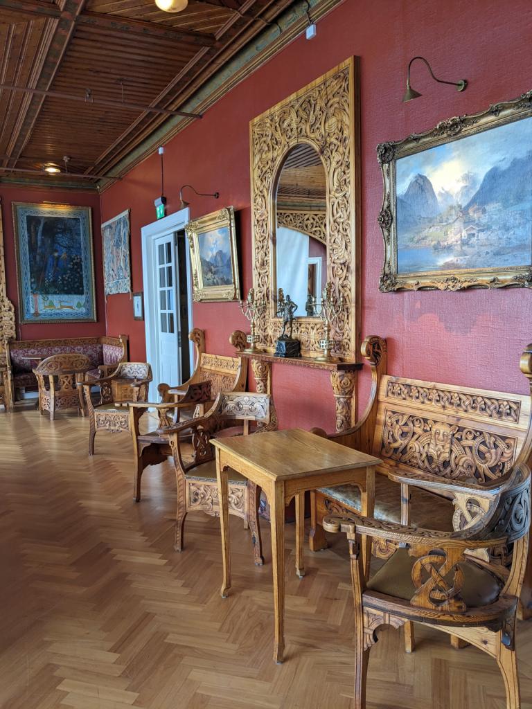
Then we headed back over to Balestrand for a night, and visited the English Church, and one of the local apple orchards and cider producers, and the local hotel filled with wonderful carved furniture, telling the Viking history of the place. This area is rich with hiking possibilities, but we were short of time and had to forgo any hikes.


Then it was back to Floro with a stop overnight in Hamnoyhamn. We cleared out of Norway with a good weather window to head back to the UK, although we wished we could stay in Norway and continue our explorations there.
After a few days in Tromso, we moved back over to Finsness and did a marathon wash day and oil change for the boat. We talked to the tourist office in town about hiking in Senja, as we had gotten a taste on the way up, but the snow was still deep enough to prevent us from getting very high. Senja is a large island indented with many fiords and covered with high mountains. The hiking in Senja was calling us and so we called at Stonglandseidet and did a first hike up to the top of the mountain over looking the harbor. The wild flowers were in full bloom.
Then we moved up to Torsken on a really foggy day and didn't see anything until we entered the harbor and tied up to the dock. The fog eventually lifted and showed the surrounding peaks, all very majestic. The next morning, we hiked up to Ravnfloya, and into the cloud.
Next was a move up to Gryllefiord and an even more spectacular hike up to Glaeret and Middagstinden.
Here's a rock snake that the local kids made in the marina. Our final Senja destination was Hamm and the dock at the resort, Hamm I Senja. We took a walk up to Sukkertoppen (Sugartop in English). A very spectacular hike and followed that with a spectacular dinner at the resort that night.
We headed further south, down to the island of Langoya and made a stop for the night at Tranesvagen and then on to Sto.
Here was the most challenging hike of our plan, the Queen's Path, which crosses along the crest of the ridge from Sto to Nyksund and then along the coast to return to Sto. There's a lot of climbing and up and down, but it's one of the most spectacular hikes I've done.
We then headed to Skipnes, a restored fishing village which now is home to a collection of summer homes and rentals for vacationers. We took a walk to Tinden, an old trading post which has also been restored and now is controlled by a trust. It was closed while we were there, but in a beautiful spot.
We left Skipnes on an early run down to Nordvagen, a beautiful cove anchorage and then on to Melbu to stop for groceries. We then made a run down Raftsundet, one of the passes through the Lofoton island chain, and a dramatic fiord with cliffs reaching for the sky.
With the wind in our face and getting stronger, we tacked south and west to Kabelvag for the night, where it just so happened a celebration concert was going on related to the end of a plan to drill for oil in the Lofotons.
The next day we headed out close hauled to Reine and anchored in what has been voted Norway's most scenic spot.
The next morning we were up early for a 5 AM departure and said goodbye to the Lofotons and were heading south down to Rodoya and the Klokkergarden using a brisk northeasterly wind, but only to anchor for the night this time. We were off early the next morning again heading south, trying to stay ahead of the weather, with strong easterly's forecast. The wind is notoriously fickle in the fiords and we started with a good 15-20 knot reach, but the wind died and then instantly became 30 knots, and then as high as 56 knots as we crossed the mouth of another fiord. It was a long day of dealing with the strong wind and sailing under staysail alone most of the time. We pulled into the island of Igeroya and settled in for a couple of nights to let the wind blow itself out. We had a chance to do a walk up to the top of a hill and almost got blown away.
Then it was off to Sklinna, an island off the coast which is now a bird sanctuary. There is a protected harbor there with three moorings available to use. While there we took a look around the lighthouse, but there are restrictions because of the nesting birds. There were a group of folks there doing research on some of the birds. We saw many puffins and cormerants.
We made a couple of stops while quickly moving down the coast at Grisvagen and Rostoya, both picturesque anchorages and then back to Kristiansund with a stop for fuel and groceries.
An early start got us underway all the way down to Storensetsouth of Alesund and then on to Floro. We spent a couple of days there, planning to do a quick trip into the Sognafjord, the longest fiord in Norway and second in the world.
We headed down to the mouth of the fiord and spent a night at Medholmen, and then the next day bashed our way up the fiord against a 25 knot easterly wind, finally getting to a wonderful anchorage at Kvansoy. The island there is the smallest to have its own church, dating from the 1300's.
Then we went further into the fiord and into Naeroyfjorden and Aurlandsfjorden. The Naeroyfiord is one of the narrowest , with walls going up thousands of feet and many waterfalls cascading down.
We spent the night at the guest dock in Aurlands, and enjoyed dinner out at the local pub.
Then we headed back over to Balestrand for a night, and visited the English Church, and one of the local apple orchards and cider producers, and the local hotel filled with wonderful carved furniture, telling the Viking history of the place. This area is rich with hiking possibilities, but we were short of time and had to forgo any hikes.
Then it was back to Floro with a stop overnight in Hamnoyhamn. We cleared out of Norway with a good weather window to head back to the UK, although we wished we could stay in Norway and continue our explorations there.
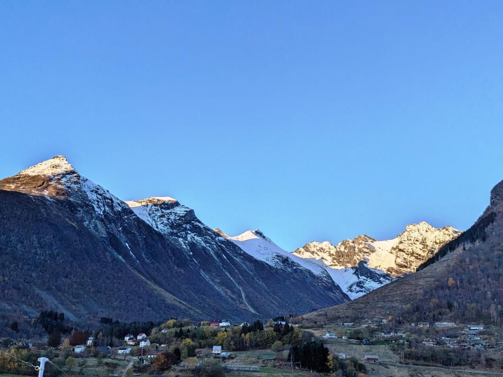
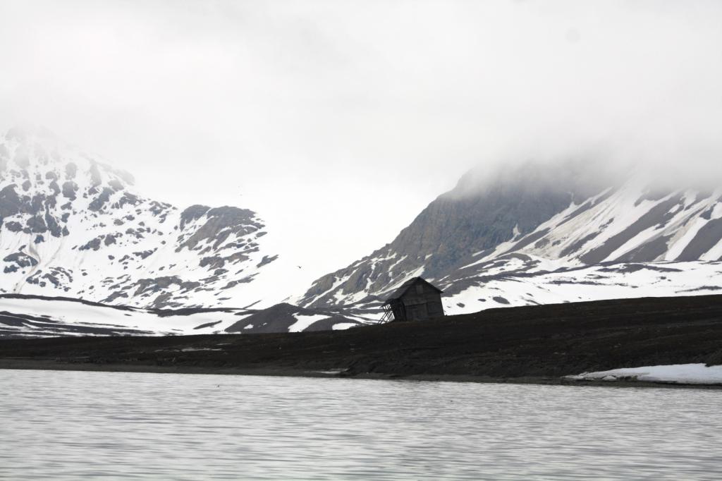
Thoughts on Svalbard
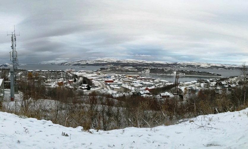
14 August 2023 | Kristiansund
Robert Strickland
I thought I might write down a few suggestions for any cruisers who have found their way to this blog and would like more info on going up to Svalbard.
1. First if you’re thinking about it, do it. Svalbard is a place like no other we’ve been to and is wonderful. You’ll see more glaciers than you can imagine and the wildlife is incredible. Unfortunately, as with many wonderful places, it’s being loved to death, many cruise ships, both large and expedition sized, and smaller tour boats are plying its waters. Climate change is negatively affecting the landscape and the wildlife. Before the end of our lifetimes, it will be gone. We used several cruising guides, including the five volume set Cruising Norway by Phyllis Nickel et al, and Sail to Svalbard, by Jon Amtrup, and den-norsk-los-bind7-englisk.pdf, a free coast pilot for Svalbard.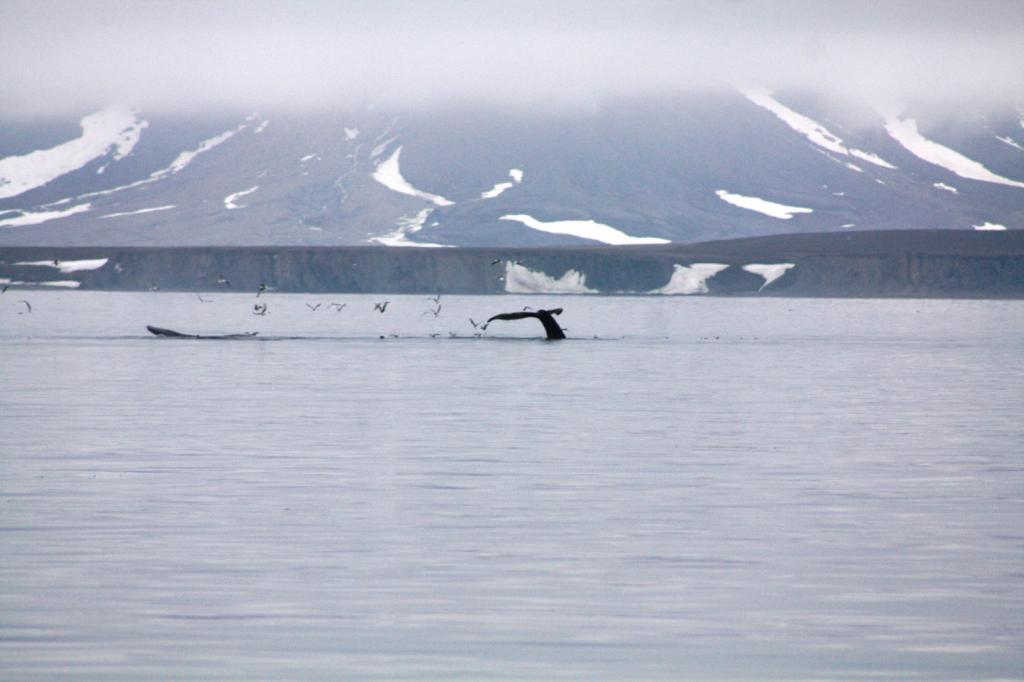


2. The boat. You need to make sure your vessel is up to the trip. It’s a four day run to Isfiorden from Tromso, with a possible stop at Bjornoya, about half way. We did not stop as we had good wind and decided to take advantage of that. It is important to carry all the spares you can think of, as there is limited availability of parts and services in Longyearbyen. Some sort of heating capability is important, and the Sysselman(Governor) requires boats to have AIS, EPIRBS, and some sort of long range communication.(Sat Phone). We bought a 2x2 pole in Tromso to use as an ice pusher and we used it and were glad we had it on a couple of occasions when floating ice got too close to the boat.
3. Ground tackle. Be very confident in your anchoring system. You will be anchoring in deep water most of the time and the weather can change very fast. Carry spares.
4. Fuel. There is fuel available in Longyearbyen and Ny Alesund and it’s cheaper than in Tromso. When we were there, it was cheaper in Ny Alesund than Longyearbyen, but we heard that that can be variable. Plan to do a lot of motoring. The wind is usually light and variable in the fiords.
5. Groceries. There is an excellent Co-op in Longyearbyen and the selection of produce and other fresh food is remarkable. There are good restaurants and accommodations in Longyearbyen as well. The cost is actually better than in Norway because there is no tax. (VAT is 25% in Norway)
6. Clothes. Be prepared for cold weather. The water is very cold and if the wind is blowing, it feels cold. Good gloves are important, as is layering, and good foul weather gear. We purchased drysuits for emergency use in case we had to abandon ship and get into the liferaft. Longyearbyen has several outfitter shops, that carry excellent cold weather clothes, although to us, quite pricey.
7. Weather. The weather is very changeable and you can get four seasons in a day. Your sails need to be capable and able to handle strong breeze, as it’s not unusual to have serious wind blowing down the fiords. You will see ice, especially in the fiords around the glaciers, but we saw ice out in the ocean on several occasions north of Spitzbergen. When we went it was an unusually icy year and we were prevented from getting into some of the fiords due to ice. We went fairly early, in mid June, and the snow was beautiful, but the ice is worse early. You need to have a good means of getting weather. We used sailmail and a satphone to download gribs. We saw a few boats with Starlink and it seems that everyone was satisfied with its performance up there. The gribs were more useful coming and going and while there we just took what we got, as the gribs weren’t very reliable for weather in the fiords. We were very fortunate in that we had great weather the whole time we were there. The locals remarked that they hadn’t seen such a stretch of good weather in their memories. The glaciers generate their own weather. We almost always encountered a cold breeze coming down off the glaciers and it’s not uncommon for then to generate fog banks as well.
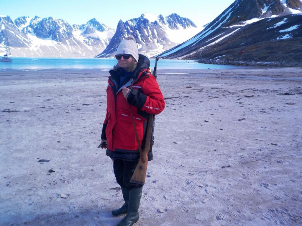
8. Planning the trip. You will need to start planning several months ahead by going to www.syslmesteren.no and applying for permission to visit. This entails putting together a planned itinerary, a resume of experience and a summary of your boat’s equipment and preparedness. You also have to arrange SAR insurance. We used Garmin insurance which is very reasonable. At the same time apply for a permit to rent a weapon in Longyearbyen or if you have one bring it with you. We rented one in Longyearbyen (a Mauser 30 cal of WWII vintage), but doing that precludes you getting off the boat in the southern fiords. I’m not a proponent of carrying weapons on board, but this is one time when having your own rifle or shotgun is an advantage. It’s a requirement to have some sort of polar bear protection if on land outside of Longyearbyen. We rented the rifle, and a flare gun and carried it with us at all times when ashore. We did not see a bear. We met some folks who were not able to get a gun and so only had a flare gun to frighten a bear, however, I’d strongly recommend making sure a rifle was available and reserve one ahead if possible. We rented one for the maximum of three weeks. It’s also necessary to get a permit to visit Virgohamna, a historic site with much to see, so do that at the same time. All this is available on the website. You will be checked by the Sysselman rangers while cruising so it’s important to have all the paperwork in order. We were checked twice and they were very friendly and courteous and an excellent source of info.
9. Medical- Be sure you carry all the meds you normally need and a good medical kit. There is a good hospital in Longyearbyen and helicopter evacuation is available. We heard one taking place while we were there. You’ll see caches of 55 gallon drums around some of the emergency shelter huts, which are helicopter fuel. Consider skin protection from sun and wind burn. We used sunscreen and neck gaiters all the time. The sun never sets and just goes around in a circle in the sky. We got excellent performance out of our solar panels.
10. Customs. Svalbard is not part of Schengen and although it’s a part of Norway there is no visa requirements. We cleared out of Norway before leaving to go to Svalbard and then checked back into Norway when we returned to save our Schengen time. It’s not required to clear into Svalbard. At the present time for nonresidents to buy liquor and beer a permit is required from the Sysselmestren. We got one when we arrived and went by there to make sure all our paperwork was in order. We were told that next year nonresidents would not be allowed to purchase beer or liquor and you should bring it with you. It seems that wine can be bought without any special permit. You should check the status of that ruling before leaving.
11. Good waterproof boots are important. We had Wellies which we wore to get to shore and then changed into hiking boots if we were going for a long walk. A good dinghy to get to shore is important as well, and setting up a kit of spares and repair materials for the dinghy in case of a puncture or engine trouble. We heard stories of bear mischief with dinghies as well.
12. If I was planning another trip there, I would stay for a longer time and circumnavigate Spitzbergen. That requires being there later in the season to let the ice go away, but it’s also good to be there early enough to see the snow.(It’s beautiful) It also would require bringing your own bear protection. We could only rent a rifle for a maximum of three weeks, so we ran out of time. Having your own allows more time and also going ashore in the southern fiords, and if you are circumnavigating, avoids having to come back to Longyearbyen.
All in all, it turned out, for us, to be a great experience and one which we'll always remember.
1. First if you’re thinking about it, do it. Svalbard is a place like no other we’ve been to and is wonderful. You’ll see more glaciers than you can imagine and the wildlife is incredible. Unfortunately, as with many wonderful places, it’s being loved to death, many cruise ships, both large and expedition sized, and smaller tour boats are plying its waters. Climate change is negatively affecting the landscape and the wildlife. Before the end of our lifetimes, it will be gone. We used several cruising guides, including the five volume set Cruising Norway by Phyllis Nickel et al, and Sail to Svalbard, by Jon Amtrup, and den-norsk-los-bind7-englisk.pdf, a free coast pilot for Svalbard.
2. The boat. You need to make sure your vessel is up to the trip. It’s a four day run to Isfiorden from Tromso, with a possible stop at Bjornoya, about half way. We did not stop as we had good wind and decided to take advantage of that. It is important to carry all the spares you can think of, as there is limited availability of parts and services in Longyearbyen. Some sort of heating capability is important, and the Sysselman(Governor) requires boats to have AIS, EPIRBS, and some sort of long range communication.(Sat Phone). We bought a 2x2 pole in Tromso to use as an ice pusher and we used it and were glad we had it on a couple of occasions when floating ice got too close to the boat.
3. Ground tackle. Be very confident in your anchoring system. You will be anchoring in deep water most of the time and the weather can change very fast. Carry spares.
4. Fuel. There is fuel available in Longyearbyen and Ny Alesund and it’s cheaper than in Tromso. When we were there, it was cheaper in Ny Alesund than Longyearbyen, but we heard that that can be variable. Plan to do a lot of motoring. The wind is usually light and variable in the fiords.
5. Groceries. There is an excellent Co-op in Longyearbyen and the selection of produce and other fresh food is remarkable. There are good restaurants and accommodations in Longyearbyen as well. The cost is actually better than in Norway because there is no tax. (VAT is 25% in Norway)
6. Clothes. Be prepared for cold weather. The water is very cold and if the wind is blowing, it feels cold. Good gloves are important, as is layering, and good foul weather gear. We purchased drysuits for emergency use in case we had to abandon ship and get into the liferaft. Longyearbyen has several outfitter shops, that carry excellent cold weather clothes, although to us, quite pricey.
7. Weather. The weather is very changeable and you can get four seasons in a day. Your sails need to be capable and able to handle strong breeze, as it’s not unusual to have serious wind blowing down the fiords. You will see ice, especially in the fiords around the glaciers, but we saw ice out in the ocean on several occasions north of Spitzbergen. When we went it was an unusually icy year and we were prevented from getting into some of the fiords due to ice. We went fairly early, in mid June, and the snow was beautiful, but the ice is worse early. You need to have a good means of getting weather. We used sailmail and a satphone to download gribs. We saw a few boats with Starlink and it seems that everyone was satisfied with its performance up there. The gribs were more useful coming and going and while there we just took what we got, as the gribs weren’t very reliable for weather in the fiords. We were very fortunate in that we had great weather the whole time we were there. The locals remarked that they hadn’t seen such a stretch of good weather in their memories. The glaciers generate their own weather. We almost always encountered a cold breeze coming down off the glaciers and it’s not uncommon for then to generate fog banks as well.
8. Planning the trip. You will need to start planning several months ahead by going to www.syslmesteren.no and applying for permission to visit. This entails putting together a planned itinerary, a resume of experience and a summary of your boat’s equipment and preparedness. You also have to arrange SAR insurance. We used Garmin insurance which is very reasonable. At the same time apply for a permit to rent a weapon in Longyearbyen or if you have one bring it with you. We rented one in Longyearbyen (a Mauser 30 cal of WWII vintage), but doing that precludes you getting off the boat in the southern fiords. I’m not a proponent of carrying weapons on board, but this is one time when having your own rifle or shotgun is an advantage. It’s a requirement to have some sort of polar bear protection if on land outside of Longyearbyen. We rented the rifle, and a flare gun and carried it with us at all times when ashore. We did not see a bear. We met some folks who were not able to get a gun and so only had a flare gun to frighten a bear, however, I’d strongly recommend making sure a rifle was available and reserve one ahead if possible. We rented one for the maximum of three weeks. It’s also necessary to get a permit to visit Virgohamna, a historic site with much to see, so do that at the same time. All this is available on the website. You will be checked by the Sysselman rangers while cruising so it’s important to have all the paperwork in order. We were checked twice and they were very friendly and courteous and an excellent source of info.
9. Medical- Be sure you carry all the meds you normally need and a good medical kit. There is a good hospital in Longyearbyen and helicopter evacuation is available. We heard one taking place while we were there. You’ll see caches of 55 gallon drums around some of the emergency shelter huts, which are helicopter fuel. Consider skin protection from sun and wind burn. We used sunscreen and neck gaiters all the time. The sun never sets and just goes around in a circle in the sky. We got excellent performance out of our solar panels.
10. Customs. Svalbard is not part of Schengen and although it’s a part of Norway there is no visa requirements. We cleared out of Norway before leaving to go to Svalbard and then checked back into Norway when we returned to save our Schengen time. It’s not required to clear into Svalbard. At the present time for nonresidents to buy liquor and beer a permit is required from the Sysselmestren. We got one when we arrived and went by there to make sure all our paperwork was in order.
We were told that next year nonresidents would not be allowed to purchase beer or liquor and you should bring it with you. It seems that wine can be bought without any special permit. You should check the status of that ruling before leaving.11. Good waterproof boots are important. We had Wellies which we wore to get to shore and then changed into hiking boots if we were going for a long walk. A good dinghy to get to shore is important as well, and setting up a kit of spares and repair materials for the dinghy in case of a puncture or engine trouble. We heard stories of bear mischief with dinghies as well.
12. If I was planning another trip there, I would stay for a longer time and circumnavigate Spitzbergen. That requires being there later in the season to let the ice go away, but it’s also good to be there early enough to see the snow.(It’s beautiful) It also would require bringing your own bear protection. We could only rent a rifle for a maximum of three weeks, so we ran out of time. Having your own allows more time and also going ashore in the southern fiords, and if you are circumnavigating, avoids having to come back to Longyearbyen.
All in all, it turned out, for us, to be a great experience and one which we'll always remember.
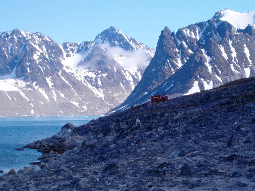
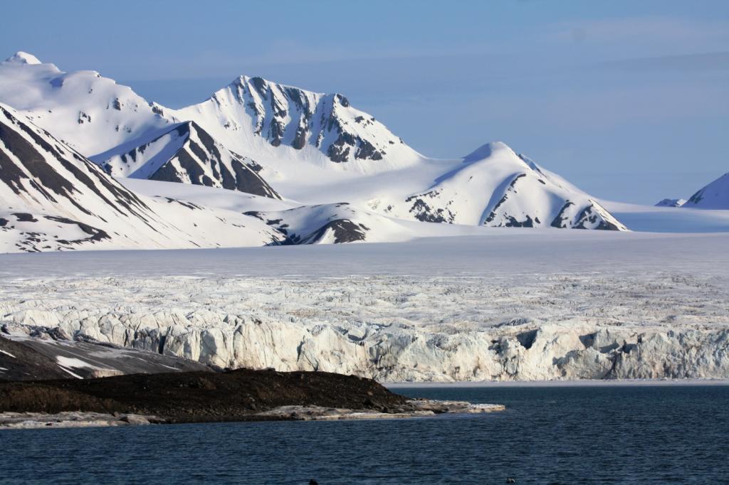
Svalbard, Part 2
23 July 2023 | Tromso
Cee

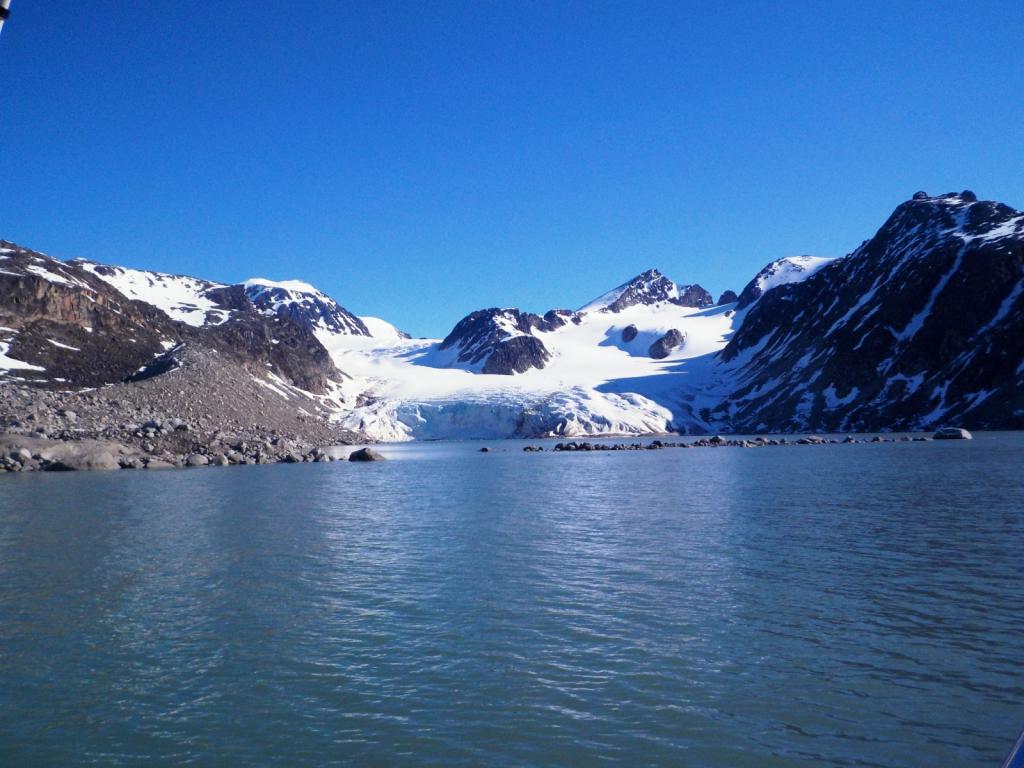
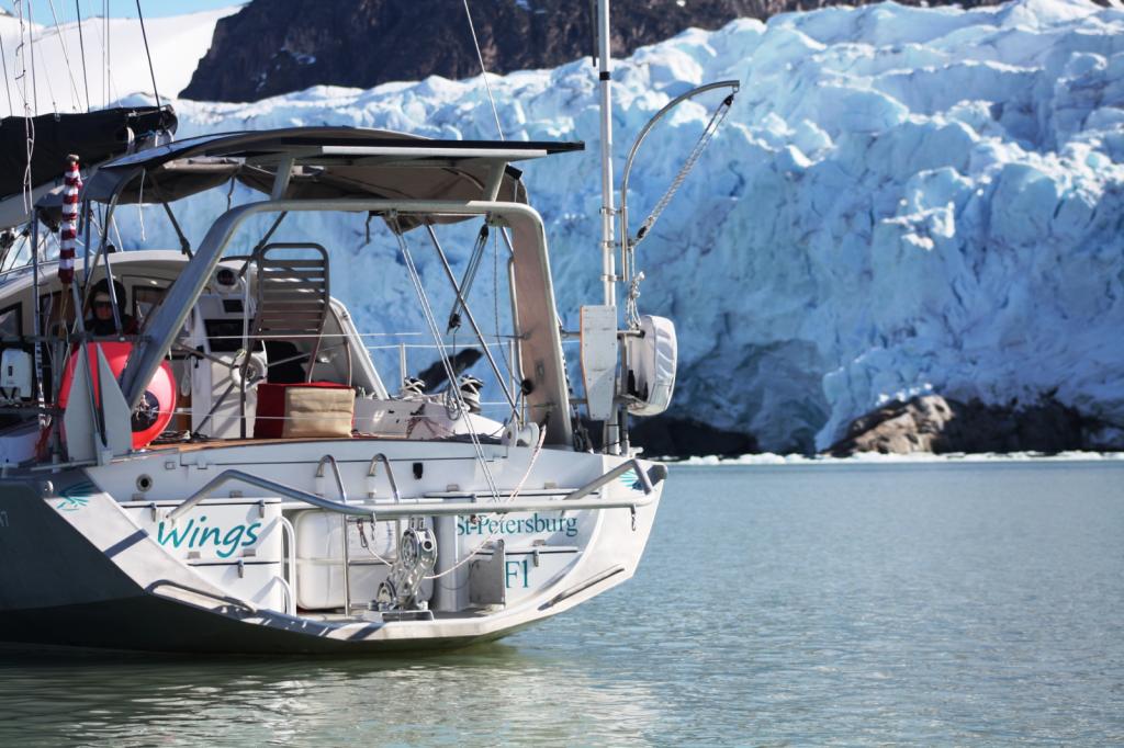
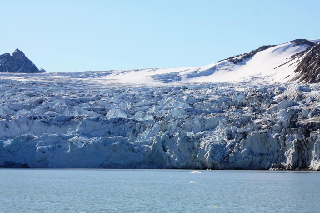
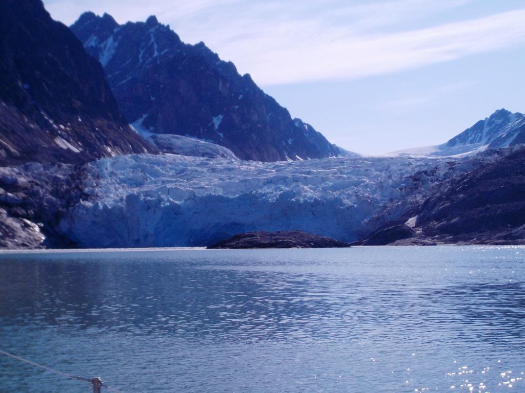
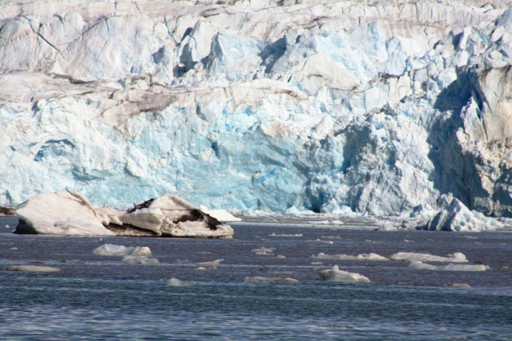
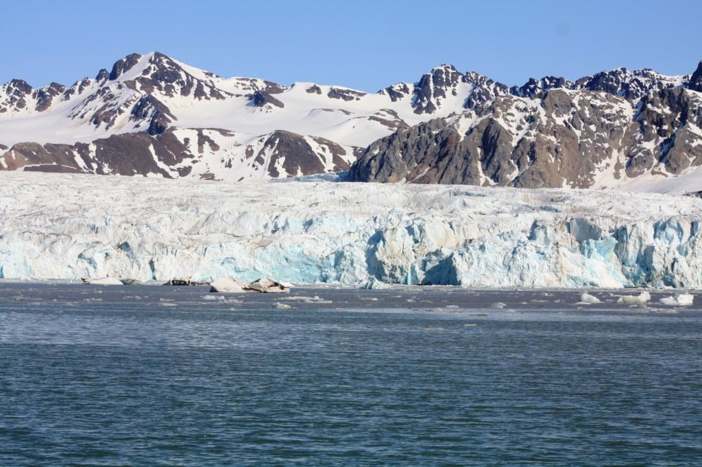
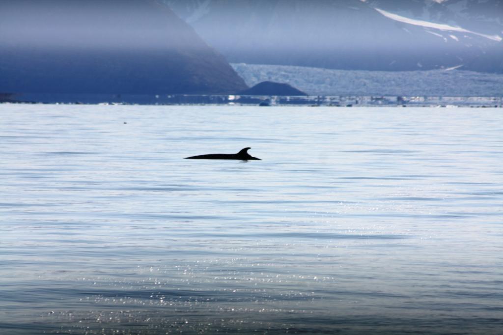
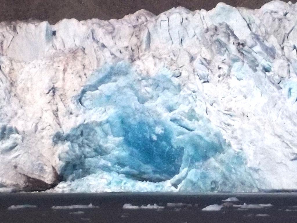
We sailed to get up close and personal with the Smeerenburg Glacier. This truly is the land of glaciers with several everywhere you look. Each is a little different and all are beautiful. It's is so amazing that ice can flow downhill in these great highways. And alter the landscape completely. 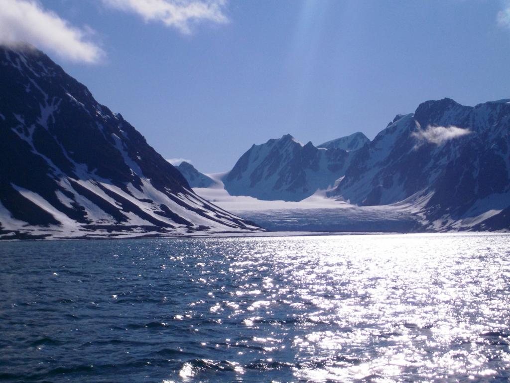


We sat for a while just listening to the glacier thunder and watching great chunks of ice calve off the face of the glacier and into the water.

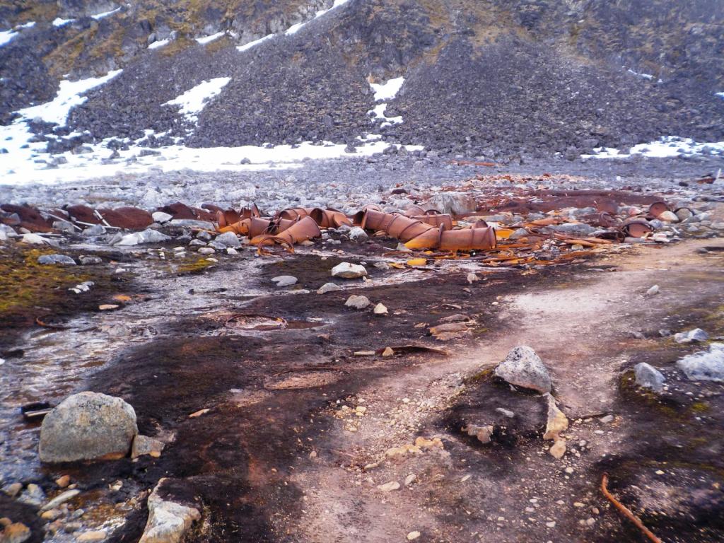
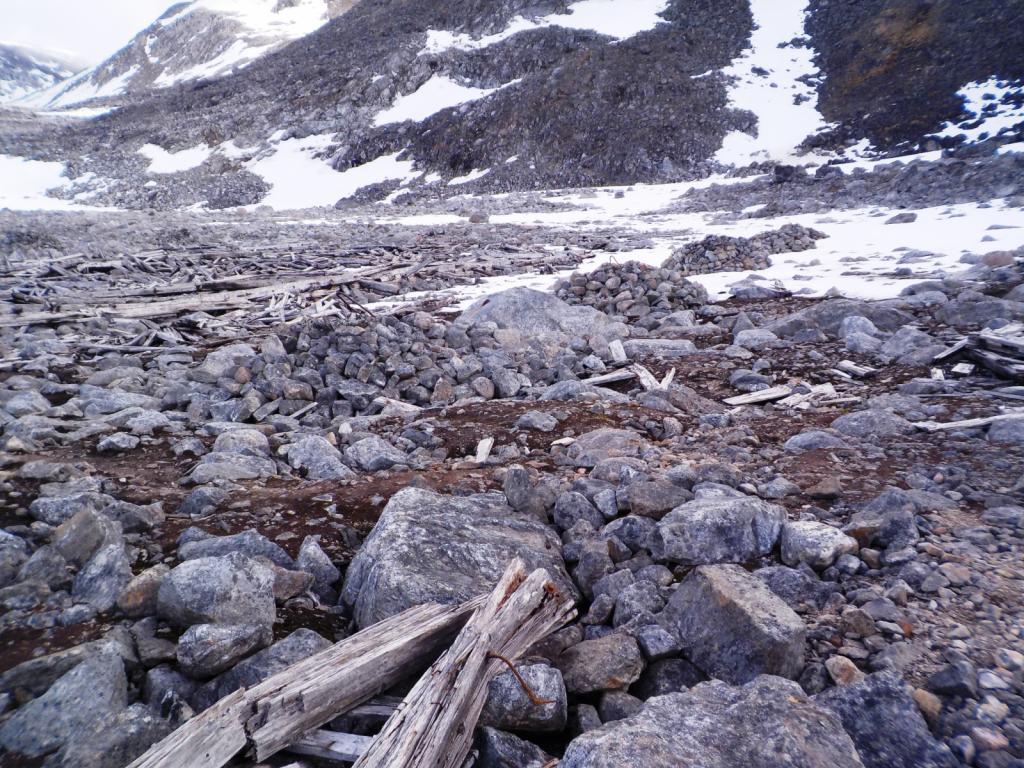
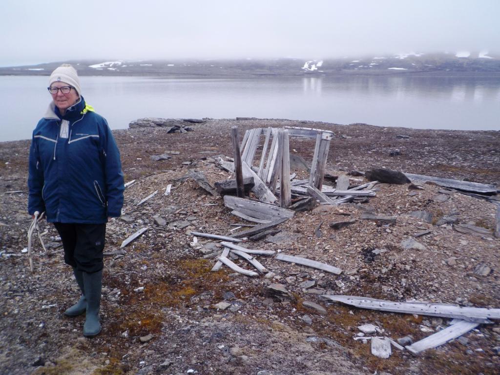
Then we came back to Virgohamna to check out the historical site. There hasd been whaling activity here for hundreds of years, but it is also the place where two expeditions to the northpole started, by balloon.
One was the Swedish explorer, Andree who tried to fly to the pole in a balloon in 1897, but crashed and made a heroic attempt to return by crossing the ice but didn't make it back. The remains of his party were discovered later on an island, Kvitoya in the NW part of the archipelago. In 1906 Wellman, an American, made several attempts ending in failure with a Zeppelin balloon. There are extensive remains of the hanger and hydrogen generating apparatus left as well as some older graves and hut remains.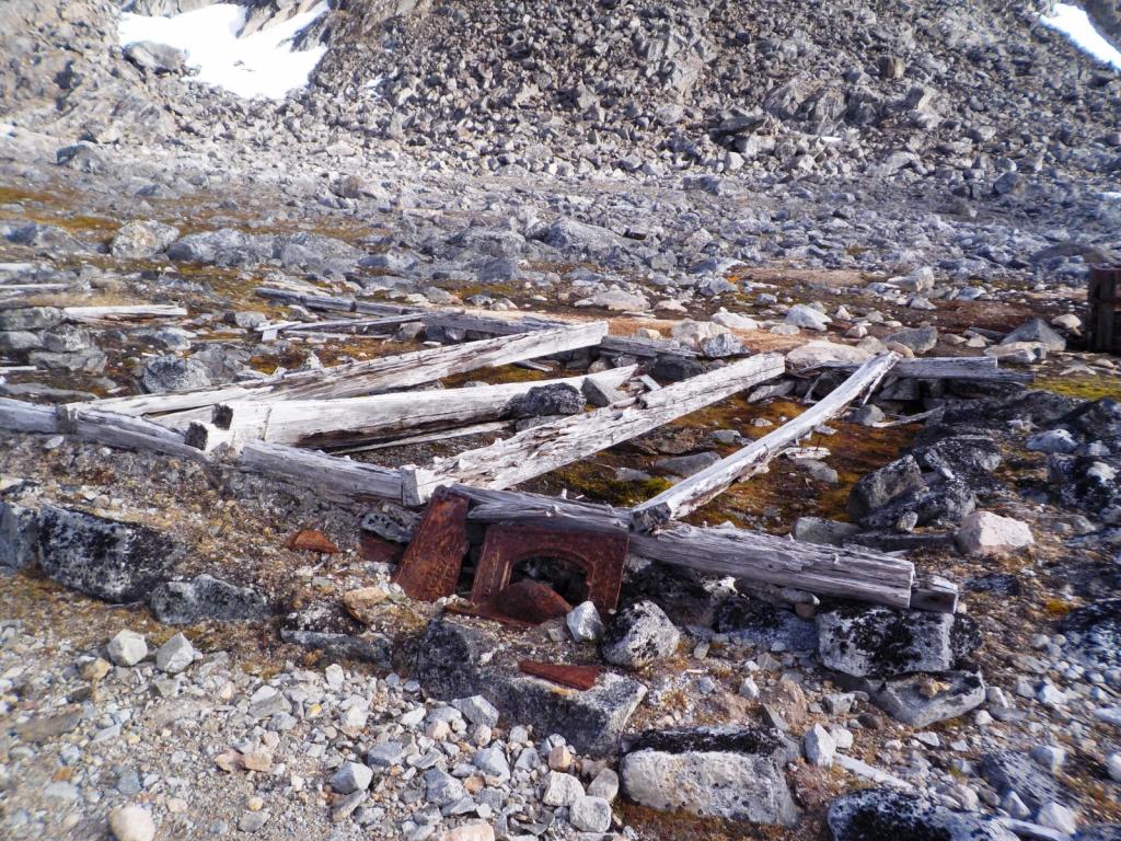

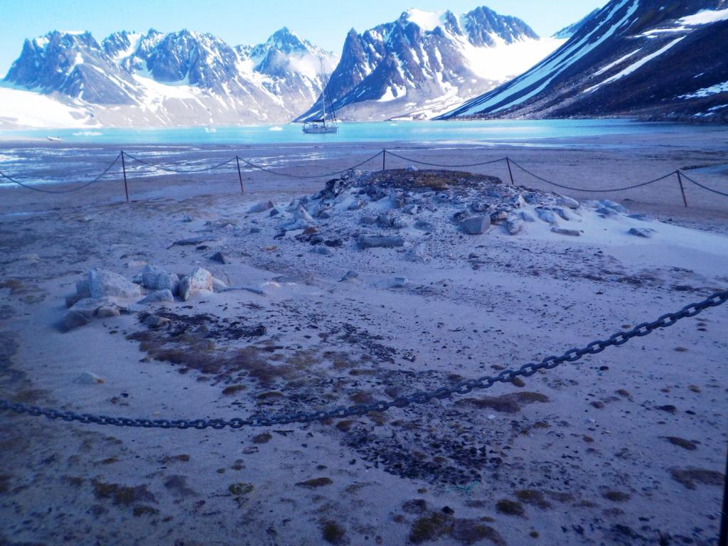
By now we had come to the realization that going further east was not in the picture for us this time. We needed to be back in Longyearbyen to return the gun by the 13th of July and we had many palces to visit in the meantime. So, we headed back south with the first stop and Magdelenefjorden, tucked into the cove at Trinityhamna. There are many graves at Gravneset, mostly English whalers, and the hut where the Sysselman rangers live is also there.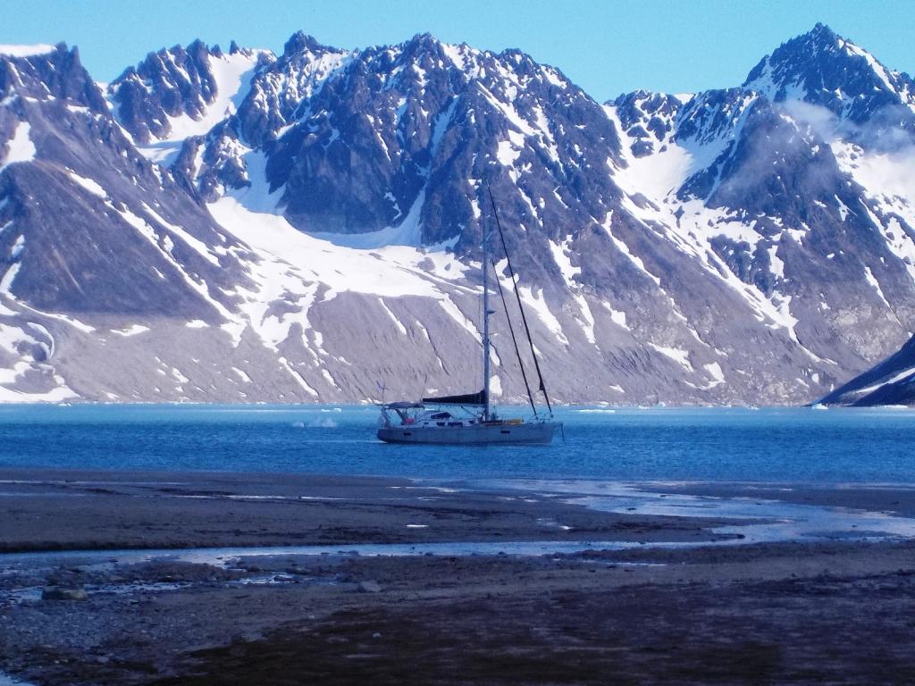


The Magdelene Glacier is actively calving and ice commonly gets into the anchorage, and we had a midnight visit from and small berg as well. They are surprisingly easy to push around, and it's important to keep them away from the anchor chain and the boat. They make a very interesting sound down inside the boat. The combination of the ice melting and the release of trapped gas, results in a sound of running water and it's quite loud when the burgs are near by. It's also somewhat disconcerting at first until you get used to it.
 Ice for the rum.
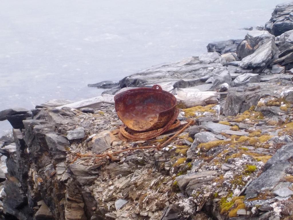
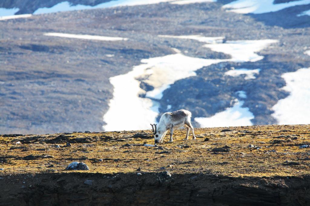
We then went a bit further south to Ebeltofthamna, at the mouth of Krossfjorden. There are several remains of trappers huts and whaling activity there and several graves. There are many raindeer there as well.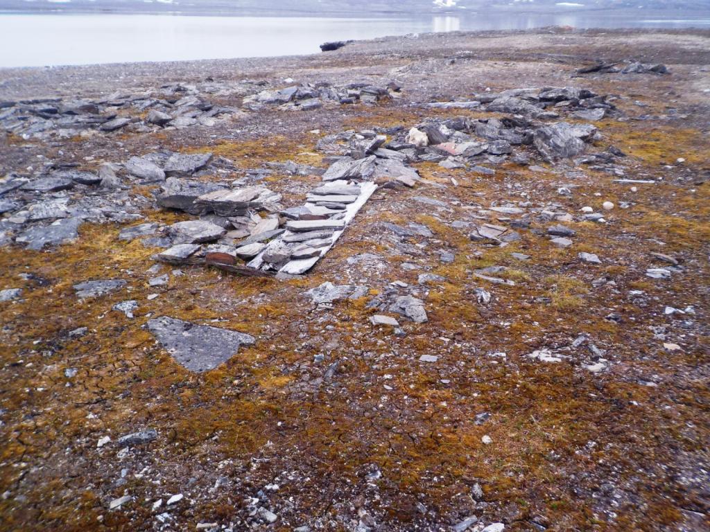
Then we went up to Signehamna, near the giant Lilliehook Glacier, on a foggy day. We played with the ice there as well coming into the anchorage from the glacier. We hiked up to visit the remnants of an old WWII German weather station, that was destroyed by the Norwegians during the war. There are several fresh water lakes with reported good fishing, but they were all frozen over.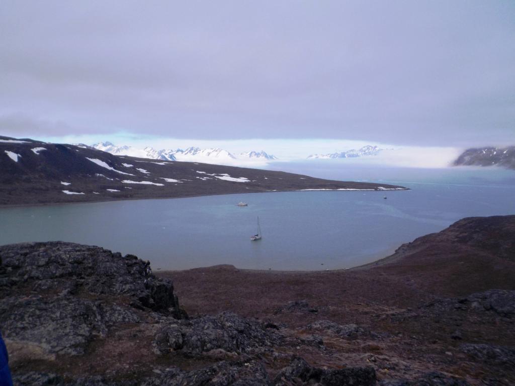
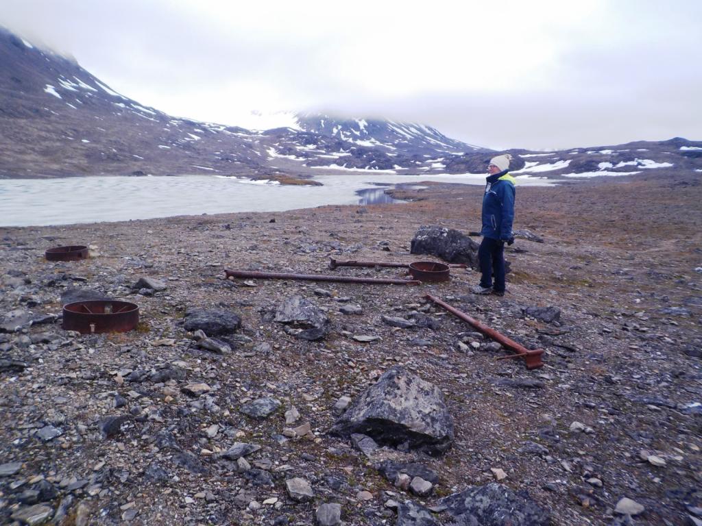
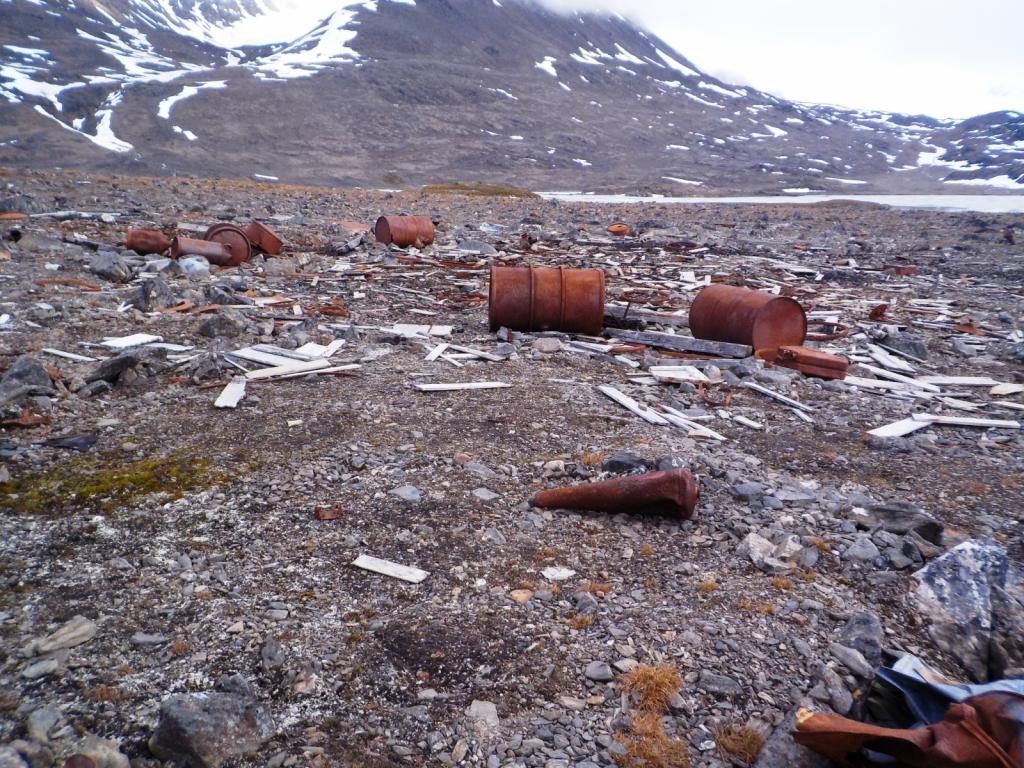

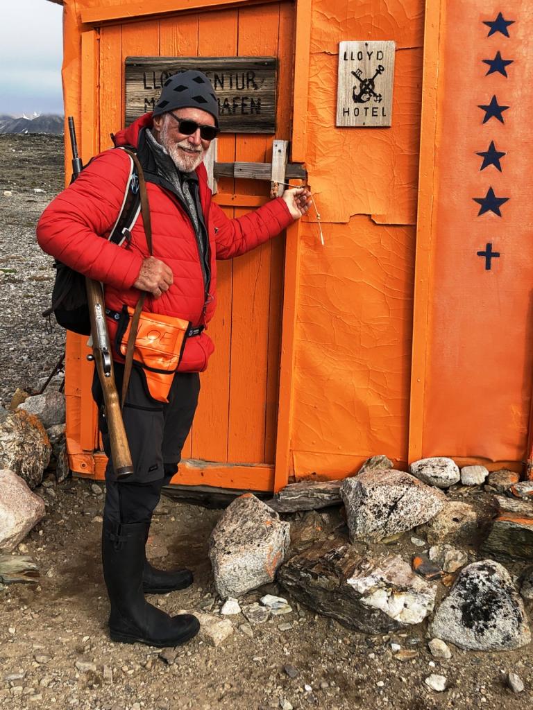
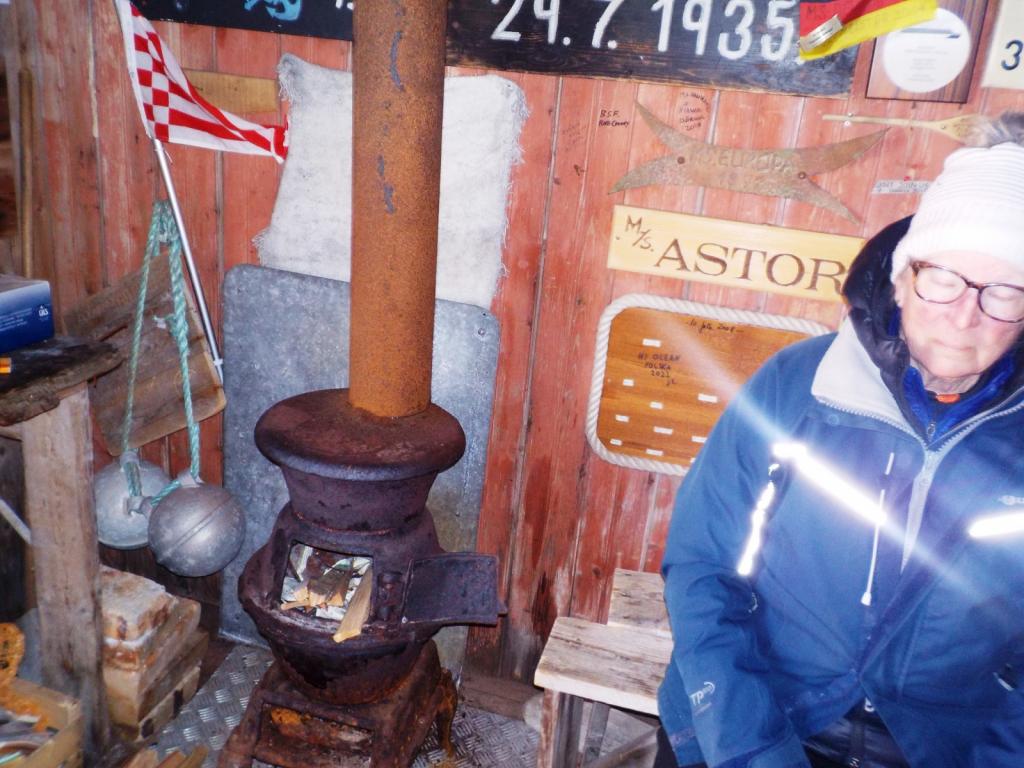
We then went around to Mollerhamna, and walked to a refuge hut called Lloyds Hotel. There are huts like this scattered around as places of refuge for shipwrecked sailors and they are stocked with first aid supplies and usually a wood stove for heat.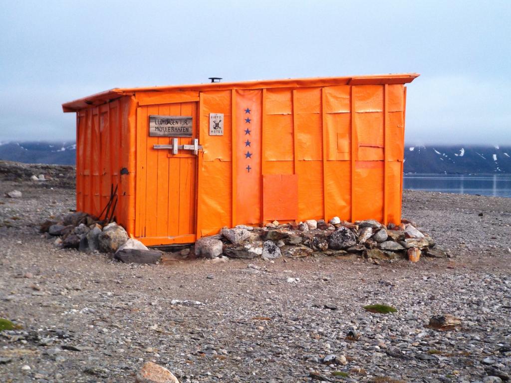


We saw an Arctic Fox, getting pretty far into his summer coat, as well as a few more raindeer.
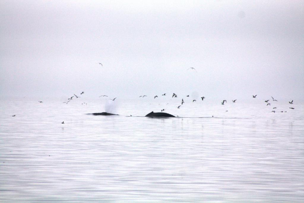
After a peaceful night, we went by a few more glaciers, mesmerized by the ice. We ran into a few Beluga whales along the way.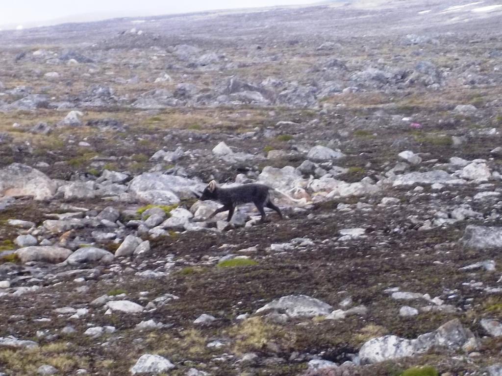


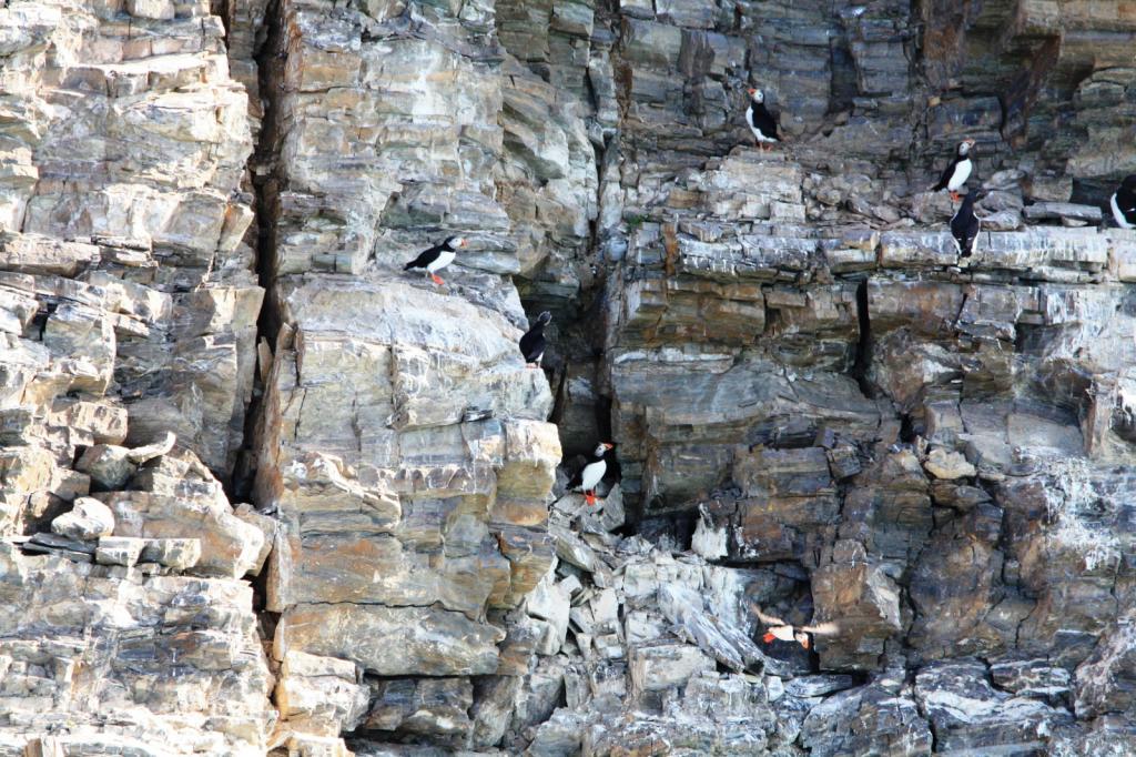
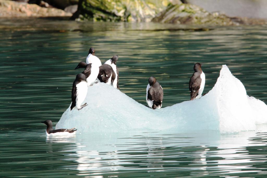
One of the most amazing things about this place is the birds. More than we ever imagined, Guillemots, Puffins, Auks,Eiders, and Kitiwakes.


 .
.
There are no trees here put this time of year the flora is busting out in a flurry of activity.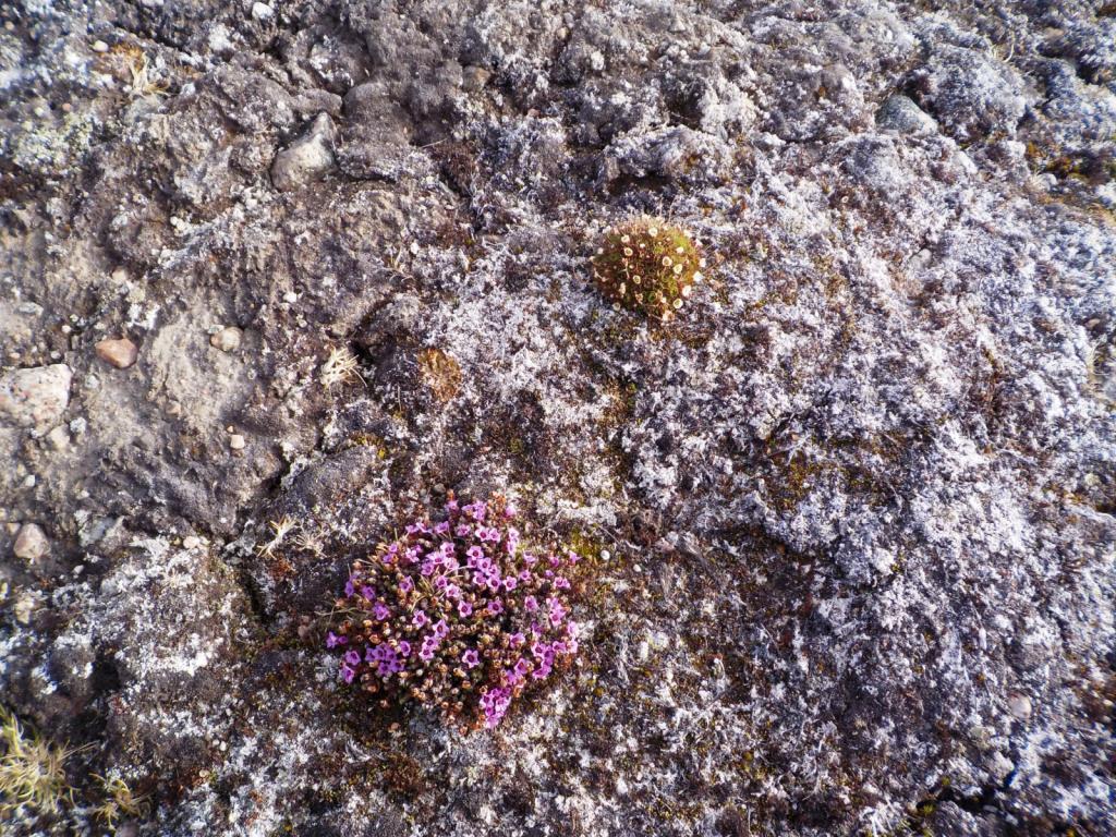

We stopped for the night at the 14th of July glacier and listened to it's thunder all night long.
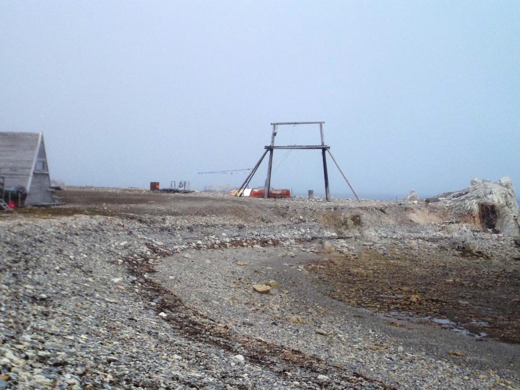
Then it was back down to Kongsfjorden and Ny Alesund, the northern most settlement. It started out as a coalmining facility but now is devoted mostly to research related to climate change, sea level rise and tectonic drift. It's population ranges from around 40 in winter to 150 in the summer.
It is also famous for the location that Amundsen departed from in his flight over the North Pole in an airship. The tether pole for the blimp remains.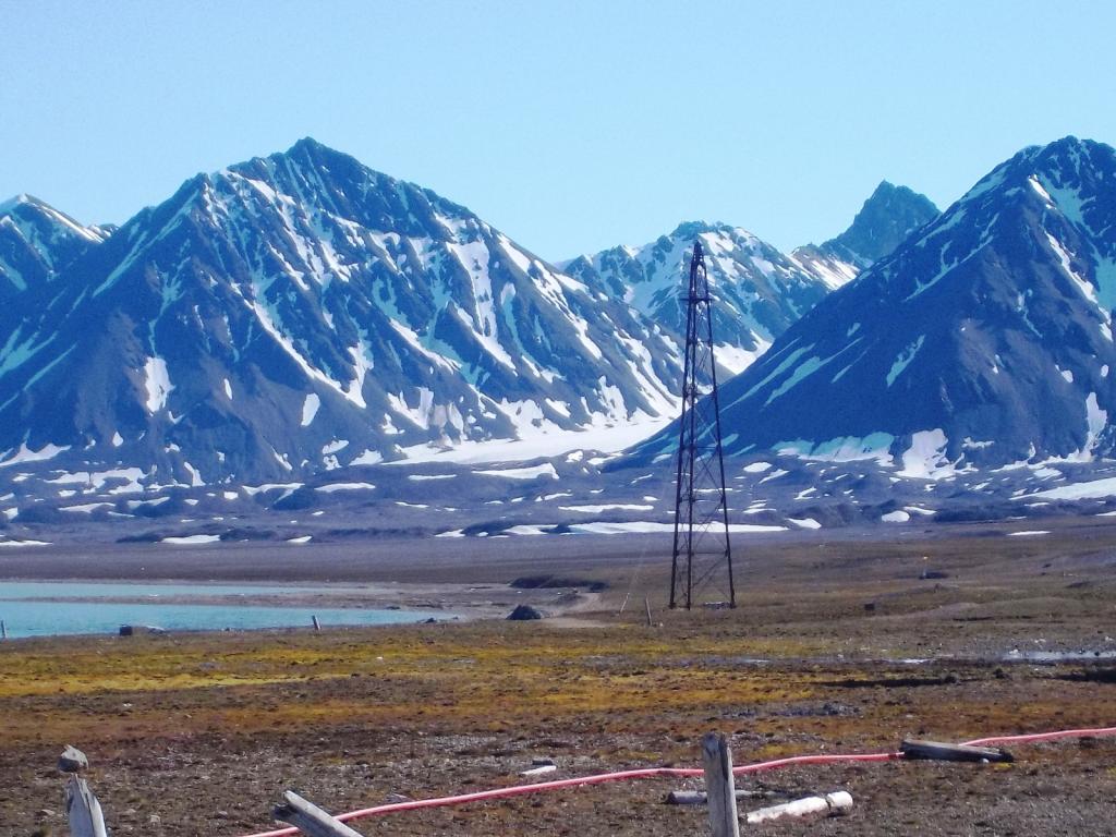


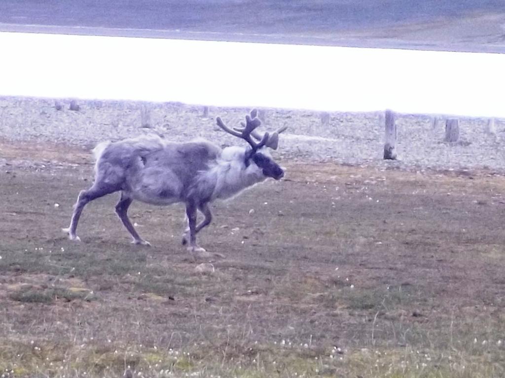
We spent the night at the dock, and topped off our fuel as, interestingly, it was cheaper there that Longyearbyen, despite being at the end of the world. We had a look around town, and saw some more raindeer and Barnacle Geese.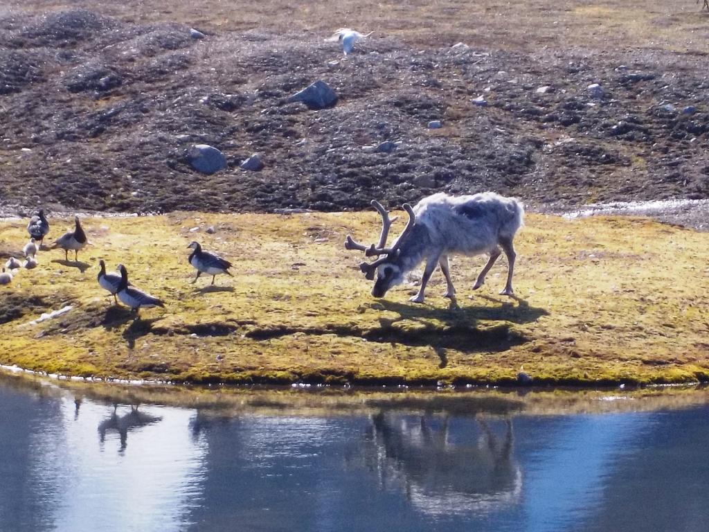
 The terns nest on the ground and if you get too close they dive bomb you.
The glaciers there keep the bay filled with ice.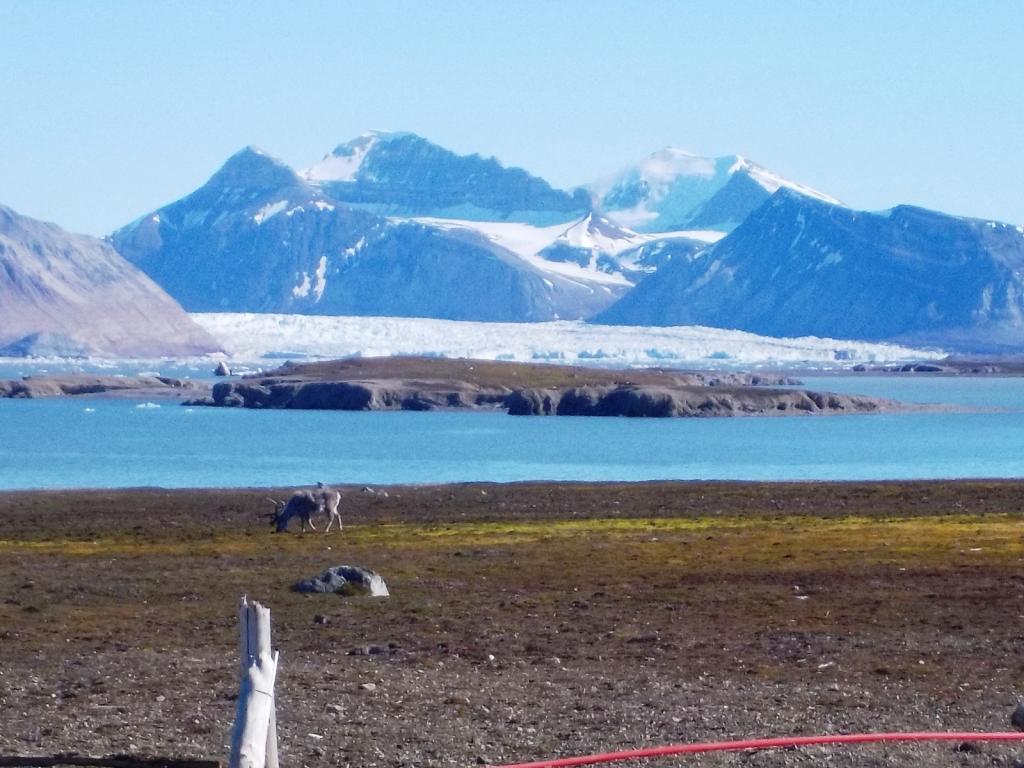
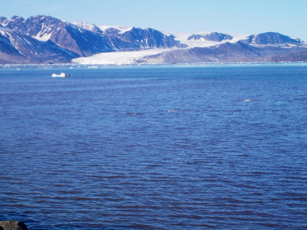
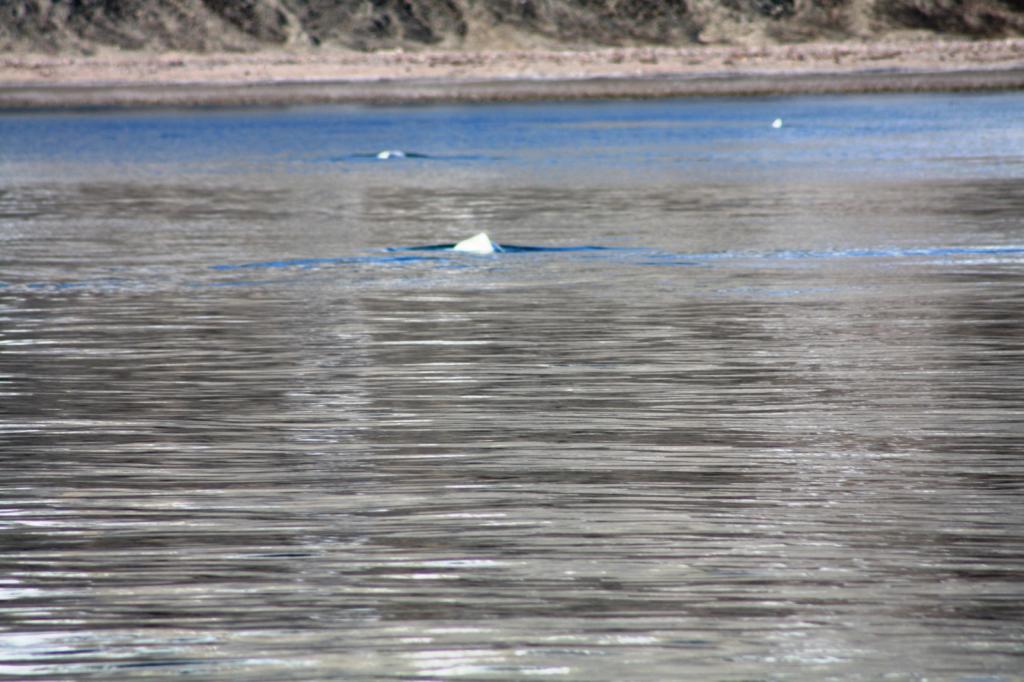
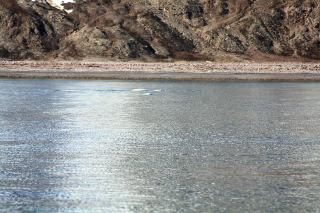
We saw another pod of belugas there as well.
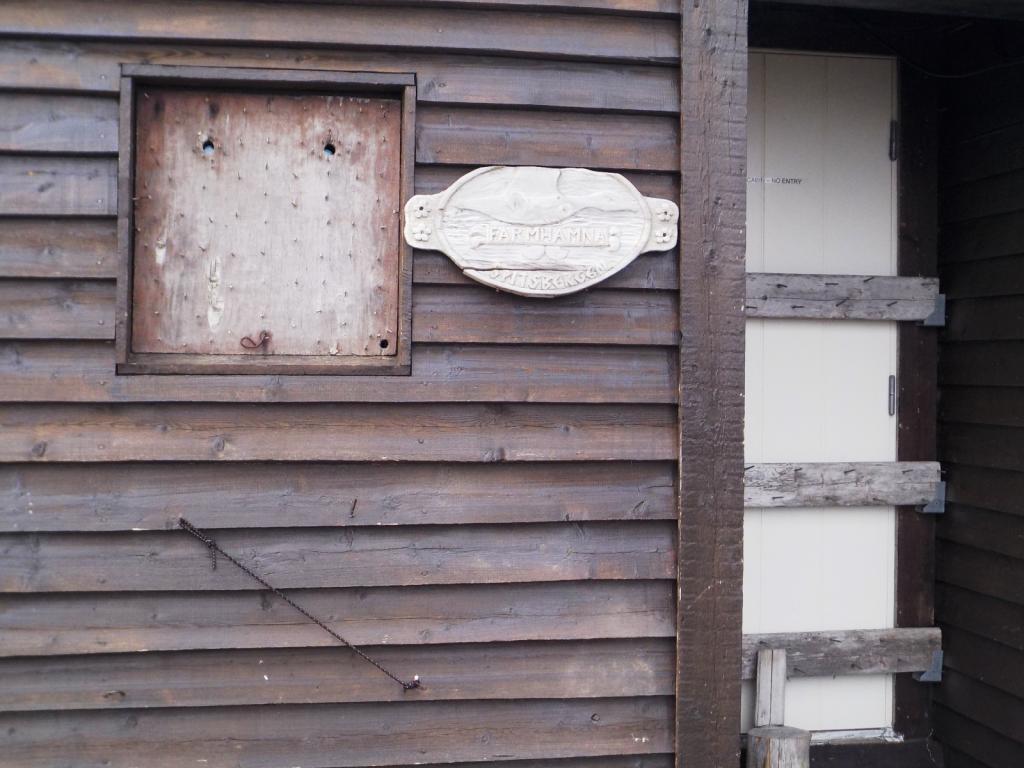
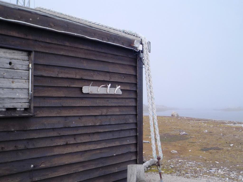
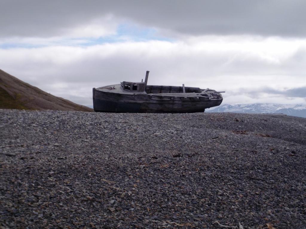
From there we spent a long day heading back south down to Farmhamna. There is a homestead there and it has been the site for a trapper's hut for many years. There was no one around except the raindeer while we were there. The Platform is for meat storage to keep it away from bears. You can see the bear deterrents around the house, as well as the roof tiedowns to keep the wind from taking the roof away.


From there we headed to Borenbukta, in front of a couple of glaciers for the night.

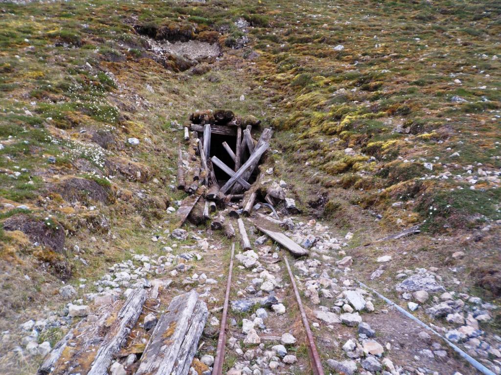
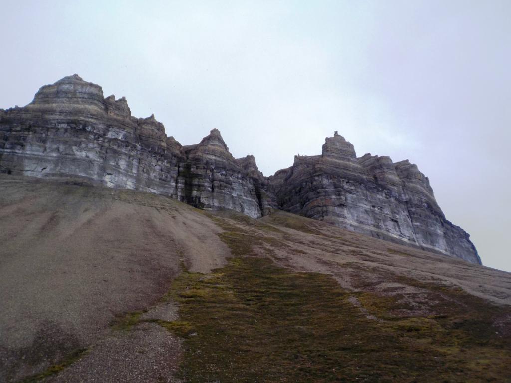
Then it was on to Pyramiden, the site of a Russian settlement that is now deserted. It was a coalmining town and was closed in 1998, after a serious accident in the mine. The topogrphy is different here and reminded us of the SW US.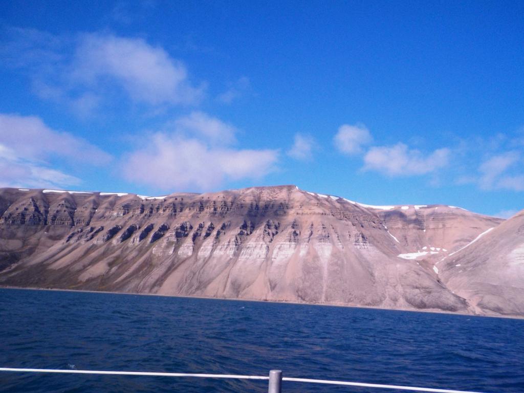
Now, it is manned by a skeleton staff and has become quite a local tourist attraction. They have several tour boats coming over from Longyearbyen on most days.


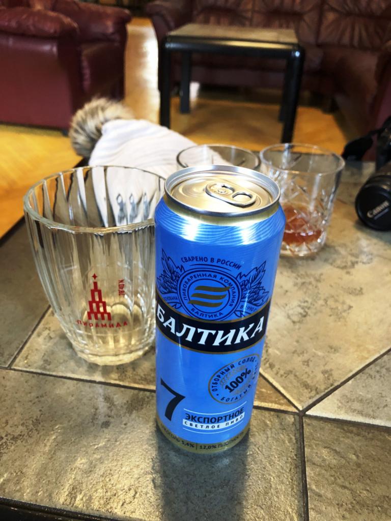
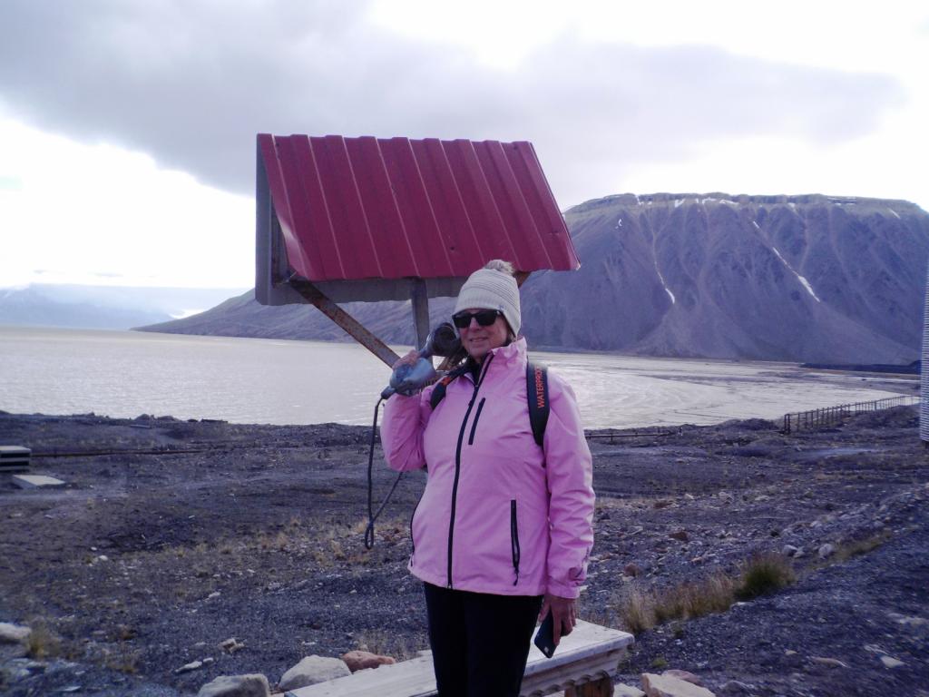 They even have a hotel open now for visitors. We stopped in for a Russian beer.
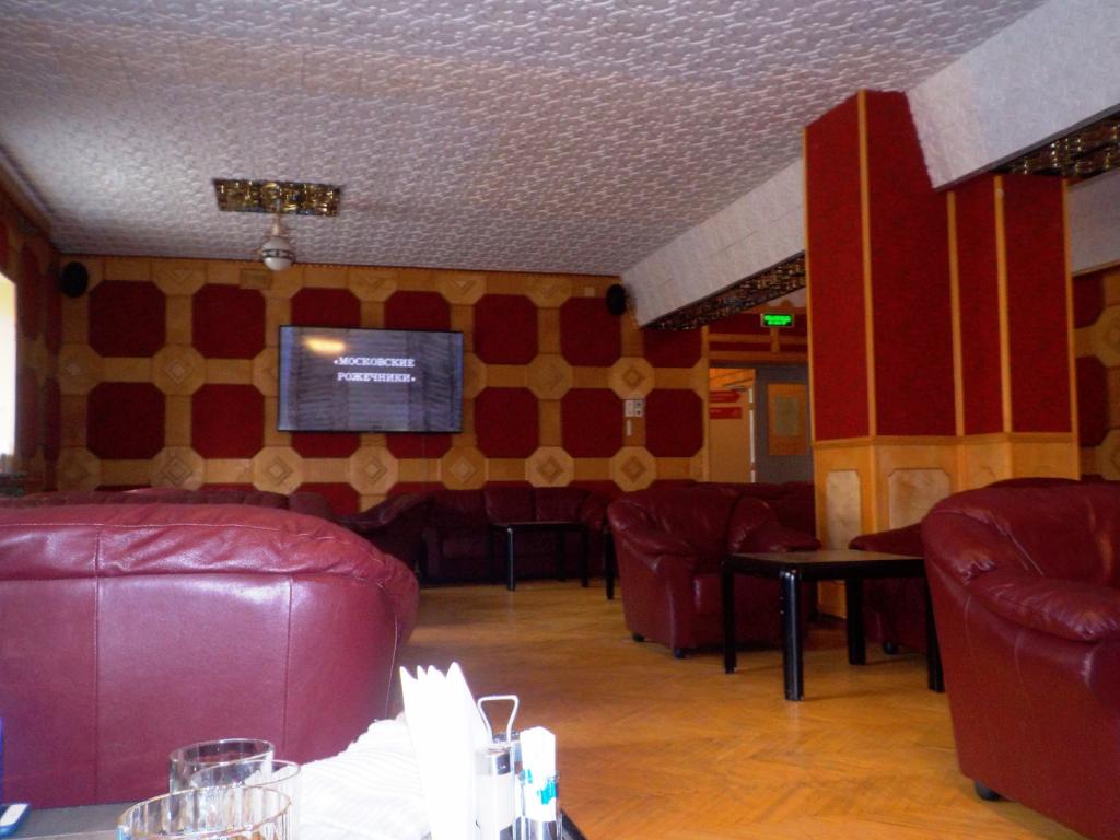
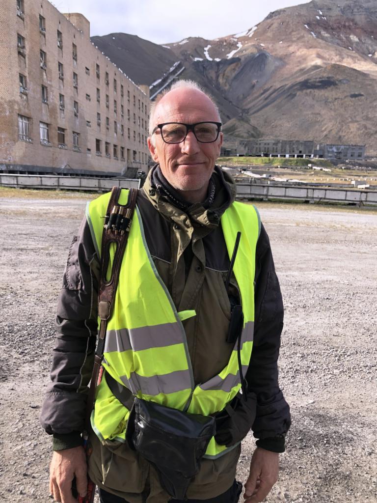
Previously you could wander around at will, but they've had some problems with vandalism, so now although you can still wander, all the buildings are locked and you have to take a tour with a guide to see inside. Our guide was Johan and he was a wealth of knowledge, having worked there for many years.
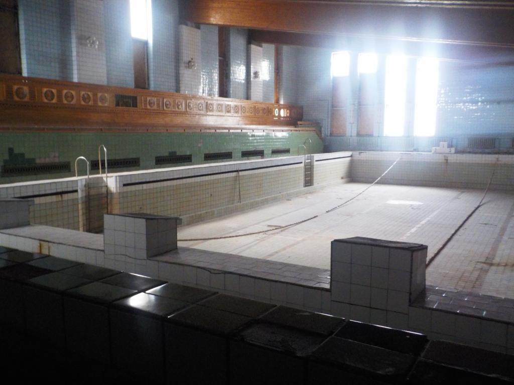
 We saw the community dining area, school, theater/auditorium, and even an Olympic size swimming pool. There was also a gymnasium, and sports field and music complex.


Johan was an interesting and very pleasant guy. He stated at the outset that he didn't want to talk any politics, but then continuously extoled the benefits of being a part of the socialist society. He was very proud of what they had accomplished there and rightly so, as it is a very isolated place and had to be self sufficient especially in the winter.
We then headed up to Skansbukta, for a peaceful night at anchor. This is the site of an old gypsum mine that never became profitable.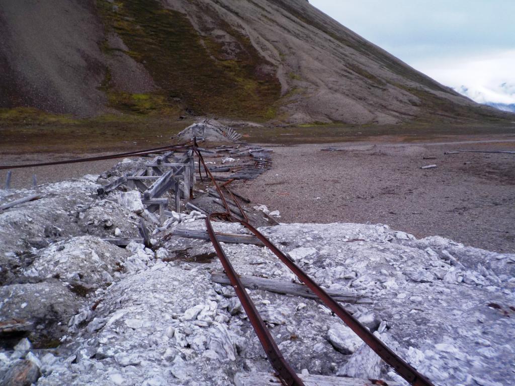
It is also the site of an old trppers cabin and the grave of the trappers wife.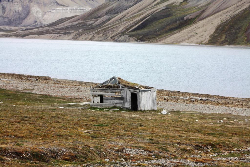
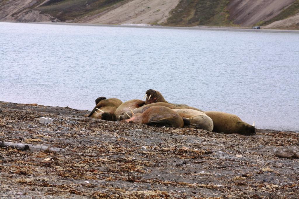
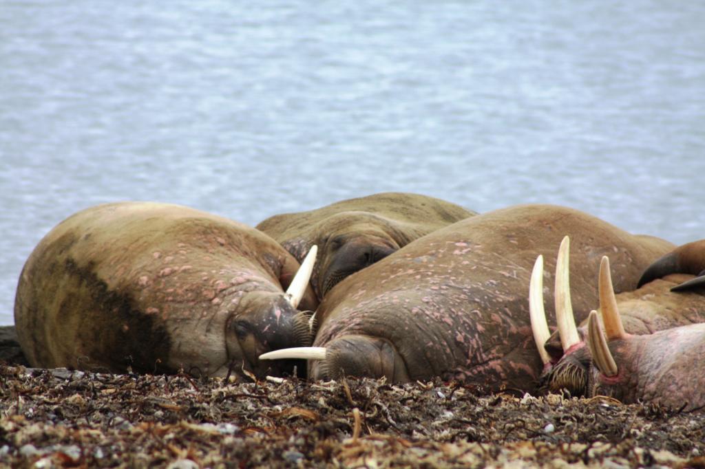
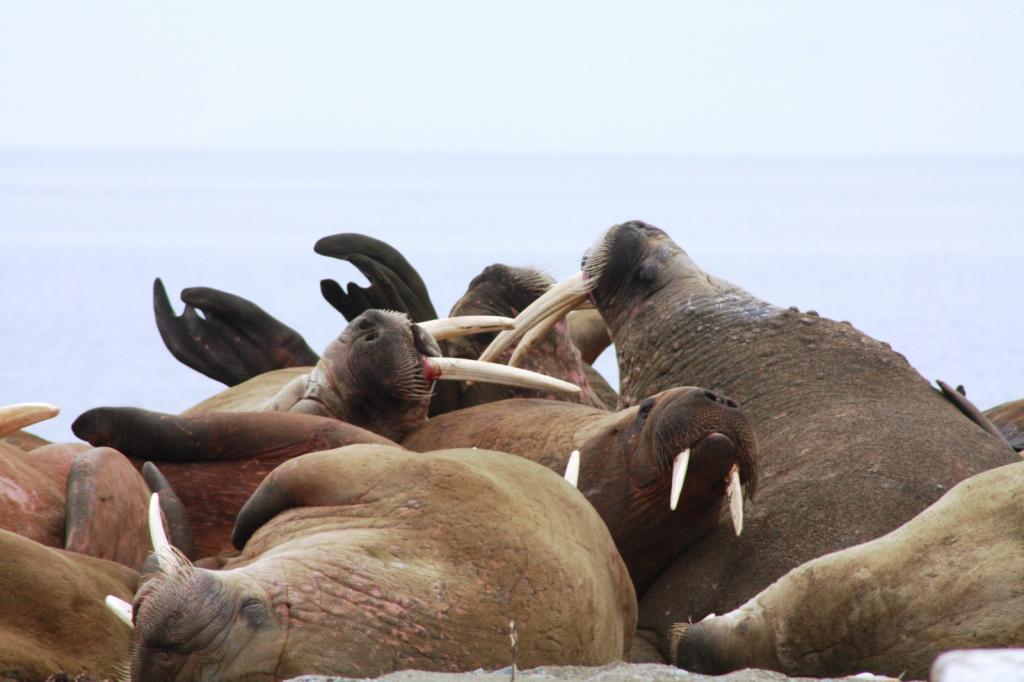
We saw some more walrus and raindeer, as well.
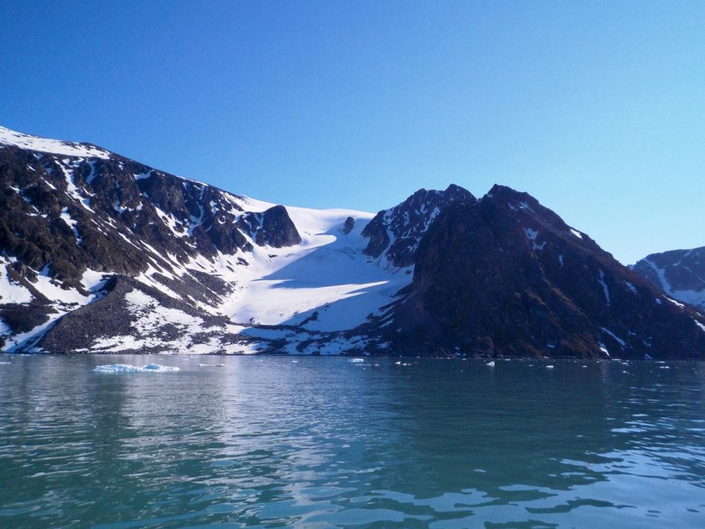
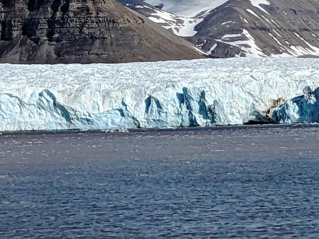
Then we moved over to the Von Post Glacier for another up close and personal, again listening to the glacier roar and the ice falling into the water. The deep blue color of the very dense ice is entrancing. Then it was down to Bjornhamna for the night.

It was time to head back to Longyearbyen to turn the gun back in and reprovision and get ready to make the run back to the mainland. We had started this year thinking we would go to Iceland, Greenland and on to Canada, but with some boat issues to deal with and also the desire to go back to Norway to do some more hiking, we have decided to spend another winter in Scotland and head west next year.
After a couple of days at the dock in Longyeasrbyen we headed south down to Bellsund and to anchor in Fridtjovhamna, on of our first anchorages in Svalbard. Just a quik overnight and then on south to Hornsund and the anchorage at Bjornhamna, the site of the Polish research station. We pulled in there inflat calm, but with the anchorage filled with ice for the adjacent glacier.
We got in far enough to be past most of the big stuff land dropped anchor. Around 1 AM we were awaked by a dramatic increase in wind and ice crashing all around. We quickly raised anchor and bugged out to anchor just outside the Hornsund fiord at Vestvika. Interestingly the wind died as soon as we left the fiord.
We saw a weather window to leave and off we went on a screaming reach heading south. The ride was very uncomfortable due to all the cross seas, and initially with winds to 30 knots. After the first day though things settled down and we made a good passage back to the mainland and to Tromso. We cleared back into Norway and licked our wounds for a couple of days and now are off to do some hiking. Our Svalbard adventure seems like a dream, and I'm sure it will take a bit of time to process all that we have seen and experienced, but it certainly was the trip of a lifetime.
We sat for a while just listening to the glacier thunder and watching great chunks of ice calve off the face of the glacier and into the water.
Then we came back to Virgohamna to check out the historical site. There hasd been whaling activity here for hundreds of years, but it is also the place where two expeditions to the northpole started, by balloon.
One was the Swedish explorer, Andree who tried to fly to the pole in a balloon in 1897, but crashed and made a heroic attempt to return by crossing the ice but didn't make it back. The remains of his party were discovered later on an island, Kvitoya in the NW part of the archipelago. In 1906 Wellman, an American, made several attempts ending in failure with a Zeppelin balloon. There are extensive remains of the hanger and hydrogen generating apparatus left as well as some older graves and hut remains.
By now we had come to the realization that going further east was not in the picture for us this time. We needed to be back in Longyearbyen to return the gun by the 13th of July and we had many palces to visit in the meantime. So, we headed back south with the first stop and Magdelenefjorden, tucked into the cove at Trinityhamna. There are many graves at Gravneset, mostly English whalers, and the hut where the Sysselman rangers live is also there.
The Magdelene Glacier is actively calving and ice commonly gets into the anchorage, and we had a midnight visit from and small berg as well. They are surprisingly easy to push around, and it's important to keep them away from the anchor chain and the boat. They make a very interesting sound down inside the boat. The combination of the ice melting and the release of trapped gas, results in a sound of running water and it's quite loud when the burgs are near by. It's also somewhat disconcerting at first until you get used to it.
Ice for the rum.We then went a bit further south to Ebeltofthamna, at the mouth of Krossfjorden. There are several remains of trappers huts and whaling activity there and several graves. There are many raindeer there as well.
Then we went up to Signehamna, near the giant Lilliehook Glacier, on a foggy day. We played with the ice there as well coming into the anchorage from the glacier. We hiked up to visit the remnants of an old WWII German weather station, that was destroyed by the Norwegians during the war. There are several fresh water lakes with reported good fishing, but they were all frozen over.
We then went around to Mollerhamna, and walked to a refuge hut called Lloyds Hotel. There are huts like this scattered around as places of refuge for shipwrecked sailors and they are stocked with first aid supplies and usually a wood stove for heat.
We saw an Arctic Fox, getting pretty far into his summer coat, as well as a few more raindeer.
After a peaceful night, we went by a few more glaciers, mesmerized by the ice. We ran into a few Beluga whales along the way.
One of the most amazing things about this place is the birds. More than we ever imagined, Guillemots, Puffins, Auks,Eiders, and Kitiwakes.
. There are no trees here put this time of year the flora is busting out in a flurry of activity.
We stopped for the night at the 14th of July glacier and listened to it's thunder all night long.
Then it was back down to Kongsfjorden and Ny Alesund, the northern most settlement. It started out as a coalmining facility but now is devoted mostly to research related to climate change, sea level rise and tectonic drift. It's population ranges from around 40 in winter to 150 in the summer.
It is also famous for the location that Amundsen departed from in his flight over the North Pole in an airship. The tether pole for the blimp remains.
We spent the night at the dock, and topped off our fuel as, interestingly, it was cheaper there that Longyearbyen, despite being at the end of the world. We had a look around town, and saw some more raindeer and Barnacle Geese.
The terns nest on the ground and if you get too close they dive bomb you. The glaciers there keep the bay filled with ice.
We saw another pod of belugas there as well.
From there we spent a long day heading back south down to Farmhamna. There is a homestead there and it has been the site for a trapper's hut for many years. There was no one around except the raindeer while we were there. The Platform is for meat storage to keep it away from bears. You can see the bear deterrents around the house, as well as the roof tiedowns to keep the wind from taking the roof away.
From there we headed to Borenbukta, in front of a couple of glaciers for the night.
Then it was on to Pyramiden, the site of a Russian settlement that is now deserted. It was a coalmining town and was closed in 1998, after a serious accident in the mine. The topogrphy is different here and reminded us of the SW US.
Now, it is manned by a skeleton staff and has become quite a local tourist attraction. They have several tour boats coming over from Longyearbyen on most days.
They even have a hotel open now for visitors. We stopped in for a Russian beer. Previously you could wander around at will, but they've had some problems with vandalism, so now although you can still wander, all the buildings are locked and you have to take a tour with a guide to see inside. Our guide was Johan and he was a wealth of knowledge, having worked there for many years.
We saw the community dining area, school, theater/auditorium, and even an Olympic size swimming pool. There was also a gymnasium, and sports field and music complex. Johan was an interesting and very pleasant guy. He stated at the outset that he didn't want to talk any politics, but then continuously extoled the benefits of being a part of the socialist society. He was very proud of what they had accomplished there and rightly so, as it is a very isolated place and had to be self sufficient especially in the winter.
We then headed up to Skansbukta, for a peaceful night at anchor. This is the site of an old gypsum mine that never became profitable.
It is also the site of an old trppers cabin and the grave of the trappers wife.
We saw some more walrus and raindeer, as well.
Then we moved over to the Von Post Glacier for another up close and personal, again listening to the glacier roar and the ice falling into the water. The deep blue color of the very dense ice is entrancing. Then it was down to Bjornhamna for the night.
It was time to head back to Longyearbyen to turn the gun back in and reprovision and get ready to make the run back to the mainland. We had started this year thinking we would go to Iceland, Greenland and on to Canada, but with some boat issues to deal with and also the desire to go back to Norway to do some more hiking, we have decided to spend another winter in Scotland and head west next year.
After a couple of days at the dock in Longyeasrbyen we headed south down to Bellsund and to anchor in Fridtjovhamna, on of our first anchorages in Svalbard. Just a quik overnight and then on south to Hornsund and the anchorage at Bjornhamna, the site of the Polish research station. We pulled in there inflat calm, but with the anchorage filled with ice for the adjacent glacier.
We got in far enough to be past most of the big stuff land dropped anchor. Around 1 AM we were awaked by a dramatic increase in wind and ice crashing all around. We quickly raised anchor and bugged out to anchor just outside the Hornsund fiord at Vestvika. Interestingly the wind died as soon as we left the fiord.
We saw a weather window to leave and off we went on a screaming reach heading south. The ride was very uncomfortable due to all the cross seas, and initially with winds to 30 knots. After the first day though things settled down and we made a good passage back to the mainland and to Tromso. We cleared back into Norway and licked our wounds for a couple of days and now are off to do some hiking. Our Svalbard adventure seems like a dream, and I'm sure it will take a bit of time to process all that we have seen and experienced, but it certainly was the trip of a lifetime.
A Sail to Svalbard
13 July 2023 | Longyearbyen
Dee

We left the dock at Tromso early and, after a brief stop for fuel, we were off up the fiord heading north. It took most of the day to clear the fiords going north and finally we went past Torsvag and out into the ocean. The weather window we chose involved motoring for the first day or so and we motorsailed north through the night in a riotous sea with waves coming from many directions.
Around noon the next day, the wind filled in and we shut down the engine and enjoyed the quiet and more stable conditions. We cheated west of the rumb line to stay in the wind and decided to pass by Bear Island, also the weather looked like it may change with the forecast showing possible stormy weather and adverse wind if we lingered. We were in and out of fog, but had no rain and at 2 AM on the fourth day we were motoring into Bellsund Fiord. Our intended anchorage was Fridjtohamna but it was covered in thick fog, but it was clear to the south, so we headed down to Vestvagen. What an introduction to Svalbard. We saw whales, walrus and seals in the water, and raindeer, mountains and glaciers on land.


After a few hours of sleep we motored back up to Fridjtohamna, the fog having cleared and weaved our way through ice to the anchorage.
After more rest and sleep, at 6 AM we pulled up the anchor and headed around into Isfjorden and to Longyearbyen, the commercial hub of Svalbard. The days and nights get a little confused up here as it never gets dark and the sun doesn't rise or set. It just goes around in a circle in the sky.
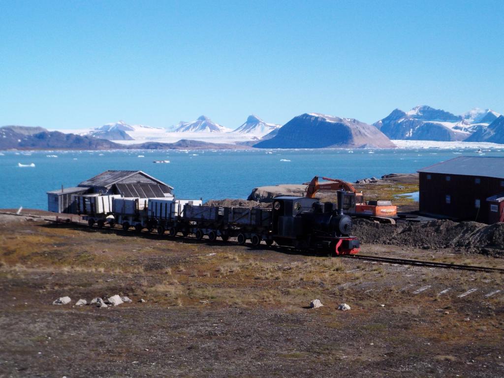
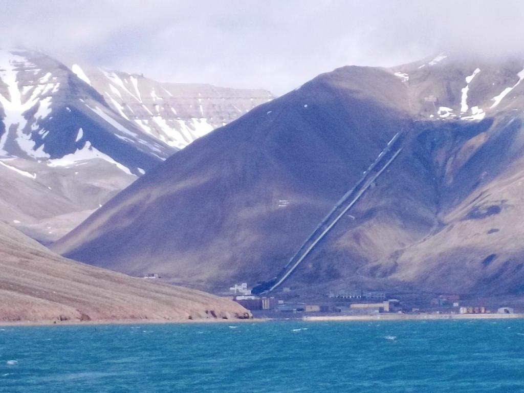
Longyearbyen is an old mining town, and has the feel of the American wild west. It really reminded us of some of the old ski towns out west like Jackson Hole, with lots if young people, and tourists everywhere. The mines are closed now and tourism is the main industry. The town is a dusty dirty place, but with many new modern apartments and the look grows on you after a while. There's a creek running through town with water colored chocolate from the glacial silt it contains.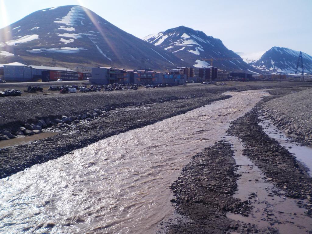
 Snowmobiles are parked for their summer rest.
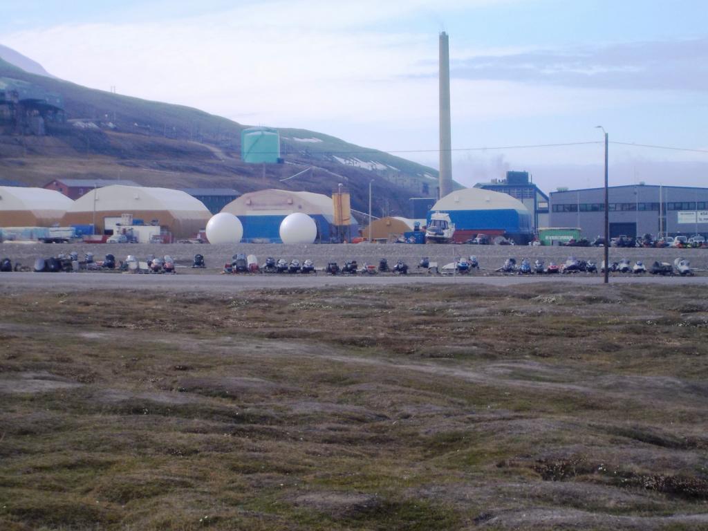
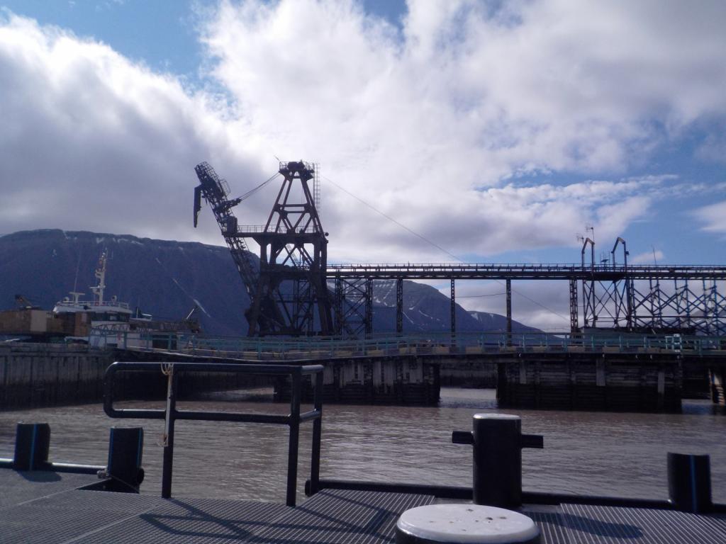
 In the days when the mines were active, the coal was moved to the docks via an arial tram.
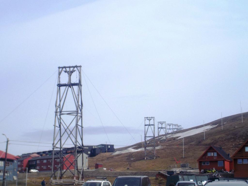
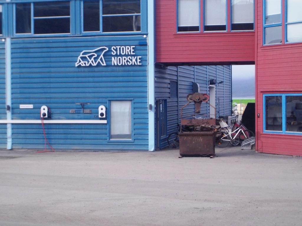
 The coal company is still open and called Store Norsk.
Svalbard is a Norwegian territory, but it requires no visa to enter and anybody can come as long as they have employment or are self supporting. Coming by private boat, we had to apply for permission and send in a proposed itinerary and other supporting documents as well as apply for a permit to rent a rifle. It is necessary to have a rifle or shotgun for polar bear protection when outside the town of Longyearbyen. Upon arrival we stopped by the Governors offices (called the Sysselman) and checked to make sure all our paperwork was in order and then went to town and rented our rifle, a Mauser 30 caliber of WWII vintage.
We spent 3 days looking around and enjoying the town. They have an excellent grocery store, with incredible produce, and a great museum. There is no tax here, which makes things cheaper than in Norway with their 25% VAT, even with the cost of shipping up here. We were surprised at the tourist infrastructure. There are several hotels, many cafes and restaurants many tour boats, small sailing cruise boats and larger cruise ships, both conventional and expedition, all coming in and out of Longyearbyen, and taking people out to see the sights. There are three main settlements, Longyearbyen, Barentsburg, a Russian mining town (the mines are still working there), and Ny Alesund, also an old mining town, but now mostly a research station. The mines here are for coal, although there have been several other enterprises for gypsum and marble which have not been successful. There is also another Russian mining settlement at Pyramiden which was closed down in the late 90's and now only a few people remain.
After getting our fill of town, we headed out with the first stop at Trygghamna, Norwegian for safe harbor, in that the anchorage is free of ice from the glaciers. It is a beautiful spot and a peaceful anchorage.
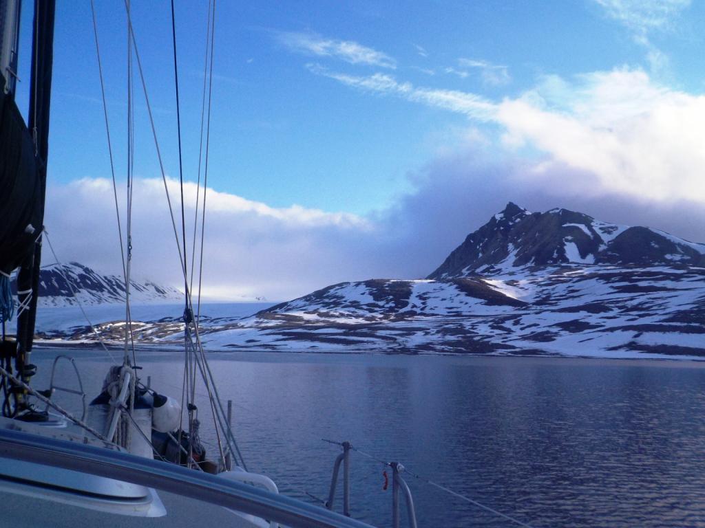
Our plan was to move quickly up north and work our way back south. Our gun rental was for three weeks so we had planned our itinerary around that. The next morning we moved out of Isfjorden and up Forlandsundet, the channel between Prins Karl Forland, a large island to the west and the mainland. About half way up the channel is Poolepynten a point out from the island and the home to a large walrus colony. We made a stop to say hello to the walruses.
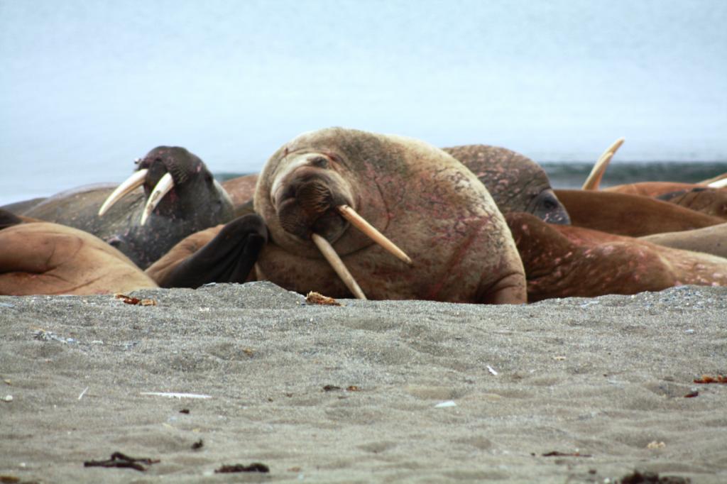

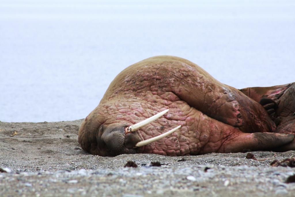

Then we were off again and out the north end of Forlandsundet and around into Kongfjorden and to anchor at Peirsonhamna. This is the site of an old ill fated marble quarry.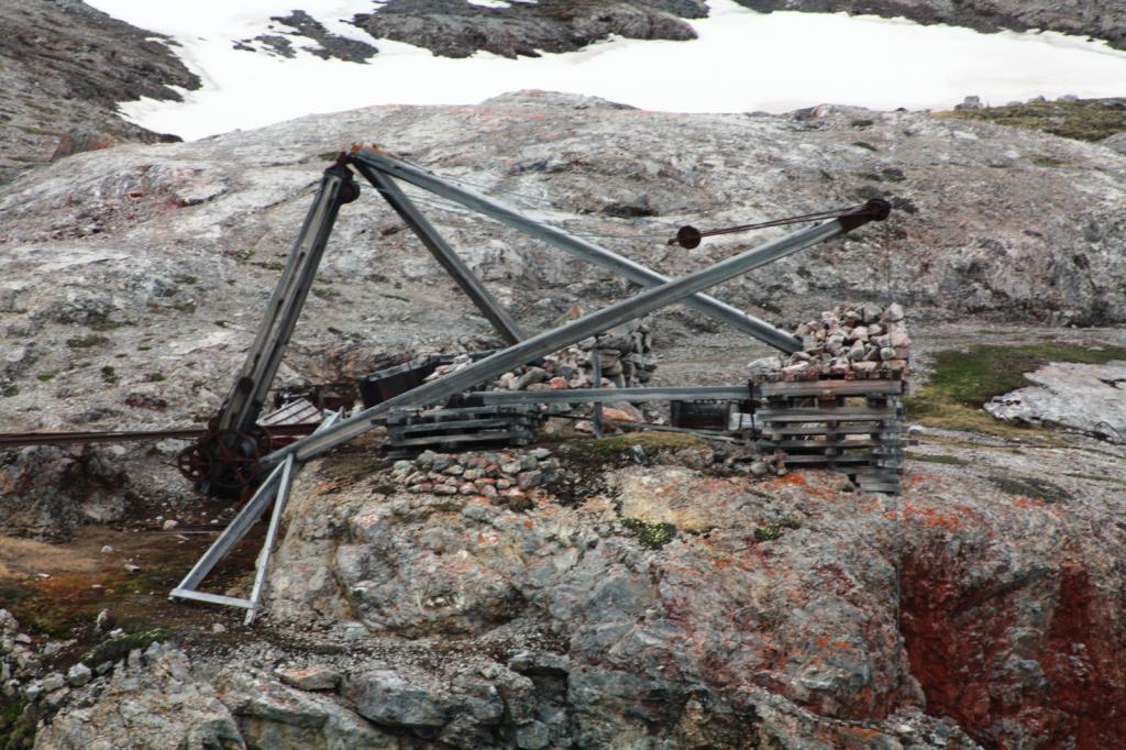
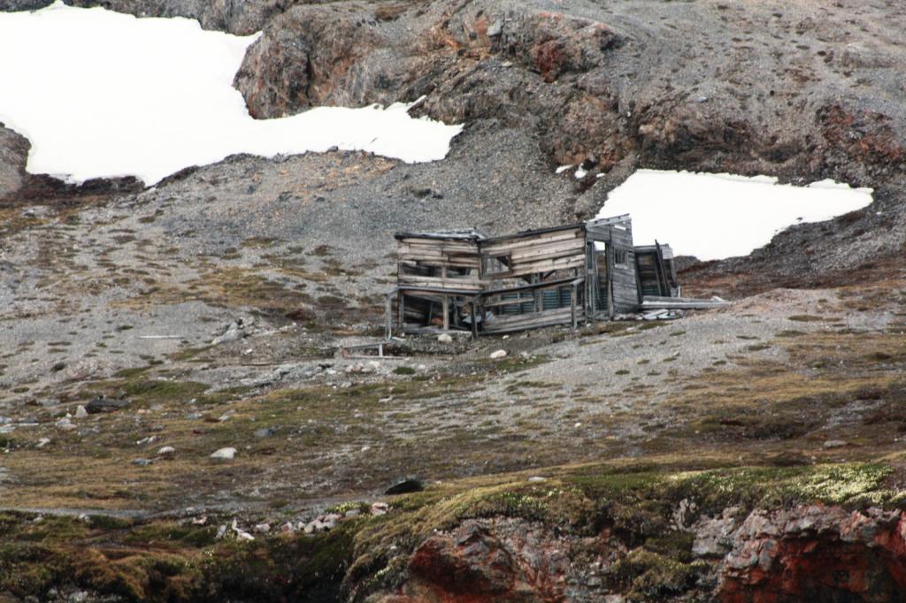
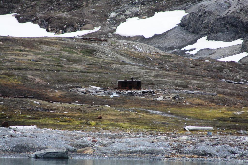
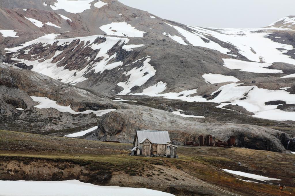
The next morning we circled Blomstrndhalvoya and checked out all the glaciers and the ice burgs calving off them.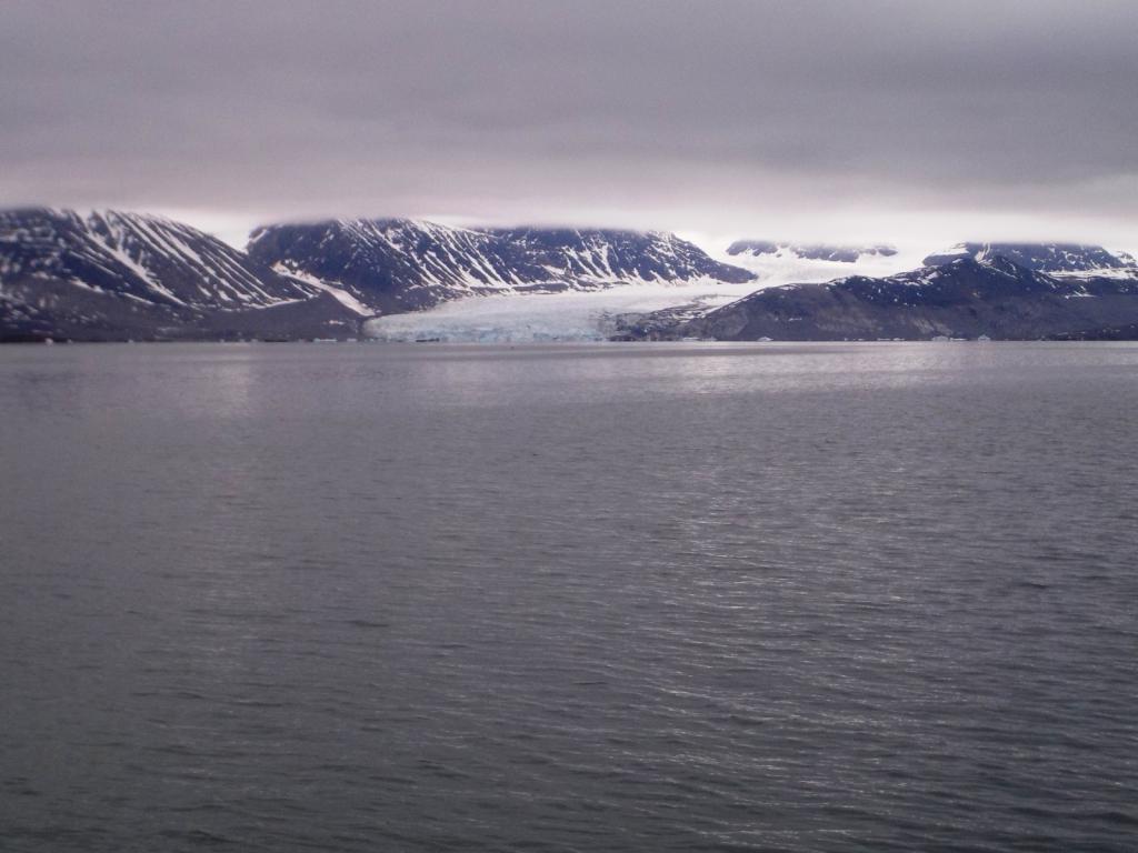

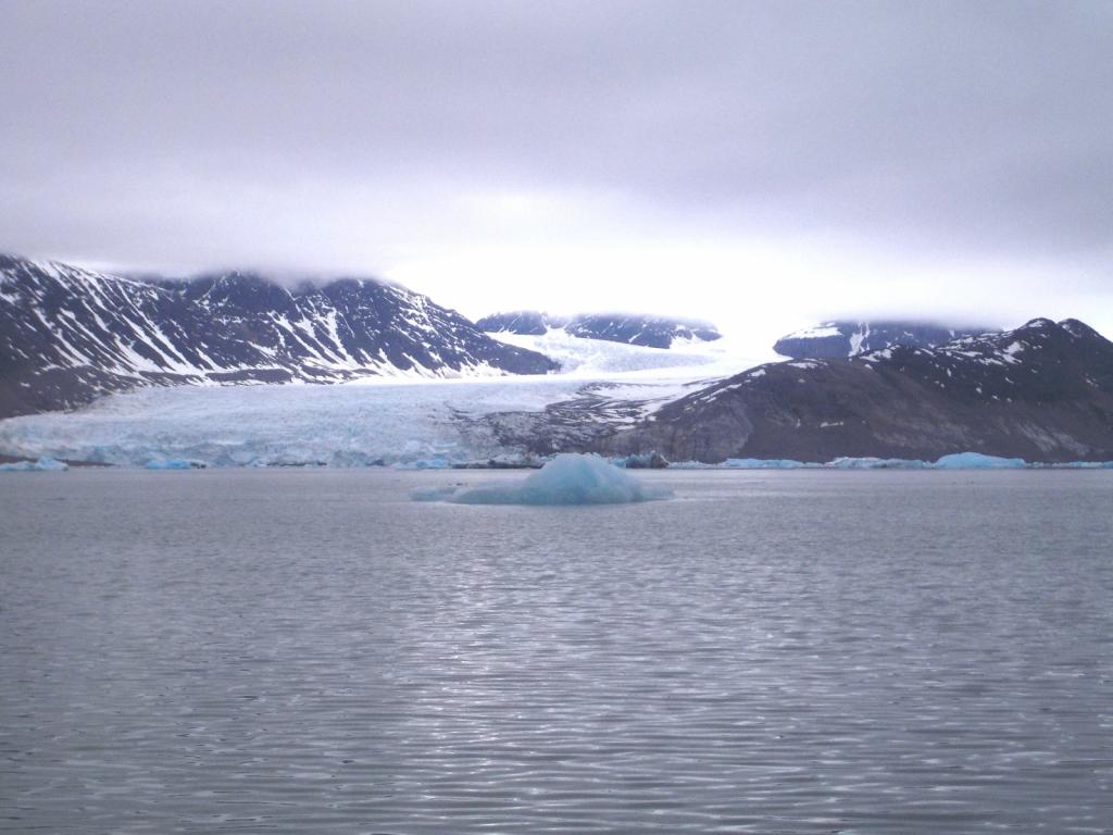
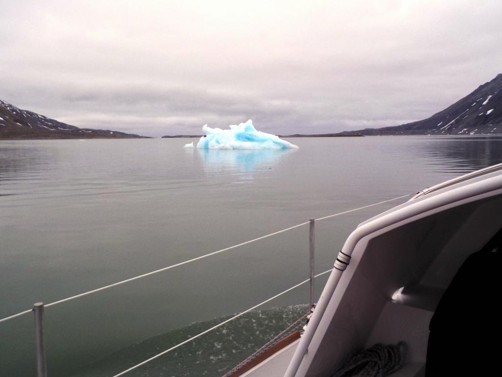


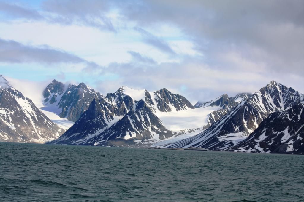
Then we headed north and found anchorage off of Virgohamna. This is a famous spot in the history of exploration and the search for the north pole. There was a Swedish attempt in a balloon and an American attempt in a zeppelin, both failures. There are extensive remains there from these attempts and special permission is required from the Sysselman to go there. We did have the permit but for a later time so we'll be back.
We were up early to sail on around the NW tip of Spitzbergen (the main island in the Svalbard archipelago) and back out into the open ocean and headed for 80 degrees north. It is a milestone for many sailors and this is the only place you can reasonably reach 80 north in a small boat. As we closed in on the mark we began to see a lot of ice, at first small floating bergs and then it became more closely packed together. We made it only a couple of tenths of a degree north of 80 before we were stopped by fairly solid ice.


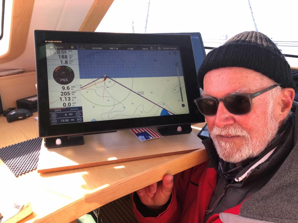
Our plan was to head over to Woodfjorden, which would the most easterly point of our trip. Unfortunately, it was not meant to be, as we ran into significant ice. We spoke to a couple of large cruise ships and even they were not attemting entry there, so we headed down to Raudfjorden and found it ice choked as well. We did find a lead into the fjiord but all the anchorages were covered with ice and we became afraid that the wind would blow the lead we came in on closed so we scrammed out as fast as we could. We sailed back west to Sallyhamna for the night arriving there at 8:30 PM tired and frustrated. At least we didn't have to worry about the light fading with 24 hours of daylight.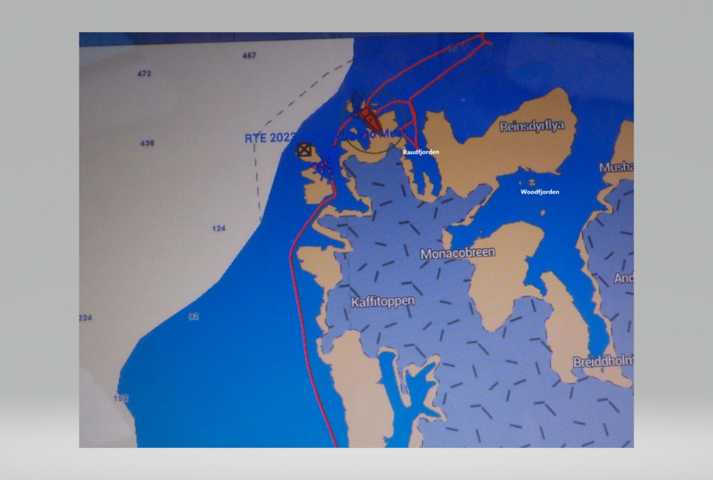
It was becoming obvious that our plan to be one of the first boats up here this year might have been too early as the ice was a big problem. We decided to head back a little and spend a few days to see if things cleared and maybe try it again. The next morning we headed back around the corner to anchor at Smeerenburg, the site of Dutch whaling in the 18th century. We walked around and sawseveral graves and some of the remains of the fire places they used to render the whale blubber.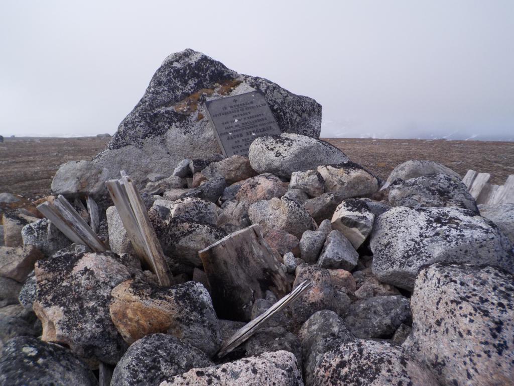
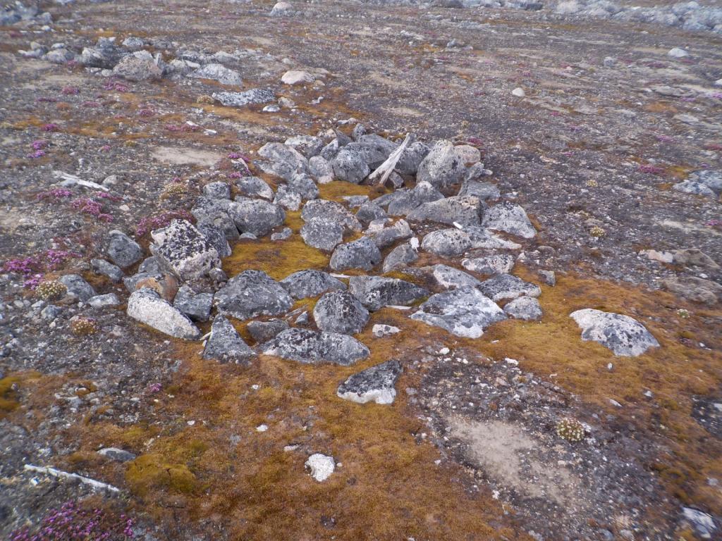 We've been on ther lookout for bears and haven't seen any but here's a footprint.
We had a visit from a couple of the Sysselman Rangers to check our paperwork and weapons, and we asked them about the ice.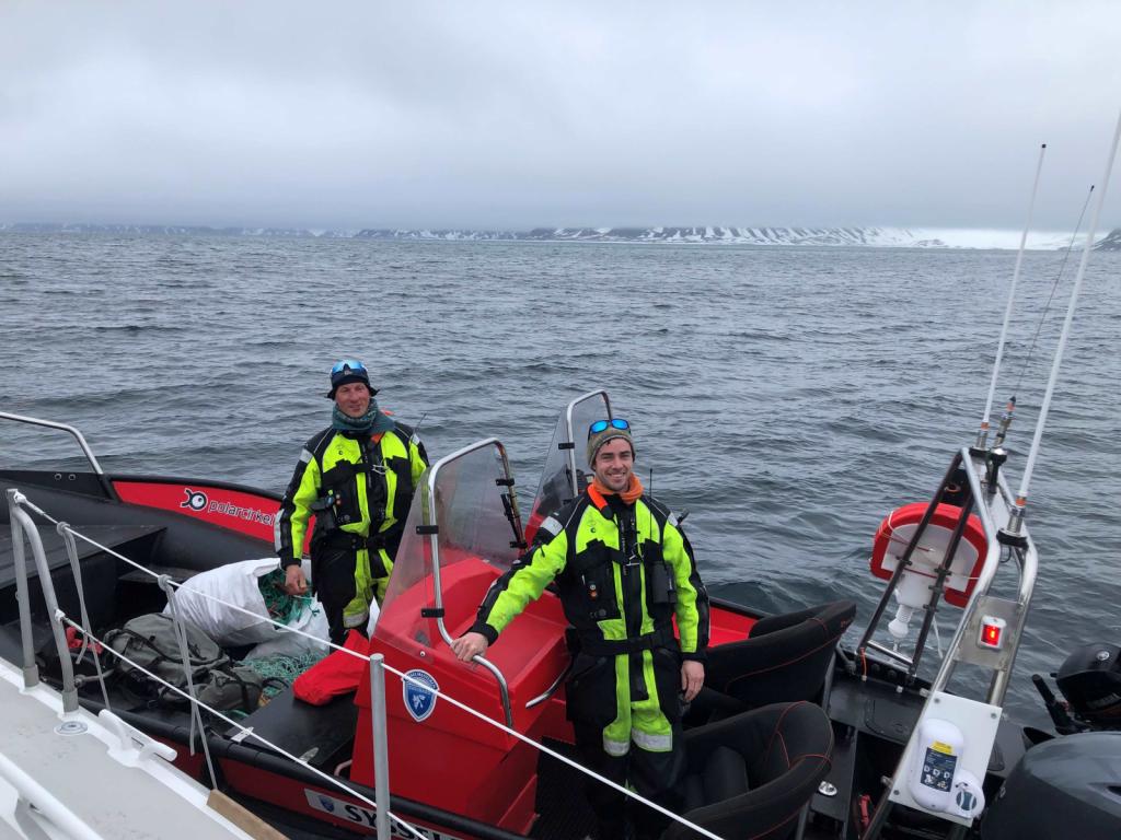 They said it had been an unusually cold and snowy winter and the ice was worse than normal, but it might clear with warm SW wind. Unfortunately the wind has been from the NE, so the outlook for us to go further was bleak.
See how it all comes out in part 2 coming up in a while.
Around noon the next day, the wind filled in and we shut down the engine and enjoyed the quiet and more stable conditions. We cheated west of the rumb line to stay in the wind and decided to pass by Bear Island, also the weather looked like it may change with the forecast showing possible stormy weather and adverse wind if we lingered. We were in and out of fog, but had no rain and at 2 AM on the fourth day we were motoring into Bellsund Fiord. Our intended anchorage was Fridjtohamna but it was covered in thick fog, but it was clear to the south, so we headed down to Vestvagen. What an introduction to Svalbard. We saw whales, walrus and seals in the water, and raindeer, mountains and glaciers on land.
After a few hours of sleep we motored back up to Fridjtohamna, the fog having cleared and weaved our way through ice to the anchorage.
After more rest and sleep, at 6 AM we pulled up the anchor and headed around into Isfjorden and to Longyearbyen, the commercial hub of Svalbard. The days and nights get a little confused up here as it never gets dark and the sun doesn't rise or set. It just goes around in a circle in the sky.
Longyearbyen is an old mining town, and has the feel of the American wild west. It really reminded us of some of the old ski towns out west like Jackson Hole, with lots if young people, and tourists everywhere. The mines are closed now and tourism is the main industry. The town is a dusty dirty place, but with many new modern apartments and the look grows on you after a while. There's a creek running through town with water colored chocolate from the glacial silt it contains.
Snowmobiles are parked for their summer rest. In the days when the mines were active, the coal was moved to the docks via an arial tram. The coal company is still open and called Store Norsk. Svalbard is a Norwegian territory, but it requires no visa to enter and anybody can come as long as they have employment or are self supporting. Coming by private boat, we had to apply for permission and send in a proposed itinerary and other supporting documents as well as apply for a permit to rent a rifle. It is necessary to have a rifle or shotgun for polar bear protection when outside the town of Longyearbyen. Upon arrival we stopped by the Governors offices (called the Sysselman) and checked to make sure all our paperwork was in order and then went to town and rented our rifle, a Mauser 30 caliber of WWII vintage.
We spent 3 days looking around and enjoying the town. They have an excellent grocery store, with incredible produce, and a great museum. There is no tax here, which makes things cheaper than in Norway with their 25% VAT, even with the cost of shipping up here. We were surprised at the tourist infrastructure. There are several hotels, many cafes and restaurants many tour boats, small sailing cruise boats and larger cruise ships, both conventional and expedition, all coming in and out of Longyearbyen, and taking people out to see the sights. There are three main settlements, Longyearbyen, Barentsburg, a Russian mining town (the mines are still working there), and Ny Alesund, also an old mining town, but now mostly a research station. The mines here are for coal, although there have been several other enterprises for gypsum and marble which have not been successful. There is also another Russian mining settlement at Pyramiden which was closed down in the late 90's and now only a few people remain.
After getting our fill of town, we headed out with the first stop at Trygghamna, Norwegian for safe harbor, in that the anchorage is free of ice from the glaciers. It is a beautiful spot and a peaceful anchorage.
Our plan was to move quickly up north and work our way back south. Our gun rental was for three weeks so we had planned our itinerary around that. The next morning we moved out of Isfjorden and up Forlandsundet, the channel between Prins Karl Forland, a large island to the west and the mainland. About half way up the channel is Poolepynten a point out from the island and the home to a large walrus colony. We made a stop to say hello to the walruses.
Then we were off again and out the north end of Forlandsundet and around into Kongfjorden and to anchor at Peirsonhamna. This is the site of an old ill fated marble quarry.
The next morning we circled Blomstrndhalvoya and checked out all the glaciers and the ice burgs calving off them.
Then we headed north and found anchorage off of Virgohamna. This is a famous spot in the history of exploration and the search for the north pole. There was a Swedish attempt in a balloon and an American attempt in a zeppelin, both failures. There are extensive remains there from these attempts and special permission is required from the Sysselman to go there. We did have the permit but for a later time so we'll be back.
We were up early to sail on around the NW tip of Spitzbergen (the main island in the Svalbard archipelago) and back out into the open ocean and headed for 80 degrees north. It is a milestone for many sailors and this is the only place you can reasonably reach 80 north in a small boat. As we closed in on the mark we began to see a lot of ice, at first small floating bergs and then it became more closely packed together. We made it only a couple of tenths of a degree north of 80 before we were stopped by fairly solid ice.
Our plan was to head over to Woodfjorden, which would the most easterly point of our trip. Unfortunately, it was not meant to be, as we ran into significant ice. We spoke to a couple of large cruise ships and even they were not attemting entry there, so we headed down to Raudfjorden and found it ice choked as well. We did find a lead into the fjiord but all the anchorages were covered with ice and we became afraid that the wind would blow the lead we came in on closed so we scrammed out as fast as we could. We sailed back west to Sallyhamna for the night arriving there at 8:30 PM tired and frustrated. At least we didn't have to worry about the light fading with 24 hours of daylight.
It was becoming obvious that our plan to be one of the first boats up here this year might have been too early as the ice was a big problem. We decided to head back a little and spend a few days to see if things cleared and maybe try it again. The next morning we headed back around the corner to anchor at Smeerenburg, the site of Dutch whaling in the 18th century. We walked around and sawseveral graves and some of the remains of the fire places they used to render the whale blubber.
We've been on ther lookout for bears and haven't seen any but here's a footprint. We had a visit from a couple of the Sysselman Rangers to check our paperwork and weapons, and we asked them about the ice.
They said it had been an unusually cold and snowy winter and the ice was worse than normal, but it might clear with warm SW wind. Unfortunately the wind has been from the NE, so the outlook for us to go further was bleak. See how it all comes out in part 2 coming up in a while.
| Vessel Name: | Wings |
| Vessel Make/Model: | Boreal 47 |
| Hailing Port: | St Petersburg. FL |
| Crew: | Dee and Molly Strickland |
| About: | |
| Extra: | Dee, Molly and daughter Lisa left Tampa Bay in 1994 and sailed to Trinidad and Venezuela, and then back up the US east coast. Lisa was home schooled and then we returned to Tampa Bay where she skipped 4th grade and moved to 5th. She is now studying for her PhD in Art History at SUNY at Stoney Brook. |
| Social: |
|
Wings's Photos - Main
|
|
|
|
|
|
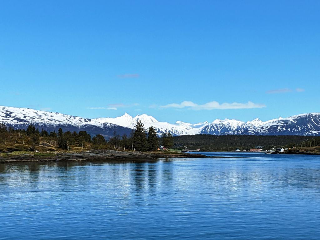 |
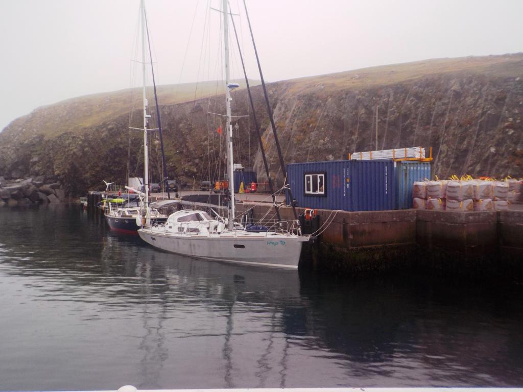 |
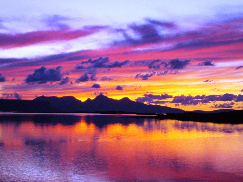 |
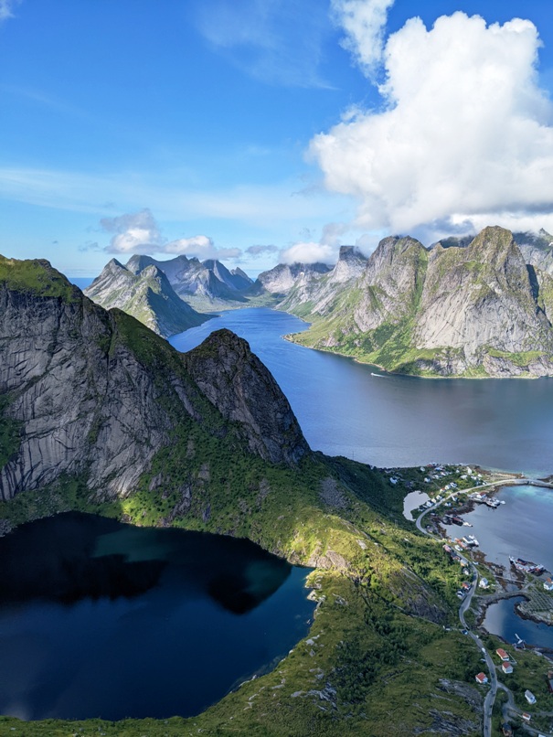 |
 |
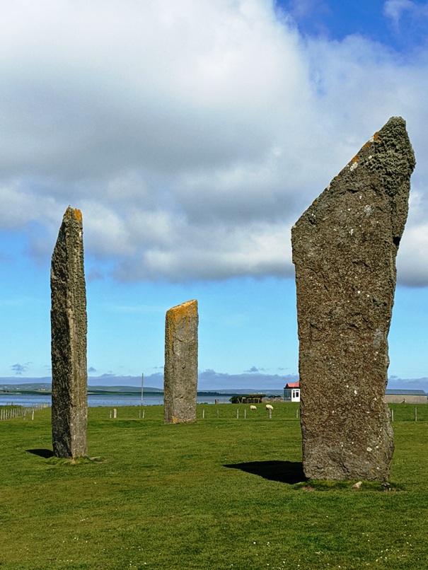 |
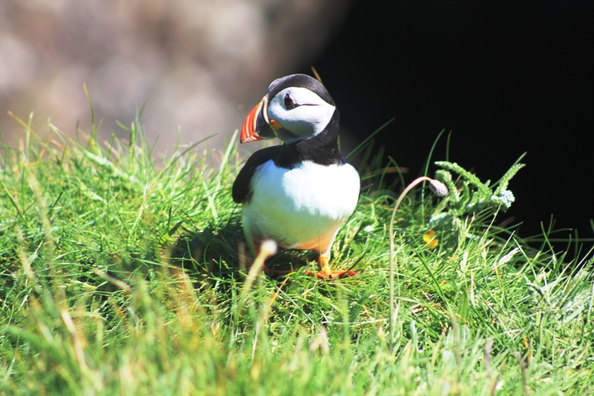 |
 |
 |
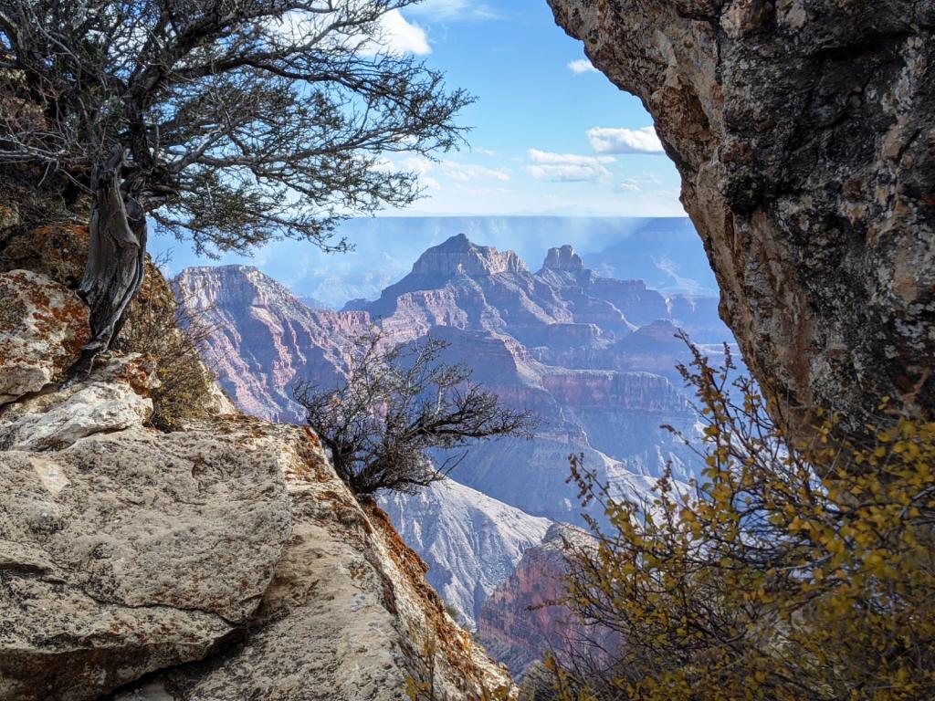 |
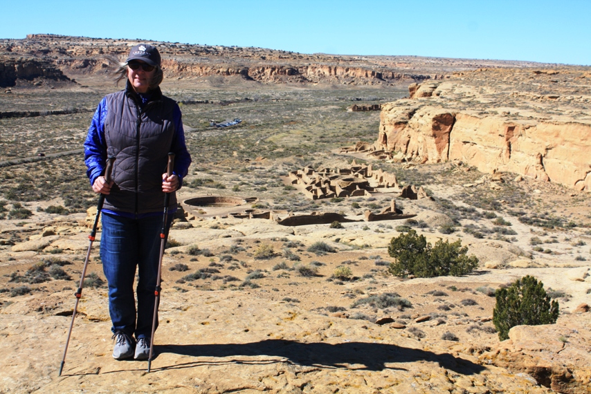 |
 |
 |
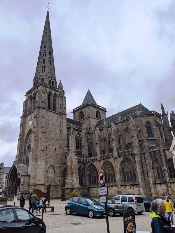 |
 |
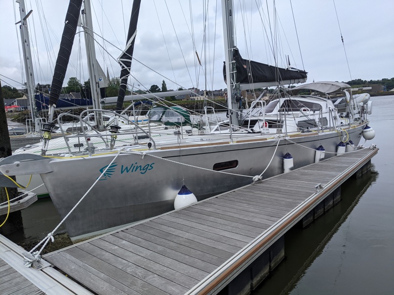 |
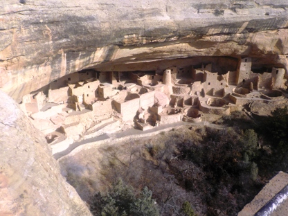 |
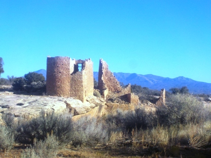 |
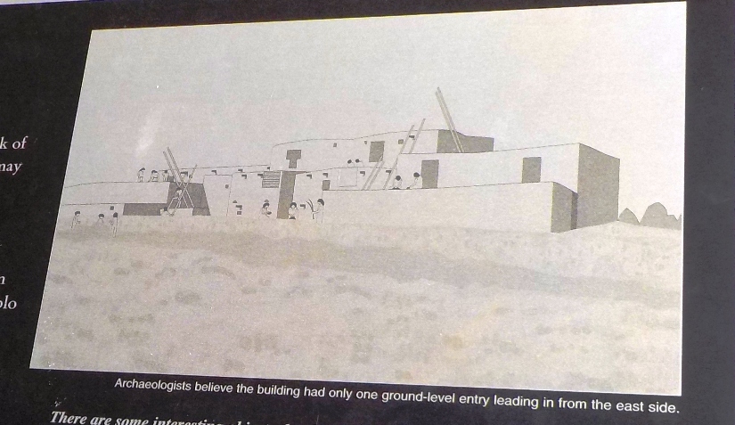 |
 |
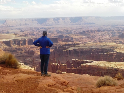 |
 |
 |
 |
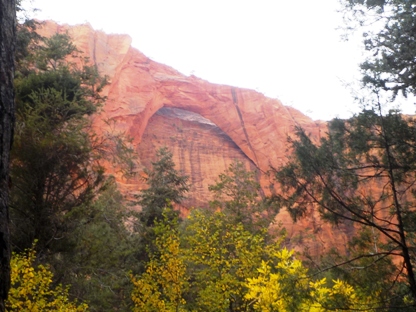 |
 |
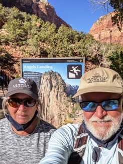 |
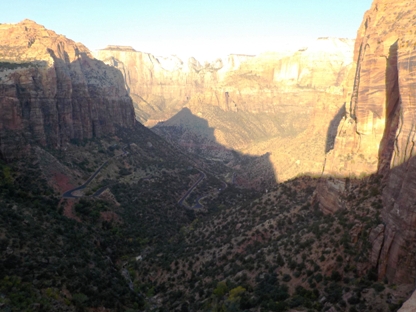 |
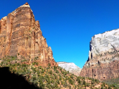 |
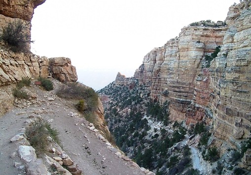 |
 |
 |
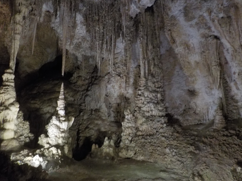 |
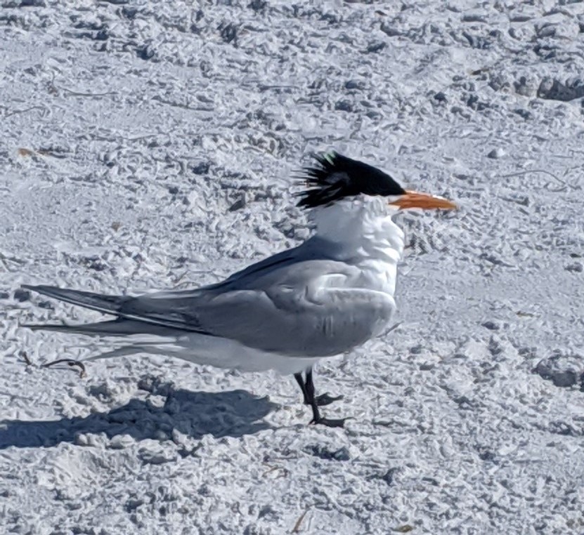 |
 |
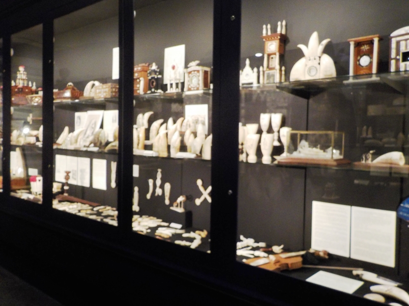 |
 |
The Main maritime museum is in Bath Maine, at the site of the Percy & Small Shipyard
10 Photos
Created 9 September 2019
|
 |
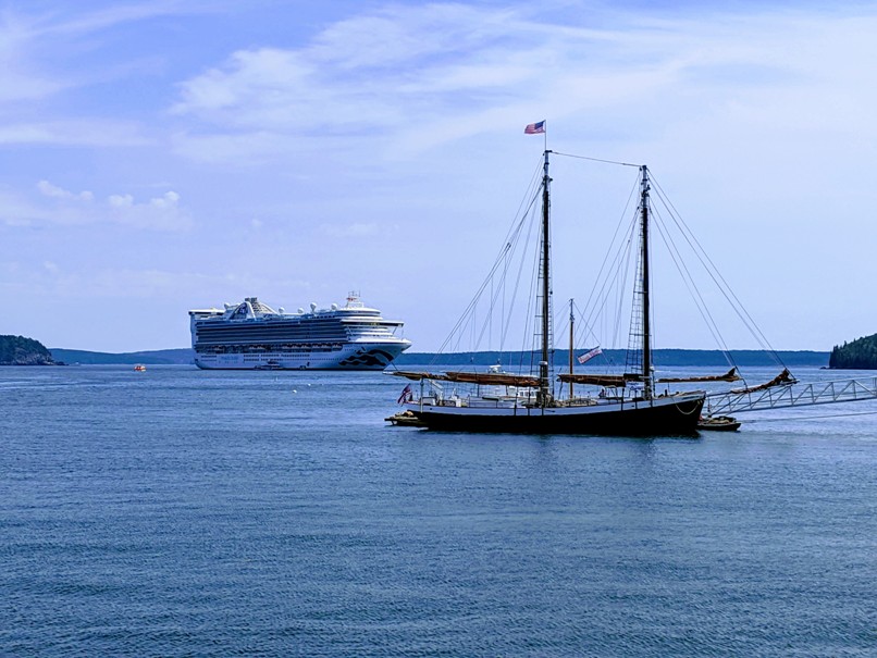 |
 |
 |
 |
 |
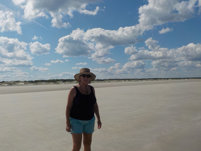 |
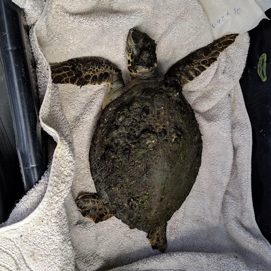 |
 |
 |
 |
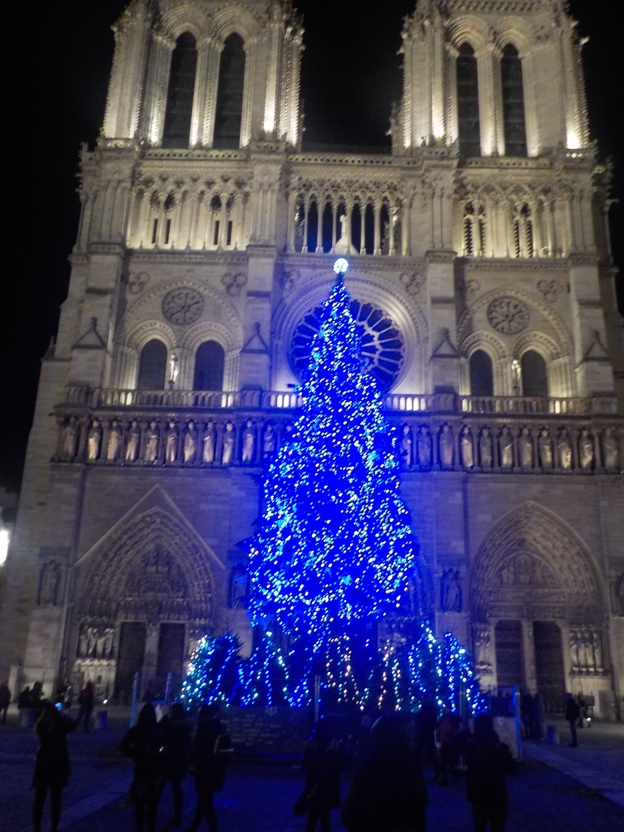 |
 |
 |
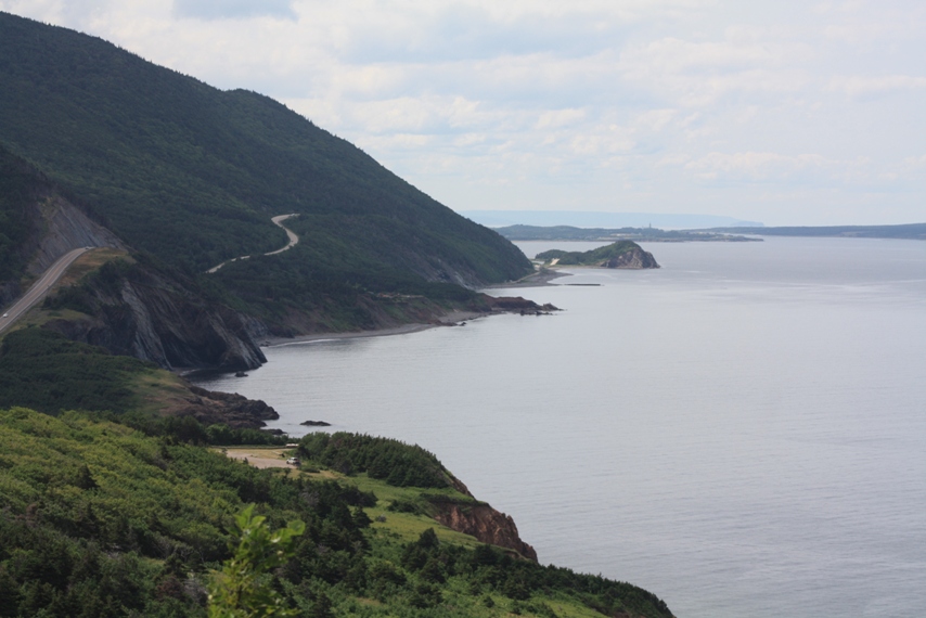 |
 |
 |
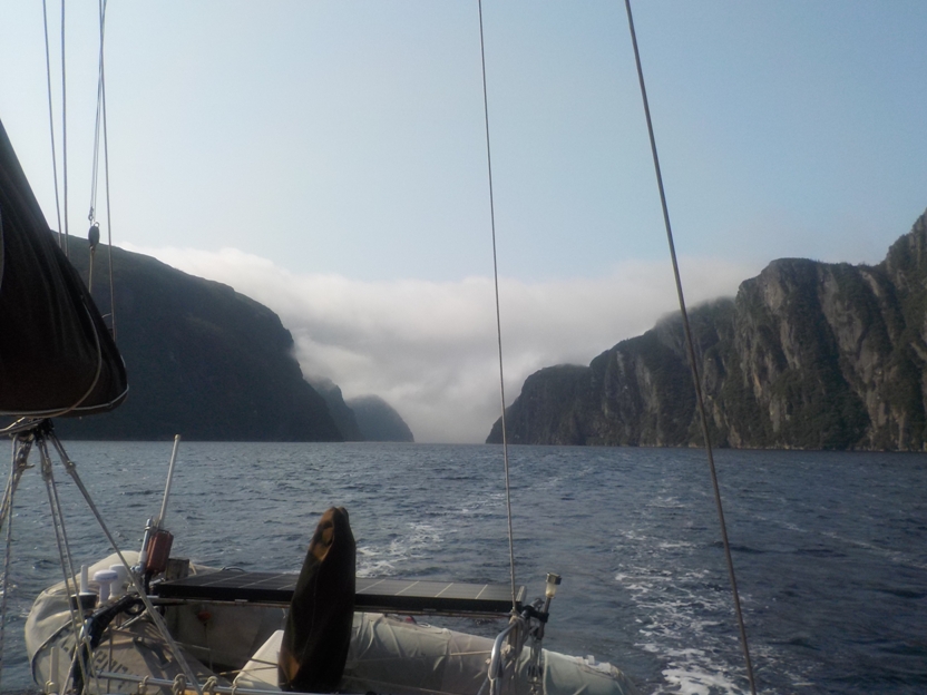 |
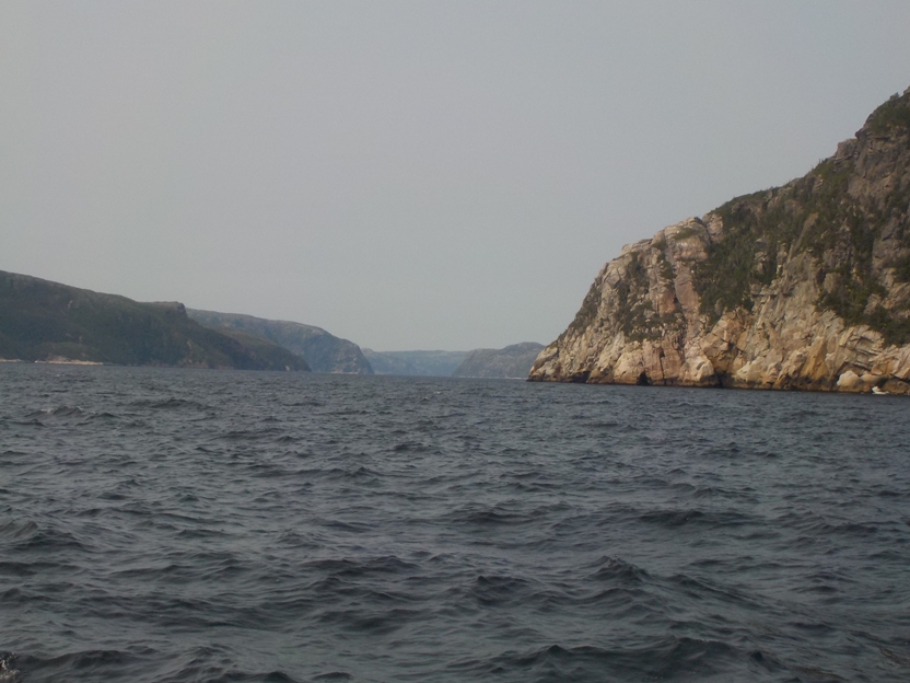 |
 |
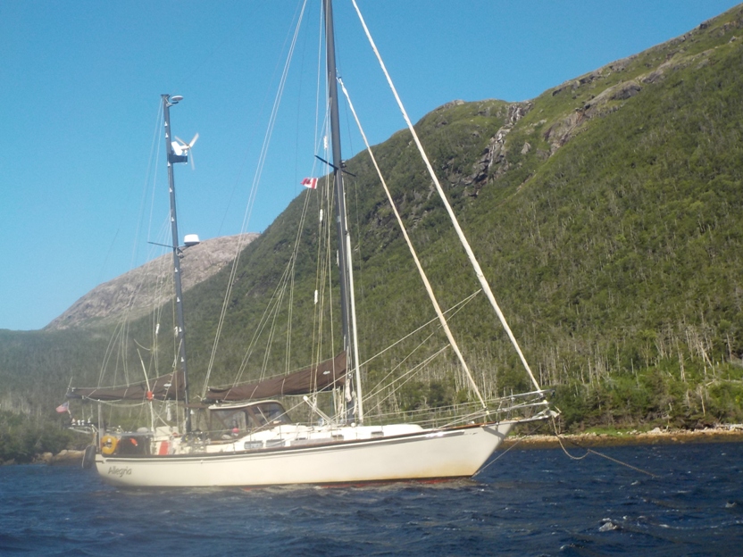 |
 |
 |
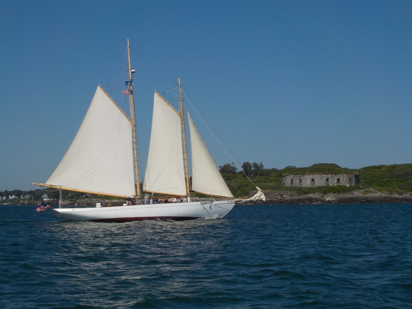 |
 |
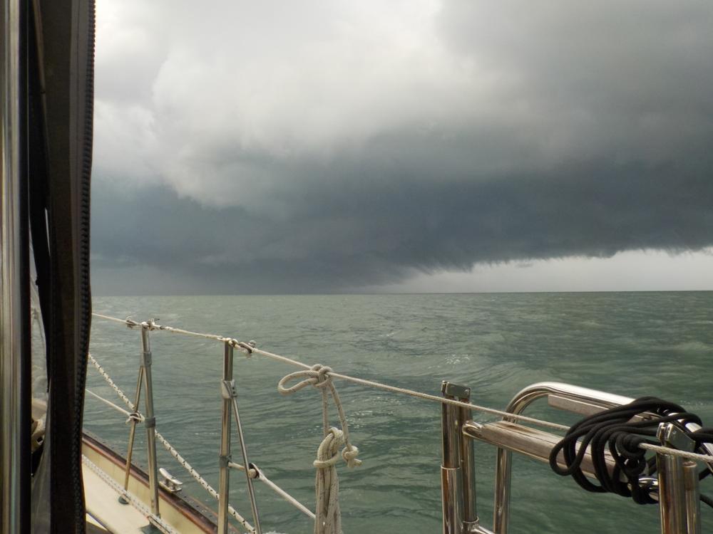 |
 |
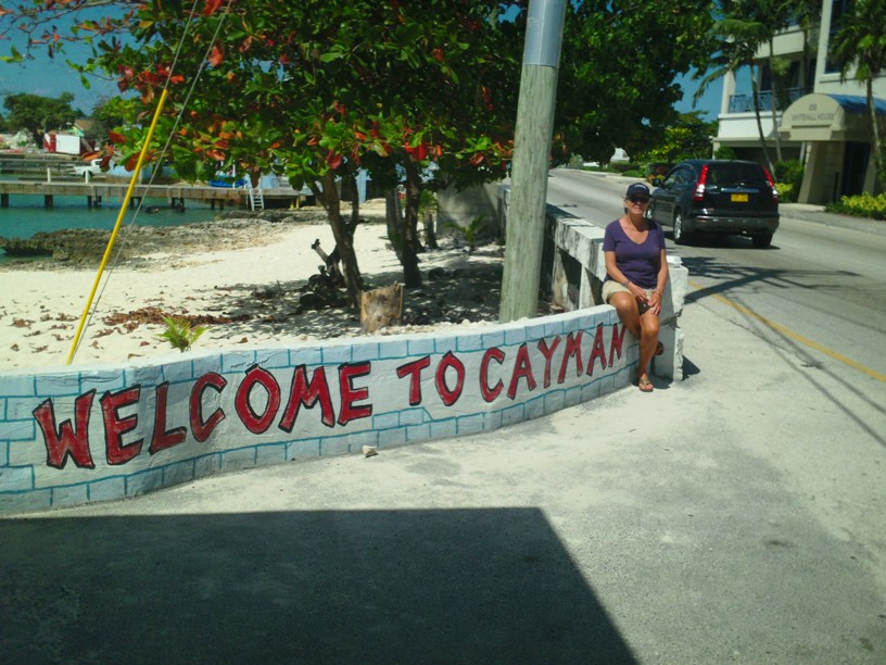 |
 |
 |
 |
 |
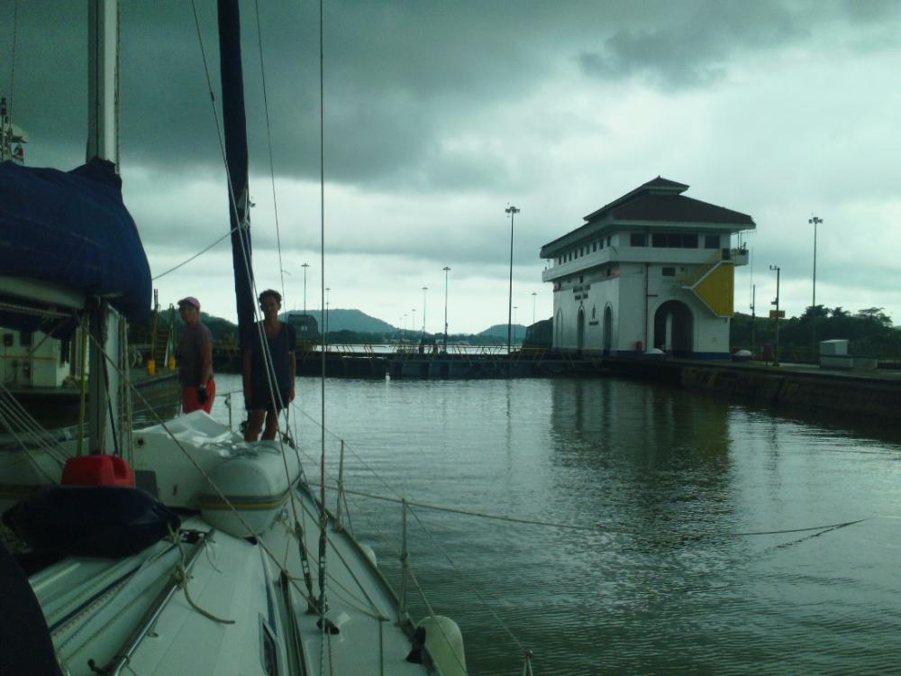 |
 |
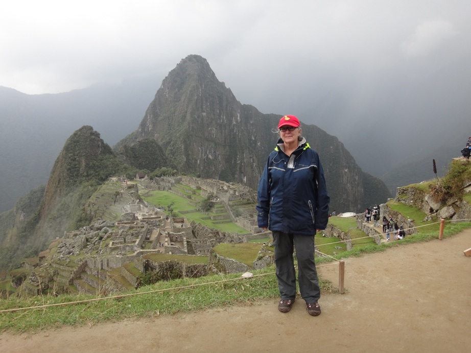 |
 |
 |
 |
 |
 |
 |
 |
 |
 |
 |
 |
 |
 |
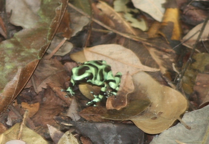 |
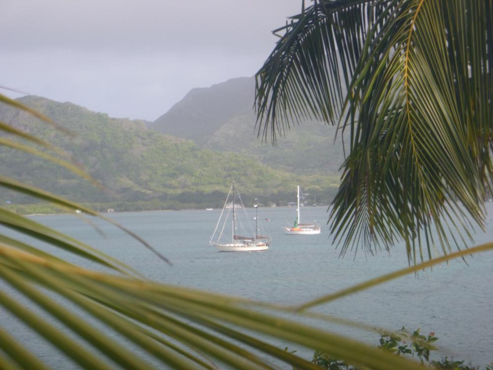 |
 |
 |
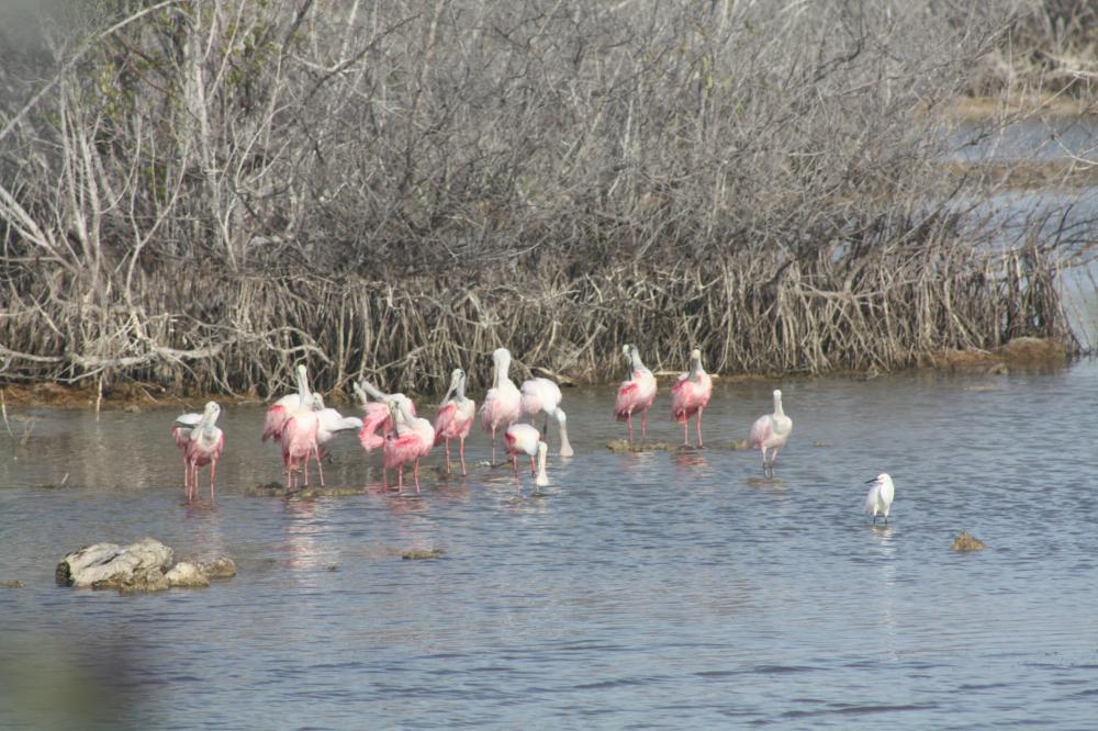 |
 |
 |
 |
First to the Bahamas and then up to Maine
46 Photos
Created 8 December 2016
|
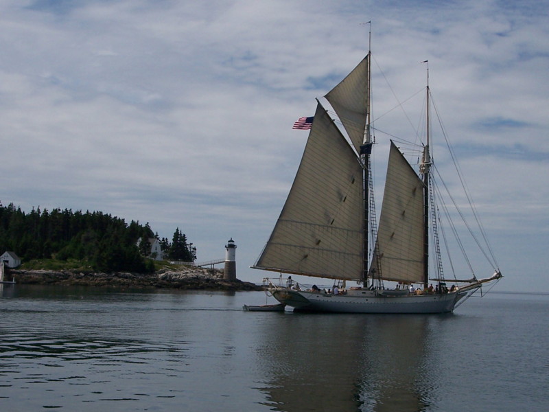 |
I love lighthouses. These are some of the lighthouses we sailed past while in Maine. How many have you seen?
25 Photos
Created 8 December 2016
|
 |
 |
 |
 |
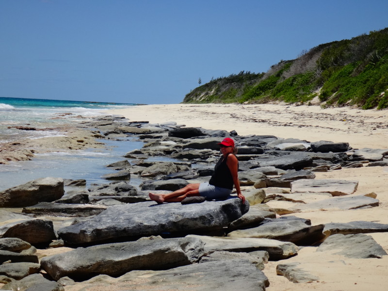 |
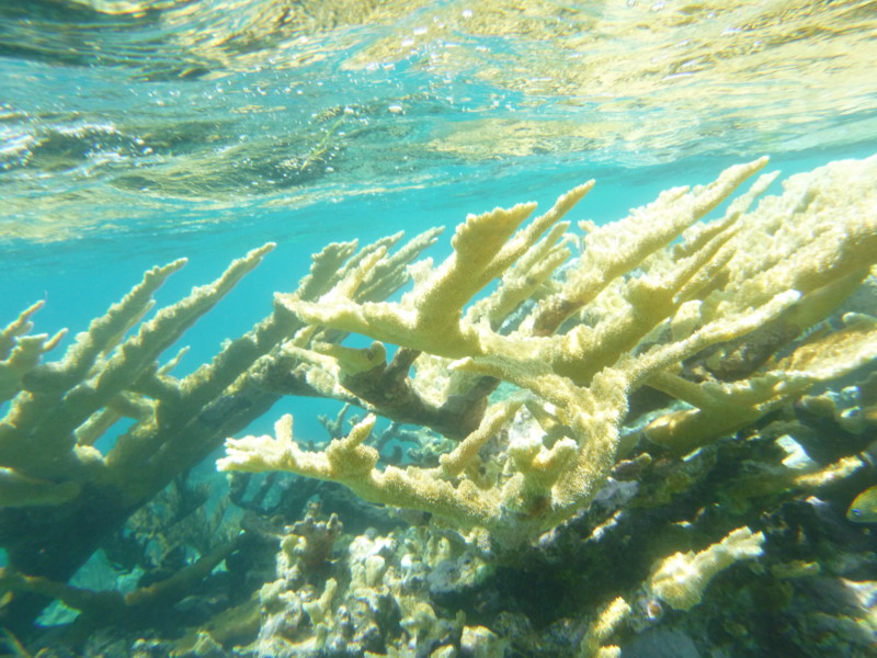 |
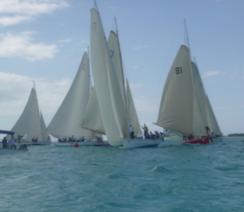 |
 |
.jpg) |
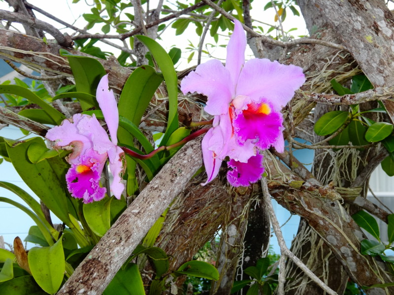 |
 |
 |
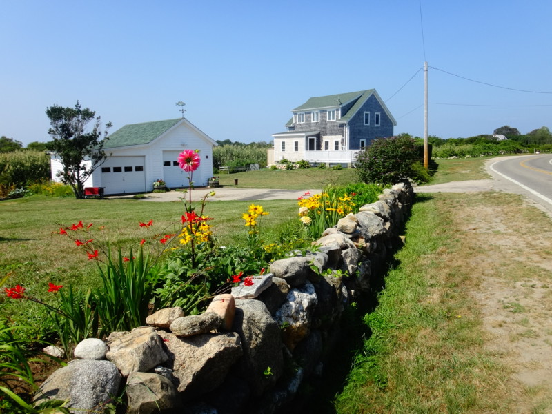 |
 |
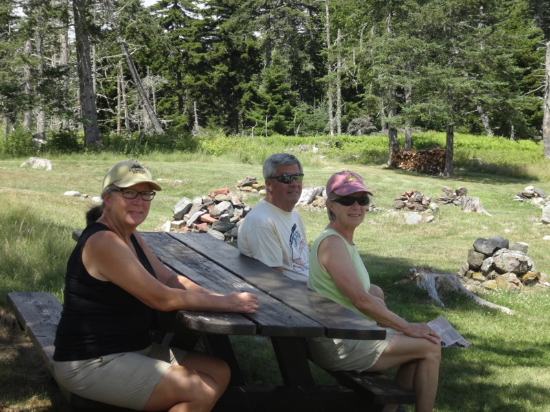 |
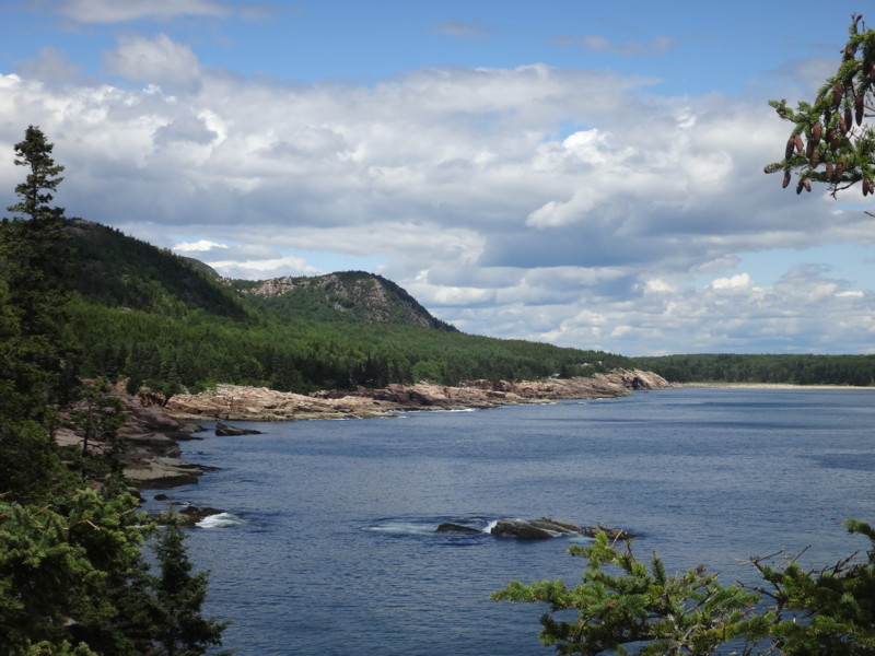 |
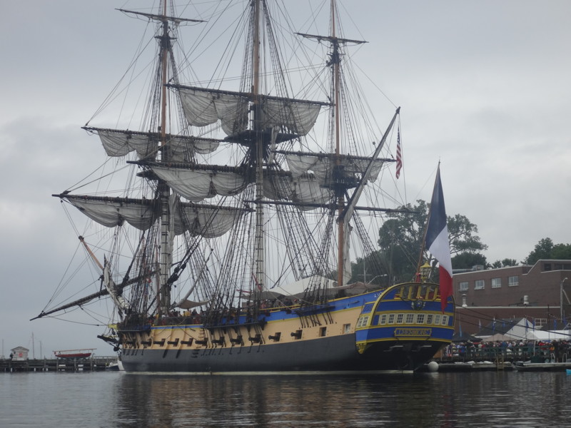 |
 |
 |
 |
 |
 |
 |
 |
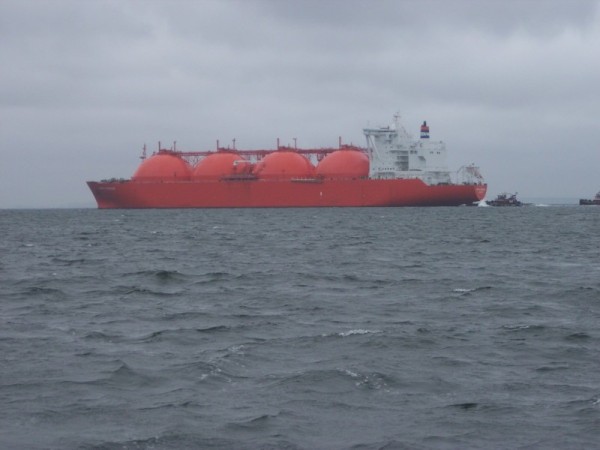 |
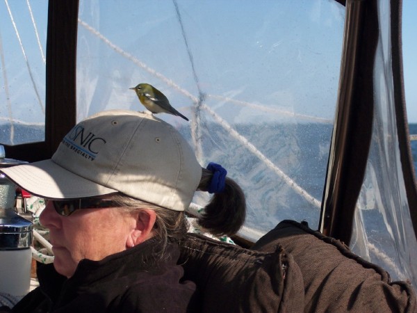 |
 |
 |
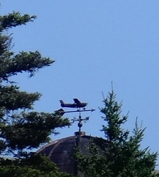 |
 |
 |
 |
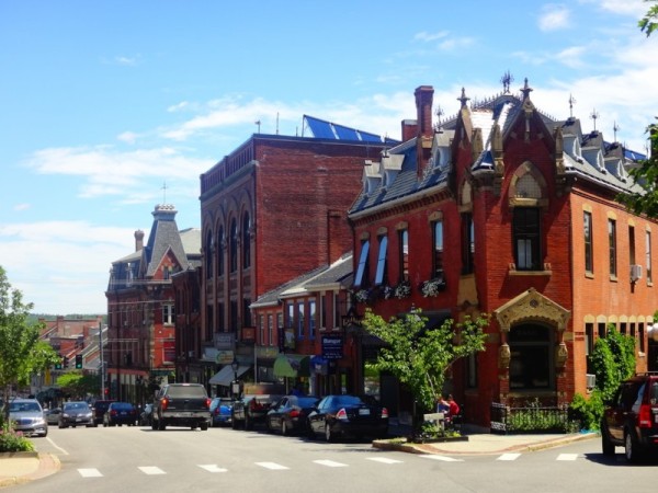 |
 |
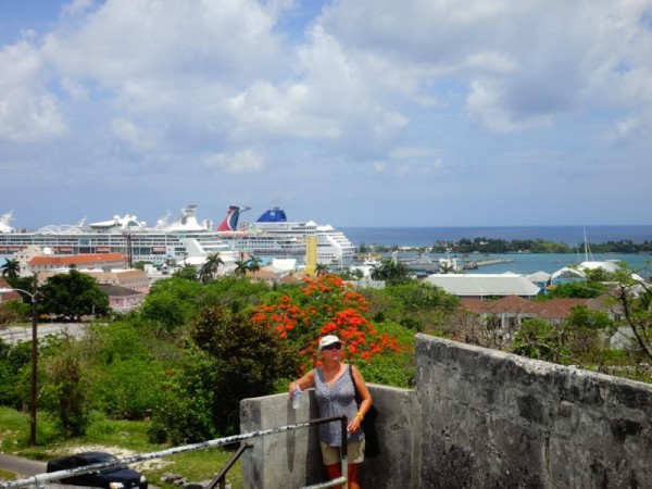 |
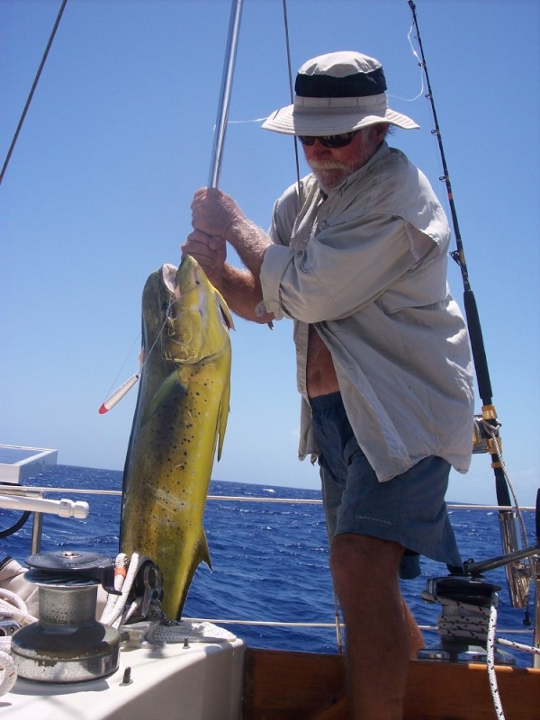 |
 |
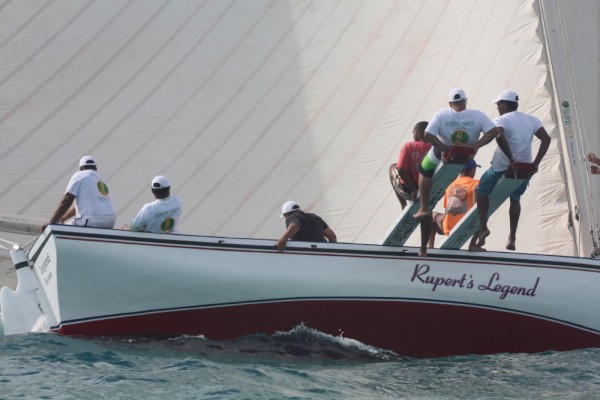 |
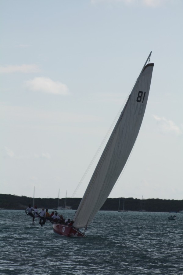 |
 |
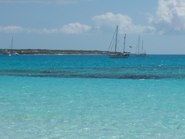 |
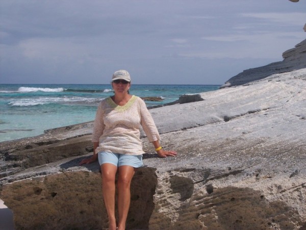 |
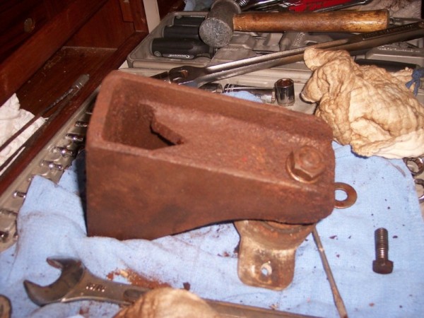 |
 |
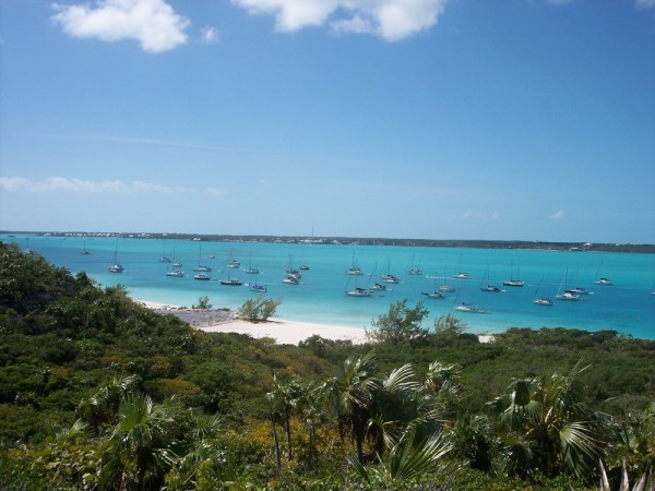 |
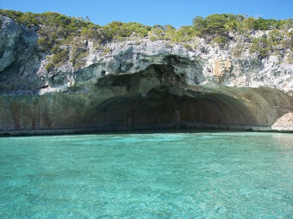 |
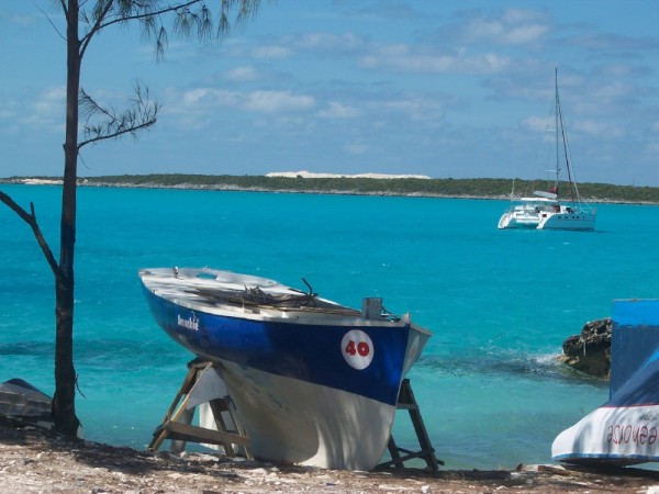 |
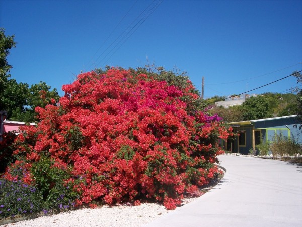 |
 |
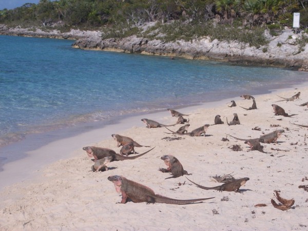 |
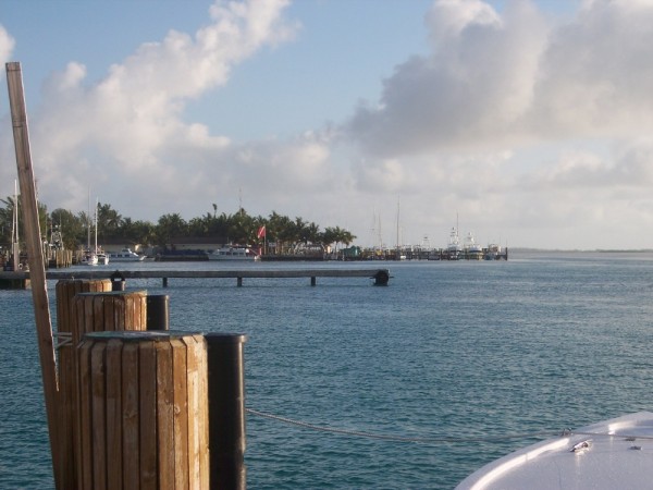 |
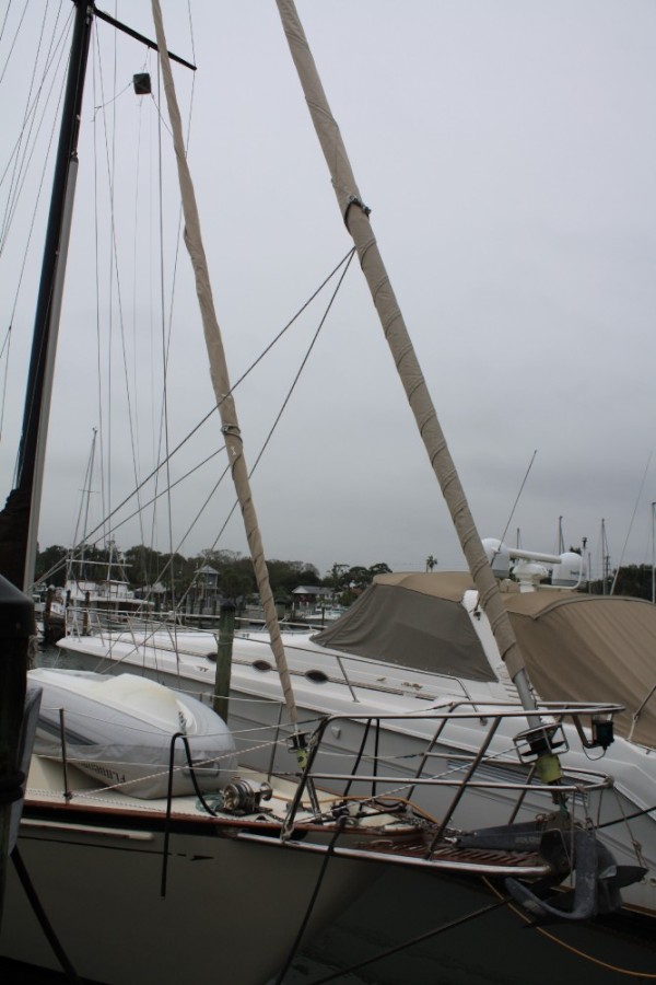 |
 |
 |
 |
 |
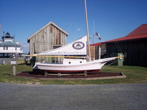 |
 |
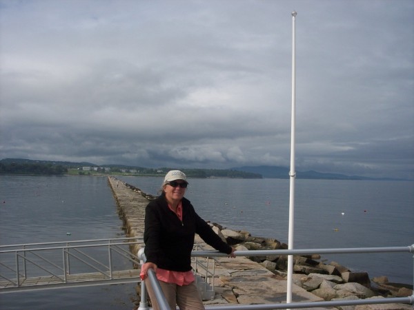 |
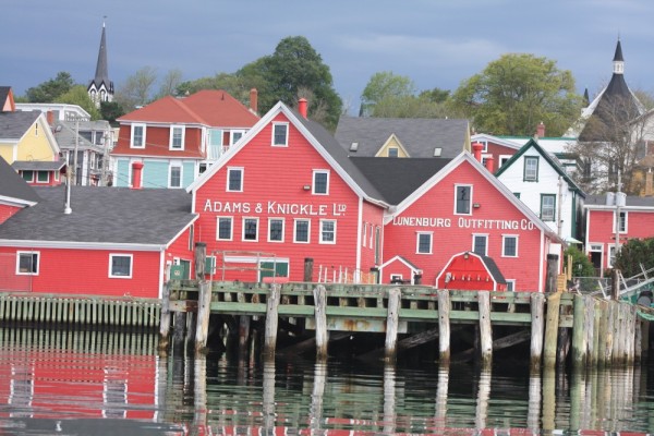 |
 |
 |
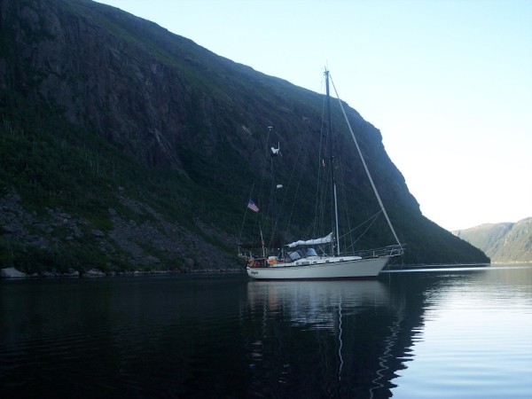 |
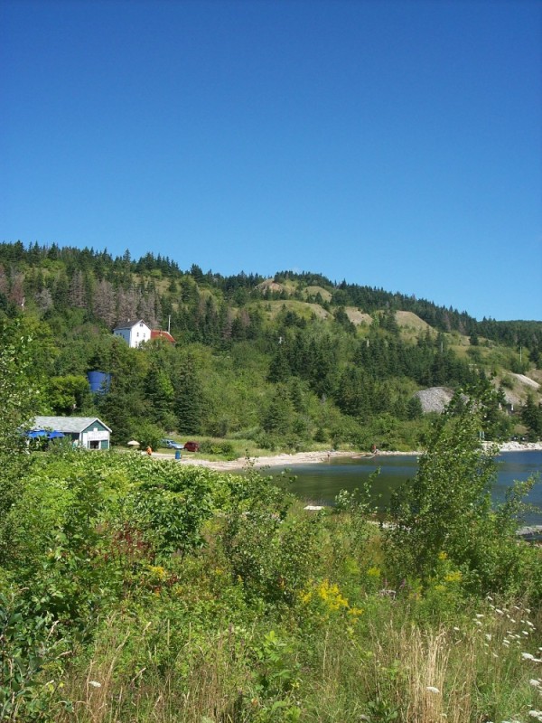 |
 |
 |
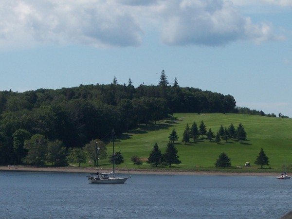 |
 |
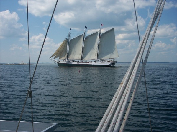 |
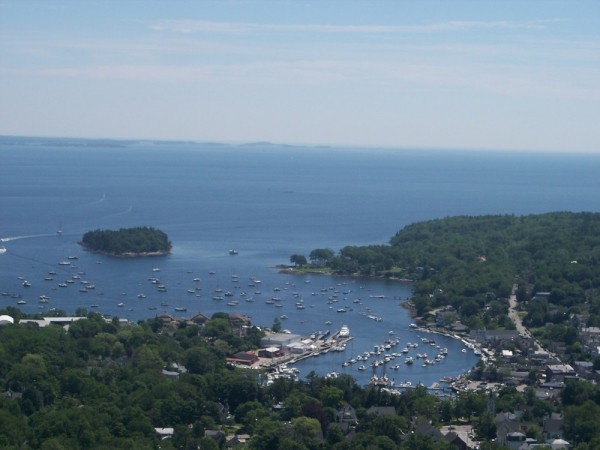 |
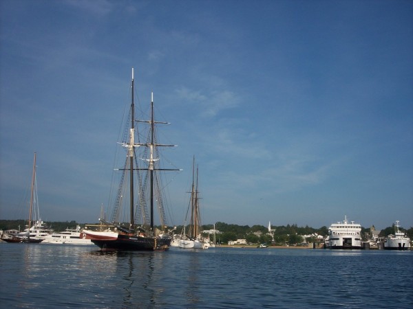 |
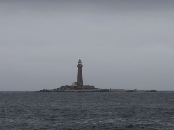 |
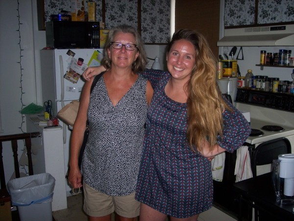 |
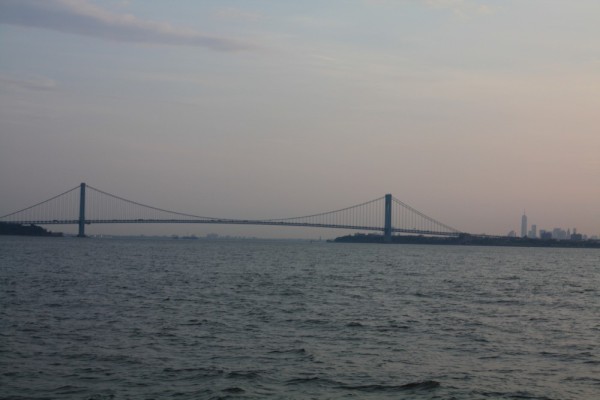 |
Passage through New York Harbor and the East River
20 Photos
Created 28 June 2013
|
 |
 |
 |
Summary of Allegria repairs and upgrades
11 Photos
Created 2 October 2012
|
Wings Crew

Who: Dee and Molly Strickland
Port: St Petersburg. FL
Gallery