
Swingin' on a Star
Ship's log for the circumnavigating Saint Francis 50 catamaran, "Swingin on a Star".
01 April 2010 | Palau
13 July 2009 | Palau
05 July 2009 | Yacht Harbor
03 July 2009 | Peleliu
02 July 2009 | Palau
01 July 2009 | Two Dog Beach
30 June 2009 | Mecharchar
29 June 2009 | Mecharchar
28 June 2009 | Ulong
27 June 2009 | Ngeruktabel
17 June 2009 | Ngeruktabel
16 June 2009 | Ngeruktabel
15 June 2009 | Ngeruktabel
14 June 2009 | Ngeruktabel
13 June 2009 | Ngerutable
25 May 2009 | Yacht Harbor
30 April 2009 | Malakal
29 April 2009 | Koror
28 April 2009 | Malakal
27 April 2009 | Malakal
Ditching in Santa Marta
08 March 2008 | Santa Marta
Randy

You never know what to think of your charts until you have been in an area for a while. So just while we were in the susceptible new country zone, coming around Punta Gallinas in Colombia, the sounder started tracking a 30 some foot bottom. Now sometimes you catch a dolphin or something and get an instantaneous bounce but this was tracking, and in a place where we should have had no bottom.
As you would expect we slowed the boat and turned off shore. After carefully consulting the paper and electronic charts, several GPSes and the Sailing Directions we decided that the sounder was having one over on us. My current explanation is that the seas were beginning to kick into gear as we came around the point. I think the turbulence under the bow can cause this, but only in places where there is no other bottom. When there is a pingable bottom this doesn't seem to happen. So after a half hour or so of frittering about to get enough confidence to proceed at speed we headed down the coast.
We were surfing down the waves by midnight at speeds up to 11 knots. Things were still reasonable though and we pressed on with the Em/Hideko team on watch from midnight until 04:00 and me taking over until 08:00. The bioluminescent critters in our wake were putting on quite a show throughout the wee hours and the girls spotted several groups of dolphins at various times of day. We make log entries every half hour when on passage and check off all of the lights on the passage plan as they go by, taking the occasional 2 LOP fix or running fix to check the GPS.
As the day wore on we closed on Santa Marta, the first real big city along the Colombian coast. As advertised things began to heat up. The area between Santa Marta and Cartagena is famous for big wind and big sharp seas. It all peaks around Baranquilla were the massive Rio Magdalena dumps out into the Caribbean. The mixing of fresh water, salt water, currents, wind and the occasional log swept out from the delta makes for some interesting and steep waves.
We had been making good time running around 9 knots but we would not clear Baranquilla by nightfall. The wind continued to build over 20 knots and the seas were progressing in lock step. As the sun approached the horizon I decided to invoke the closest ditch anchorage.
We were enroute to meet a sailing friend from Marina Del Rey in Cartagena. She was expecting us tomorrow morning. We don't like to leave people waiting for us but this was an easy call. We had set our passage to coincide with a moderation event along the Colombian coast that ended up shrinking to almost non existent. The next calm down would not be until Wednesday, five days hence. We made a valiant effort to get around Baraquilla during the calm but seeing as how we either missed it or it didn't materialize, I saw no reason to put my crew through that particular transit at night.
We had a couple of options in the Santa Marta area. Santa Marta itself is a fairly protected harbor but it is home to customs and harbor to some big ships. We wanted nothing to do with either until we reached Cartagena. Further down the coast there was a roadstead for large ships. This is the thing about the US Sailing Directions. They're really motoring directions, and for really big vessels at that. You get depth cautions about areas that are 20 feet deep for instance. A great many small wonderful boat harbors are never given the slightest mention. Still good to know information.
After studying the chart, we decided to get in behind the point to the south of Santa Marta and cruise the coast to see what looked good, ditching at the roadstead in the worst case. From off shore we spotted a sandy beach resort looking area. This is a good thing. Sandy beaches are typically protected if on the lee side of things (otherwise there's no sand) and sandy beaches give you a good shot at a shallow sandy anchorage.
As we dropped the main and motored up to the Yireth Resort I smiled. What a perfect place to anchor. There's a lot of traffic during the day because there are no roads into this little isolated beach at the bottom of the carved out cliff. You also have to be careful to stay out of the beach channel and to avoid the huge fishing net hung out from the beach to an area a good two hundred meters off shore at twilight. Other than that at sunset you have the place to yourself.
Hideko, Em and I put the boat away as the wind came howling down the hills in gusts, blowing from nothing to 20 in seconds. The holding was wonderful and the breeze kept things nice and cool aboard. Flying the Q we didn't drop the dink. Passing boats said hola but no took much notice of us. We had a nice dinner watching the sun set and then settled down for a nice sleep. We would need to get after it early tomorrow to make the Cartagena entrance by sunset.
Comments
| Vessel Name: | Swingin' on a Star |
| Vessel Make/Model: | Saint Francis 50 |
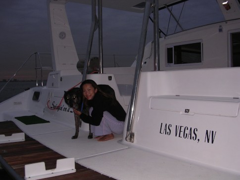
| Hailing Port: | Las Vegas, NV |
| Crew: | Randy Abernethy |
| Home Page: | http://swinginonastar.com |
Swingin' on a Star's Photos - Swingin on a Star (Main)
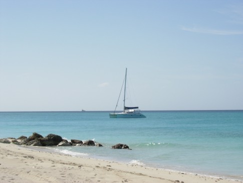 |
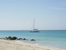
Selected photos of Swingin' on a Star at anchor.
7 Photos
Created 18 September 2007
|
 |
Swingin on a Star
Who: Randy Abernethy
Port: Las Vegas, NV
Gallery

History
Links
SailBlogs Friends

