
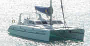
Swingin' on a Star
Ship's log for the circumnavigating Saint Francis 50 catamaran, "Swingin on a Star".
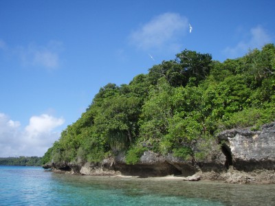
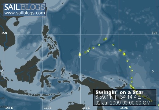
01 April 2010 | Palau
13 July 2009 | Palau
05 July 2009 | Yacht Harbor
03 July 2009 | Peleliu
02 July 2009 | Palau
01 July 2009 | Two Dog Beach
30 June 2009 | Mecharchar
29 June 2009 | Mecharchar
28 June 2009 | Ulong
27 June 2009 | Ngeruktabel
17 June 2009 | Ngeruktabel
16 June 2009 | Ngeruktabel
15 June 2009 | Ngeruktabel
14 June 2009 | Ngeruktabel
13 June 2009 | Ngerutable
25 May 2009 | Yacht Harbor
30 April 2009 | Malakal
29 April 2009 | Koror
28 April 2009 | Malakal
27 April 2009 | Malakal
Leaving Tonga
17 October 2008 | Nuku
Randy
We had an interesting day today. The sun was actually out which has been unusual while we have been here. That said I am beginning to think that the south islands are sunnier than Neiafu harbor. The larger land mass there seems to breed the dark gloom. We listened to the nets in the morning planning on a relaxing day of prepping the boat.
The Anzac net (the long range SSB cruisers net) is getting quite, with more and more boats arriving in NZ and AU, thence dropping away. We had found one other boat heading north a week ago but now they are NZ bound as well. So we are solo again. The local net was interesting as always with cruisers helping each other out with parts and expertise. After a bit of general traffic someone announced a yacht that had been lost a few days earlier on a reef in Fiji. The authorities had not responded to the yacht's mayday (they couldn't find fuel for their boat!) so a private catamaran rescued them 6 hours later. Everyone was fine but the yacht was lost.
This segued well into Curly's add for his cruising notes on Fiji. Curly is a 40 year resident of Fiji and has been involved in dive operations, heads the barometeric chamber in Suva, runs a yacht club in Savusavu and is working on a new cruising guide to Fiji with WGS84 waypoints. This last bit perked my ears up and I arranged to meet with Curly at noon in Neiafu. We were of course in Nuku, way outside the harbor. This was the longest ride I have ever taken in the dinghy. I greatly appreciated the seat and the 25 hp.
Curly is living on his massive concrete ketch (62' with a 19' beam!). He has tons of notes and waypoints from his years in Fiji and has just started (from what I can tell) to package the information into digestible bundles. I bought the Vava'u to Savusave bit. It came with a medium scale chart of the reefs and a detailed harbor chart, entry instructions and of course all of his waypoints. He says he does the route through the reefs at night most of the time.
Curly's notes say never trust one source of navigation aids and I never do. I compared the notes to my route on the Navionics charts and it was almost a match. I am very glad I purchased Curly's notes, regardless, because until talking to him I though this route would be too dangerous. Curly is a wealth of information however, and now that I have talked to someone who has actually made the crossing (several times at that) I am quite a bit more comfortable. We have no cruising guide for Fiji and 8-12 yachts are totally lost there every year. A good 200 yachts go aground yearly according to Curly.
Our original plan was to run north through Nanuku passage. There is a light on Walingilala island here to help with landfall. The Cornell World Cruising Routes book suggests this route as a more open and safe approach to Savusavu. It looks just that. Unfortunately the WCR waypoint for this passage is 9 miles from where it is described on my charts, and my charts match Curly's, so I am gaining faith in them. Even if it was where it was described, 5 miles east of the light, it would be between the island and Duff Reef, which Curly says claims an inordinate number of yachts each year. If you made for the WCR waypoint PS479 from Vava'u you would crash onto Duff Reef on my charts. I have not been there but Curly say the light has not worked in a long while and I would be very careful to take a route well north of the WCR waypoint and ensure good vis during the approach.
We are now back to taking the direct route. After a nice afternoon snorkel to check the bottom, props and all that, we circumnavigated Nuku with Roq before stowing the dink. At 5PMish Friday 10/17 (today) we will depart Vava'u for my "Katefage Isle N" waypoint (17 28.102S,178 40.748W), which agrees with Curly's. We should reach the entrance to the reefy bit at 8AMish Sunday 10/19 (Fiji date/time) and be through before sundown. We have a few steering waypoints to stay off all of the obstructions by 2.5nm (2nm being the usual max most reasonable charts are out) through the reefs but ultimately arrive at my "Vuna Point S" waypoint (17 04.476S,179 55.193E), which also agrees with Curly. We will hit the light late at night but the light here is out according to Curly. From here we head on to Lesiaceva point at 16 50.059S,179 14.650E for an early Monday morning arrival in Savusavu.
This has been one of the most challenging routes to work out with confidence and we will certainly be on our toes as we make way. I get the sense that things are only going to get more interesting as we proceed. We can't wait!
Comments
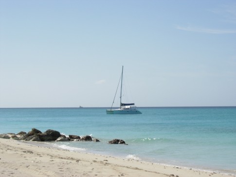
| Vessel Name: | Swingin' on a Star |
| Vessel Make/Model: | Saint Francis 50 |
| Hailing Port: | Las Vegas, NV |
| Crew: | Randy Abernethy |
| Home Page: | http://swinginonastar.com |
Swingin' on a Star's Photos - Swingin on a Star (Main)
 |
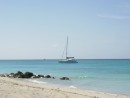
Selected photos of Swingin' on a Star at anchor.
7 Photos
Created 18 September 2007
|
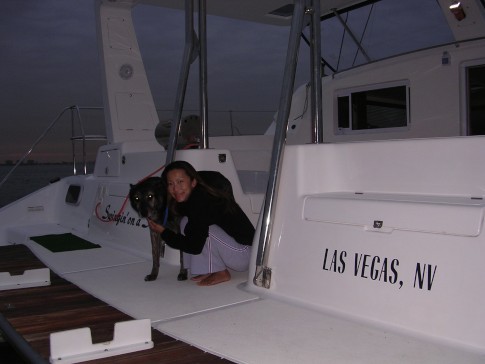 |
Swingin on a Star
Who: Randy Abernethy
Port: Las Vegas, NV
Gallery

History
Links
SailBlogs Friends

