
Swingin' on a Star
Ship's log for the circumnavigating Saint Francis 50 catamaran, "Swingin on a Star".
01 April 2010 | Palau
13 July 2009 | Palau
05 July 2009 | Yacht Harbor
03 July 2009 | Peleliu
02 July 2009 | Palau
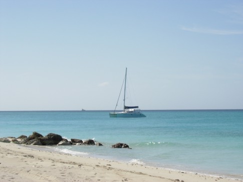
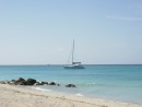
01 July 2009 | Two Dog Beach
30 June 2009 | Mecharchar
29 June 2009 | Mecharchar
28 June 2009 | Ulong
27 June 2009 | Ngeruktabel
17 June 2009 | Ngeruktabel
16 June 2009 | Ngeruktabel
15 June 2009 | Ngeruktabel
14 June 2009 | Ngeruktabel
13 June 2009 | Ngerutable
25 May 2009 | Yacht Harbor
30 April 2009 | Malakal
29 April 2009 | Koror
28 April 2009 | Malakal
27 April 2009 | Malakal
Nuguria
19 January 2009 | Nuguria Islands
Randy

We had a green light for departure on the VHF at 4:30AM today. Shortly thereafter we all proceeded out the pass in fairly thin light. Things were very settled and we had all made our way in without difficulty. Spear fishing for two hours in the pass had given me great reassurance of its open nature.
Once outside we made our way around the west end of the Green Island Atoll coming between it and its sister island to the west. What ensured was a fairly boring motor sail. We had the jib up here and there but most of the time the wind was too close to the bow to set it. Wind was often boat speed and the ocean was glass. We caught no fish and saw very few birds.
It was a little too still. In the late afternoon the obligatory squalls started setting in. Lucky for us, they formed off of our track, for once, and we ended up getting an 18 knot lift that scouted us along over the last bit of water at 8-9 knots.
The only problem was we didn't know exactly where to go. It was an 85 mile trip from Green island and we were arriving at about 16:30. Not optimal for running an atoll pass. The real problem was that the chart provided the most incorrect representation that I have seen to date. The Navionics chart had the atoll about two miles or so away from where it really was. This is a bummer because you can only put a half mile offset into the Raymarine E120 chart plotter. So even though you would like to use the chart image as a reference it is plotted in the wrong place and get confusing to look at. Worse the radar showed that not only was the charted position wrong but the actually shape of the islands and their location was off, substantially in some cases.
As we closed on the island group I ended up switching to radar only and ignoring the chart. The US Sailing directions do not describe the pass at all so the only reference we had was the South Pacific Anchorage guide. The SPA reported a pass north of Huhunati, which is the first island from the east on the south side of the atoll. We came in on the Akani islands to port of the supposed pass and then ran the mouth. The pass was pretty easy to make out but it was the first time we were attempting a pass without even a sketch chart or some bearings.
As we entered the pass the bottom came up to 30 feet pretty quickly. At this point I noticed marker buoys (like you might find in a swimming pool, so not lit) to starboard. These turned out to be marking the western extent of the reef running west from Huhunati. We left these to starboard and had an easy entrance. The atoll has lots of opening so there are not likely to be very strong currents in the passes.
We reported waypoints back to our friends on Whistler and Angelique. Both would be arriving after dark. As we were chatting on the radio a nice guy named Jack paddled by. I couldn't help but notice that he was of Polynesian descent, not Melanesian. We have heard that scattered islands in Melanesia and Micronesia are inhabited by Polynesians but this is the first atoll where we have run across these folks far from home. Jack was very friendly and gave us some coconuts in addition to pointing out a good anchoring spot near the pass.
After looking over the anchorage at the inside of the pass, we decided to make for a sandy island on the other side of the lagoon. Anchoring off of the beach over there would not only be more pretty but much more out of the chop given the wind direction and large fetch inside the lagoon. It was two miles to the other side. The water was very clear on the way over ranging from 35 to 100 feet deep. Within a half mile of the beach we ran across some menacing coral heads merely feet from the surface. The light was failing and we didn't want to run our friends aground with complex waypoints to follow two miles across the lagoon, particularly when they would probably already be very tired after 16 hour sailing days.
So we made our way back to the first anchorage just inside the pass and set the hook in 60 feet of sand, great holding. Just then Whistler asked us if we saw the waterspout. Wow. Right between Whistler and the pass a good sized squall was spinning off a water spout. This was my second sighting of one of these beasties in three days. Me no like. It didn't last too long and Whistler ended up being able to hold his track. We are still waiting for both boats to come in but it is time to grab the weather and update the blog...
Comments
| Vessel Name: | Swingin' on a Star |
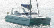
| Vessel Make/Model: | Saint Francis 50 |
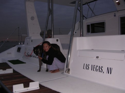
| Hailing Port: | Las Vegas, NV |
| Crew: | Randy Abernethy |
| Home Page: | http://swinginonastar.com |
Swingin' on a Star's Photos - Swingin on a Star (Main)
 |
Selected photos of Swingin' on a Star at anchor.
7 Photos
Created 18 September 2007
|
 |
Swingin on a Star
Who: Randy Abernethy
Port: Las Vegas, NV
Gallery

History
Links
SailBlogs Friends

