Log of Taiga
29 April 2014 | 14 05'N:060 57.7'E, Rodney Bay, St Lucia
27 April 2014 | 16 18.5'N:061 47.9'E, Deshaies, Guadeloupe
27 April 2014 | 17 09.1'N:062 37.9'E, Island of Nevis
27 April 2014 | 17 15'N:062 39.6'E, Island of St. Christopher
27 April 2014 | 17 55.5'N:062 52.2'E, Island of St. Barthelemy
07 April 2014 | 18 03'N:063 05.9'E, Island of St. Martin
07 April 2014 | 18 29.9'N:064 23.2'E, Norman Island to North Gorda Sound
07 April 2014 | 18 19.1'N:064 37.1'E, Soper's Hole, then Norman Island
05 April 2014 | 18 20.6'N:064 40.7'E, Round Bay, St. Johns, USVI
05 April 2014 | 18 20'N:064 58'E, St. Thomas, USVI
05 April 2014 | 18 18.4'N:065 17.8'E, Culebra Island, PR
05 April 2014 | 18 8.1'N:065 18'E, Bahia Salinas del Sur, Vieques
05 April 2014 | 18 5.5'N:065 28.2'E, Esperanza, Vieques
05 April 2014 | 17 57.5'N:066 17.5'E, Salinas, Puerto Rico
05 April 2014 | 17 53.2'N:066 31.8'E, Isla Caja de Muertos
05 April 2014 | 17 56.7'N:066 52.4'E, Bahia Guanica, P.R.
05 April 2014 | 18 04.5'N:067 11.3'E, Puerto Real, P.R.
08 March 2014 | 18 04.5'N:067 11.3'E, Puerto Real, P.R.
08 March 2014 | 19 17.2'N:069 19.8'E, Puerto del Valle
27 February 2014 | 19 24'N:069 45'E, Luperon to Puerto del Valle
Gilligan's Island
05 April 2014 | 17 56.7'N:066 52.4'E, Bahia Guanica, P.R.
Jack

Saturday, March 8, 2014 Gilligan's Island, Puerto Rico 17d, 56.7m N; 66d, 52.4m W
After some nighttime showers the day dawned clear and a little cooler, so we hauled aboard our anchor and chain, washing it throughly with the washdown hose on the bow to get off the gooey mud before it went into the anchor locker, then motored over to the fuel dock before they opened for the day, attached our water hose and filled up our water tanks.
We had a pleasant sail of about 30 miles up the coast to Bahia Guanica, the eastern end of which is a national park with a nicely protected anchorage behind Gilligan's Island, so named because of it's resemblance to the island in the old TV sitcom.
The water here was clear, and there are a few cruising boats that stop there on their west or eastward trek along the south coast of Puerto Rico. We anchored in the middle of the bay behind Gilligan's Island to be as far from the mangroves as possible to keep the nighttime bugs to a minumum. We have determined that mosquitoes can track our CO2 emissions upwind in 20 knots of wind for over a mile.
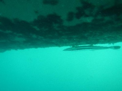
We spent 4 days here, taking an hour each day to do some bottom cleaning. In the photo you can see a small remora helping with bottom cleaning. We saw a manatee one day in the bay, grazing on the grassy bottom. Another evening we dinghied in to a small beach shack for an undistinguished meal. We also met some cruisers here that we ran into in other places later on. The water was warm and clear, although not as clear as in the Bahamas, but was at least 10 degrees warmer here.
Comments
| Vessel Name: | Taiga |
| Vessel Make/Model: | Catana 44 |
| Hailing Port: | Eagle River, Alaska |
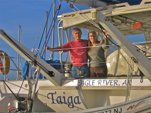
| Crew: | Jack and Sherri Hayden |
| About: | Taiga is a 1997 Catana 44 catamaran. We bought her in November, 2010 in Hampton, Virginia. This is our second sailboat and we love it. It is fast and comfortable. |
Gallery not available
Crew of Taiga

Who: Jack and Sherri Hayden
Port: Eagle River, Alaska