
Tai Mo Shan
05 December 2022 | Tasman Sea
06 January 2021 | Moreton Bay, Australia
23 October 2020 | Brisbane, Australia
15 October 2020 | Gladstone, Australia
12 October 2020 | Mackay, Australia
07 October 2020 | Mackay, Australia
03 October 2020 | Townsville Australia
25 September 2020 | Magnetic Island, Australia
20 September 2020 | Hinchinbrook Island, Australia
12 September 2020 | Great Palm Island, Australia
12 September 2020 | Horseshoe Bay, Magnetic Island, Australia
06 September 2020 | Townsville, Australia
18 August 2020 | Townsville, Australia
12 August 2020 | Hook Reef, Australia
10 August 2020 | Hook Island, Australia
10 August 2020 | South Molle Island, Australia
06 August 2020 | Airlie Beach, Australia
06 August 2020 | Cid Harbour, Whitsunday Group, Australia
29 July 2020 | Shaw Island, Australia
29 July 2020 | Goldsmith Island, Australia
Crossing The Tasman - Again
05 December 2022 | Tasman Sea
Paul Dickinson
Tai Mo Shan was under a ‘Confined to Port’ order by Australia Border Force (ABF), commonly known as Customs. This was because our Cruising Permit that allowed the boat to remain in Australian waters had expired. Each time we entered Australia we received a ‘Cruising Permit’, which allowed us to temporarily import Tai Mo Shan, and so not pay import duties. Usually we only stayed in Australia for 6 months or so. However, this visit to Australia had been extended, not least, by COVID. On condition of the Cruising Permit was that we had to report our location to ABF every 3 months. After one year, ABF informed us that our permit was about to expire and would we like it extended. We did, and the extension was no problem. Similarly the second year. However, at the 3 year point ABF informed us that the permit could not be extended and we had either to pay the duty (some 16.5% of the value of Tai Mo Shan), or leave. Had we paid we would have suffered a double whammy of paying import duty to NZ when we returned home, so we decided to leave. The ‘Confined to Port’ order was duly delivered by 4 ABF officers, and signed by Paul as the skipper. It meant we could not leave the berth unless ABF agreed. The only reason to leave was to prepare the boat for departure, so no cruising or shake down trips.
So, on Wednesday 26 October 2022, some six weeks after the ‘Confined to Port’ notice, Tai Mo Shan had had her new antifoul applied and was back in the water. The weather for the week starting at the weekend looked promising with a consistent Northerly to Westerly airflow over the Tasman. This was pretty much ideal to get us from Brisbane to Auckland, a general East South East passage. So it looked good for Paul to finish work on Friday 28 October, and us to set off the next day.
In our earlier conversation with ABF we had said we would like to leave the dock at 0900. Sure enough 3 customs officers arrived bright and breezy at 0730, with Lyle Stanaway our friend and third crew member, close behind. So Saturday 29th October saw the three of us, Paul, Helen Lyle on board talking to Customs. The formalities were, as always, carried out in a courteous and prompt manner. The only fly in the ointment was that Customs had forgotten the fuel duty refund form. This is a valuable perk of leaving Australia in that we could fill with fuel and then reclaim the duty, a not insignificant amount. The customs officer promised to email the form through (it did arrive a few days later, although we could only access once we were set up in NZ). So 0930, all done, and we cast off from berth D10 at East Coast Marina. The small crowd of Jan (Lyle’s wife), Roy, Graham and Claire (neighbours) there to see us off.
Our first leg was a short one; across the marina to the Moreton Bay Trailer Boat Club to pick up fuel. We had to wait a few minutes for another boat to finish refueling before maneuvering in the end of the tight channel to dock at the fuel pier. 45 minutes, and some 248 litres of diesel and 21 litres of unleaded petrol later, and at 1015 we cast off again. This time we were ready for the main passage, some 1360 nm or so to Auckland.
The forecast was for a variable 10 knot breeze, changing to a Northerly 10 to 15 knot wind early afternoon. This was the case as we gently motor sailed past the familiar sights of Green Island, St Helena Island and Mud Island. On across Moreton Bay towards the North end of Moreton Island. En-route we checked the HF radio. It seemed to work in the marina, but with all those metal masts, reception was poor. Unfortunately the HF airmail was simply not working on the main boat computer. Apparently the COM port was already in use. After some restarts and configuration changes we had to give up on the main computer. The laptop seemed to have more success. However, just in case we used the fading mobile phone signal to send texts warning that our daily emails might not happen, but not to worry as it was a technical issue. This proved to be a fortuitous text!
Pushing on and the 3rd batten in the main sail worked its way out of the batten pocket. The fix was quite easy; into wind, drop the main to the batten and then push the batten fully back in its pocket and secure. So, midday saw us using the strong tidal to push us along past the North of Moreton Island and into the North East channel. This channel cuts through the sand banks north of Moreton island and provides a useful shortcut of some 20 nm or so by avoiding having to go North to Caloundra Heads by the main shipping channel. However, the sand banks do move, so we had carefully checked the Notice to Mariners before leaving. Sure enough, the marker buoys had been moved in August. We updated our charts, confident in the new buoy positions. The early afternoon saw us motor sailing up the channel. The channel seemed wide and the buoys were easily visible, as were the shallow areas over the sandbanks, so the navigation was fairly easy. 1615 and we were at the NE2 buoy at the end of the channel. We could turn east and use the freshening northerly wind to get under sail. Care was needed as the sand bank to the south was only a few hundred metres away, but visible as a lighter patch of sea. 30 minutes and some 3 nm later and we were clear.
Saturday evening saw us sailing a comfortable beam reach in a moderate breeze, achieving an easy 7 knots. Sundown saw us past Flinders Reef, the last obstacle for some 300 nm. The open ocean beckoned.
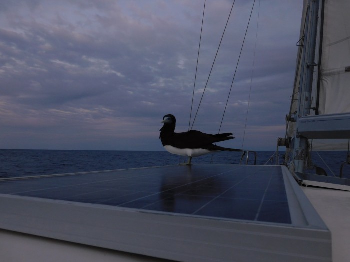
Sunday morning saw the wind drop to a light wind before increasing to a useful 20 knots, so it was a case of trimming sails, and occasionally using the motor to supplement the sails in the lighter airs. The relatively calm sea allowed nature to show its glory and we saw tuna slashing into bait fish as well as a couple of whale sharks gently swimming on surface. We even had a hitchhiker as a Booby bird sat on our solar panels for several hours. At last on the open ocean we could see that wonderful sapphire blue water.
Monday lunchtime saw a more consistent moderate North wind allowing for good sailing. However, the GRIB forecast available on the HF showed that the wind would increase to some 25 knots so last light saw us reef the sails.
Tuesday 0100 saw us pass Middleton Reef. The chart plotter indicated our closest point of approach was a very conservative 7.5 nm in a dark night. The next rocks to consider were 3 Kings just North of NZ. However, the wind had increased to some 30 knots, fully justifying our decision to reef in the daylight. Tai Mo Shan, with reefed sails, was easily handling the wind and 2m or so seas.
The high wind continued throughout Tuesday at a typical 30 knots although with occasional 40 knot gusts. Heavily reefed with a prevented Main we made good progress on a broad reach in the heavy seas; no problems. Evening saw a slight moderation in the wind, and the feeling that the main blow had past.
Wednesday early morning saw a general continuation of the 25 to 30 knot winds and 2 to 3m seas. Then at about 0345 at approximately S30°57.9, E162° 25.9 disaster struck!
Helen was on watch harnessed in in the cockpit when she saw an immense steep wave to the port side of Tai Mo Shan. She thought the wave might roll us. However, instead it built to the stern, rising above the height of the wind generator (which is some 4 metres above the water line). The steep wave picked up Tai Mo Shan’s stern and accelerated her down the face. As the speed built the keel took over and turned Tai Mo Shan to port across the face. The wind, turning action and steep face of the wave caused Tai Mo Shan to roll excessively to port, to the extent that her mast pretty much touched the water. We had been knocked down! Tai Mo Shan remained with her mast level for some 4 seconds or so before rolling back upright; the advantage of a mono hull yacht with a big, heavy keel.
Sea water rushed across the near vertical deck at some 10 knots. The force of the water smashed through the spray dodger and starboard clears. The cockpit filled with water.. Worse, the water poured through the front and aft hatches. In the cockpit Helen was harnessed in but was still forced to hold on, sustaining significant bruising on her right arm and back. Down below Paul was woken by the sudden roll and inrush of water. He immediately got up and headed to the cockpit. Along the way he saw that the water deluge was enough to set off the automatic inflation of his lifejacket sitting on nav station seat! He rushed to get a spare lifejacket. Lyle was woken by the roll at the same time and rapidly got up into the cockpit.
The knee deep water in the cockpit drained in a couple of minutes, during which time Lyle and Paul put Tai Mo Shan onto a safe heading, then removed the preventer (which held the Main in place to avoid an accidental gybe), and then Hove Tai M Shan To. The ‘Heave To’ basically turns the boat so the two sail oppose each other resulting in a very stable, safe attitude with the boat gently making way downwind at about one knot. We could then assess the damage.
The water had severely damaged the spray dodger, ripping the material, destroying the starboard side of the clear panel and causing the structure to collapse. The hardtop structure had been forced down on the starboard front, and slightly back and up at the aft starboard corner. The starboard clears had been destroyed, with the jagged aluminium rail intruding to the cockpit. Worse, the water inrush had soaked the nav station. The boat computer and screen did not work, and the laptop (used for communication and so in the chart table for safe keeping) was also soaked and did not work. Fortunately our small standby, standby chartplotter with its 5 inch screen still did work. We were grateful for this final backup!. Our HF radio was also destroyed by the salt water drenching, so we lost our long range communications (fortunately we had sent that text message in Moreton Bay!). The damage did not end there as the water had rushed aft soaking the squabs making Paul’s bed by the engine room, and then soaking the aft cabin. We had lived aboard, so all of our clothes got drenched in salt water as well as the aft bedding and squabs. This was a significant amount of wet stuff. To add insult to injury, we also had salt water in the front cabin, wetting the squabs there and rendering the cabin uninhabitable. And as a final hit, the force on the rudder had broken the attachment bracket for our autopilot hydraulic actuator. We were therefore without the autopilot, and so would be hand steering the rest of the way. But, we still had the main cabin mostly dry, the galley and so our food was untouched, and the rig stayed OK. We could still sail. It took us some 4 hours to recover from the shock and assess the damage. So 0900 saw us sailing again.
The wind moderated somewhat and turned Westerly, so good sailing conditions. The loss of our main computer meant we could not track progress directly. Instead our standby chartplotter showed out distance to the next waypoint, just North of Three Kings. Thursday 0120 saw this distance at 421 nm We sailed on and 1000 saw the wind swinging to South Westerly and drop to some 10 knots, still a good direction and reasonable strength so we were on track at 5.5 knots, some 377 nm to Three Kings. Conditions were not comfortable, but bearable. The autopilot actuator was fouling the rudder, preventing full movement. There was no option but to drop sails, stop and let Paul remove the actuator from the rudder quadrant; a tricky job in a tight space. Nevertheless, it was done and we carried on.
We had a huge pile of soaking wet clothing, towels and bedding. The salt water was full of organic matter and so it was staring to rot and cause a health hazard in the tight confines of the yacht. The mild weather meant we could start to dry and air some clothing, but we simply could not even start to dry the majority. As a result it had to be ditched over the side. Soaked and amalgamated papers and magazines had to follow for the same reason.
Thursday and Friday saw the wind vary between a good sailing breeze and a light blow needing the support of the motor. There was a lot of sail trimming and motor starting and stopping, but we kept up good progress. 0655 Saturday 5 November saw us 175 nm from Three Kings.
Unfortunately the wind was swinging to the South East, and the East South East, just where we wanted to go. We had the option of going some 45° off course, or just pushing into wind under motor. With 150 nm to go to Three Kings, we chose the latter option.
The wind stayed in that adverse direction and increased and 1900 saw a brisk 20 knot breeze, right on the nose causing a nasty steep short wave. This slowed progress, but we were still making 5 knots under motor, with 115 nm to go to Three Kings. Sometime during the day that number 3 batten came loose again. This time we did not notice until it had fallen out and so was lost in the ocean. Fortunately the sail could still mostly hold its shape so we only lost a small amount of sail efficiency.
Sunday 6 Nov at 0330 saw us slowed considerably by the wind and sea. Our usual cruising 2000 rpm on the motor saw us making only 2 knots, so we had to increase to 2500 rpm. The increase in speed made up for the increase in fuel burn. 0520 saw us making 5 knots again, 76 nm to Three Kings. Later in morning, at 1120, the seas moderated slightly and we were 49nm from the waypoint. Then at 1420, 33nm from the waypoint Helen shouted ‘Land Ahoy’. Sure enough there on the horizon against the grey sky was the slightly darker blue grey lump of one of the Three Kings. As we approached we could make out another, and then another lump. The Three Kings may only be small rocky, uninhabited islands but they are land, and only 32 nm North West of Cap Reinga, and some 47 nm from North Cape, which we had to round. 2100 saw us past the Three Kings waypoint, we were getting close to NZ!
Monday 7 November saw a strong Easterly wind opposing us. The currents around the top of New Zealand, and particularly the Three Kings can be strong, and as a result the sea was very rough. We were mindful of the large sport fishing boat that had been capsized in the area a few months before resulting in the loss of two people. As it was we were in a washing machine of confused seas. At 0115 we were making some 3 knots with 2500 rpm. The conditions worsened. At about 0500 even with full engine power (some 3000 rpm) we were struggling to make headway in the very, very rough confused seas, a strong head wind and opposing current. We consulted the chart and then, on the helm, Paul turned towards Spirits Bay on the Northern edge of New Zealand. This gave us an easier, but still not easy, passage across the waves and current, and the bay would give us some shelter to let the worse of the weather pass.
We drove on, high seas splashing us, but at least we could make progress. Gradually the headland to the East of Spirits Bay appeared. Spirits Bay is a large bay with the headland to the East providing shelter. It has a reef off the headland heading into the bay but otherwise is free of danger. With Lyle checking the chart and calling out headings and Paul helming we entered the bay. The sea abated as we passed the headland. The wide sweeping sandy shore showed breaking surf on the majority of its length. However, the South Eastern corner looked fairly calm so we headed there. 0800 saw us anchored some 200 metres or so off the sandy shore protected from the full force of the storm by the high rock headland and lower hills heading south. There was a rise and fall due to the swell but otherwise the sea was mercifully flat, although occasional ‘bullets’, 35 knot gusts, blasted through. Still we were anchored off New Zealand.
Helen’s phone had been destroyed by the water inrush. Paul’s was on the Telstra network, but he could not get international roaming on the prepay plan! Fortunately Lyle’s phone could get roaming. Perhaps more fortunately there was a weak phone signal in the bay and so we could make contact. First to Jan, Lyle’s wife, to say we were safe and to ask her to contact family and friends to let them know. Then to Customs to let them know where we were. Paul emphasized that it was a safety call to anchor, and Customs were content with this. Of course we could not go ashore. Then we could get the weather forecast. It was not encouraging. There was a gale warning in force; no surprises there. The wind would remain Easterly at 25 to 35 knots throughout Monday and Tuesday before abating to South East 15 knots later on Wednesday. Then a new storm was coming through on Thursday, with 40 knot Easterlies! And Easterly is a fairly unusual direction for New Zealand; the prevailing wind is South Westerly.
Tuesday saw us get a good night’s sleep and a real morale boost as Helen landed a nice sized Trevally; it was fresh fish for dinner. The wind continued to blow all day with occasional showers. We could get the weather on Lyle’s phone and, surprisingly clearly on the VHF radio. It still had strong winds through Wednesday with the very strong Easterly late Thursday and Friday before turning Northerly late Friday. Spirits Bay offered reasonable shelter to the Easterly but was open, and so dangerous, in a Northerly!
A later forecast showed Wednesday being variable 10 knots with a 15 knot South Easterly developing in the evening and then 20 increasing to 40 knots Easterly on Thursday. This was a weather window that would allow us to get to the much more sheltered, and so safer, anchorage of Whangaroa some 65 nm away (and so 60 nm closer to Auckland). So come Wednesday we were up at first light and at 0630 (now on NZ time) we weighed anchor and carefully motored past the reef. Once clear it was a case of full sails and motor at gentle revs to make progress around North Cape. Fortunately the sea had moderated so we made reasonable progress, some 7 knots through the water, but with a 2 knot opposing current only 5 knots over the ground! We pushed on past the cape and turned south to south east down the coast of New Zealand. This gave us a gentle beam reach to tight reach, so we could sail most of the way. The number 2 batten decided to join the number 3 but, fortunately, ended up on the deck. We stopped and put the batten back in securely before continuing on watching the coastal headlands slide by.
Mid to late afternoon the wind died completely, forcing us to motor. A little while later the weather closed in. The cloud base dropped right down to sea level and the visibility dropped to less than one nm. We were motoring in the goldfish bowl with only grey cloud and grey sea visible in all directions. The coast had completely disappeared so relying on the chartplotter and compass we pushed on. The entrance to Whangaroa harbour is narrow and ‘guarded’ by the rocky Stephenson Island. We continued on carefully, eyes straining as we searched the grey veil for landmarks. We turning at our waypoint, solely relying on the Chartplotter. We only saw Stephenson Island as we drew abeam, a few hundred metres away. 30 minutes later and the fog lifted somewhat so we could see the entrance to Whangaroa; the cloud draped over the surrounding hills. 1840 saw us safely anchored in the first (southern) arm of Whangaroa harbour. This is a stunning anchorage with steep, reasonably high hills all around, offering superb shelter. With the cloud now just above the hills and minimal wind the water was mirror calm reflecting the green, bush covered steep slopes; just beautiful.
Anticipating the blow we put out 50m of chain, despite being in only 7m of water.
Thursday saw the wind increase. In our anchorage the high hills meant most of the wind passed overhead, but an occasional bullet gust would strike the water to remind us that the bad weather was indeed upon us. We contacted NZ Customs again to let them know we had moved position. Unusually, the officer on the end of the phone was unhelpful. She questioned why we had sought shelter (which got the very measured controlled response of ‘because there is a storm blowing’!). She also stated we could not get fuel from Whangeroa; if we were at sea and ran out of fuel we were to call Coastguard. Another measured response. Our true response of ‘how ******* stupid’ only came once the call had finished!
The forecast for Friday was for a North West 15 knot wind to set in once the rain stopped changing to South West 15 knots, extending through Sunday and then dropping to variable 10 on Monday. This would be enough to get us the 140 nm or so to Auckland, despite only having some 70 litres of diesel left. Friday 11 November dawned damp and grey after a wet night with heavy rain and occasional wind gusts in the otherwise calm anchorage. However, the weather looked as forecast, so we prepared to leave when the rain stopped.
So Friday 1040 saw the rain stop and Tai Mo Shan’s anchor being raised. The anchorage had a muddy bottom which gave great holding but also meant a messy chain. It took 15 minutes to weigh anchor as we had to repeatedly drop it to clean the chain. Nevertheless, we were soon under way, motoring our of Whangaroa through the narrow opening and then motor sailing pas the headlands. As our sailing angle improved we could reduce the engine revs to the extent that by midday we were purely sailing at a reasonable 5 knots in the fairly light airs. 1500 and suddenly the main sail outhaul broke! The lower end of the sail flapped uselessly in the breeze. A quick repair to lash the end of the sail to the boom followed and 20 minutes later we were back under way.
Unfortunately the wind dropped and by 1600 we were in very light wind; so much for the nice 15 knots! We were just off the entrance to the Bay of Islands, and did not have the fuel to motor all the way to Auckland. However, Opua, some 20 nm away in the Bay of Islands is also an entry port. We called Yacht Report (Customs) and left a message requesting entry at Opua. We then changed course and motored to Opua Marina. 1940 saw us secure on the Quarantine pier at Opua. The pier is very secure as it is the outer part of the marina with no shore access. The quarantine part is also fenced in with a large locked gate separating it from the other part. Interestingly there was a large German or French catamaran on the other part with a quarantine flag flying. We later found out that the owner/ skipper had tried to smuggle a cat into the country, and was now in 14 days quarantine, and facing a very large fine. Simple message; do not break the bio security and customs laws!
We then tried to call NZ Customs again, and got through to Rashid on the Auckland watch desk. He was outstandingly helpful and called us back later that night to say that Customs and the Ministry of Primary Industries (MPI) officer would be aboard the next morning to check us in.
Sure enough 0900 and the MPI officer appeared in his RHIB. Polite and courteous, he duly checked us for contraband food. He informed us that swine flu in Indonesia meant all pork products including those in tins were banned. Fortunately we did not have much contraband and so the disposal bags were comparatively light. A moment of humour was when the MPI officer asked if we had any animals aboard; we answered that of course we had Ella the cat. Of no, another smuggler! Then we produced Ella, the ships cat. She had been soaked in the knock down and so looked the worse for wear and distinctly fluffy. The MPI officer roared with laughter when he saw Ella, the stuffed toy cat. He then asked if he could take a photo; of course he could. He then phoned his boss to declare he had a problem and sent pictures of Ella. Great fun! The MPI officer was soon followed by Gary the local Customs officer. Again, the entry process involved a lot of necessary forms, but was done in good humour. The only slightly off note was when we complained about the customs officer we had talked to when in Whangaroa, We kept the complaint vocal and said we only wanted her to have a better understanding of small boats and weather. The complaint was well received.
So 1100 and we then moved to the nearby fuel dock. After uplifting some 250 litres of diesel, Paul and Lyle rushed off to get local SIM cards for their phones. Back after a few minutes, we were underway at 1210.
The brisk wind allowed us to push out of the Bay of Islands under a sailing tight reach. We turned Cape Brett at about 1500 and were soon heading down wind in a brisk Northerly on a rolly sea. At 1800 we smelled diesel and discovered a major fuel leak from the primary diesel filter. We continued sailing whilst Paul attended to the leak. This was initially a broken ‘O’ ring but extended to the primary fuel filter itself. Despite repeated reassemblies Paul could not fix the leak, so instead had to bypass the filter entirely. Another fun job!
As the night progressed the wind dropped meaning that early morning saw us motoring in a light wind.
Sunday 13 November saw us sailing again in a moderate South Westerly just off Cape Rodney. Kawau Island lay ahead and abeam; we were now in home waters, no chartplotter needed!
The New Zealand weather decided to dampen the welcome, literally with drizzly rain! Still we sailed until Auckland Harbour approach when the fitful wind proved to be just too fine. We then motored gently along the Harbour. It was great to see the familiar sights again; Devonport at the harbour entry with the Naval Base a little later, and the CBD with its sights on the southern bank. We had arrived at Opua and so did not need to go into Westhaven. Instead we continued on, under the Harbour Bridge and into the upper harbour. Then on past Kauri Point to the red post at the entrance to the Westharbour/ Westpark (or is it now Hobsonville?) channel. Here a nice surprise as there were posts on either side of the channel clearly marking its extent. And as we were only a couple of hours after high tide, we had plenty of water underneath us; nice.
We were soon into Hobsonville Marina, slowly motoring along F pier, looking for the (stupidly small) berth numbers. A quick call to a sailor on his berthed boat to confirm his berth number, a count along, and there was the empty berth, F49, just waiting for us.
So at 1404 we were in. Just a couple of surprises; the berth only had a half finger so we needed to deploy our steps to get off, and the office was not manned on a Sunday! Still, we had made it. Wet, dented, but we had crossed that nasty patch of ocean called the Tasman Sea.
The loss of our main computer meant we could not keep the stats as usual. We know from passage planning that he direct route was some 1362 nm. However, we did have to go off course to anchor in Spirits Bay and Whangaroa, and to arrive in Opua. This probably added another 70 nm, so say 1430 nm.
As to overall time, well we left Manly Harbour at 1015 on Sat 29th October, and were berthed in Hobsonville Marina at 1400 on Sunday 13th November, so a total passage of some 15 days 4 hours. However, this was not a normal passage and we had been at anchor in Spirits Bay for one day 21 ½ hours, and at Whangaroa anchored for one day 16 hours, and then tied up at Opua for some 15 ½ hours. So our actual sailing time was some 10 days 23 hours.
So at just over 130 nm per day we made reasonable progress; indeed given the terrible progress on a couple of days, we actually had some good sailing – shame about the knock down!
And the photo. Well we were just too busy in the bad weather, so here is one of the hitchhiker.
So, on Wednesday 26 October 2022, some six weeks after the ‘Confined to Port’ notice, Tai Mo Shan had had her new antifoul applied and was back in the water. The weather for the week starting at the weekend looked promising with a consistent Northerly to Westerly airflow over the Tasman. This was pretty much ideal to get us from Brisbane to Auckland, a general East South East passage. So it looked good for Paul to finish work on Friday 28 October, and us to set off the next day.
In our earlier conversation with ABF we had said we would like to leave the dock at 0900. Sure enough 3 customs officers arrived bright and breezy at 0730, with Lyle Stanaway our friend and third crew member, close behind. So Saturday 29th October saw the three of us, Paul, Helen Lyle on board talking to Customs. The formalities were, as always, carried out in a courteous and prompt manner. The only fly in the ointment was that Customs had forgotten the fuel duty refund form. This is a valuable perk of leaving Australia in that we could fill with fuel and then reclaim the duty, a not insignificant amount. The customs officer promised to email the form through (it did arrive a few days later, although we could only access once we were set up in NZ). So 0930, all done, and we cast off from berth D10 at East Coast Marina. The small crowd of Jan (Lyle’s wife), Roy, Graham and Claire (neighbours) there to see us off.
Our first leg was a short one; across the marina to the Moreton Bay Trailer Boat Club to pick up fuel. We had to wait a few minutes for another boat to finish refueling before maneuvering in the end of the tight channel to dock at the fuel pier. 45 minutes, and some 248 litres of diesel and 21 litres of unleaded petrol later, and at 1015 we cast off again. This time we were ready for the main passage, some 1360 nm or so to Auckland.
The forecast was for a variable 10 knot breeze, changing to a Northerly 10 to 15 knot wind early afternoon. This was the case as we gently motor sailed past the familiar sights of Green Island, St Helena Island and Mud Island. On across Moreton Bay towards the North end of Moreton Island. En-route we checked the HF radio. It seemed to work in the marina, but with all those metal masts, reception was poor. Unfortunately the HF airmail was simply not working on the main boat computer. Apparently the COM port was already in use. After some restarts and configuration changes we had to give up on the main computer. The laptop seemed to have more success. However, just in case we used the fading mobile phone signal to send texts warning that our daily emails might not happen, but not to worry as it was a technical issue. This proved to be a fortuitous text!
Pushing on and the 3rd batten in the main sail worked its way out of the batten pocket. The fix was quite easy; into wind, drop the main to the batten and then push the batten fully back in its pocket and secure. So, midday saw us using the strong tidal to push us along past the North of Moreton Island and into the North East channel. This channel cuts through the sand banks north of Moreton island and provides a useful shortcut of some 20 nm or so by avoiding having to go North to Caloundra Heads by the main shipping channel. However, the sand banks do move, so we had carefully checked the Notice to Mariners before leaving. Sure enough, the marker buoys had been moved in August. We updated our charts, confident in the new buoy positions. The early afternoon saw us motor sailing up the channel. The channel seemed wide and the buoys were easily visible, as were the shallow areas over the sandbanks, so the navigation was fairly easy. 1615 and we were at the NE2 buoy at the end of the channel. We could turn east and use the freshening northerly wind to get under sail. Care was needed as the sand bank to the south was only a few hundred metres away, but visible as a lighter patch of sea. 30 minutes and some 3 nm later and we were clear.
Saturday evening saw us sailing a comfortable beam reach in a moderate breeze, achieving an easy 7 knots. Sundown saw us past Flinders Reef, the last obstacle for some 300 nm. The open ocean beckoned.
Sunday morning saw the wind drop to a light wind before increasing to a useful 20 knots, so it was a case of trimming sails, and occasionally using the motor to supplement the sails in the lighter airs. The relatively calm sea allowed nature to show its glory and we saw tuna slashing into bait fish as well as a couple of whale sharks gently swimming on surface. We even had a hitchhiker as a Booby bird sat on our solar panels for several hours. At last on the open ocean we could see that wonderful sapphire blue water.
Monday lunchtime saw a more consistent moderate North wind allowing for good sailing. However, the GRIB forecast available on the HF showed that the wind would increase to some 25 knots so last light saw us reef the sails.
Tuesday 0100 saw us pass Middleton Reef. The chart plotter indicated our closest point of approach was a very conservative 7.5 nm in a dark night. The next rocks to consider were 3 Kings just North of NZ. However, the wind had increased to some 30 knots, fully justifying our decision to reef in the daylight. Tai Mo Shan, with reefed sails, was easily handling the wind and 2m or so seas.
The high wind continued throughout Tuesday at a typical 30 knots although with occasional 40 knot gusts. Heavily reefed with a prevented Main we made good progress on a broad reach in the heavy seas; no problems. Evening saw a slight moderation in the wind, and the feeling that the main blow had past.
Wednesday early morning saw a general continuation of the 25 to 30 knot winds and 2 to 3m seas. Then at about 0345 at approximately S30°57.9, E162° 25.9 disaster struck!
Helen was on watch harnessed in in the cockpit when she saw an immense steep wave to the port side of Tai Mo Shan. She thought the wave might roll us. However, instead it built to the stern, rising above the height of the wind generator (which is some 4 metres above the water line). The steep wave picked up Tai Mo Shan’s stern and accelerated her down the face. As the speed built the keel took over and turned Tai Mo Shan to port across the face. The wind, turning action and steep face of the wave caused Tai Mo Shan to roll excessively to port, to the extent that her mast pretty much touched the water. We had been knocked down! Tai Mo Shan remained with her mast level for some 4 seconds or so before rolling back upright; the advantage of a mono hull yacht with a big, heavy keel.
Sea water rushed across the near vertical deck at some 10 knots. The force of the water smashed through the spray dodger and starboard clears. The cockpit filled with water.. Worse, the water poured through the front and aft hatches. In the cockpit Helen was harnessed in but was still forced to hold on, sustaining significant bruising on her right arm and back. Down below Paul was woken by the sudden roll and inrush of water. He immediately got up and headed to the cockpit. Along the way he saw that the water deluge was enough to set off the automatic inflation of his lifejacket sitting on nav station seat! He rushed to get a spare lifejacket. Lyle was woken by the roll at the same time and rapidly got up into the cockpit.
The knee deep water in the cockpit drained in a couple of minutes, during which time Lyle and Paul put Tai Mo Shan onto a safe heading, then removed the preventer (which held the Main in place to avoid an accidental gybe), and then Hove Tai M Shan To. The ‘Heave To’ basically turns the boat so the two sail oppose each other resulting in a very stable, safe attitude with the boat gently making way downwind at about one knot. We could then assess the damage.
The water had severely damaged the spray dodger, ripping the material, destroying the starboard side of the clear panel and causing the structure to collapse. The hardtop structure had been forced down on the starboard front, and slightly back and up at the aft starboard corner. The starboard clears had been destroyed, with the jagged aluminium rail intruding to the cockpit. Worse, the water inrush had soaked the nav station. The boat computer and screen did not work, and the laptop (used for communication and so in the chart table for safe keeping) was also soaked and did not work. Fortunately our small standby, standby chartplotter with its 5 inch screen still did work. We were grateful for this final backup!. Our HF radio was also destroyed by the salt water drenching, so we lost our long range communications (fortunately we had sent that text message in Moreton Bay!). The damage did not end there as the water had rushed aft soaking the squabs making Paul’s bed by the engine room, and then soaking the aft cabin. We had lived aboard, so all of our clothes got drenched in salt water as well as the aft bedding and squabs. This was a significant amount of wet stuff. To add insult to injury, we also had salt water in the front cabin, wetting the squabs there and rendering the cabin uninhabitable. And as a final hit, the force on the rudder had broken the attachment bracket for our autopilot hydraulic actuator. We were therefore without the autopilot, and so would be hand steering the rest of the way. But, we still had the main cabin mostly dry, the galley and so our food was untouched, and the rig stayed OK. We could still sail. It took us some 4 hours to recover from the shock and assess the damage. So 0900 saw us sailing again.
The wind moderated somewhat and turned Westerly, so good sailing conditions. The loss of our main computer meant we could not track progress directly. Instead our standby chartplotter showed out distance to the next waypoint, just North of Three Kings. Thursday 0120 saw this distance at 421 nm We sailed on and 1000 saw the wind swinging to South Westerly and drop to some 10 knots, still a good direction and reasonable strength so we were on track at 5.5 knots, some 377 nm to Three Kings. Conditions were not comfortable, but bearable. The autopilot actuator was fouling the rudder, preventing full movement. There was no option but to drop sails, stop and let Paul remove the actuator from the rudder quadrant; a tricky job in a tight space. Nevertheless, it was done and we carried on.
We had a huge pile of soaking wet clothing, towels and bedding. The salt water was full of organic matter and so it was staring to rot and cause a health hazard in the tight confines of the yacht. The mild weather meant we could start to dry and air some clothing, but we simply could not even start to dry the majority. As a result it had to be ditched over the side. Soaked and amalgamated papers and magazines had to follow for the same reason.
Thursday and Friday saw the wind vary between a good sailing breeze and a light blow needing the support of the motor. There was a lot of sail trimming and motor starting and stopping, but we kept up good progress. 0655 Saturday 5 November saw us 175 nm from Three Kings.
Unfortunately the wind was swinging to the South East, and the East South East, just where we wanted to go. We had the option of going some 45° off course, or just pushing into wind under motor. With 150 nm to go to Three Kings, we chose the latter option.
The wind stayed in that adverse direction and increased and 1900 saw a brisk 20 knot breeze, right on the nose causing a nasty steep short wave. This slowed progress, but we were still making 5 knots under motor, with 115 nm to go to Three Kings. Sometime during the day that number 3 batten came loose again. This time we did not notice until it had fallen out and so was lost in the ocean. Fortunately the sail could still mostly hold its shape so we only lost a small amount of sail efficiency.
Sunday 6 Nov at 0330 saw us slowed considerably by the wind and sea. Our usual cruising 2000 rpm on the motor saw us making only 2 knots, so we had to increase to 2500 rpm. The increase in speed made up for the increase in fuel burn. 0520 saw us making 5 knots again, 76 nm to Three Kings. Later in morning, at 1120, the seas moderated slightly and we were 49nm from the waypoint. Then at 1420, 33nm from the waypoint Helen shouted ‘Land Ahoy’. Sure enough there on the horizon against the grey sky was the slightly darker blue grey lump of one of the Three Kings. As we approached we could make out another, and then another lump. The Three Kings may only be small rocky, uninhabited islands but they are land, and only 32 nm North West of Cap Reinga, and some 47 nm from North Cape, which we had to round. 2100 saw us past the Three Kings waypoint, we were getting close to NZ!
Monday 7 November saw a strong Easterly wind opposing us. The currents around the top of New Zealand, and particularly the Three Kings can be strong, and as a result the sea was very rough. We were mindful of the large sport fishing boat that had been capsized in the area a few months before resulting in the loss of two people. As it was we were in a washing machine of confused seas. At 0115 we were making some 3 knots with 2500 rpm. The conditions worsened. At about 0500 even with full engine power (some 3000 rpm) we were struggling to make headway in the very, very rough confused seas, a strong head wind and opposing current. We consulted the chart and then, on the helm, Paul turned towards Spirits Bay on the Northern edge of New Zealand. This gave us an easier, but still not easy, passage across the waves and current, and the bay would give us some shelter to let the worse of the weather pass.
We drove on, high seas splashing us, but at least we could make progress. Gradually the headland to the East of Spirits Bay appeared. Spirits Bay is a large bay with the headland to the East providing shelter. It has a reef off the headland heading into the bay but otherwise is free of danger. With Lyle checking the chart and calling out headings and Paul helming we entered the bay. The sea abated as we passed the headland. The wide sweeping sandy shore showed breaking surf on the majority of its length. However, the South Eastern corner looked fairly calm so we headed there. 0800 saw us anchored some 200 metres or so off the sandy shore protected from the full force of the storm by the high rock headland and lower hills heading south. There was a rise and fall due to the swell but otherwise the sea was mercifully flat, although occasional ‘bullets’, 35 knot gusts, blasted through. Still we were anchored off New Zealand.
Helen’s phone had been destroyed by the water inrush. Paul’s was on the Telstra network, but he could not get international roaming on the prepay plan! Fortunately Lyle’s phone could get roaming. Perhaps more fortunately there was a weak phone signal in the bay and so we could make contact. First to Jan, Lyle’s wife, to say we were safe and to ask her to contact family and friends to let them know. Then to Customs to let them know where we were. Paul emphasized that it was a safety call to anchor, and Customs were content with this. Of course we could not go ashore. Then we could get the weather forecast. It was not encouraging. There was a gale warning in force; no surprises there. The wind would remain Easterly at 25 to 35 knots throughout Monday and Tuesday before abating to South East 15 knots later on Wednesday. Then a new storm was coming through on Thursday, with 40 knot Easterlies! And Easterly is a fairly unusual direction for New Zealand; the prevailing wind is South Westerly.
Tuesday saw us get a good night’s sleep and a real morale boost as Helen landed a nice sized Trevally; it was fresh fish for dinner. The wind continued to blow all day with occasional showers. We could get the weather on Lyle’s phone and, surprisingly clearly on the VHF radio. It still had strong winds through Wednesday with the very strong Easterly late Thursday and Friday before turning Northerly late Friday. Spirits Bay offered reasonable shelter to the Easterly but was open, and so dangerous, in a Northerly!
A later forecast showed Wednesday being variable 10 knots with a 15 knot South Easterly developing in the evening and then 20 increasing to 40 knots Easterly on Thursday. This was a weather window that would allow us to get to the much more sheltered, and so safer, anchorage of Whangaroa some 65 nm away (and so 60 nm closer to Auckland). So come Wednesday we were up at first light and at 0630 (now on NZ time) we weighed anchor and carefully motored past the reef. Once clear it was a case of full sails and motor at gentle revs to make progress around North Cape. Fortunately the sea had moderated so we made reasonable progress, some 7 knots through the water, but with a 2 knot opposing current only 5 knots over the ground! We pushed on past the cape and turned south to south east down the coast of New Zealand. This gave us a gentle beam reach to tight reach, so we could sail most of the way. The number 2 batten decided to join the number 3 but, fortunately, ended up on the deck. We stopped and put the batten back in securely before continuing on watching the coastal headlands slide by.
Mid to late afternoon the wind died completely, forcing us to motor. A little while later the weather closed in. The cloud base dropped right down to sea level and the visibility dropped to less than one nm. We were motoring in the goldfish bowl with only grey cloud and grey sea visible in all directions. The coast had completely disappeared so relying on the chartplotter and compass we pushed on. The entrance to Whangaroa harbour is narrow and ‘guarded’ by the rocky Stephenson Island. We continued on carefully, eyes straining as we searched the grey veil for landmarks. We turning at our waypoint, solely relying on the Chartplotter. We only saw Stephenson Island as we drew abeam, a few hundred metres away. 30 minutes later and the fog lifted somewhat so we could see the entrance to Whangaroa; the cloud draped over the surrounding hills. 1840 saw us safely anchored in the first (southern) arm of Whangaroa harbour. This is a stunning anchorage with steep, reasonably high hills all around, offering superb shelter. With the cloud now just above the hills and minimal wind the water was mirror calm reflecting the green, bush covered steep slopes; just beautiful.
Anticipating the blow we put out 50m of chain, despite being in only 7m of water.
Thursday saw the wind increase. In our anchorage the high hills meant most of the wind passed overhead, but an occasional bullet gust would strike the water to remind us that the bad weather was indeed upon us. We contacted NZ Customs again to let them know we had moved position. Unusually, the officer on the end of the phone was unhelpful. She questioned why we had sought shelter (which got the very measured controlled response of ‘because there is a storm blowing’!). She also stated we could not get fuel from Whangeroa; if we were at sea and ran out of fuel we were to call Coastguard. Another measured response. Our true response of ‘how ******* stupid’ only came once the call had finished!
The forecast for Friday was for a North West 15 knot wind to set in once the rain stopped changing to South West 15 knots, extending through Sunday and then dropping to variable 10 on Monday. This would be enough to get us the 140 nm or so to Auckland, despite only having some 70 litres of diesel left. Friday 11 November dawned damp and grey after a wet night with heavy rain and occasional wind gusts in the otherwise calm anchorage. However, the weather looked as forecast, so we prepared to leave when the rain stopped.
So Friday 1040 saw the rain stop and Tai Mo Shan’s anchor being raised. The anchorage had a muddy bottom which gave great holding but also meant a messy chain. It took 15 minutes to weigh anchor as we had to repeatedly drop it to clean the chain. Nevertheless, we were soon under way, motoring our of Whangaroa through the narrow opening and then motor sailing pas the headlands. As our sailing angle improved we could reduce the engine revs to the extent that by midday we were purely sailing at a reasonable 5 knots in the fairly light airs. 1500 and suddenly the main sail outhaul broke! The lower end of the sail flapped uselessly in the breeze. A quick repair to lash the end of the sail to the boom followed and 20 minutes later we were back under way.
Unfortunately the wind dropped and by 1600 we were in very light wind; so much for the nice 15 knots! We were just off the entrance to the Bay of Islands, and did not have the fuel to motor all the way to Auckland. However, Opua, some 20 nm away in the Bay of Islands is also an entry port. We called Yacht Report (Customs) and left a message requesting entry at Opua. We then changed course and motored to Opua Marina. 1940 saw us secure on the Quarantine pier at Opua. The pier is very secure as it is the outer part of the marina with no shore access. The quarantine part is also fenced in with a large locked gate separating it from the other part. Interestingly there was a large German or French catamaran on the other part with a quarantine flag flying. We later found out that the owner/ skipper had tried to smuggle a cat into the country, and was now in 14 days quarantine, and facing a very large fine. Simple message; do not break the bio security and customs laws!
We then tried to call NZ Customs again, and got through to Rashid on the Auckland watch desk. He was outstandingly helpful and called us back later that night to say that Customs and the Ministry of Primary Industries (MPI) officer would be aboard the next morning to check us in.
Sure enough 0900 and the MPI officer appeared in his RHIB. Polite and courteous, he duly checked us for contraband food. He informed us that swine flu in Indonesia meant all pork products including those in tins were banned. Fortunately we did not have much contraband and so the disposal bags were comparatively light. A moment of humour was when the MPI officer asked if we had any animals aboard; we answered that of course we had Ella the cat. Of no, another smuggler! Then we produced Ella, the ships cat. She had been soaked in the knock down and so looked the worse for wear and distinctly fluffy. The MPI officer roared with laughter when he saw Ella, the stuffed toy cat. He then asked if he could take a photo; of course he could. He then phoned his boss to declare he had a problem and sent pictures of Ella. Great fun! The MPI officer was soon followed by Gary the local Customs officer. Again, the entry process involved a lot of necessary forms, but was done in good humour. The only slightly off note was when we complained about the customs officer we had talked to when in Whangaroa, We kept the complaint vocal and said we only wanted her to have a better understanding of small boats and weather. The complaint was well received.
So 1100 and we then moved to the nearby fuel dock. After uplifting some 250 litres of diesel, Paul and Lyle rushed off to get local SIM cards for their phones. Back after a few minutes, we were underway at 1210.
The brisk wind allowed us to push out of the Bay of Islands under a sailing tight reach. We turned Cape Brett at about 1500 and were soon heading down wind in a brisk Northerly on a rolly sea. At 1800 we smelled diesel and discovered a major fuel leak from the primary diesel filter. We continued sailing whilst Paul attended to the leak. This was initially a broken ‘O’ ring but extended to the primary fuel filter itself. Despite repeated reassemblies Paul could not fix the leak, so instead had to bypass the filter entirely. Another fun job!
As the night progressed the wind dropped meaning that early morning saw us motoring in a light wind.
Sunday 13 November saw us sailing again in a moderate South Westerly just off Cape Rodney. Kawau Island lay ahead and abeam; we were now in home waters, no chartplotter needed!
The New Zealand weather decided to dampen the welcome, literally with drizzly rain! Still we sailed until Auckland Harbour approach when the fitful wind proved to be just too fine. We then motored gently along the Harbour. It was great to see the familiar sights again; Devonport at the harbour entry with the Naval Base a little later, and the CBD with its sights on the southern bank. We had arrived at Opua and so did not need to go into Westhaven. Instead we continued on, under the Harbour Bridge and into the upper harbour. Then on past Kauri Point to the red post at the entrance to the Westharbour/ Westpark (or is it now Hobsonville?) channel. Here a nice surprise as there were posts on either side of the channel clearly marking its extent. And as we were only a couple of hours after high tide, we had plenty of water underneath us; nice.
We were soon into Hobsonville Marina, slowly motoring along F pier, looking for the (stupidly small) berth numbers. A quick call to a sailor on his berthed boat to confirm his berth number, a count along, and there was the empty berth, F49, just waiting for us.
So at 1404 we were in. Just a couple of surprises; the berth only had a half finger so we needed to deploy our steps to get off, and the office was not manned on a Sunday! Still, we had made it. Wet, dented, but we had crossed that nasty patch of ocean called the Tasman Sea.
The loss of our main computer meant we could not keep the stats as usual. We know from passage planning that he direct route was some 1362 nm. However, we did have to go off course to anchor in Spirits Bay and Whangaroa, and to arrive in Opua. This probably added another 70 nm, so say 1430 nm.
As to overall time, well we left Manly Harbour at 1015 on Sat 29th October, and were berthed in Hobsonville Marina at 1400 on Sunday 13th November, so a total passage of some 15 days 4 hours. However, this was not a normal passage and we had been at anchor in Spirits Bay for one day 21 ½ hours, and at Whangaroa anchored for one day 16 hours, and then tied up at Opua for some 15 ½ hours. So our actual sailing time was some 10 days 23 hours.
So at just over 130 nm per day we made reasonable progress; indeed given the terrible progress on a couple of days, we actually had some good sailing – shame about the knock down!
And the photo. Well we were just too busy in the bad weather, so here is one of the hitchhiker.
The New Year Cruise January 2021
06 January 2021 | Moreton Bay, Australia
Paul Dickinson
Wow, time flies and we had not sailed for 2 months! We spent Christmas with family and friends and so were itching to head off.
Monday 28th December saw a forecast of North to North East winds of 10 to 15 knots with less than one metre seas and mostly sunny; just nice for a gentle sail. 0925 saw us cast off lines from our berth and motor out. We unfurled sails at the end of the entrance channel and were soon sailing along at a gentle 5 knots in a 10 knot or so abeam breeze.
Our destination was the anchorage at Myora, just off North Stradbroke Island, some 14nm away. We had known of the anchorage, but not visited it. Our friend, John, on La Rose highly recommended the anchorage and we planned to meet him there.
We sailed gently across Moreton Bay, heading for the narrower eastern channel around Peel Island. The channel is well marked with red ‘port’ markers (on our starboard side as we headed away from Brisbane port). This was just as well as the fringing reef on Peel comes out a long way; typically over 1/3 nm and in places up to 1nm. At all but low tide, the posts appear to be in the middle of the sea and can take some spotting as they seem so far from the island. The other, eastern, side of the channel has even more extensive mud banks extending literally miles from Stradbroke and Moreton Islands. There is no confusion though as the channel does not have markers appearing in the middle of the sea on that side.
That’s Moreton Bay for you!
The wind dropped as we reached the eastern channel. We remained sailing but when our speed reached 1 knot even Paul had to admit defeat and start the motor.
From the channel we could see Myora anchorage in the distance, and some boats in there. We confirmed the location by taking bearings using the sighting compass; the old school techniques still work. As we were in sight, John contacted us and said there were 17 boats in the anchorage, but still plenty of room.
We approached the cardinal mark at the end of the channel. The chart shows the water depth reducing here, and this was evident by the change in water colour. We knew that the sand banks are fairly mobile here and so gave the mark a good clearance. It was now mid tide and we still had over 2 metres under the keel, so there was no great drama. We then headed along the channel parallel to North Stradbroke Island for a couple of miles before furling sails and turning into the anchorage.
The anchorage itself is off the main channel and so out of the significant tidal current. North Stradbroke Island provides shelter from winds from North North East through East to South, and possibly South West. The mud banks provide further protection. The entrance is between a drying mud bank extending from the shore and another mud bank coming out and then parallel to the shore. Both banks are well marked so it is a simple task of heading between the posts and in. Well, there is the ‘lump’ described as ‘oh, yes, that’ by John once we had anchored. As we left the main channel the water depth decreased, as expected, from some 12m to about 3m under the keel. No problem, except in the middle of the entry the depth reduced suddenly to about 0.6m under the keel, and then equally suddenly returned to 3m. The change was so sudden there was no time to react and so curiously there was no effect on Tai Mo Shan, just an increased heart rate for the crew!
Still we were safely anchored at 1325, and soon enough John was alongside in his dinghy.
John has spent his life boating and sailing around Moreton Bay and the Gold Coast. As a result he has amassed an extensive local knowledge, and can regale us with tales of adventures on the local waters. We spent a week anchored at Myora and with John’s company had a very pleasant time.
We discussed fishing and John soon noted that the best bait was a good fresh juicy ‘Yabby’. Technically ‘Yabbies’ are a freshwater crustacean. However, it is also the colloquial name for the similar saltwater species. These little creatures are some 2.5cm long and look like small lobsters, including with one oversized claw. They live in the coastal sand and mud banks. John had a Yabby pump on board and so as low tide approached we headed to the exposed beach extending several hundred metres from the shore. The Yabby pump looks a little like a bicycle tyre pump; a shiny metal cylinder some 0.75m long with a ‘T’ handle attached to a rod and piston. Selecting a patch of wet mud and sand with several small holes in it John would plunge the pump in, pull the handle, lift the pump out and then eject the mud/sand/water mixture by pushing the handle. The efflux would, hopefully, contain one or more rather surprised ‘Yabbies’. There was then the race to pluck the Yabby up and into the waiting bucket before the creature recovered and wriggles its way back into the mud and sand. Half an hour or so saw a tired John (well he had the technique!) and a bucket with a couple of dozen Yabbies resting in water. Back on board Tai Mo Shan we fished the next couple of evenings. This fish liked the Yabbies, the only problem being that the fish just nibbled and were too small to take the hook. So no fish supper, but getting Yabbies was entertaining.
As noted before, the Myora anchorage is just off North Stradbroke Island, and is guarded by mud banks. Indeed, the coast of this part of North Stradbroke Island consists of extensive mud banks fringed by equally extensive mangroves. The view shoreward therefore depends on the tide. High tide sees light blue water lapping verdant green mangroves with the bush covered sand island rising behind in a range of less rich hues of green and brown. The occasional dwelling shows through the bush. Occasionally heard, but not seen, is the main (indeed, only road) between the small town of Dunwich and the lesser settlements of Amity and Point Lookout. Low tide sees the water retreat to be replaced by the gently sloping brown mud and sand beach. To seaward, the channel empties a significant part of Moreton Bay into the ocean between Moreton Island to the North and North Stradbroke Island to the South. Some 9nm long, but only ¼ nm wide, the tidal current is fierce. To cap it all, the meeting of channel and sea results in the notorious South Passage Bar. To quote our chart ‘South Passage Bar is dangerous and rapidly changing’. Fortunately we were at the other end of the channel. So high tide has a view of uninterrupted water stretching away to Moreton Island and, indeed, even further within the 40nm long Moreton Bay. Low tide reveals the immense low mud banks across the channel with several oyster farms.
Being out of the main channel and currents, the anchorage offers good swimming opportunities. Paul had his morning bath consisting of diving in and swimming around the boat until bored (5 to 10 laps). One morning also allowed the chance to clean part of the hull from the slime and growth accumulated over 2 months stationary in the berth. This proved an excellent arm work out scrubbing 80 odd foot of hull waterline with a small scrubbing brush. Thank goodness for the Queensland weather and 24 degree water. We were also able to go to the edge of the mangroves at high tide and swim in the waist to chest deep water. John’s local knowledge was useful in finding a nice isolated mangrove tree to tie up to surrounded by a seabed of soft white sand. One such swimming trip was curtailed when Helen, who was in the dinghy, spotted a ‘Bluebottle’ jellyfish. These jellyfish are like small Portuguese Man o War in that they have a blue air-filled body that floats on the surface and acts as a sail allowing them to drift with the wind. They also have nasty stinging tentacles extending about 10 times the body length. Fortunately the Bluebottles are only small, up to 3cm across, which still leaves some 30cm of tentacles in the water. Whilst not lethal, the sting is described as excruciatingly painful. Needless to say Paul and John made an expeditious exit from the water!
Myora is famous (well, famous in Brisbane) for the freshwater spring. This spawns a small stream that flows into the sea. Mangroves do not grow well in this fresher water and so the stream generates a small winding path through the forest. Again, John’s local knowledge guided us to the entrance. At high tide we could take the dinghy in the mangroves, following the stream for a few hundred metres to the swimming hole. This has been developed with a couple of well-built viewing platforms, and fabric sandbags protecting the banks. The road is only some 25m away with a good path, so this is popular tourist spot. Helen tried the crystal clear water; well she put her foot in it before declaring it to be freezing cold. Excuses abounded (including that Paul had already had a ‘bath’) and so no one tried the fresh water. To be fair, some other people did, and they seemed to enjoy splashing around in the chest deep water, shivering gently as their lips turned blue!
As usual we also did our ‘tikki’ tours in both directions along the mangroves at high tide. The clear waist to chest deep water meant that we could readily see the bottom and the creatures in the sea. Rays were common and often broke cover from their hollows in sea bed with a sudden sprint as we approached. We also saw several turtles including some almost under the dinghy. Of particular interest we saw a couple of shovel nose sharks. These 2m or so long fish have a distinctive double diamond shape and cruise the margins of the mangroves. Of course, the mangroves also house a host of smaller fish and birds, all seen and/or heard as we passed slowly by.
Myora is only a couple of miles from the north end of Dunwich, and the famous ‘Little Ship Club. One tikki tour naturally ended up there supporting the local economy with the purchase of fish and chips washed down with cold beer.
Naturally we had a social time with John a frequent guest for dinner and drinks. Another friend, Rob on Cactus Dreaming, also anchored nearby for a few days and joined us for refreshments and chat.
Having spent nearly a week at Myora (including quiet New Year drinks) we raised anchor on Sunday 3 January at 1210 in very light winds. Fortunately the winds increased as we passed Peel allowing for a pleasant sail back to the marina.
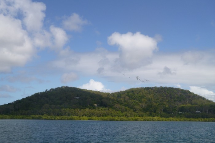
Picture: a flock of Pelicans heading to North Stradbroke Island (the tide is in!).
Monday 28th December saw a forecast of North to North East winds of 10 to 15 knots with less than one metre seas and mostly sunny; just nice for a gentle sail. 0925 saw us cast off lines from our berth and motor out. We unfurled sails at the end of the entrance channel and were soon sailing along at a gentle 5 knots in a 10 knot or so abeam breeze.
Our destination was the anchorage at Myora, just off North Stradbroke Island, some 14nm away. We had known of the anchorage, but not visited it. Our friend, John, on La Rose highly recommended the anchorage and we planned to meet him there.
We sailed gently across Moreton Bay, heading for the narrower eastern channel around Peel Island. The channel is well marked with red ‘port’ markers (on our starboard side as we headed away from Brisbane port). This was just as well as the fringing reef on Peel comes out a long way; typically over 1/3 nm and in places up to 1nm. At all but low tide, the posts appear to be in the middle of the sea and can take some spotting as they seem so far from the island. The other, eastern, side of the channel has even more extensive mud banks extending literally miles from Stradbroke and Moreton Islands. There is no confusion though as the channel does not have markers appearing in the middle of the sea on that side.
That’s Moreton Bay for you!
The wind dropped as we reached the eastern channel. We remained sailing but when our speed reached 1 knot even Paul had to admit defeat and start the motor.
From the channel we could see Myora anchorage in the distance, and some boats in there. We confirmed the location by taking bearings using the sighting compass; the old school techniques still work. As we were in sight, John contacted us and said there were 17 boats in the anchorage, but still plenty of room.
We approached the cardinal mark at the end of the channel. The chart shows the water depth reducing here, and this was evident by the change in water colour. We knew that the sand banks are fairly mobile here and so gave the mark a good clearance. It was now mid tide and we still had over 2 metres under the keel, so there was no great drama. We then headed along the channel parallel to North Stradbroke Island for a couple of miles before furling sails and turning into the anchorage.
The anchorage itself is off the main channel and so out of the significant tidal current. North Stradbroke Island provides shelter from winds from North North East through East to South, and possibly South West. The mud banks provide further protection. The entrance is between a drying mud bank extending from the shore and another mud bank coming out and then parallel to the shore. Both banks are well marked so it is a simple task of heading between the posts and in. Well, there is the ‘lump’ described as ‘oh, yes, that’ by John once we had anchored. As we left the main channel the water depth decreased, as expected, from some 12m to about 3m under the keel. No problem, except in the middle of the entry the depth reduced suddenly to about 0.6m under the keel, and then equally suddenly returned to 3m. The change was so sudden there was no time to react and so curiously there was no effect on Tai Mo Shan, just an increased heart rate for the crew!
Still we were safely anchored at 1325, and soon enough John was alongside in his dinghy.
John has spent his life boating and sailing around Moreton Bay and the Gold Coast. As a result he has amassed an extensive local knowledge, and can regale us with tales of adventures on the local waters. We spent a week anchored at Myora and with John’s company had a very pleasant time.
We discussed fishing and John soon noted that the best bait was a good fresh juicy ‘Yabby’. Technically ‘Yabbies’ are a freshwater crustacean. However, it is also the colloquial name for the similar saltwater species. These little creatures are some 2.5cm long and look like small lobsters, including with one oversized claw. They live in the coastal sand and mud banks. John had a Yabby pump on board and so as low tide approached we headed to the exposed beach extending several hundred metres from the shore. The Yabby pump looks a little like a bicycle tyre pump; a shiny metal cylinder some 0.75m long with a ‘T’ handle attached to a rod and piston. Selecting a patch of wet mud and sand with several small holes in it John would plunge the pump in, pull the handle, lift the pump out and then eject the mud/sand/water mixture by pushing the handle. The efflux would, hopefully, contain one or more rather surprised ‘Yabbies’. There was then the race to pluck the Yabby up and into the waiting bucket before the creature recovered and wriggles its way back into the mud and sand. Half an hour or so saw a tired John (well he had the technique!) and a bucket with a couple of dozen Yabbies resting in water. Back on board Tai Mo Shan we fished the next couple of evenings. This fish liked the Yabbies, the only problem being that the fish just nibbled and were too small to take the hook. So no fish supper, but getting Yabbies was entertaining.
As noted before, the Myora anchorage is just off North Stradbroke Island, and is guarded by mud banks. Indeed, the coast of this part of North Stradbroke Island consists of extensive mud banks fringed by equally extensive mangroves. The view shoreward therefore depends on the tide. High tide sees light blue water lapping verdant green mangroves with the bush covered sand island rising behind in a range of less rich hues of green and brown. The occasional dwelling shows through the bush. Occasionally heard, but not seen, is the main (indeed, only road) between the small town of Dunwich and the lesser settlements of Amity and Point Lookout. Low tide sees the water retreat to be replaced by the gently sloping brown mud and sand beach. To seaward, the channel empties a significant part of Moreton Bay into the ocean between Moreton Island to the North and North Stradbroke Island to the South. Some 9nm long, but only ¼ nm wide, the tidal current is fierce. To cap it all, the meeting of channel and sea results in the notorious South Passage Bar. To quote our chart ‘South Passage Bar is dangerous and rapidly changing’. Fortunately we were at the other end of the channel. So high tide has a view of uninterrupted water stretching away to Moreton Island and, indeed, even further within the 40nm long Moreton Bay. Low tide reveals the immense low mud banks across the channel with several oyster farms.
Being out of the main channel and currents, the anchorage offers good swimming opportunities. Paul had his morning bath consisting of diving in and swimming around the boat until bored (5 to 10 laps). One morning also allowed the chance to clean part of the hull from the slime and growth accumulated over 2 months stationary in the berth. This proved an excellent arm work out scrubbing 80 odd foot of hull waterline with a small scrubbing brush. Thank goodness for the Queensland weather and 24 degree water. We were also able to go to the edge of the mangroves at high tide and swim in the waist to chest deep water. John’s local knowledge was useful in finding a nice isolated mangrove tree to tie up to surrounded by a seabed of soft white sand. One such swimming trip was curtailed when Helen, who was in the dinghy, spotted a ‘Bluebottle’ jellyfish. These jellyfish are like small Portuguese Man o War in that they have a blue air-filled body that floats on the surface and acts as a sail allowing them to drift with the wind. They also have nasty stinging tentacles extending about 10 times the body length. Fortunately the Bluebottles are only small, up to 3cm across, which still leaves some 30cm of tentacles in the water. Whilst not lethal, the sting is described as excruciatingly painful. Needless to say Paul and John made an expeditious exit from the water!
Myora is famous (well, famous in Brisbane) for the freshwater spring. This spawns a small stream that flows into the sea. Mangroves do not grow well in this fresher water and so the stream generates a small winding path through the forest. Again, John’s local knowledge guided us to the entrance. At high tide we could take the dinghy in the mangroves, following the stream for a few hundred metres to the swimming hole. This has been developed with a couple of well-built viewing platforms, and fabric sandbags protecting the banks. The road is only some 25m away with a good path, so this is popular tourist spot. Helen tried the crystal clear water; well she put her foot in it before declaring it to be freezing cold. Excuses abounded (including that Paul had already had a ‘bath’) and so no one tried the fresh water. To be fair, some other people did, and they seemed to enjoy splashing around in the chest deep water, shivering gently as their lips turned blue!
As usual we also did our ‘tikki’ tours in both directions along the mangroves at high tide. The clear waist to chest deep water meant that we could readily see the bottom and the creatures in the sea. Rays were common and often broke cover from their hollows in sea bed with a sudden sprint as we approached. We also saw several turtles including some almost under the dinghy. Of particular interest we saw a couple of shovel nose sharks. These 2m or so long fish have a distinctive double diamond shape and cruise the margins of the mangroves. Of course, the mangroves also house a host of smaller fish and birds, all seen and/or heard as we passed slowly by.
Myora is only a couple of miles from the north end of Dunwich, and the famous ‘Little Ship Club. One tikki tour naturally ended up there supporting the local economy with the purchase of fish and chips washed down with cold beer.
Naturally we had a social time with John a frequent guest for dinner and drinks. Another friend, Rob on Cactus Dreaming, also anchored nearby for a few days and joined us for refreshments and chat.
Having spent nearly a week at Myora (including quiet New Year drinks) we raised anchor on Sunday 3 January at 1210 in very light winds. Fortunately the winds increased as we passed Peel allowing for a pleasant sail back to the marina.
Picture: a flock of Pelicans heading to North Stradbroke Island (the tide is in!).
Gladstone and the last leg to Brisbane – October 2020
23 October 2020 | Brisbane, Australia
Paul Dickinson
Sunday 11th October midday saw us arriving at Gladstone Marina, and we were soon secure in the berth and on shore power.
We planned to head south from Gladstone. We had crossed the Great Sandy Strait on our way North, taking easy day sail length passages and including a stop at Bundaberg. However, we did not enjoy parts of the Great Sandy Straits, indeed most of the straits. There were just too many mud banks and the channels were just too narrow and shallow for our liking. This was especially true of the Sheridan Flats in the middle where the strong tidal currents make the sea bed highly mobile with the drying mud banks constantly shifting. Our charts had proven inaccurate and we had had a hair raising time following the navigation buoys with little or no water under our keel. Entering the straits had also meant crossing the Wide Bay Bar. This had not been a problem but still needed navigational care and tidal assistance.
The alternative route was to go direct to Brisbane from Gladstone. This meant cutting across Hervey Bay, then heading south down the eastern coast of Fraser Island, and then continuing south down the Sunshine Coast and through Moreton Bay. The only all-wind stop would be Moolalaba, which being quite crowded was not ideal, but would provide an emergency hideaway from bad weather. We had stopped at Double Island point on the way north but this anchorage was an open roadstead and only really offered shelter from the Southern and Western quadrants. The single passage was some 310nm long, which, given our planning speed of 5 knots, or 120nm per day, equated to just over 2 ½ days sailing. This was quite tolerable, and so our preferred route. All we needed was a weather window. In short, a gap in the predominant South East wind, or a light South East or East wind. Ideally the wind would be in the north sector to give us a nice push down the coast. So we waited.
The marina is quite new so the facilities are good and, being in an artificial lagoon, the marina is very sheltered. The town of Gladstone is a reasonable walk away, with a Woolworths supermarket in ‘the Valley’ a gentle 2 to 3km walk. The marina is situated in parklands recently created by the Gladstone Port Authority. The surrounds are therefore well kept lawns and patches of tended bushes and trees with good quality winding foot paths throughout. Various areas house children’s’ playgrounds, barbeque areas, a performance arena, a commercial building with ferry office, shops and café/restaurant, and, of course the marina offices and facilities. The marine precinct with marine trades workshops and a small chandlery is also close by. The marina was probably about ½full so there were plenty of other sailors, including some semi-permanent liveaboards to provide a social outlet. In short, it was very pleasant in the marina, and we could use our time to do odd jobs such as washing the boat down and refilling our diesel jerry cans (some 42 litres).
We did have one major job to do. The new outboard had stopped jetting water out of the ‘tell tale’ We were not sure if the outboard was being cooled and had therefore only used it sparingly. The dealer in Townsville had told us to take the motor into any Yamaha dealer. There was a dealer in Gladstone, Curtis Reef Marine. We called them, and they stated they were very busy, but would look at the outboard if we bought it in. Unfortunately they did not do calls to the marina. So Wednesday Paul booked an Uber and took the motor to them and left it there, walking the 2km or so back to the marina. The next day we had a call. As expected it was only the tell-tale that was blocked, and that had been cleared using an air line. All worked well now. And a hot hint for us; the tell tale gets blocked before the main cooling galleries, so a quick blast from a foot pump, perhaps assisted with some wire, usually cures the problem. Paul walked to the dealer and Uber’d the motor back.
By Friday we had decided that we had a weather window allowing us to leave on Saturday. It was not ideal as the forecast was for an East to North East wind on Saturday followed by essentially Northerlies down the coast until Monday evening when a strong South Easterly would set in. So, favourable winds as long as we could get to East Coast Marina in 2 ½ days; we would need to keep the speed up.
So Friday Paul headed off to the supermarket to get some last minute groceries. As he came to the small river separating the marina parklands from the town, the sirens sounded on the bridge and the arms lowered across the road. The bridge would lift and allow a tug to pass underneath. Paul stopped and watched this fascinating event (well, it not every day that the road rises to vertical). A cyclist stopped by Paul and chatted. This was Dave, an American who had cruised for the past 30 odd years! Needless to say the chat continued with a coffee at a nearby café as tall cruising stories were swapped. Trip delayed by an hour or so, Paul continued with a detour up Lookout Hill. This low hill overlooks the port, marina and, to an extent, the town. It was easily accessed by some 110 steps (according to the warning sign at the base!) and was worth the climb as the views were great. The hill had a café at the top, and the road down led into town and close to the supermarket. That evening Paul settled down to watch the rugby semi-finals. Unfortunately the TV signal was not good and so much of the first half was unwatchable. However, salvation for Paul came when Dave telephoned to invite Paul onto his boat, Elangeni … and he had good TV reception. Of course, Helen was not unhappy that she did not have to endure another 40 minutes of the game! On board Elangeni the sailing chat continued washed down by some reasonable beer and decidedly strange whisky; the whisky was spiced and … different. (It was Canadian so enough said!).
Saturday dawned cloudy with a gentle breeze. We had showers and dropped the keys off at the marina office before casting off. 0910 saw us motoring gently across the marina lagoon. A VHF call to Gladstone VTS allowed us to continue into the shipping channel. High tide was at 0919, and as we progressed down the 16nm long channel we noticed the tidal outflow increase markedly. Fortunately the current was with us and provided a welcome boost, not least at the wind was a steady east-southeasterly; exactly the direction we wanted to go! As we went down the channel, just about mid tide, we monitored our progress past the frequent navigation mark posts. By the end, the tidal current was such that the water was churning mightily downstream of the posts; the white water clearly visible. Also visible was the red brown scum on the water. We had previously thought this was whale poo, but had been corrected; it was algae, although at least some in Gladstone referred to as coral spawn. The only consensus was that it was natural. Whatever, the stuff was everywhere, with great patches on the water.
We continued on, 16nm down the Gladstone Channel, a further 16nm to Bustard Point, just past Pancake Creek. We then had to cross Hervey Bay, a further 78nm. And all pushing into a gentle head wind. The trusty Yanmah engine hummed away pushing us on at a steady 5 knots, the Main sail set to steady us. We were making progress but it was the usual compromise of maintaining a reasonable speed whilst keeping the fuel burn as low as we could.
At about 1530, half way across Hervey Bay we had a fish take one of our trolled lures. This was a new one that the shop owner had assured us would definitely trick the fish, and it had! Helen happened to be looking aft at the time, and clearly saw a large fish, over 1 metre long, take the lure and then jump clear out of the water. The result was that our 60lb trace parted and the fish won to fight another day.
Later at 1710 we saw an aircraft low in the sky. It seemed to line up on our wake. It grew larger and larger before roaring past us at an altitude of perhaps 100 feet. The Fokker F28-type aircraft was painted red and white, the usual colours of coast guard. A couple of minutes later and the VHF radio burst into life with Border Force 22 calling up the ‘white sloop we have just flown by’. We answered with our name. Border Force wanted us to spell out our name which we did. We suspected this was to confirm we had not stolen the boat as we were broadcasting on AIS and had the boat name clearly on the side. Sure enough they asked for confirmation that we were registered in Auckland, thus proving that they had our details! The call continued with us detailing our itinerary (Gladstone to Brisbane going outside Fraser Island) before Border Force wishing us a safe journey and our thanking them for guarding the borders.
We continued crossing Hervey Bay overnight. During the night the wind backed north and we were able to raise sails and use the wind to help the motor. Dawn saw us coming up on the cardinal marker showing the end of Breaksea Spit, the 20nm long tongue of rocks, reefs and sand shoals extending north of Fraser Island. Helen, on watch could clearly see the post a mile or so away. Our chart showed a shallower patch some 9m deep just by the post. We could have easily sailed over this patch, but had plotted a course to avoid it. And just as well as the currents in the area were fierce. Indeed, so fierce that the waves were breaking over the shallower (9m deep) patch!
As we rounded the end of the spit we changed course to more southerly. We could sail! We had a favourable current, which was probably the East Australian Current, giving us a useful push. As the day progressed the wind increased so by midday we were running before the wind, the Yankee poled out and the Main prevented, each with a reef in them. Still we had a water speed of at least 6 knots, and the current pushed our speed over the ground up to between 7 and 8 knots. Indeed, the increasing wind had also encouraged a following sea and at times we surfed down the waves. Helen recorded a top speed of 10.4 knots!
At about 1800 we were joined by a pod of dolphins. We had noticed that Australian dolphins were generally quite lazy, content to just break the surface with only short bow rides. This bunch were out to set the record straight. They were full of energy, blasting past us and across our path, and surfing the waves alongside the cockpit (Dolphins seem to have an uncanny knack of knowing where we were on the boat). Even better, they also jumped clear of the water, performing occasional summersaults. And just in case the humans were not impressed some dolphins performed synchronised jumps, close to and in time with each other. And just to catch our attention some dolphins even managed their synchronised jumps to cross not more than 2 metres in front of our anchor! The display lasted some 20 minutes. These animals clearly were just having fun and to the mere humans watching it was truly uplifting.
We continued southwards at pace down the 75nm length of Fraser Island (did we mention that Australia is big?!). Overnight we covered the 60nm or so across Wide Bay and down the Sunshine Coast. The early morning saw a wind drop meaning we had to use the motor at low revs to maintain our 5 knot progress. Daybreak saw us turn past the high rise buildings, parks and cliffs of Caloundra Heads and head into Moreton Bay.
Low tide at Brisbane Bar was 0458. We therefore travelled along Moreton Bay with an incoming tide, another useful boost to our speed in the light northerly to westerly breeze. In fact we found we could maintain satisfactory progress under sail alone. We sailed the 15nm past Bribie Island alongside the shipping channel before re-entering the shipping route at the ‘Spitfire Channel’. The wind dropped and started to swing southerly so it was a case of motor on again. Fortunately we only had some 15nm to go. And so the passage ended with us motoring across a flat calm sea, the breeze gentle on the bow.
We were soon in the familiar surroundings of the Manly Boat Harbour. We had telephoned our friend Phil as we approached the entrance channel and sure enough as we came to the end of D pier Phil was there at our new berth (D10) waving and ready to take lines.
1315 saw us secure on the berth. 1800 saw a strong south easterly wind kick in; we had made the passage in the weather window.
And the numbers: 310 nm in 2 days, 4 hours and 5 minutes, giving us a very respectable average speed of 6.2 knots – that purple patch blasting down Fraser Island certainly helped.
Picture; Border Force 22.
Southwards with a stop at Percy for posterity – October 2020
15 October 2020 | Gladstone, Australia
Paul Dickinson
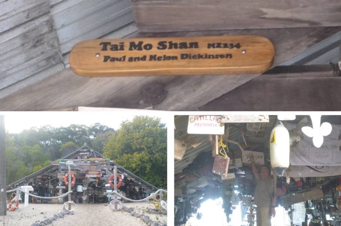
Friday 9th October and we were ready for the lunge to Middle Island of the Percy Group. This was some 67nm from Mackay and a popular, unlit anchorage. We were therefore keen to arrive in daylight. Dusk fell at about 1830 so we needed to start early and make good progress. We were up at the thoroughly unreasonable time of 0500 and cast off from the dock at 0535. We motored out through the commercial harbour and soon had our mainsail up.
There was a light land breeze blowing from the South West. This was great as we were heading pretty much south east and so we had a nice beam wind. We had both the Yankee and Main out and sailing alone would have quite easily achieved 5 knots, and possibly more, most of the time. However, we had to push on and so left the motor running at a reasonable 1500 to 2000 rpm. This kept our momentum during the lulls and allowed us to maintain progress at a useful 6 to 7 knots.
We could see the cargo ships at anchor some 10 nm off Hay Point. As we approached it was clear that those anchored closest to the land were pointing one way; south to south westerly. However, those further out, were pointing another way; pretty much easterly. We anticipated a wind shift and, sure enough as we passed the outer ships, some 15nm or so from Mackay, the wind dropped and shifted. With the wind on the bow we were back to motoring with the Main up as a steadying sail. Still the wind was light and at a slight angle so we were able to maintain reasonable progress at about 5.5 knots.
At 1030 we had some small compensation. We were trolling and the ‘flashing’ lure had tricked a fish. We were able to haul in the small Wahoo without reducing speed and within 15 minutes it was filleted. Half went in the freezer, the rest the fridge; our evening meal was sorted!
We pushed on and at about 1530 the breeze shifted easterly. We could use this and soon had the sails out to assist the motor. We enjoyed a good increase in speed, to the extent that we could reduce engine revs.
By 1700 we were in sight of the anchorage and could start counting masts and then boats at anchor. 1755 saw us securely anchored having threaded our way in through the other boats at anchor; it was still daylight. We counted 9 boats in total, a mix of monohull, catamaran and trimaran yachts, and a couple of motor launches. This left plenty of room to anchor but would have been a bit of a challenge in the dark. Indeed, as the last light faded another catamaran arrived and anchored on the edge of the anchorage.
We had a restful night, albeit with a gentle motion as, even with a light wind, the water in the anchorage was never still. We were up early, intent on going ashore before sailing on. Still, by 0630 there were only 3 other boats left in the anchorage.
We took the dinghy ashore and headed to the A frame building comprising the famed Percy Island Yacht Club. This building is covered with memorabilia from passing yachts. There are literally hundreds of plaques, flags, inscribed old equipment and general knick knacks. We were keen to record Tai Mo Shan’s passing and so had made a small wooden plaque, nicely inscribed and varnished. The problem was finding a space where we could securely fix the plaque so it would withstand the inevitable storms. After some time searching we found a space on a roof beam and, standing on a stool on a table, soon had the plaque screwed in place. Job done we headed back to Tai Mo Shan and weighed anchor at 0750 to start the 160 nm or so passage to Gladstone. The forecast was for light winds, initially south east but perhaps swinging with the sea breeze. Our route would follow the coast; south east and then bending a little more southerly at Cape Capricorn before heading North West up the Gladstone channel.
The wind was initially a light south easterly, pretty much where we wanted to go, so it was a case of motor and steadying Main. About 1300 the wind shifted slightly to the east and we could get the Yankee out to assist the motor. 1530 saw us get a sailing angle, just, and so the motor was turned off. An hour later and we were back to motor and sails. And then an hour or so later and we could turn the motor off. Ah, the fickle wind … kept us busy.
As the night progressed the wind swung easterly and strengthened. The motor was off and as our sailing angel improved so did our speed. Indeed, we spent most of the night happily sailing on a tight to beam reach at 6 to 7 knots.
The Gladstone shipping channel stretches south east of the town and extends for some 16nm or so. There are a couple of channels that form a short cut for southbound vessels like us. The North East channel offers the greatest reduction; however, it is winding and shallow with shifting mud banks. Our discussions with other sailors when we were last in Gladstone indicated that we needed local knowledge to use this channel. The other channel, the Eastern Channel looked promising. It was well marked and, according to our chart, generally deep. There was a narrow patch where the channel joined the main channel which our charts indicated only had some 2m of water at lowest astronomical tide. This option offered a useful reduction of some 10nm in the passage length.
As the sun rose we did the tidal calculations. The low tide was at 1009, and would be 1.59m. Even at this lowest tide we would have at least 1.5m under the keel. 0630 decision made, we would use the channel. At 0800 we had mobile phone coverage and so telephone the marina. They had berths spare and allocated us L10. Even better, if we called as we entered the marina basin there would be people ready to take our lines.
As we passed the north end of Facing Island we saw a fishing boat head into the North East channel; he clearly had local knowledge. 9nm later, at 0955, we turned to line up on the Eastern Channel. Ahead we saw a high speed catamaran ferry powering through the channel. We gave some searoom and the ferry roared past at over 25 knots. We entered the channel. Heading downwind the sails failed to fill as we stole apparent wind and so we motored on. Facing Island was a rock and sand shore just to the north, whilst the shoals just to the south showed the white of breaking waves. We were reminded that whilst we had plenty of water under the keel we had to keep discipline and stick to the channel. A bit of historical interest here at the southern end of Facing Island. In 1847 the first settlers (apparently a mixture of convicts and troops!) had sailed this channel and become shipwrecked (!). They had gone ashore at Settlement Point and been marooned on Facing Island, unable to make the mainland due to the channels and fierce currents. 7 weeks later they were rescued by a resupply vessel and so made the settlement.
1025 and we exited the East Channel and entered the main Gladstone Channel. We had already called up Gladstone Vessel Traffic Services on VHF channel 13 and obtained clearance. The shallow end of the channel had proved interesting. The seabed was clearly scoured by the strong currents of the main channel as our depth sounder recorded several sharp edged depth variations from 6m to 3.5m under our keel.
We sailed up the main channel safely, dropping sails outside the entrance to the Auckland Inlet and motoring the short distance into the marina basin. Sure enough one of the marina staff was at the berth to take our lines. 1215 saw us tied up and secure. The 161nm passage had taken one day, 4 hours and 25 minutes. That nice, fast overnight sail meant we had averaged a respectable 5.67 knots.
Picture: Tai Mo Shan’s plaque in the Percy Island Yacht Club.
MacKay and Inland – October 202
12 October 2020 | Mackay, Australia
Paul Dickinson
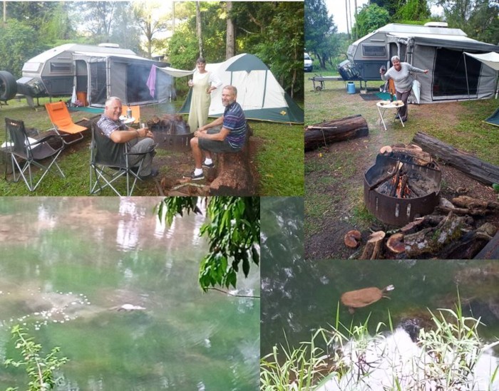
Friday 2nd October saw us arrive at Mackay Marina and secure in B36, the berth we had occupied in July on our way north. That evening we met up with the other marina residents for the regular sailors barbeque and chat. It was good to catch up with many of the people we had met on our first stay, and the various tales flew. Of note, Scott and Miriam, who had helped Paul with the dinghy at Brampton were at the gathering, and the tales elaborated.
Saturday was a day of general chores, not least unblocking the rear head from a calcium build up at the hull fitting, and tidying up. We also re-established contact with our friends Lyle and Jan, who were touring Queensland in their caravan. They happened to be near to MacKay and we were keen to meet up. Helen’s birthday provided the perfect excuse and so we reconnoitred the local restaurants to find a suitable venue.
Sunday morning Lyle and Jan arrived in their wagon. Jan took the opportunity to catch up on their washing in the marina laundrette whilst Paul, Helen and Lyle headed to Woolworths in MacKay. It is a short, 6km, car journey to the supermarket, and so a couple of hours later we were back with sufficient groceries for our trip. Sunday was also Helen’s early birthday. Of course birthdays are the perfect reason to go and eat a decent meal. We had discovered a restaurant in the marina precinct, the Breakwater Bar and Restaurant, and booked a table, so midday we all headed there. The restaurant specialised in seafood and we tucked in to excellent prawns, calamari and barramundi washed down with some bottles of nice white wine; a good lunch. Then it was back to Tai Mo Shan for coffee before Lyle and Jan headed off… for the night.
Monday early (well about 0800) and Lyle and Jan were back. We were off on a road trip! The wagon had the caravan on the back and, bags loaded, off we went to Eungella National Park.
The park was some 80km to the west of Mackay. Initially the road was quite flat as it crossed the coastal plain. This was sugar cane territory, and it was big business. The fields stretched for kms either side of the road with the narrow gauge railway tracks following the road and then branching off into the fields. The long lines of cane wagons, some full, others empty, were regular sights as were the small diesel locomotives pulling them. There were a number of large can processing plants along the way. These were very industrial; great buildings of corrugated steel partially hiding the complex multitude of pipes and conveyors. The smoke stacks often belched out continuous clouds of steam. The towns en-route were typical rural towns, located where they are to serve the scattered farming communities.
Nearly 60km along and the coastal plain met the hills. This was a spectacular change as the flat land met a granite wall. The slopes were very steep and the road signs warned of a steep incline with limits on vehicle lengths. The road changed character from the straight, flat plain highway to a narrow winding ascent path. Lyle used the wagons low gears effectively and we climbed steadily.
Mackay had been sunny with occasional cloud and a gentle to moderate south easterly breeze. That moisture laden air had flowed over the coastal plain and then met the line of the hills. It had nowhere to go but up where it condensed into thick cloud. And we climbed the road into that cloud. Eungella National Park was described as the longest continual stretch of sub-tropical rain forest in Australia. Rain forest, created by rain, caused by that rising air.
We reached the top of the hills and the road flattened out and continued through the hamlet of Eungella. We rolled on, past the ‘Sky Window’ lookout. The cloud base was well below the road and it was clear that the sky window showed, well, the cloud; we did not stop. A few km later we came to the campsite. This was operated by Queensland Parks and Forests, a government department. The site was basic with a long drop toilet block, and half a dozen or so camp areas, along with some firepits and sitting logs. Lyle had timed our arrival to fit between campers leaving for home and others arriving. It worked as we had the pick of the sites and so chose one in a corner with a fire pit and seating logs close by. Setting up the caravan and tent we were to sleep in only took an hour or so despite the tent being novel to us. At this point is it worth mentioning that Lyle and Jan’s caravan is a work of art and has been fitted out to be very self sufficient and excellent for bush travel. Among the features is a very handy annex consisting of wind out roof, attachable walls and good quality fabric floor. This easily doubled the living area and was most welcome in the near continual drizzle.
The site, Broken River, was next to a small shallow river. This is very picturesque and is renowned for its population of Duck Billed Platypus. During our two night stay we saw the creatures in the river. They were not shy and did their thing quite unconcerned by humans watching from the river bank and single track road bridge (with separate pedestrian lane). For some reason we had expected platypus to be quite large, perhaps Otter sized or even larger. However, these were only 20 to 30 cm long. They feed on small creatures found in the river bed and use their prominent ‘duck bills’ to dabble in the mud. Typically a line of small bubbles rising to the surface betray their presence, along with clouds of mud in the shallows. The creatures themselves are often on the surface, to breathe and transit. They are fascinating to watch, and we spent quite some time doing just that. To add to the interest the river also hosted some fresh water turtles. Looking like a brown lily pad with a small stick attached, they paddled gently on the surface before sliding under the water. Other beasties Paul found near the river were leeches. The first one looked like a worm attached to his foot; removal showed it had just started to bite. The second was probably attached and feeding when Paul put his foot in his crocs. The result was the crocs filled with a bloody mess as the full leech met a crushing end.
The rain forest was, of course, full of bird life. These were mostly heard rather than seen and provided a nice background soundtrack. To be fair though, the pre dawn chorus by a group of Kookaburras was more of a raucous racket of laughter that we could have done without!
The fire pit was a steel circular construction which allowed an open fire to be easily controlled. Lyle’s well equipped caravan included a battery powered chain saw that readily changed deadfall logs to fuel. The fires were not easy to light in the damp conditions, but each night we had a good blaze to focus on. There is something primal about the human need to gather around the warmth and light of a fire. We were no exception with the fire being our focus as we sat around eating (of course, we had plenty of good food), drinking (red wine is essential to warm the body and soul), and chatting. Good nights.
Wednesday morning saw our return to the marina and the departure of Lyle and Jan. Thursday was a hectic day as we caught the bus into town for a shopping trip. This included clothes and boots which took full advantage of the large discounts available (typically 30 to 70%) as well as another grocery top up. Back aboard Helen did the washing as Paul fitted a new voltmeter to monitor the house batteries. Then it was preparing the boat for the next leg. We had a good weather window for the 67 nm lunge to Middle Island of the Percy Group. We wanted to arrive at the popular unlit anchorage in daylight and so would need to be off at day break. An early night was called for.
Pictures: Clockwise from top left: Its tough camping; a turtle and a platypus.
Southwards to Mackay – September and October 20
07 October 2020 | Mackay, Australia
Paul Dickinson
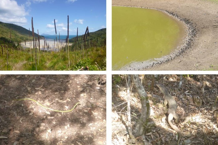
We had arrived in one of our favourite anchorages, Cid Harbour, on Wednesday 23 September. We had hoped for a fairly short stay followed by favourable winds to allow us to continue south. Indeed, the forecast was for East to North East winds that would have been suitable. However, forecasts are educated guesses at best and sure enough moderate to strong South Easterlies blew for the rest of the week! We were well sheltered in Cid Harbour by the bulk of Whitsunday Island and so remained secure despite the odd ‘bullet’ gust dropping down the hill. We had a range of odd jobs to do and had already thoroughly explored the beaches and the two walking tracks. We therefore elected to leave the dinghy in the davits, remain on board and enjoy the view. As we have noted previously Cid Harbour has a very pleasant outlook. With the sun shining, the relatively shallow water allows the light to reflect off the sand/mud seabed turning the water turquoise blue. The shoreline is a mixture of white yellow sand and rocks of various shades of brown. The land consists of steep slopes covered in verdant bush in a range of greens with the occasional light brown rock outcrop. And the sun shines in a deep blue sky with the occasional white cloud. The view is enhanced by the sounds of the birds, particularly noticeable with a morning and evening chorus. There was a wide range of birds in the choir, although the screetching parakeets and the laughing kookaburras stood out. We spotted several turtles doing their turtle thing of surfacing, taking a breath, looking around before diving again. Helen also saw sharks swimming under the boat on two occasions; good reinforcement of the ‘No Swimming’ message on the buoys!
Monday 28 September, and the forecast was for an East to South Easterly breeze. This would give us a sailing angle, just, on our next stop, Brampton Island, some 40nm away. We set off at 0900 and sailed out of Cid Harbour. As we turned south into the Whitsunday Passage we realised that we would be tight on the wind; tight but sailable. However, the churning water gave the clue that we would be fighting a strong tidal current. And what a current; we estimate some 1 to 2 knots past Dent Island with noticeable turbulence on the surface. Still we pushed on, at times having to use the motor to assist the sails in pushing against tide and wind. Lunchtime saw us clear Dent Island and the worst of the adverse current. It was then a case of sailing close to the wind. We had noticed that the waters off the Queensland coast can generate a short sharp chop in moderated winds, and this day was no exception. We had to keep power in the sails to drive through the small waves. If we pointed too high into wind we lost power and Tai Mo Shan just lost momentum and stalled out. The autopilot was having some issues with the wind gusts as it only relied on magnetic heading and so Paul hand steered most of the way. This was not exactly a hardship as putting a yacht in her groove and holding her there is one of the joys of sailing.
We continued southwards until about abeam of the islet Bellows Island, almost 20 nm south of Dent Island. Here we had to alter course to the east which made the wind angle about 20 degrees off our bow; too tight to sail. In addition, the wind had increased to a good 20 knots, and the chop had also increased. Goldsmith Island at just under 5 nm was 10 nm closer than Brampton Island but directly into wind. However, we would soon get into the lee of Goldsmith Island which would reduce the wind effect. Therefore we started the ‘iron topsail’ and headed the 20 degrees more into wind.
A couple of boats were already in the anchorage, but only one was on the park mooring buoys. One buoy was still available so we headed to it and secured to it.
We had an interesting welcome from a black hulled mono hull boat anchored a couple of hundred metres from us. The boat was quite old and needed a bit of tender loving care, but did have paintings of marine animals on the hull and superstructure. OK, they might not be hippies … until we say that the crew were naked (!). Nubile twenty year olds OK, but not so nice when the view is of 50 to 60 year old flesh. Ah well, it takes all sorts. Of more interest one of the other boats at anchor was the 48 foot catamaran Jupiter 1 with our friends Rob and Maxine on board. We soon had the dinghy in the water and sundowners organised for the next day, Tuesday.
Tuesday and we headed to the beach to explore. One of the crew from another yacht was fishing from the beach. We talked. Paul complained that nearly all the islands were nature reserves and had very few, if any, walking tracks. The response was that the fisherman was from Mackay and that they often came to Goldsmith Island, and that there was a walk that crossed over the saddle to a beach on the other side of the island. He had walked the track several times, but it was a little indistinct in places and involved walking through a Blackboy forest. The challenge was set! That afternoon, Paul set off on the walk; stick and machete in hand. The ‘track’ initially followed a small dry stream bed up from the beach. This proved to be surprisingly good to follow, with the path quite clear. At the saddle a few hundred metres along the stream petered out but the track continued thorough a wooded slope for another few hundred metres to the crest. The Blackboys then started. Blackboys are native Australian plants consisting of a green grassy ‘hump’ on the ground out of which a substantial green stalk rises to over two metres. The top of the stalk has the brown seed pod, up to 0.5 metre long. This seed pod consists of many pointed elements which, as Paul found out, are sharp and easily capable of drawing blood. The slope dropped away quite steeply and it was a case of chopping the Blackboy stalks, and some of the ‘humps’ to make a path. Not easy as the sharp seed pods needed to be dodged as they fell. In addition, the steep slope was rocky which meant treacherous footing. Fortunately someone had gone before and placed an aluminium beer can on one of the stalks as a guide. Still, it was a case of carefully picking down the slope to where the bush grew and a new stream bed started a few hundred metres down the slope. This bush proved to be a real challenge. Paul would start a path only to be blocked by impenetrable vegetation after a few dozen metres. It was then a case of reverse and try another route. After half an hour or so he was forced to give up, and only one to two hundred metres from the other bay; very frustrating. So it was a case of back up the slope through the Blackboys to the crest. Here, a thoughtful prior walker had lugged up a half scaffold plank up the slope and set it down between two large boulders to make a very welcome seat. Time for lots of fluid and to take in the view. The ‘target’ beach was at the inner end of a narrow bay some 800 metres long and 300 metres wide. The tide was mostly out and the bay had completely dried revealing sand/mud banks with occasional natural drainage channels ending at the seaward end with flat coralline rock.
With the path to the beach blocked Paul decided to head up the southern slope to try to get a view of the anchorage. This was another steep rocky slope with Blackboys and grass. More clambering, a bit of chopping, and yet more pushing on upwards. Eventually he was rewarded with a view of the anchorage. A later check on ‘Google Earth’ put the crest at scramble.
Back on the water, another catamaran, Whiskers, came and anchored nearby. The crew, Mark and Heather, joined us for a very sociable sundowners on Jupiter 1.
We also found out the likely reason why the mooring buoy was unoccupied. The tidal current in the anchorage was quite strong and the island shielded us from the wind. As a result the current would cause Tai Mo Shan to ride up on the buoy, bow to wind. The buoy would then knock against the hull … for a few hours. Fortunately the buoy was plastic so no damage was done, but it was very annoying.
The wind continued to be a moderate to strong South Easterly, so Wednesday was a quieter day with a short dinghy tikki tour and walk on the beach. Fortunately come Thursday the wind had dropped giving us the opportunity to head to Brampton Island, and then onto Mackay before the stronger wind forecast for the weekend eventuated. So Thursday saw us off the mooring at 0855. Initially we could sail well, tacking into the moderate breeze; however as the morning progressed the wind disappeared and so we had to motor the last 5 or 6 nm of the 16nm passage. Still, we were anchored at 1200. After lunch Paul set out to finish the round island walk. He had tried when we had first visited back in July but been thwarted as the overgrown path disappeared some ¾ of the way around. This time he started from the ‘other end’ of the walk. Initially the path was very good, an old and slightly overgrown vehicle track. A turn off meant following a walking track. This was also well formed and only slightly overgrown. The walk climbed up through a temperate forest alive with nature; many varieties of bush and trees housing hordes of butterflies and several types of birds. The birds were usually heard rather than seen although a couple of large bustard type birds kept running away from Paul along the path, only for Paul to catch up with them a little later. As the path continued it dropped back to the beach on the other side of a saddle. A junction appeared with a couple of lichen-covered signs pointing to ‘Resort’ and ‘West Bay’. The third track looked interesting, wide and overgrown, so Paul followed it. A couple of hundred metres later and a pond appeared on Paul’s left. As he broke cover over a dozen ducks rose off the water and flew off shouting loudly. The pond seemed quite rectangular and so was probably man-made. This may have been a water supply, a guess supported by a ruined concrete base, decrepit remains of a junction box and some old PVC pipes. However, the water was now quite green. That said, it was clearly a viable water supply for butterflies. There were hundreds, if not thousands, of them lining the water’s edge. Onwards and back on the main path and West Bay appeared. This was a fairly large bay that almost completely dried out on the low tide. There was a well maintained campsite, sun shelter and long drop toilet there along with a clear sign naming the bay. Interestingly a large sign board also included a map showing the island walks. Interesting as the route from the campsite to the path was overgrown and only visible as Paul had just walked it! Onwards and the path was getting even more overgrown, at times Paul had to chop fallen trees to clear it. Over a bridge, still in good order. On a bit and a wooden walkway, still in good order but being overwhelmed by alder-type trees, the young branches had spread right across the path. The machete soon cleared the way and the path continued. And suddenly Paul recognised a stretch of path and information board; he was now on the part he had walked in July. The walk continued around. The louder rustling in the bush appeared; a couple of kangaroos! They stopped and looked at Paul but bounced away into the bush as he reached for the camera. Further on and the sizeable Turtle Beach was completely clear of human signs; the only tracks were from a pair of kangaroos. Further on and there, in the middle of the path was a yellow whip snake; about 0.6 metre long, the colour bright in the dappled sunlight. Paul stopped some 2 metres from the snake. The snake and Paul eyed each other; neither moved. After 30 seconds or so it was clear that the snake would have to move to let Paul pass. Stick tapped on the ground and advanced. The snake remained motionless; was it alive? Then, with the tip of the stick about 15 cm away the snake took off, gliding quickly into the bush. Onwards perhaps a km and a Goanna sat on the path. The Goanna is quite a large lizard, this one was almost one metre long, with sharp teeth, sharp claws and a nasty bite (full of bacteria as they eat carrion); well, the Goanna is Australian and so just has to be venomous! Fortunately the Goanna was shy and retreated as Paul approached. And so the 8½ km walk ended although not without some drama. Paul had landed the dinghy at high tide, and it was now nearly low tide, and at some 3 metres the tides were quite significant. The rocky shoreline did not change to sand, it just consisted of (luckily rounded) large rocks. These were quite an obstacle. Fortunately one other boat was at anchor and the couple aboard were on the beach. Scott and Miriam from the monohull Victorous were based in Mackay and knew Brampton Island well. They had come ashore for a beach fire, and had used kayaks rather than their tender as they knew of the rocks! Interestingly the beach used to be sandy but had been largely stripped by the cyclone that destroyed the resort on the island, and had been losing sand ever since. Paul separated the motor from the dinghy and he and Scott carried the dinghy to the water. Before long the motor was back on and Paul was heading towards Tai Mo Shan; Helen looking on somewhat amused.
Friday 2nd October started with a moderate South Easterly which we were keen to use before the wind increased over the weekend. We were underway before 9am sailing very tight to the wind. As before the short chop and variance in the wind meant we had to hand steer to keep Tai Mo Shan driving into wind. After 3 hours it was clear that we could not quite hold the heading needed to clear shoals north of Mackay. The wind was strengthening and it was time to start the motor and push into wind. An hour and a half later we had telephoned Mackay Marina. They had a berth available for us, in fact the one we were in back in July. A little later and we called up Mackay Vessel Traffic Services (VTS) who confirmed there were no ships due to move in the ship harbour and so we could pass through to the marina. 1325hrs saw us secure on berth B36 in the marina.
Picture: Australian wildlife clockwise from top left: Blackboy forest heading down the slope; butterflies taking a drink; Goanna; and yellow whip snake.
| Vessel Name: | Tai Mo Shan |
| Vessel Make/Model: | North Cape 43 (Ed Brewer) |
| Hailing Port: | Auckland, NZ |
| Crew: | Paul and Helen Dickinson |
| About: | |
| Extra: | Tai Mo Shan was built in Hong Kong in 1980 by Emsworth Ltd of Athang Hau. Her name translates to 'Big Hat Mountain' which overlooks the boat yard. We prefer 'Tai Mo Shan'; something is lost in translation. Tai Mo Shan has a proud tradition of cruising the Pacific, and we intend to continue that. |
Gallery not available
Who: Paul and Helen Dickinson
Port: Auckland, NZ