29 October 2013 | Sag Harbor, NY
25 June 2013 | Sag Harbor, NY
18 June 2013 | Port Washington, NY
16 June 2013 | Atlantic Highlands, New Jersey
13 June 2013 | CapeMay
13 June 2013 | Chesapeake
08 June 2013 | Washington DC
15 May 2013 | North Carolina
15 May 2013 | North Carolina
15 May 2013 | North Carolina
15 May 2013 | Florida and S. Carolina
01 May 2013 | St Augustine
01 May 2013 | Marathon, Florida
01 May 2013 | Dry Tortuga, Florida
09 March 2013 | Isla Mujeres
09 March 2013 | Isla Mujeres
20 February 2013 | Isla Providencia
06 February 2013 | San Blas Panama
06 February 2013 | Portobelo, Panama
12 January 2013 | Green Turtle Cay, Panama
ICW - Intercoastal Waterways
15 May 2013 | North Carolina
Ann

The thousand miles from the tip of Florida to Sag Harbor, for us, includes 200 miles of the ICW. We could have picked up the channel in the Keys, but we would have hit on both end - the keel in the mud and the mast on some bridges. We also knew it would involve lots and lots of motoring. The ICW is part natural inland waters, and part canal dug in the 1930's to create a water highway between the Chesapeake and Southern Florida. We opted to sail off-shore, rather than motor inland. The final 200 miles avoids Cape Hatteras, for those on the West coast this is the Cape Mendacino of the mid-Atlantic states, for those on the East Coast it is the widow-maker of a coast. Dave and I have motored around Mendacina twice, but with the weather we have been having, we decided to play it safe. Anyway, we have heard about the beauty of the ICW. It is beautiful, in a low country kind of way, but the Inside Passage in Canada is majestic. One thing the ICW has stunning sunsets and. Our first day up the ICW was as expected, seven hours of motoring. We were able to motor sail the last hour, ya hoo. We pulled off and anchored in Goose Creek. We found the deep spot - eight feet and set the hook. Without a tidal drop or lift we were fine for the night. Dave and I are learning new anchoring skills to find a spot in this thin stuff. We can't motor around to check all the depths, because at six feet we are aground, so we trust the charts - not something we ever did in Central America. We set out 10:1 chain, opposed to our old 5:1, and worry. You never know when soft mud will liquefy and off you go. We were protected from the wind, so our worry was unnecessary. Day two dawned with cherry red stripes fading to coral wisps, and the orange orb rising quickly. The 15 knots from last night was still with us, and we were leaving a man-made cut for an open bay. Time to set the chute! As my mother would say "we had a glorious sail" for half of our daily passage of 42 miles. Then we hit Alligator cut and were able to motor sail with the genoa. I felt like we stole a day of glee from in our itinerary. The transition from Alligator Cut to Alligator River is a very small bay. We passed a boat motoring into the 15 knot wind, and smirked that we were in shorts, but they had full foulies. Dave and I were sitting in the cockpit planning our sun shower as soon as we anchored, when the wind suddenly gusted to 20 knots, and didn't drop. We had 1.5 miles to the anchorage, and decided to furl the genoa. That is when I looked back to see the huge, black thunderstorm bearing down on us. I hurled things down below, like the camera, clothes and books, I even grabbed a foulie jacket for myself (I offered one to Dave, but he declined) before the full brunt hit. Dave kept aiming for the anchorage, and I watched anometer climb as the rain came down in streams. 30 knots, fine, 45 knots, I've seen that before but I don't like it, 50 knots, we should peak soon, 55 knots, this first blow only lasts a few minutes. Visibility was the limit of our boat - just rain behind us, and nothing past the bow. The crack of lightning and the drum of thunder, simultaneous, 58 knots, it should go down now, the waves behind us were building, and we were in 15 feet of water. 62 knots, is this like the micro burst in El Salvador? 65.8 knots, hurricane force. Then 63 knots, it is finally going in the right direction. Where will it settle, please drop below 50, yes we have 45 knots. The lightning didn't expand our visibility; the rain was a curtain around us. 35 knots and holding, we passed the anchorage, and the landscape opened before us - not a good thing, because we wouldn't have any wind or wave break, and we also wouldn't have deep water. I pulled a cushion in front of the companionway to keep some of the rain from blowing down the steps. Visibility is better, we can see a power boat, just off the ICW, they must have known we had no place to go, and got out of our way. Thank you. Dave sent me down below to find another anchorage, but I couldn't get the computer to recognized the GPS, and before the river delta there were only two anchorages, really dimples off the ICW, exposed to the SW storm. I don't want to anchor in 35 knots, especially at Deep Point, which sports 9 feet of water (misnamed in my book.) I'm blinded by another crack of lightning, but I don't hear the thunder for half a second. It is passing. We turn around and head for Deep Point, by the time we have the hook down it is blowing a mere 23 knots. Where was Miss Kara during all this drama? Our clever girl found her own emergency to handle. She saw the leak over our bed turn from a drip to a stream. She grabbed some towels and protected our bed. Thank you. I found why I couldn't get the computer-GPS connection. I forgot to turn on the back-up GPS, the one connected to the computer - oops. Dave and I stripped off our soaking clothes, and lamented the loss of the sun shower. Kara felt that the cold rain was an adequate replacement for the sun shower. Too bad I hadn't grabbed the shampoo.
Comments
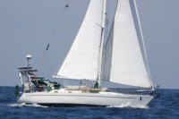
| Vessel Name: | Taking Flight |
| Vessel Make/Model: | Nordic Yachts 40 |
| Hailing Port: | Seattle, Washington |
| Crew: | David Rhoades, Ann Sutphen and Kara Rhoades |
| About: | We are a family of three cruising in our Nordic 40 down the west coast of the United States into Mexico and Central America. |
Gallery not available
Taking Flight Adventures
Who: David Rhoades, Ann Sutphen and Kara Rhoades
Port: Seattle, Washington