
Offshore Hawaii
31 July 2011 | 48 43'N:125 35'W,
26 July 2011 | 47 14'N:140 33'W,
22 July 2011 | 44 38'N:152 26'W,
20 July 2011 | 42 54'N:157 44'W,
18 July 2011 | 39 16'N:159 15'W,
16 July 2011 | 34 20'N:159 34'W,
15 July 2011 | 31 56'N:159 31'W,
15 July 2011
12 July 2011 | 26 20'N:157 16'W,
21 June 2011 | 20 58'N:154 00'W,
18 June 2011 | 26 04'N:148 28'W,
16 June 2011 | 29 05'N:144 27'W,
14 June 2011
14 June 2011
14 June 2011
14 June 2011
14 June 2011
27 May 2011 | Semiahmoo Marina
12 May 2011
Back on the Air!
26 July 2011 | 47 14'N:140 33'W,
We lost our satellite phone connection on Friday when the sat phone company dropped the ball and failed to institute additional minutes to my account. We did have our contact through e-mail with the sideband radio but it is appreciably slower and therefore no blog was uploaded.
We have had to change our plans and terms of use of radar because our present route places us on the Great Circle Routing from Japan to San Francisco and we are seeing considerable traffic sometimes up to 3-4 ships per day. This brings me to the question of how sharp their lookouts are on watch.
You often hear stories of freighters arriving in port with masts and rigging of sailing ships tied up in anchor chains and it makes you cringe at the thought of this disaster. We have had freighters pass within a mile and a half of us and they have consistently failed to answer radio calls to alert them of our presence. This is in spite of us running our rigging lights as well as a strobe at the top of our mast which must make us stand out like a Christmas tree.
You are definitely low man on the totem pole out here and have to make sure that you keep well out of their way. With the fog we are often running our radar during the day as well, as visibility can sometimes be down to 2-3 miles which gives you little time to react if you have a rogue freighter bearing down on you.
We're also seeing more sea life and a couple of days ago were visited by a group of porpoises as well as an orca. Unfortunately no one had their cameras out so you'll just have to take my word for it.
We are now approximately 650 miles north of Cape Flattery having made the turn at the top of the Pacific High. It's hard to believe that it's July in the Pacific Northwest with temperatures of 12°C. We have so much wool on that we're starting to look like Michelin men. In any case, it gives us opportunities to try out our warm gear including our survival suits at night when temperatures are bitterly cold. The good news is that we are being blessed with good Northwest winds at 15 kn makes a pleasant sail at an average of 6.5 kn.
It doesn't seem like it's very fast but at this steady pace, you are covering the equivalent of walking a golf course every hour. In a watch of 6 hours you will cover the distance of White Rock to Horseshoe Bay. In the course of 24 hours, we make the equivalent of two round trips. Do that for 6 weeks that you can cover over 5000 miles as we will have done!
Comments
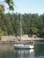
| Vessel Name: | S/V Telltales |
| Vessel Make/Model: | Island Packet 40 |
| Hailing Port: | Semiahmoo Marina |
| Crew: | Steve, Heather, Wayne, John, Kevin, Mark |
Gallery not available
S/V Telltales
Who: Steve, Heather, Wayne, John, Kevin, Mark
Port: Semiahmoo Marina