Around the World One Step at a Time
23 September 2019
08 June 2019
01 June 2019
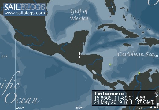
24 May 2019 | Vivario Cays
01 May 2019
26 April 2019
22 March 2019
21 February 2019
08 February 2019
21 January 2019
21 January 2019
26 November 2018
15 November 2018
09 November 2018
31 May 2018
31 May 2018
15 May 2018
06 April 2018
22 March 2018 | Martinique
Our new Blog - www.svtintamarre.com
23 September 2019
Andrew Glasspool
Please store the address of our new blog in your settings
https://www.svtintamarre.com/
Direct link to our new site
Looking forward to seeing you there
https://www.svtintamarre.com/
Direct link to our new site
Looking forward to seeing you there
The next Honduran Island - Roatan!
08 June 2019
Clare Glasspool
A gentle day sail brought us to Roatan. Knowing that jet aeroplanes fly in to Roatan I was expecting it to be "developed", in a way that I was not expecting to enjoy. In contrast to Guanaja there are roads and traffic jams, supermarkets and tourists. However, it is all very low key, and the slightly elevated level of development gave us opportunities. We were able to hire a car and take buses to explore, and Andy was able to resume his interest in diving.
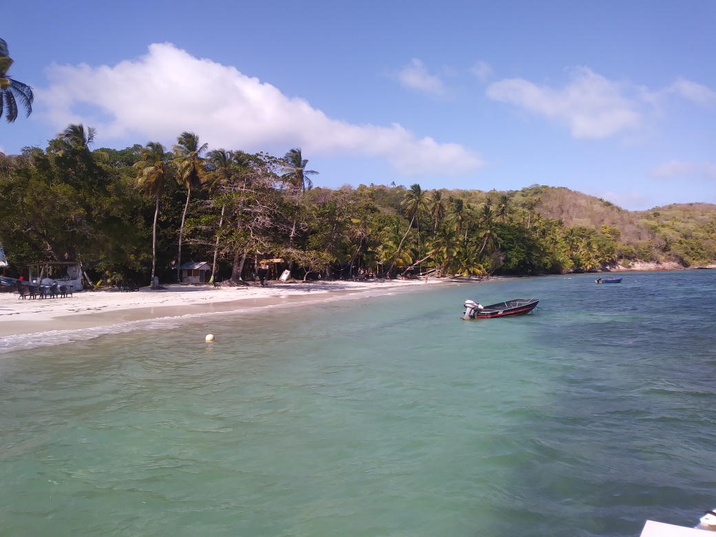
Our first stop was at the rather dull sounding anchorage of Jonesville. The southern coast of long, thin Roatan is deeply indented with inlets - Bights, which, if depths and gaps in the coral reefs allow, make for superbly sheltered anchorages. (Curiously reminiscent of the rias of my home county of Cornwall).
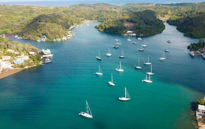
Jonesville Bight Anchorage
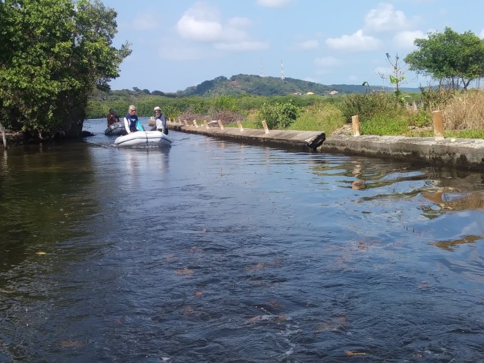
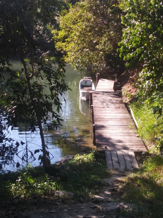
Jonesville Bight has a tiny 4-slip marina on one shore, and a small fishing harbour on the other. The various bights along the coast are linked to each other by a series of canals - with mangroves lining the banks on either side in some places -
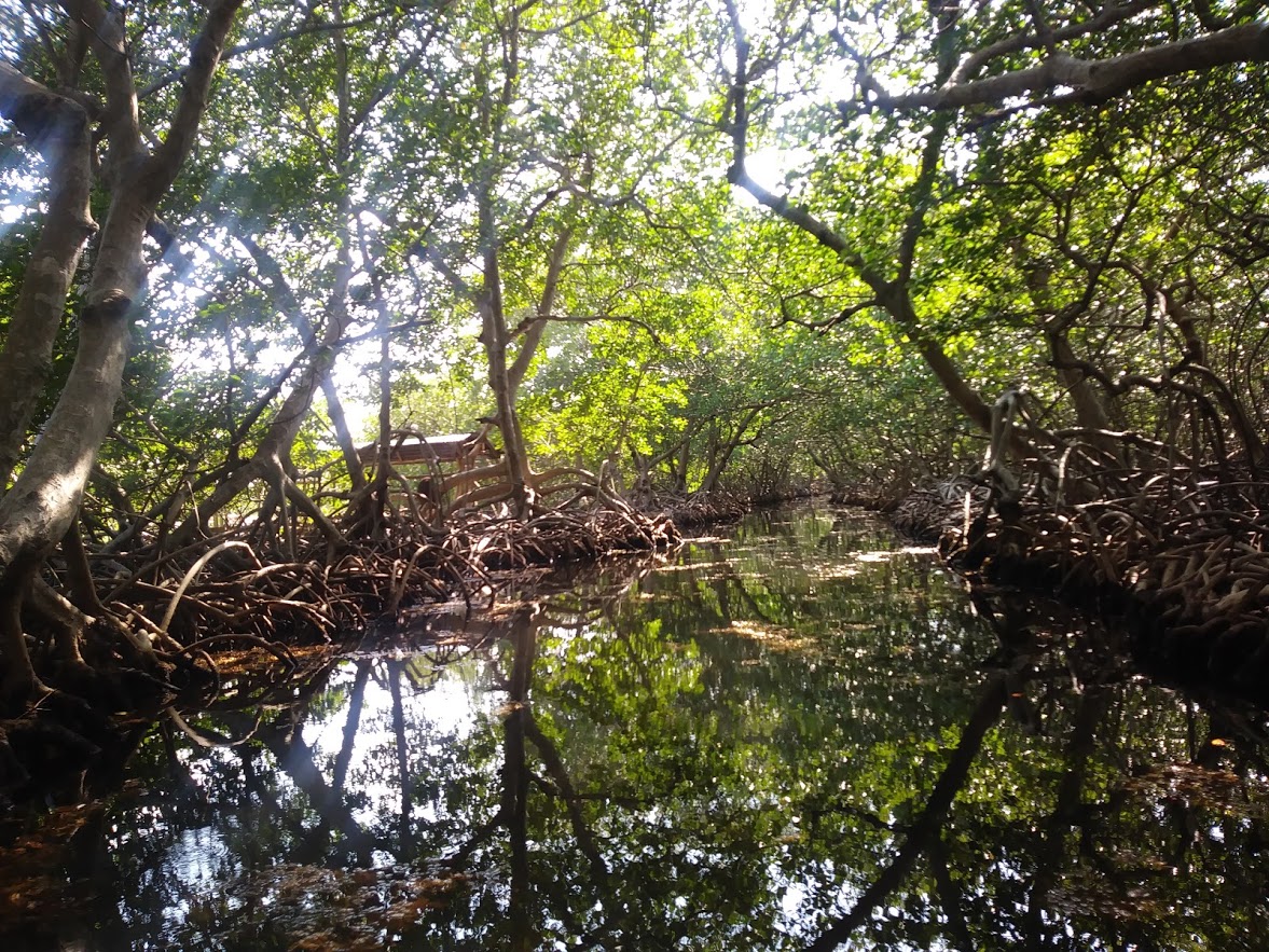
Mangrove Lined Canal
whilst in other places houses and small business had sprouted up. The canals are much too shallow for Tintamarre - but were fun to explore with a dinghy.
One expedition took us to a good snorkelling spot out on the reef in another bight. Another took us to a small village community where we stopped for a chicken and chips lunch and were urged to return later in the week for roast iguana or fresh turtle. (we weren't tempted) and watched the villagers wading back and forth across the canal - there were no bridges.
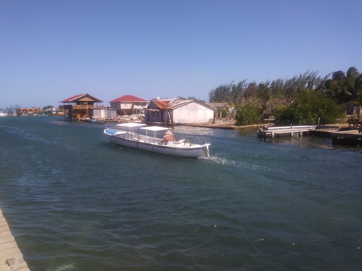
Canal Through the Villages
Hiring a car with friends allowed us to drive to the very tip of the eastern end of the island - where the roads became unpaved, steep and rutted - and a string of beautiful almost deserted bays tempted us to pause for a swim and lunch.
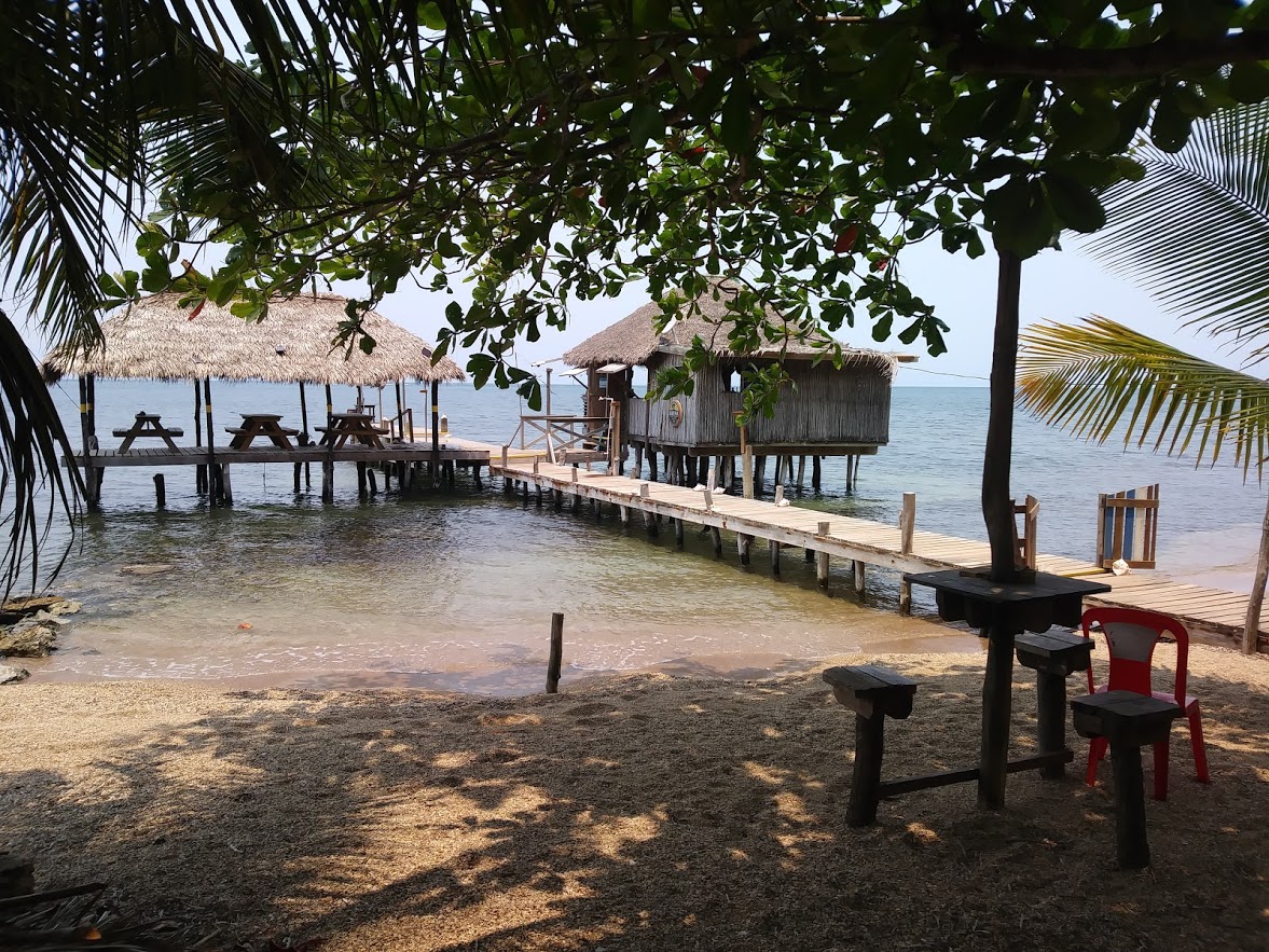
Camp Bay Lunch Spot
More prosaically we could drive to a well stocked supermarket and refill our food lockers with provisions. (though of course all purchases had to be lugged down the path to the jetty, loaded into our dinghy and hoisted ship to ship onto Tintamarre.)
A week into our time on Roatan we decided to sail to West End, Roatan and enjoy the snorkelling and diving opportunities there. Our departure from Jonesville was delayed by the failure of the windlass. With some much appreciated help from our rally friends the dodgy electrical relays were renewed in record time. Our gentle down wind sail then became an unofficial race between ourselves and Wild Iris. They chose to goose-wing their sails (genoa poled out to port and mainsail rigged to starboard - whilst we put both sails out to starboard. Wild Iris had chosen well and although we slipped into the anchorage through the gap in the reef first, they had set out some time after us.
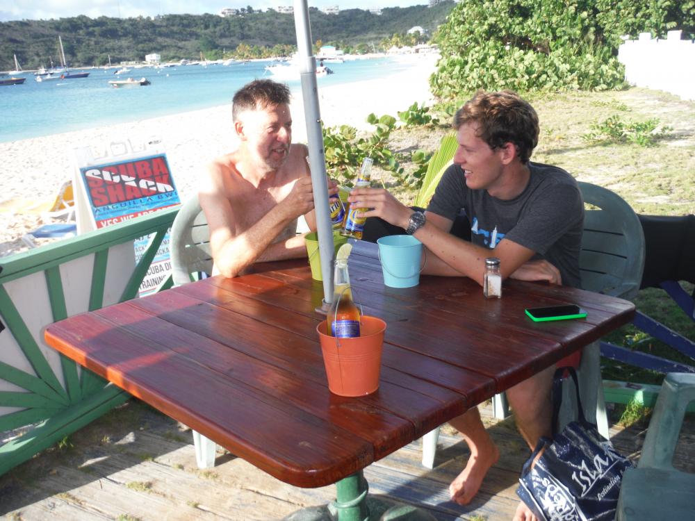
Convivial Evening in West End
West End is a lively diving and tourist oriented community. Unsophisticated, colourfully painted wodden shacks were strung along the beach selling superb inexpensive food and drink. Dollar buses ran every few minutes to the main island town of Coaxen Hole. Andy enthusiastically embraced the opportunities to take up diving again with the support of rally friends - and bought some excellent kit here (on the basis that it will be useful to clean the bottom of the hull). I was very happy to snorkel just off Tintamarre's stern - or take the dinghy just a short way and tie to a dive buoy - to access beautiful coral reefs and wonderful coloured fish in the clear, warm sea.
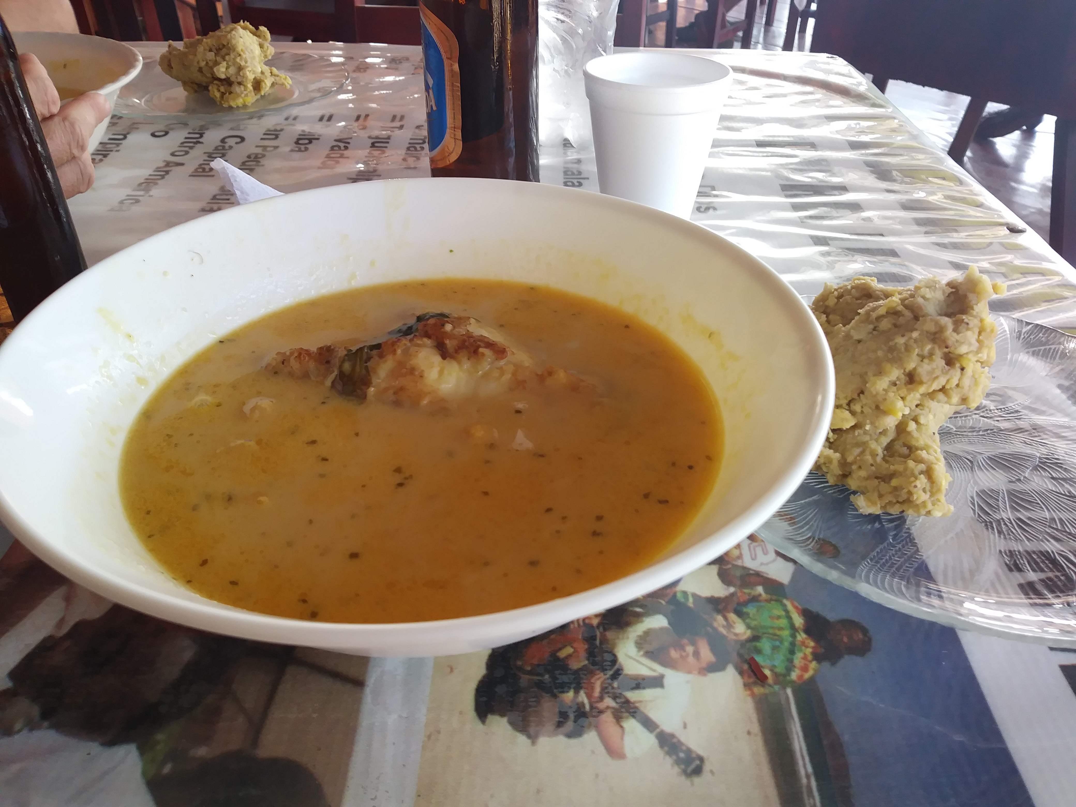
As a change, one day I went with a friend on the dollar buses, travelling for several hours across the island to a Garifuna village. The Garifuna are an ethnic group descending from African slaves intermarried with the Carib communities of St Vincent in the eastern Carribbean And expelled to Roatan (and other lands in this part of central America). The Garifuna are a colourful people, with their own language, customs and cuisine. It turned out that Lisa and I were too late for the festival that we had planned on taking part in, but were still able to sample some delicious tapado (coconut, fish and conch soup) served with machuca (a yukka based carb - rather stodgy for our tastes).
Garifuna Lunch
The carefree days in this anchorage came to an end with our commitment to sail to Belize. Checking out of Roatan proved to be a long winded process - partly because the authorities in Guanaja (also part of Honduras) had issued the correct paperwork but not entered our details onto the countries immigration data base. All was eventually resolved, the dollar bus found to take us back to our anchorage, and the next evening the windlass performed beautifully to raise the anchor for our overnight sail to Belize. As we slipped through the reef out of the anchorage we were joined by a pod of dolphins who played alongside for 20 minutes or so, before leaving us for our last night sail of the season.
Our first stop was at the rather dull sounding anchorage of Jonesville. The southern coast of long, thin Roatan is deeply indented with inlets - Bights, which, if depths and gaps in the coral reefs allow, make for superbly sheltered anchorages. (Curiously reminiscent of the rias of my home county of Cornwall).
Jonesville Bight Anchorage
Jonesville Bight has a tiny 4-slip marina on one shore, and a small fishing harbour on the other. The various bights along the coast are linked to each other by a series of canals - with mangroves lining the banks on either side in some places -
Mangrove Lined Canal
whilst in other places houses and small business had sprouted up. The canals are much too shallow for Tintamarre - but were fun to explore with a dinghy.
One expedition took us to a good snorkelling spot out on the reef in another bight. Another took us to a small village community where we stopped for a chicken and chips lunch and were urged to return later in the week for roast iguana or fresh turtle. (we weren't tempted) and watched the villagers wading back and forth across the canal - there were no bridges.
Canal Through the Villages
Hiring a car with friends allowed us to drive to the very tip of the eastern end of the island - where the roads became unpaved, steep and rutted - and a string of beautiful almost deserted bays tempted us to pause for a swim and lunch.
Camp Bay Lunch Spot
More prosaically we could drive to a well stocked supermarket and refill our food lockers with provisions. (though of course all purchases had to be lugged down the path to the jetty, loaded into our dinghy and hoisted ship to ship onto Tintamarre.)
A week into our time on Roatan we decided to sail to West End, Roatan and enjoy the snorkelling and diving opportunities there. Our departure from Jonesville was delayed by the failure of the windlass. With some much appreciated help from our rally friends the dodgy electrical relays were renewed in record time. Our gentle down wind sail then became an unofficial race between ourselves and Wild Iris. They chose to goose-wing their sails (genoa poled out to port and mainsail rigged to starboard - whilst we put both sails out to starboard. Wild Iris had chosen well and although we slipped into the anchorage through the gap in the reef first, they had set out some time after us.
Convivial Evening in West End
West End is a lively diving and tourist oriented community. Unsophisticated, colourfully painted wodden shacks were strung along the beach selling superb inexpensive food and drink. Dollar buses ran every few minutes to the main island town of Coaxen Hole. Andy enthusiastically embraced the opportunities to take up diving again with the support of rally friends - and bought some excellent kit here (on the basis that it will be useful to clean the bottom of the hull). I was very happy to snorkel just off Tintamarre's stern - or take the dinghy just a short way and tie to a dive buoy - to access beautiful coral reefs and wonderful coloured fish in the clear, warm sea.
As a change, one day I went with a friend on the dollar buses, travelling for several hours across the island to a Garifuna village. The Garifuna are an ethnic group descending from African slaves intermarried with the Carib communities of St Vincent in the eastern Carribbean And expelled to Roatan (and other lands in this part of central America). The Garifuna are a colourful people, with their own language, customs and cuisine. It turned out that Lisa and I were too late for the festival that we had planned on taking part in, but were still able to sample some delicious tapado (coconut, fish and conch soup) served with machuca (a yukka based carb - rather stodgy for our tastes).
Garifuna Lunch
The carefree days in this anchorage came to an end with our commitment to sail to Belize. Checking out of Roatan proved to be a long winded process - partly because the authorities in Guanaja (also part of Honduras) had issued the correct paperwork but not entered our details onto the countries immigration data base. All was eventually resolved, the dollar bus found to take us back to our anchorage, and the next evening the windlass performed beautifully to raise the anchor for our overnight sail to Belize. As we slipped through the reef out of the anchorage we were joined by a pod of dolphins who played alongside for 20 minutes or so, before leaving us for our last night sail of the season.
Guanaja -
01 June 2019
Clare Glasspool
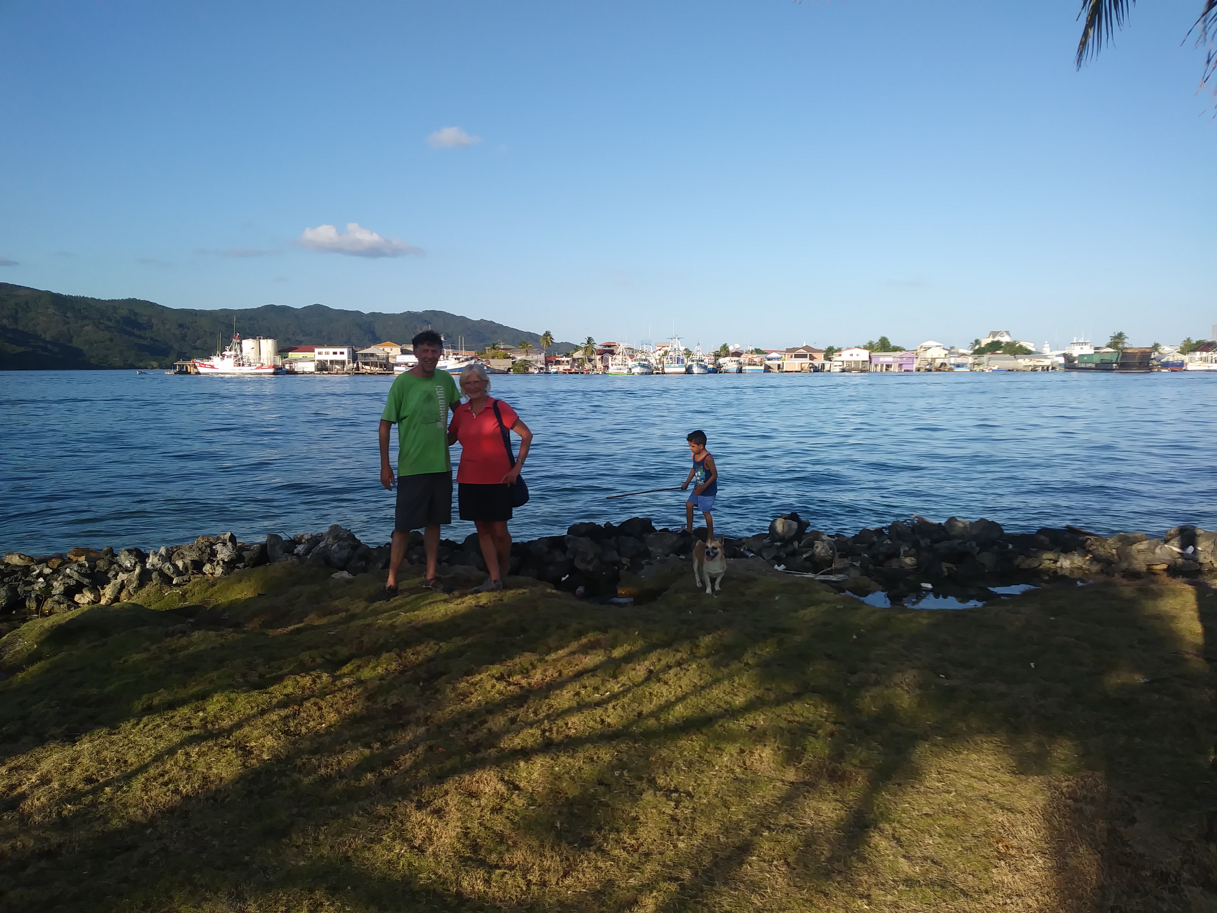
We had never heard of Guanaja. (pronounced "Gwunaha"). It is the smaller sibling of Roatan and Utila - small islands themselves, which sit out in the Bay of Honduras - and as a group are known as "The Bay Islands"
Despite having a population of some 10,000 people, Guanaja boasts only 2 miles of roads, and can only be reached by tiny plane (and the airstrip has no road leading to it) or by private boat. It is mountainous and green. It is an island that seems to be by passed by the rest of the world - except for Christopher Colombus, of course, who visited in 1502, and declared the water here to be the very best.
The main language spoken here is English;- or a Creole derivative of English, with Spanish being the official language and spoken by some. Many people are bilingual. All the people of Guanaja seemed to speak the language of welcome and friendship. Visitors to the island are rare - English visitors even more so! Tourism is not even in its infancy here. The main industry is fishing - although it was not the season for prawns so much of the fishing fleet was in port.
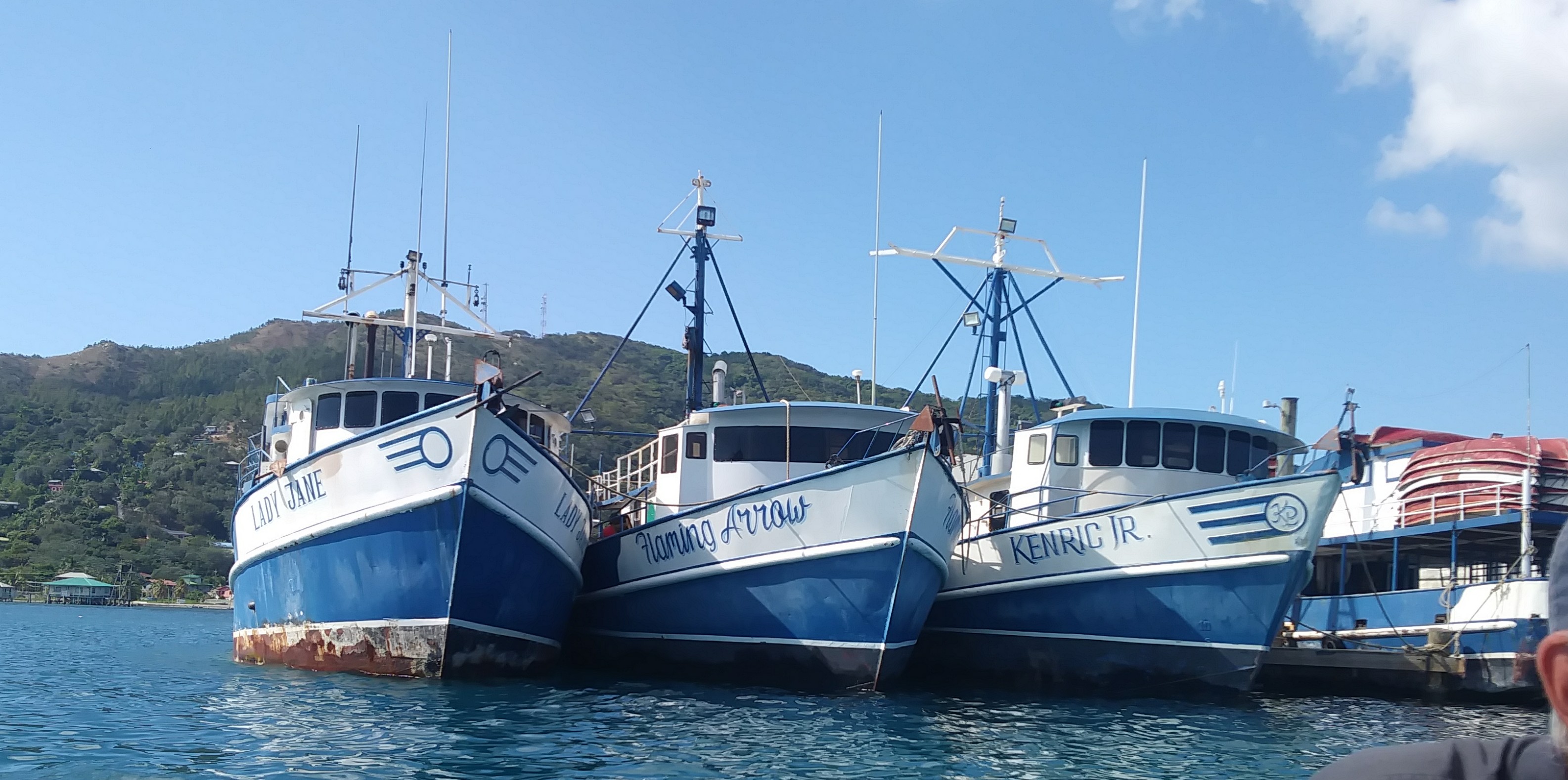
Fishing Fleet
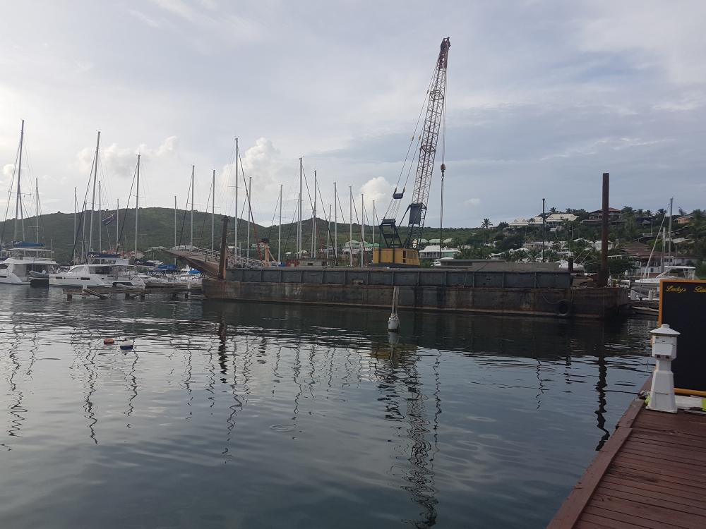
Our first port of call was the fuel dock - somewhere we could secure Tintamarre whilst we fixed our broken windlass (anchor winding kit). Most fuel docks in the world would probably refuse such a request for help - but here we were welcomed - and over the next few days became firm friends with the family in charge. We spent a pleasant evening supping on coconuts picked off the trees, playing football with the youngsters and sharing a few cold beers under the palm trees. The dock was on a cute little island, just across from the main town of Bonacca. Not only did we fix the fault on the windlass (another did appear a couple of weeks later but that's another story) - but we were able to access propane, water and supplies of fish.
Fuel Dock Island
A water taxi would whisk us across the water to the main island town Bonacca - itself crammed on to a separate island. Bonacca is referred to as The Venice of the Caribbean" - which doesn't do justice to either place - but does reflect the water ways and tiny pedestrian streets which feature in both. Bonacca houses all stand on stilts. There is a crazy haphazard style to the place, with bright colour schemes, wooden balconies and jaunty angles the norm.
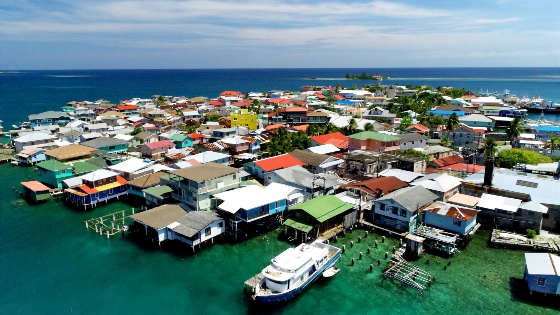
Colourful Bonacca
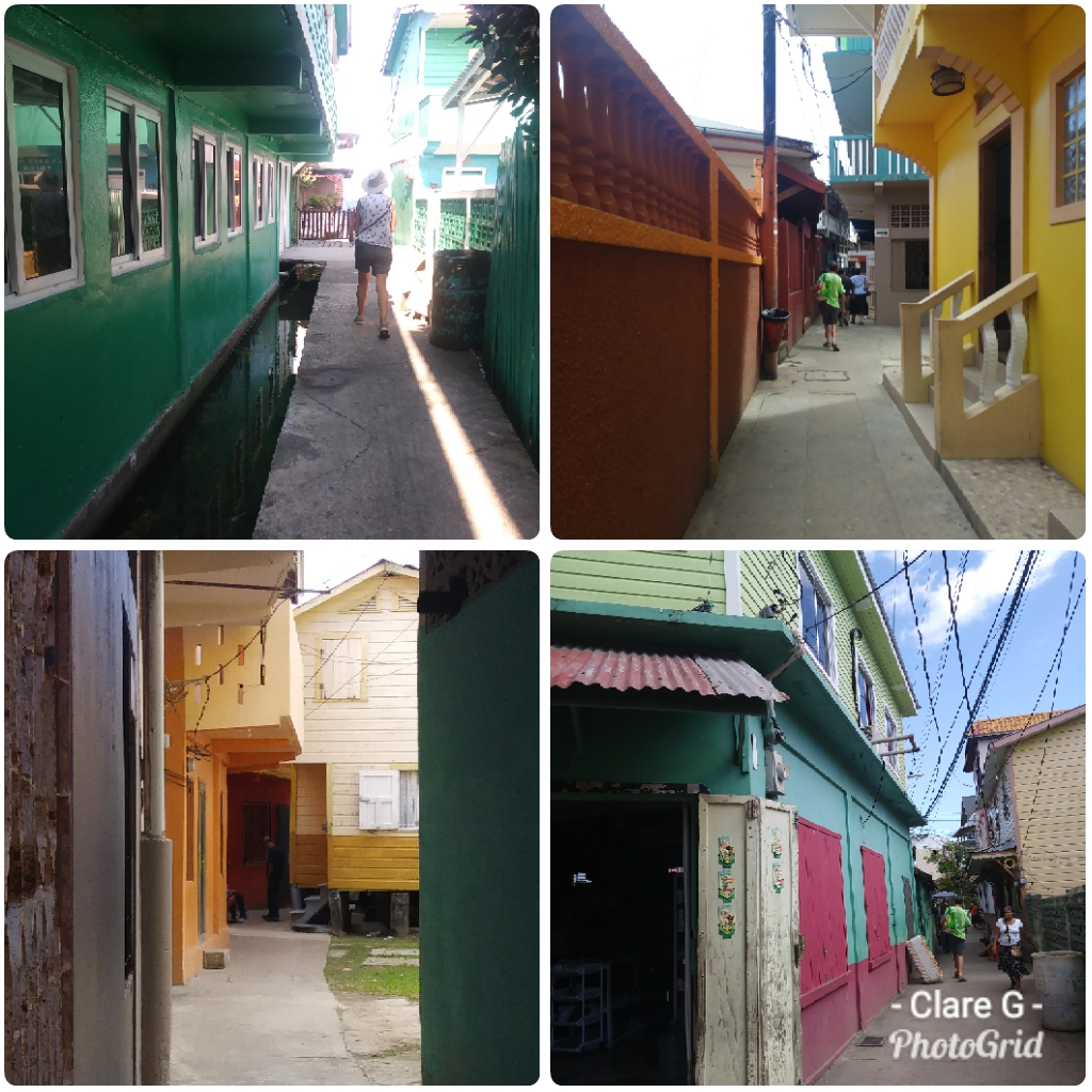
Bonacca Streets
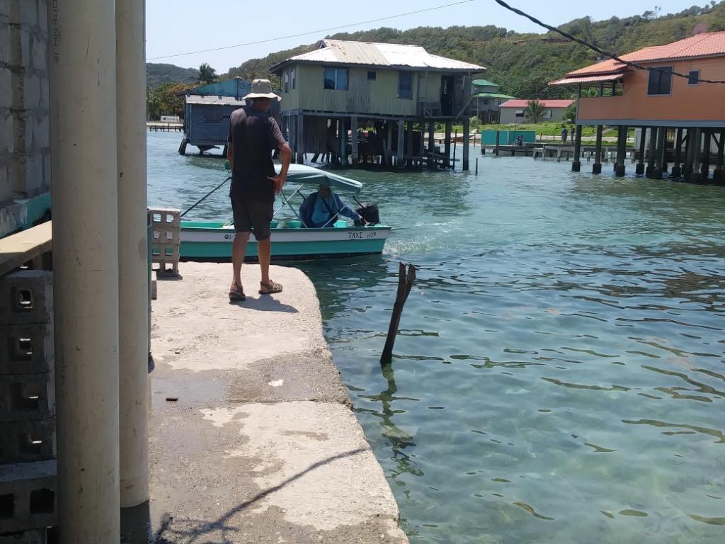
There are no cars, no motor bikes - not even bicycles. Little docks abound - and small boats with willing drivers too. Small children climb onto boats with the poise and assurance that comes with doing it every day.
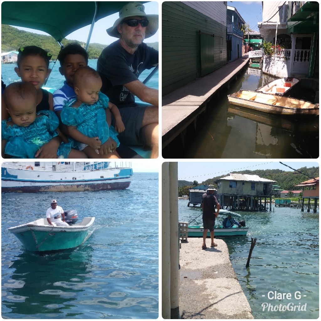
Boat Transport in Guanaja
In these narrow streets little stalls sell fruit - mango season was just beginning and was sold ready cut in small cups - and there was some small green fruit I never learned the name of, eaten with salt. There were a couple of small "supermarkets" which were surprisingly well stocked. We found ourselves a courtesy flag for Honduras in a hardware/toy store - for about one tenth the usual price in a chandlery. Everyone was charmingly helpful.
After our sojourn on the fuel dock we rejoined our friends in a wonderfully peaceful anchorage called "The Bight". Ashore one could walk the sandy path along the shore to pick up a boat ride to Bonacca, or follow an uphill trail to waterfalls.

Shore line pathways
An enterprising local man had set up a tiny shack style eatery, cooking up the best pizzas in a simple wood fired oven. A girl from Guatemala juggled being a vet with taking in laundry and cooking wonderful bread. There was a wonderful small palapa built out over the water for small social gatherings.
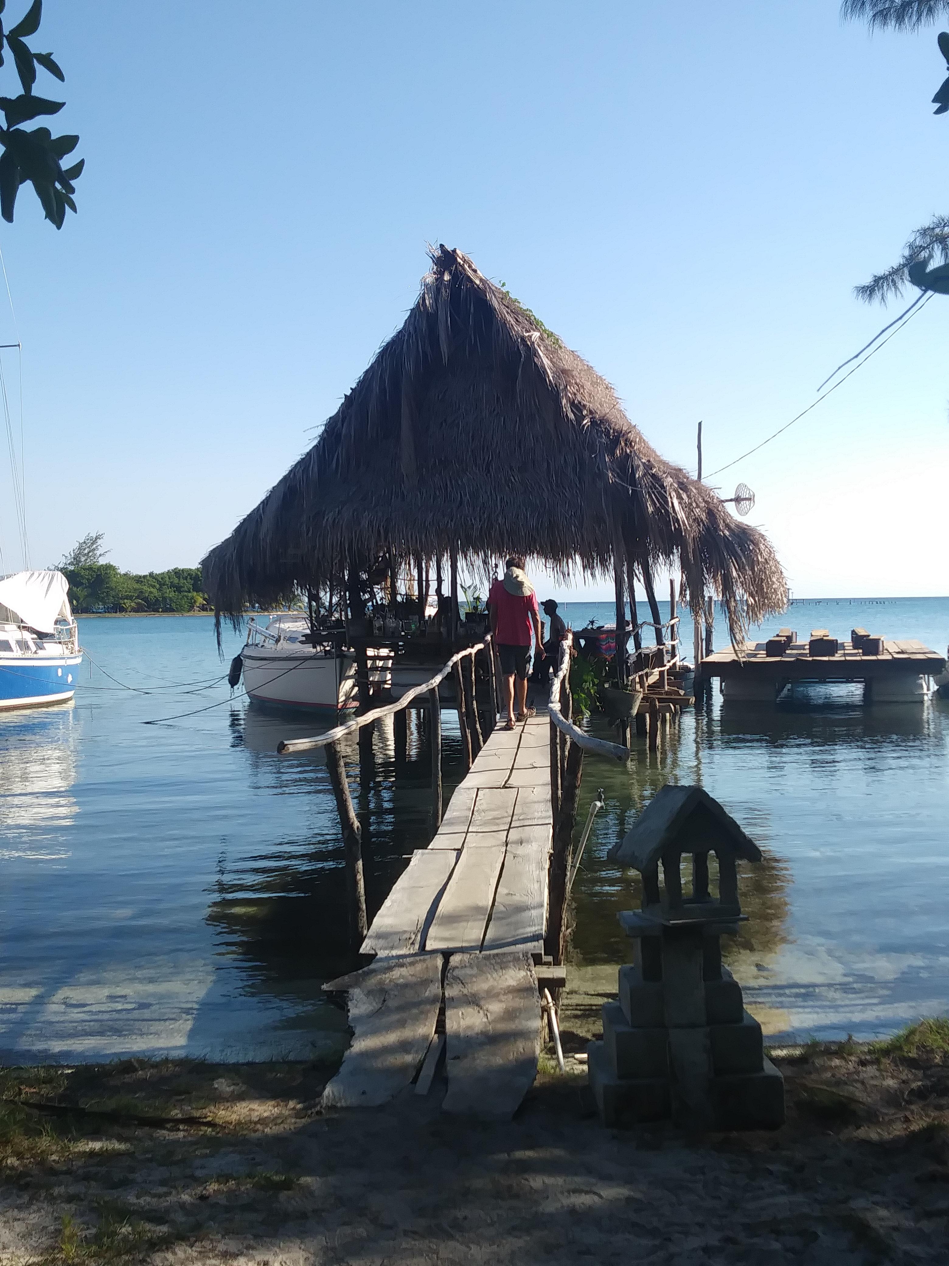
Palapa at The Bight
One day a boat taxi took us out to one of the cays for the best snorkelling experience ever. We waded into the warm sea from the white sandy beach The clarity of the water, the colour and variety of the corals and fish life (the reefs in The Bay islands are part of the Mesoamerican Barrier Reef which is second only to The Great Barrier Reef of Australia in length) were superb.
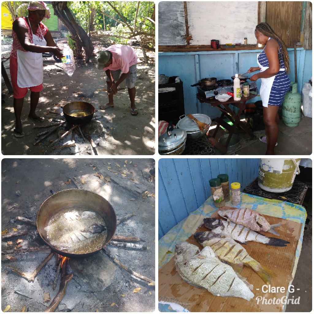
In Bonacca we enjoyed some of the tastiest meals of our trip. At "Pat's Place" we enjoyed her fish, jacket potatoes and vegetable assortment for the equivalent of £2.50. She suggested we come back on Sunday to try the island speciality of "coconut dinner". We returned at Sunday lunch time to find that she had sold out. Noting our disappointment she hurried into the kitchen and emerged with what was clearly her own family portion, which she insisted on treating us to. And so we enjoyed the mix of green bananas, sweet and regular potatoes, and yucca, all cooked in coconut milk with lashings of salt beef then stirred into it. To be honest, it didn't look pretty - but it was very tasty - and we enjoyed hearing about Patricia's family and her connections with Liverpool.
It would have been easy to stay in this paradise for a very long time. Maybe it was a good thing there was some sort of schedule to keep to. During our time in the Bight David, our much-valued crew, left us. Whilst we were sure to miss him we all agreed that this was a good hop off point. So the next sail, an easy day sail of 32 miles to the next island in the Honduran Bay Island chain - Roatan, would be our first sail this season on our own.
Despite having a population of some 10,000 people, Guanaja boasts only 2 miles of roads, and can only be reached by tiny plane (and the airstrip has no road leading to it) or by private boat. It is mountainous and green. It is an island that seems to be by passed by the rest of the world - except for Christopher Colombus, of course, who visited in 1502, and declared the water here to be the very best.
The main language spoken here is English;- or a Creole derivative of English, with Spanish being the official language and spoken by some. Many people are bilingual. All the people of Guanaja seemed to speak the language of welcome and friendship. Visitors to the island are rare - English visitors even more so! Tourism is not even in its infancy here. The main industry is fishing - although it was not the season for prawns so much of the fishing fleet was in port.
Fishing Fleet
Our first port of call was the fuel dock - somewhere we could secure Tintamarre whilst we fixed our broken windlass (anchor winding kit). Most fuel docks in the world would probably refuse such a request for help - but here we were welcomed - and over the next few days became firm friends with the family in charge. We spent a pleasant evening supping on coconuts picked off the trees, playing football with the youngsters and sharing a few cold beers under the palm trees. The dock was on a cute little island, just across from the main town of Bonacca. Not only did we fix the fault on the windlass (another did appear a couple of weeks later but that's another story) - but we were able to access propane, water and supplies of fish.
Fuel Dock Island
A water taxi would whisk us across the water to the main island town Bonacca - itself crammed on to a separate island. Bonacca is referred to as The Venice of the Caribbean" - which doesn't do justice to either place - but does reflect the water ways and tiny pedestrian streets which feature in both. Bonacca houses all stand on stilts. There is a crazy haphazard style to the place, with bright colour schemes, wooden balconies and jaunty angles the norm.
Colourful Bonacca
Bonacca Streets
There are no cars, no motor bikes - not even bicycles. Little docks abound - and small boats with willing drivers too. Small children climb onto boats with the poise and assurance that comes with doing it every day.
Boat Transport in Guanaja
In these narrow streets little stalls sell fruit - mango season was just beginning and was sold ready cut in small cups - and there was some small green fruit I never learned the name of, eaten with salt. There were a couple of small "supermarkets" which were surprisingly well stocked. We found ourselves a courtesy flag for Honduras in a hardware/toy store - for about one tenth the usual price in a chandlery. Everyone was charmingly helpful.
After our sojourn on the fuel dock we rejoined our friends in a wonderfully peaceful anchorage called "The Bight". Ashore one could walk the sandy path along the shore to pick up a boat ride to Bonacca, or follow an uphill trail to waterfalls.
Shore line pathways
An enterprising local man had set up a tiny shack style eatery, cooking up the best pizzas in a simple wood fired oven. A girl from Guatemala juggled being a vet with taking in laundry and cooking wonderful bread. There was a wonderful small palapa built out over the water for small social gatherings.
Palapa at The Bight
One day a boat taxi took us out to one of the cays for the best snorkelling experience ever. We waded into the warm sea from the white sandy beach The clarity of the water, the colour and variety of the corals and fish life (the reefs in The Bay islands are part of the Mesoamerican Barrier Reef which is second only to The Great Barrier Reef of Australia in length) were superb.
In Bonacca we enjoyed some of the tastiest meals of our trip. At "Pat's Place" we enjoyed her fish, jacket potatoes and vegetable assortment for the equivalent of £2.50. She suggested we come back on Sunday to try the island speciality of "coconut dinner". We returned at Sunday lunch time to find that she had sold out. Noting our disappointment she hurried into the kitchen and emerged with what was clearly her own family portion, which she insisted on treating us to. And so we enjoyed the mix of green bananas, sweet and regular potatoes, and yucca, all cooked in coconut milk with lashings of salt beef then stirred into it. To be honest, it didn't look pretty - but it was very tasty - and we enjoyed hearing about Patricia's family and her connections with Liverpool.
It would have been easy to stay in this paradise for a very long time. Maybe it was a good thing there was some sort of schedule to keep to. During our time in the Bight David, our much-valued crew, left us. Whilst we were sure to miss him we all agreed that this was a good hop off point. So the next sail, an easy day sail of 32 miles to the next island in the Honduran Bay Island chain - Roatan, would be our first sail this season on our own.
A night passage to remember and close encounters with "white lobster"
24 May 2019 | Vivario Cays
Andrew Glasspool
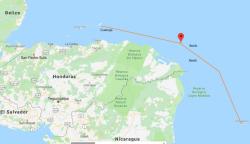
The passage from Providencia to Guanaja passes close to the Nicaraguan and mainland Honduran coast. Nicaragua was the country that our college union was always trying to send funds to, to support the Sandinistas, the freedom fighters, guerrillas or terrorists, depending on your political persuasion.
Inevitably the political activists won the votes because most of us were too busy enjoying ourselves drinking our grant money to attend the meetings. But winning these votes was always short lived as such donations were strictly banned by the rules on Ultra Vires expenditure. Ultra Vires Definition
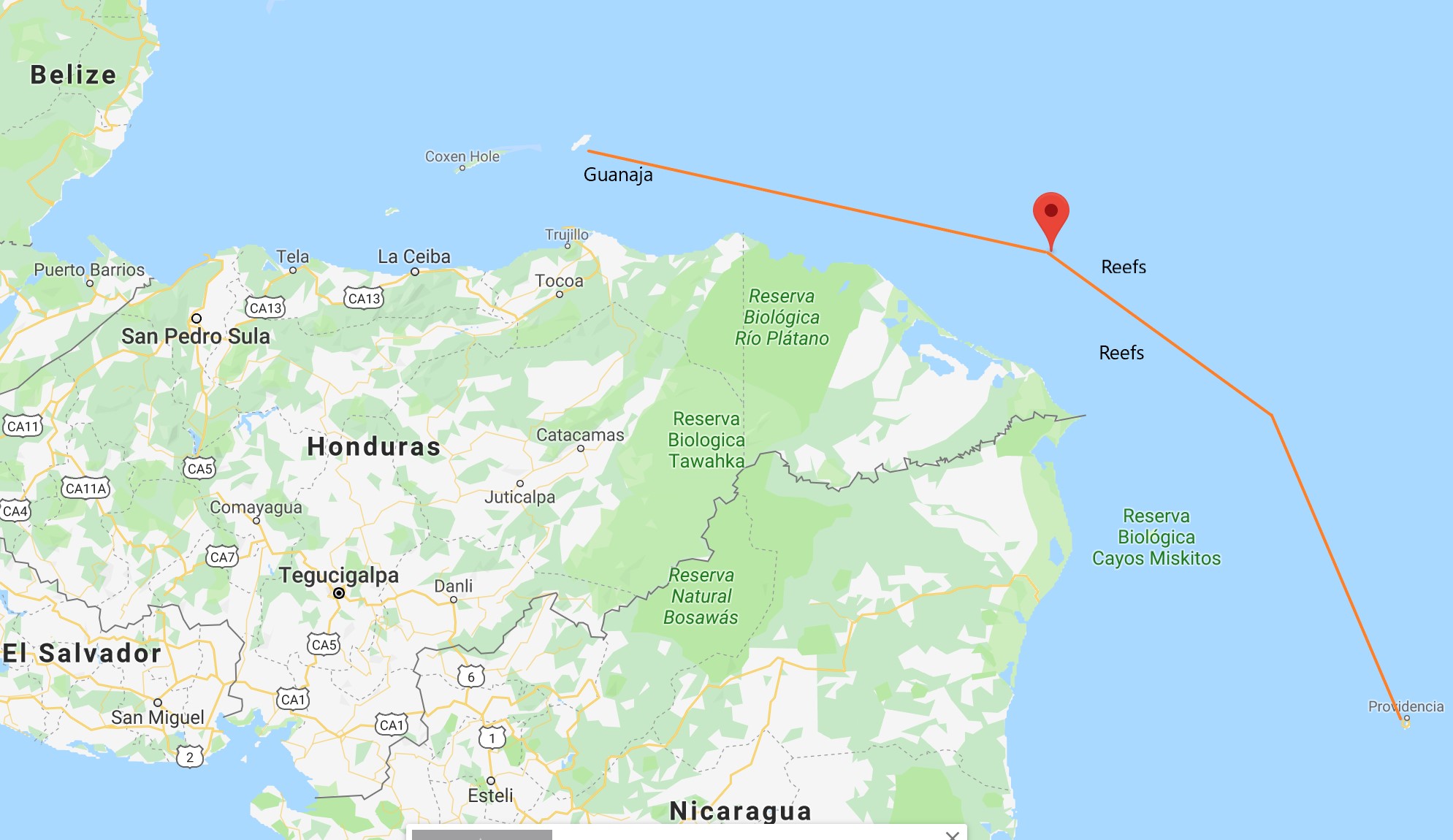
At least, therefore, when we started to plan the passage I knew of Nicaragua and some of its history. Oh, and I knew that its coastline is notorious for piracy and drug running along with much of the Central American coast. Guanaja, our destination was somewhere I had not yet learned to spell and Vivario Cays didn't seem to be on the map (it isn't on Google maps, though you can show its position as on the map above). You have to zoom in a very long way on the Nautical Charts to find it and when you do they show lots of coral reefs and shallows for this passage, the most difficult part to be navigated at night according to our passage plan.
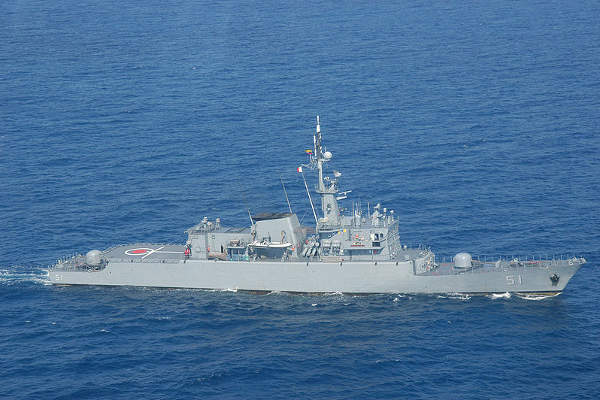
The Navy
Our plans were made more complex by the need for the safety of the Rally. It was feared that a large group of yachts might attract unwelcome attention, though like a convoy, a large group also provides protection. The Colombian Navy had been called in to provide additional protection, but they could not sail into Nicaraguan waters. Honduras would provide coverage from land; Nicaragua would do nothing and we would be in their waters at the most critical times when we passed close to their shoreline.
The timing of our passage was determined by the availability of naval (Colombia) and coast guard (Honduras) support but even this was overruled by the weather and the inability of the authorities to issue the required papers. We waited with an increasingly restless group while the winds died or turned in the wrong direction for nearly two weeks.
Polar Diagrams and Weather Planning
But not these Polars
To take advantage of the protection we had been offered we needed a weather window that would allow 30 disparate boats to sail at roughly the same speed with the group sub-divided into 5 groups of 6 boats that were meant to stay within a few miles of each other.
In planning for this passage polar diagrams become my speciality. These diagrams allow one to compare or predict performance of the different yachts in the group, showing a yachts speed for any given wind angle and speed.
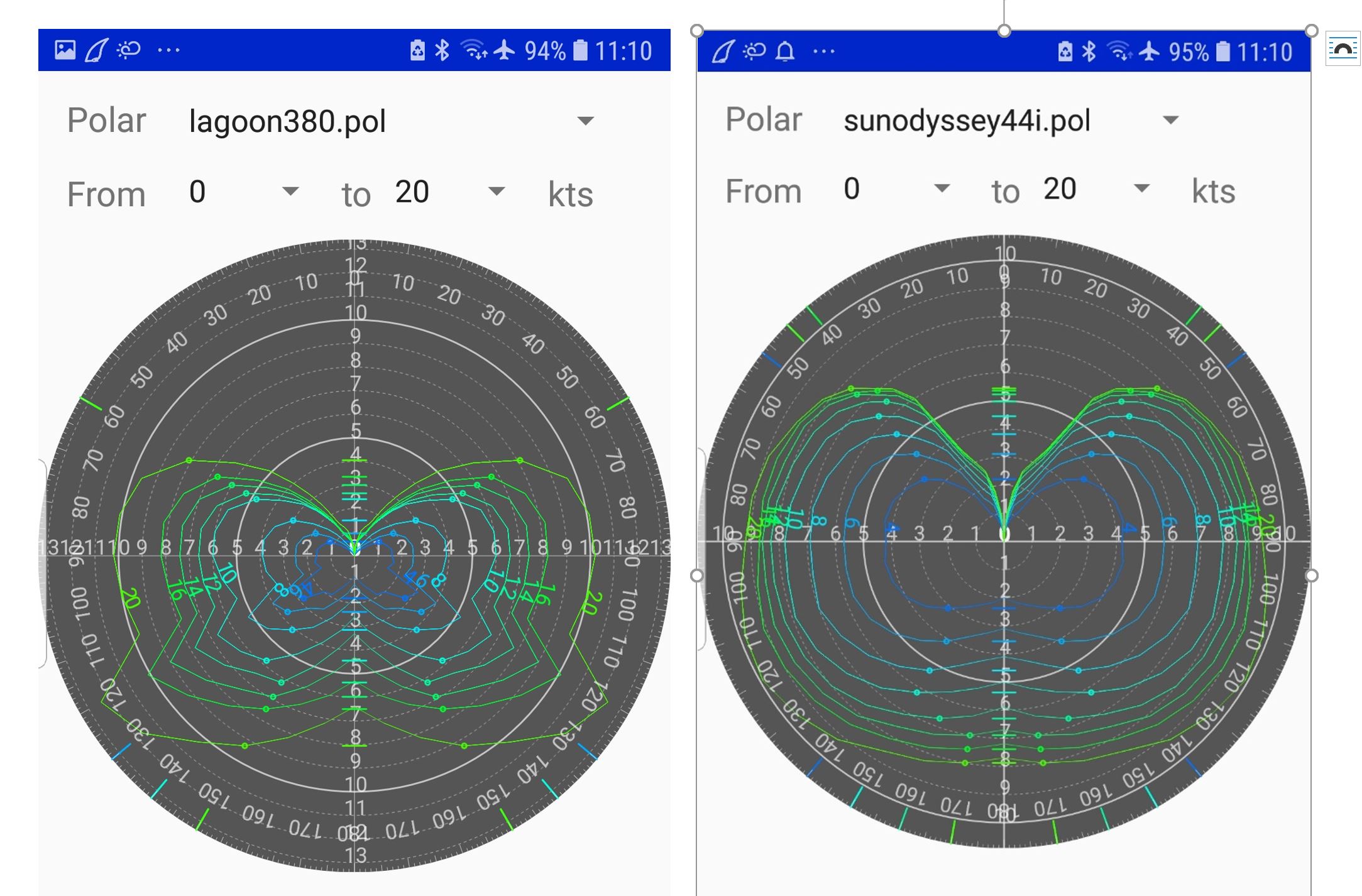
Quickly one learns that Catamarans and Monohulls are not designed to sail together, nor are heavy long keel boats and lighter boats and those with fin keels, or 57ft boats and 36ft boats. Inevitably some would have to resort to motoring to stay with the group, but we had to sail as our total engine hours were restricted by the need for a 50 hour service to maintain the warranty.
I had most of the polar diagrams we needed included in the navigation software I use. This also gave me access to synoptic charts and all the main weather models such as the GFS and ECMWF, all freely provided and often it seemed more up to date than the paid services most others were using.
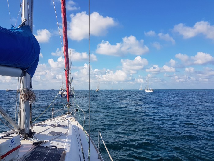
Waving a finger in the air and with some good guess- work a departure date was agreed. Despite Customs being late issuing our papers we finally managed to depart, with a weather window to suit all and our departure aligned with a nearly full moon and clear skies.
The Start
The passage to Vivario Cays was uneventful but as always the fun starts after dark. On this first night a mystery boat nearly collided with several of the yachts in the group. (It passed us a few metres from our starboard side). Bright lights and random movements, though, had some wondering if this was an attempted pirate attack. We now think this was the Nicaraguan coast guard as they boarded some of the Rally boats in group 2 that sailed the passage two weeks later. I was blissfully asleep for this little encounter.
Vivario Cays
A tiny Cay, the reefs known for their shrimp and lobster. But these were out of season, so the islands were deserted, or should have been, until we arrived. But arriving on the islands we noticed fast boats approaching. It was, we discovered later, the "white lobster" (cocaine) fishermen rushing in to protect their stock as this was their season. We think they were alarmed by the sight of thirty boats approaching and anchoring off the coral reefed island.
This article provides some interesting background on white lobster, much of which goes astray when released from boats or let to drift at the wrong time. Guardian Article on White Lobster
We have seen close-up photos taken from a drone, thankfully one not seen by the "fishermen", that no one dares to publish. These pictures show a football field size area covered in bagged "white lobster", all ready to drop at sea and be taken by the current up to Mexico or the USA. An operation on this scale could not go unobserved without many law enforcement organisations turning a blind eye, an operation large enough to be seen by any self respecting satellite or spy plane. These few days must have proved difficult for those that were meant to be watching us whilst somehow not seeing anything else.
..and then our Windlass failed
We were, though, blissfully unaware of the scale of the operation at the time. However, we had been warned not to go ashore. We were still able to enjoy the snorkelling, which was excellent. The weather for the rest of the passage was thought to be best if we stayed here two nights. Two nights though was longer than the "white lobster fishermen" wanted as we discovered when they approached us advising us to leave because of the approaching strong winds not shown on any forecasts we were studying.
"Time to leave, "fishermen" approaching our friends on Wild Iris advising them to leave after checking we were also on our way.."
We assured them we were on our way and immediately were struck with a non-functioning windlass. Our Anchor would not come up. The windlass joining the growing list of systems starting with "wind" that were not working on Tintamarre, notably the wind generator, Windexand the wind instruments.
With assistance from the last three boats in the anchorage, we hauled the anchor up by hand and set sail for a very pleasant day's sailing, no sign of the promised scattered squalls. The windlass to be fixed another day and arranging for a dockside mooring on our arrival was added to the work to be done while on passage.
Not Under Command
After a beautiful day darkness fell even more rapidly than the usual tropical sunset. We turned north to try to avoid the small squall building ahead of us. This seemed harmless enough on the radar, then the rain started, and the radar showed the squall was now all around us extending to the limit of the radar's range. The winds blew strong and weak from all directions. We had tried to sail but with 30 boats weaving around in pitch dark and poor visibility, or rather us weaving and others going straight on the engine we felt it too dangerous to follow the wind and resorted to the iron donkey for an hour. It was 10pm before the winds stabilised and the rain stopped. I thought I could go below to get some rest but with other boats sailing close by and the conditions still quite difficult I would have to remain on watch and not get my promised sleep. Then to add to the workload we heard there was a cargo ship drifting just north of our planned track. It had declared its own one-mile exclusion zone and according to our AIS we would pass within a few metres of it. We had to make further North into wind or be driven South towards the all too dangerous coastline and have to make up the ground to windward later. We opted to go North, with only one other boat, and eventually passed the cargo ship safely around 2 am but not before contending with a number of other cargo ships also avoiding the drifting ship only to find a somewhat scattered group of thirty sailing boats on their track.
It may not have been crossing an Ocean but sailing with 30 other boats in coastal waters with reefs, the threat of pirate activity, "white lobster" fishing, drifting cargo ships and a storm worthy of being called a tempest, this passage was one of the most challenging we have faced. We would never attempt it on our own and as others have found, it is really too dangerous to do so.
We arrived in Guanaja, just over 24 hours after leaving Vivario Cays. It was like arriving in another world, with houses on stilts and a real fishing fleet laid up until the start of the lobster and prawn fishing season in July.
Footnote: Was it really dangerous? We were in a large group, with some oversight from the authorities, we had a safe passage and were never threatened. However, two boats traveling alone have been attacked since we passed through these waters. One is written up in some detail here. Noonsite report of the pirate attack.
Inevitably the political activists won the votes because most of us were too busy enjoying ourselves drinking our grant money to attend the meetings. But winning these votes was always short lived as such donations were strictly banned by the rules on Ultra Vires expenditure. Ultra Vires Definition
At least, therefore, when we started to plan the passage I knew of Nicaragua and some of its history. Oh, and I knew that its coastline is notorious for piracy and drug running along with much of the Central American coast. Guanaja, our destination was somewhere I had not yet learned to spell and Vivario Cays didn't seem to be on the map (it isn't on Google maps, though you can show its position as on the map above). You have to zoom in a very long way on the Nautical Charts to find it and when you do they show lots of coral reefs and shallows for this passage, the most difficult part to be navigated at night according to our passage plan.
The Navy
Our plans were made more complex by the need for the safety of the Rally. It was feared that a large group of yachts might attract unwelcome attention, though like a convoy, a large group also provides protection. The Colombian Navy had been called in to provide additional protection, but they could not sail into Nicaraguan waters. Honduras would provide coverage from land; Nicaragua would do nothing and we would be in their waters at the most critical times when we passed close to their shoreline.
The timing of our passage was determined by the availability of naval (Colombia) and coast guard (Honduras) support but even this was overruled by the weather and the inability of the authorities to issue the required papers. We waited with an increasingly restless group while the winds died or turned in the wrong direction for nearly two weeks.
Polar Diagrams and Weather Planning
But not these Polars
To take advantage of the protection we had been offered we needed a weather window that would allow 30 disparate boats to sail at roughly the same speed with the group sub-divided into 5 groups of 6 boats that were meant to stay within a few miles of each other.
In planning for this passage polar diagrams become my speciality. These diagrams allow one to compare or predict performance of the different yachts in the group, showing a yachts speed for any given wind angle and speed.
Quickly one learns that Catamarans and Monohulls are not designed to sail together, nor are heavy long keel boats and lighter boats and those with fin keels, or 57ft boats and 36ft boats. Inevitably some would have to resort to motoring to stay with the group, but we had to sail as our total engine hours were restricted by the need for a 50 hour service to maintain the warranty.
I had most of the polar diagrams we needed included in the navigation software I use. This also gave me access to synoptic charts and all the main weather models such as the GFS and ECMWF, all freely provided and often it seemed more up to date than the paid services most others were using.
Waving a finger in the air and with some good guess- work a departure date was agreed. Despite Customs being late issuing our papers we finally managed to depart, with a weather window to suit all and our departure aligned with a nearly full moon and clear skies.
The Start
The passage to Vivario Cays was uneventful but as always the fun starts after dark. On this first night a mystery boat nearly collided with several of the yachts in the group. (It passed us a few metres from our starboard side). Bright lights and random movements, though, had some wondering if this was an attempted pirate attack. We now think this was the Nicaraguan coast guard as they boarded some of the Rally boats in group 2 that sailed the passage two weeks later. I was blissfully asleep for this little encounter.
Vivario Cays
A tiny Cay, the reefs known for their shrimp and lobster. But these were out of season, so the islands were deserted, or should have been, until we arrived. But arriving on the islands we noticed fast boats approaching. It was, we discovered later, the "white lobster" (cocaine) fishermen rushing in to protect their stock as this was their season. We think they were alarmed by the sight of thirty boats approaching and anchoring off the coral reefed island.
This article provides some interesting background on white lobster, much of which goes astray when released from boats or let to drift at the wrong time. Guardian Article on White Lobster
We have seen close-up photos taken from a drone, thankfully one not seen by the "fishermen", that no one dares to publish. These pictures show a football field size area covered in bagged "white lobster", all ready to drop at sea and be taken by the current up to Mexico or the USA. An operation on this scale could not go unobserved without many law enforcement organisations turning a blind eye, an operation large enough to be seen by any self respecting satellite or spy plane. These few days must have proved difficult for those that were meant to be watching us whilst somehow not seeing anything else.
..and then our Windlass failed
We were, though, blissfully unaware of the scale of the operation at the time. However, we had been warned not to go ashore. We were still able to enjoy the snorkelling, which was excellent. The weather for the rest of the passage was thought to be best if we stayed here two nights. Two nights though was longer than the "white lobster fishermen" wanted as we discovered when they approached us advising us to leave because of the approaching strong winds not shown on any forecasts we were studying.
"Time to leave, "fishermen" approaching our friends on Wild Iris advising them to leave after checking we were also on our way.."
We assured them we were on our way and immediately were struck with a non-functioning windlass. Our Anchor would not come up. The windlass joining the growing list of systems starting with "wind" that were not working on Tintamarre, notably the wind generator, Windexand the wind instruments.
With assistance from the last three boats in the anchorage, we hauled the anchor up by hand and set sail for a very pleasant day's sailing, no sign of the promised scattered squalls. The windlass to be fixed another day and arranging for a dockside mooring on our arrival was added to the work to be done while on passage.
Not Under Command
After a beautiful day darkness fell even more rapidly than the usual tropical sunset. We turned north to try to avoid the small squall building ahead of us. This seemed harmless enough on the radar, then the rain started, and the radar showed the squall was now all around us extending to the limit of the radar's range. The winds blew strong and weak from all directions. We had tried to sail but with 30 boats weaving around in pitch dark and poor visibility, or rather us weaving and others going straight on the engine we felt it too dangerous to follow the wind and resorted to the iron donkey for an hour. It was 10pm before the winds stabilised and the rain stopped. I thought I could go below to get some rest but with other boats sailing close by and the conditions still quite difficult I would have to remain on watch and not get my promised sleep. Then to add to the workload we heard there was a cargo ship drifting just north of our planned track. It had declared its own one-mile exclusion zone and according to our AIS we would pass within a few metres of it. We had to make further North into wind or be driven South towards the all too dangerous coastline and have to make up the ground to windward later. We opted to go North, with only one other boat, and eventually passed the cargo ship safely around 2 am but not before contending with a number of other cargo ships also avoiding the drifting ship only to find a somewhat scattered group of thirty sailing boats on their track.
It may not have been crossing an Ocean but sailing with 30 other boats in coastal waters with reefs, the threat of pirate activity, "white lobster" fishing, drifting cargo ships and a storm worthy of being called a tempest, this passage was one of the most challenging we have faced. We would never attempt it on our own and as others have found, it is really too dangerous to do so.
We arrived in Guanaja, just over 24 hours after leaving Vivario Cays. It was like arriving in another world, with houses on stilts and a real fishing fleet laid up until the start of the lobster and prawn fishing season in July.
Footnote: Was it really dangerous? We were in a large group, with some oversight from the authorities, we had a safe passage and were never threatened. However, two boats traveling alone have been attacked since we passed through these waters. One is written up in some detail here. Noonsite report of the pirate attack.
Two weeks in Providence
01 May 2019
Clare Glasspool
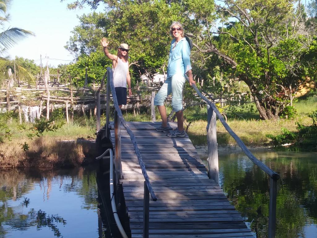
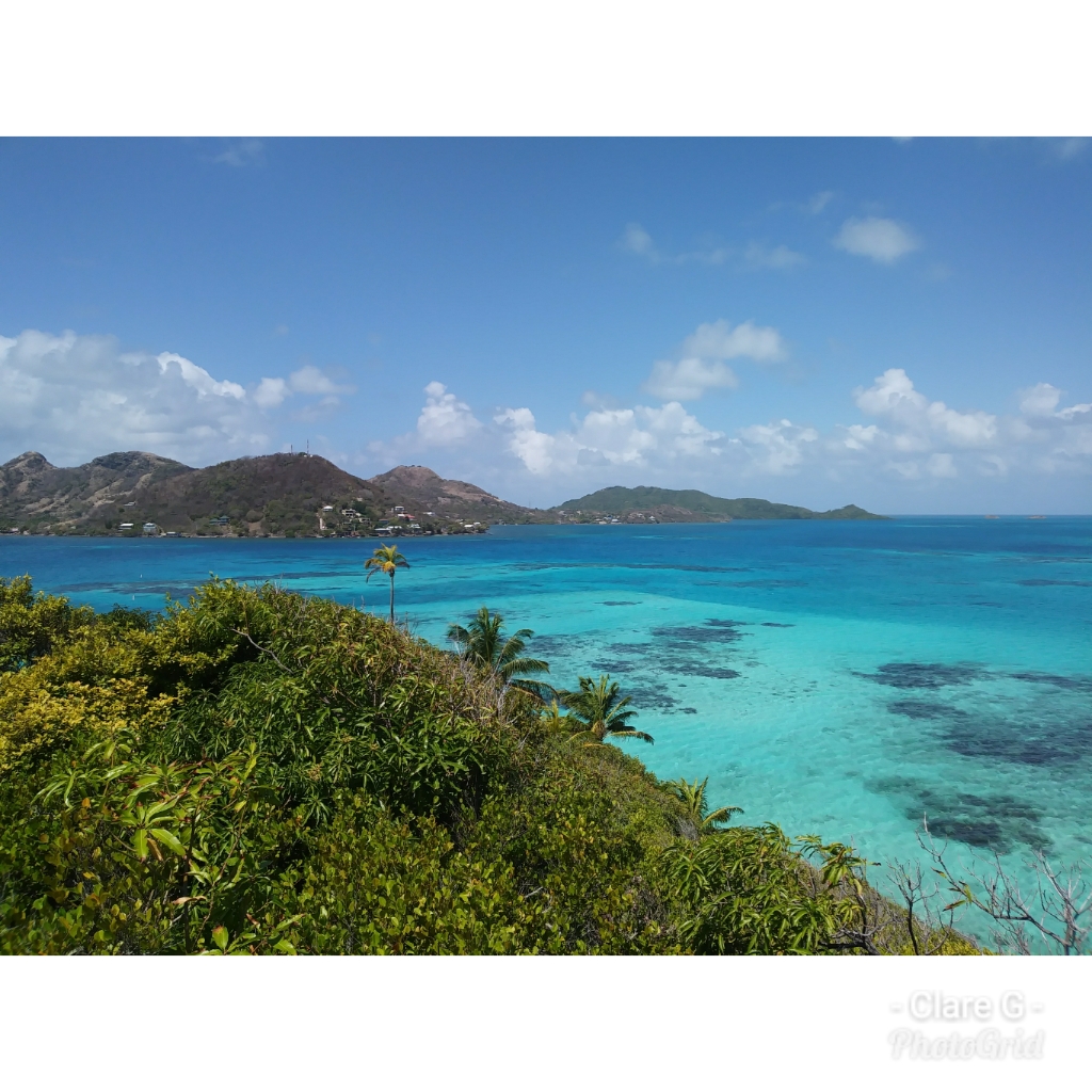
Providence Island, 65 miles north of San Andres, more than 500 miles from the Colombian mainland, is such a tiny island (just a few miles long and 8.5 square miles in area) that arriving in the company of thirty other boats seemed like a bit a pitch invasion. A huge sheltered bay formed by the main island and the small sister island of Santa Catalina (linked to the main island by a colourful but ricketty pedestrian bridge) and backed by the high island hills provided our anchorage. The locals reported to us that they had never seen so many sailing boats anchored in their bay. Fortunately, they were all seemed delighted and visited the bay after dark to photograph the twinkling anchor lights out in the bay.
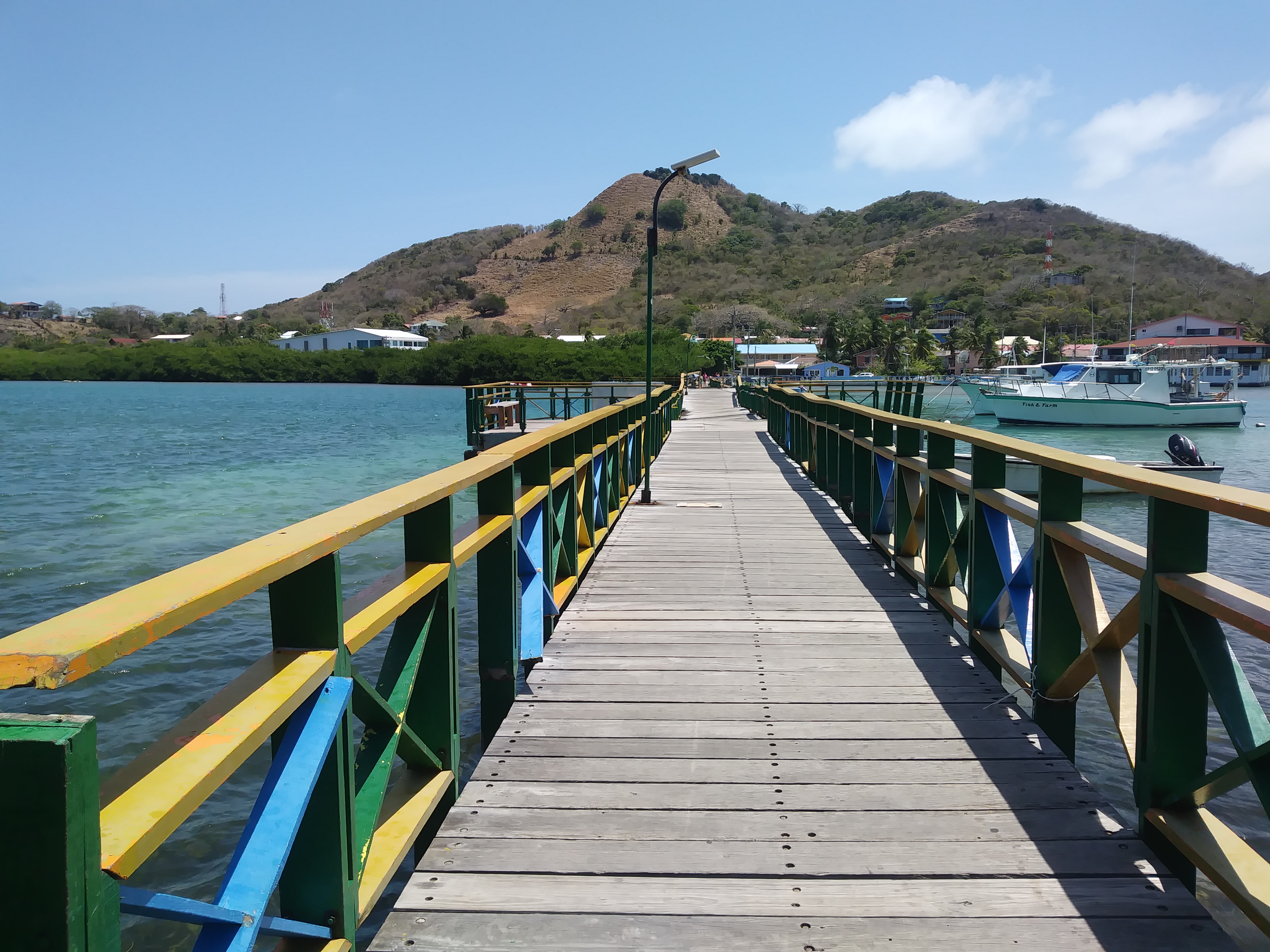
Santa Catalina Bridge
Admittedly, we caused a little congestion at the dinghy dock...
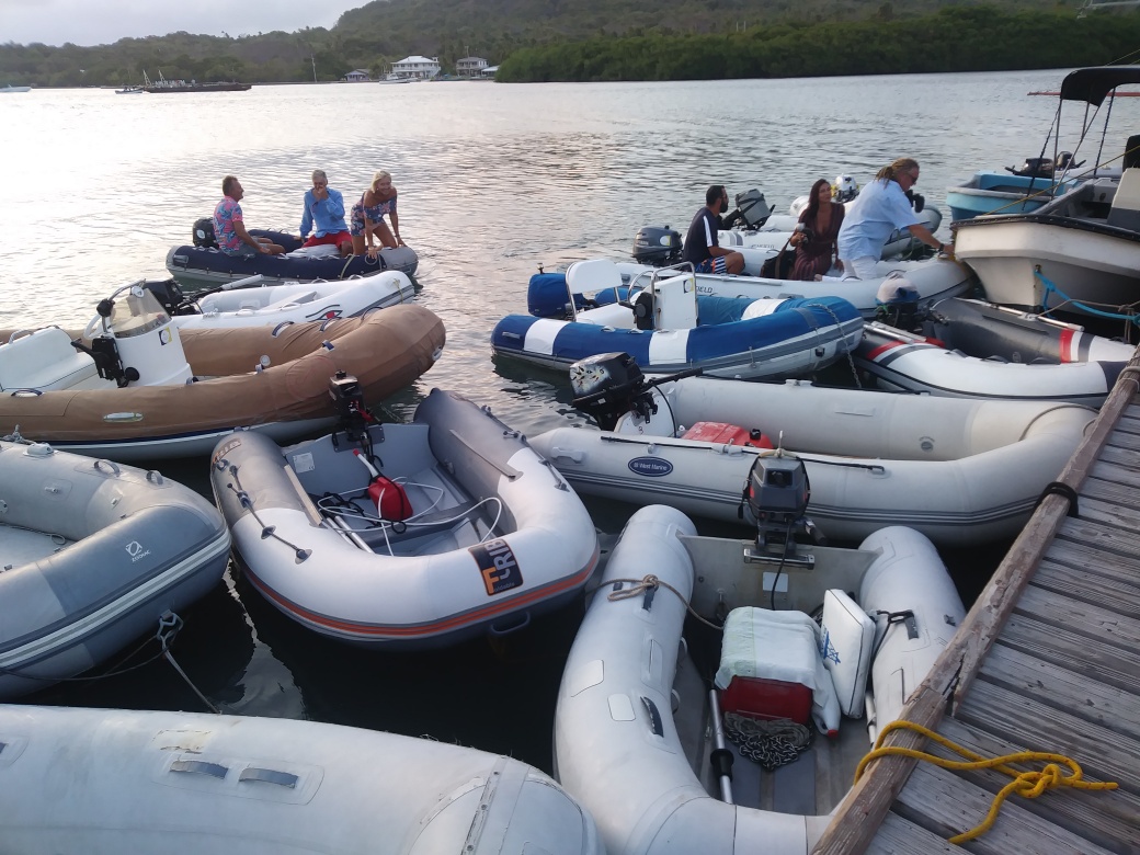
Dinghy Dock
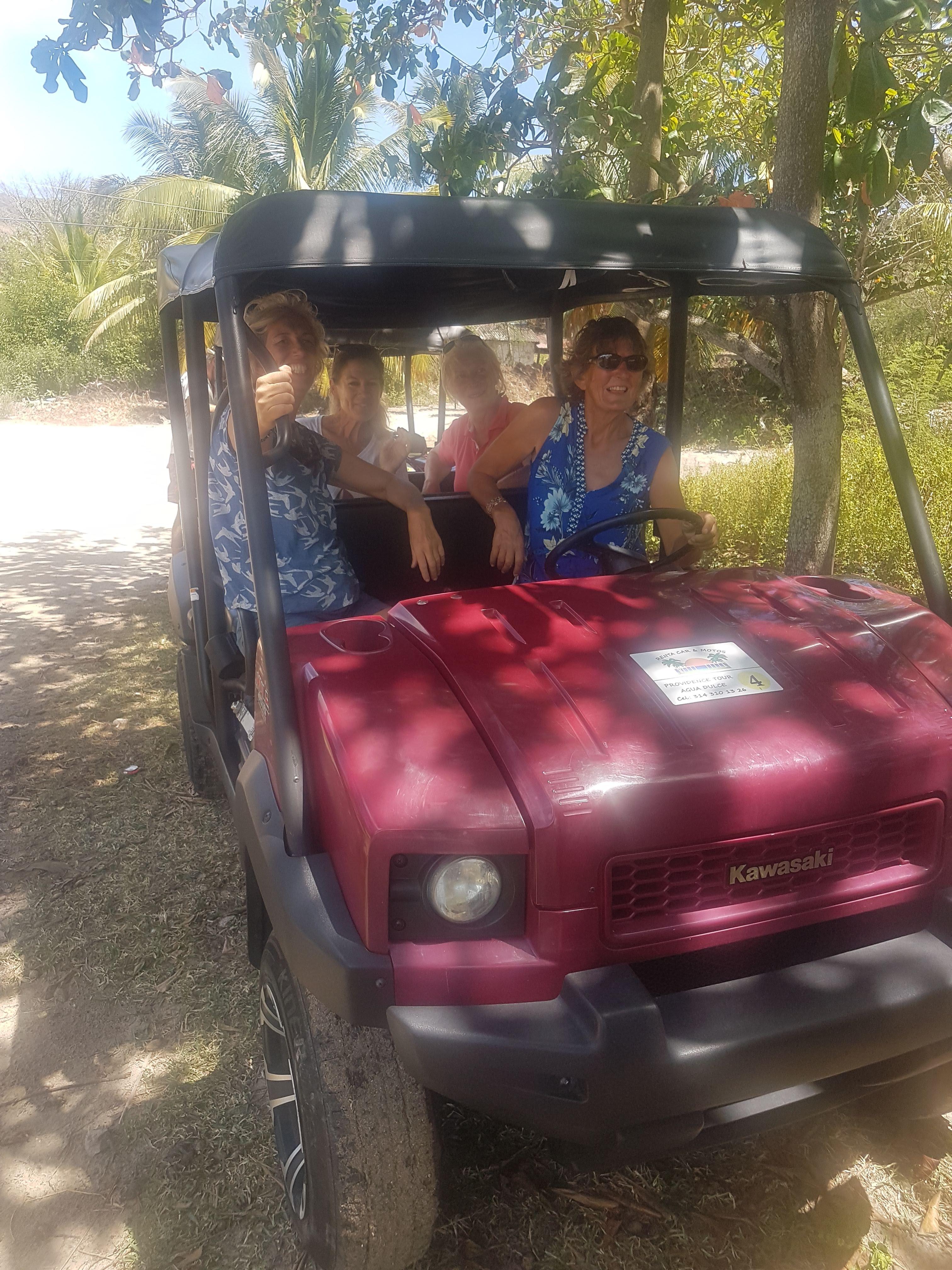
Ashore in this bay is the main island town of Santa Isabella - with a town dock, a selection of small shops including some tiny supermarkets and a hospital. From here a single narrow paved road circles the island. The main form of transport are scooters. A 5,000 COP (£1.25) payment to the driver would get you anywhere on the island. For group travel there were a number of rugged jeeps with open backs and bench seating - or alternatively one could hire a battered golf cart for the day.
Perched above our anchorage on the Catalina side were the remains of old fortifications, topped with cannon - a testament to the struggles for control over the island.
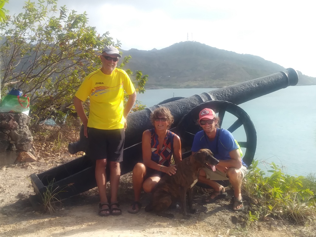
Providencia Fortifications
It all started in 1629 when a boat carrying English and Dutch Puritans arrived on the island of Providence aboard the Seaflower (their more famous friends on the Mayflower landed in the US). The island was re-taken by the Spanish a few years later - and over the years slave trading and buccaneering mixed with a little unsuccessful agriculture have been the mainstays. Providencia is now a part of Colombia, but the British influence lives on with a high percentage of the population speaking English or an English based Creole. Some resent the fact that education here is in Spanish. It appears that the Colombian government sees the value of the island in terms of the territorial waters which it gives access to. Here was evidence to of government support for some small start up enterprises;- the ice cream shop was set up with government support, as was the small cinema and the footpaths into the countryside. The employment opportunities here are limited. Few tourists come here. We learned that a shocking percentage of the adult male population are incarcerated in foreign gaols for drugs offences.
Although this may make Providence sound unappealing, the actuality was a stunningly beautiful island; and the two weeks we spent here were hugely enjoyable.
Providencia Beach
After the faded mass tourism look of San Andres the unsophisticated and simple inexpensive pleasures on offer more than compensated for the frequent lack of fresh fruit and vegetables, and the almost complete lack of internet (both items having to be bought up from mainland Columbia - now over 500 miles away). Island exploration was easy and inexpensive;- the islanders are cheerfully friendly and helpful. There was always a small shack available where someone would light a fire and cook up some fish for a tasty lunch;- with the ubiquitous rice and beans.
Simple lunch at the beach
Often, though not necessarily, the location would be some beautiful palm backed strand of white sandy beach. On one such beach we found that horse racing took place at the weekend - very exciting).
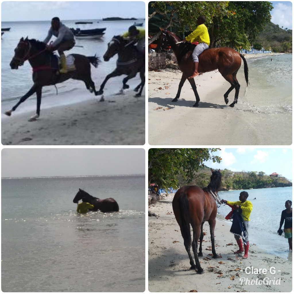
Beach horse raacing
The waters around Providence were a beautiful turquoise. David, our much appreciated extra crew, learned to dive. We enjoyed snorkelling and were taken out in a curious shallow drafted catamaran by Robert who knew just where to go to find beautiful corals and huge shoals of blue tang, angel fish, parrot fish rand other wonderful brightly coloured fish species.
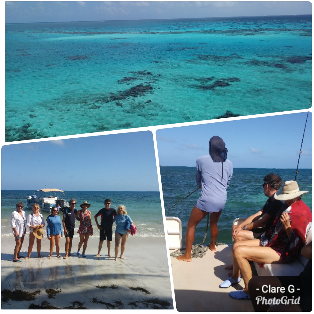
Snorkelling Day Out
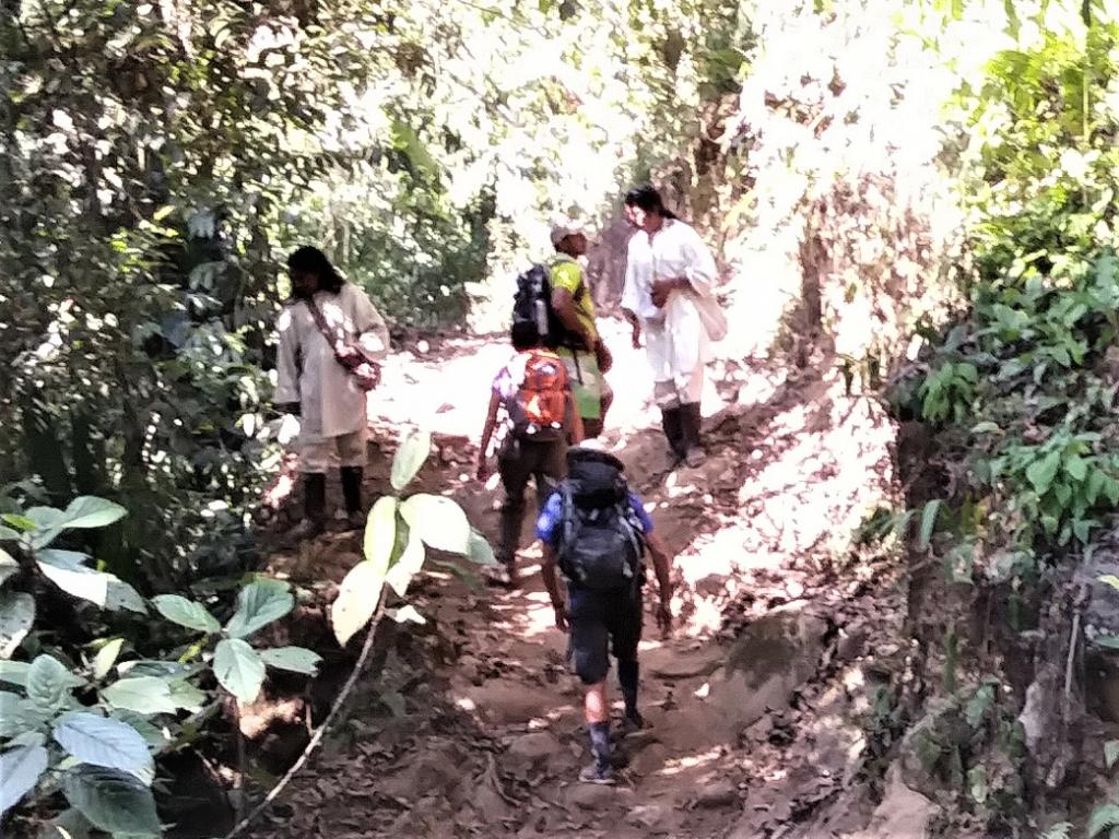
One day we climbed the highest peak - a sweaty trek through light woodlands and cloud forest up to a spectacular 360 degree view of the island.
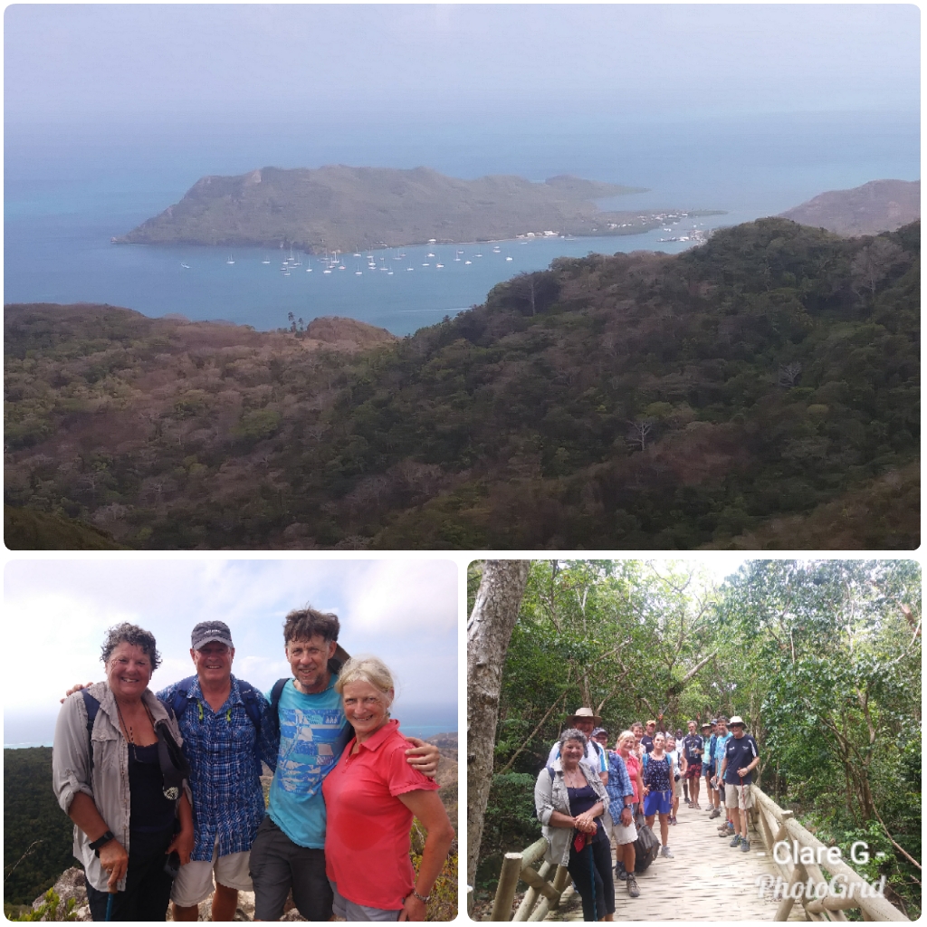
Climbing the Peak
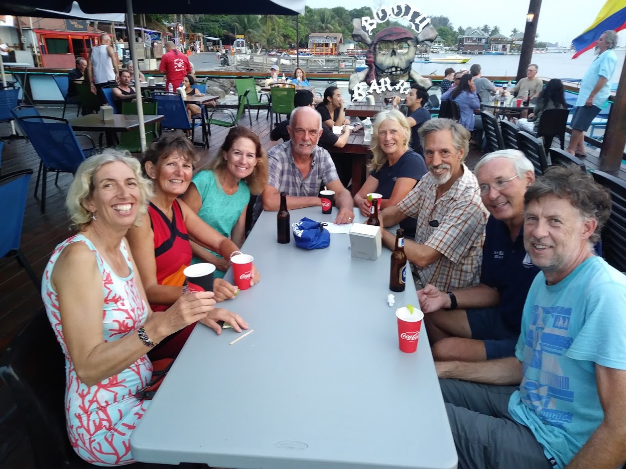
Evening entertainment was mostly limited to sharing a beer, game playing or a simple meal - or all three - with rally friends. We started to find our feet amongst the rally;- I organised an evening trip to the tiny cinema to see a string of locally made films telling us more about the islands' history and culture. Twenty of us filled the cinema;- sea breezes blew in over the ocean facing balcony and the owner (who had made the films) brought us home made lemonade and tasty snacks.
Andy joined the weather committee who puzzled over the conundrum of when the winds would allow us to sail northwards towards the Bay Islands of Honduras. Winds were forecast to be against us or too slight to be useful;- and the distance of over 400 miles was too far to motor. To complicate the decision, this passage was deemed to be rather dangerous, with the seas off of Nicaragua and Honduras being used by drug smuggling pirates. To protect us the Colombian navy was standing by with a warship and wished us to sail soon. A further complication was that the authorities needed about 48 hours notice of departure to process all the paperwork. As a rally we subdivided down into small buddy groups for the sail. Boats of similar speed and capability to sail close to the wind were put together- to give mutual support.
At last a decision was made for departure. We checked out; Boat paperwork was completed, passports were stamped and early in the morning anchors were raised and the 35 sailing boats of the rally streamed out of the bay, sailing northwards.
Santa Catalina Bridge
Admittedly, we caused a little congestion at the dinghy dock...
Dinghy Dock
Ashore in this bay is the main island town of Santa Isabella - with a town dock, a selection of small shops including some tiny supermarkets and a hospital. From here a single narrow paved road circles the island. The main form of transport are scooters. A 5,000 COP (£1.25) payment to the driver would get you anywhere on the island. For group travel there were a number of rugged jeeps with open backs and bench seating - or alternatively one could hire a battered golf cart for the day.
Perched above our anchorage on the Catalina side were the remains of old fortifications, topped with cannon - a testament to the struggles for control over the island.
Providencia Fortifications
It all started in 1629 when a boat carrying English and Dutch Puritans arrived on the island of Providence aboard the Seaflower (their more famous friends on the Mayflower landed in the US). The island was re-taken by the Spanish a few years later - and over the years slave trading and buccaneering mixed with a little unsuccessful agriculture have been the mainstays. Providencia is now a part of Colombia, but the British influence lives on with a high percentage of the population speaking English or an English based Creole. Some resent the fact that education here is in Spanish. It appears that the Colombian government sees the value of the island in terms of the territorial waters which it gives access to. Here was evidence to of government support for some small start up enterprises;- the ice cream shop was set up with government support, as was the small cinema and the footpaths into the countryside. The employment opportunities here are limited. Few tourists come here. We learned that a shocking percentage of the adult male population are incarcerated in foreign gaols for drugs offences.
Although this may make Providence sound unappealing, the actuality was a stunningly beautiful island; and the two weeks we spent here were hugely enjoyable.
Providencia Beach
After the faded mass tourism look of San Andres the unsophisticated and simple inexpensive pleasures on offer more than compensated for the frequent lack of fresh fruit and vegetables, and the almost complete lack of internet (both items having to be bought up from mainland Columbia - now over 500 miles away). Island exploration was easy and inexpensive;- the islanders are cheerfully friendly and helpful. There was always a small shack available where someone would light a fire and cook up some fish for a tasty lunch;- with the ubiquitous rice and beans.
Simple lunch at the beach
Often, though not necessarily, the location would be some beautiful palm backed strand of white sandy beach. On one such beach we found that horse racing took place at the weekend - very exciting).
Beach horse raacing
The waters around Providence were a beautiful turquoise. David, our much appreciated extra crew, learned to dive. We enjoyed snorkelling and were taken out in a curious shallow drafted catamaran by Robert who knew just where to go to find beautiful corals and huge shoals of blue tang, angel fish, parrot fish rand other wonderful brightly coloured fish species.
Snorkelling Day Out
One day we climbed the highest peak - a sweaty trek through light woodlands and cloud forest up to a spectacular 360 degree view of the island.
Climbing the Peak
Evening entertainment was mostly limited to sharing a beer, game playing or a simple meal - or all three - with rally friends. We started to find our feet amongst the rally;- I organised an evening trip to the tiny cinema to see a string of locally made films telling us more about the islands' history and culture. Twenty of us filled the cinema;- sea breezes blew in over the ocean facing balcony and the owner (who had made the films) brought us home made lemonade and tasty snacks.
Andy joined the weather committee who puzzled over the conundrum of when the winds would allow us to sail northwards towards the Bay Islands of Honduras. Winds were forecast to be against us or too slight to be useful;- and the distance of over 400 miles was too far to motor. To complicate the decision, this passage was deemed to be rather dangerous, with the seas off of Nicaragua and Honduras being used by drug smuggling pirates. To protect us the Colombian navy was standing by with a warship and wished us to sail soon. A further complication was that the authorities needed about 48 hours notice of departure to process all the paperwork. As a rally we subdivided down into small buddy groups for the sail. Boats of similar speed and capability to sail close to the wind were put together- to give mutual support.
At last a decision was made for departure. We checked out; Boat paperwork was completed, passports were stamped and early in the morning anchors were raised and the 35 sailing boats of the rally streamed out of the bay, sailing northwards.
San Andres – Colombian Holiday Island – and Meeting the Susie Too Rally
01 May 2019
Clare Glasspool
Our arrival at San Andres joined us with the group of boats touring the Western Caribbean this season called "The Susie Too Rally". Under the auspices of the Ocean Cruising Club, Suzanne Chappelle was leading a group of almost 70 boats, split into 2 groups. It had been our plan to join this group from the outset, to sail with them from Curacao in November. Circumstances had thwarted this plan - but our long sail up from Colombia had put us back on track. Although we were somewhat daunted by the prospect of sailing within such a large group, the benefits of security (in an area that has a reputation for pirate attacks), the possibility to learn and extend our knowledge, and re-joining friends and forging new friendships with like minded people were all good reasons to join in. And so, on our first morning in the San Andres anchorage we were introduced to the rally group over the early morning "net" - a vhf briefing held by the group each day.
When we went ashore it was good to be met by old friends who were able to show us around and introduce us to other group members.
Our time in San Andres was a bit of a blur. We had various boat jobs to get done;- commissioning our water maker - which, having been in a marina we had not needed until this point; investigating the cause of the "clonking" on Robbie (some loose bolts); measuring up and ordering a new batten for our mainsail (to be delivered by our friend Suzanne); commissioning our new dinghy and general cleaning up after our sail. David was on a hunt for decent wifi in order to do some skype job interviews. We discovered that internet services (like all other provisions - including fruit and veg) are delivered from mainland Colombia, hundreds of miles away, and are therefore of variable, but mostly poor quality. We discovered the best internet on our last day, in the very flashy and amazingly well equipped new library.
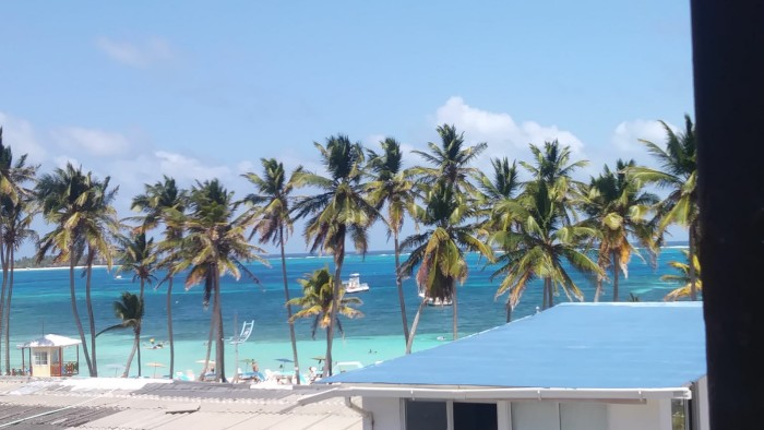
San Andres is Colombia's holiday island; Jets arrive from mainland Colombia with city dwellers looking for sand, sea and fun. Tintamarre was anchored at the back of a big, slightly rolly anchorage with poor holding, so that although our own anchor held us securely, other boats around us dragged their anchors and slid around rather alarmingly. The dinghy ride into the island dock was choppy, long and damp. Ashore we found a slightly run down resort town. The streets were busy with cars. The shops were themed around the duty free status of the island - stores selling cheap liquor (£4 bottles of rum), alternated with fancy clothes stores. It was harder to find useful shops - a small supermarket, a hardware store, a pharmacy. We didn't really have time to miss the fact that we had not yet been able to swim in the Caribbean Sea - I'm sure there must have been nice places to swim on the island, but we didn't find them in the few days we were here. I enjoyed a "ladies day" outing, with a leisurely lunch at a rustic beach restaurant whilst Andy caught up with some paid work projects.
After just a few days here it was time to "check out". Although our next port of call was to be another Colombian island paperwork had to be filed, passports, boat papers shown and dollars handed over. Perhaps unsurprisingly, the mass exodus seemed to overwhelm the local agent. Our paperwork declared us to be Canadian! All was resolved, and at 5am the next morning we raised the anchor for our sail north and east to Providencia 65 miles away.
When we went ashore it was good to be met by old friends who were able to show us around and introduce us to other group members.
Our time in San Andres was a bit of a blur. We had various boat jobs to get done;- commissioning our water maker - which, having been in a marina we had not needed until this point; investigating the cause of the "clonking" on Robbie (some loose bolts); measuring up and ordering a new batten for our mainsail (to be delivered by our friend Suzanne); commissioning our new dinghy and general cleaning up after our sail. David was on a hunt for decent wifi in order to do some skype job interviews. We discovered that internet services (like all other provisions - including fruit and veg) are delivered from mainland Colombia, hundreds of miles away, and are therefore of variable, but mostly poor quality. We discovered the best internet on our last day, in the very flashy and amazingly well equipped new library.
San Andres is Colombia's holiday island; Jets arrive from mainland Colombia with city dwellers looking for sand, sea and fun. Tintamarre was anchored at the back of a big, slightly rolly anchorage with poor holding, so that although our own anchor held us securely, other boats around us dragged their anchors and slid around rather alarmingly. The dinghy ride into the island dock was choppy, long and damp. Ashore we found a slightly run down resort town. The streets were busy with cars. The shops were themed around the duty free status of the island - stores selling cheap liquor (£4 bottles of rum), alternated with fancy clothes stores. It was harder to find useful shops - a small supermarket, a hardware store, a pharmacy. We didn't really have time to miss the fact that we had not yet been able to swim in the Caribbean Sea - I'm sure there must have been nice places to swim on the island, but we didn't find them in the few days we were here. I enjoyed a "ladies day" outing, with a leisurely lunch at a rustic beach restaurant whilst Andy caught up with some paid work projects.
After just a few days here it was time to "check out". Although our next port of call was to be another Colombian island paperwork had to be filed, passports, boat papers shown and dollars handed over. Perhaps unsurprisingly, the mass exodus seemed to overwhelm the local agent. Our paperwork declared us to be Canadian! All was resolved, and at 5am the next morning we raised the anchor for our sail north and east to Providencia 65 miles away.
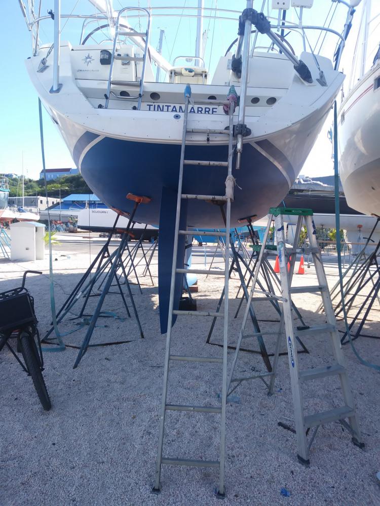
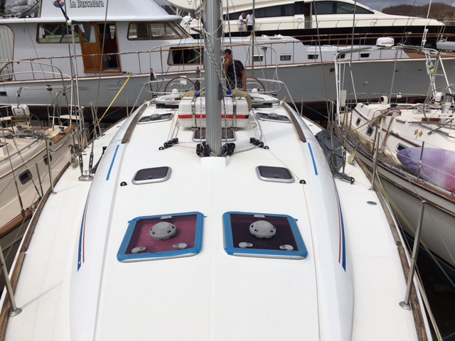
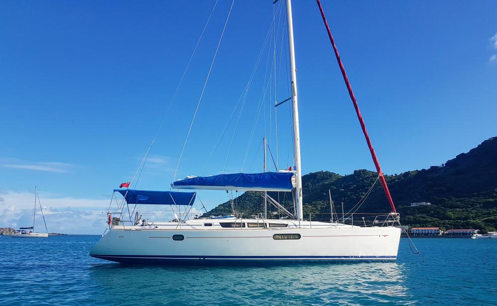
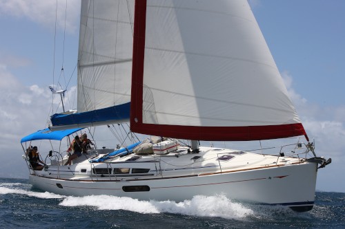
| Vessel Name: | Tintamarre |
| Vessel Make/Model: | Jeanneau SO 44i |
| Hailing Port: | Portsmouth |
| Crew: | Clare and Andrew Glasspool |
Tintamarre's Photos - Main
 |
|
|
 |
 |
|
 |
 |
|
 |
 |
.jpg) |
 |
 |
 |
 |
 |
 |
 |
 |
 |
 |
 |
 |
 |
 |
 |
 |
 |
 |
 |
|
|
 |
 |
|
 |
 |
 |
 |
walk to the boiling lake, Dominica
11 Photos
Created 27 February 2017
|
 |
 |
 |
 |
 |
 |
 |
 |
 |
Photos of Oyster Pond Marina - work not in progress
1 Photo
Created 7 November 2016
|
 |
 |
From leaving the UK - to accepting Tintamarre from Sunsail to equiping for the first steps..
15 Photos
Created 5 November 2016
|
Who: Clare and Andrew Glasspool
Port: Portsmouth
Gallery