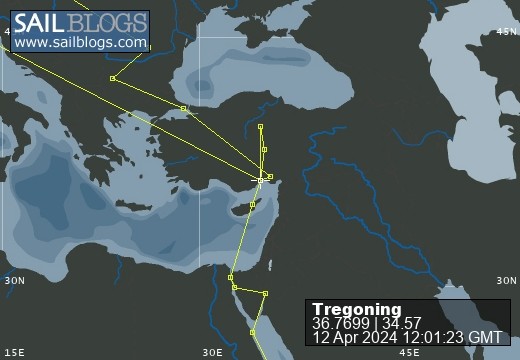
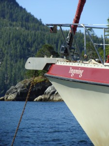
Tregoning
12 April 2024 | We are back aboard Tregoning in Mersin Marina, Mersin, Türkiye
02 April 2024 | We are in Toronto Airport, Canada: Tregoning is in Mersin Marina, Mersin, Türkiye
25 February 2024 | We are back in Gainesville, FL: Tregoning is in Mersin Marina, Mersin, Türkiye
18 February 2024 | We are in Glenwood, New Mexico: Tregoning is in Mersin Marina, Mersin, Türkiye
12 February 2024 | We are in Morro Bay, California: Tregoning is in Mersin Marina, Mersin, Türkiye
19 January 2024 | We are in Vancouver, BC Canada: Tregoning is in Mersin Marina, Mersin, Türkiye
01 January 2024 | We are in Washington State: Tregoning is in Mersin Marina, Mersin, Türkiye
15 December 2023 | We are in Minnesota: Tregoning is in Mersin Marina, Mersin, Türkiye
18 November 2023 | We are in Florida: Tregoning is in Mersin Marina, Mersin, Türkiye
29 October 2023 | We're in Florida - Tregoning is at B-dock, Mersin Marina, Mersin, Türkiye
21 October 2023 | 7 Oda Kapadokya Cave Hotel, Ürgüp, Türkiye
14 October 2023 | Hotel Aşikoğlu, Boğazkale, Türkiye
07 October 2023 | B-dock, Mersin Marina, Mersin, Türkiye
19 September 2023 | “Chez Jon & Angela”, Near Otterton, Devon, UK
14 September 2023 | Airbnb in Fortuneswell on the Isle of Portland, Dorset, UK
11 September 2023 | With Mike, Grange-over-Sands, Cumbria, UK
03 September 2023 | Ardington House, Ardington, Oxfordshire, UK
24 August 2023 | Near "Chez Joan and Peter", College of Roseisle, Moray, Scotland
11 August 2023 | Andrew's house (not exactly), Lichfield, UK
22 July 2023 | Chez Gail, near the New York Café, Budapest, Hungary
A swift ride to a new volcano
14 March 2017 | Islington Bay between Rangitoto and Motutapu Islands, Hauraki Gulf, New Zealand
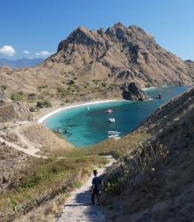
Photo: Rangitoto volcano seen from the western side of Mototapu
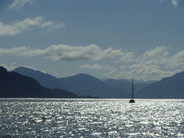
The current bout of unsettled weather, including various gale warnings, seems to be the result of a complex, stalled trough just to the east of New Zealand. We wanted to be in Auckland on Tuesday (March 14th) so we decided to bolt towards Auckland at the first opportunity, hoping that we could return to explore more of Aotea another time in more clement weather. Initially we planned to go on Saturday (which, in retrospect, might have been drier) but on Thursday, the forecast was slightly better for the following day.
Following winds of 25 knots were predicted, with gusts to 35 knots in the afternoon, so we nosed out into the Hauraki Gulf with three reefs in the mainsail, and only unfurled a third of the jib. Thanks to northern and easterly swells of around 2 m (6 feet), it was a bouncy ride but with the 20 - 25 knot wind coming over our shoulder, Tregoning went really fast. This included a moment of surfing down a wave at 10 knots of boat speed, which is the fastest we have ever seen her go without an assisting current.
The Great Barrier Island lived up to its name and protected us from the worst of the open ocean swells and there was only a narrow gap, the Colville Channel, through which the eastern swells squeezed before we were again protected, this time by the Coromandel Peninsula. The ride was actually much more enjoyable than I had anticipated and there were many birds rapidly wheeling over the waves. These included: a definitive identification of black petrels; Buller's shearwater; fluttering shearwater; diving petrels; Australasian gannets; and probably others that swept past too quickly to be identified.
A pair of short-beaked common dolphins accompanied us part of the way, riding Tregoning's bow-wave and surfing inside big waves. I went up to the bow and was instantly reminded of the utter joy of interacting with ocean mammals and, yes, they did turn sideways and stare at me as I was watching them. It was a wonderful reminder that viewing wildlife is one of the things that we love most about cruising.
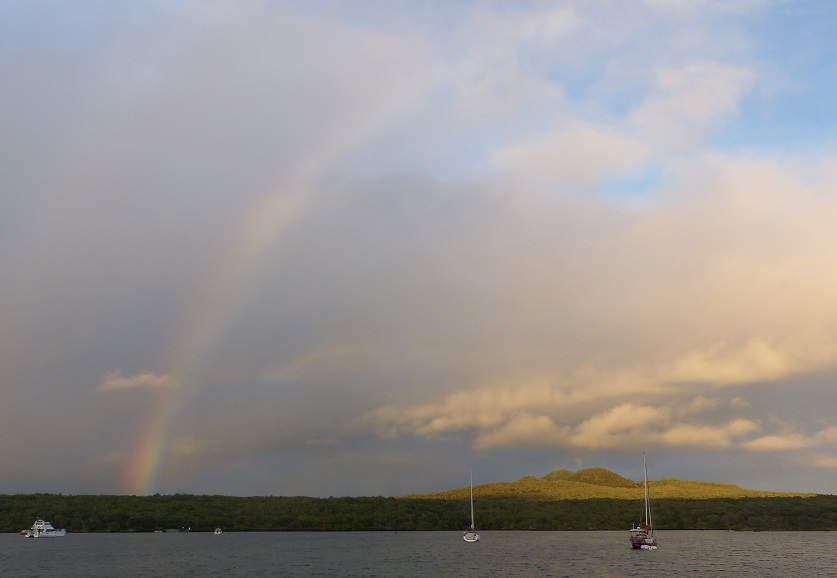
A rainbow over Rangitoto seen from Islington Bay
Approaching our destination islands from the north, we had to follow a marked channel between Waiheke Island to the east (a large, well-populated island) and Motutapu to the west. We both were desperately hoping that the gale-force winds that we were hearing mentioned on the VHF radio were not going to arrive during these maneuvers. Instead, the wind actually calmed a fraction (15 - 20 knots) but torrential rain started which limited our visibility considerably. Luckily, the fast ferries that operate in the area are easy to see with AIS on the chart-plotter and we were able to negotiate the channel and turn up into Islington Bay between Motutapu and Rangitoto Islands without interfering with any of the several ferries that flew past.
Islington Bay is a large, shallow anchorage, exposed to the south but well-protected otherwise. We assume that in the summer this bay is packed with small boats from Auckland but we arrived to find just three other cruising boats. Our anchor did not set perfectly in the soft mud on the east side of the bay and in the 20 knot winds (it took us two tries) but once we were sure that we were not dragging, it was a great relief to take off our wet clothes (especially Randall who had been at the windlass on the bow during the heaviest rain) and enjoy the wave-free water.
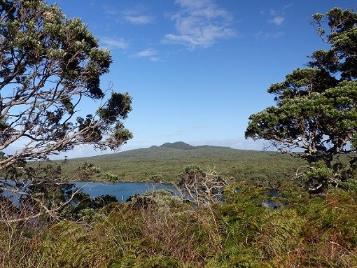
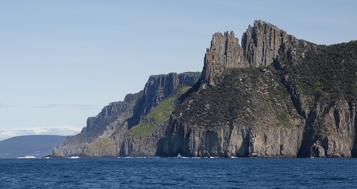
Rangitoto Island to our west, is about 5.5 km in diameter (3.4 miles), a symmetrical volcanic cone that only erupted from the sea between 550 to 600 years ago. It is the youngest island in the Hauraki Gulf and the last and largest volcano to be formed in the Auckland volcanic field. The eruptions were witnessed by the Māori inhabitants of the neighboring island, Mototapu, which is one of the oldest islands in the Gulf. Human footprints have been found there between the layers of volcanic ash from Rangitoto that landed on Mototapu.
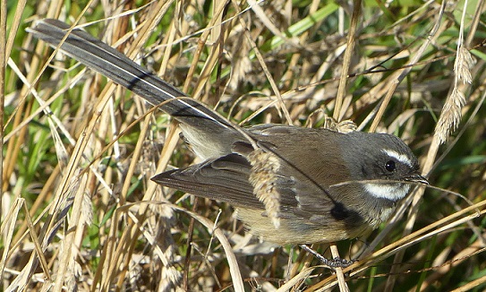
An uncooperative fantail on Motutapu - not fanning its tail
The two islands are joined by a short causeway and bridge, and both are pest-free, meaning that there are no mammalian predators. Traps for rodents are scattered all over the islands and dogs trained to smell specific pests are used as part of an ongoing program to maintain the pest-free status. Signs at all landing points instruct visitors to be very vigilant about any pests that they may unwittingly bring ashore, and because it is a kiwi habitat, pet dogs are not allowed on Rangitoto.
Rangitoto's 260 m-high (850 feet) cone is an iconic landmark seen from Auckland and the close proximity to the city (25-minute ferry service) makes it a very popular destination for day-tours. Andrew and Judith had been most enthusiastic about their visit there in November 2015, so we were keen to see the island as well as making the most of the sheltered anchorage.
Sunday had plenty of wind and rain so the ferries came through the anchorage to the Islington Wharf rather than using the wharf outside the bay that is closer to Auckland. While we stayed dry aboard Tregoning, we pitied the visitors who arrived and did not have much dry time on the island. There were about a dozen boats in the anchorage over the weekend but the number was down to four by Monday morning when the weather finally cleared-up.
Fighting a bit of headwind, we rowed west across Islington Bay to Yankee Wharf, so-named because it was used by American troops during World War II. Both islands have quite a few military sites from WWII, when it was feared that the Japanese might attack New Zealand and Auckland was considered as a possible base for US operations. The summit of the volcano made an excellent observation post but the only action seen near Auckland was the sinking of a passenger ship (no loss of life) from mines laid by a German raider in June 1940, and the sighting of an amphibious reconnaissance plane sent from a Japanese submarine in 1942.
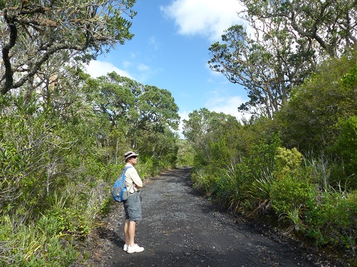
Randall on a road through the pohutukawa forest on Rangitoto Island
Several roads were made from ground-volcanic rock by prisoners and we followed one of these to the summit of the volcano. Here we found a surprisingly deep (60 m or 200 feet), 200 m-wide (650 feet) crater which is lined with thickets of manuka and kanuka shrubs. Trees are scattered around the crater's rim but in the mid-19th century, there was almost no vegetation at the volcano's summit. Most of the lava that we saw was the very rough, dark brown a` a` lava (as contrasted to the smooth coils of pahoehoe lava). Views from the loop path around the crater were spectacular, especially looking across the small volcanic cones on the Devonport Peninsula to downtown Auckland.
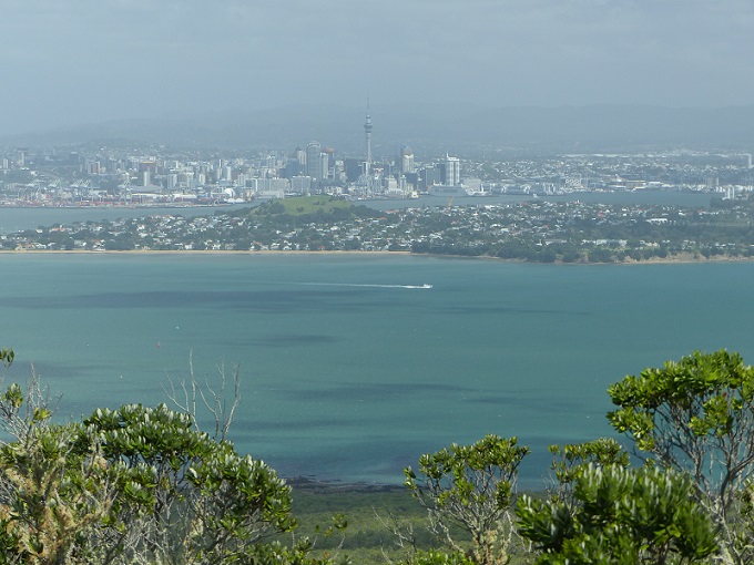
The Sky Tower in Auckland seen over the Devonport Peninsula from Rangitoto summit
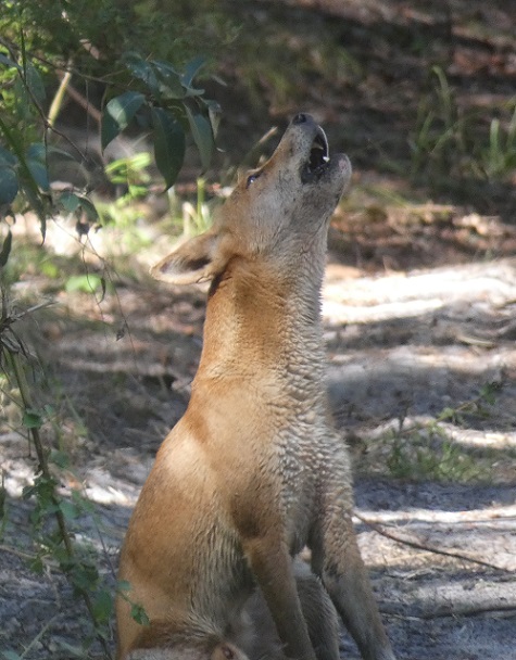
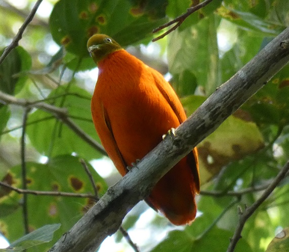
On our way to the summit, passing through the world's largest pohutukawa (a.k.a. New Zealand Christmas tree) forest, we saw the green backs of some rare endemic parakeets as they flew away from us. Being unable to see their faces we could not tell if they were yellow- or red-crowned parakeets. (The latter is listed as on Tiritiri Matangi, another Hauraki Gulf island, so maybe is the most likely candidate.) We also saw many other native birds including the ostentatious fantail, tui, North Island tomtit, silvereye, grey warbler, kingfisher, and the melodious bellbird. At the summit, we had our first sighting of a flock of small, brown quail, a locally common Australian introduction.
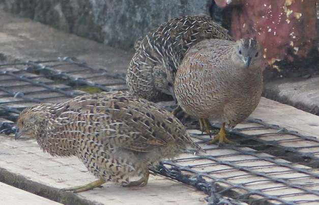
Brown quail at the WWII Observation Post on Rangitoto summit
I had really hoped to see the North Island saddleback, an endemic species that was reintroduced onto the island once all the non-native predators were removed, and I was optimistic, knowing that Judith had seen one during her visit. However, I heard their call (accurately described in our bird book as 'a "strident "cheet, te-te-te-te" like an engine turning over') in two places but never saw one. I spoke to a man at the summit when I first heard the call, and we ran in to him again later. He said that after I had looked and left the summit, he eventually did see a saddleback...lucky him, and curses that I left too soon!
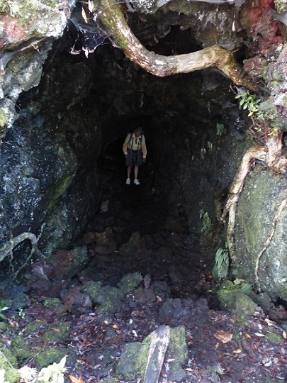
Randall emerging from a lava tunnel on Rangitoto Island
On descending from the summit heading south, we visited some lava tubes, the largest and last of which we could walk through for about 50 m (165 feet). We then continued down the trail to the main wharf, arriving in time to watch the last ferry leave with about 40 satisfied-looking visitors. We had been warned that the coastal track back to Yankee Wharf was not worth the effort so it was a bit of a trudge along the Islington Bay Road instead. At least the wind was behind us for the easy row back to Tregoning.
The following day we went ashore at the head of Islington Bay where we met a Department of Conservation employee checking rodent traps with his spaniel, trained to sniff-out the non-native rainbow skink. On our way to the bridge to Motutapu Island, we walked past some of the baches that are scattered around the shores of Rangitoto. A bach (pronounced "batch") is a small, simple holiday house (possibly named for the many cabins for bachelors installed around developing mines or railroads). By 1937, there were 101 of them on Rangitoto and there was quite a lively summer program of activities and parties on the island. Further bach construction was prohibited in 1937 and between 1939 and 1943 the island was closed to the public because of the military activities. As most baches fell into disrepair they were removed but a few are still owned and used by Auckland families but they cannot be sold and cannot be lived in permanently.
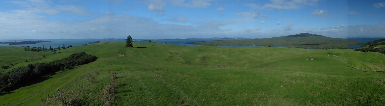
Pastures on western Motutapu with reforestation to the left and Rangitoto to the right
While the Māori had no permanent settlements on Rangitoto, just hunting and fishing camps, Motutapu has more than 300 recorded Māori archeological sites including villages, storage pits, gardens, middens, and fortified pa. The Māori would have cleared much of the island's forest and any remaining trees were destroyed during the eruption of Rangitoto. Eventually, the volcanic ash provided good agricultural soil so that Motutapu attracted intensive Māori settlement and subsequently homesteads for cattle and sheep farming. A volunteer restoration project initiated in 1992, has resulted in the planting of more than 500,000 native trees but much of the western side of the island is still covered in lush pasture grasses.
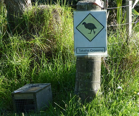
Takahe crossing sign next to a rodent trap on Motutapu Island
We followed a loop trail through some of these pastures looking for a very rare, native bird, the takahe. These were introduced to some of the Hauraki Gulf islands from near Te Anua in the Fiordland of the South Island. These birds are like a large version of the very common pukeko (purple gallinule). I was sure that I could see some takahe at the distant edge of a field but as I got closer, it became evident that they were just more pukekos. It was a lovely sunny walk nonetheless, with fine views back to Rangitoto and good sightings of the brilliantly colored eastern rosella (a parakeet introduced from Australia). However, by the time we returned to the dinghy, it had clouded over and the wind had picked-up and was on the nose for our row back to Tregoning. Once the dinghy was stowed, we raised the muddy anchor and, vowing that we would return to search again for the elusive saddleback, we motored into the wind towards Auckland Harbour.
Following winds of 25 knots were predicted, with gusts to 35 knots in the afternoon, so we nosed out into the Hauraki Gulf with three reefs in the mainsail, and only unfurled a third of the jib. Thanks to northern and easterly swells of around 2 m (6 feet), it was a bouncy ride but with the 20 - 25 knot wind coming over our shoulder, Tregoning went really fast. This included a moment of surfing down a wave at 10 knots of boat speed, which is the fastest we have ever seen her go without an assisting current.
The Great Barrier Island lived up to its name and protected us from the worst of the open ocean swells and there was only a narrow gap, the Colville Channel, through which the eastern swells squeezed before we were again protected, this time by the Coromandel Peninsula. The ride was actually much more enjoyable than I had anticipated and there were many birds rapidly wheeling over the waves. These included: a definitive identification of black petrels; Buller's shearwater; fluttering shearwater; diving petrels; Australasian gannets; and probably others that swept past too quickly to be identified.
A pair of short-beaked common dolphins accompanied us part of the way, riding Tregoning's bow-wave and surfing inside big waves. I went up to the bow and was instantly reminded of the utter joy of interacting with ocean mammals and, yes, they did turn sideways and stare at me as I was watching them. It was a wonderful reminder that viewing wildlife is one of the things that we love most about cruising.
A rainbow over Rangitoto seen from Islington Bay
Approaching our destination islands from the north, we had to follow a marked channel between Waiheke Island to the east (a large, well-populated island) and Motutapu to the west. We both were desperately hoping that the gale-force winds that we were hearing mentioned on the VHF radio were not going to arrive during these maneuvers. Instead, the wind actually calmed a fraction (15 - 20 knots) but torrential rain started which limited our visibility considerably. Luckily, the fast ferries that operate in the area are easy to see with AIS on the chart-plotter and we were able to negotiate the channel and turn up into Islington Bay between Motutapu and Rangitoto Islands without interfering with any of the several ferries that flew past.
Islington Bay is a large, shallow anchorage, exposed to the south but well-protected otherwise. We assume that in the summer this bay is packed with small boats from Auckland but we arrived to find just three other cruising boats. Our anchor did not set perfectly in the soft mud on the east side of the bay and in the 20 knot winds (it took us two tries) but once we were sure that we were not dragging, it was a great relief to take off our wet clothes (especially Randall who had been at the windlass on the bow during the heaviest rain) and enjoy the wave-free water.
Rangitoto Island to our west, is about 5.5 km in diameter (3.4 miles), a symmetrical volcanic cone that only erupted from the sea between 550 to 600 years ago. It is the youngest island in the Hauraki Gulf and the last and largest volcano to be formed in the Auckland volcanic field. The eruptions were witnessed by the Māori inhabitants of the neighboring island, Mototapu, which is one of the oldest islands in the Gulf. Human footprints have been found there between the layers of volcanic ash from Rangitoto that landed on Mototapu.
An uncooperative fantail on Motutapu - not fanning its tail
The two islands are joined by a short causeway and bridge, and both are pest-free, meaning that there are no mammalian predators. Traps for rodents are scattered all over the islands and dogs trained to smell specific pests are used as part of an ongoing program to maintain the pest-free status. Signs at all landing points instruct visitors to be very vigilant about any pests that they may unwittingly bring ashore, and because it is a kiwi habitat, pet dogs are not allowed on Rangitoto.
Rangitoto's 260 m-high (850 feet) cone is an iconic landmark seen from Auckland and the close proximity to the city (25-minute ferry service) makes it a very popular destination for day-tours. Andrew and Judith had been most enthusiastic about their visit there in November 2015, so we were keen to see the island as well as making the most of the sheltered anchorage.
Sunday had plenty of wind and rain so the ferries came through the anchorage to the Islington Wharf rather than using the wharf outside the bay that is closer to Auckland. While we stayed dry aboard Tregoning, we pitied the visitors who arrived and did not have much dry time on the island. There were about a dozen boats in the anchorage over the weekend but the number was down to four by Monday morning when the weather finally cleared-up.
Fighting a bit of headwind, we rowed west across Islington Bay to Yankee Wharf, so-named because it was used by American troops during World War II. Both islands have quite a few military sites from WWII, when it was feared that the Japanese might attack New Zealand and Auckland was considered as a possible base for US operations. The summit of the volcano made an excellent observation post but the only action seen near Auckland was the sinking of a passenger ship (no loss of life) from mines laid by a German raider in June 1940, and the sighting of an amphibious reconnaissance plane sent from a Japanese submarine in 1942.
Randall on a road through the pohutukawa forest on Rangitoto Island
Several roads were made from ground-volcanic rock by prisoners and we followed one of these to the summit of the volcano. Here we found a surprisingly deep (60 m or 200 feet), 200 m-wide (650 feet) crater which is lined with thickets of manuka and kanuka shrubs. Trees are scattered around the crater's rim but in the mid-19th century, there was almost no vegetation at the volcano's summit. Most of the lava that we saw was the very rough, dark brown a` a` lava (as contrasted to the smooth coils of pahoehoe lava). Views from the loop path around the crater were spectacular, especially looking across the small volcanic cones on the Devonport Peninsula to downtown Auckland.
The Sky Tower in Auckland seen over the Devonport Peninsula from Rangitoto summit
On our way to the summit, passing through the world's largest pohutukawa (a.k.a. New Zealand Christmas tree) forest, we saw the green backs of some rare endemic parakeets as they flew away from us. Being unable to see their faces we could not tell if they were yellow- or red-crowned parakeets. (The latter is listed as on Tiritiri Matangi, another Hauraki Gulf island, so maybe is the most likely candidate.) We also saw many other native birds including the ostentatious fantail, tui, North Island tomtit, silvereye, grey warbler, kingfisher, and the melodious bellbird. At the summit, we had our first sighting of a flock of small, brown quail, a locally common Australian introduction.
Brown quail at the WWII Observation Post on Rangitoto summit
I had really hoped to see the North Island saddleback, an endemic species that was reintroduced onto the island once all the non-native predators were removed, and I was optimistic, knowing that Judith had seen one during her visit. However, I heard their call (accurately described in our bird book as 'a "strident "cheet, te-te-te-te" like an engine turning over') in two places but never saw one. I spoke to a man at the summit when I first heard the call, and we ran in to him again later. He said that after I had looked and left the summit, he eventually did see a saddleback...lucky him, and curses that I left too soon!
Randall emerging from a lava tunnel on Rangitoto Island
On descending from the summit heading south, we visited some lava tubes, the largest and last of which we could walk through for about 50 m (165 feet). We then continued down the trail to the main wharf, arriving in time to watch the last ferry leave with about 40 satisfied-looking visitors. We had been warned that the coastal track back to Yankee Wharf was not worth the effort so it was a bit of a trudge along the Islington Bay Road instead. At least the wind was behind us for the easy row back to Tregoning.
The following day we went ashore at the head of Islington Bay where we met a Department of Conservation employee checking rodent traps with his spaniel, trained to sniff-out the non-native rainbow skink. On our way to the bridge to Motutapu Island, we walked past some of the baches that are scattered around the shores of Rangitoto. A bach (pronounced "batch") is a small, simple holiday house (possibly named for the many cabins for bachelors installed around developing mines or railroads). By 1937, there were 101 of them on Rangitoto and there was quite a lively summer program of activities and parties on the island. Further bach construction was prohibited in 1937 and between 1939 and 1943 the island was closed to the public because of the military activities. As most baches fell into disrepair they were removed but a few are still owned and used by Auckland families but they cannot be sold and cannot be lived in permanently.
Pastures on western Motutapu with reforestation to the left and Rangitoto to the right
While the Māori had no permanent settlements on Rangitoto, just hunting and fishing camps, Motutapu has more than 300 recorded Māori archeological sites including villages, storage pits, gardens, middens, and fortified pa. The Māori would have cleared much of the island's forest and any remaining trees were destroyed during the eruption of Rangitoto. Eventually, the volcanic ash provided good agricultural soil so that Motutapu attracted intensive Māori settlement and subsequently homesteads for cattle and sheep farming. A volunteer restoration project initiated in 1992, has resulted in the planting of more than 500,000 native trees but much of the western side of the island is still covered in lush pasture grasses.
Takahe crossing sign next to a rodent trap on Motutapu Island
We followed a loop trail through some of these pastures looking for a very rare, native bird, the takahe. These were introduced to some of the Hauraki Gulf islands from near Te Anua in the Fiordland of the South Island. These birds are like a large version of the very common pukeko (purple gallinule). I was sure that I could see some takahe at the distant edge of a field but as I got closer, it became evident that they were just more pukekos. It was a lovely sunny walk nonetheless, with fine views back to Rangitoto and good sightings of the brilliantly colored eastern rosella (a parakeet introduced from Australia). However, by the time we returned to the dinghy, it had clouded over and the wind had picked-up and was on the nose for our row back to Tregoning. Once the dinghy was stowed, we raised the muddy anchor and, vowing that we would return to search again for the elusive saddleback, we motored into the wind towards Auckland Harbour.
Comments
| Vessel Name: | Tregoning |
| Vessel Make/Model: | Morgan Classic 41 |
| Hailing Port: | Gainesville, FL |
| Crew: | Alison and Randall |
| About: | We cast-off from Fernandina Beach in north Florida on 1st June 2008 and we have been cruising on Tregoning ever since. Before buying Tregoning, both of us had been sailing on smaller boats for many years and had worked around boats and water throughout our careers. |
| Extra: | “Tregoning” (rhymes with “belonging”) and is a Cornish word (meaning “homestead of Cohnan” or “farm by the ash trees”) and was Alison's mother’s middle name. Cornwall is in southwest England and is where Alison grew-up. |
Tregoning's Photos - Main
 |
 |
 |
 |
 |
 |
 |
 |
 |
 |
 |
The Sailblogs Prequel: Adding old posts from expired blog
166 Photos
Created 26 May 2020
|
 |
 |
 |
 |
 |
 |
 |
 |
 |
 |
 |
 |
Extra photographs from our three-week campervan tour of the South Island from November 15th to December 5th 2015
217 Photos
Created 4 January 2016
|
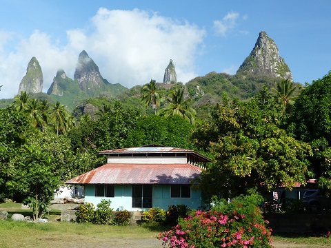 |
Random pictures from our month spent on the islands of Hiva Oa, Tahuata, Ua Pou, and Nuku Hiva
45 Photos
Created 18 July 2015
|
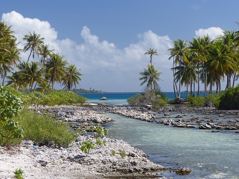 |
Random pictures from our month spent in 4 Tuamotu Atolls; Ahe, Fakarava, Tahanea, and Toau
32 Photos
Created 1 July 2015
|
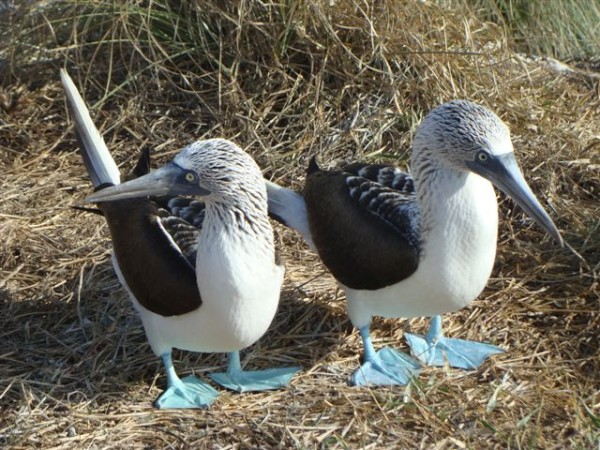 |
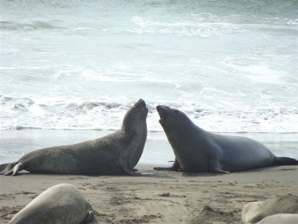
Some of the birds, fish, reptiles, and mammals (and others) that we have seen in Mexico
74 Photos
Created 5 May 2014
|
 |
Tregoning
Who: Alison and Randall
Port: Gainesville, FL
Gallery