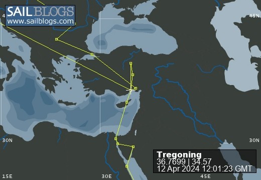
Tregoning
12 April 2024 | We are back aboard Tregoning in Mersin Marina, Mersin, Türkiye
02 April 2024 | We are in Toronto Airport, Canada: Tregoning is in Mersin Marina, Mersin, Türkiye
25 February 2024 | We are back in Gainesville, FL: Tregoning is in Mersin Marina, Mersin, Türkiye
18 February 2024 | We are in Glenwood, New Mexico: Tregoning is in Mersin Marina, Mersin, Türkiye
12 February 2024 | We are in Morro Bay, California: Tregoning is in Mersin Marina, Mersin, Türkiye
19 January 2024 | We are in Vancouver, BC Canada: Tregoning is in Mersin Marina, Mersin, Türkiye
01 January 2024 | We are in Washington State: Tregoning is in Mersin Marina, Mersin, Türkiye
15 December 2023 | We are in Minnesota: Tregoning is in Mersin Marina, Mersin, Türkiye
18 November 2023 | We are in Florida: Tregoning is in Mersin Marina, Mersin, Türkiye
29 October 2023 | We're in Florida - Tregoning is at B-dock, Mersin Marina, Mersin, Türkiye
21 October 2023 | 7 Oda Kapadokya Cave Hotel, Ürgüp, Türkiye
14 October 2023 | Hotel Aşikoğlu, Boğazkale, Türkiye
07 October 2023 | B-dock, Mersin Marina, Mersin, Türkiye
19 September 2023 | “Chez Jon & Angela”, Near Otterton, Devon, UK
14 September 2023 | Airbnb in Fortuneswell on the Isle of Portland, Dorset, UK
11 September 2023 | With Mike, Grange-over-Sands, Cumbria, UK
03 September 2023 | Ardington House, Ardington, Oxfordshire, UK
24 August 2023 | Near "Chez Joan and Peter", College of Roseisle, Moray, Scotland
11 August 2023 | Andrew's house (not exactly), Lichfield, UK
22 July 2023 | Chez Gail, near the New York Café, Budapest, Hungary
The Denison Canal shallow-cut
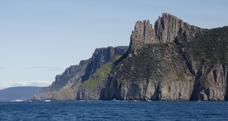
14 March 2020 | Off Shelly Beach, Prosser Bay, east Tasmania, Australia
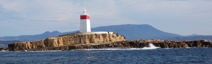
Alison Stocker | Photo: Iron Pot Lighthouse with Mount Wellington beyond
The weather-window for crossing the Bass Strait that we had seen in the forecasts, prior to our two-day excursion to southwest Tasmania, was still looking viable when we returned from the Gordon Dam. So around 7 am on Thursday (12th March) we left Prince of Wales Bay Marina having dropped-off the car and marina keys and saying goodbye to Phil, Jan, and Carl. The previous day we had seen an email from the President of the University of Florida announcing that, as of Monday, UF would be stopping all class meetings, and courses would have to be taught online. If we had been in any doubt before, this confirmed that social-distancing was going to be taken very seriously, at least, in Gainesville. We needed to go north while we still could.
The freshening wind was not in a very cooperative direction, so we motored south past Hobart and out into Storm Bay. We were very relieved to find that our boat speed was back to normal. When out with Roger and Katie, we had noticed that the speed-through-the-water for a given engine rpm was significantly reduced. Consequently, we had paid a diver to scrape the lawn of barnacles off Tregoning's hull. Normally, this is something that I would do by snorkeling but given the cold water, our hurry to leave, and the murky conditions in the marina, I was more than happy to pay someone else to do it.
We turned eastward around Iron Pot Lighthouse (a.k.a. Derwent Lighthouse) which sits on an island with slanted strata of rocks that, when seen from the southeast, perfectly imitate the slopes of Mount Wellington. Built in 1832, the square tower is the oldest lighthouse in Tasmania, the second oldest in the nation, and the first in Australia to be converted to solar power. The origin of the "Iron Pot" name of the tiny desolate island is unknown but may be related to the big iron pots used to extract oil from blubber by whalers.
We then followed the shoreline past Goats and Clifton Beaches. We cut northeast across Frederick Henry Bay, past the appropriately named Sloping Island, and were about to head across the north end of Norfolk Bay when we decided that with the easterly winds, we should find a sheltered cove in which to spend the night. We anchored off a sandy beach on the south side of Carlton Bluff and in sight of the village of Primrose Sands. With such a pretty name it was a pity not to go ashore but we had already stowed the dinghy for our ocean passage. Another sailboat, Beatrix, anchored nearby and we guessed that we would be going the same way.
We were in no hurry the next morning because we were only about 5 nm from the Denison Bridge near the mouth of the Denison Canal, and we could not pass through them until high tide, around 1:30 pm. We had booked our transit through the swing bridge several days previously so when we checked with the bridge-tender, he was expecting us and told us to call again when we got to the mouth of the canal. When the time came, we did not need to do that because Jeff and Kathy on SV Beatrix had agreed to lead the way and called for both of us. We had talked to them on the VHF radio as we both approached the canal and, learning that they had been through several times before, we suggested that we follow them. Even at high tide, there are places in the canal that are only a little deeper than our draft so any local-knowledge would be helpful. Dina and Malcolm had come this way on their arrival in Tasmania and had told us of gently touching bottom in the canal at least once.
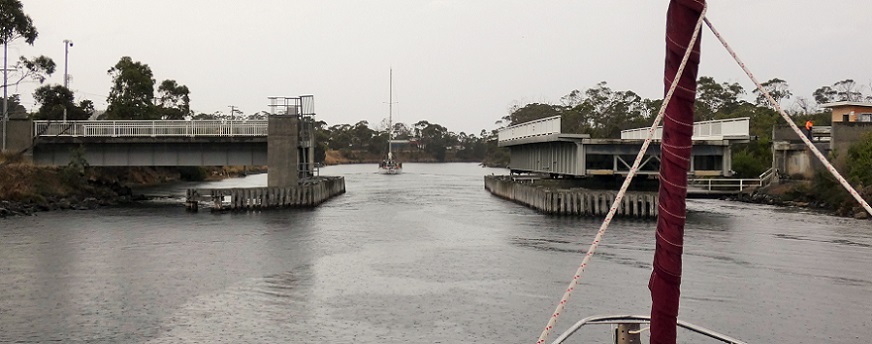
Approaching the Denison Canal Bridge following SV Beatrix
The Denison swing bridge is on the only road that connects the Forestier and Tasman Peninsulas to the rest of Tasmania. The Denison Canal was constructed in 1905 to provide a short-cut for small boats between Hobart and the east coast. It divides the first narrow isthmus that is crossed when driving from Hobart to Port Arthur, with the second even narrower isthmus being on the other end of the Forestier Peninsula, at Eaglehawk Neck.
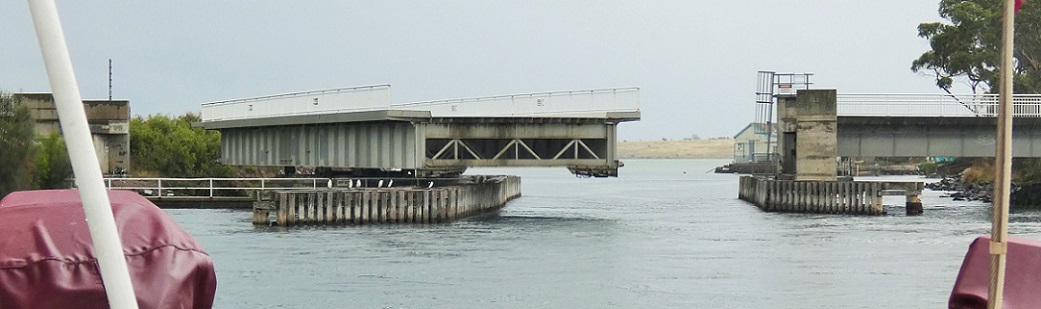
The Denison Canal Swing Bridge closing behind us
Over the years, we have been through far more bascule bridges (where the deck is rotated upwards and is balanced by a counterweight - e.g., Spit Bridge in Sydney) than horizontally rotating, swing bridges so this seemed like a bit of a novelty to us. By the time we were passing through, it was raining hard enough that I was reluctant to take the camera outside, so I had to take pictures from the cockpit rather than on the deck (hence, all the lines and other boat parts in the way).
"The Ditch" or Denison Canal
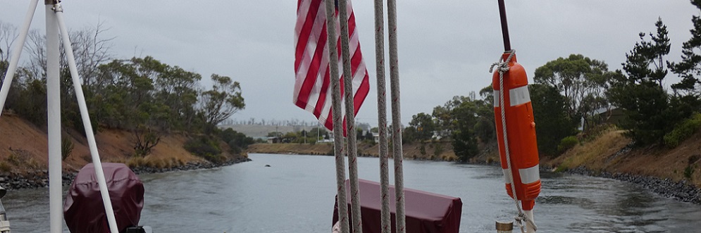
The canal itself is quite short, about 0.5 nm and is rather unceremoniously called "The Ditch". However, once the land is left behind, the narrow, shallow channel continues through even shallower tidal flats for several miles across Blackman Bay. In the rain it was not particularly scenic but SV Beatrix led us well and we never touched the bottom which was a relief. As we were about to leave the channel, a familiar American boat passed in the opposite direction, SV Philiosophy. We had first met Kim, at Big Mama's Restaurant and anchorage in Tonga then in Whangarei, New Zealand, and most recently on the Bundaberg Rally. If he was planning to go through the canal and bridge, we hoped that he would get there with enough water-depth but maybe his draft was less than ours.
By the time we rounded Long Spit and left the channel, it was still raining hard and the wind had increased but it was now in a useful direction. So we unfurled the jib and enjoyed sailing northeast across Marion Bay towards the south end of Maria Island. Turning slightly more northerly, to get through Mercury Passage (between Maria Island and the mainland), we motor-sailed to keep the appropriate angle. We were also keen to arrive in the unfamiliar anchorage in Prosser Bay before dark. We managed this by getting there before 6:30 pm and, with the raining stopping soon thereafter, we enjoyed a lovely calm night on a public mooring. To the north of Orford, with binoculars I could identify the beach where Katie, Roger, and I had stopped briefly on our way to the Freycinet Peninsula. Jeff on SV Beatrix had told us that they were going a little further north up Spring Bay to the small town of Triabunna. They were expecting to pick-up a delivery there before they left to cross the Bass Strait, so we did not expect to see them again in Tasmania.
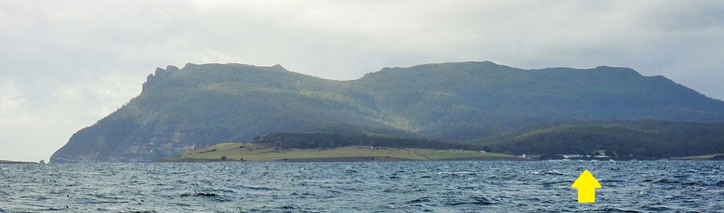
North end of Maria Island with the small community and former penal settlement of Darlington indicted by the yellow arrow
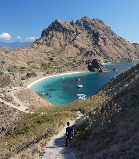
On Saturday, we sailed off the mooring around 8:30 am with about 340 nm to go to the entrance of Twofold Bay (where Eden is located). Passing north of Maria Island, we had a fairly good view of where the old penal settlement had been at Darlington. A regular ferry travels between Triabunna and Darlington but there are no sealed roads or cars in the Maria Island National Park. With trails to the impressive north-coast cliffs and the central peak of Northern Maria Island, Mount Maria (711 m or 2,333 feet), the Park is a popular place to camp or stay in the former penitentiary, now a hostel. We would have loved to have been able to explore the island, its various anchorages, trails, and profusion of protected wildlife, but time had run out for us so we regretfully left it in our wake.
As we rounded Schouten Island, at the south end of the Freycinet Peninsula, we had to reduce the jib because the following wind was up to 20 knots. The mainsail was triple-reefed so changing the size of the jib was our easiest mechanism to control our speed. Furling-in the jib in a strong wind takes quite a bit of effort even when using a winch, so we tried not to change it too often. It was good to be going fairly fast but in the 3 m (10 feet) waves, we wanted a bit more control than we had with the full jib. Fortunately, the wind and waves eased a bit before nightfall but we could maintain a respectable speed even with the reefed main and jib and with about 1 knot of opposing current. During the night we were passed by the cruise-ship Magnifica which was heading to Sydney. We wondered if they would have any problems with quarantine restrictions on arrival there or if they had only been to Australian ports on their voyage and the passengers and crew were all healthy.
By Sunday afternoon, even with the full jib unfurled, our over-ground speed had dropped below 4 knots. While this would often be quite acceptable, Randall was anxious that we maintained sufficient speed to arrive in Eden before the winds turned northerly again. Thus, we had start the engine and motor-sail. The following wind was just sufficient that we could keep the jib out and as the wind waxed and waned we adjusted the engine speed to maintain 5 to 6 knots of speed-over-ground. It was not exactly the conservation of fuel that we would have preferred but being caught south of Twofold Bay, with few comfortable options for anchoring, when the northerly winds picked-up was not appealing. We had filled the diesel tank at the Royal Yacht Club of Tasmania (just south of Hobart) the day before we left on our road-trip to Strathgordon so we knew that we should not need to refuel for a long time.
Monday was similar to Sunday afternoon and we were enjoying many sightings of shy albatrosses and muttonbirds. I was treated to seeing a huge pod of what I think were pantropical spotted dolphins. It seemed a little far south for them which may explain why they were passing us to dash north. By 6:30 pm, Randall had sung the "Land Ho!" song and we felt lucky to have had a relatively easy crossing of Bass Strait. Most of the land he could see then was in Victoria but by the time we got close to the coast off Cape Howe, we were crossing the border into New South Wales. This left us only 28 nm to the mouth of Twofold Bay which we reached just before dawn. We motored very slowly across the Bay to let the sun rise and with great relief we dropped the anchor in the shelter of Eden's long commercial wharf in Snug Cove. The forecasts suggested that it would be at least a week before we could continue moving north but we were happy to be in the familiar waters of Twofold Bay and we were very thankful to have reached the Australian mainland before long-distance travel restrictions might halt us. Now it was time for a long nap and then a chance, after a three day hiatus, to catch-up via the internet and local radio on the world's news in the face of the worsening coronavirus pandemic.
The freshening wind was not in a very cooperative direction, so we motored south past Hobart and out into Storm Bay. We were very relieved to find that our boat speed was back to normal. When out with Roger and Katie, we had noticed that the speed-through-the-water for a given engine rpm was significantly reduced. Consequently, we had paid a diver to scrape the lawn of barnacles off Tregoning's hull. Normally, this is something that I would do by snorkeling but given the cold water, our hurry to leave, and the murky conditions in the marina, I was more than happy to pay someone else to do it.
We turned eastward around Iron Pot Lighthouse (a.k.a. Derwent Lighthouse) which sits on an island with slanted strata of rocks that, when seen from the southeast, perfectly imitate the slopes of Mount Wellington. Built in 1832, the square tower is the oldest lighthouse in Tasmania, the second oldest in the nation, and the first in Australia to be converted to solar power. The origin of the "Iron Pot" name of the tiny desolate island is unknown but may be related to the big iron pots used to extract oil from blubber by whalers.
We then followed the shoreline past Goats and Clifton Beaches. We cut northeast across Frederick Henry Bay, past the appropriately named Sloping Island, and were about to head across the north end of Norfolk Bay when we decided that with the easterly winds, we should find a sheltered cove in which to spend the night. We anchored off a sandy beach on the south side of Carlton Bluff and in sight of the village of Primrose Sands. With such a pretty name it was a pity not to go ashore but we had already stowed the dinghy for our ocean passage. Another sailboat, Beatrix, anchored nearby and we guessed that we would be going the same way.
We were in no hurry the next morning because we were only about 5 nm from the Denison Bridge near the mouth of the Denison Canal, and we could not pass through them until high tide, around 1:30 pm. We had booked our transit through the swing bridge several days previously so when we checked with the bridge-tender, he was expecting us and told us to call again when we got to the mouth of the canal. When the time came, we did not need to do that because Jeff and Kathy on SV Beatrix had agreed to lead the way and called for both of us. We had talked to them on the VHF radio as we both approached the canal and, learning that they had been through several times before, we suggested that we follow them. Even at high tide, there are places in the canal that are only a little deeper than our draft so any local-knowledge would be helpful. Dina and Malcolm had come this way on their arrival in Tasmania and had told us of gently touching bottom in the canal at least once.
Approaching the Denison Canal Bridge following SV Beatrix
The Denison swing bridge is on the only road that connects the Forestier and Tasman Peninsulas to the rest of Tasmania. The Denison Canal was constructed in 1905 to provide a short-cut for small boats between Hobart and the east coast. It divides the first narrow isthmus that is crossed when driving from Hobart to Port Arthur, with the second even narrower isthmus being on the other end of the Forestier Peninsula, at Eaglehawk Neck.
The Denison Canal Swing Bridge closing behind us
Over the years, we have been through far more bascule bridges (where the deck is rotated upwards and is balanced by a counterweight - e.g., Spit Bridge in Sydney) than horizontally rotating, swing bridges so this seemed like a bit of a novelty to us. By the time we were passing through, it was raining hard enough that I was reluctant to take the camera outside, so I had to take pictures from the cockpit rather than on the deck (hence, all the lines and other boat parts in the way).
"The Ditch" or Denison Canal
The canal itself is quite short, about 0.5 nm and is rather unceremoniously called "The Ditch". However, once the land is left behind, the narrow, shallow channel continues through even shallower tidal flats for several miles across Blackman Bay. In the rain it was not particularly scenic but SV Beatrix led us well and we never touched the bottom which was a relief. As we were about to leave the channel, a familiar American boat passed in the opposite direction, SV Philiosophy. We had first met Kim, at Big Mama's Restaurant and anchorage in Tonga then in Whangarei, New Zealand, and most recently on the Bundaberg Rally. If he was planning to go through the canal and bridge, we hoped that he would get there with enough water-depth but maybe his draft was less than ours.
By the time we rounded Long Spit and left the channel, it was still raining hard and the wind had increased but it was now in a useful direction. So we unfurled the jib and enjoyed sailing northeast across Marion Bay towards the south end of Maria Island. Turning slightly more northerly, to get through Mercury Passage (between Maria Island and the mainland), we motor-sailed to keep the appropriate angle. We were also keen to arrive in the unfamiliar anchorage in Prosser Bay before dark. We managed this by getting there before 6:30 pm and, with the raining stopping soon thereafter, we enjoyed a lovely calm night on a public mooring. To the north of Orford, with binoculars I could identify the beach where Katie, Roger, and I had stopped briefly on our way to the Freycinet Peninsula. Jeff on SV Beatrix had told us that they were going a little further north up Spring Bay to the small town of Triabunna. They were expecting to pick-up a delivery there before they left to cross the Bass Strait, so we did not expect to see them again in Tasmania.
North end of Maria Island with the small community and former penal settlement of Darlington indicted by the yellow arrow
On Saturday, we sailed off the mooring around 8:30 am with about 340 nm to go to the entrance of Twofold Bay (where Eden is located). Passing north of Maria Island, we had a fairly good view of where the old penal settlement had been at Darlington. A regular ferry travels between Triabunna and Darlington but there are no sealed roads or cars in the Maria Island National Park. With trails to the impressive north-coast cliffs and the central peak of Northern Maria Island, Mount Maria (711 m or 2,333 feet), the Park is a popular place to camp or stay in the former penitentiary, now a hostel. We would have loved to have been able to explore the island, its various anchorages, trails, and profusion of protected wildlife, but time had run out for us so we regretfully left it in our wake.
As we rounded Schouten Island, at the south end of the Freycinet Peninsula, we had to reduce the jib because the following wind was up to 20 knots. The mainsail was triple-reefed so changing the size of the jib was our easiest mechanism to control our speed. Furling-in the jib in a strong wind takes quite a bit of effort even when using a winch, so we tried not to change it too often. It was good to be going fairly fast but in the 3 m (10 feet) waves, we wanted a bit more control than we had with the full jib. Fortunately, the wind and waves eased a bit before nightfall but we could maintain a respectable speed even with the reefed main and jib and with about 1 knot of opposing current. During the night we were passed by the cruise-ship Magnifica which was heading to Sydney. We wondered if they would have any problems with quarantine restrictions on arrival there or if they had only been to Australian ports on their voyage and the passengers and crew were all healthy.
By Sunday afternoon, even with the full jib unfurled, our over-ground speed had dropped below 4 knots. While this would often be quite acceptable, Randall was anxious that we maintained sufficient speed to arrive in Eden before the winds turned northerly again. Thus, we had start the engine and motor-sail. The following wind was just sufficient that we could keep the jib out and as the wind waxed and waned we adjusted the engine speed to maintain 5 to 6 knots of speed-over-ground. It was not exactly the conservation of fuel that we would have preferred but being caught south of Twofold Bay, with few comfortable options for anchoring, when the northerly winds picked-up was not appealing. We had filled the diesel tank at the Royal Yacht Club of Tasmania (just south of Hobart) the day before we left on our road-trip to Strathgordon so we knew that we should not need to refuel for a long time.
Monday was similar to Sunday afternoon and we were enjoying many sightings of shy albatrosses and muttonbirds. I was treated to seeing a huge pod of what I think were pantropical spotted dolphins. It seemed a little far south for them which may explain why they were passing us to dash north. By 6:30 pm, Randall had sung the "Land Ho!" song and we felt lucky to have had a relatively easy crossing of Bass Strait. Most of the land he could see then was in Victoria but by the time we got close to the coast off Cape Howe, we were crossing the border into New South Wales. This left us only 28 nm to the mouth of Twofold Bay which we reached just before dawn. We motored very slowly across the Bay to let the sun rise and with great relief we dropped the anchor in the shelter of Eden's long commercial wharf in Snug Cove. The forecasts suggested that it would be at least a week before we could continue moving north but we were happy to be in the familiar waters of Twofold Bay and we were very thankful to have reached the Australian mainland before long-distance travel restrictions might halt us. Now it was time for a long nap and then a chance, after a three day hiatus, to catch-up via the internet and local radio on the world's news in the face of the worsening coronavirus pandemic.
Comments
| Vessel Name: | Tregoning |
| Vessel Make/Model: | Morgan Classic 41 |
| Hailing Port: | Gainesville, FL |
| Crew: | Alison and Randall |
| About: | We cast-off from Fernandina Beach in north Florida on 1st June 2008 and we have been cruising on Tregoning ever since. Before buying Tregoning, both of us had been sailing on smaller boats for many years and had worked around boats and water throughout our careers. |
| Extra: | “Tregoning” (rhymes with “belonging”) and is a Cornish word (meaning “homestead of Cohnan” or “farm by the ash trees”) and was Alison's mother’s middle name. Cornwall is in southwest England and is where Alison grew-up. |
Tregoning's Photos - Main
 |
 |
 |
 |
 |
 |
 |
 |
 |
 |
 |
The Sailblogs Prequel: Adding old posts from expired blog
166 Photos
Created 26 May 2020
|
 |
 |
 |
 |
 |
 |
 |
 |
 |
 |
 |
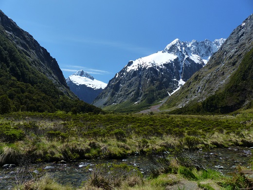 |
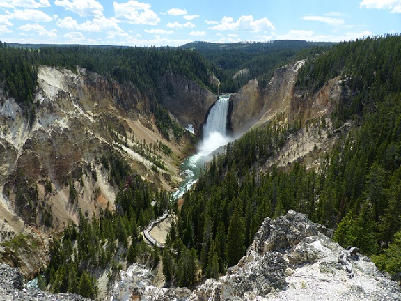
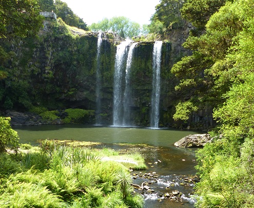
Extra photographs from our three-week campervan tour of the South Island from November 15th to December 5th 2015
217 Photos
Created 4 January 2016
|
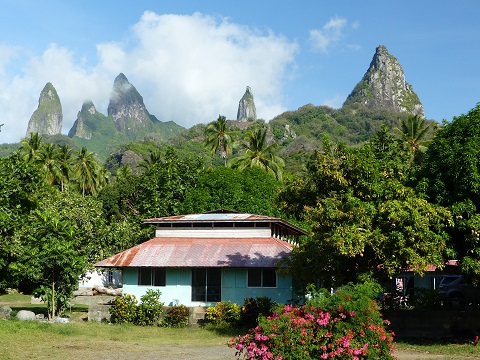 |
Random pictures from our month spent on the islands of Hiva Oa, Tahuata, Ua Pou, and Nuku Hiva
45 Photos
Created 18 July 2015
|
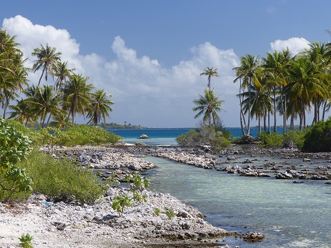 |
Random pictures from our month spent in 4 Tuamotu Atolls; Ahe, Fakarava, Tahanea, and Toau
32 Photos
Created 1 July 2015
|
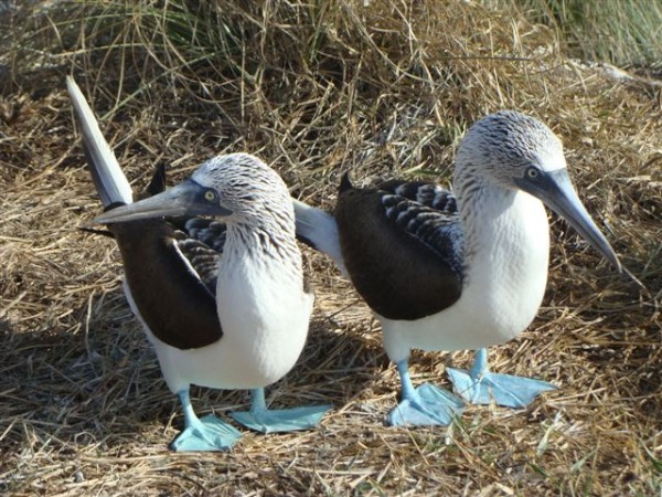 |
Some of the birds, fish, reptiles, and mammals (and others) that we have seen in Mexico
74 Photos
Created 5 May 2014
|
 |
Tregoning
Who: Alison and Randall
Port: Gainesville, FL
Gallery