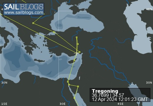
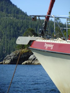
Tregoning
12 April 2024 | We are back aboard Tregoning in Mersin Marina, Mersin, Türkiye
02 April 2024 | We are in Toronto Airport, Canada: Tregoning is in Mersin Marina, Mersin, Türkiye
25 February 2024 | We are back in Gainesville, FL: Tregoning is in Mersin Marina, Mersin, Türkiye
18 February 2024 | We are in Glenwood, New Mexico: Tregoning is in Mersin Marina, Mersin, Türkiye
12 February 2024 | We are in Morro Bay, California: Tregoning is in Mersin Marina, Mersin, Türkiye
19 January 2024 | We are in Vancouver, BC Canada: Tregoning is in Mersin Marina, Mersin, Türkiye
01 January 2024 | We are in Washington State: Tregoning is in Mersin Marina, Mersin, Türkiye
15 December 2023 | We are in Minnesota: Tregoning is in Mersin Marina, Mersin, Türkiye
18 November 2023 | We are in Florida: Tregoning is in Mersin Marina, Mersin, Türkiye
29 October 2023 | We're in Florida - Tregoning is at B-dock, Mersin Marina, Mersin, Türkiye
21 October 2023 | 7 Oda Kapadokya Cave Hotel, Ürgüp, Türkiye
14 October 2023 | Hotel Aşikoğlu, Boğazkale, Türkiye
07 October 2023 | B-dock, Mersin Marina, Mersin, Türkiye
19 September 2023 | “Chez Jon & Angela”, Near Otterton, Devon, UK
14 September 2023 | Airbnb in Fortuneswell on the Isle of Portland, Dorset, UK
11 September 2023 | With Mike, Grange-over-Sands, Cumbria, UK
03 September 2023 | Ardington House, Ardington, Oxfordshire, UK
24 August 2023 | Near "Chez Joan and Peter", College of Roseisle, Moray, Scotland
11 August 2023 | Andrew's house (not exactly), Lichfield, UK
22 July 2023 | Chez Gail, near the New York Café, Budapest, Hungary
Remembering to check the tidal range!
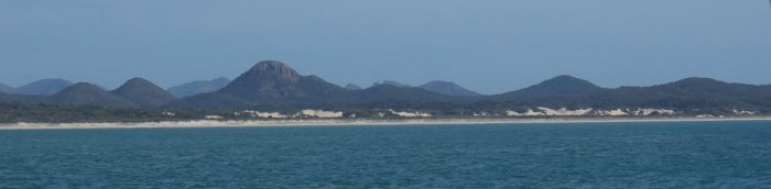
22 September 2021 | South Arm, Port Clinton, QLD, Australia
Alison Stocker | Photo: Sand dunes along the west coast of Port Clinton under Mount Gibraltar
After our delightful three-day vacation from the boat, it was a busy weekend as we got ready to leave on Monday morning on the next stage of our southerly migration. We did not know exactly how long we would be away from shops and phone coverage once we set sail, so we used the car to stock-up with groceries before returning it to the airport. We responded to emails and took care of other internet matters as much as possible, despite the rather slow connection in the marina. I completed three loads of laundry and we prepared the boat for another overnight passage.
We also managed to get some exercise by joining the many other people on Saturday evening who were enjoying the 3.2 km walk or bike-ride along the southern breakwater and back. The next morning, we ran or walked south along a trail and sandy road to the mouth of the Pioneer River. If we had been staying for longer, it would have been an interesting area to go birding, but we needed to catch the next weather-window to go south. That started on Monday morning, so even though we had a day left on our week’s stay at the Mackay Marina, we quietly left at 6:45 am.
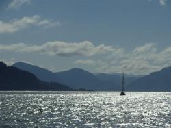
After getting away from the breakwater and the confused seas that the reflected waves created, we raised the mainsail, unfurled the jib, and actually started sailing and turned off the engine...woohoo! Shockingly, this was the first time that we had actually sailed without the motor since leaving Cairns. Depressingly, it only lasted for 36 minutes. The wind was not as easterly as had been forecast and our southerly course was aiming us towards the long coal-loading jetty at Hay Point. Although we could have gybed, we needed to make good progress southeastward, into the wind, so we reluctantly started the engine and furled the jib.
We made our way between the 16 anchored ships that were waiting to be loaded with coal at Hay Point. Using diesel fuel to motor-sail pass coal-exporting ships felt like a treacherous rebuke to our concerns about global climate change. We could only hope that as spring arrived and we progressed further south, sailing would become a more viable option. If only we had not had to get to Moreton Bay so early...or maybe we should have paid the import tax in Cairns?
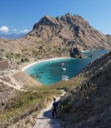
The wind gradually decreased until conditions were glassy by the evening. With a full moon, it was rather beautiful weaving between the many small islands of the Northumberland Group. We continued past Middle and South Percy Island during the night. We had considered stopping there as we had not visited Middle Percy before and other cruisers have raved about hiking ashore and visiting the homestead and the shed decorated with the names of many boats and crews. However, there was not enough time to enjoy these things before the next southeasterly blow and the West Bay anchorage at Middle Percy is prone to the swell. Thus it would not be very comfortable to stay there during those winds and we were not excited about revisiting South Percy. Instead, we planned to go to Island Head Creek, which we visited last year, or 12 nm further south to Port Clinton which we had never visited. Conditions allowing, we might as well go to a new site.
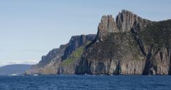
The wind had increased a little during the night and with an assisting current we were making good speed-over-ground between 5 to 7 knots, so we reduced the engine rpm until dawn. After passing the entrance to Island Head Creek, we made a slight detour to look at Pearl Bay. As we had been told, this was a very pretty anchorage with a golden sand beach overlooked by a steep, forested hillside on the mainland, and rocky islands which should protect the anchorage from wind waves in all directions. Unfortunately, this anchorage is “less than comfortable in developed winds, the swell entering the bay as a constant surge” (from Lucas – Cruising the Coral Coast).

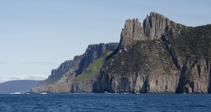
Rugged coastline just south of Pearl Bay
On entering Port Clinton, we found two boats anchored just south of Mount Flinders on the east side of the uninhabited harbor. However, that area looked quite exposed from the south so we continued into the South Arm to a bend that was well-protected by mangroves, just short of the military boat ramp. Port Clinton is part of the Shoalwater Bay Military Training Area so we could not go ashore, especially not at the tempting boat ramp. We had checked online to find that the inner parts of the military area would be closed later in the week but not these coastal anchorages.
Motoring south through Port Clinton, the cockpit was invaded by about a dozen large, green-eyed flies. They looked disturbingly like horse or deer flies, so we quickly draped the bug-screen over the companionway to keep them out of the cabins. We assumed that they would try to bite us but, if that was their intention, they were so slow about it that they were easy to swat and none actually did take a nip. Surprisingly, by the time we reached our anchorage, surrounded by mangroves in South Arm, they had disappeared and did not bother us again until it was time to leave.
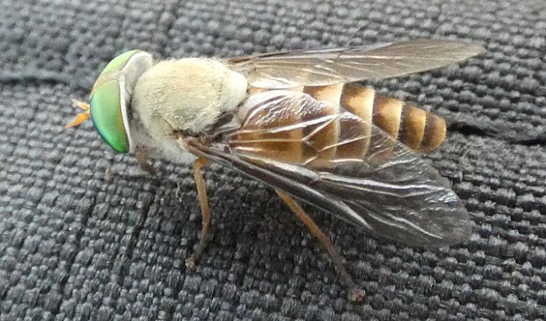
One of the large green-eyed flies (about 2.5 cm or 1 inch in length) in Port Clinton
We were thankful that the flies were not a nuisance because even though we did not expect to get off the boat for a few days, it would be confining not to be able to use the cockpit. As long as the wind blew, as it did for most of the next two days, we were not bothered by insects. However, whenever there was a lull in the wind, the air was full of no-see-ums (a.k.a. sand-flies), making trips outside itchy unless insect repellant was used.
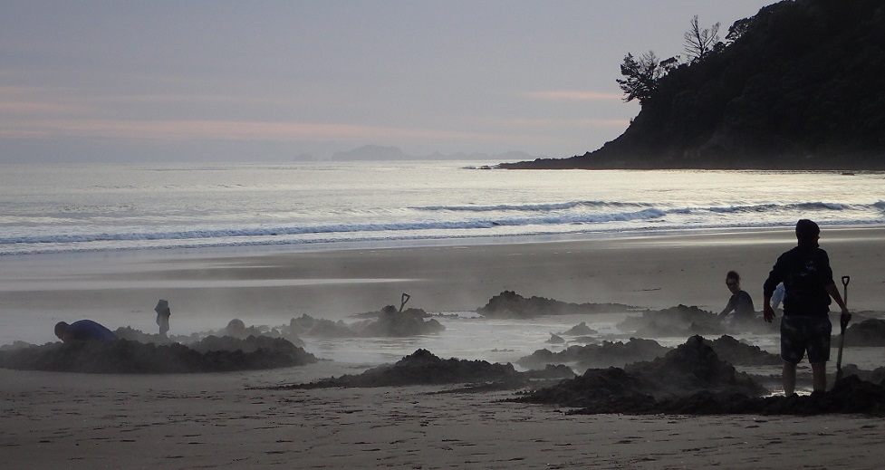
When we arrived in South Arm around 10:30 am, we were initially going to anchor in water that we measured as 17 feet (5.2 m) deep. This was certainly deep enough for Tregoning’s 6.6 foot (2 m) draft and it meant that we would not need much length of anchor rode, an advantage in the relatively narrow channel. As we were about to set the anchor, I looked at the local tide chart, knowing that this was high tide. What caught my attention was that this high tide was 14.3 feet (4.4 m) above datum and overnight the low tide was only 1.6 feet (0.5 m). This meant that there would be a reduction in water level of 12.7 feet (3.9 m), which would leave a water depth here of only 4.3 feet (1.3 m) at low tide!
Even allowing for the approximately 2 feet (0.6 m) of buffer in our calculation of water depth (the depth below the water surface of the transducer/depth sounder on Tregoning’s hull), we would likely be aground at low tide, especially if the wind and tide swung us into even shallower water. While this would have been tolerable if we had been desperate, we had the whole Arm to ourselves, so we raised the anchor and circled around looking for water that was over 20 feet (6.1 m) deep.
Luckily, there was a hole to 50 feet (15.2 m) deep nearby. On one side, the water depth dropped off rather steeply so we zig-zagged across the area watching the depth sounder until we were sure that we would neither swing into an area that was too shallow nor would be putting the anchor on a slope so steep that the anchor would slide down it. Finally, we anchored in water that was 32 feet (9.7 m) deep and we were both happy. It was important that we felt secure because not only would the winds increase to 20-30 knots in the late evening but there were strong tidal currents flowing past, especially on the ebb tide. A motorboat eventually came to anchor downriver of us. Despite the strong winds, there were no waves, so we had a very comfortable night.

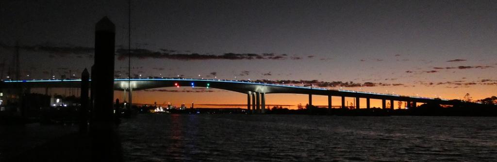
Sunset over the Shoalwater Bay Military Training Area seen from the South Arm of Port Clinton
The following morning was surprisingly cold, with southeasterly winds seemingly blowing straight off Antarctica. This did not deter the local wildlife, so we were treated to sights of white-breasted sea-eagles, Brahminy kites, red-tailed black-cockatoos, pelicans, crested terns, some unidentified smaller shorebirds, rays slapping their wings on the water surface, eels occasionally popping to the water surface, and three small dolphins, which I assumed were dwarf spinner dolphins. We also heard a variety of bird-calls that we could not identify including a very distinctive “cara-wee-wee”. When we next have good internet, I will see if I can work out what it was. For a brief time, I heard a roaring in the distance and saw a dust cloud moving across the landscape but that was the only sign of military activity during our three-night stay. Otherwise, it was a peaceful and restful interlude in our southerly migration.
We also managed to get some exercise by joining the many other people on Saturday evening who were enjoying the 3.2 km walk or bike-ride along the southern breakwater and back. The next morning, we ran or walked south along a trail and sandy road to the mouth of the Pioneer River. If we had been staying for longer, it would have been an interesting area to go birding, but we needed to catch the next weather-window to go south. That started on Monday morning, so even though we had a day left on our week’s stay at the Mackay Marina, we quietly left at 6:45 am.
After getting away from the breakwater and the confused seas that the reflected waves created, we raised the mainsail, unfurled the jib, and actually started sailing and turned off the engine...woohoo! Shockingly, this was the first time that we had actually sailed without the motor since leaving Cairns. Depressingly, it only lasted for 36 minutes. The wind was not as easterly as had been forecast and our southerly course was aiming us towards the long coal-loading jetty at Hay Point. Although we could have gybed, we needed to make good progress southeastward, into the wind, so we reluctantly started the engine and furled the jib.
We made our way between the 16 anchored ships that were waiting to be loaded with coal at Hay Point. Using diesel fuel to motor-sail pass coal-exporting ships felt like a treacherous rebuke to our concerns about global climate change. We could only hope that as spring arrived and we progressed further south, sailing would become a more viable option. If only we had not had to get to Moreton Bay so early...or maybe we should have paid the import tax in Cairns?
The wind gradually decreased until conditions were glassy by the evening. With a full moon, it was rather beautiful weaving between the many small islands of the Northumberland Group. We continued past Middle and South Percy Island during the night. We had considered stopping there as we had not visited Middle Percy before and other cruisers have raved about hiking ashore and visiting the homestead and the shed decorated with the names of many boats and crews. However, there was not enough time to enjoy these things before the next southeasterly blow and the West Bay anchorage at Middle Percy is prone to the swell. Thus it would not be very comfortable to stay there during those winds and we were not excited about revisiting South Percy. Instead, we planned to go to Island Head Creek, which we visited last year, or 12 nm further south to Port Clinton which we had never visited. Conditions allowing, we might as well go to a new site.
The wind had increased a little during the night and with an assisting current we were making good speed-over-ground between 5 to 7 knots, so we reduced the engine rpm until dawn. After passing the entrance to Island Head Creek, we made a slight detour to look at Pearl Bay. As we had been told, this was a very pretty anchorage with a golden sand beach overlooked by a steep, forested hillside on the mainland, and rocky islands which should protect the anchorage from wind waves in all directions. Unfortunately, this anchorage is “less than comfortable in developed winds, the swell entering the bay as a constant surge” (from Lucas – Cruising the Coral Coast).
Rugged coastline just south of Pearl Bay
On entering Port Clinton, we found two boats anchored just south of Mount Flinders on the east side of the uninhabited harbor. However, that area looked quite exposed from the south so we continued into the South Arm to a bend that was well-protected by mangroves, just short of the military boat ramp. Port Clinton is part of the Shoalwater Bay Military Training Area so we could not go ashore, especially not at the tempting boat ramp. We had checked online to find that the inner parts of the military area would be closed later in the week but not these coastal anchorages.
Motoring south through Port Clinton, the cockpit was invaded by about a dozen large, green-eyed flies. They looked disturbingly like horse or deer flies, so we quickly draped the bug-screen over the companionway to keep them out of the cabins. We assumed that they would try to bite us but, if that was their intention, they were so slow about it that they were easy to swat and none actually did take a nip. Surprisingly, by the time we reached our anchorage, surrounded by mangroves in South Arm, they had disappeared and did not bother us again until it was time to leave.
One of the large green-eyed flies (about 2.5 cm or 1 inch in length) in Port Clinton
We were thankful that the flies were not a nuisance because even though we did not expect to get off the boat for a few days, it would be confining not to be able to use the cockpit. As long as the wind blew, as it did for most of the next two days, we were not bothered by insects. However, whenever there was a lull in the wind, the air was full of no-see-ums (a.k.a. sand-flies), making trips outside itchy unless insect repellant was used.
When we arrived in South Arm around 10:30 am, we were initially going to anchor in water that we measured as 17 feet (5.2 m) deep. This was certainly deep enough for Tregoning’s 6.6 foot (2 m) draft and it meant that we would not need much length of anchor rode, an advantage in the relatively narrow channel. As we were about to set the anchor, I looked at the local tide chart, knowing that this was high tide. What caught my attention was that this high tide was 14.3 feet (4.4 m) above datum and overnight the low tide was only 1.6 feet (0.5 m). This meant that there would be a reduction in water level of 12.7 feet (3.9 m), which would leave a water depth here of only 4.3 feet (1.3 m) at low tide!
Even allowing for the approximately 2 feet (0.6 m) of buffer in our calculation of water depth (the depth below the water surface of the transducer/depth sounder on Tregoning’s hull), we would likely be aground at low tide, especially if the wind and tide swung us into even shallower water. While this would have been tolerable if we had been desperate, we had the whole Arm to ourselves, so we raised the anchor and circled around looking for water that was over 20 feet (6.1 m) deep.
Luckily, there was a hole to 50 feet (15.2 m) deep nearby. On one side, the water depth dropped off rather steeply so we zig-zagged across the area watching the depth sounder until we were sure that we would neither swing into an area that was too shallow nor would be putting the anchor on a slope so steep that the anchor would slide down it. Finally, we anchored in water that was 32 feet (9.7 m) deep and we were both happy. It was important that we felt secure because not only would the winds increase to 20-30 knots in the late evening but there were strong tidal currents flowing past, especially on the ebb tide. A motorboat eventually came to anchor downriver of us. Despite the strong winds, there were no waves, so we had a very comfortable night.
Sunset over the Shoalwater Bay Military Training Area seen from the South Arm of Port Clinton
The following morning was surprisingly cold, with southeasterly winds seemingly blowing straight off Antarctica. This did not deter the local wildlife, so we were treated to sights of white-breasted sea-eagles, Brahminy kites, red-tailed black-cockatoos, pelicans, crested terns, some unidentified smaller shorebirds, rays slapping their wings on the water surface, eels occasionally popping to the water surface, and three small dolphins, which I assumed were dwarf spinner dolphins. We also heard a variety of bird-calls that we could not identify including a very distinctive “cara-wee-wee”. When we next have good internet, I will see if I can work out what it was. For a brief time, I heard a roaring in the distance and saw a dust cloud moving across the landscape but that was the only sign of military activity during our three-night stay. Otherwise, it was a peaceful and restful interlude in our southerly migration.
Comments
| Vessel Name: | Tregoning |
| Vessel Make/Model: | Morgan Classic 41 |
| Hailing Port: | Gainesville, FL |
| Crew: | Alison and Randall |
| About: | We cast-off from Fernandina Beach in north Florida on 1st June 2008 and we have been cruising on Tregoning ever since. Before buying Tregoning, both of us had been sailing on smaller boats for many years and had worked around boats and water throughout our careers. |
| Extra: | “Tregoning” (rhymes with “belonging”) and is a Cornish word (meaning “homestead of Cohnan” or “farm by the ash trees”) and was Alison's mother’s middle name. Cornwall is in southwest England and is where Alison grew-up. |
Tregoning's Photos - Main
 |
 |
 |
 |
 |
 |
 |
 |
 |
 |
 |
The Sailblogs Prequel: Adding old posts from expired blog
166 Photos
Created 26 May 2020
|
 |
 |
 |
 |
 |
 |
 |
 |
 |
 |
 |
 |
Extra photographs from our three-week campervan tour of the South Island from November 15th to December 5th 2015
217 Photos
Created 4 January 2016
|
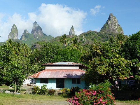 |
Random pictures from our month spent on the islands of Hiva Oa, Tahuata, Ua Pou, and Nuku Hiva
45 Photos
Created 18 July 2015
|
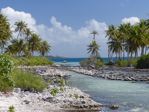 |
Random pictures from our month spent in 4 Tuamotu Atolls; Ahe, Fakarava, Tahanea, and Toau
32 Photos
Created 1 July 2015
|
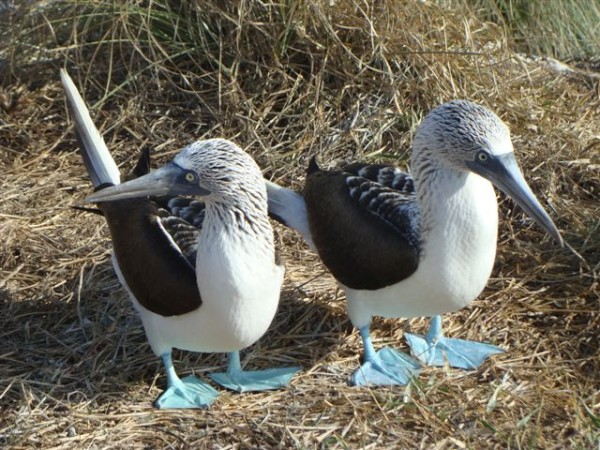 |
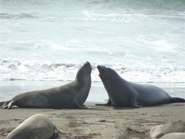
Some of the birds, fish, reptiles, and mammals (and others) that we have seen in Mexico
74 Photos
Created 5 May 2014
|
 |
Tregoning
Who: Alison and Randall
Port: Gainesville, FL
Gallery