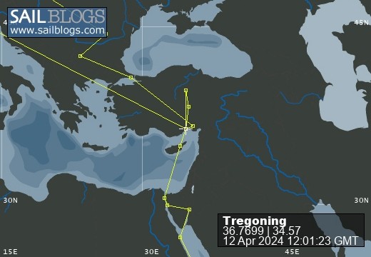
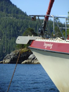
Tregoning
12 April 2024 | We are back aboard Tregoning in Mersin Marina, Mersin, Türkiye
02 April 2024 | We are in Toronto Airport, Canada: Tregoning is in Mersin Marina, Mersin, Türkiye
25 February 2024 | We are back in Gainesville, FL: Tregoning is in Mersin Marina, Mersin, Türkiye
18 February 2024 | We are in Glenwood, New Mexico: Tregoning is in Mersin Marina, Mersin, Türkiye
12 February 2024 | We are in Morro Bay, California: Tregoning is in Mersin Marina, Mersin, Türkiye
19 January 2024 | We are in Vancouver, BC Canada: Tregoning is in Mersin Marina, Mersin, Türkiye
01 January 2024 | We are in Washington State: Tregoning is in Mersin Marina, Mersin, Türkiye
15 December 2023 | We are in Minnesota: Tregoning is in Mersin Marina, Mersin, Türkiye
18 November 2023 | We are in Florida: Tregoning is in Mersin Marina, Mersin, Türkiye
29 October 2023 | We're in Florida - Tregoning is at B-dock, Mersin Marina, Mersin, Türkiye
21 October 2023 | 7 Oda Kapadokya Cave Hotel, Ürgüp, Türkiye
14 October 2023 | Hotel Aşikoğlu, Boğazkale, Türkiye
07 October 2023 | B-dock, Mersin Marina, Mersin, Türkiye
19 September 2023 | “Chez Jon & Angela”, Near Otterton, Devon, UK
14 September 2023 | Airbnb in Fortuneswell on the Isle of Portland, Dorset, UK
11 September 2023 | With Mike, Grange-over-Sands, Cumbria, UK
03 September 2023 | Ardington House, Ardington, Oxfordshire, UK
24 August 2023 | Near "Chez Joan and Peter", College of Roseisle, Moray, Scotland
11 August 2023 | Andrew's house (not exactly), Lichfield, UK
22 July 2023 | Chez Gail, near the New York Café, Budapest, Hungary
So far, so good: the first half
25 February 2023 | In the Arabian Sea, north Indian Ocean
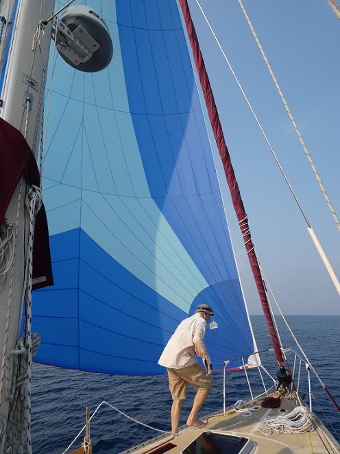
Alison Stocker | Photo: Randall checking on Nevil the asymmetrical spinnaker
Yay! At 12:17 pm today (Saturday 25th February, Day 11 of our passage) we just passed the half-way point. Well, to be precise, since we are unlikely to stick exactly to our planned 1890-nm route from Uligamu to Djibouti, we now have half of that distance to go.
As if to celebrate the approach of that auspicious waypoint, very early this morning I had the fabulous experience of watching a few dolphins swimming around Tregoning, blazing brilliant trails in the bright bioluminescence. Not since Tasmania, have I witnessed such magic, with the dolphin's shape and flicking tail so clearly outlined in a neon-green glow in the black sea. Tregoning's bow waves push flexible, ephemeral, sparkling green wings on either side of her hull, while astern she leaves behind a luminous trail. Big schools of fish stir the phytoplankton into pale green patches of activity, just visible when the moon is gone and only the stars cast light upon the sea.
With rare wonders like this, life is good.
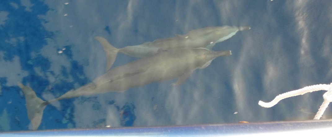
A pair of spinner dolphins riding in Tregoning's bow wave
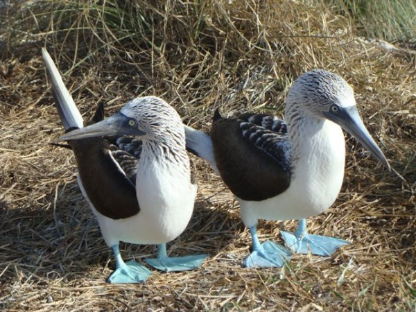
We have seen quite a few spinner dolphins during our passage so far. Sometimes just a few chasing us to play in our bow waves, sometimes huge pods of 50 or more that charge past us, occasionally leaping and spinning clear of the waves. We have also been seeing an increasing number of birds, usually just one at a time, either red-billed tropic birds with their long, white, streaming tails, or masked boobies that circle Tregoning perhaps hopeful of a place to rest or a fishy snack being cast-off. Two brown noddies spent most of one night hitching a ride at the stern, nestled on the barbecue grill and outboard motor, until leaving just before dawn.
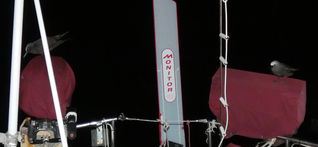
Our pair of overnight hitchhikers
And the constellations of stars are like old friends who can be depended upon to join us on our nighttime travels. Our latitude allows us to feel the comforting embrace of the Southern Cross to our left and the Big Dipper to our right. Early in the night, Orion and his cadre (Taurus, Pleiades, Canis Major and minor, and Gemini) keep watch over us from above. Of course, the positions of the constellations vary during the night and over the weeks, with the dramatic swath of Scorpio a rising presence that is coming to dominate the southeastern sky just before dawn.
Between these much-appreciated wildlife and astronomical sightings, we have been keeping ourselves occupied with sleeping (both), stargazing (both), puzzles (A) and computer games (R), sending and receiving messages on Iridium Go (R), compiling fish survey data (A), digital French lessons (both - French is one of the official languages in Djibouti), and, of course, plenty of reading. Among a variety of books, I enjoyed reading "A Tale of Two Yachts" by our British friend Barb, about the first half of their global circumnavigation on Zoonie. It was wonderful to be reading about many places, particularly in the South Pacific, that are now familiar to us, and it was fun to feel such a close connection to the author.
We have both been healthy and have eaten well, with our quarter- and half-way goals celebrated with chocolate bars and either tortilla/cassava chips or, today, a small camembert cheese. Unable to get much exercise other than constantly keeping our balance, we are trying to reserve such naughty snacks as something to look forward to, and rewards for progress made.
As for the actual sailing itself, it has been a bit variable, with insufficient wind being the main issue, not too much. We used the motor for just 30 minutes when we left Uligamu on the 15th February, passing close enough to Deo Juvante to wave goodbye, and being wished well on the VHF by Hans and Sonja on Ikinoo. As we were leaving, we could hear the crews on SVs Modesta and Wolo talking on channel 16 as they approached from Sri Lanka, so a steady stream of cruising boats continues to pass through the northern Maldives.
Most of the time, we have been sailing with the mainsail and jib, but we have also used our asymmetrical spinnaker (a.k.a. APC or Neville - as in the author Nevil Shute) instead of the jib when conditions have been suitable. This included on Day 3 and then again on Day 9 to the present time. This is the first time that we have kept the APC up overnight and has been possible because there have been no squalls so far on this passage. At night, we check the radar every 30 minutes to make sure that we see nothing forming, but this is a dry part of the world. Only small clouds come and go but there has been no sign of rain since before we reached Uligamu.
The initial route planned according to the weather forecasts (done using several computer models on PredictWind), recommended that we go due west from Uligamu to stay with the wind, turning northward 30 to 50% into the passage. We had intended to follow this advice but ended up staying more or less on the rhumb line from Uligamu to the mouth of the Gulf of Aden, a northwest route. This direct line was several hundred miles shorter and started with very suitable winds, but (as predicted) we eventually found an area with very little wind, especially during the nights. Days 3 to 5 saw us sailing slowly at best and drifting aimlessly at night. By the morning of the 5th day, the sea was truly glassy until the wind slowly started to resume by midday.
We chose to drift rather than run the engine when the winds diminished because we are keen to save all of our fuel until we reach the Gulf of Aden where we will be in a channel between the shipping separation lanes. Hopefully, we will still be able to sail then but that is when we will need to have the option to motor as this would not be a wise place to be drifting without steerage.
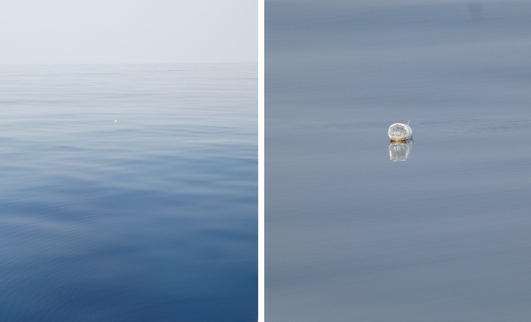
Glassy conditions unfortunately make any trash obvious such as this floating water bottle (white dot in center of left photo)
Some of our cruising colleagues have been less concerned about conserving fuel. Eugenie and Paul left Uligamu the day after us. Their large catamaran can go much faster than us with more than, say, 10 knots of wind but below that, which has been much of the time, they have been motor-sailing. They passed us early on our Day 4 and are now about 300 nm ahead of us, hoping to reach the shipping channels at the mouth of the Gulf of Aden tonight. Originally, they considering stopping at the Yemini Island of Socotra, (off the tip of the horn of Africa), but now they have decided to continue directly to Djibouti where we hope to be able to catch-up with them again.
Jackie and Wayne on CathayOz left Uligamu several days after us, but they are now only about 200 nm behind us and are also likely to pass us on the way to Djibouti. The catamarans do seem to have the advantage in downwind conditions...and probably carry more fuel than we do. It has been fun to keep track of our fellow cruisers using the Iridium Go system. Sonja and Hans do not use it, so we are unsure of their current location.
Although we have generally tolerated the calm periods with resignation, during one of the windless nights, we did have to run the engine for one hour because the current was carrying us towards a net icon showing on our AIS. We have not seen any vessels for several days but on Days 2, 3, 4 and 6, there were AIS icons on the chart-plotter showing fishing boats and nets near our route. We saw a few cargo ships during the first days of the passage, but we have mostly been south of the main shipping route. We have only seen commercial ship AIS icons at a distance, but most of the time none have been detected at all.
On Day 2, we found ourselves slowly sailing on a perpendicular, collision course with a slow-moving southward-bound, SW Cook, a research/survey vessel. In the AIS notes under "Destination" this vessel showed "Towing 7 nm cables" which is a bit unusual. We assumed that this was a cable-laying vessel. At evenly spaced intervals within the 7 nm behind this vessel, were three AIS icons following the ship. Initially, we hoped that we could maintain just enough speed to pass in front of the vessel, but it was eventually evident that this was not possible, so our choice was to start the engine to hurry ahead or tack to go behind.
While pondering these options, the SW Cook called us on the VHF radio and explained that they required a 3 nm clearance ahead of them and 2 nm clearance behind their 7 nm cables. While this part of the transmission was clear, we did not quite understand the nature of the vessel and its cables, but we think that he said something about seismic detection.
This information helped us to make our decision because we could not be sure of maintaining the 3 nm clearance ahead of SW Cook even using the motor. So, we tacked to a northeasterly route and then tacked back to our westerly route once we had cleared behind the vessel and its cables. To make sure that the SW Cook was not approached too closely, it had an accompanying vessel which was labelled on the AIS as the "SW Cook guard vessel". Judging by their chatter on the radio, this vessel had activities related to the cables other than just "guarding" but it was a reminder that we were approaching waters that have had a troubled reputation in the not-too-distant past.
I would be lying if I said that we had started this passage without any concerns about security. We were not planning to go any closer to Somalia or Yemen than we needed but we had seen the film "Captain Philips" (about Somali pirates hijacking a cargo ship) and knew that Yemen was riven by civil war. The latter parts of this passage had been labelled "High Risk" until January 2023, but in the last year more cruising vessels had been safely making the trip, and no recreational vessel had been involved in an incident since 2011. The first part of the passage had the advantage of being far enough from any shore, that people with ill-intent were unlikely to be out there.
Bearing in mind, our sensitivity to this potential issue, however, you might understand my slight concern on Day 3 when I heard what sounded like an outboard motor approaching and yet could see no boat nor any AIS icons. As it approached, it soon became apparent that the droning noise was from above and eventually I spotted a plane that circled high overhead. It made several such circles at varying altitudes and distances, and I managed to take a few photographs. Only on the last one, could I see that it was labelled Indian Coast Guard.
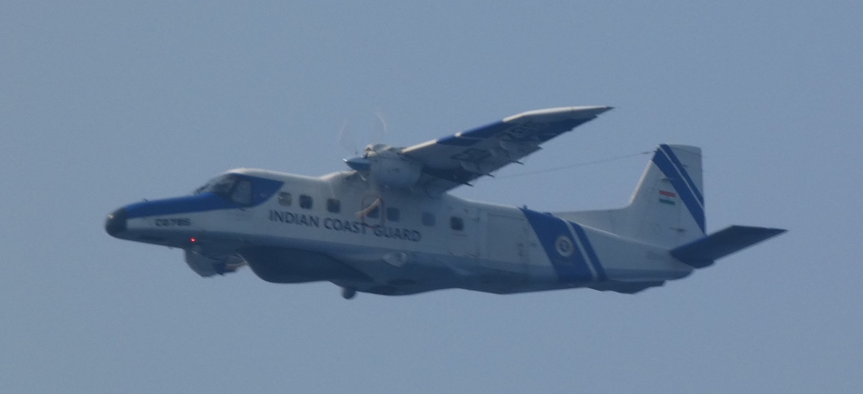
The Indian Coast Guard plane that circled us several times before calling on the VHF radio
Sure enough, we received a call to Tregoning on VHF channel 16 from the plane, and after switching to channel 18, we had a very pleasant conversation. Mostly, as expected, they asked for the usual details (last port, destination, vessel flag, number of people aboard, and nationality) but they also asked if all was well with us (which it was) and told us to call them if we had any difficulties. Once the conversation was over, the plane made a final loop and headed westward. I am not sure how far into the Arabian Sea we would be able to reach the Indian Coast Guard on the VHF radio, but it was somewhat reassuring to know that they were aware of our position and route.
Yesterday, I noticed some unusual information on the AIS "Destination" category of a ship that passed some distance from us, heading towards the Gulf of Aden. Instead of the usual code for the destination country and port, it said "Armed guard onboard". Again, while not entirely surprising, this was a slightly sobering reminder of the poor reputation that this area off the horn of Africa has.
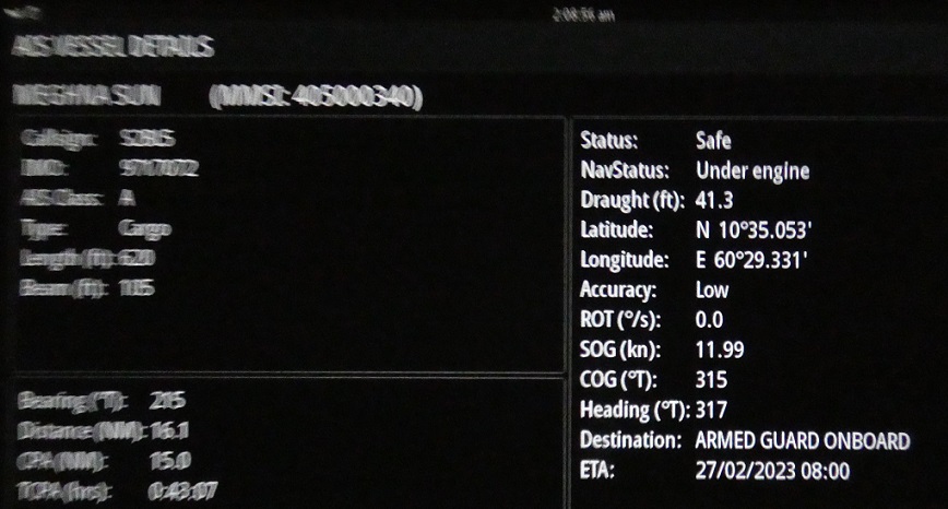
The information on an AIS vessel where the unusual destination is shown bottom right
We have about 360 nm to go northwest to get to the mouth of the Gulf of Aden and from there it will be about 600 nm going southwest between the shipping separation channels to get to Djibouti and the mouth of the Red Sea. We have just entered what was formerly considered the "High Risk Area" and as a consequence we are now sending our position reports twice daily by email on Iridium Go to agencies that monitor vessels in the area. We have been reporting once a day since Uligamu to the "Watchkeepers" at UKMTO (Maritime Trade Operations) and we have now added twice daily messages to MCSHOA (Marine Security Center - Horn of Africa).
Our friends on SV Tamina made this passage a few weeks ahead of us without incident (and they had perfect winds for much of the way), and Deo Juvante is now leading the way. So, we feel pretty confident that all will go well but we are certainly not complacent. So far, between the light winds and dearth of nearby vessels the passage has been very relaxing. I have found myself humming quite the medley of tunes, mostly ones that Randall has been playing on his guitar in the afternoons. I certainly hope that the second half of this passage will also be relaxing, despite the expected abundance of vessels that we will meet as we approach the busy shipping lanes. If it is not, I am curious to see which tune will become my nervous brain-worm...I just hope that it will be something uplifting and positive.
As if to celebrate the approach of that auspicious waypoint, very early this morning I had the fabulous experience of watching a few dolphins swimming around Tregoning, blazing brilliant trails in the bright bioluminescence. Not since Tasmania, have I witnessed such magic, with the dolphin's shape and flicking tail so clearly outlined in a neon-green glow in the black sea. Tregoning's bow waves push flexible, ephemeral, sparkling green wings on either side of her hull, while astern she leaves behind a luminous trail. Big schools of fish stir the phytoplankton into pale green patches of activity, just visible when the moon is gone and only the stars cast light upon the sea.
With rare wonders like this, life is good.
A pair of spinner dolphins riding in Tregoning's bow wave
We have seen quite a few spinner dolphins during our passage so far. Sometimes just a few chasing us to play in our bow waves, sometimes huge pods of 50 or more that charge past us, occasionally leaping and spinning clear of the waves. We have also been seeing an increasing number of birds, usually just one at a time, either red-billed tropic birds with their long, white, streaming tails, or masked boobies that circle Tregoning perhaps hopeful of a place to rest or a fishy snack being cast-off. Two brown noddies spent most of one night hitching a ride at the stern, nestled on the barbecue grill and outboard motor, until leaving just before dawn.
Our pair of overnight hitchhikers
And the constellations of stars are like old friends who can be depended upon to join us on our nighttime travels. Our latitude allows us to feel the comforting embrace of the Southern Cross to our left and the Big Dipper to our right. Early in the night, Orion and his cadre (Taurus, Pleiades, Canis Major and minor, and Gemini) keep watch over us from above. Of course, the positions of the constellations vary during the night and over the weeks, with the dramatic swath of Scorpio a rising presence that is coming to dominate the southeastern sky just before dawn.
Between these much-appreciated wildlife and astronomical sightings, we have been keeping ourselves occupied with sleeping (both), stargazing (both), puzzles (A) and computer games (R), sending and receiving messages on Iridium Go (R), compiling fish survey data (A), digital French lessons (both - French is one of the official languages in Djibouti), and, of course, plenty of reading. Among a variety of books, I enjoyed reading "A Tale of Two Yachts" by our British friend Barb, about the first half of their global circumnavigation on Zoonie. It was wonderful to be reading about many places, particularly in the South Pacific, that are now familiar to us, and it was fun to feel such a close connection to the author.
We have both been healthy and have eaten well, with our quarter- and half-way goals celebrated with chocolate bars and either tortilla/cassava chips or, today, a small camembert cheese. Unable to get much exercise other than constantly keeping our balance, we are trying to reserve such naughty snacks as something to look forward to, and rewards for progress made.
As for the actual sailing itself, it has been a bit variable, with insufficient wind being the main issue, not too much. We used the motor for just 30 minutes when we left Uligamu on the 15th February, passing close enough to Deo Juvante to wave goodbye, and being wished well on the VHF by Hans and Sonja on Ikinoo. As we were leaving, we could hear the crews on SVs Modesta and Wolo talking on channel 16 as they approached from Sri Lanka, so a steady stream of cruising boats continues to pass through the northern Maldives.
Most of the time, we have been sailing with the mainsail and jib, but we have also used our asymmetrical spinnaker (a.k.a. APC or Neville - as in the author Nevil Shute) instead of the jib when conditions have been suitable. This included on Day 3 and then again on Day 9 to the present time. This is the first time that we have kept the APC up overnight and has been possible because there have been no squalls so far on this passage. At night, we check the radar every 30 minutes to make sure that we see nothing forming, but this is a dry part of the world. Only small clouds come and go but there has been no sign of rain since before we reached Uligamu.
The initial route planned according to the weather forecasts (done using several computer models on PredictWind), recommended that we go due west from Uligamu to stay with the wind, turning northward 30 to 50% into the passage. We had intended to follow this advice but ended up staying more or less on the rhumb line from Uligamu to the mouth of the Gulf of Aden, a northwest route. This direct line was several hundred miles shorter and started with very suitable winds, but (as predicted) we eventually found an area with very little wind, especially during the nights. Days 3 to 5 saw us sailing slowly at best and drifting aimlessly at night. By the morning of the 5th day, the sea was truly glassy until the wind slowly started to resume by midday.
We chose to drift rather than run the engine when the winds diminished because we are keen to save all of our fuel until we reach the Gulf of Aden where we will be in a channel between the shipping separation lanes. Hopefully, we will still be able to sail then but that is when we will need to have the option to motor as this would not be a wise place to be drifting without steerage.
Glassy conditions unfortunately make any trash obvious such as this floating water bottle (white dot in center of left photo)
Some of our cruising colleagues have been less concerned about conserving fuel. Eugenie and Paul left Uligamu the day after us. Their large catamaran can go much faster than us with more than, say, 10 knots of wind but below that, which has been much of the time, they have been motor-sailing. They passed us early on our Day 4 and are now about 300 nm ahead of us, hoping to reach the shipping channels at the mouth of the Gulf of Aden tonight. Originally, they considering stopping at the Yemini Island of Socotra, (off the tip of the horn of Africa), but now they have decided to continue directly to Djibouti where we hope to be able to catch-up with them again.
Jackie and Wayne on CathayOz left Uligamu several days after us, but they are now only about 200 nm behind us and are also likely to pass us on the way to Djibouti. The catamarans do seem to have the advantage in downwind conditions...and probably carry more fuel than we do. It has been fun to keep track of our fellow cruisers using the Iridium Go system. Sonja and Hans do not use it, so we are unsure of their current location.
Although we have generally tolerated the calm periods with resignation, during one of the windless nights, we did have to run the engine for one hour because the current was carrying us towards a net icon showing on our AIS. We have not seen any vessels for several days but on Days 2, 3, 4 and 6, there were AIS icons on the chart-plotter showing fishing boats and nets near our route. We saw a few cargo ships during the first days of the passage, but we have mostly been south of the main shipping route. We have only seen commercial ship AIS icons at a distance, but most of the time none have been detected at all.
On Day 2, we found ourselves slowly sailing on a perpendicular, collision course with a slow-moving southward-bound, SW Cook, a research/survey vessel. In the AIS notes under "Destination" this vessel showed "Towing 7 nm cables" which is a bit unusual. We assumed that this was a cable-laying vessel. At evenly spaced intervals within the 7 nm behind this vessel, were three AIS icons following the ship. Initially, we hoped that we could maintain just enough speed to pass in front of the vessel, but it was eventually evident that this was not possible, so our choice was to start the engine to hurry ahead or tack to go behind.
While pondering these options, the SW Cook called us on the VHF radio and explained that they required a 3 nm clearance ahead of them and 2 nm clearance behind their 7 nm cables. While this part of the transmission was clear, we did not quite understand the nature of the vessel and its cables, but we think that he said something about seismic detection.
This information helped us to make our decision because we could not be sure of maintaining the 3 nm clearance ahead of SW Cook even using the motor. So, we tacked to a northeasterly route and then tacked back to our westerly route once we had cleared behind the vessel and its cables. To make sure that the SW Cook was not approached too closely, it had an accompanying vessel which was labelled on the AIS as the "SW Cook guard vessel". Judging by their chatter on the radio, this vessel had activities related to the cables other than just "guarding" but it was a reminder that we were approaching waters that have had a troubled reputation in the not-too-distant past.
I would be lying if I said that we had started this passage without any concerns about security. We were not planning to go any closer to Somalia or Yemen than we needed but we had seen the film "Captain Philips" (about Somali pirates hijacking a cargo ship) and knew that Yemen was riven by civil war. The latter parts of this passage had been labelled "High Risk" until January 2023, but in the last year more cruising vessels had been safely making the trip, and no recreational vessel had been involved in an incident since 2011. The first part of the passage had the advantage of being far enough from any shore, that people with ill-intent were unlikely to be out there.
Bearing in mind, our sensitivity to this potential issue, however, you might understand my slight concern on Day 3 when I heard what sounded like an outboard motor approaching and yet could see no boat nor any AIS icons. As it approached, it soon became apparent that the droning noise was from above and eventually I spotted a plane that circled high overhead. It made several such circles at varying altitudes and distances, and I managed to take a few photographs. Only on the last one, could I see that it was labelled Indian Coast Guard.
The Indian Coast Guard plane that circled us several times before calling on the VHF radio
Sure enough, we received a call to Tregoning on VHF channel 16 from the plane, and after switching to channel 18, we had a very pleasant conversation. Mostly, as expected, they asked for the usual details (last port, destination, vessel flag, number of people aboard, and nationality) but they also asked if all was well with us (which it was) and told us to call them if we had any difficulties. Once the conversation was over, the plane made a final loop and headed westward. I am not sure how far into the Arabian Sea we would be able to reach the Indian Coast Guard on the VHF radio, but it was somewhat reassuring to know that they were aware of our position and route.
Yesterday, I noticed some unusual information on the AIS "Destination" category of a ship that passed some distance from us, heading towards the Gulf of Aden. Instead of the usual code for the destination country and port, it said "Armed guard onboard". Again, while not entirely surprising, this was a slightly sobering reminder of the poor reputation that this area off the horn of Africa has.
The information on an AIS vessel where the unusual destination is shown bottom right
We have about 360 nm to go northwest to get to the mouth of the Gulf of Aden and from there it will be about 600 nm going southwest between the shipping separation channels to get to Djibouti and the mouth of the Red Sea. We have just entered what was formerly considered the "High Risk Area" and as a consequence we are now sending our position reports twice daily by email on Iridium Go to agencies that monitor vessels in the area. We have been reporting once a day since Uligamu to the "Watchkeepers" at UKMTO (Maritime Trade Operations) and we have now added twice daily messages to MCSHOA (Marine Security Center - Horn of Africa).
Our friends on SV Tamina made this passage a few weeks ahead of us without incident (and they had perfect winds for much of the way), and Deo Juvante is now leading the way. So, we feel pretty confident that all will go well but we are certainly not complacent. So far, between the light winds and dearth of nearby vessels the passage has been very relaxing. I have found myself humming quite the medley of tunes, mostly ones that Randall has been playing on his guitar in the afternoons. I certainly hope that the second half of this passage will also be relaxing, despite the expected abundance of vessels that we will meet as we approach the busy shipping lanes. If it is not, I am curious to see which tune will become my nervous brain-worm...I just hope that it will be something uplifting and positive.
Comments
| Vessel Name: | Tregoning |
| Vessel Make/Model: | Morgan Classic 41 |
| Hailing Port: | Gainesville, FL |
| Crew: | Alison and Randall |
| About: | We cast-off from Fernandina Beach in north Florida on 1st June 2008 and we have been cruising on Tregoning ever since. Before buying Tregoning, both of us had been sailing on smaller boats for many years and had worked around boats and water throughout our careers. |
| Extra: | “Tregoning” (rhymes with “belonging”) and is a Cornish word (meaning “homestead of Cohnan” or “farm by the ash trees”) and was Alison's mother’s middle name. Cornwall is in southwest England and is where Alison grew-up. |
Tregoning's Photos - Main
 |
 |
 |
 |
 |
 |
 |
 |
 |
 |
 |
The Sailblogs Prequel: Adding old posts from expired blog
166 Photos
Created 26 May 2020
|
 |
 |
 |
 |
 |
 |
 |
 |
 |
 |
 |
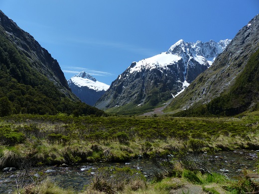 |
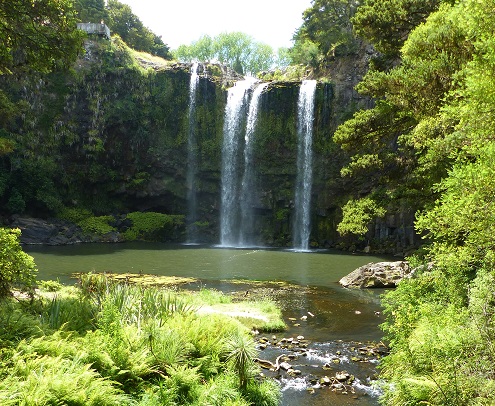
Extra photographs from our three-week campervan tour of the South Island from November 15th to December 5th 2015
217 Photos
Created 4 January 2016
|
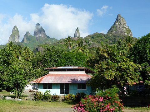 |
Random pictures from our month spent on the islands of Hiva Oa, Tahuata, Ua Pou, and Nuku Hiva
45 Photos
Created 18 July 2015
|
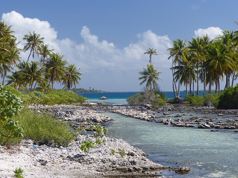 |
Random pictures from our month spent in 4 Tuamotu Atolls; Ahe, Fakarava, Tahanea, and Toau
32 Photos
Created 1 July 2015
|
 |
Some of the birds, fish, reptiles, and mammals (and others) that we have seen in Mexico
74 Photos
Created 5 May 2014
|
 |
Tregoning
Who: Alison and Randall
Port: Gainesville, FL
Gallery