
Vanish - Making The Switch From Sail to Power
29 October 2016 | Georgia, USA
29 October 2016 | Georgia, USA
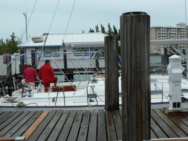
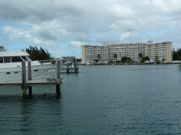
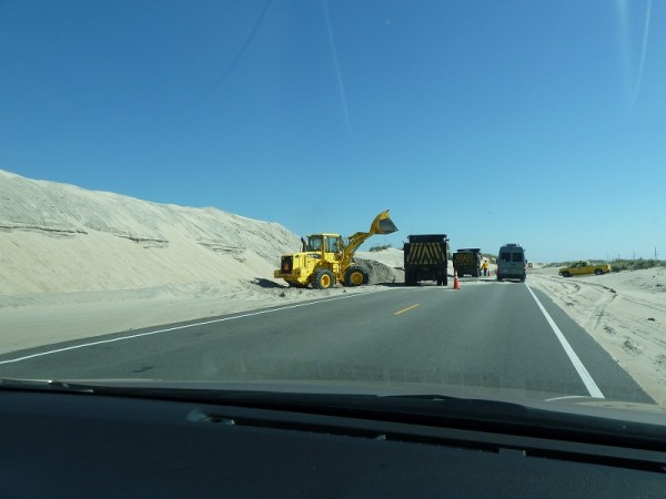
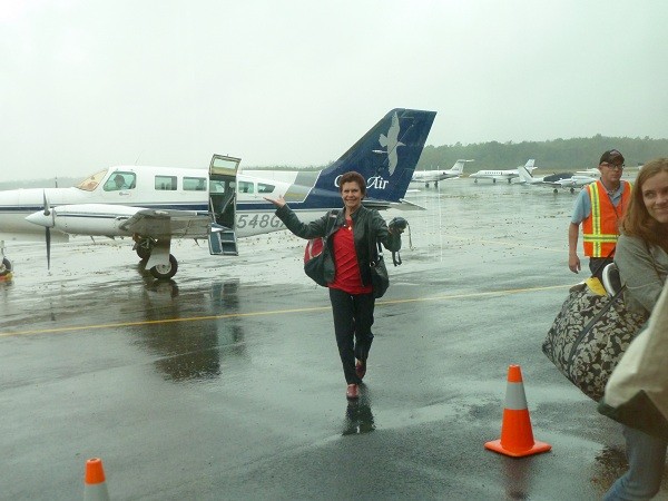
08 October 2016 | Brunswick, Georgia, USA
07 October 2016 | Hotel on West Side of Hwy I-95, Brunswick, GA, USA
07 October 2016 | Brunswick, Georgia, USA
06 October 2016 | Brunswick, Georgia, USA
05 October 2016 | Brunswick, Georgia, USA
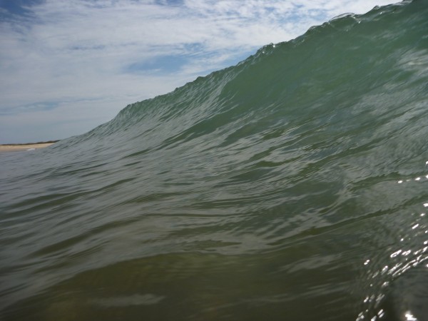
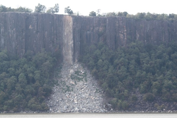
04 October 2016 | Photo off Outer Banks near Cape Lookout, North Carolina.
27 September 2016 | Piankatank River, Chesapeake Bay, Virginia, USA
22 September 2016 | Current Position - Sassafras River, Chesapeake Bay, Maryland, USA
16 September 2016 | Orient, Long Island, New York, USA
11 September 2016 | Ebenecook Harbor near Boothbay Harbor, Maine, USA
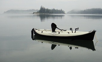
07 September 2016 | Penobscot Bay, Maine, USA
05 September 2016 | Penobscot Bay, Maine, USA
04 September 2016 | North Haven, Vinalhaven, Maine, USA
28 August 2016 | Castine, Maine, USA
27 August 2016 | Belfast, Maine, USA
12 August 2016 | Mount Washington, New Hampshire, USA
06 August 2016 | Canada/USA Border Crossing
04 August 2016 | La Malbaie, Quebec, Canada
Back or Forth
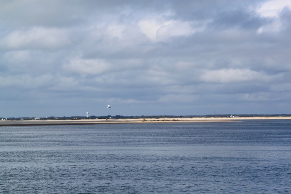
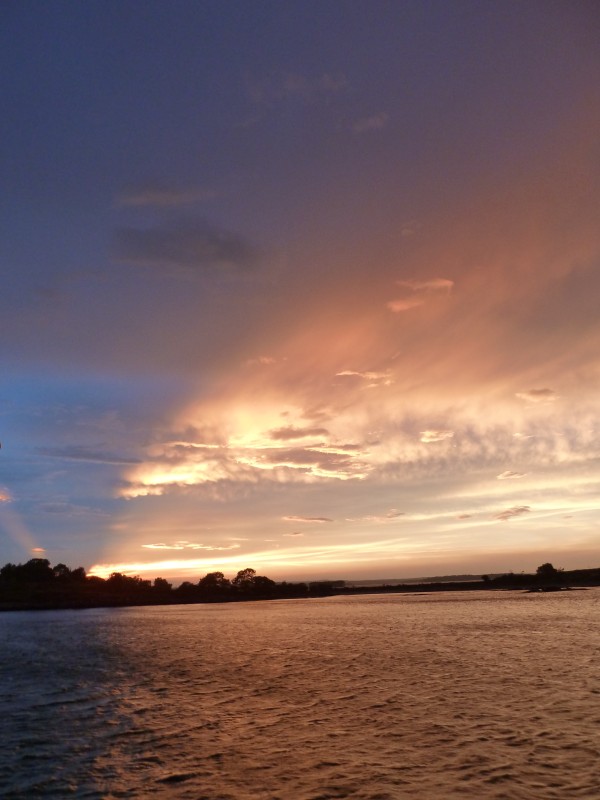
27 September 2016 | Piankatank River, Chesapeake Bay, Virginia, USA
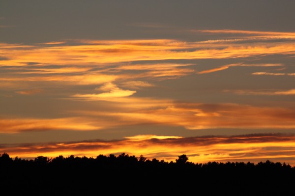
Vicki – Air 21 deg , Water 24 deg C, 8/8 Cloud, Rain Showers, 1 kn S
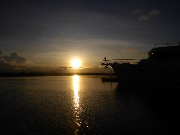
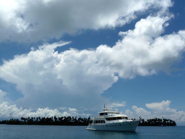
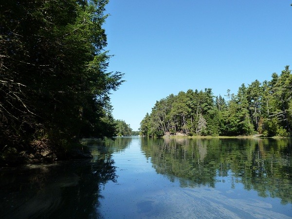
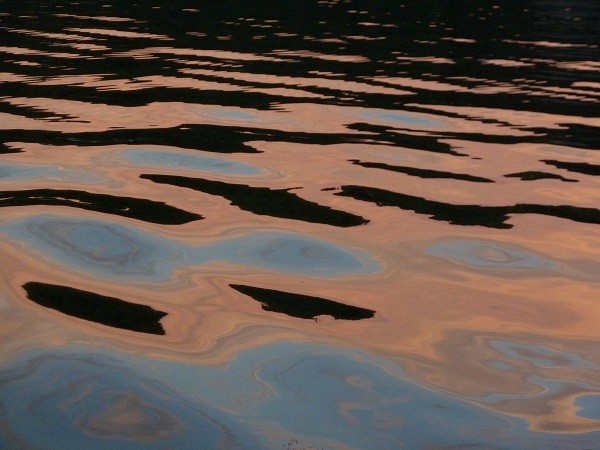
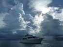
One could spend a lifetime exploring the Chesapeake Bay. It is 200 miles long with a width ranging from 4 to 30 miles across. The bay and its tributaries have a length of 11,684 miles, only 5,000 miles less than Australia’s entire coastline. The average depth of the bay is just 21 feet making it easy in which to anchor. There are always hidey holes to escape every direction of wind and in a number of places, the anchorages are almost enclosed so that no real weather can intrude. In the last few days, we’ve anchored just off the Choptank River in the Tred Avon River and also the Piankatank River which provides wonderful protection for all wind directions. We passed a lighthouse called Sharps Island Light leaning at a crazy angle off Tilghman Island and is known as the Leaning Tower of Pisa. This current lighthouse was constructed in 1892 and was knocked sideways due to an ice floe in 1977. Up until I saw this lighthouse, I didn’t realise Chesapeake Bay often freezes in winter.

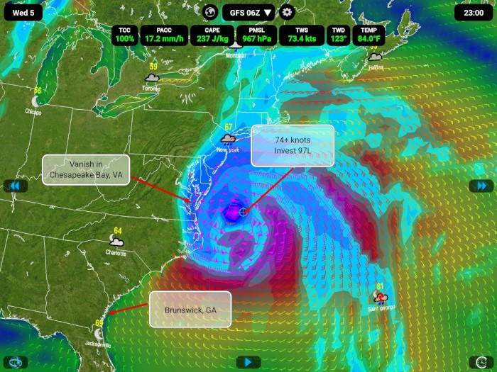
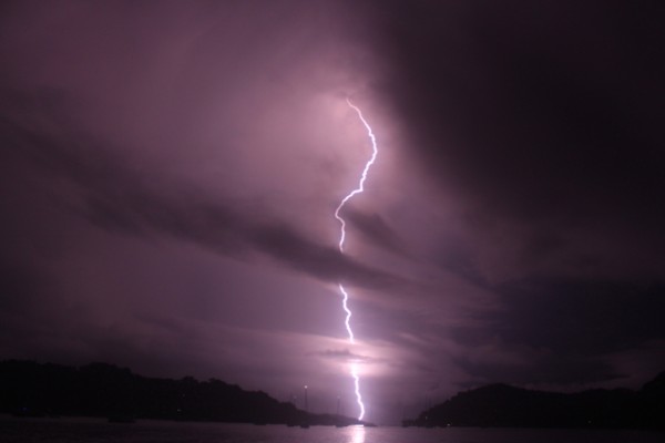
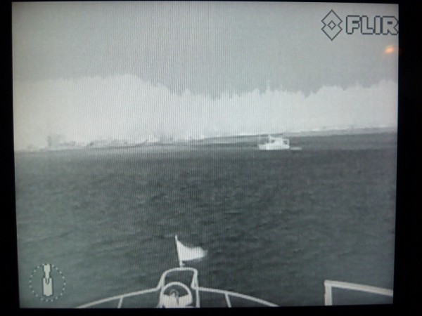
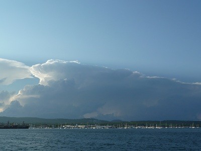
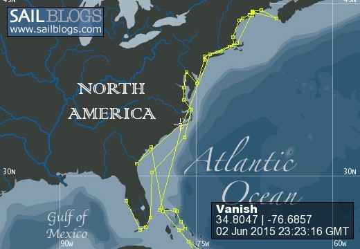
A tropical disturbance appeared a few days ago spinning off Gambia in Africa called Invest 97L. Today it is expected to be upgraded to a Tropical Depression called Matthew with further development as a hurricane. The models show it travelling in a westerly direction before making a sharp right to pass over the Dominican Republic where it will continue northward through the Bahamas thence onto the USA. These models change daily but we watch them carefully as we need to decide what action to take heading south to Georgia. Yesterday I found an interesting website http://www.vaemergency.gov/readyvirginia/stay-informed/hurricanes/hurricane-history which documents the effects of hurricanes recorded in the Chesapeake Bay since 1635. It was interesting to read the months these hurricanes arrived in the area, the amount of surge recorded (between 8 and 15 feet), the fact that tornadoes associated with the hurricanes also greatly impacted the lives of many and just the sheer damage caused by the force of waves and wind. Just looking onshore at some of the houses near our current anchorage, some are indeed set at 15 feet above sea level, a very wise decision. This information told us that in the event of Invest 97L making an impact on the Chesapeake Bay, we would need to return as far north up the Chesapeake Bay, possibly to Baltimore or Philadelphia to avoid flooding and wind effects.
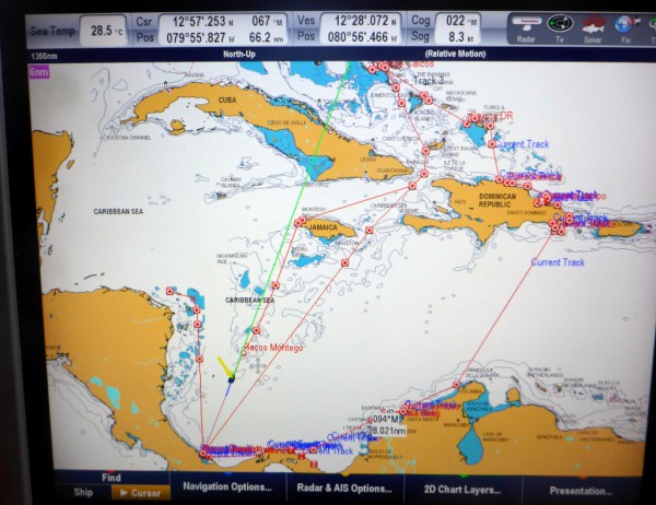
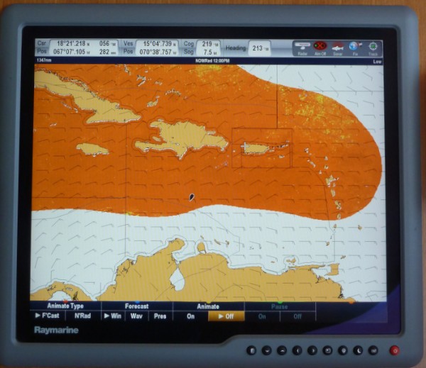
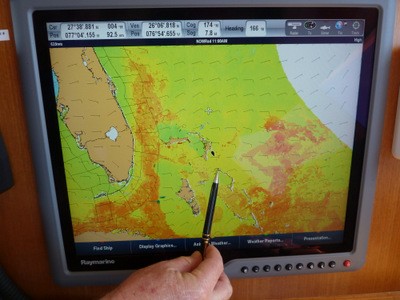
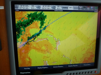
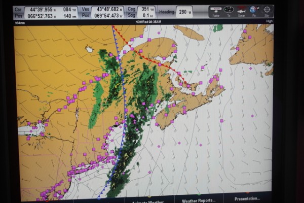
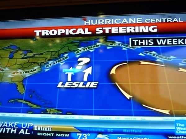
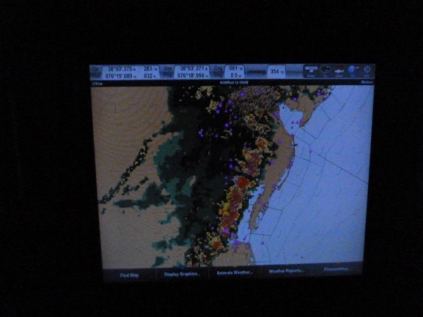
The Weather 4D model above for October 5 shows Invest 97L passing close to our current position. The weather models only need to move the hurricane slightly westward for us to take action. We either need to wait and watch, ready to move or sneak down the coast ahead of it before adverse weather affects wind and wave heights out at sea. Brunswick, GA is 500 miles away and can be reached in 2 to 3 days if the weather co-operates. Again, if the models change and Brunswick is in or close to its path, we would not like to think what would happen to Vanish. If we wait here until the hurricane passes, it will be several weeks before we can travel south. Time is ticking. What would YOU do?
A tropical disturbance appeared a few days ago spinning off Gambia in Africa called Invest 97L. Today it is expected to be upgraded to a Tropical Depression called Matthew with further development as a hurricane. The models show it travelling in a westerly direction before making a sharp right to pass over the Dominican Republic where it will continue northward through the Bahamas thence onto the USA. These models change daily but we watch them carefully as we need to decide what action to take heading south to Georgia. Yesterday I found an interesting website http://www.vaemergency.gov/readyvirginia/stay-informed/hurricanes/hurricane-history which documents the effects of hurricanes recorded in the Chesapeake Bay since 1635. It was interesting to read the months these hurricanes arrived in the area, the amount of surge recorded (between 8 and 15 feet), the fact that tornadoes associated with the hurricanes also greatly impacted the lives of many and just the sheer damage caused by the force of waves and wind. Just looking onshore at some of the houses near our current anchorage, some are indeed set at 15 feet above sea level, a very wise decision. This information told us that in the event of Invest 97L making an impact on the Chesapeake Bay, we would need to return as far north up the Chesapeake Bay, possibly to Baltimore or Philadelphia to avoid flooding and wind effects.
The Weather 4D model above for October 5 shows Invest 97L passing close to our current position. The weather models only need to move the hurricane slightly westward for us to take action. We either need to wait and watch, ready to move or sneak down the coast ahead of it before adverse weather affects wind and wave heights out at sea. Brunswick, GA is 500 miles away and can be reached in 2 to 3 days if the weather co-operates. Again, if the models change and Brunswick is in or close to its path, we would not like to think what would happen to Vanish. If we wait here until the hurricane passes, it will be several weeks before we can travel south. Time is ticking. What would YOU do?
Comments
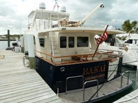
| Vessel Name: | Vanish |
| Vessel Make/Model: | Marlow Voyager 76LR |
| Hailing Port: | Brisbane, Queensland, Australia |
| Crew: | Maynard and Vicki |
| Home Page: | sailblogs.com/member/vanish |
Vanish's Photos - Main
 |
|
Post Hurricane Matthew, Brunswick, GA, USA
15 Photos
Created 8 October 2016
|
|
|
|
|
|
|
|
|
|
|
|
|
|
|
|
Saguaney to La Malbaie, Quebec, Canada
28 Photos
Created 20 August 2016
|
|
|
|
|
|
|
|
|
|
|
|
|
Narragansett Bay, Rhode Island, USA
9 Photos
Created 11 June 2016
|
|
Noyack Bay, nr Sag Harbor, Long Island, New York
7 Photos
Created 11 June 2016
|
|
 |
|
|
|
|
|
|
Eatons Neck, Long Island, New York, USA
2 Photos
Created 16 September 2015
|
|
Massachusetts and Long Island, New York, USA
9 Photos
Created 16 September 2015
|
|
|
|
|
|
|
|
|
|
Norfolk, Virginia to Mattapoisett, Massachussets, USA
16 Photos
Created 17 June 2015
|
|
ICW Beaufort, North Carolina, to Norfolk, Virginia, USA
16 Photos
Created 12 June 2015
|
|
|
2015 Brunswick, Georgia to Beaufort, North Carolina
12 Photos
Created 4 June 2015
|
 |
 |
 |
 |
 |
 |
 |
 |
 |
 |
 |
 |
 |
 |
 |
 |
 |
 |
 |
 |
 |
 |
 |
 |
 |
 |
 |
 |
 |
 |
Exploring the Interior of the Dominican Republic
26 Photos
Created 24 April 2013
|
 |
Samana Bay to La Romana, Dominican Republic
12 Photos
Created 19 April 2013
|
 |
 |
Samana Bay, Dominican Republic
10 Photos
Created 10 April 2013
|
 |
Dominican Republic
12 Photos
Created 5 April 2013
|
 |
 |
 |
 |
 |
 |
 |
 |
Eleuthera, The Bahamas
12 Photos
Created 25 February 2013
|
 |
 |
 |
 |
 |
 |
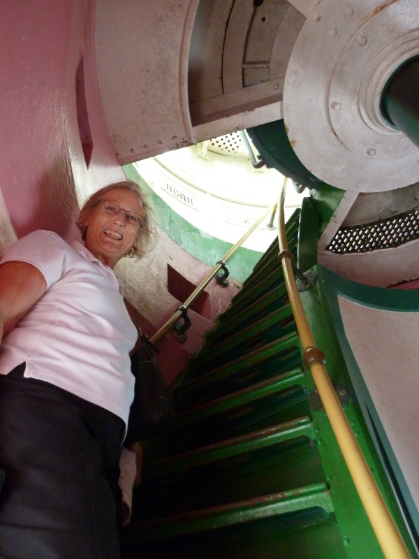 |
Elbow Reef Lighthouse, Hope Town, Abaco, The Bahamas
35 Photos
Created 29 November 2012
|
 |
 |
 |
 |
 |
Hurricane Sandy in the Bahamas
9 Photos
Created 24 October 2012
|
 |
 |
 |
 |
 |
 |
Barden Inlet, Nr Beaufort, North Carolina, USA
4 Photos
Created 4 October 2012
|
 |
Cape Lookout Area near Beaufort, North Carolina, USA
5 Photos
Created 2 October 2012
|
 |
 |
New York State of Mind, USA
13 Photos
Created 27 September 2012
|
 |
 |
 |
 |
 |
 |
 |
 |
 |
 |
Rockland, Maine to Trafton Island, Maine, USA
14 Photos
Created 3 September 2012
|
 |
 |
Orcutt Harbor and Horseshoe Cove areas, Maine, USA
2 Photos
Created 26 August 2012
|
 |
 |
 |
 |
 |
 |
 |
 |
 |
Somes Sound, Mt Desert Island to Bar Harbor, Mt Desert Island in Maine, USA
16 Photos
Created 6 August 2012
|
 |
 |
Pictures from Seal Cove, Vinalhaven, Maine, USA
4 Photos
Created 29 July 2012
|
 |
Rockland, Maine and Matinicus Rock, Maine, USA
15 Photos
Created 28 July 2012
|
 |
 |
Portland, Maine to The Basin, Phippsburg, Maine, USA
22 Photos
Created 20 July 2012
|
 |
Anchorage view from House Island, South Portland, Maine, USA
4 Photos
Created 18 July 2012
|
 |
 |
 |
 |
Chesapeake Bay - Virginia & Maryland, USA
3 Photos
Created 30 June 2012
|
 |
Vanish
Who: Maynard and Vicki
Port: Brisbane, Queensland, Australia
Gallery


Favourites - Videos & Websites
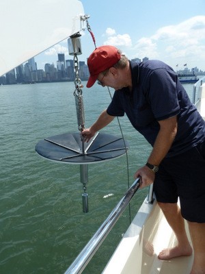
- Flopper Stopper Info
- Puffin Live Streaming (During June/July/August)
- Video - Life's A Beach
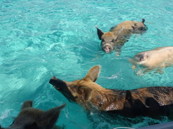
- Video - Swimming Pigs of Staniel Cay, Exuma, Bahamas
- Wide Open Throttle
- Free Cruising Guides
- Intellicast Infrared Weather
- zyGrib Weather Forecasting
- Pink Sand Beach at Harbour Island aka Briland, Eleuthera, The Bahamas
- Power & Motoryacht Magazine Article on Vanish Mar 2013
- Amazing Limbo Dancer Vicki Filmed at Port Lucaya, Grand Bahama Dec 2012
- Puffin and Foghorn Sounds at Matinicus Rock, Maine, USA
- Take A Peek Inside Vanish