Yacht Cerulean Atlantic Adventure
| Vessel Name: | Cerulean of Penryn |
| Vessel Make/Model: | Seastream43 |
| Hailing Port: | Gosport |
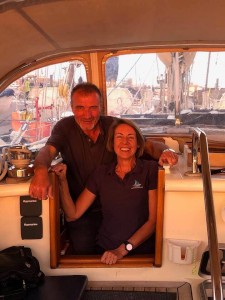
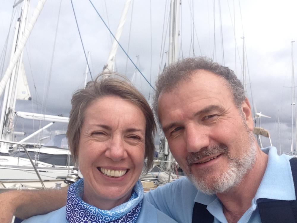
| Crew: | Richard & Alison Rowley |
| About: | |
| Extra: | We have both taken a year off work to sail the Atlantic in our 43' (13m) sailing yacht Cerulean of Penryn which we purchased in 2015. We are signed up for the ARC+ 2018 rally from Las Palmas Gran Canaria to St Lucia via the Cape Verde Islands |
| Home Page: | www.yachtcerulean.com |
| Social: |
 |
12 July 2019 | Gosport
17 June 2019
14 June 2019 | 47:45N 009:10W
13 June 2019 | 46:38N 010:47W
13 June 2019 | 46:34N 010:51W
11 June 2019 | 44:05N 014:40W
10 June 2019 | 42:51N 018:48W
08 June 2019 | 40:56N 021:26W
07 June 2019 | 38:15N 024:41W
25 May 2019 | Horta, Faial, Azores
21 May 2019 | 38:25N 029:20W
19 May 2019 | 38:31N 034:16W
18 May 2019 | 38:31N 037:37W
17 May 2019 | 38:10N 040:49W
17 May 2019 | 37:55N 042:01W
15 May 2019 | 37:49N 042:58W
15 May 2019 | 36:26N 046:39W
15 May 2019 | 37:10N 044:57W
14 May 2019 | 35:39N 048:42W
14 May 2019 | 35:03N 050:29W
Recent Blog Posts
12 July 2019 | Gosport
A ship is safe in harbour...but that's not what they are for
The Cerulean Big Atlantic Adventure is now over. We are moored back at our home port of Gosport in the UK, and our adventure is rapidly turning into just a memory.
14 June 2019 | 47:45N 009:10W
Ponta Delgado-Bishops Rock 07
Log:958 DTW 166; BTW 039deg 47deg 45'N 009deg 10'W COG: 060 SOG:4.6 Wind SW f3; baro 1016 Status: Sailing; dead run; Port tack; poled out genoa to Starboard
13 June 2019 | 46:38N 010:47W
Ponta Delgado-St Mary's 6
Log:863 DTW 259; BTW 040deg 46deg 38'N 010deg 47'W COG: 040 SOG:6.0 Wind NW f3; baro 1017 Status: motor sailing; main/genoa/staysail
13 June 2019 | 46:34N 010:51W
Ponta Delgado-St Mary's 05
Log:859 DTW 264; BTW 040deg 46deg 34'N 010deg 51'W COG: 040 SOG:6.0 Wind NW f3; baro 1017 Status: motor sailing; main/genoa/staysail
11 June 2019 | 44:05N 014:40W
Ponta Delgado-St mary's 04
Log:6908 DTW 511; BTW 044deg 44deg 05'N 015deg 40'W COG: 075 SOG:5.3 Wind NNE f4; baro 1029 Satus: Sailing 1 reefs main /100% staysail / 100% Genoa
The South Caicos and south east Bahama Islands
28 March 2019 | 22:35 073:37
Richard Rowley
We are currently anchored of the tiny uninhabited island of West Plana Cay, a real desert island. It has a maximum height of 19m above sea level. We are anchored off the west coast of the island off a long coral sand beach that looks beautiful in the sunlight. It has some plam trees and mangroves, just behind the beach is a natural salina lagoon which are common on theses islands, and it was in fact it was the exploitation of these salinas and the salt industry that led to the first settlement of the Turks and Caicos Islands and the Bahamas by Bermudans to work the salt ponds, followed by Spanish, French and English back in the 1700's. Salt was an important commodity in those days as it was the only way of preserving fresh meat and fish.
The Turks and Caicos islands and the Bahamas are low lying non-volcanic islands, they are built on fragments of the continental crust that were left behind when Pangea, the only land mass on earth, broke apart in the Triassic Period 200 million years ago to form the land masses of North America and West Africa. The islands we see are of oolitic limestone rock.
We had a great few days in the Turks and Caicos islands, they are extraordinary islands. They are British 'owned' islands and have been since 1766. To work the salt ponds slaves where imported from Africa. The salt trade from these islands became unprofitable and had ceased completely by 1970, however the salt ponds still exist a long with remnants of the wind pumps and salt houses and old quays for loading the lighters that took the bags of salt to the waiting ships.
Grand Turk has a rather excellent museum, set up in Guinep House, one of the oldest surviving residences on the island dating back to before 1850. The museum, despite being small is one of the best we have been to, housing a collection of artifacts from the ancient Lucayans people who inhabited the islands pre-Columbus AD700 to AD1520. The Lucayan people where wiped out by probably by disease of slavery with in a short period of the arrival of Columbus around 1492. The museum also house many fascinations artifacts, and a piece of a shipwreck from a early Spanish ship which foundered on the Molasses Reef around 1515. There is also an exhibition of important role Grand Turk played in the 'space race' when John Glenn's spacecraft Friendship 7 and splashed down in the Atlantic close to the Turks and Caicos on February 20 1962 after orbiting the earth 3 times, John Glenn and his spacecraft where recovered and brought to Grand Turk flown back to the USA, followed 3 month later by Scott Carpenter's and his spacecraft Aurora 7 on May 24th 1962.
It was great to meet up with sailing yacht Emotion whilst anchored at Cockburn Town, Grand Turk. Emotion and their crew Sveinung Trude and the delightful children Anddine, Tnius and Ingrid are Norwegian we first met last August in Figuira De Foz in Portugal on our way down to the Canaries last year, they also sailed the ARC+ with us across the Atlantic, we last saw them in St Lucia. It's always nice to meet up with old friends, we had a great evening aboard Cerulean sharing a glass or two and stories, whilst the children watched Harry Potter.
Salt Cay was a delightful island, it was like stepping back 50 years, with a very simple lifestyle and many old traditional buildings including the White House and the Brown House, both old Salt Baron's Houses dating back to the 1840's. The White House being built of liemstone brought from Bermuda as ballast in the old salt ships, and the Brown House being built from timber, using many oak timbers from the plentifully ship wrecks in the area. We spotted Humpback whales breaching on our 2 hours voyage down to our anchorage off of Barfleur Town.
All these islands have shown signs of devastation from hurricanes over the years in particular hurricanes Irma and Maria in 2017. South Caicos seems to have been particularly badly hit with many destroyed buildings, and many many damaged buildings, including many buildings that are still lived in with half of their roofs missing. These people are very poor, many are not able to afford house insurance and the local administration has verly limited funds carry out essential repairs, even to the government buildings, the medical centre still has a temporary roof covering. We were shown around by a chap who looks after the water utility on the island and looks after the water desalination plant. Many of the government water cisterns and catchment tanks are damaged and in a state of disrepair. The desalination plant although kept in good order, does not have any back up power generator or any spare pumps or reverse osmosis membranes, if the plant it down for more than a day the town's water supply is in jeopardy. Fundunbg from the British Government to the Turks and Caicios does not seem to be getting through to the communities most in need...perhaps the EU can help as it has done in other Caribbean Islands.
It took about 22hrs for us to sail the 120nm from South Caicos to Mayaguana Island on a overnight passage. We sailed under a moonless clear sky with the Milky Way stretching over us and a million stars and the familiar sight of Ursa Major and Orion clearly visible rotating around Polaris, the North Star, we were treated to a lightening storm going on some 10-20nm behind us lighting up the sky with spectacular effect. Earlier during the voyage on rounding East Caicos we could see a few hundreds yards off the flippers of humpback whales frolicking in the shallow water off Phillips reef, no doubt feeding in the fertile waters. We arrived at Abraham's Bay Mayaguana at 10:00am and picked our way through the narrow gap in the reef looking out for coral heads and rocks on the leading line using 'eyeball navigation, under a blue sky with the sun behind us. The water is so clear here that you can see the bottom in 14m plus of water, wearing polarizing sun glasses brings clarity to the sea bed and one can easily see the rocks and coral, as well as fish swimming by. We made our way into the bay, and anchored in a patch of sand along with the half dozen or so other yachts in the expansive bay, because of the shallows, rocks and coral, the anchorage is just shott of a mile from the dinghy dock, which is a long way in our small inflatable dinghy with our small outboard engine. Having had a short rest and cup of tea, we got our paperwork gear together,(lifejackets, spare fuel, toolkit, VHF and distress flare, essential kit in these sparsely populated islands and anchorages) to go an 'check in', at our first port of entry in the Bahamas. A quarter of an hours walk up from the dock is the small town. The first building we came to was the phone shop, which was great to get a new sim card for the mobile phone and some data. Next we found the Customs and Immigration office...unfortunately the administrator, the only person allowed to check us in for customs and immigration was 'off the island' and not due back to the 5th April, however the nice lady in the office, and took our details, and Scully the man to go to on the island if you need help said, just head on down through the Islands and check in when you can. We walked around the small town, past the 'bandstand' all the islands and towns have this small bandstand like structure at the 'centre' a place where locals gather, sit in the shade and pass the time of day and welcome us visitors. We wandered past the Police station and the secondary school with its 17 or so students, past the Administrators House and back round to the town centre and Reggie's bar and liquor store where we sampled to local Baharmian Beer. Back to the boat and then to to the next door boat, 'Think Twice' for sundowners and a pleasant evening with new Swedish friends.
We set sail the next morning, picking our way with eyeball navigation across the rock strewn bay and out of the West entrance an heading up to West Plana Cay to anchor for the night. With a light tail wind we ended motoring most of the way under a Cerulean blue sky through a blue sea. A few miles short of the island we came across sailing yacht Radiance, drifting slowly with the wind and current, we had met them the day before and knew they had been experiencing engine trouble. I called them on the VHF and asked if they wanted to be towed to the anchorage, of which they gratefully accepted as it was getting on late in the afternoon and the wind was dying further and they wanted to be safely anchored before night fall. We set up a bridle using both stern cleats an the genoa winches to spread the load and threw them a line and towed them the 2 or so miles to the anchorage, then lent them some tools to fix their starter motor. We joined them for drinks in the evening and had another super evening with new South African friends. Our anchorage on the west coast of West Plane Cay, although a well protected anchorage in a easterly wind was not protected when the wind went round to the North West as a front approached bringing with it strong winds, force 6 gusting 24knots and heavy rain during the small hours. I was altered by the anchor drift alarm going off and us in a lee shore, the alarm went of as we swung round, I monitored the situation for a few minutes, reset the alarm, we were not dragging just at the opposite end of a scope, our position tracing a good arc across the chart plotter. We managed to get back to an uneasy sleep, but all was well, the wind has dropped and is moving back round to the north and will hopefully move back round to the north east soon.
It is difficult in these parts to find a safe anchorage with protection from the wind when it blows from the north or west, although where we are is not great, we have good holding in sand and a safe and easy get away day or night straight into open sea, so we have decided to stay here today, 'the better the devil you know' and all that and probably move on tomorrow the 20nm to Attwood Harbour and the neighbouring Ackins Island.
We feel very lucky and privileged to be undertaking this adventure, we have seem some extraordinary places and site and met many lovely peoples, either fellow yachtsmen, other travellers or the islanders themselves. We hope that by reading these blogs and following our facebook posts your are able to feel part of it. We also know how vulnerable we are to the weather and the gear failure on the boat, whether it be engine problems, systems going down or rigging problems. In these remote locations we are grateful for the company of other yachts and our friends and family following us back home and new friends following us from far and near.
Fayre Wynds and Kynd Seas
Richard and Alison yacht Cerulean of Penryn
if you want to see pictures or more look us up on for us at www.yachtcerulean.com facebook @yachtcerulean, instagram and if that is not enough you can always search 'Yacht Cerulean' on youtube if you are really bored.
Comments
Cerulean of Penryn's Photos - Main
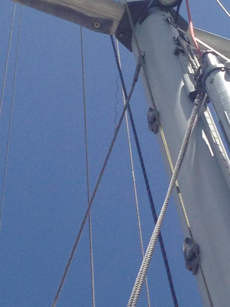 |
Photos of rigging failure; Lower Aft stays; Bermuda to Horta; 22/05/2019
10 Photos
Created 25 May 2019
|
 |
Passage along the south coast from Gosport to Plymouth
2 Photos
Created 1 November 2018
|
 |